
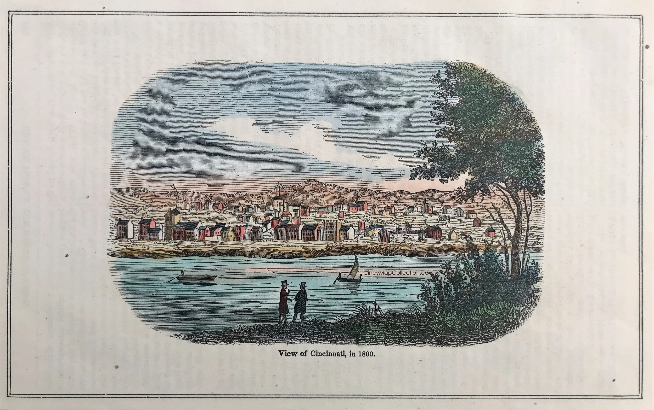
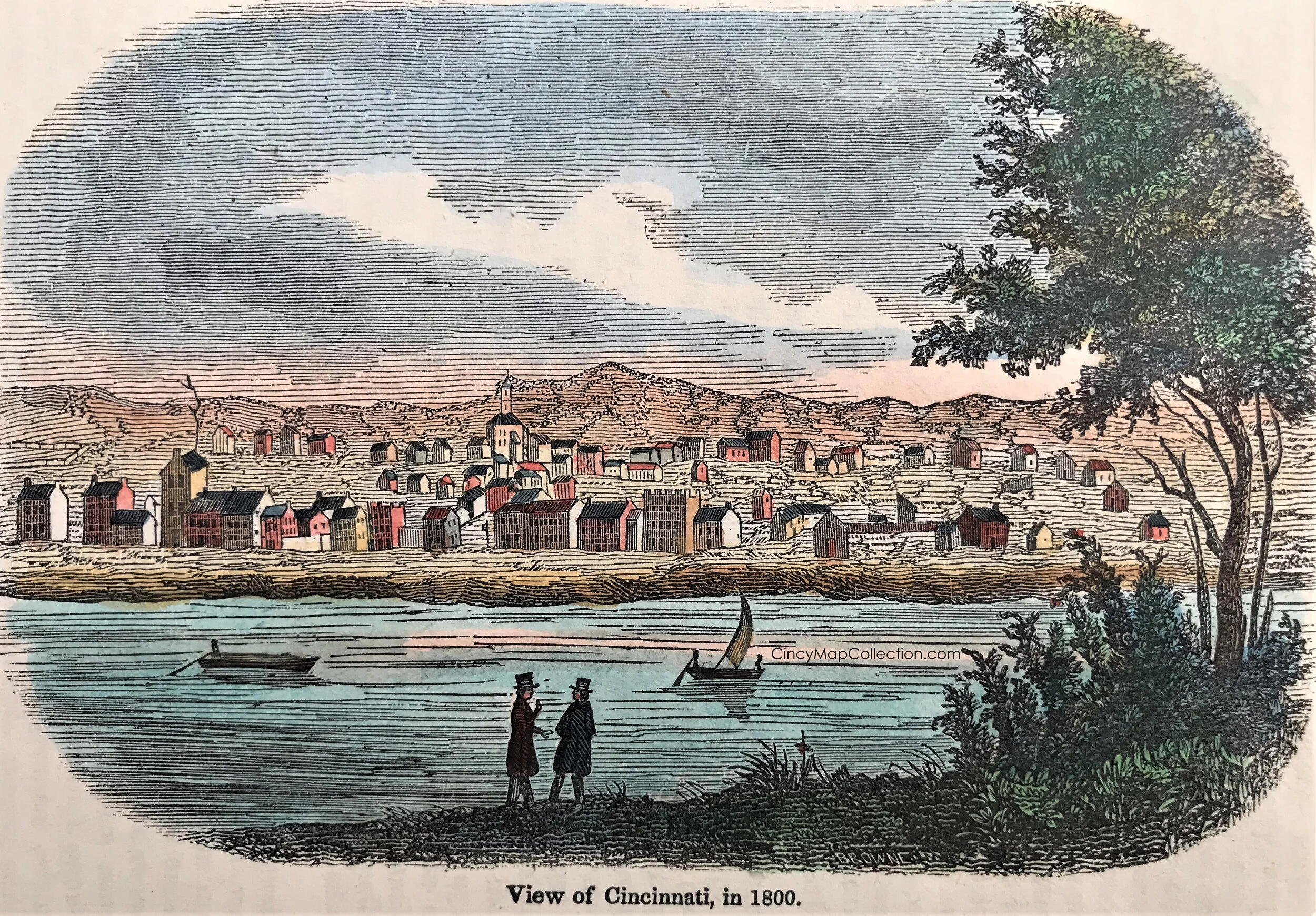


2
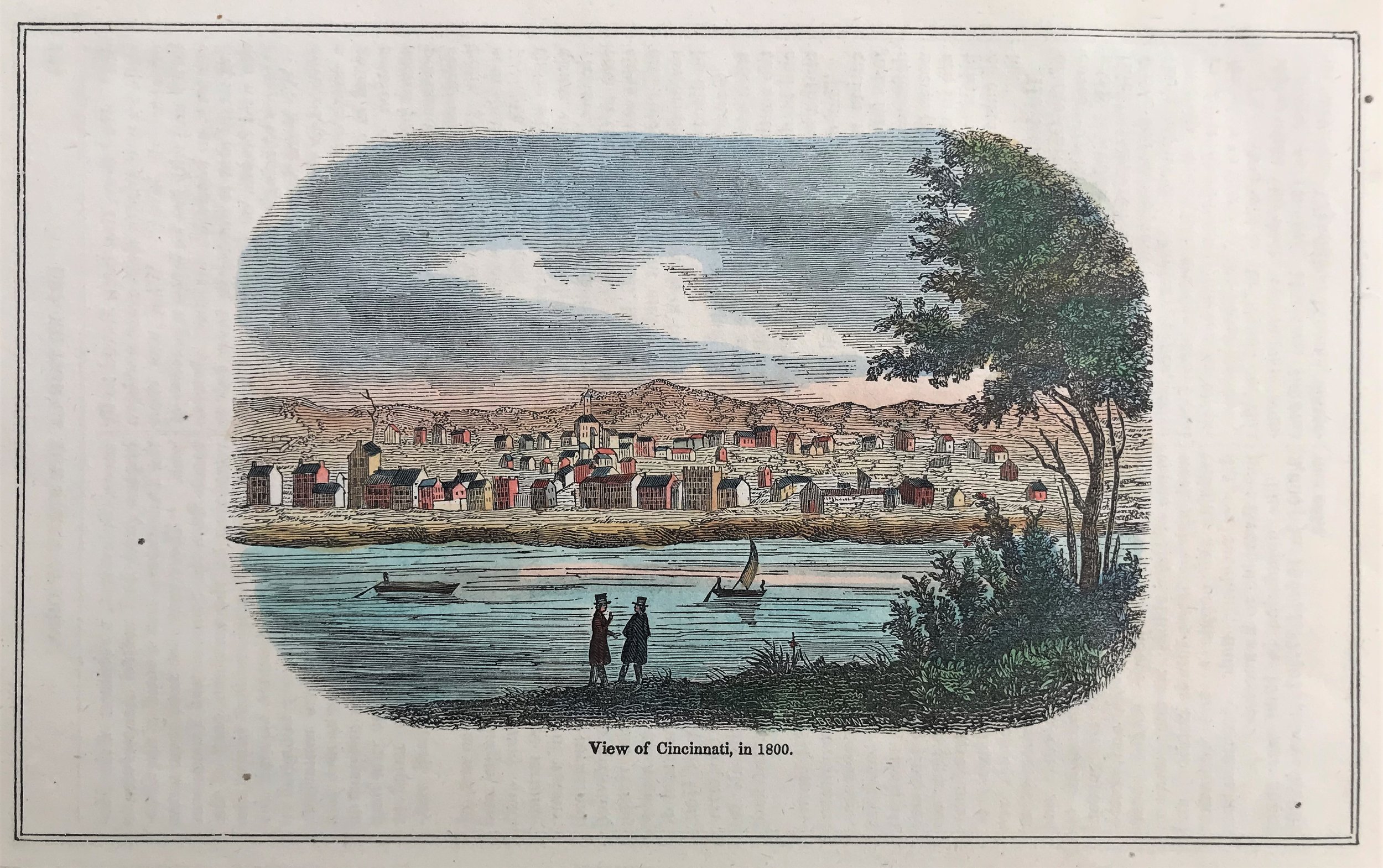
1800 View of Cincinnati
4
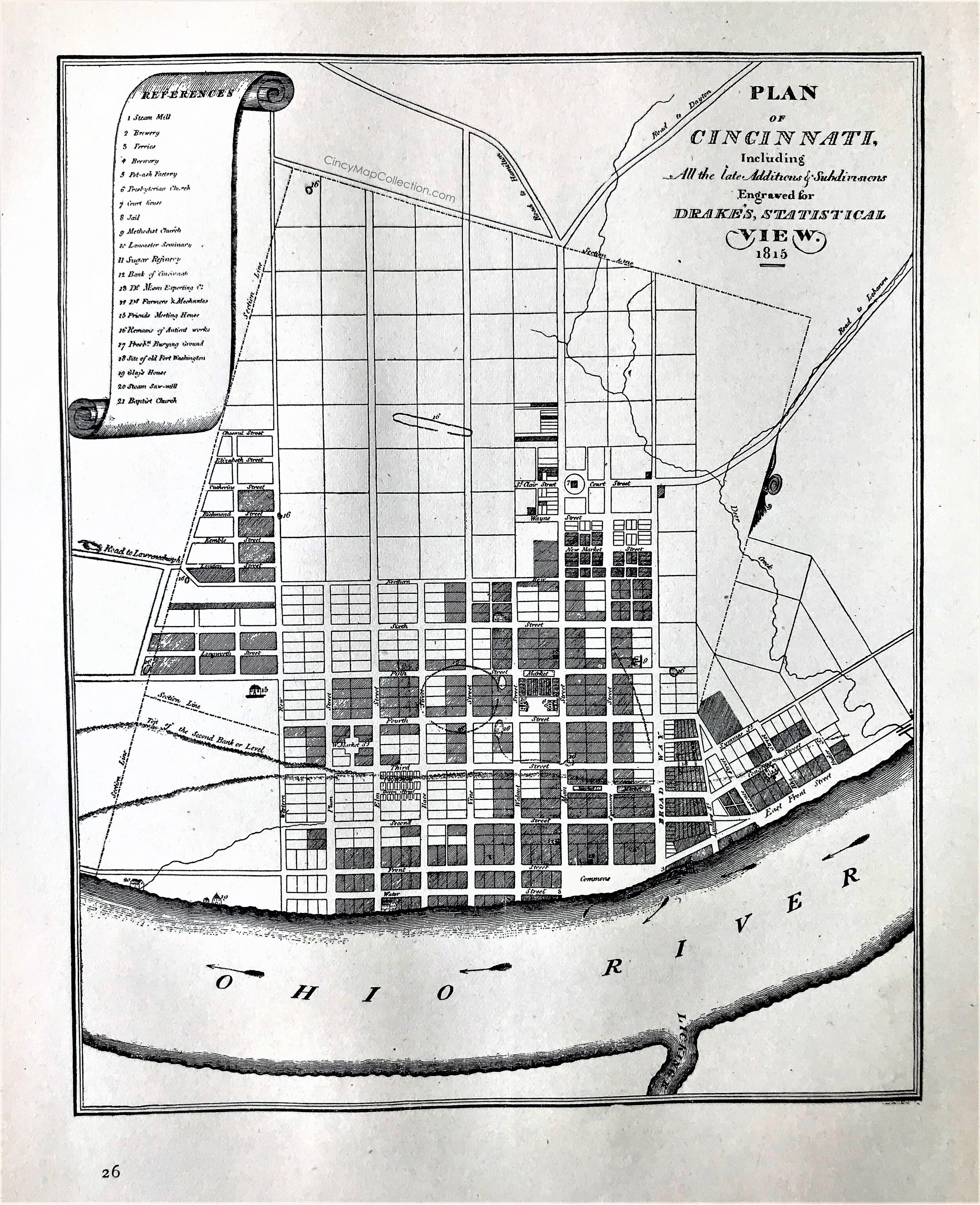
1815 Plan of Cincinnati
6
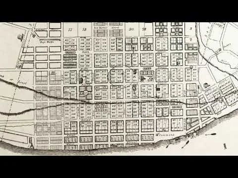
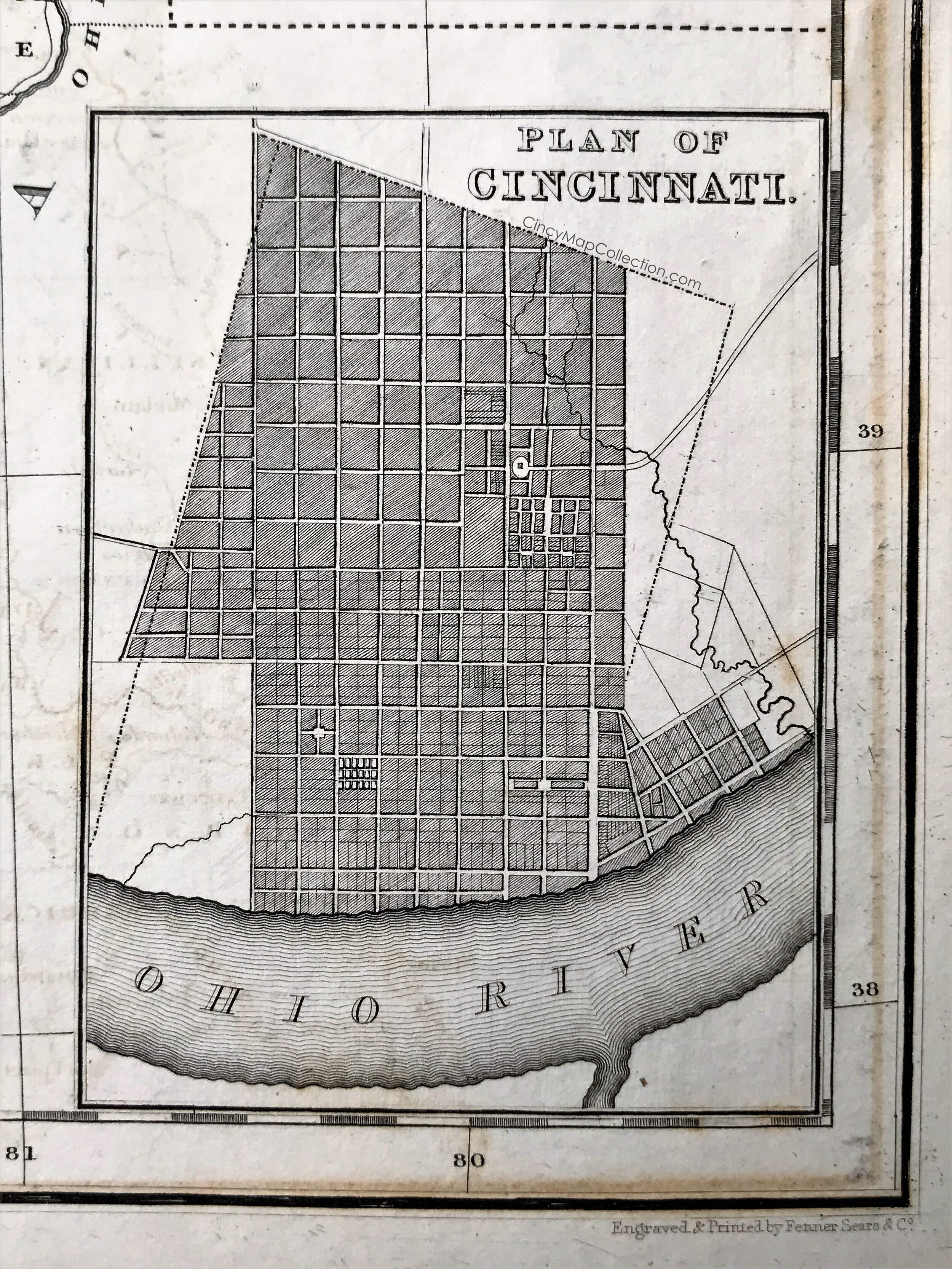
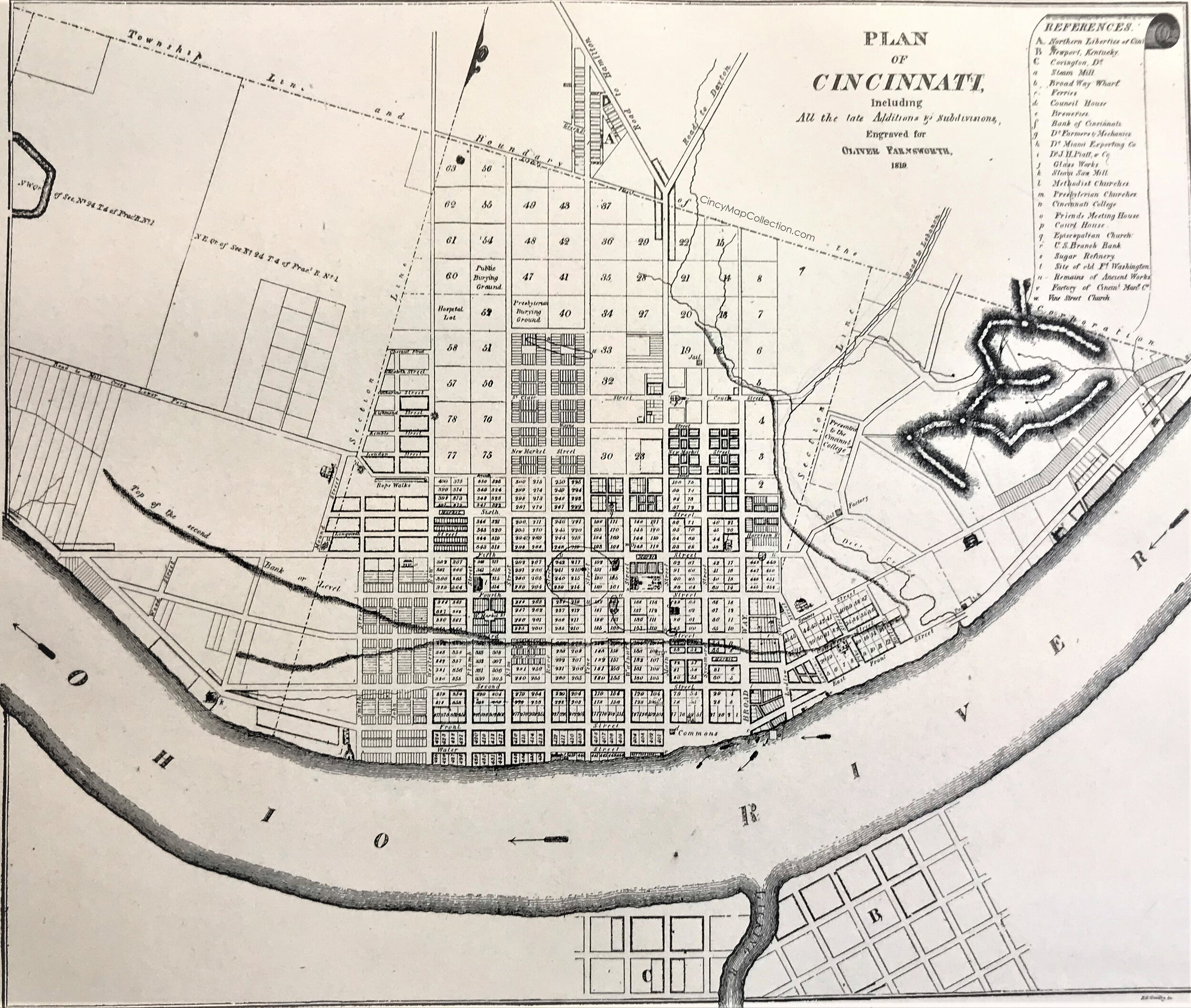
1819 Plan of Cincinnati
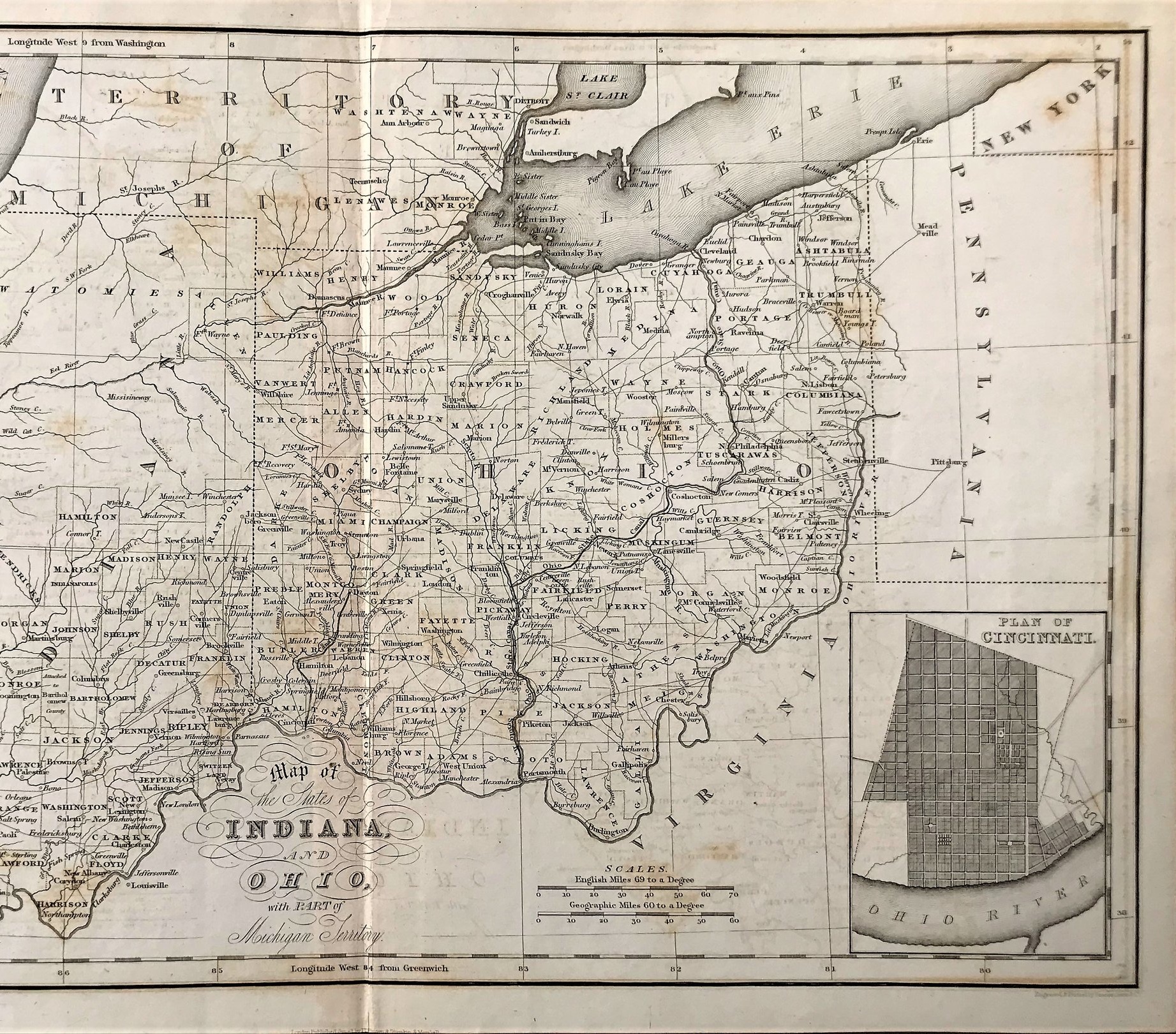
11
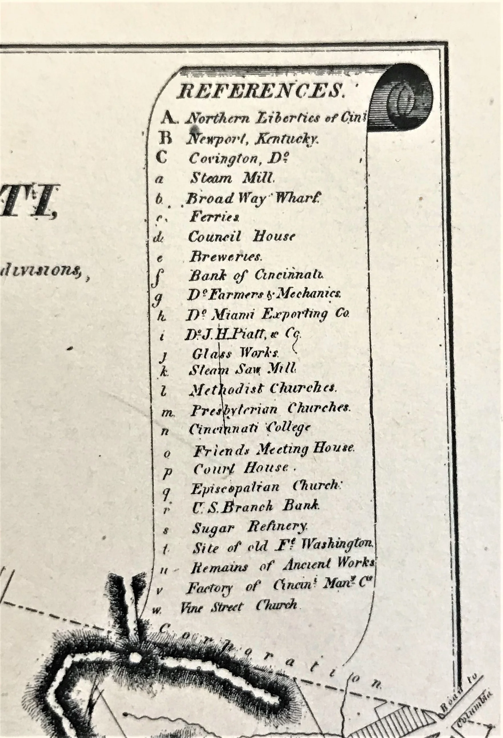
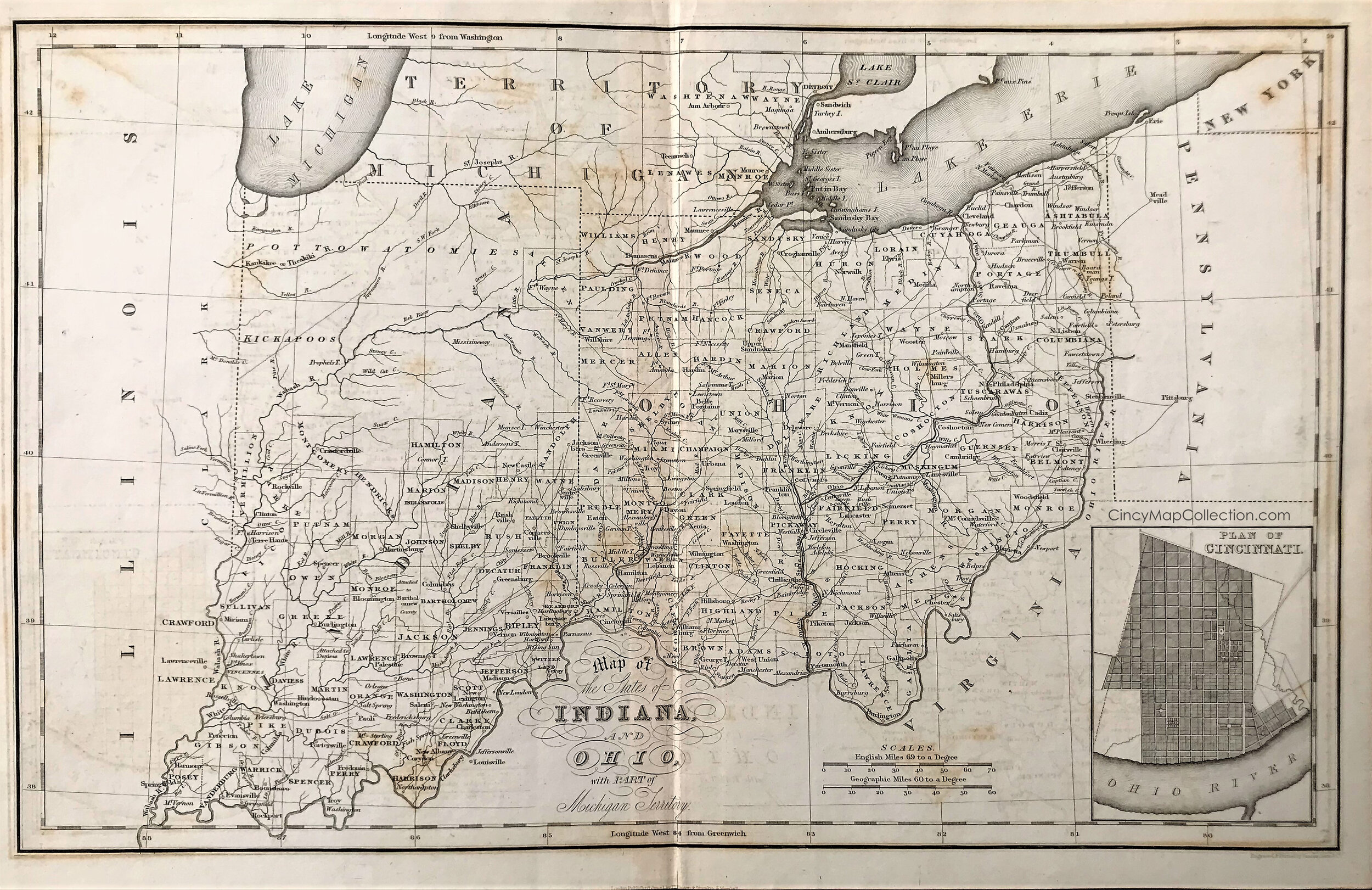
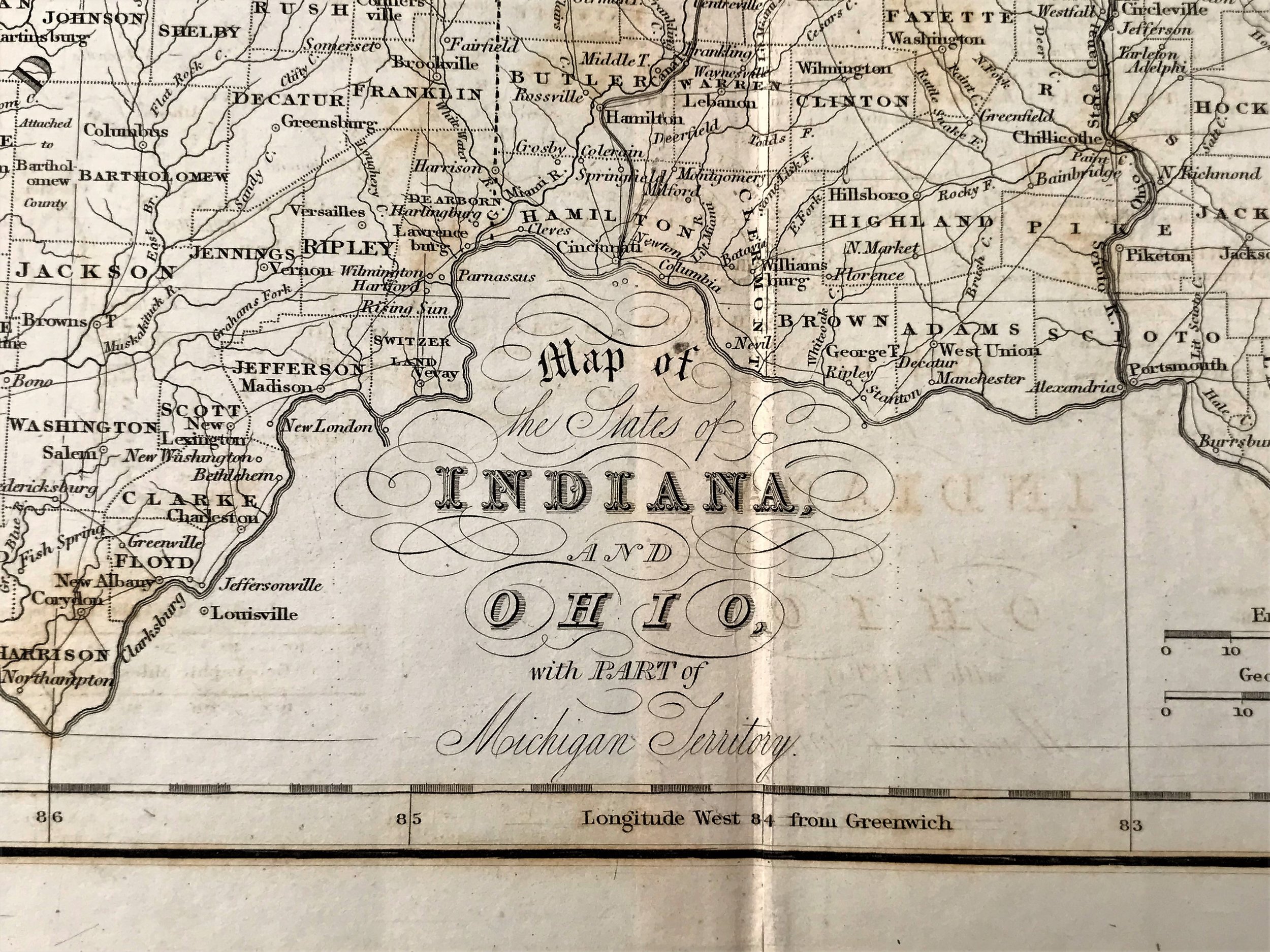
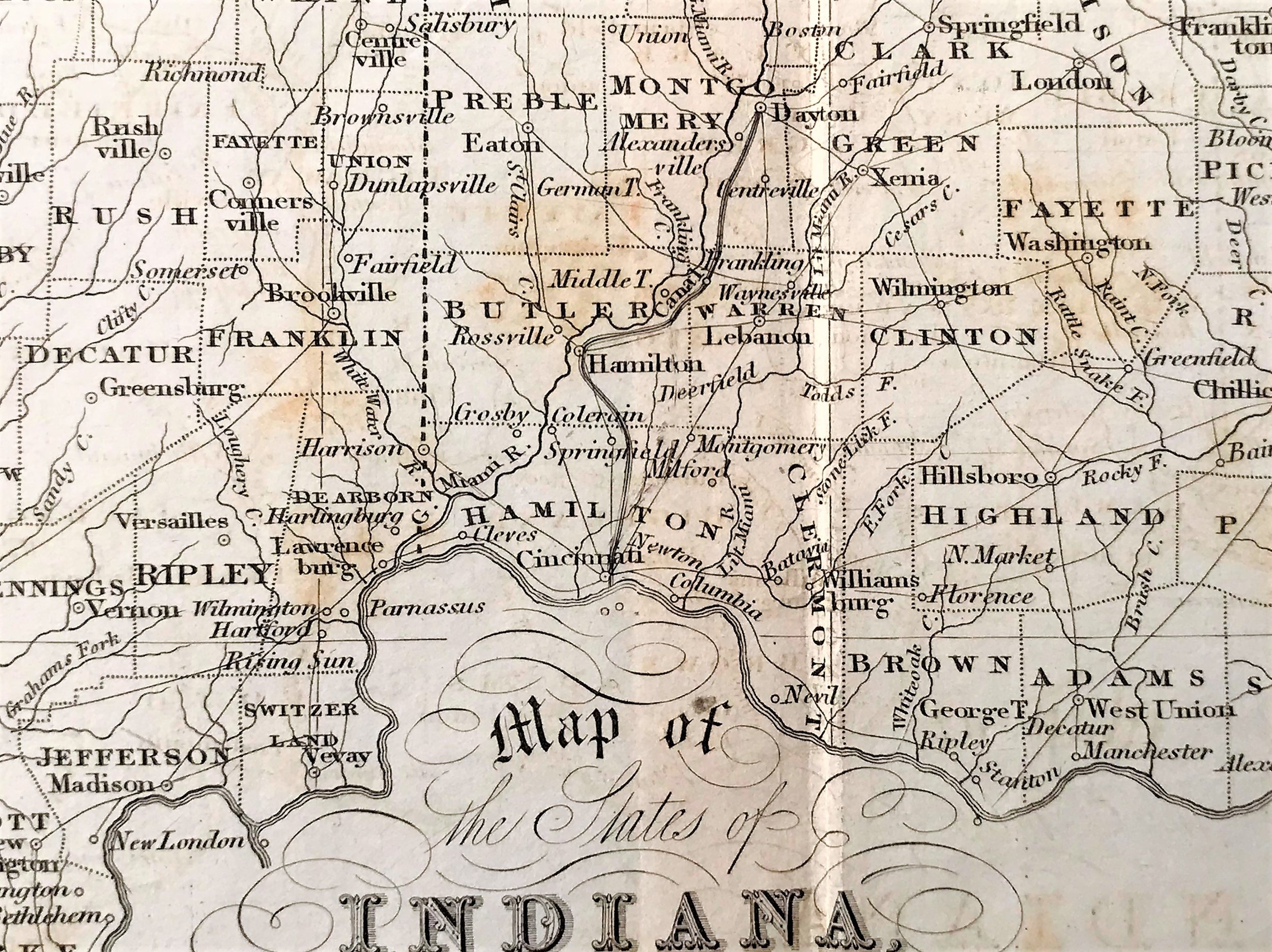
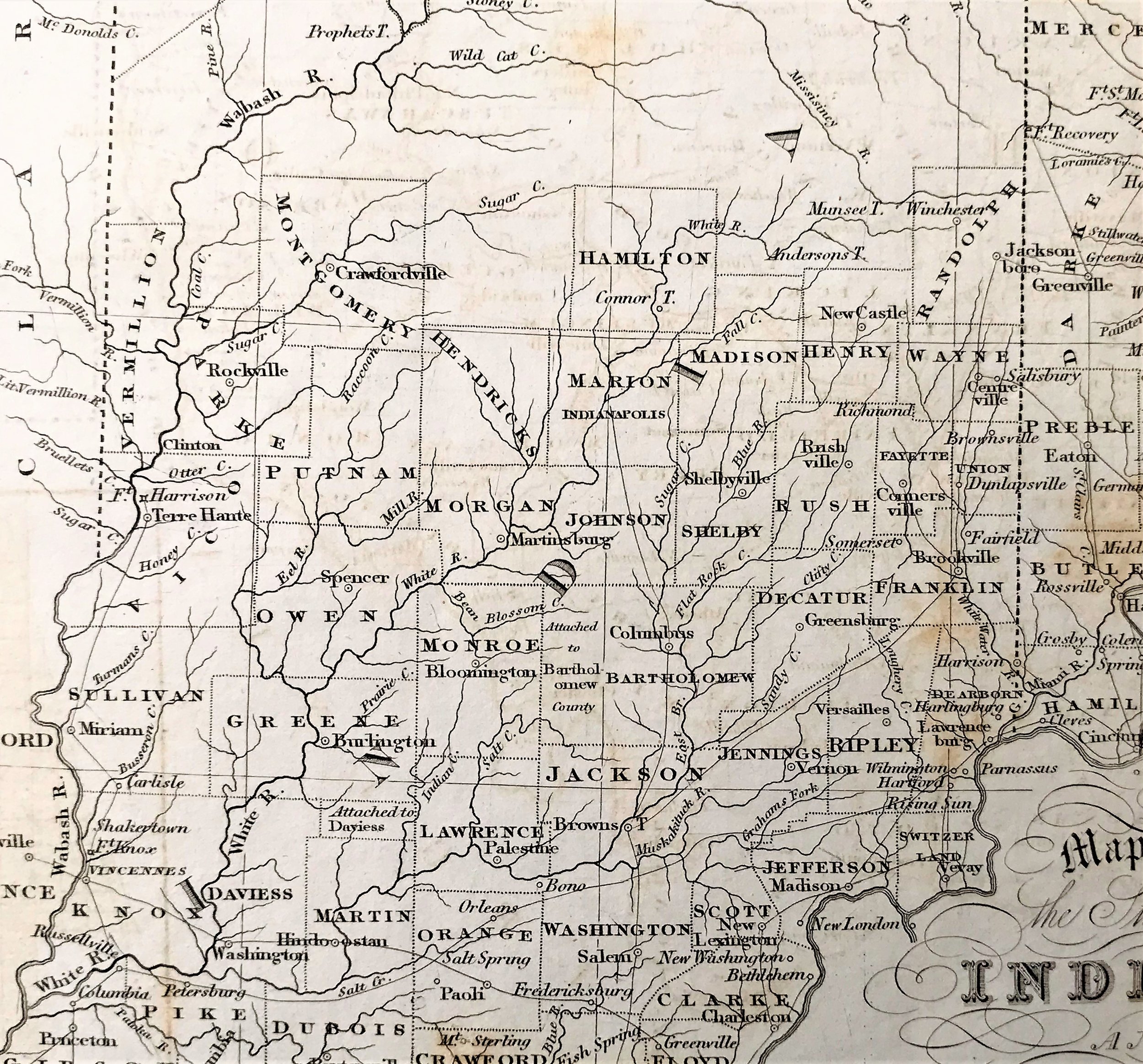
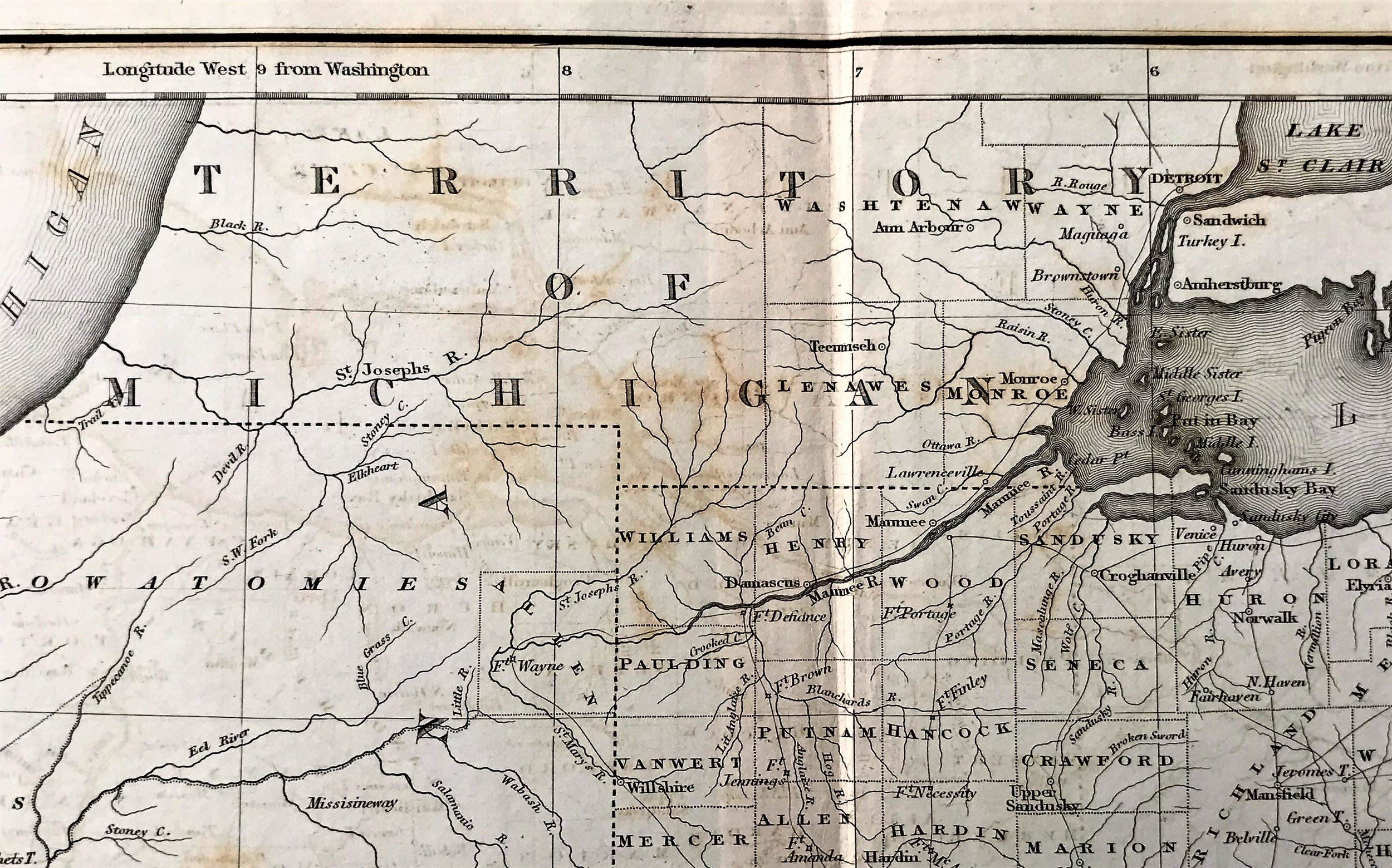
1820 Map of the States of Indiana and Ohio with parts of Michigan Territory
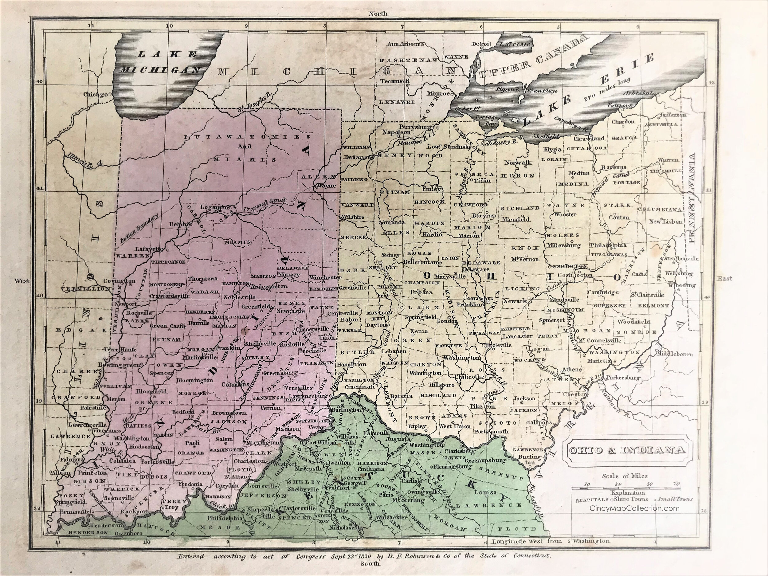
7
1830 Map of Ohio & Indiana
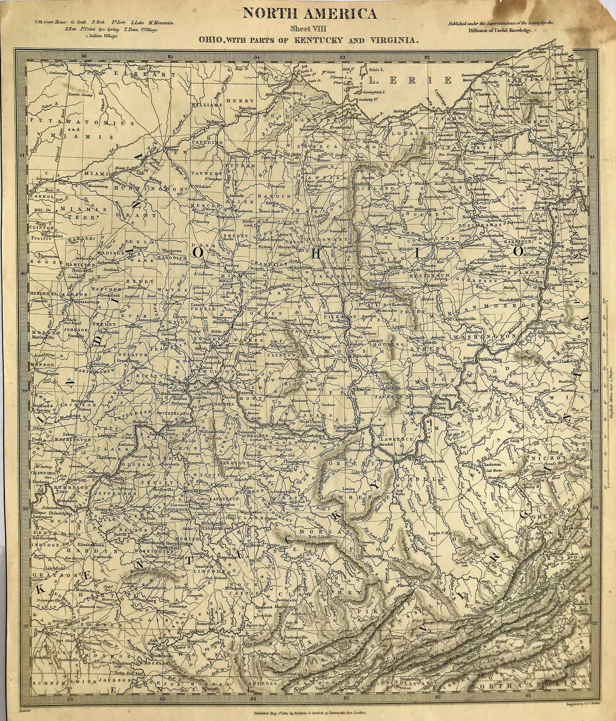
9
1833 Map of Ohio with parts of Kentucky and Virgina
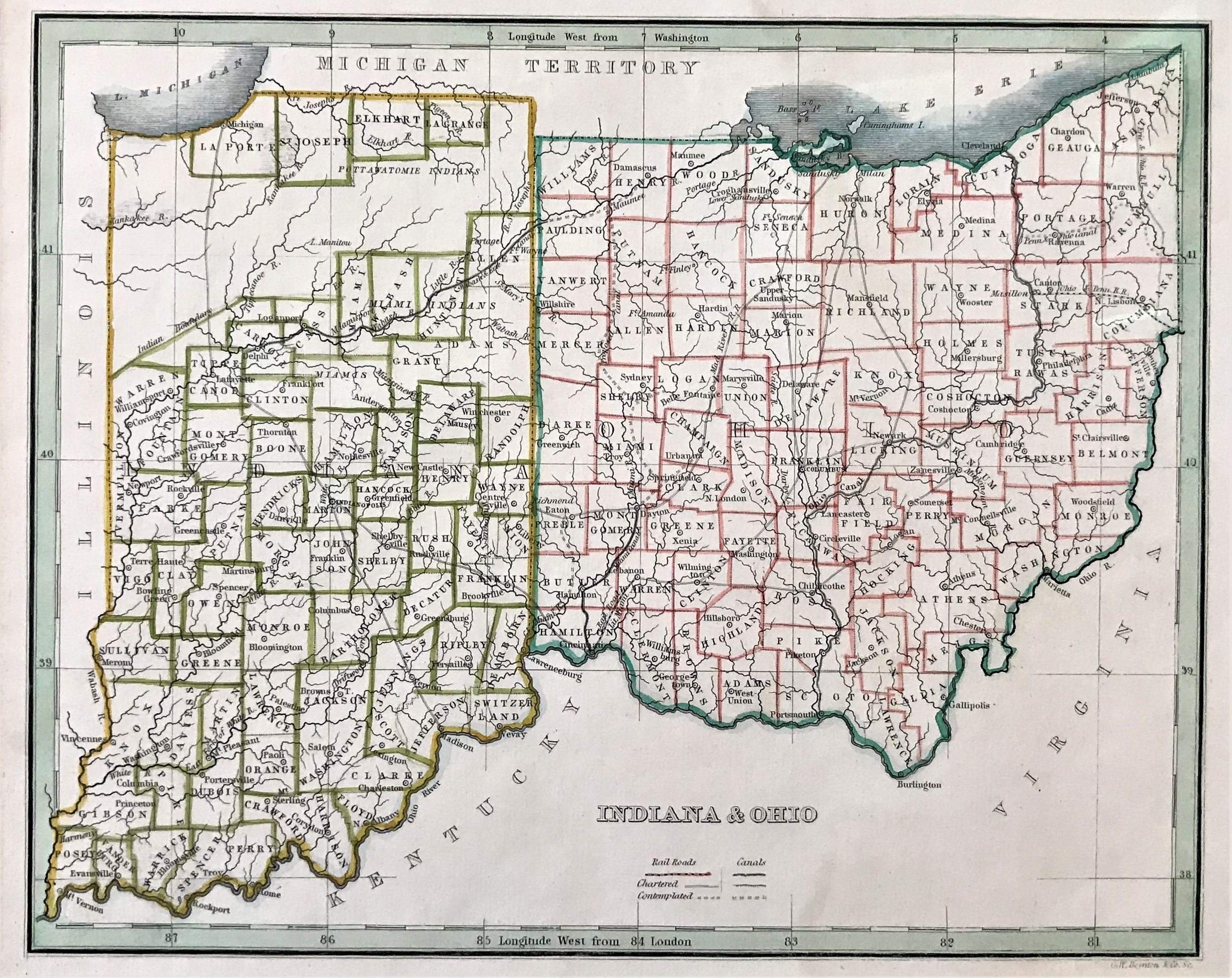
5
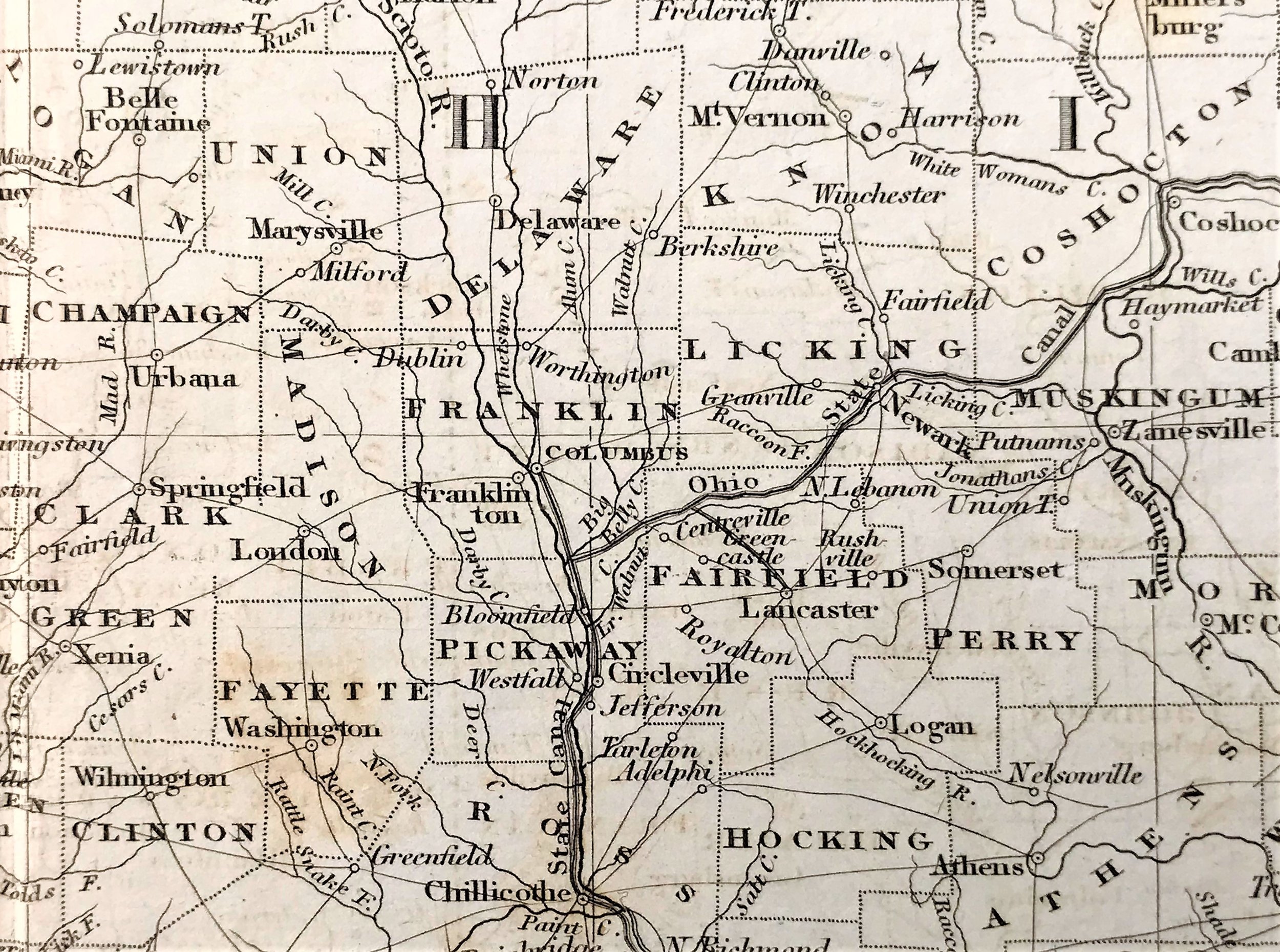
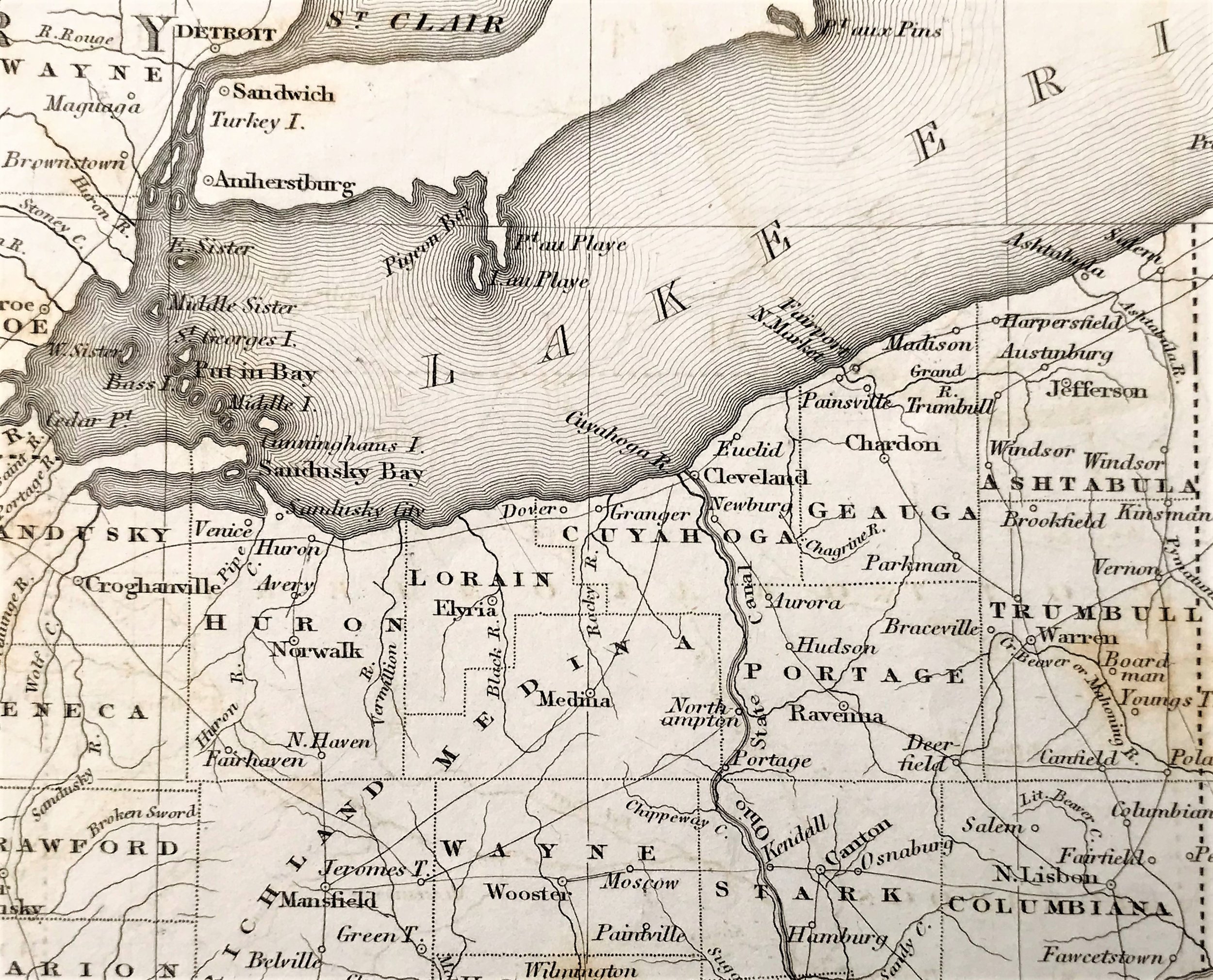
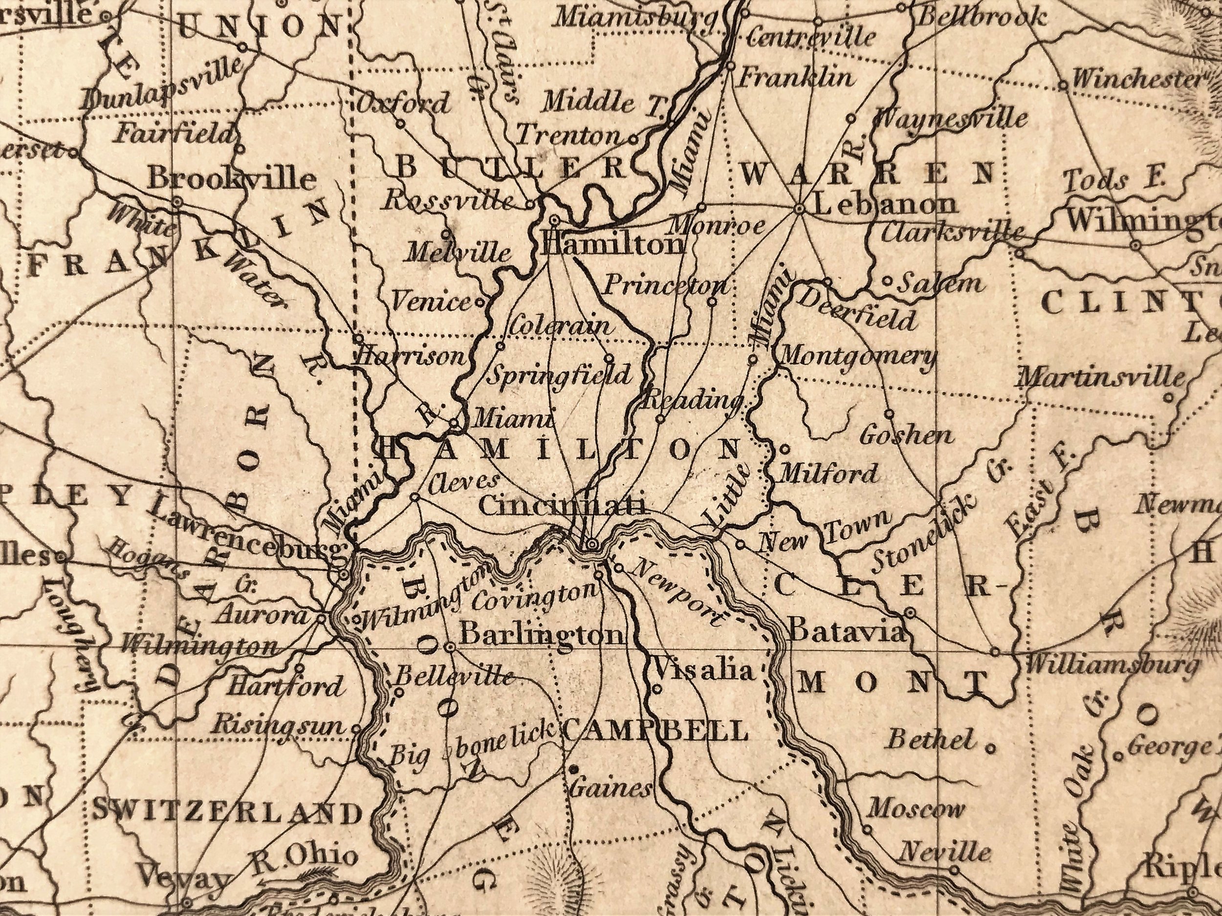
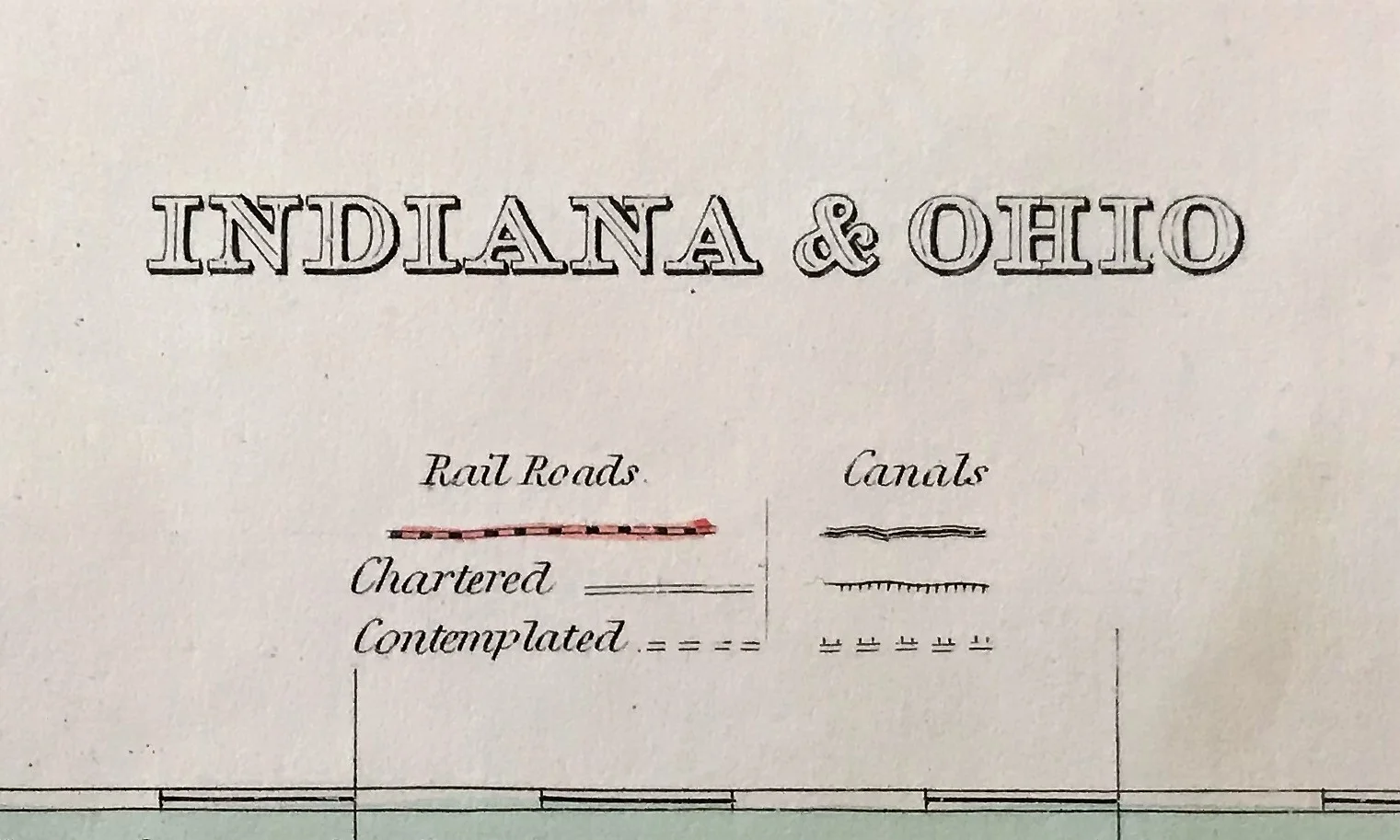
1835 Map of Indiana & Ohio
2
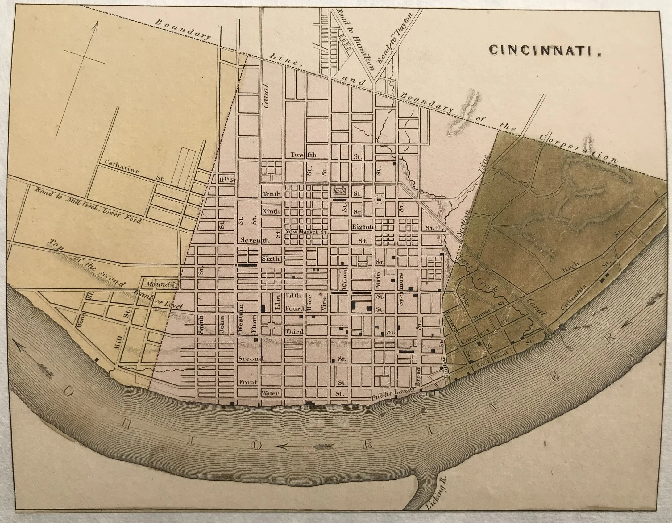
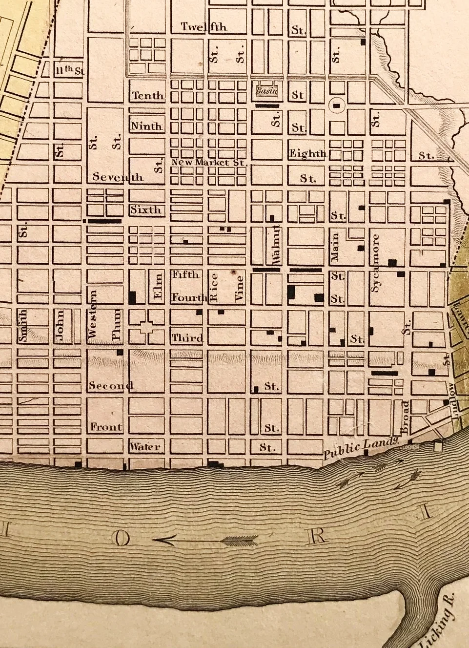
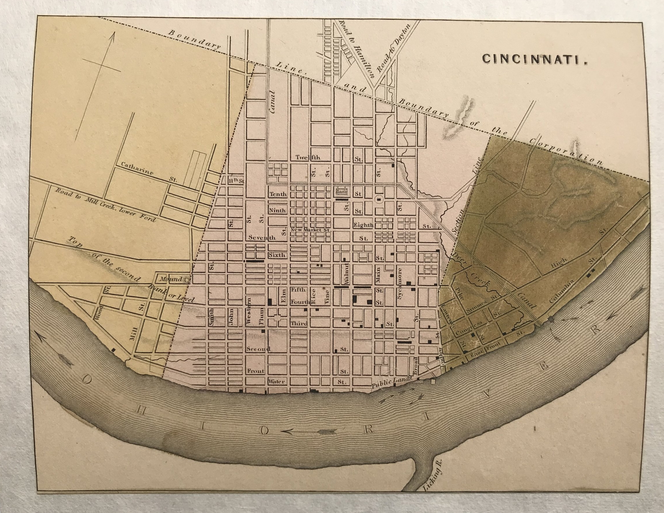
1838 Map of Cincinnati, Ohio
2
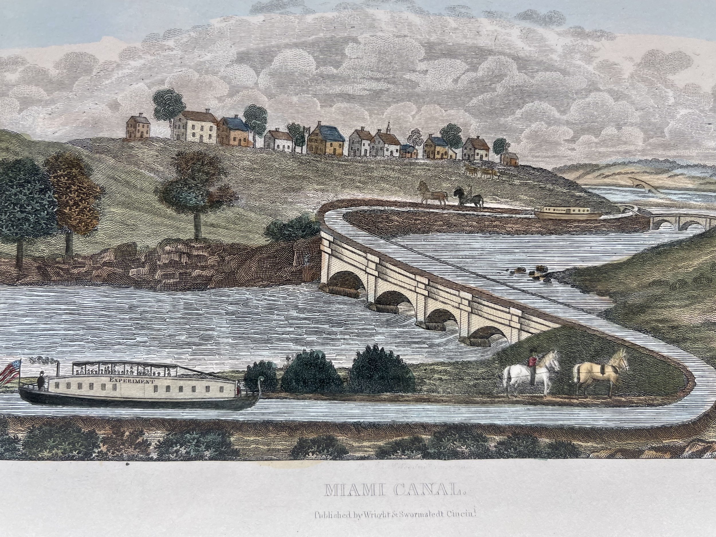
1840 Miami Canal
2
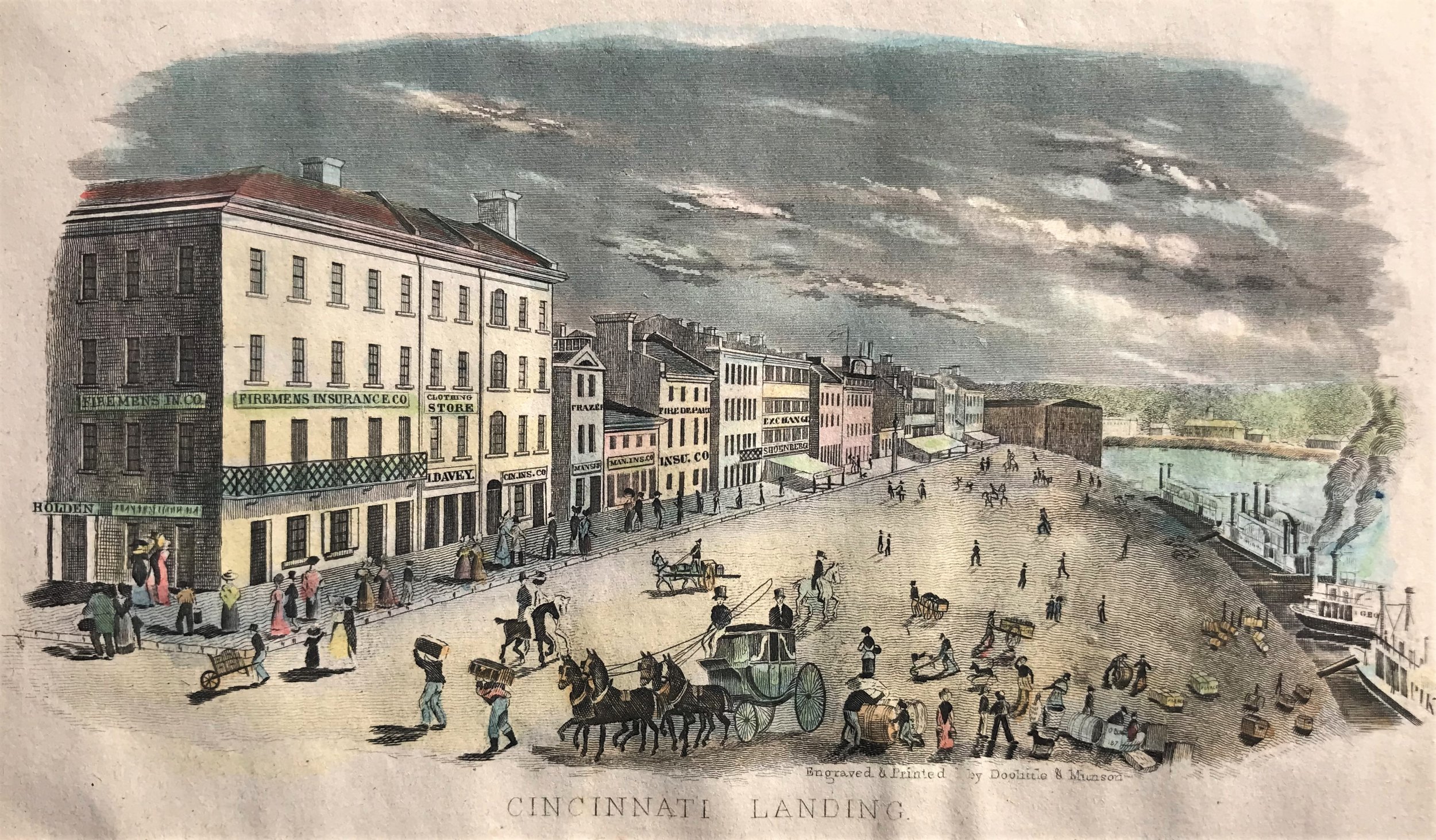
1841 Cincinnati Landing
1
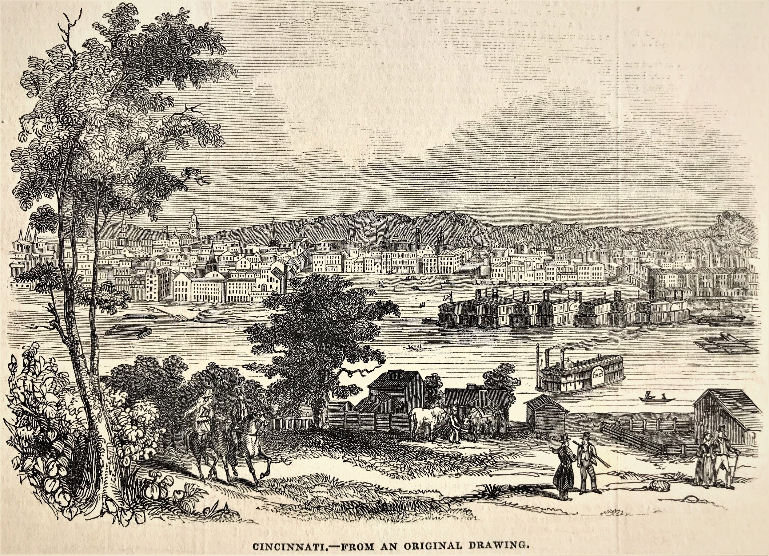
1845 Print: Cincinnati
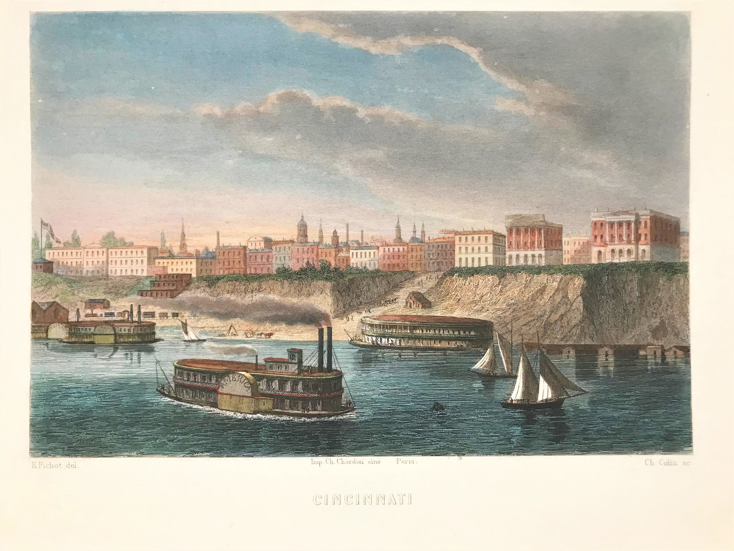
2
1850 Cincinnati Riverfront Engraving
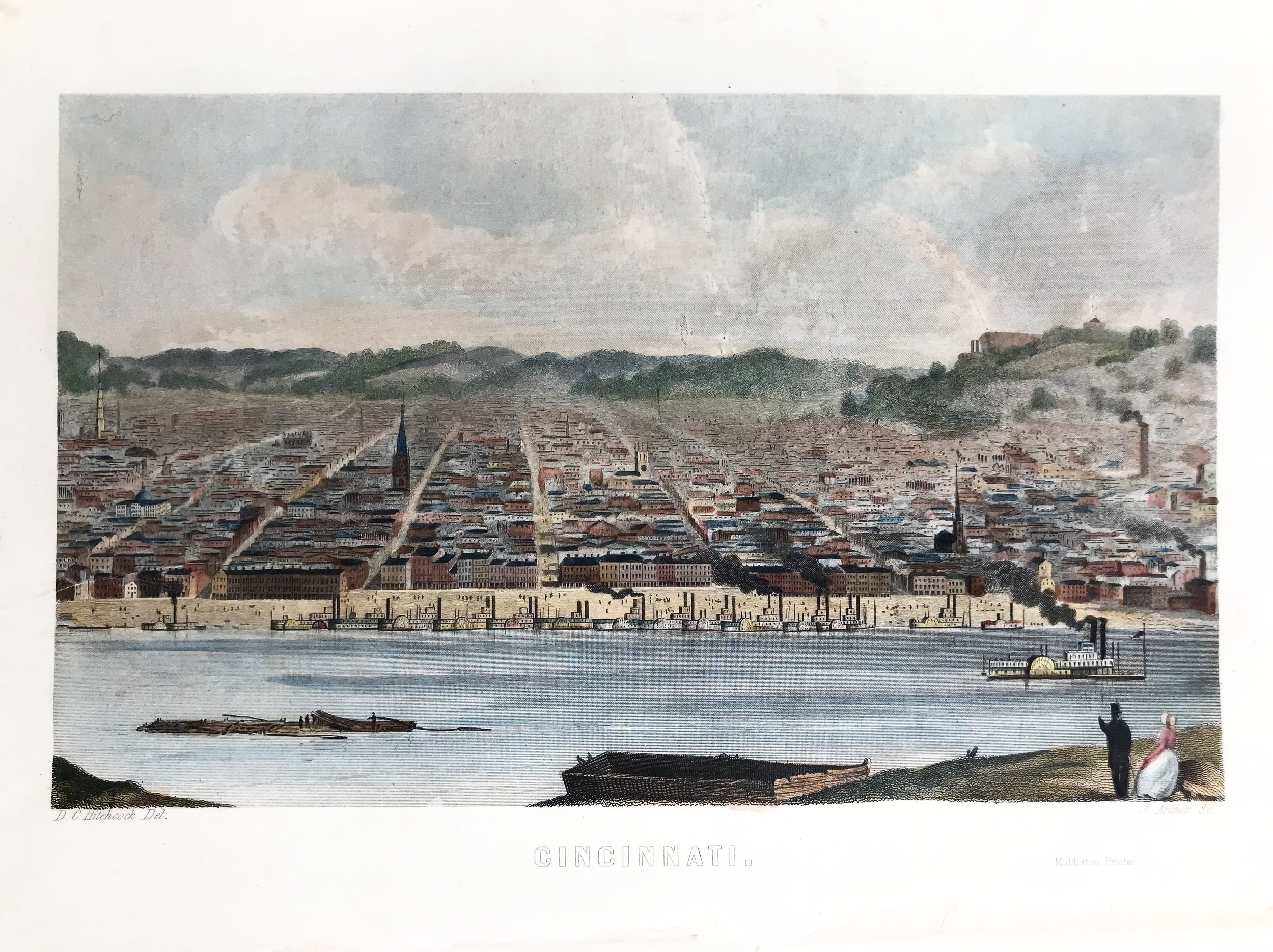
4
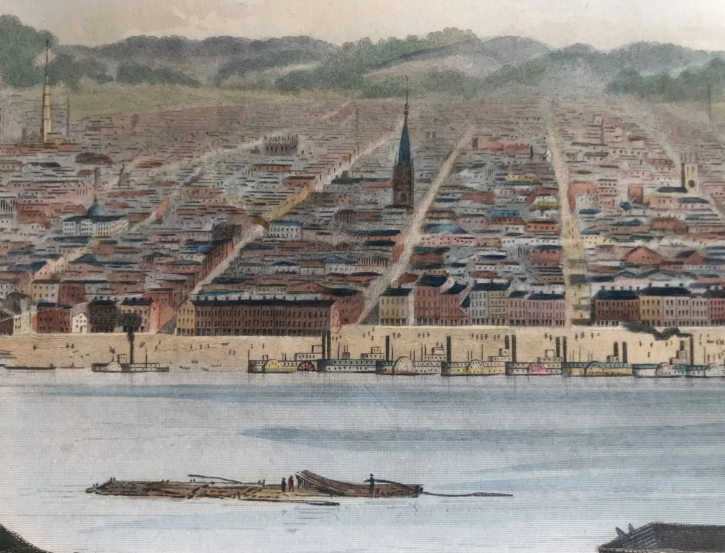
1852 Print: Bird's Eye View of Cincinnati
6
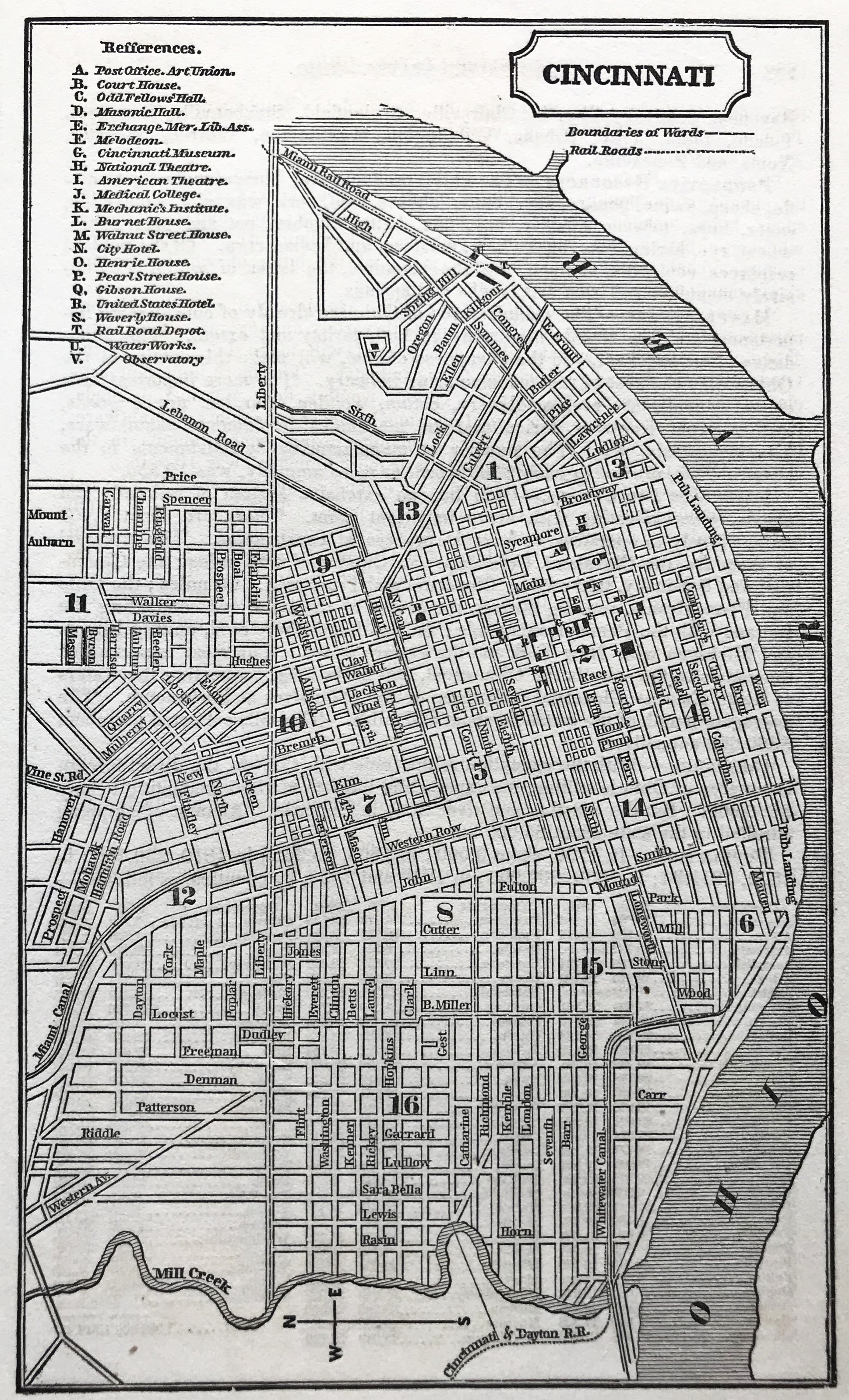
1853 Map of Cincinnati
2
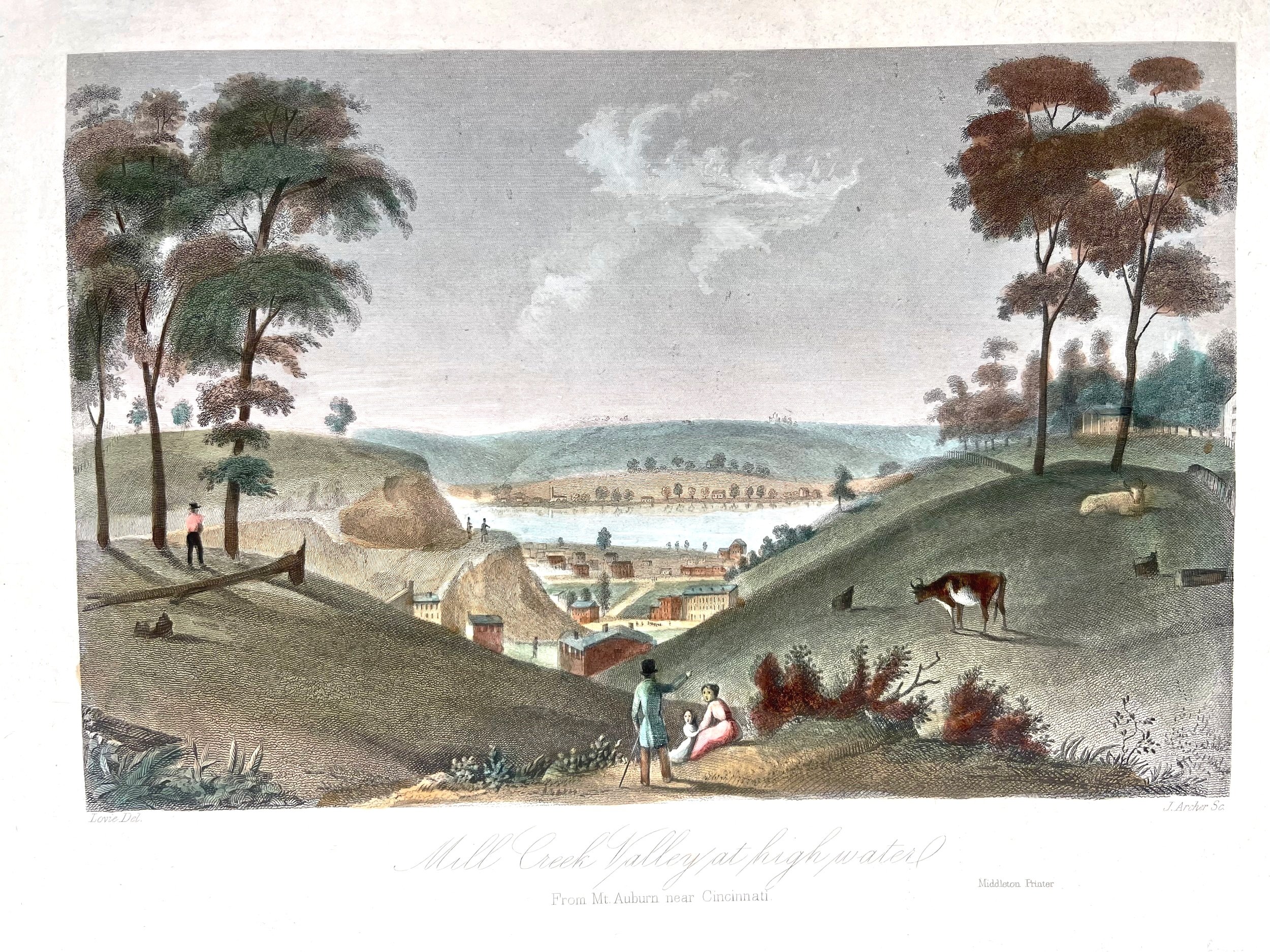
1853 Mill Creek Valley at high water, Mt. Auburn
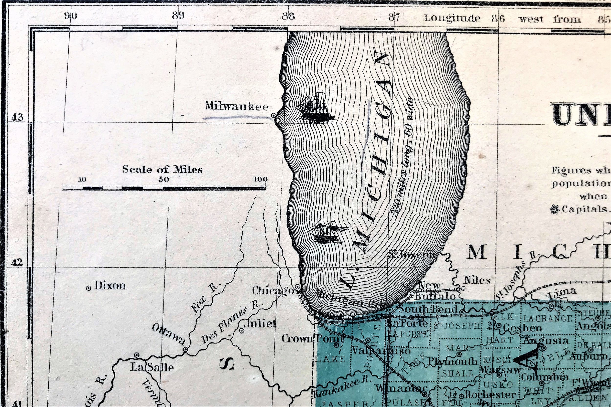
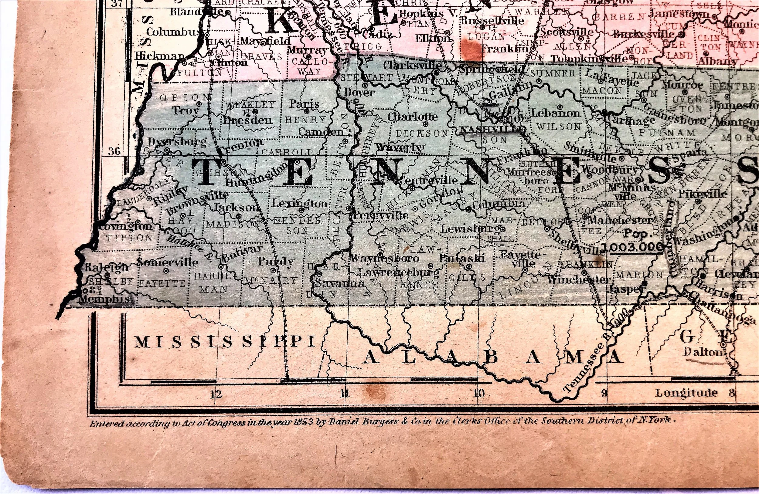
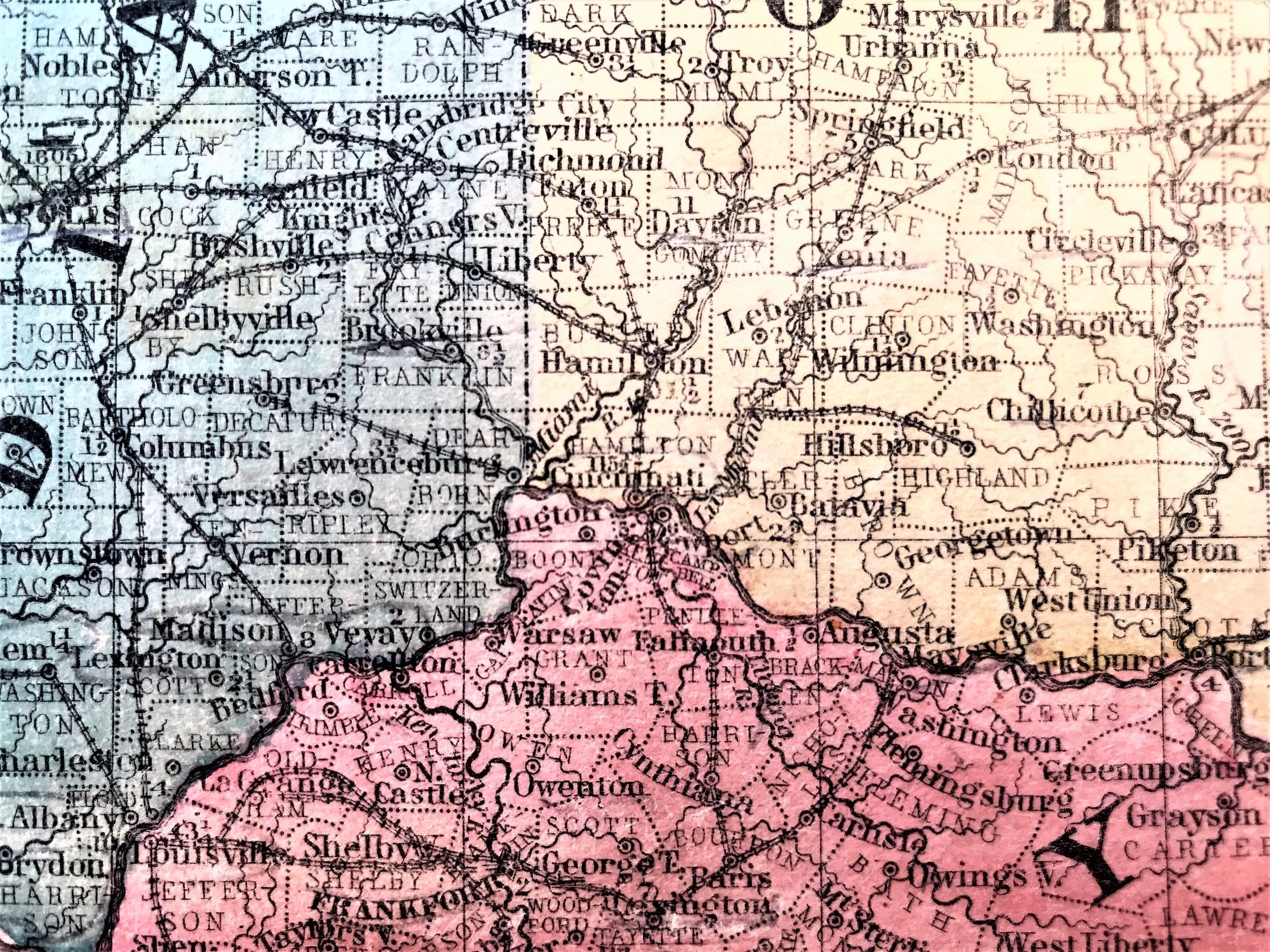
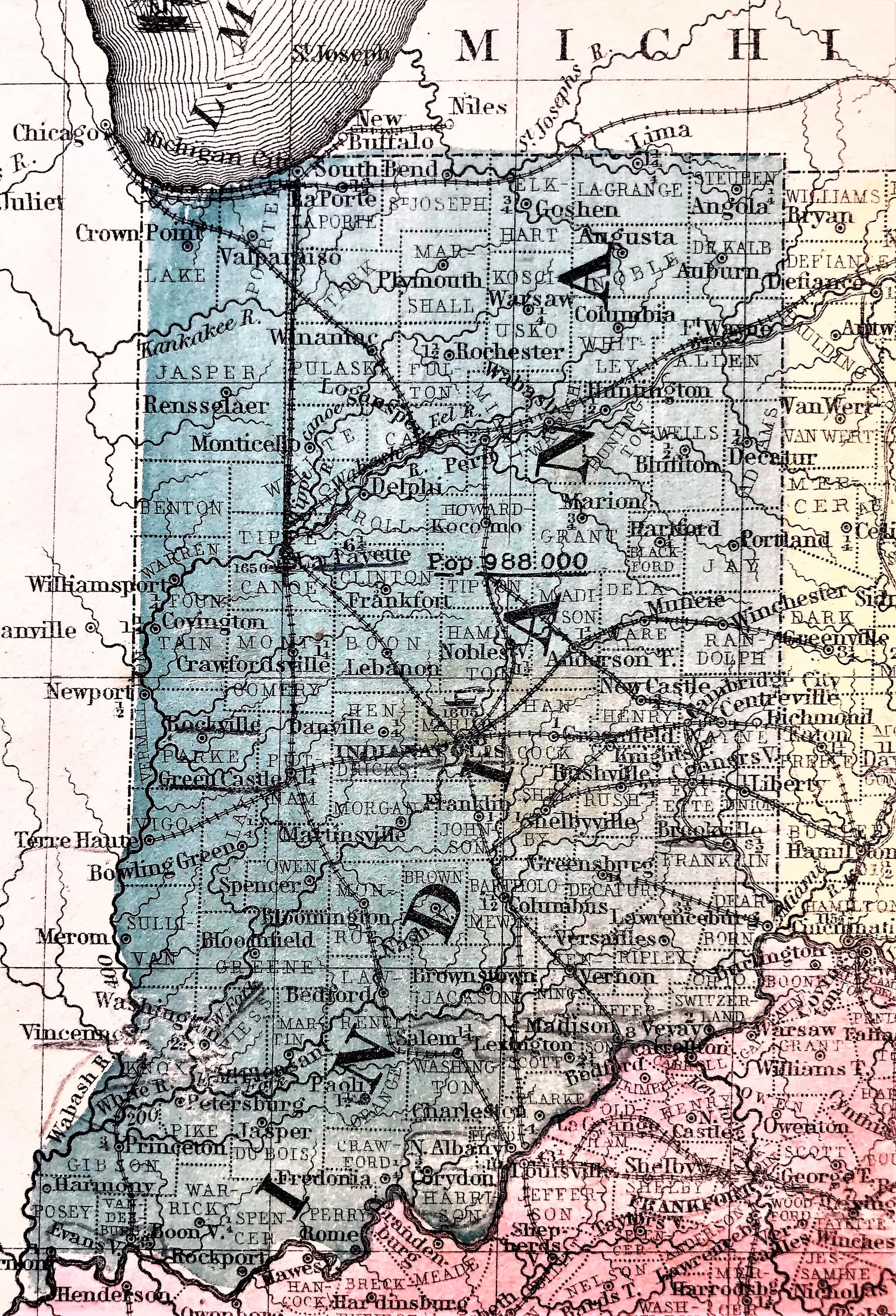
8
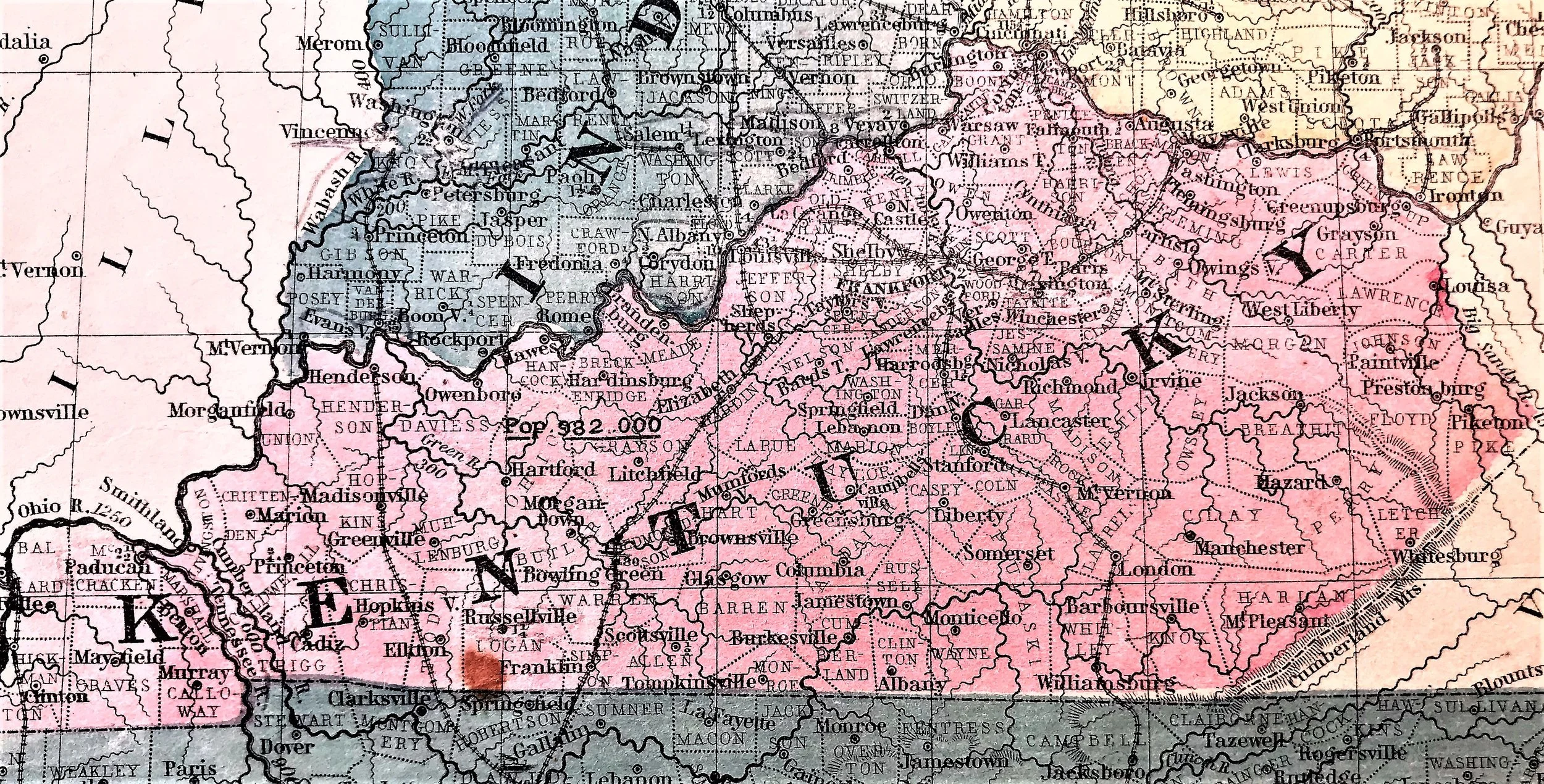
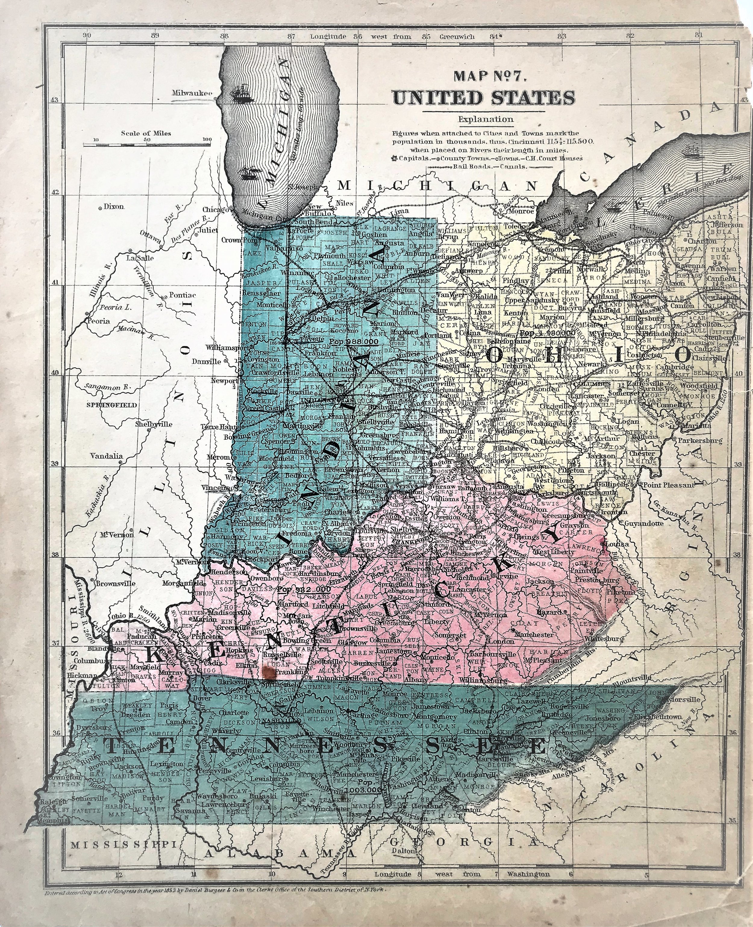
1853 Map of Ohio, Indiana, Kentucky and Tennessee
8
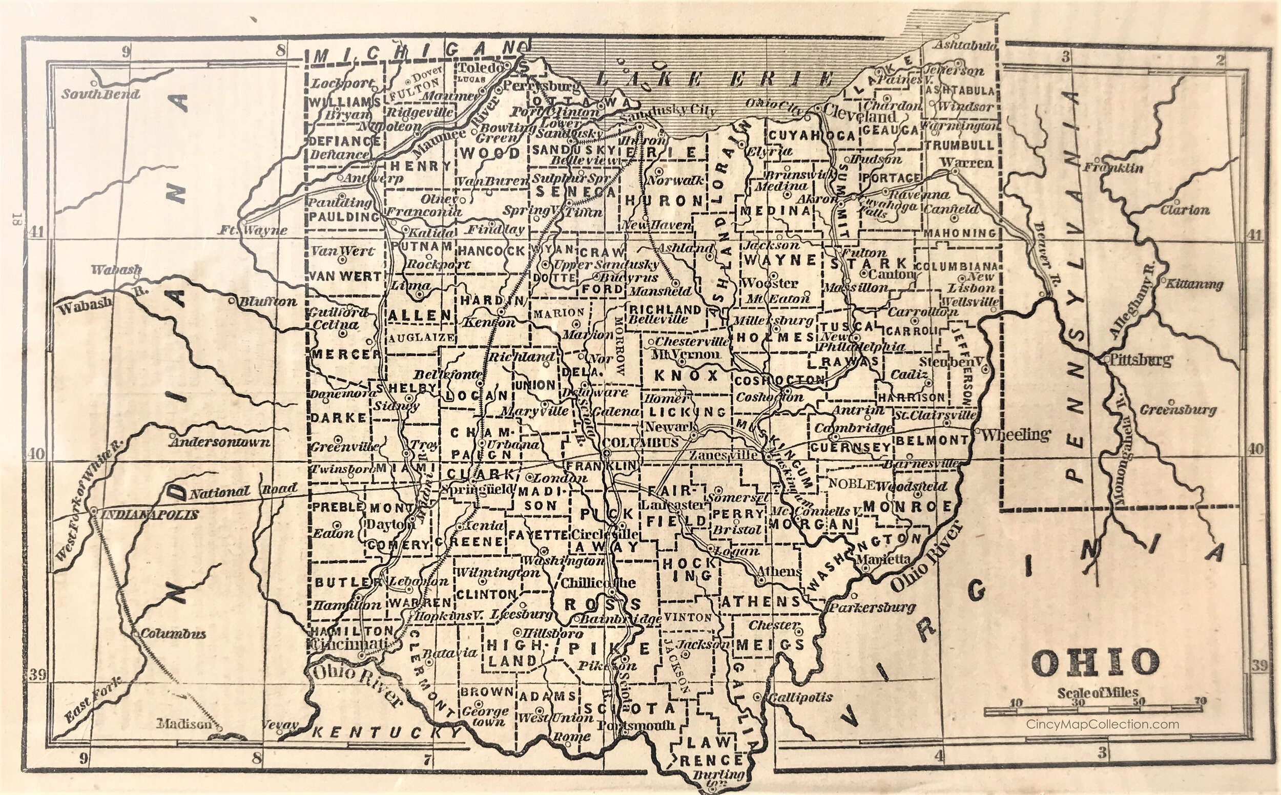
1854 Map of Ohio
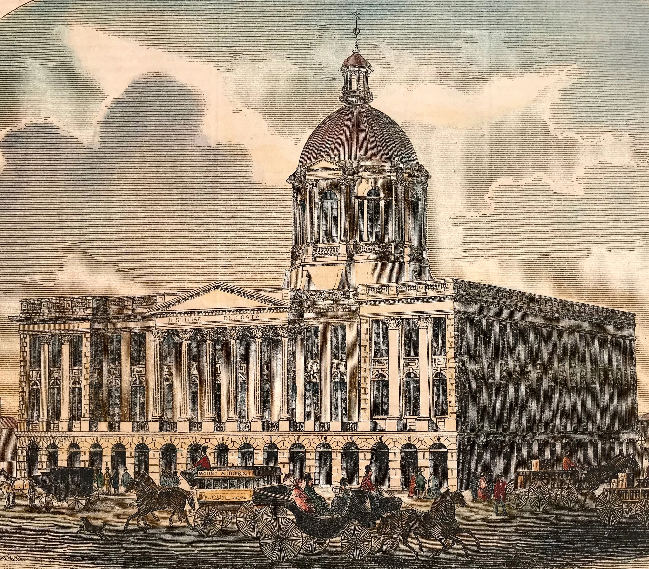
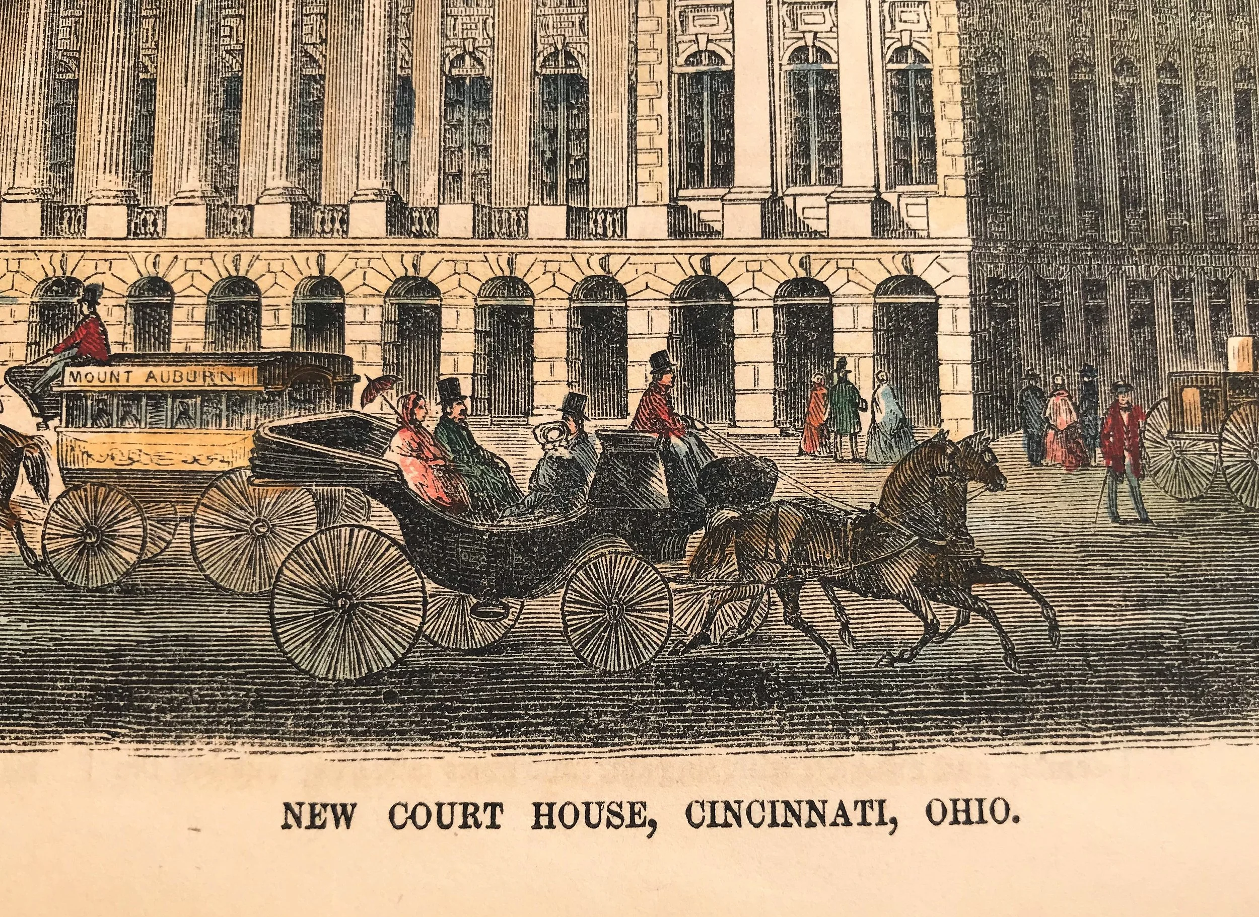
3
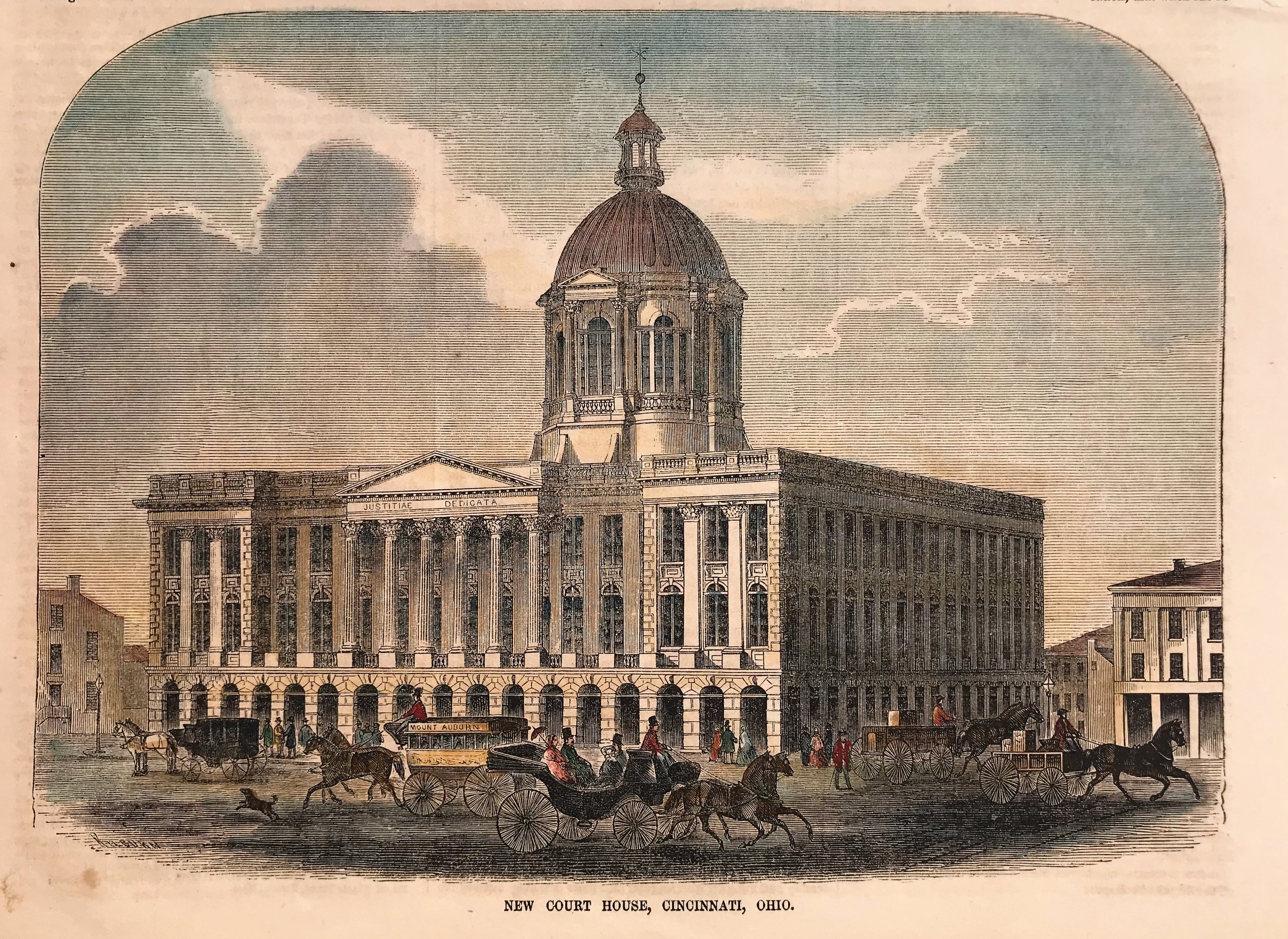
1855 Print: New Court House, Cincinnati, Ohio
6
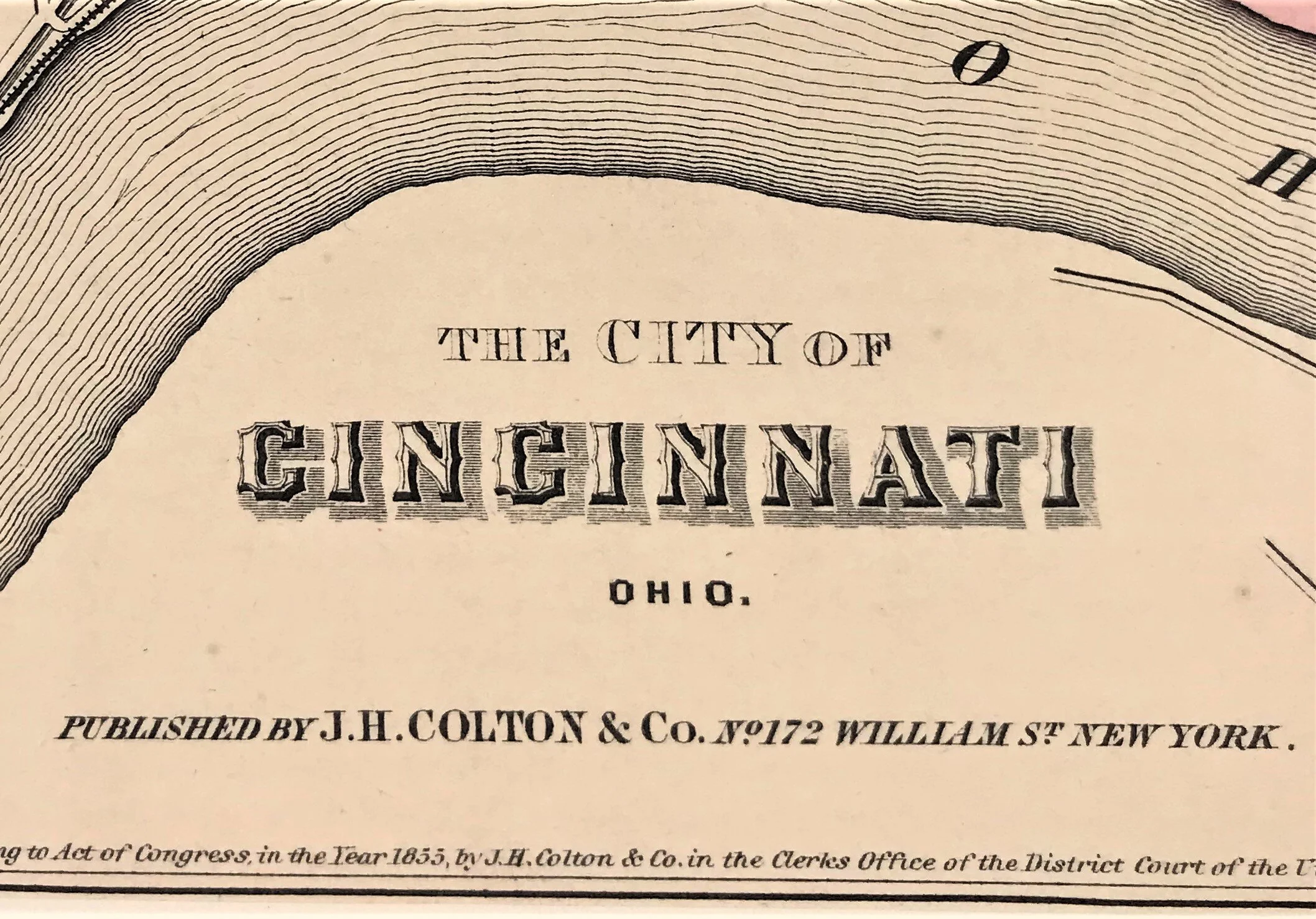
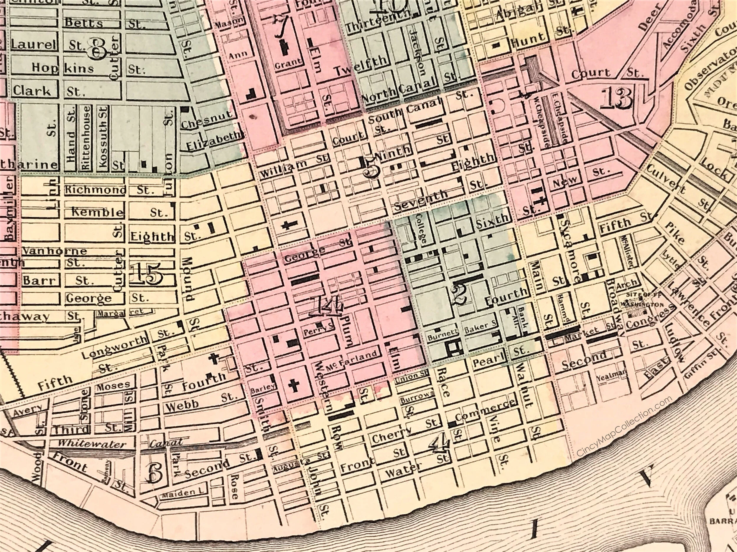
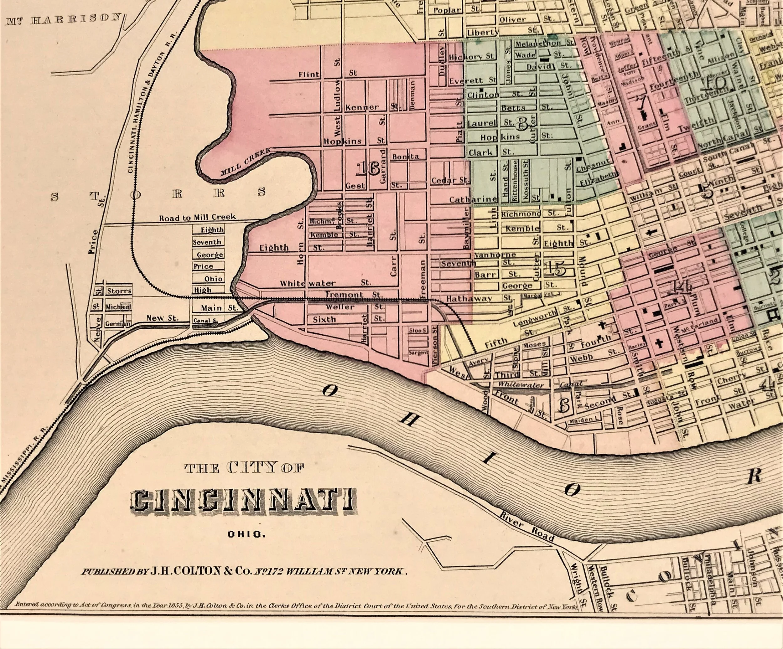
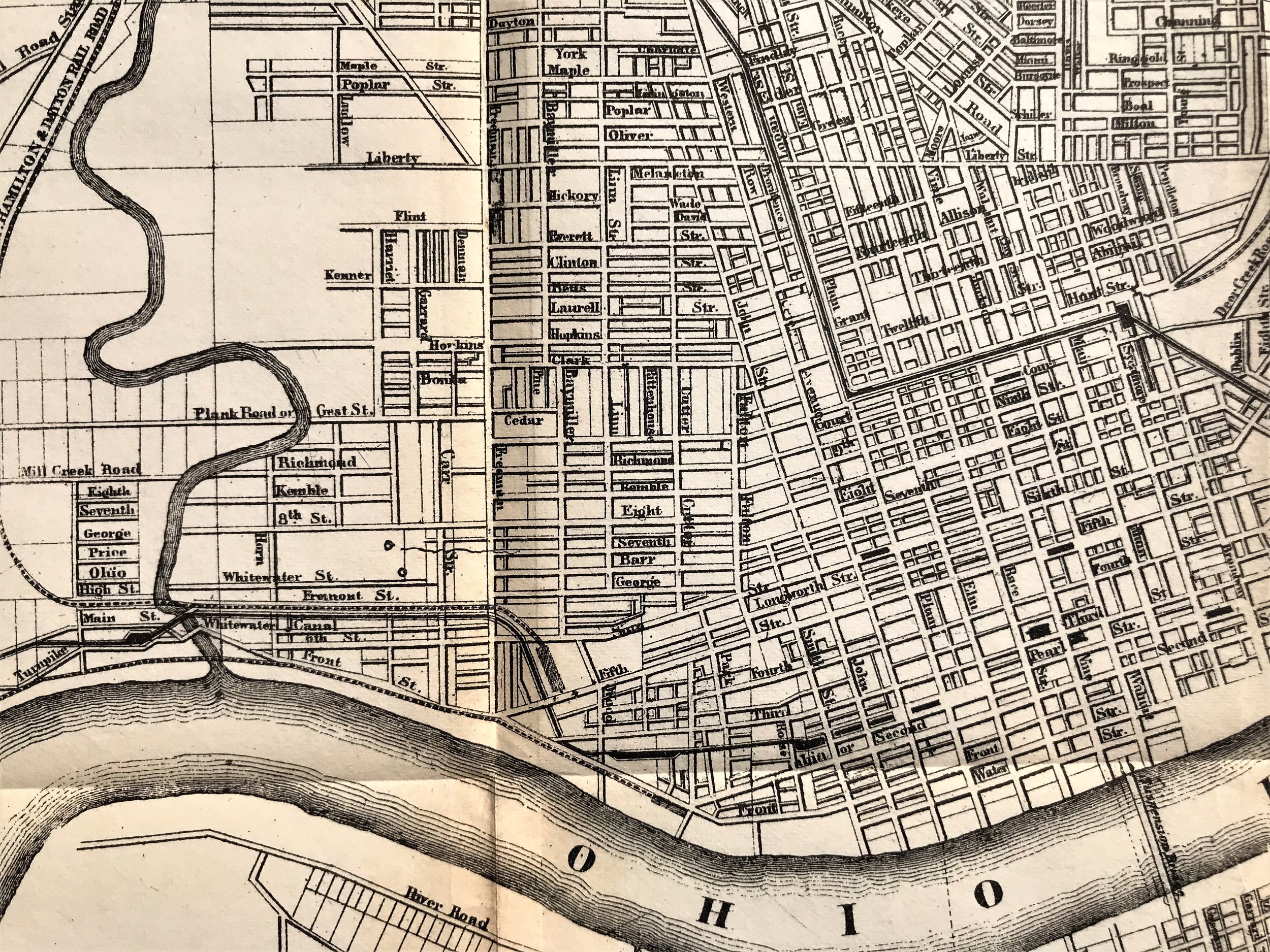
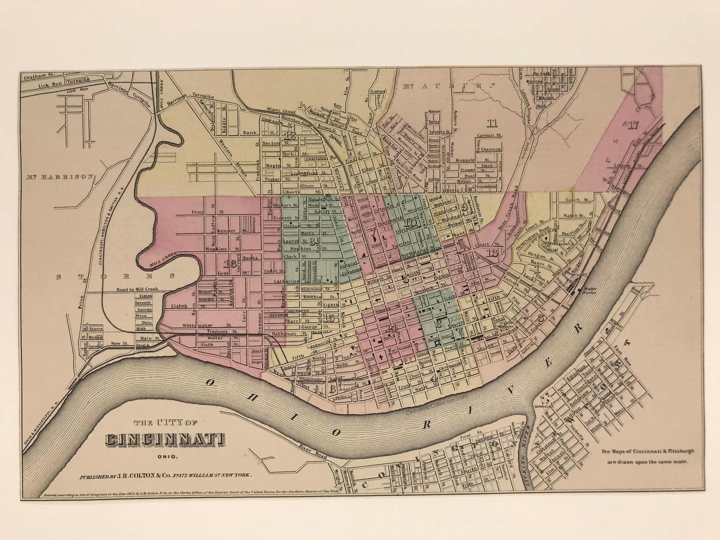
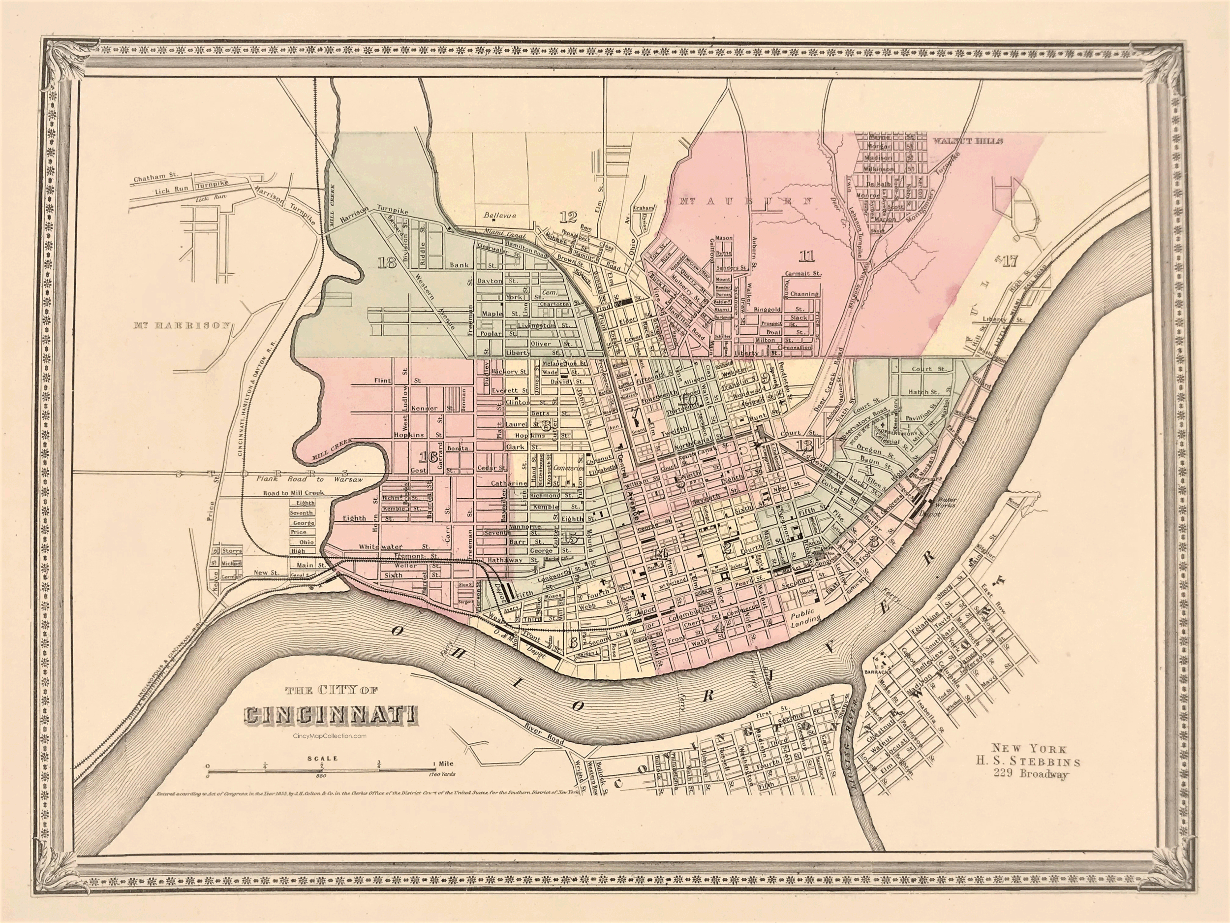
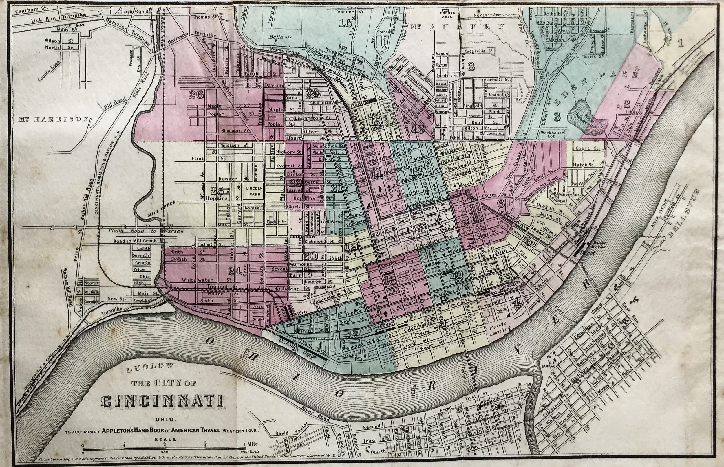
1855 Map of Cincinnati, J.H. Colton
3
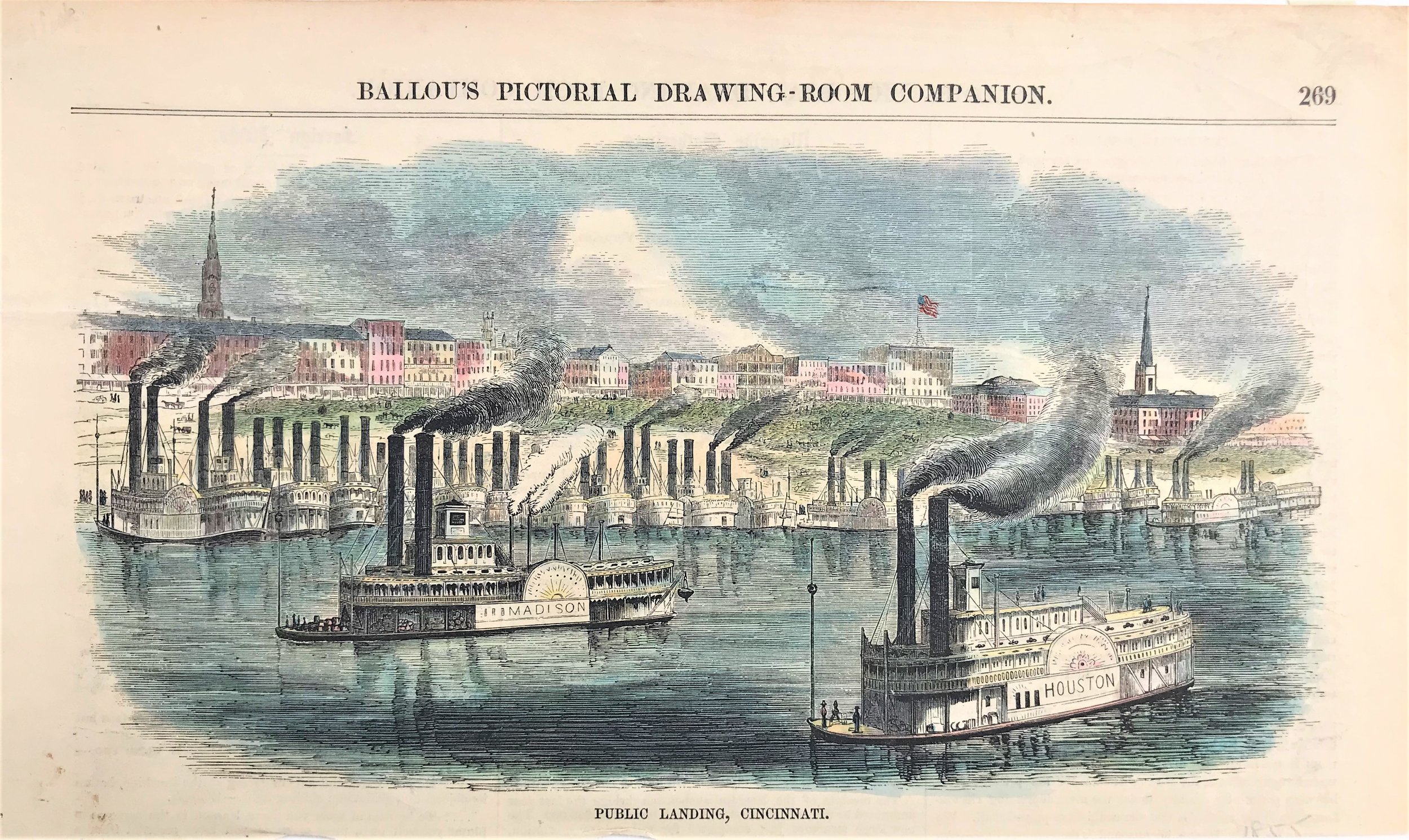
1855 Public Landing, Cincinnati
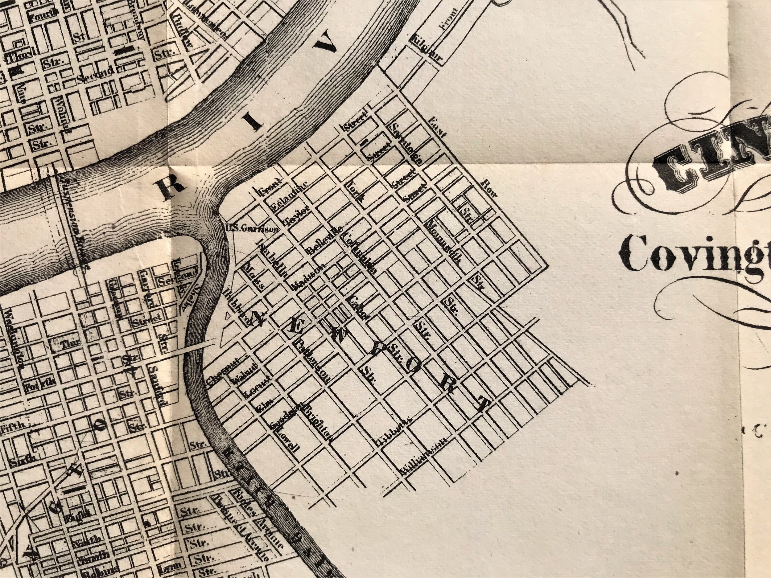
11
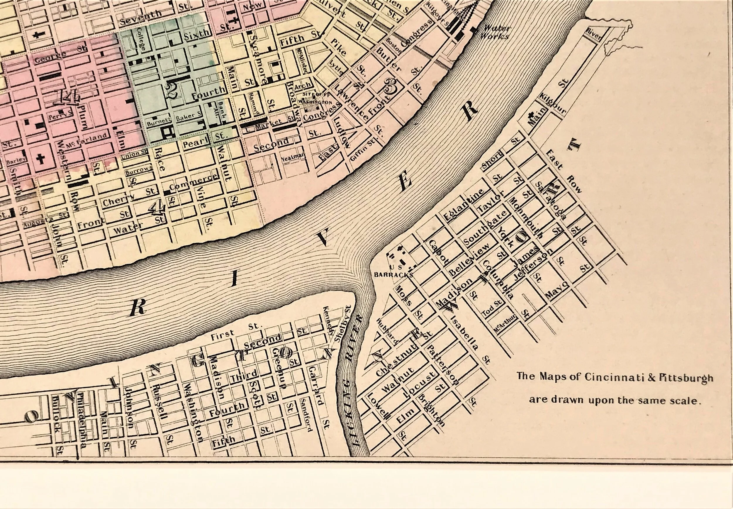
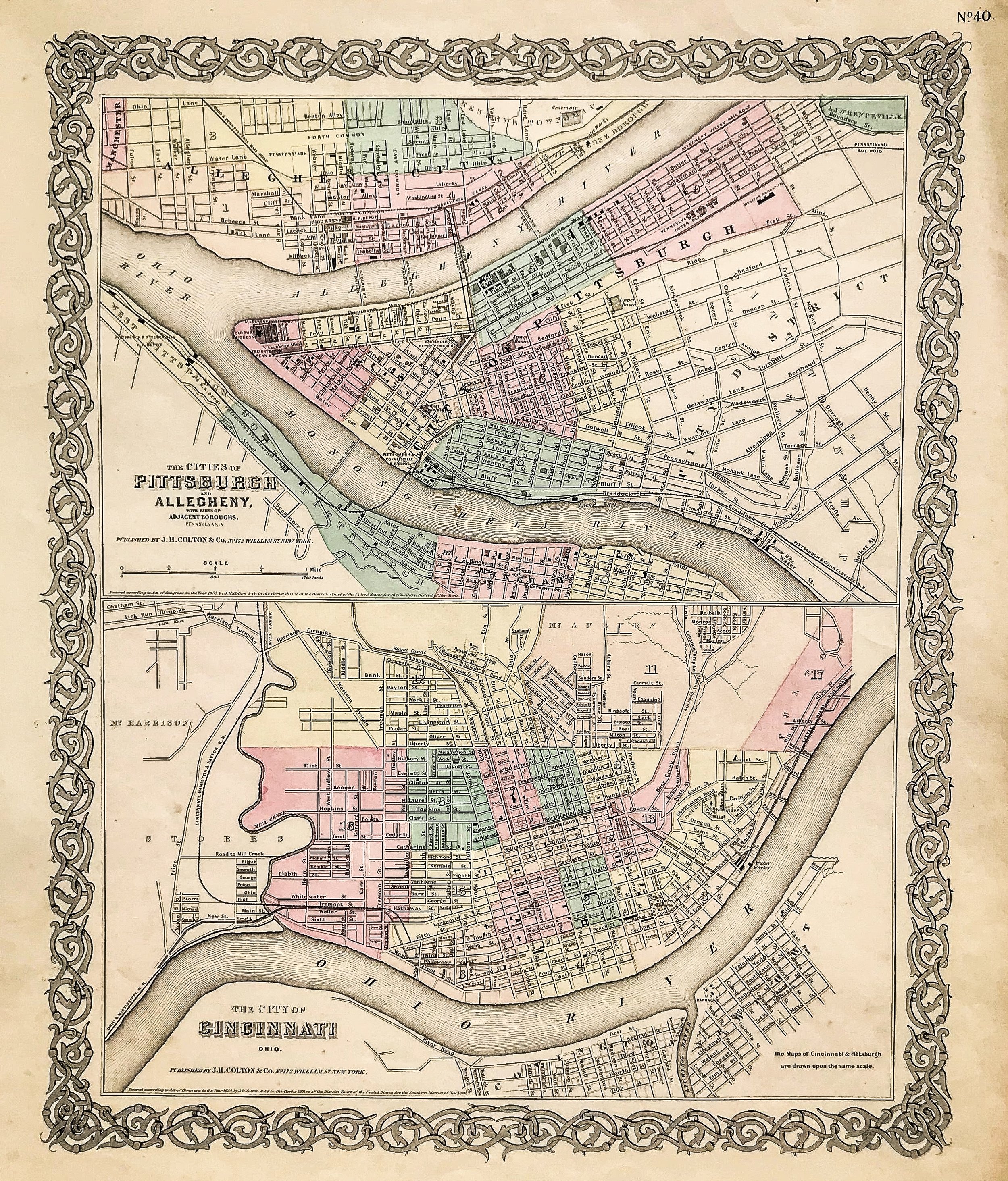
1856 The Cities of Cincinnati and Pittsburg
6
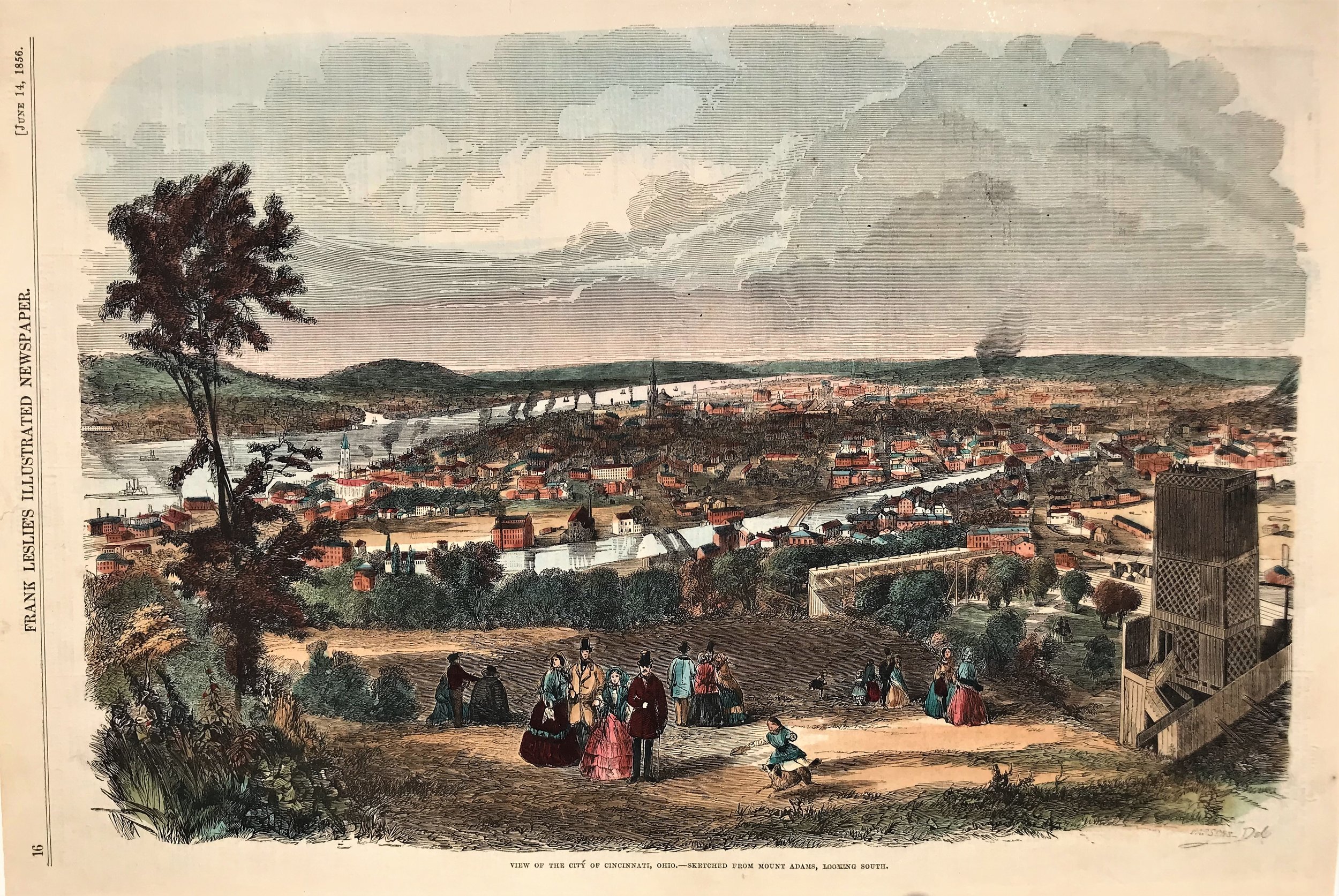
1856 Print: View of the City of Cincinnati, Ohio
3
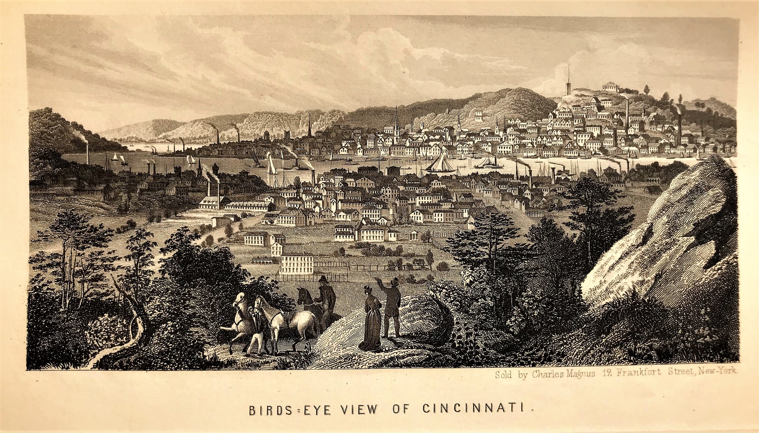
1856 Print: Birds Eye View of Cincinnati
5
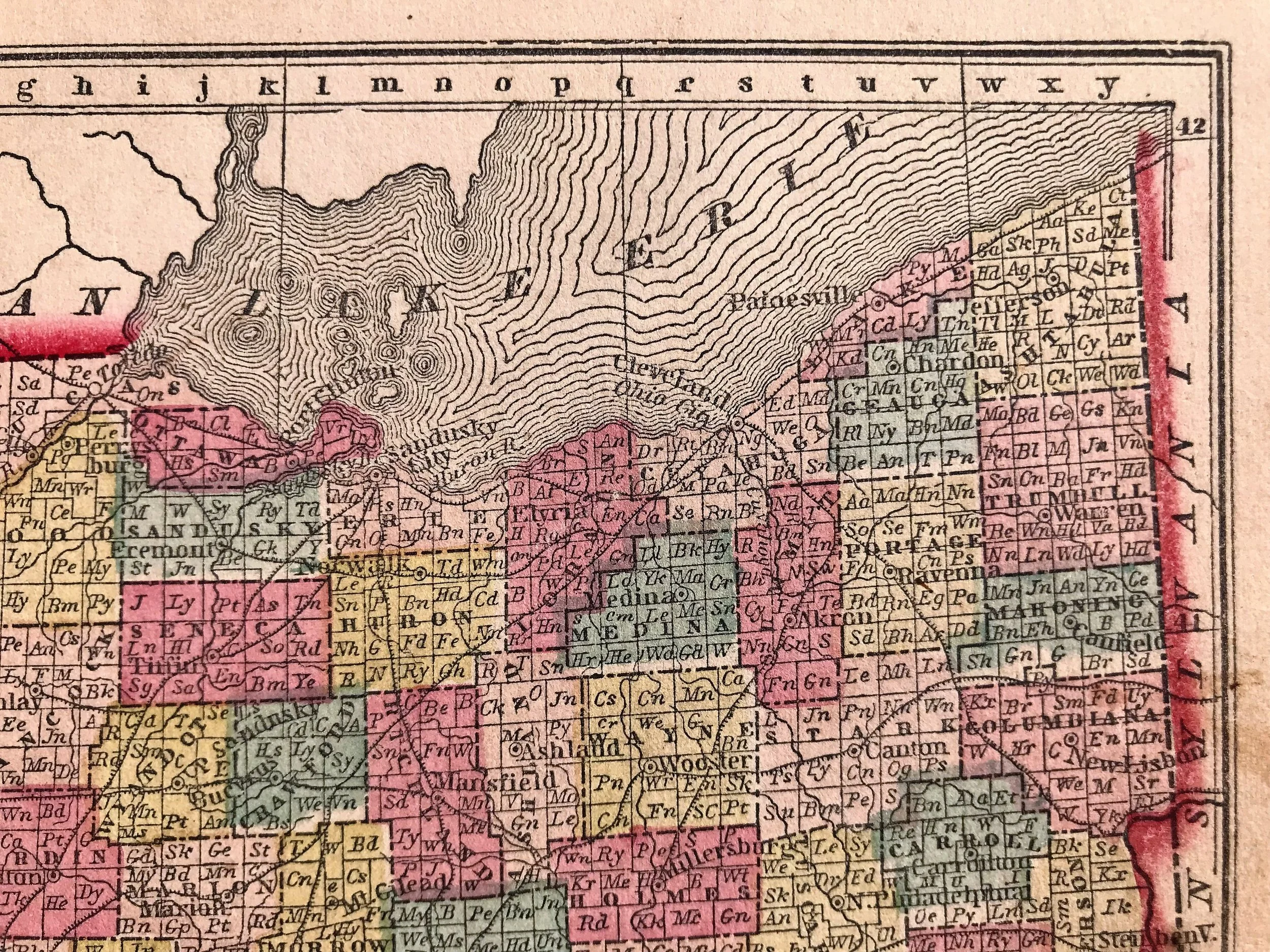
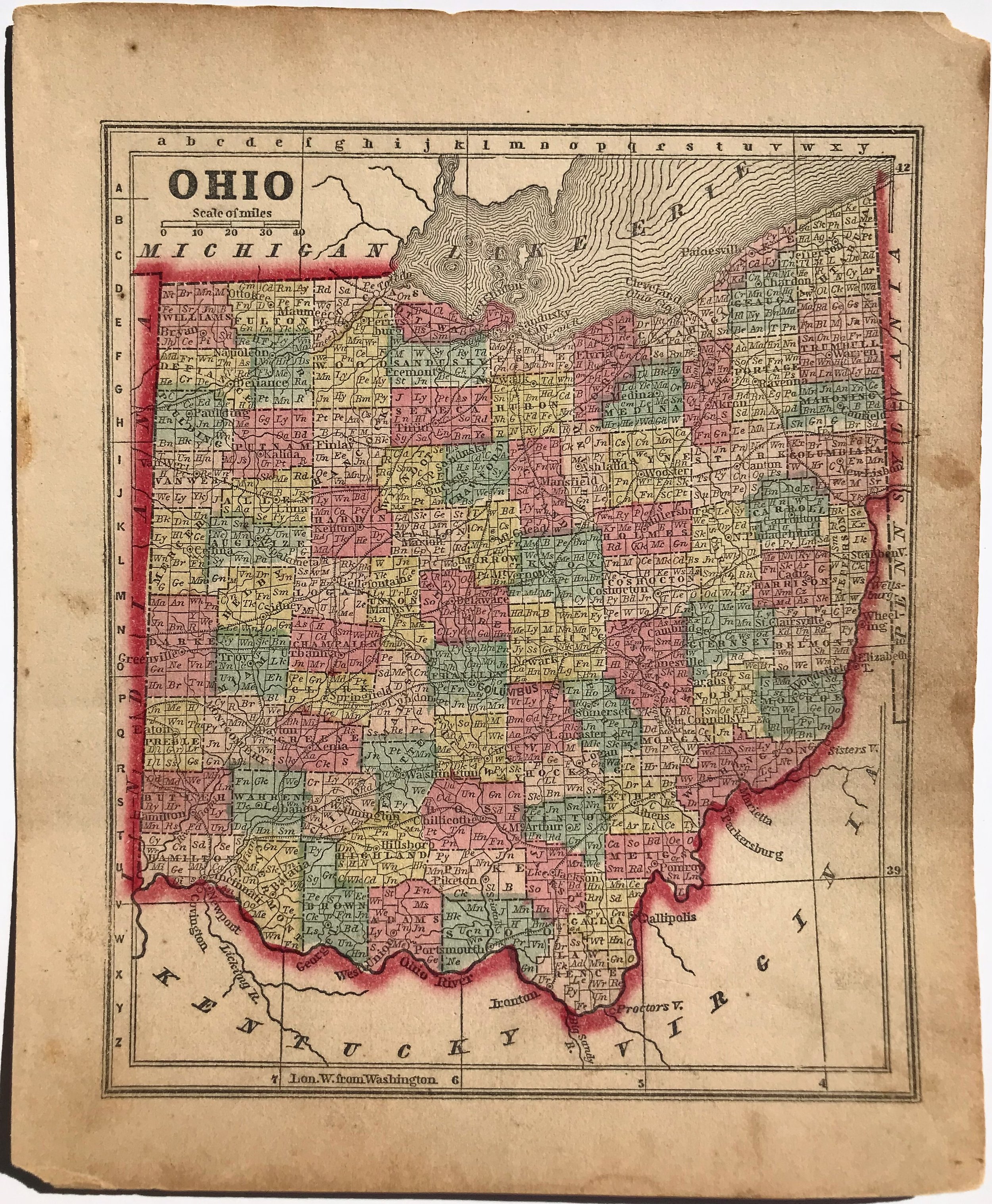
1857 Map of Ohio
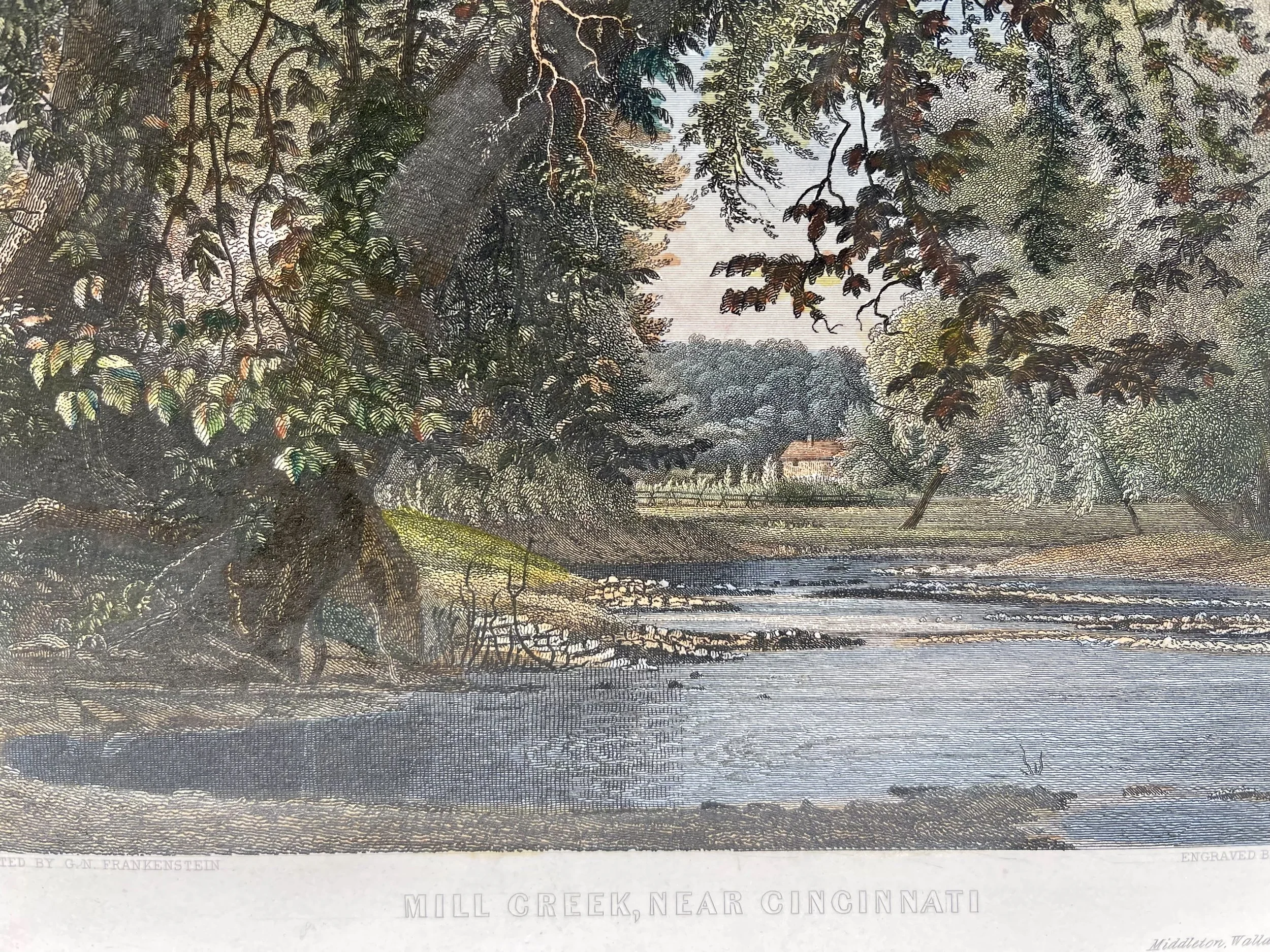
2
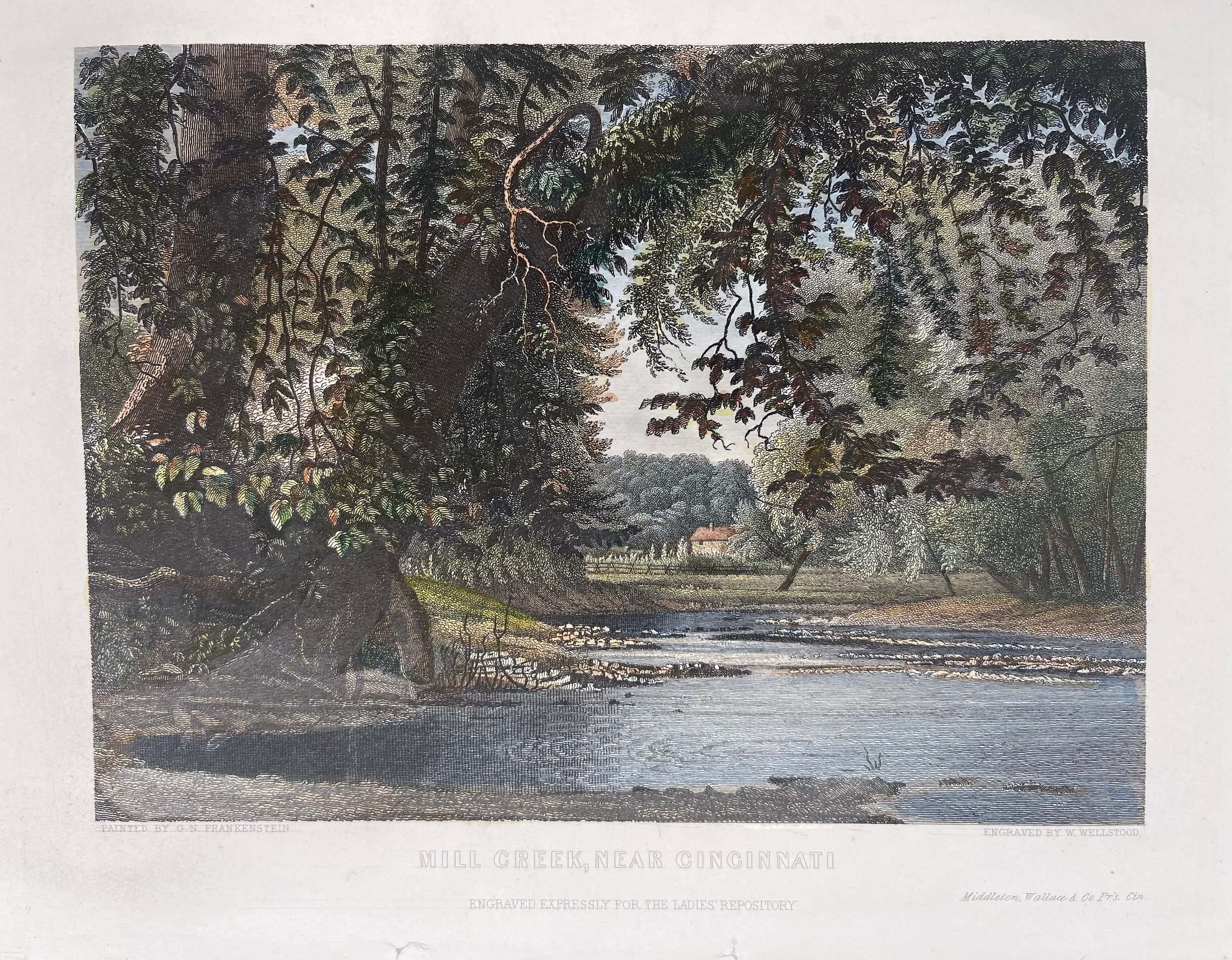
1857 Mill Creek, near Cincinnati
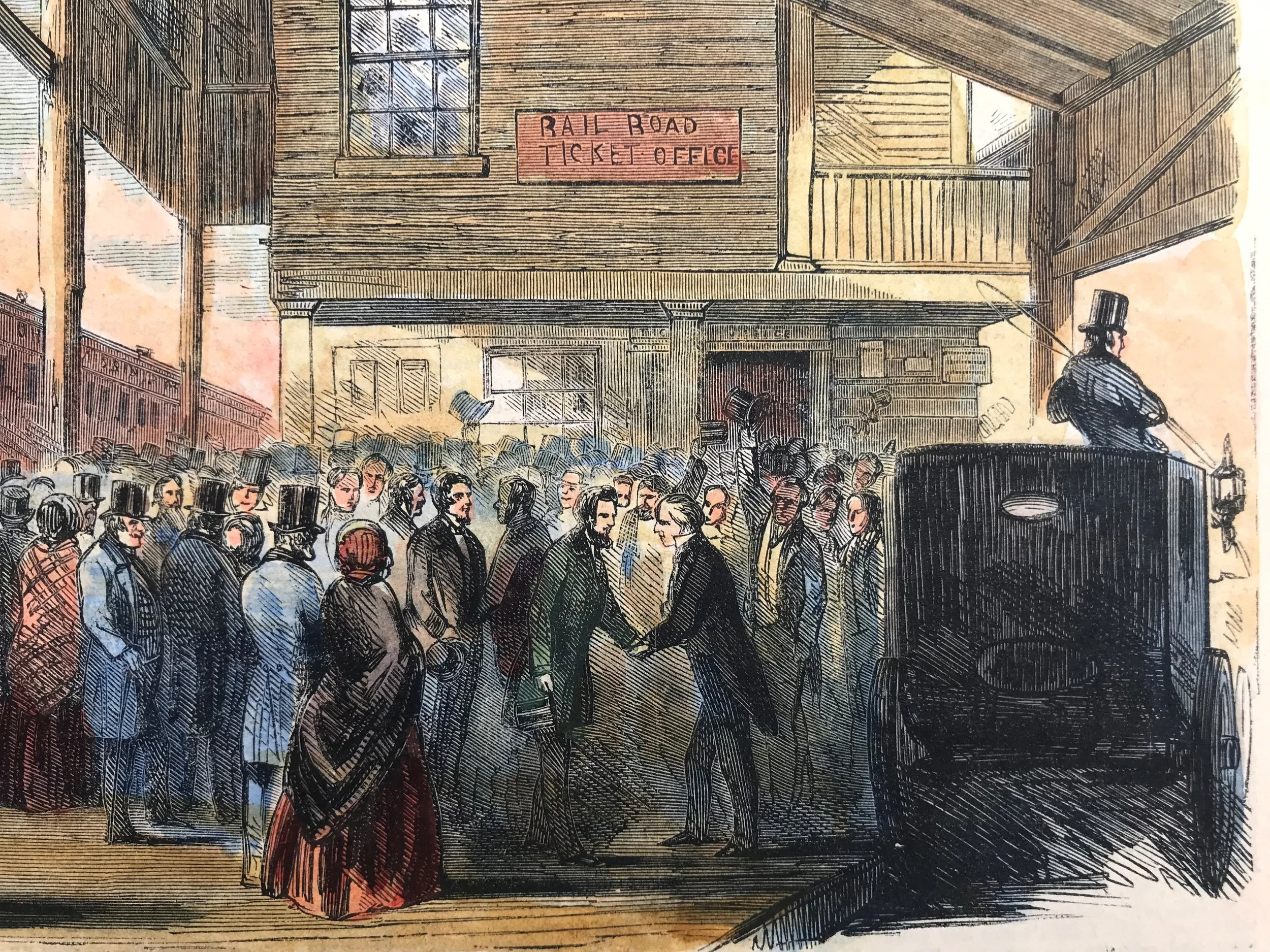
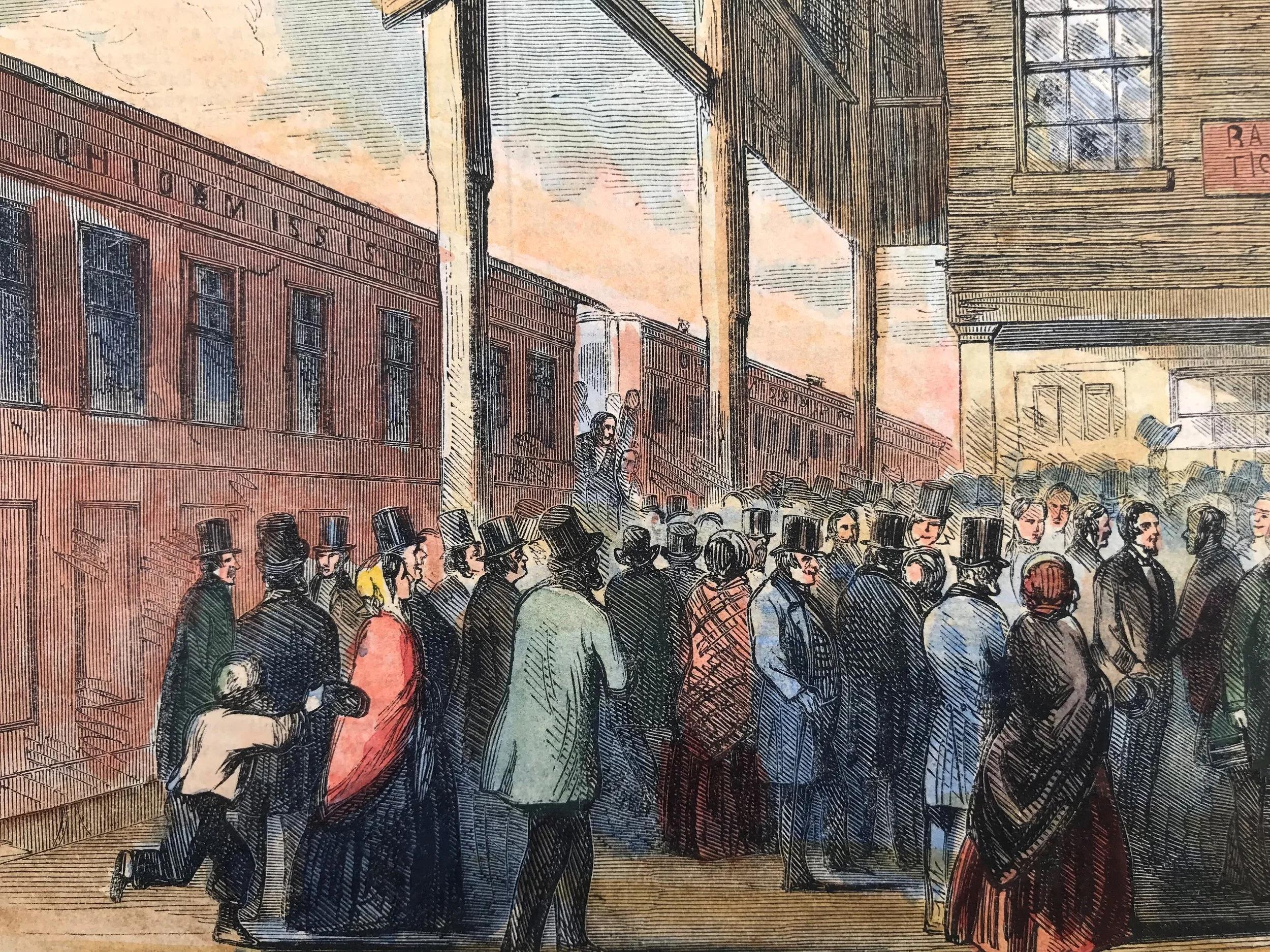
4
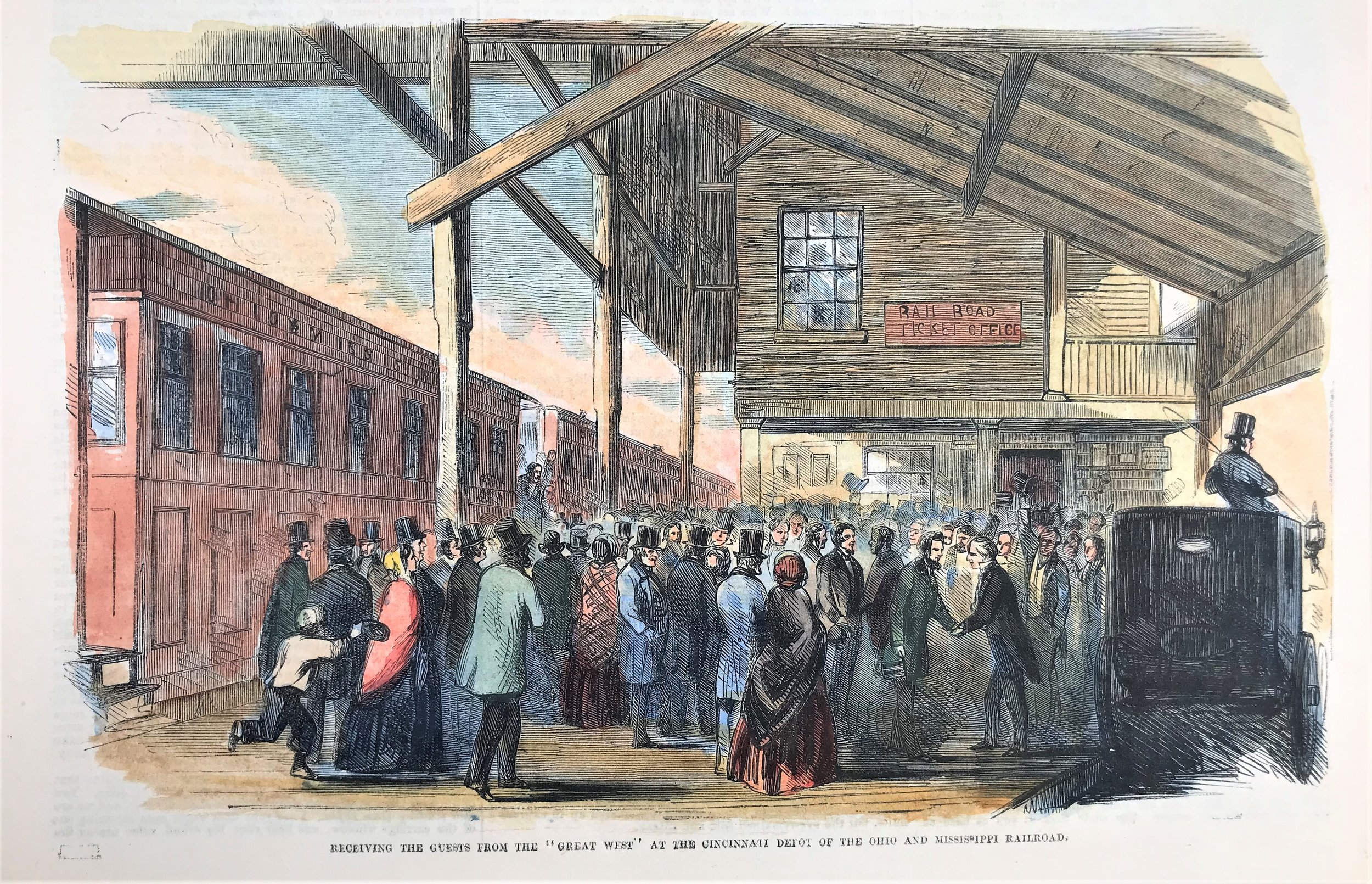
1857 The Cincinnati Depot of the Ohio and Mississippi Railroad
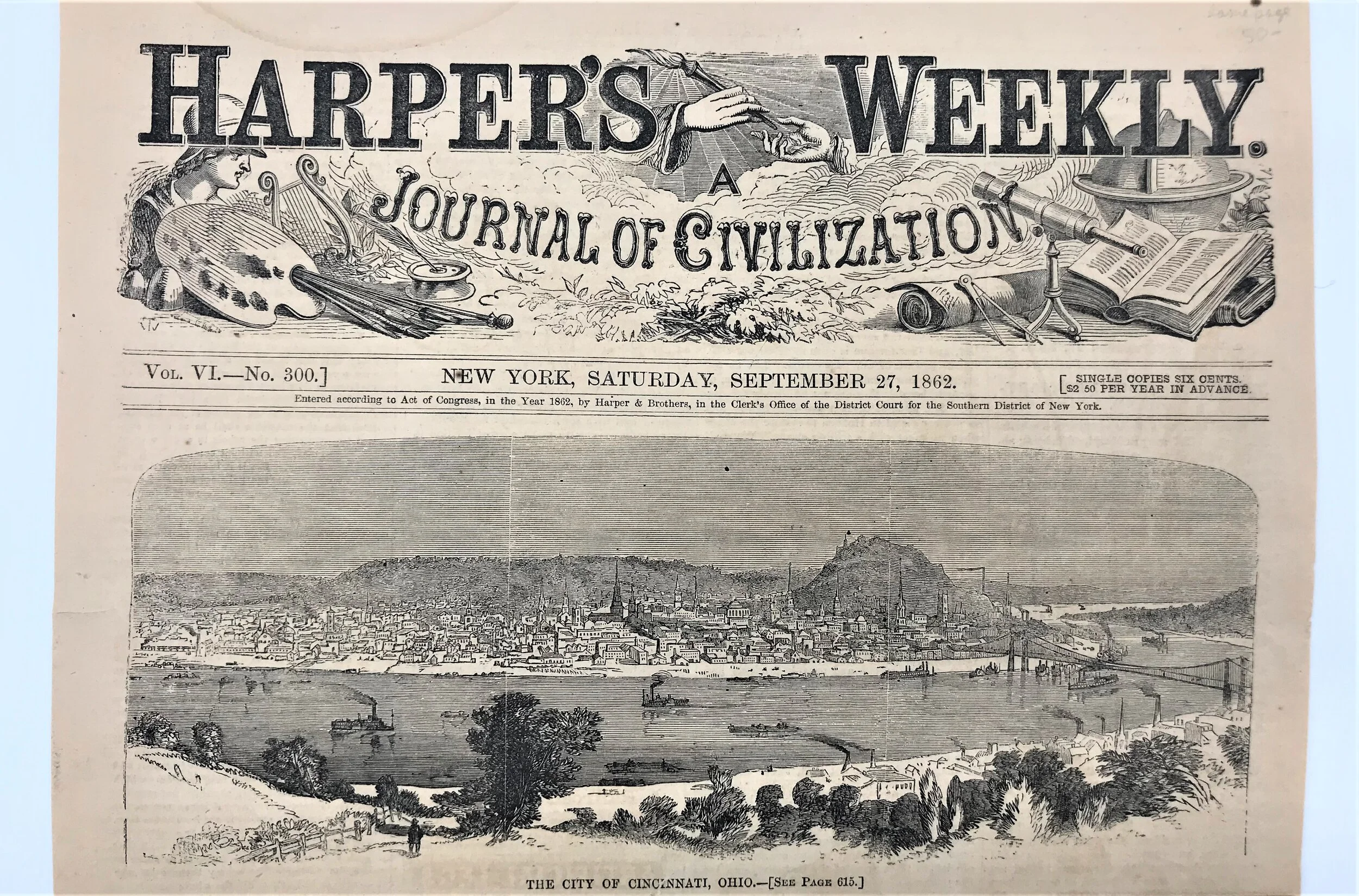
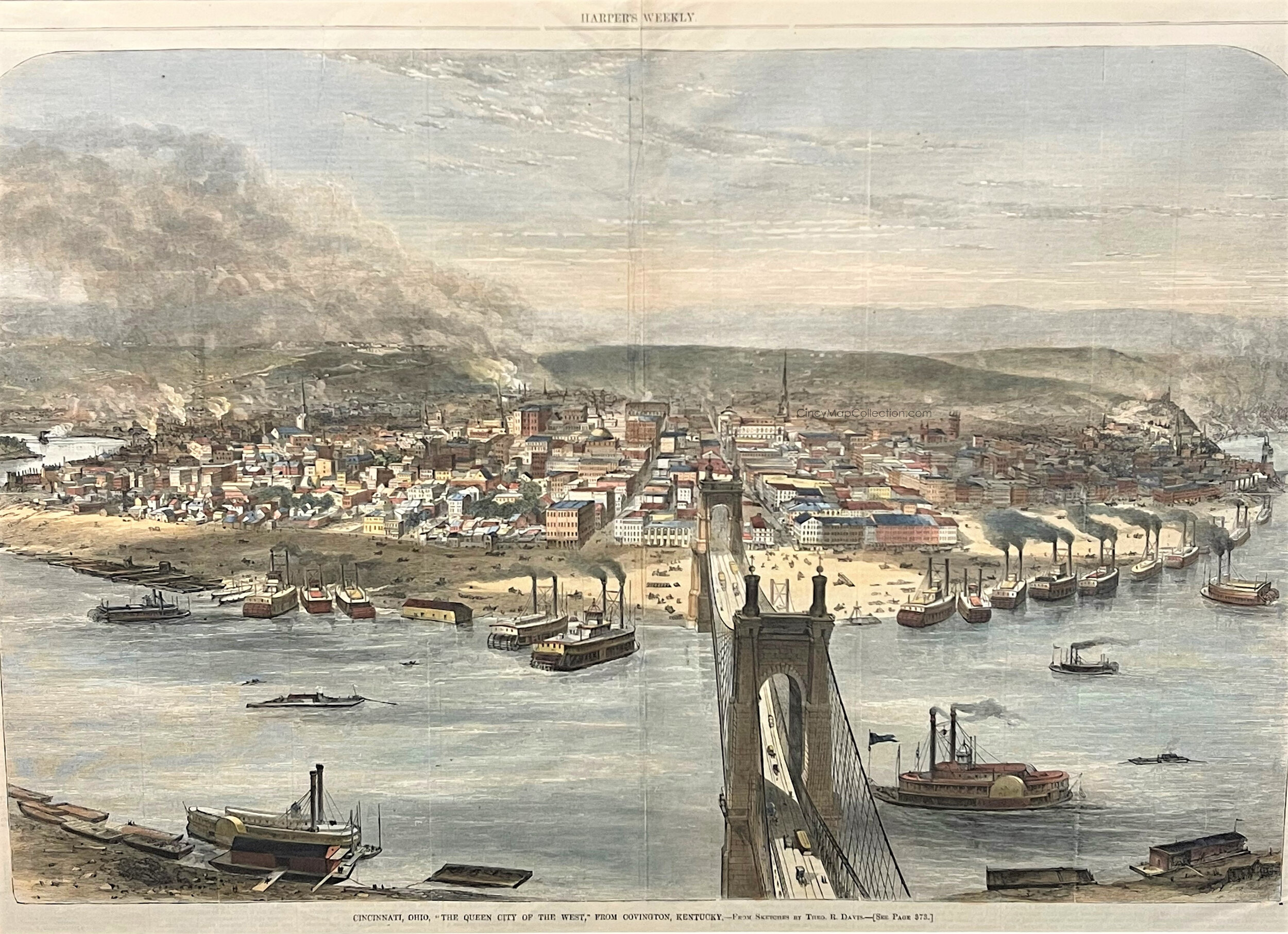
3
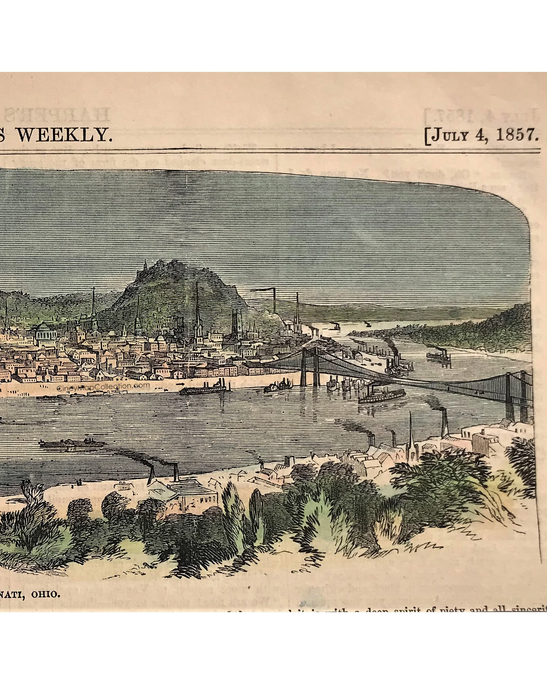
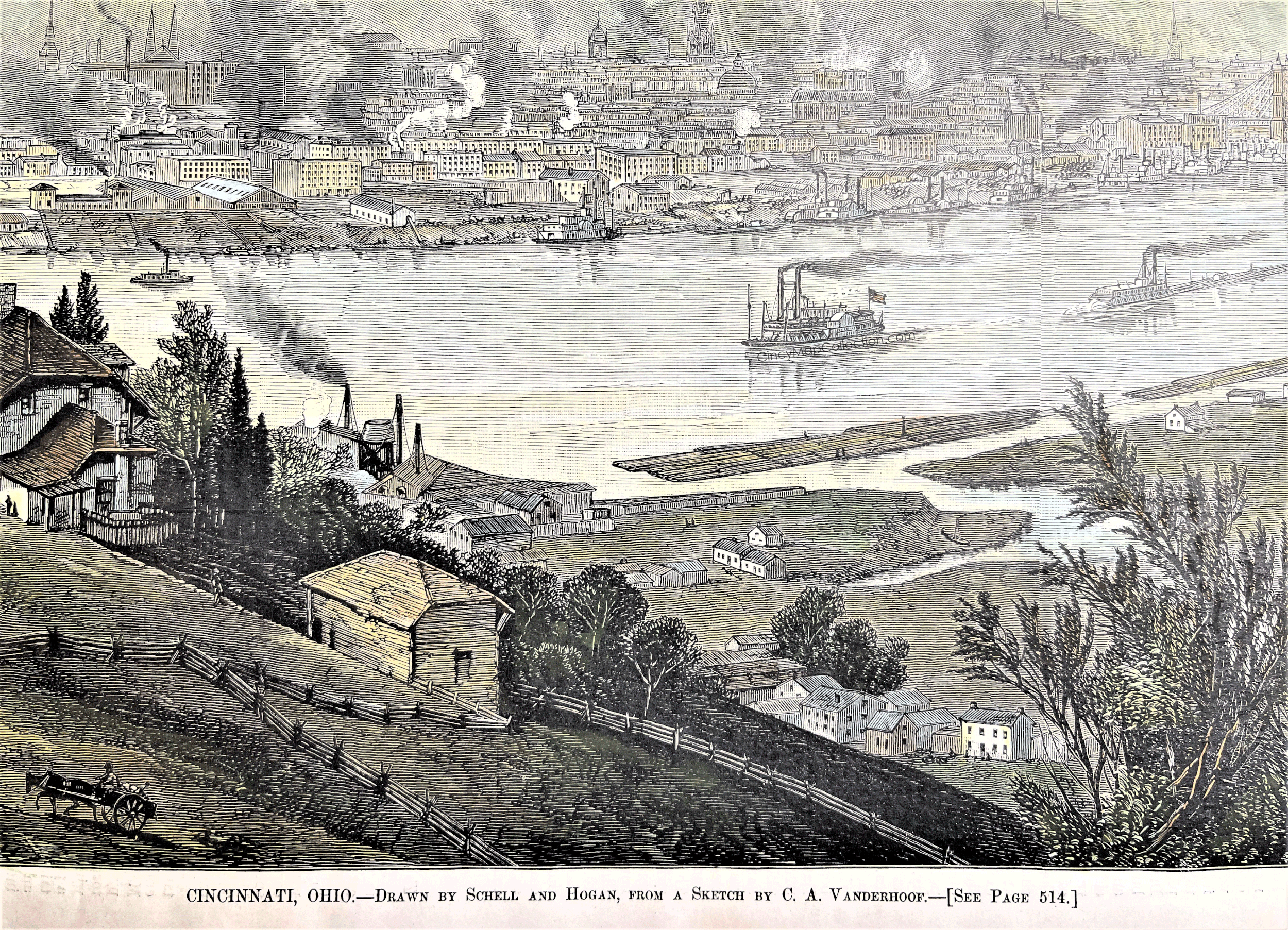
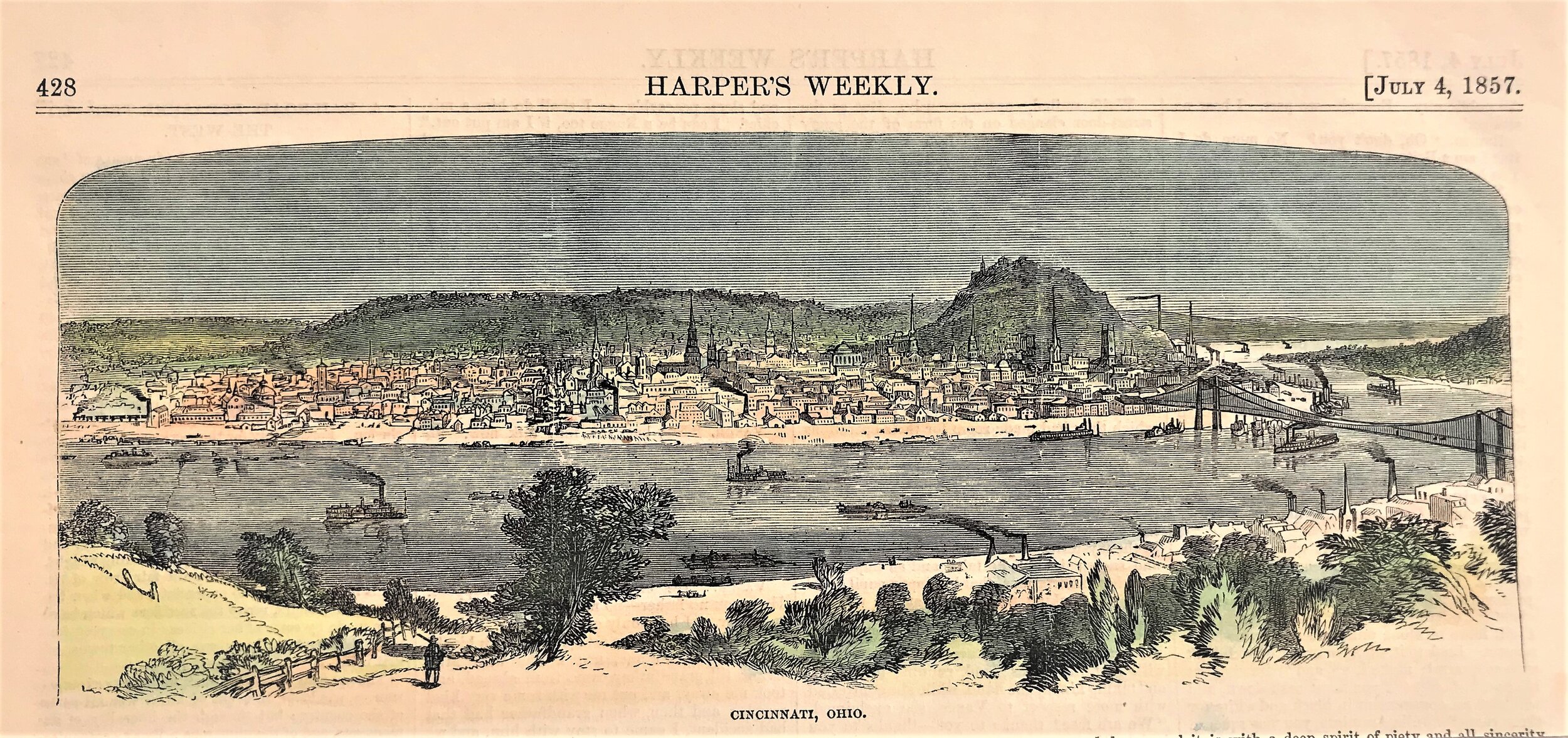
1857 Print: Cincinnati, Ohio - Harper's Weekley
4
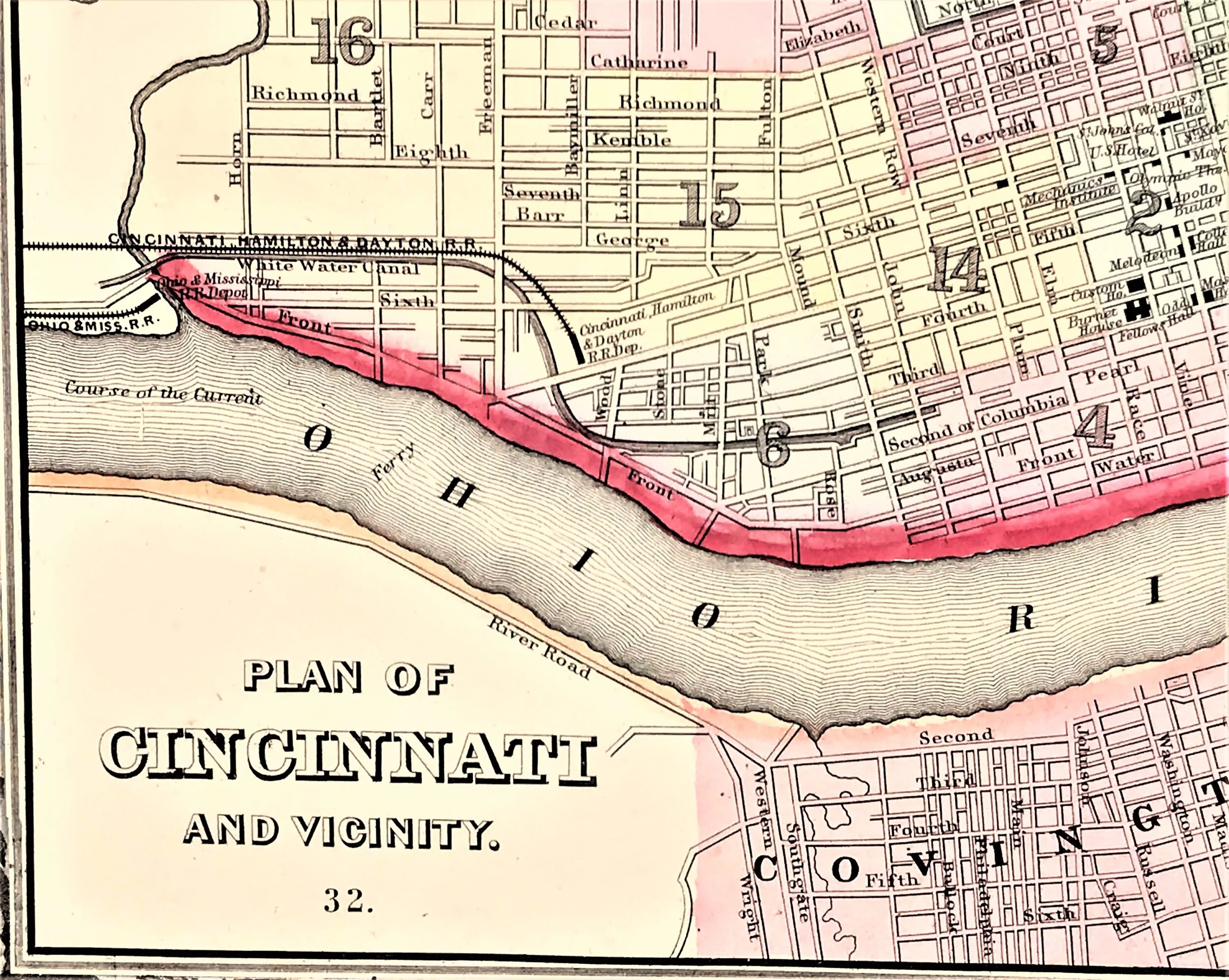
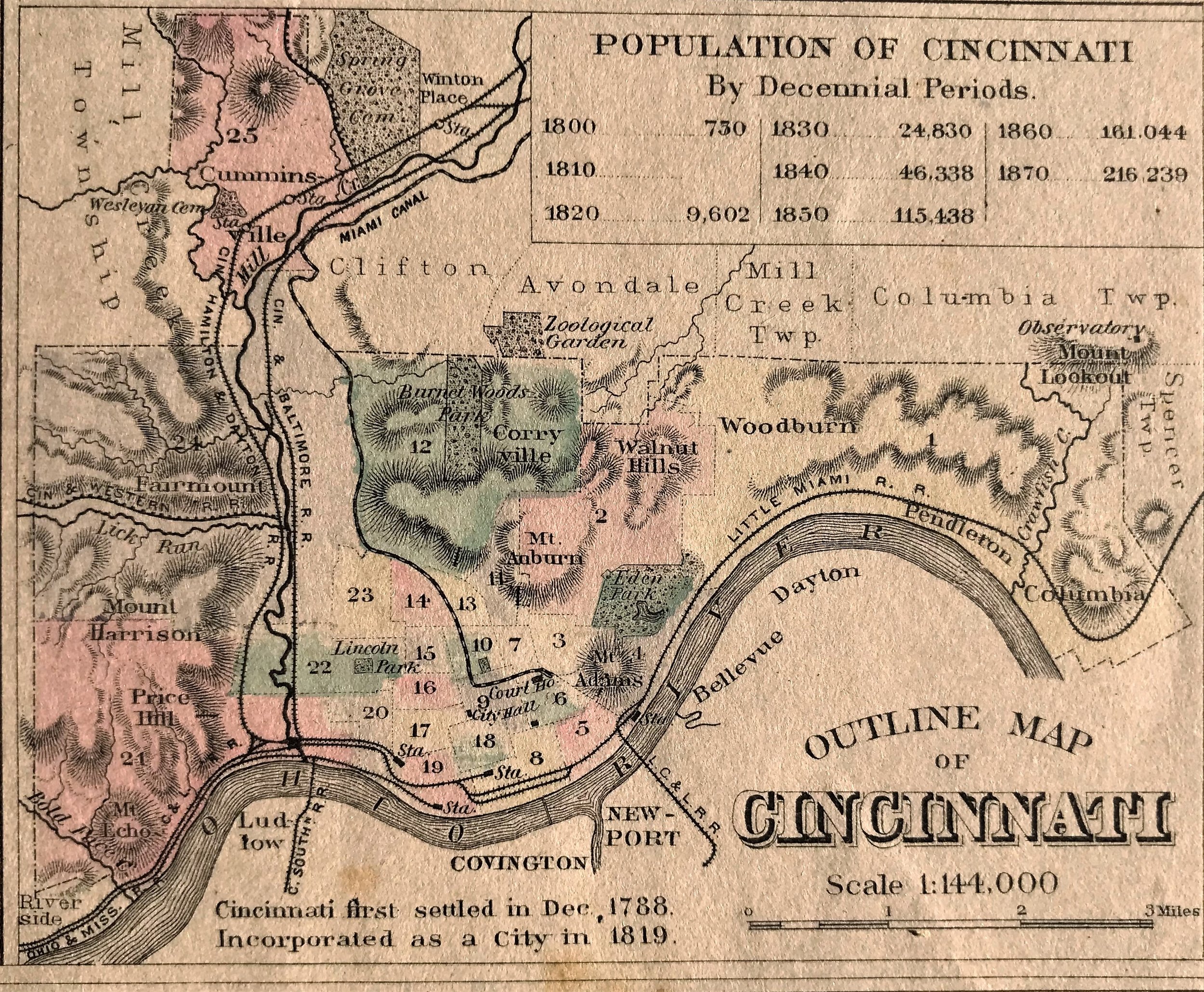
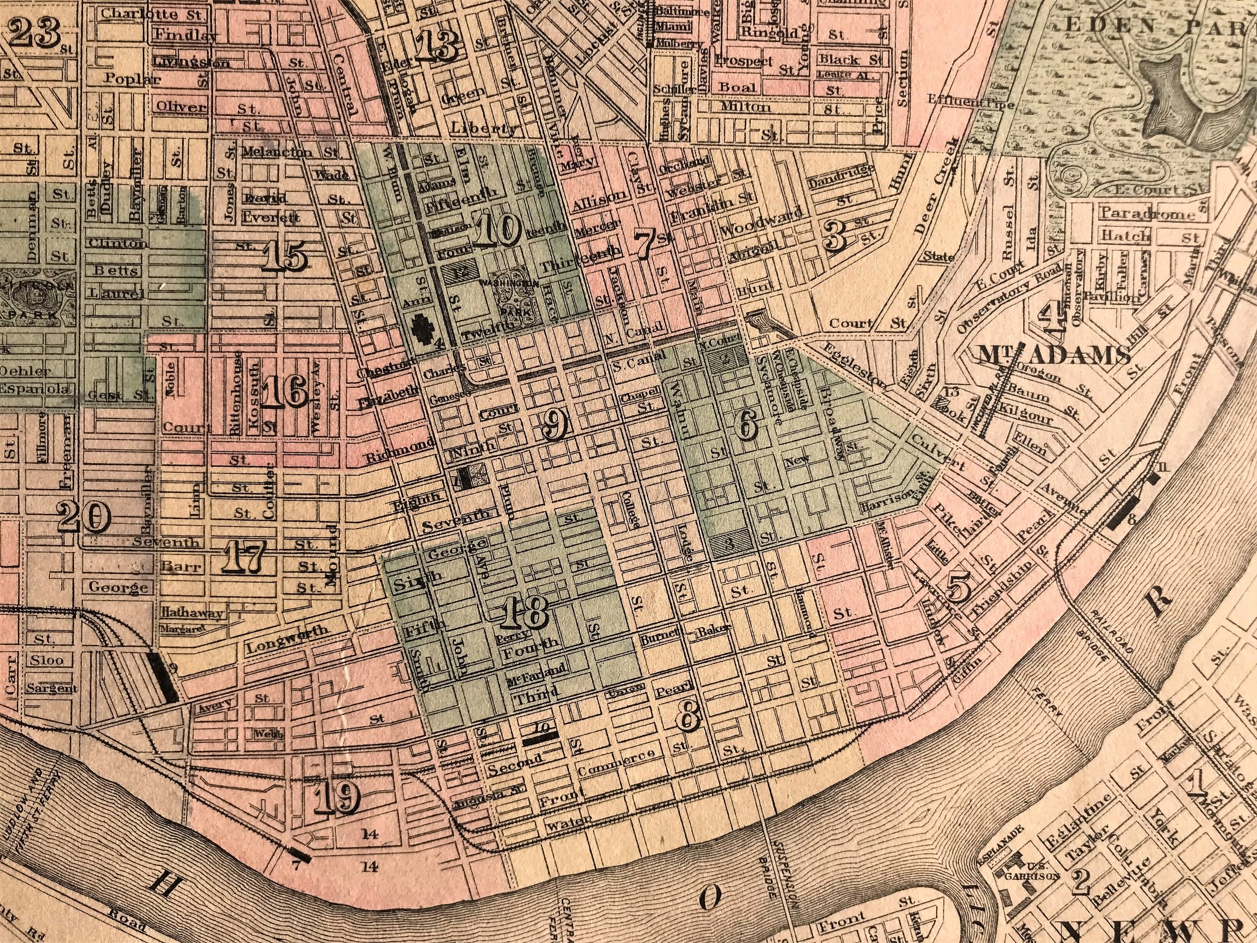
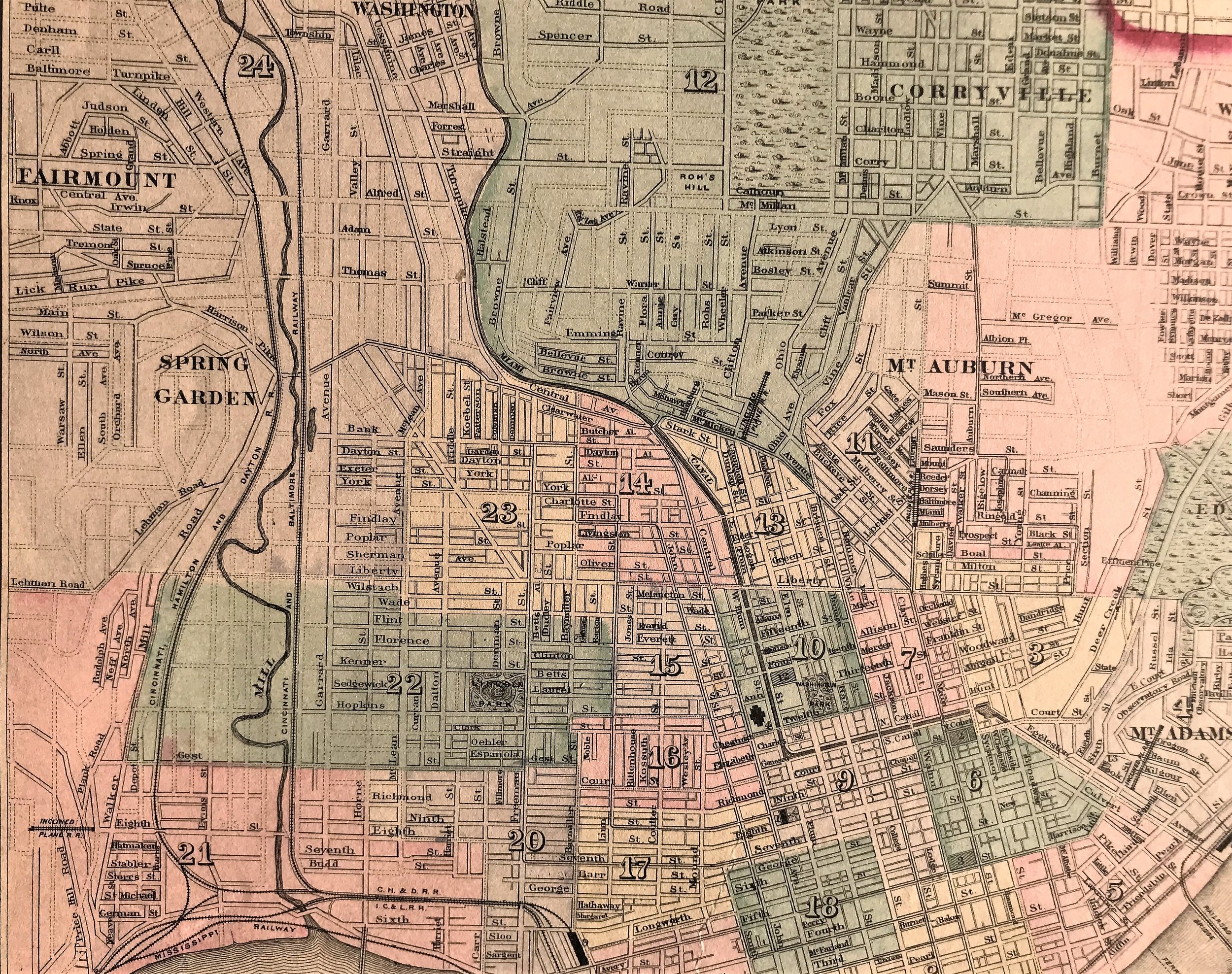
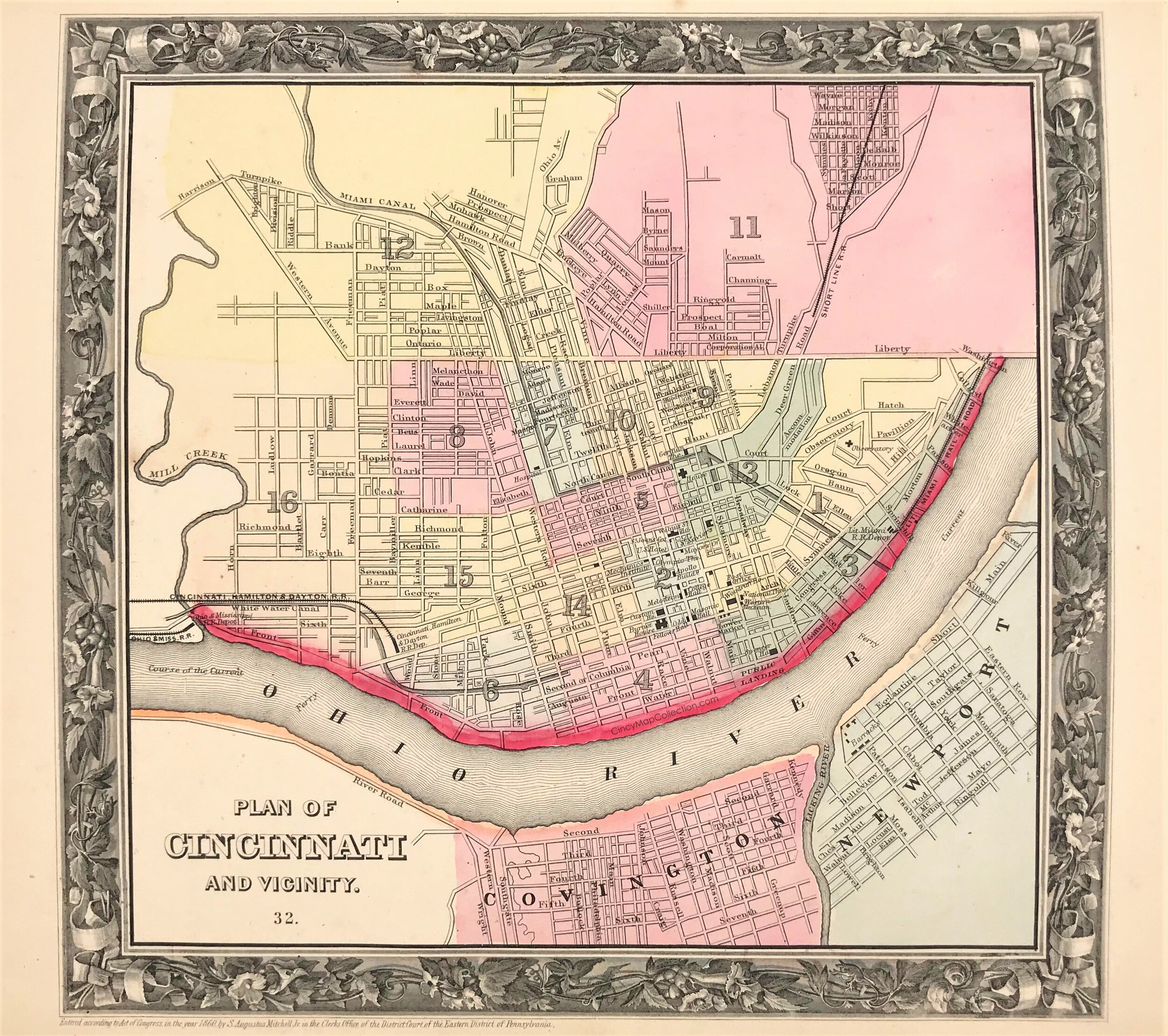
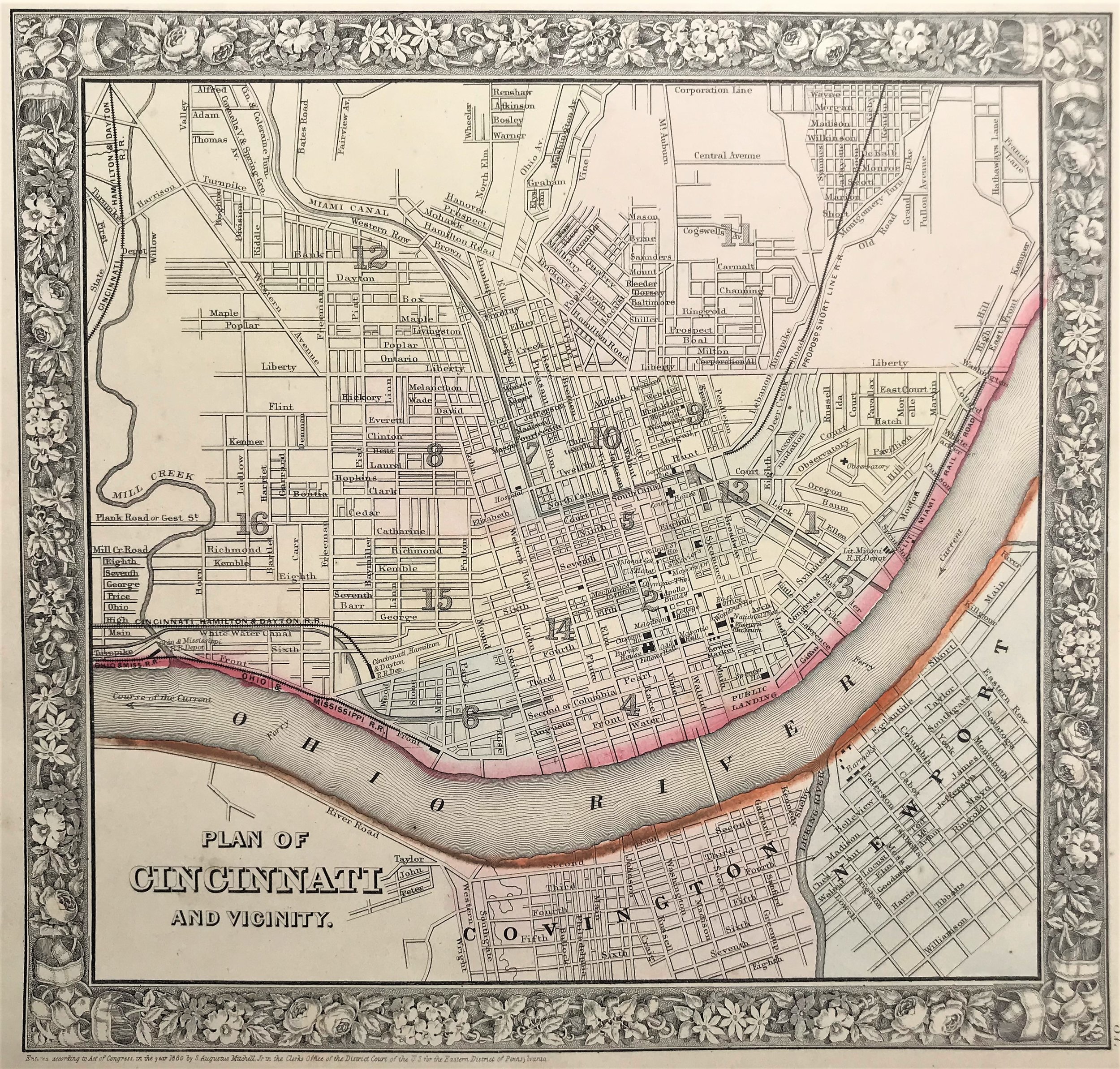
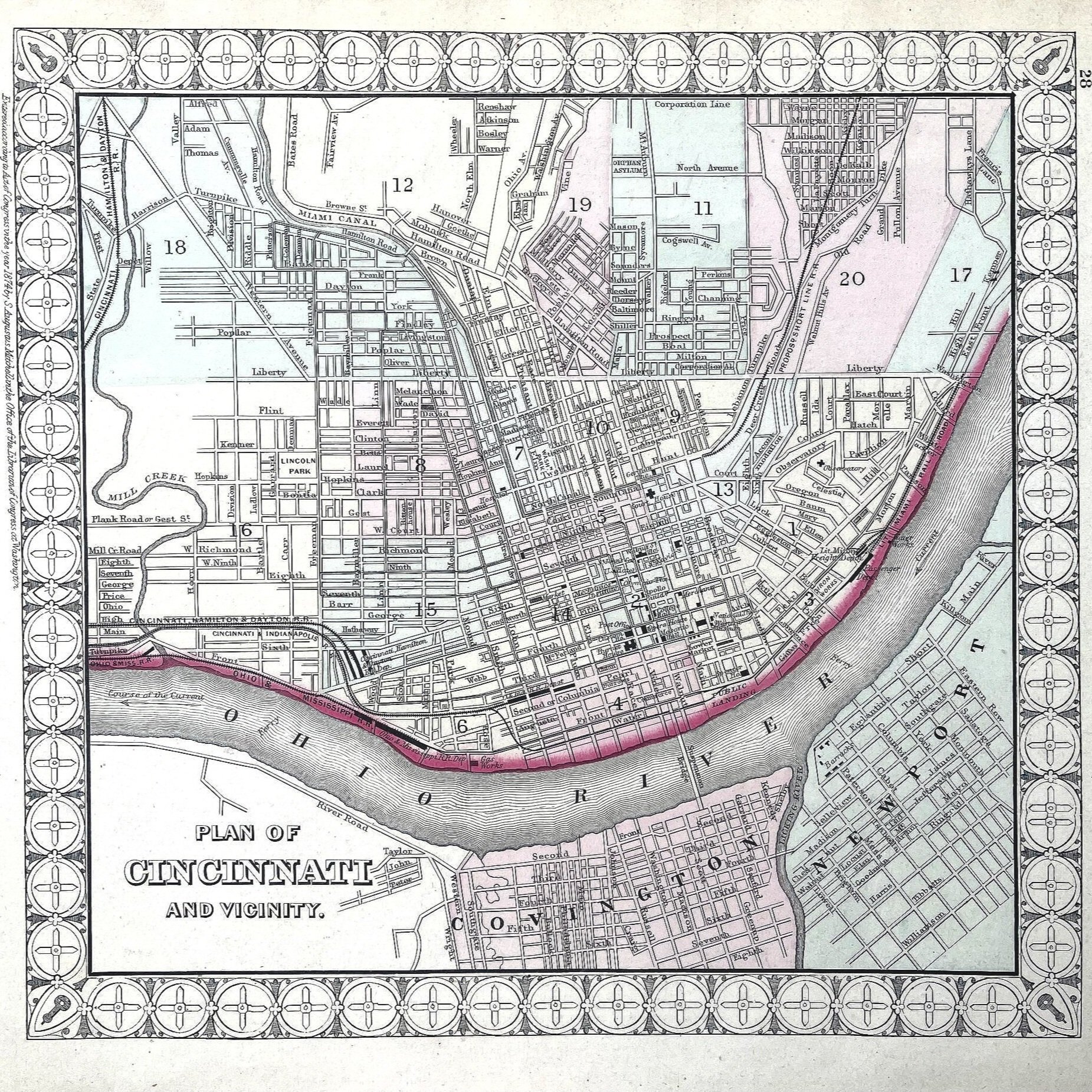
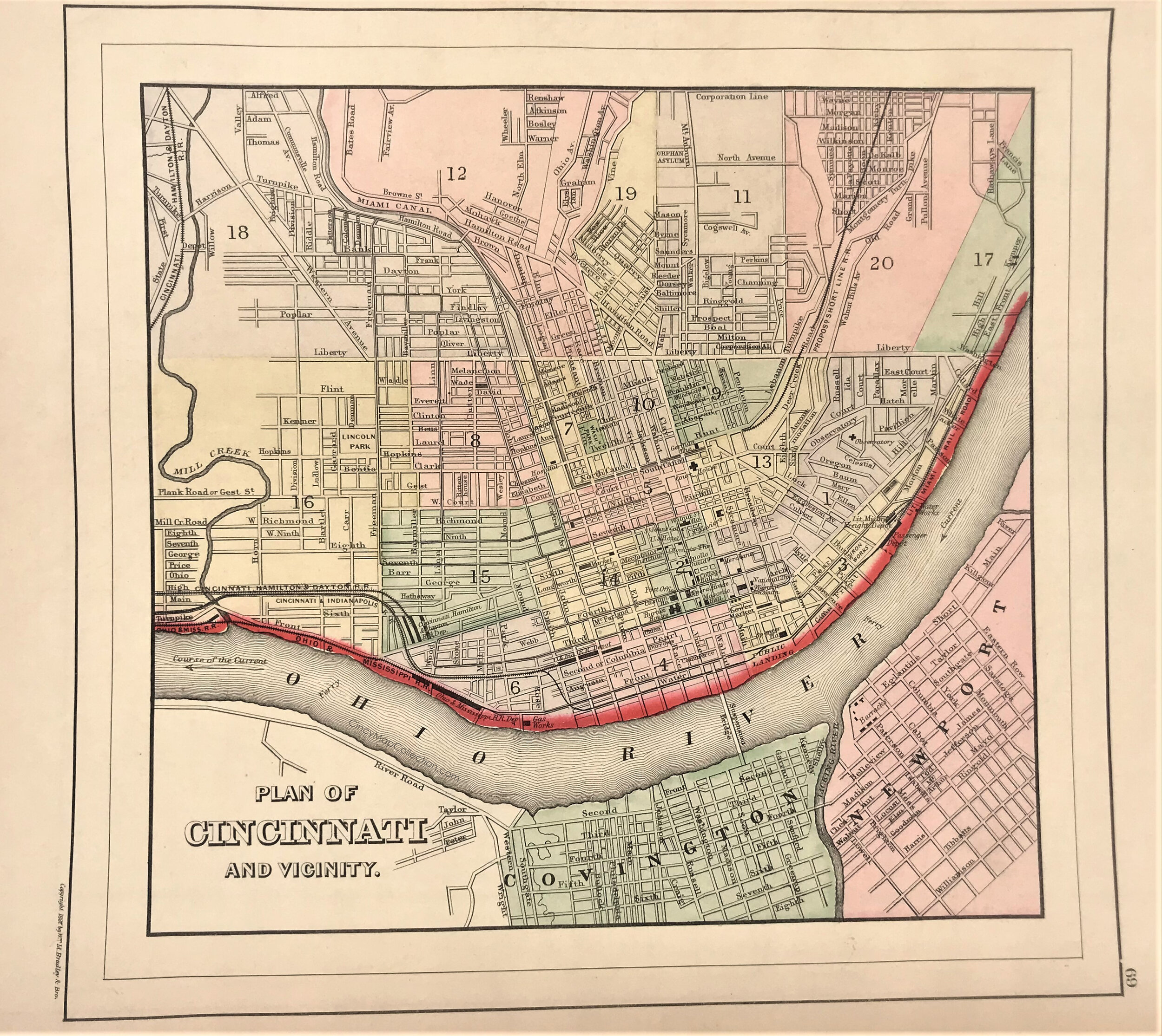
1860 Plan of Cincinnati and Vicinity
4
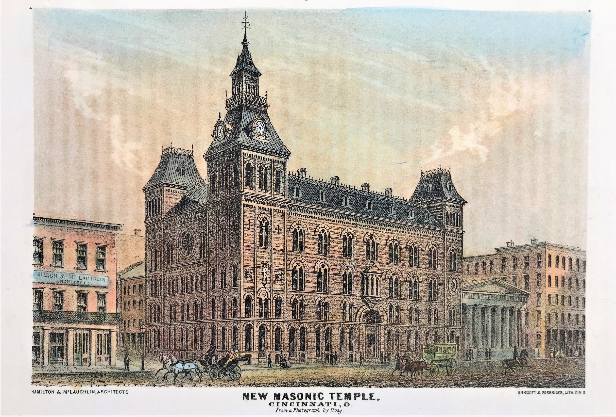
1860 New Masonic Temple, Cincinnati
5
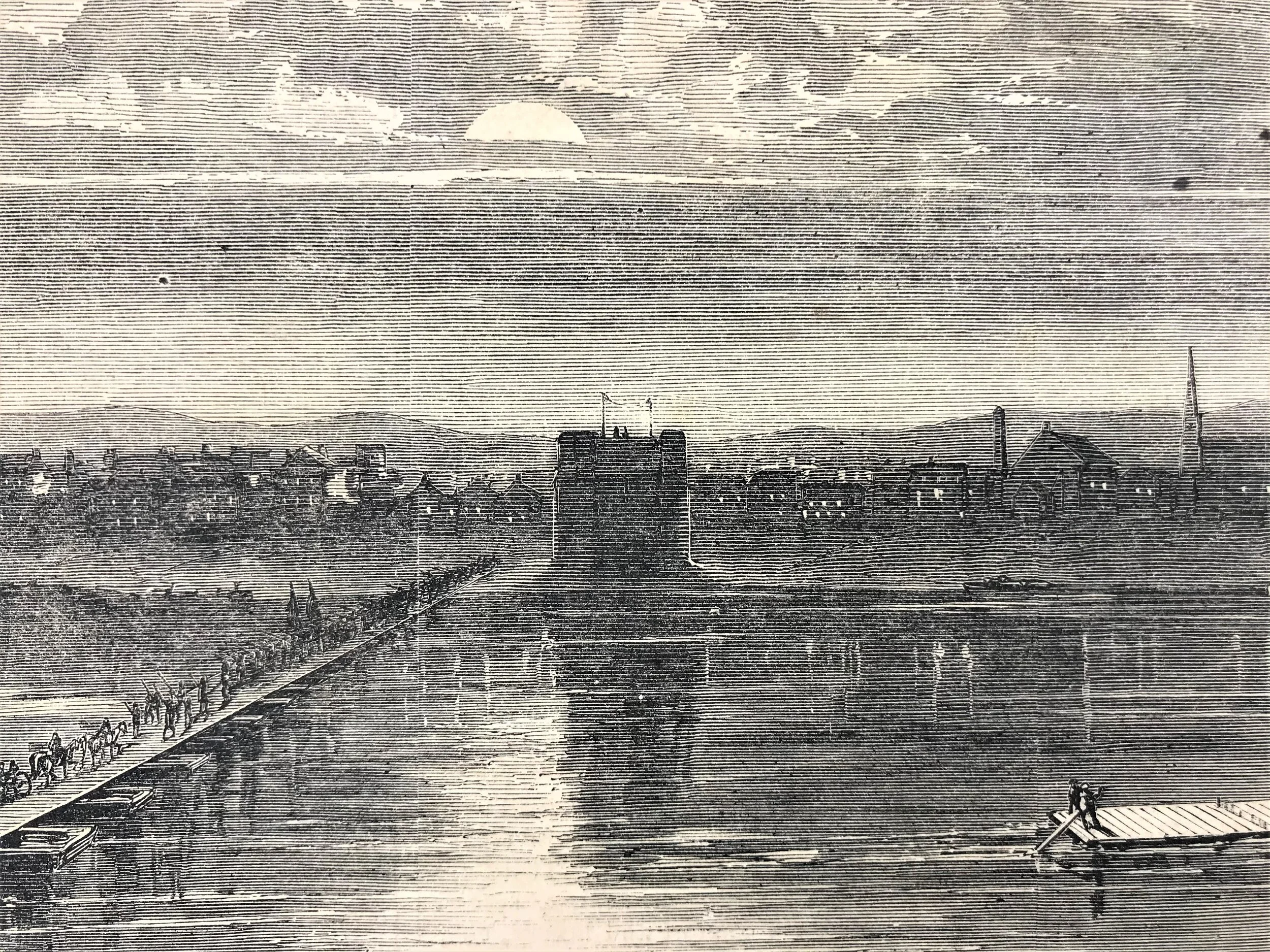
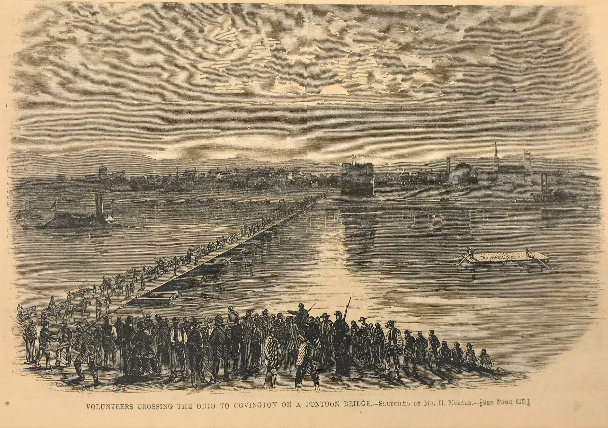
1862 Volunteers Crossing The Ohio to Covington
9
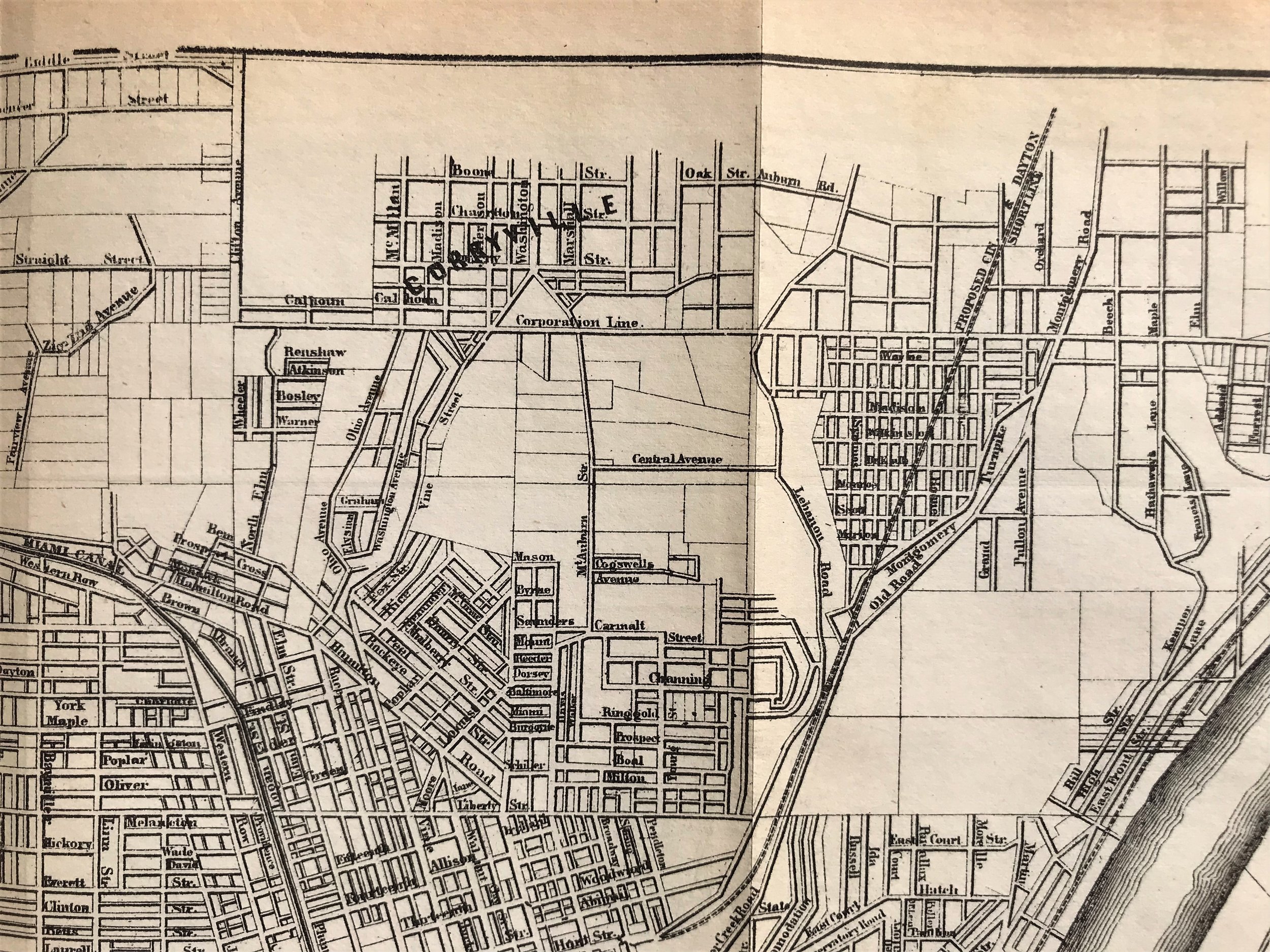
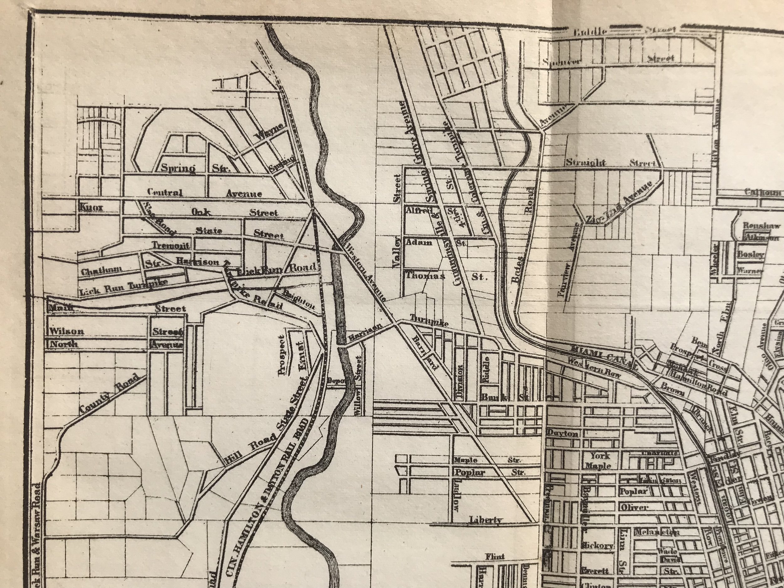
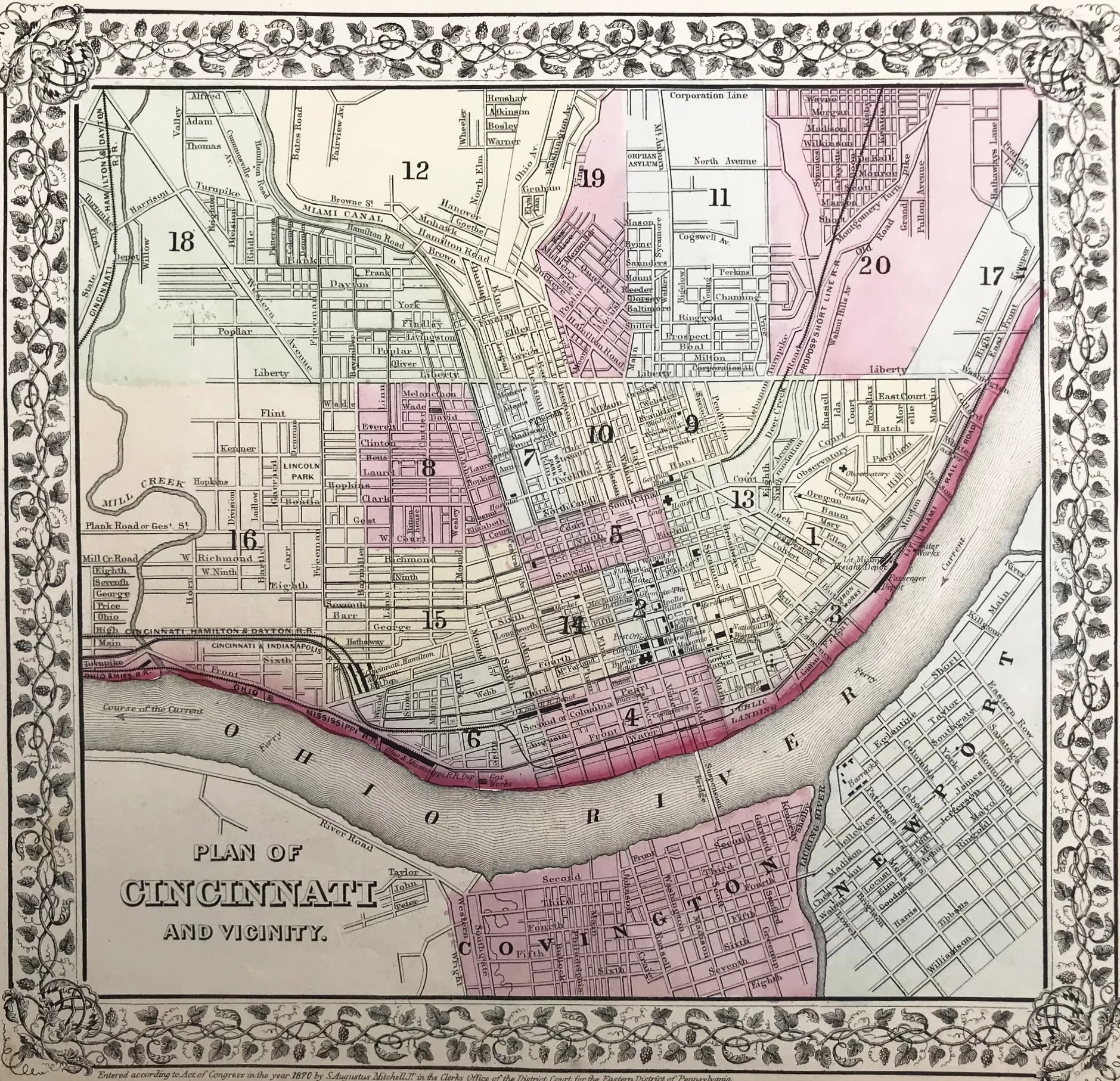
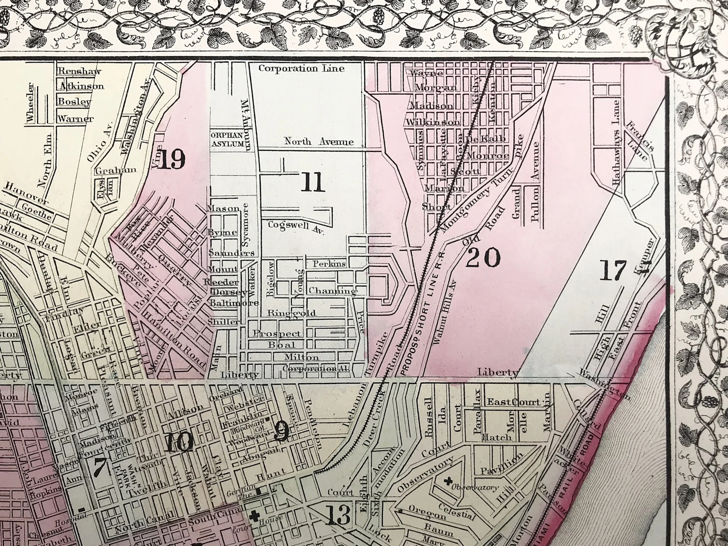
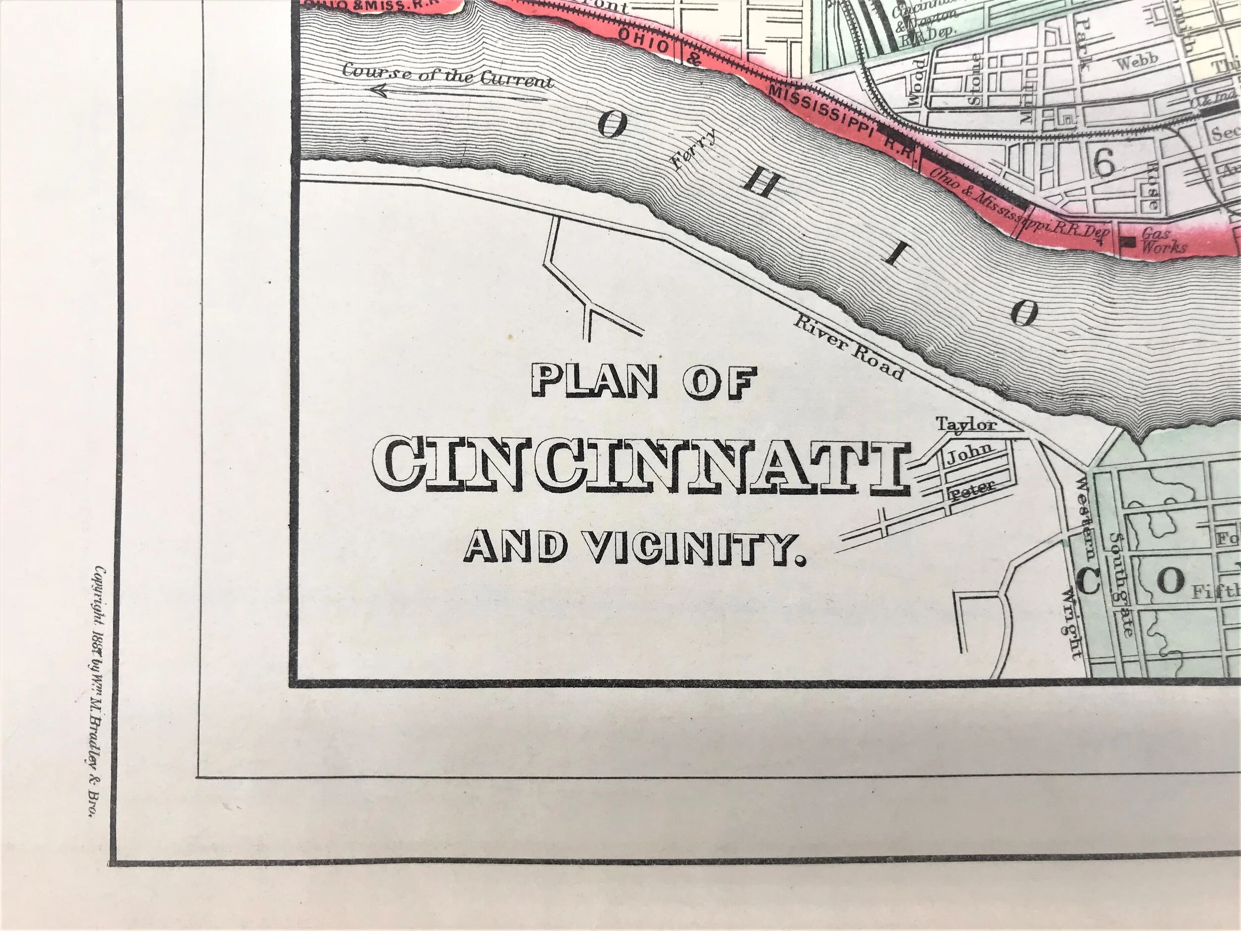
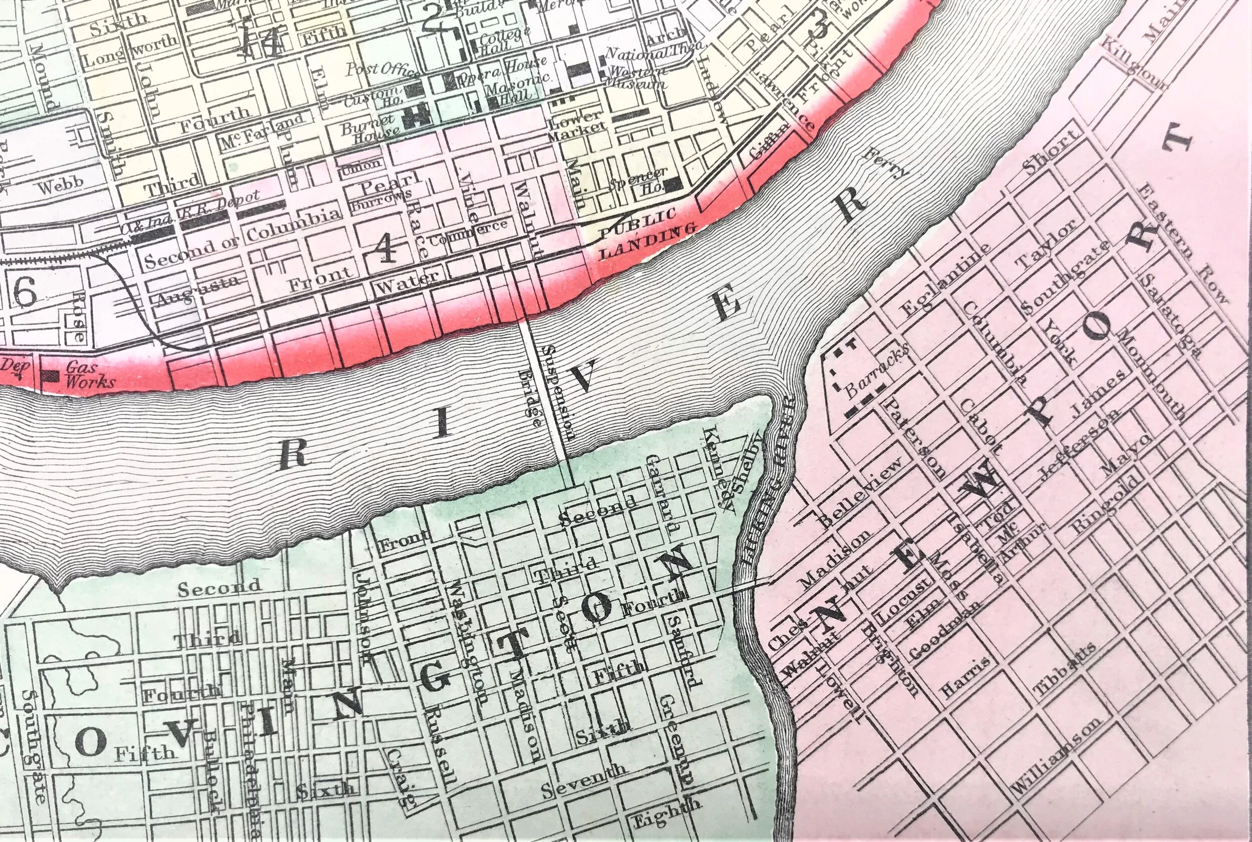
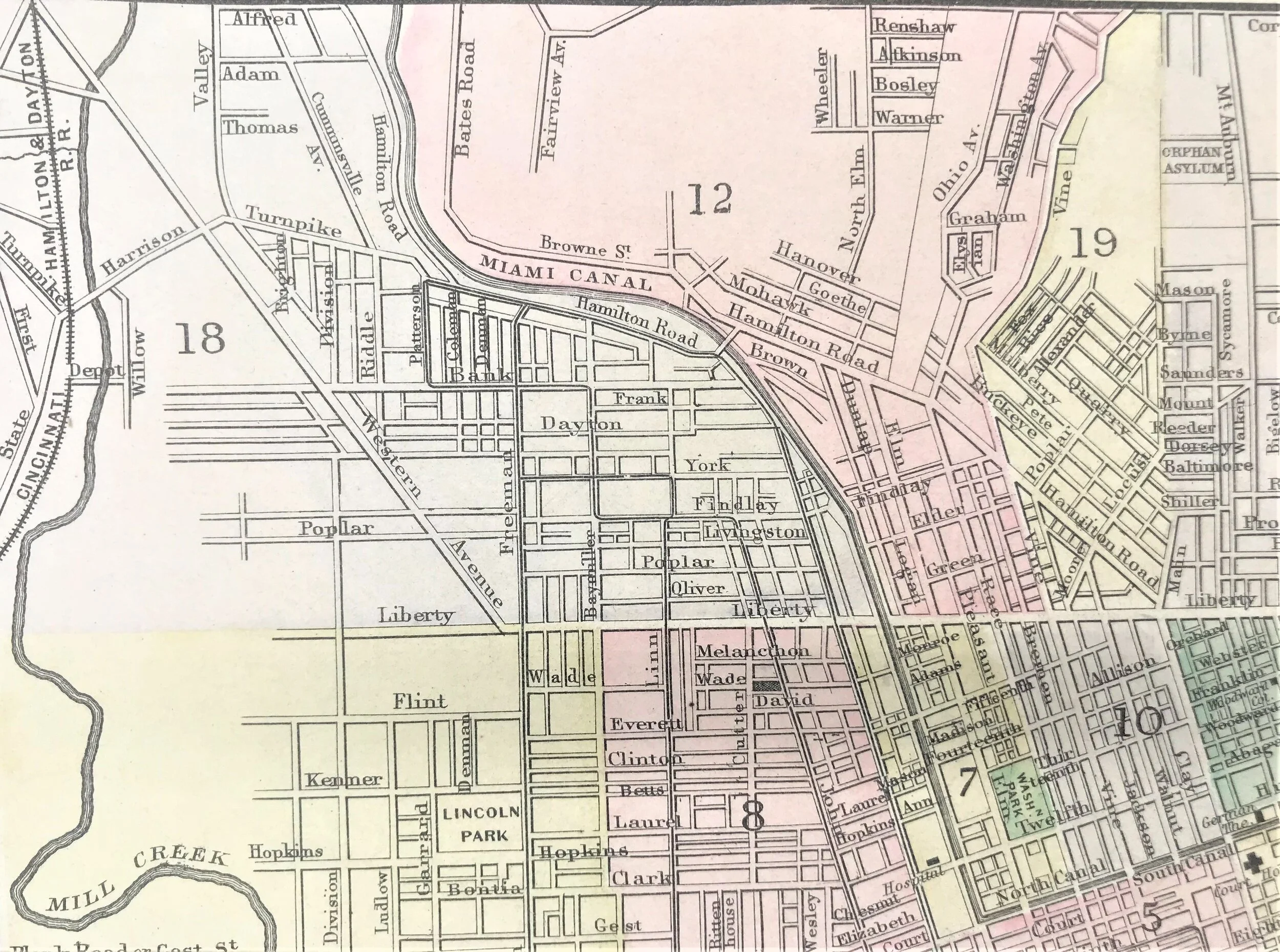
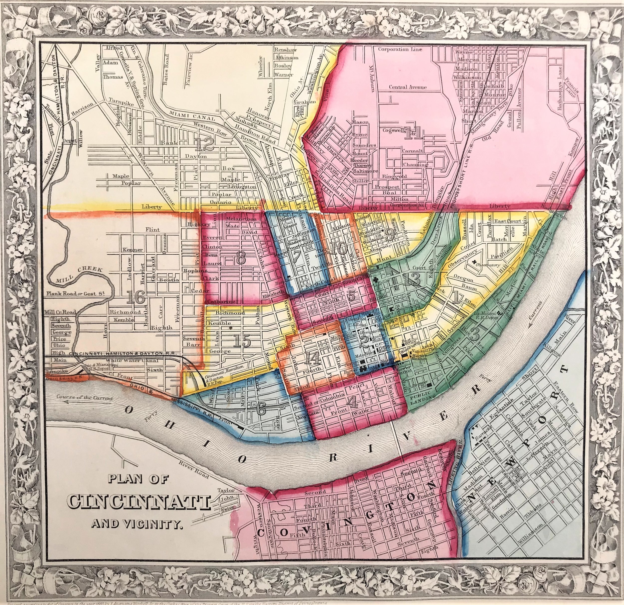
1862 Plan of Cincinnati and Vicinity
8
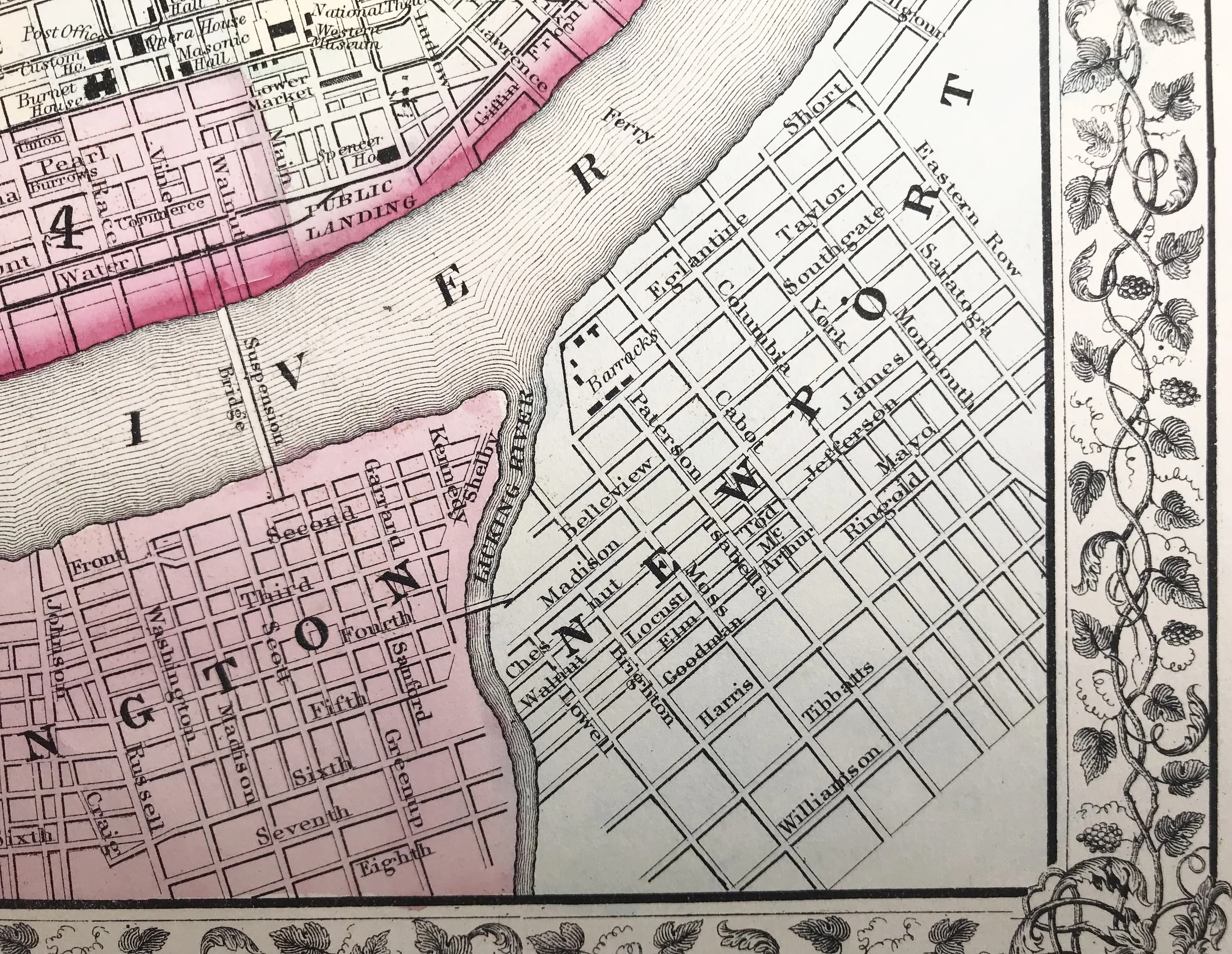
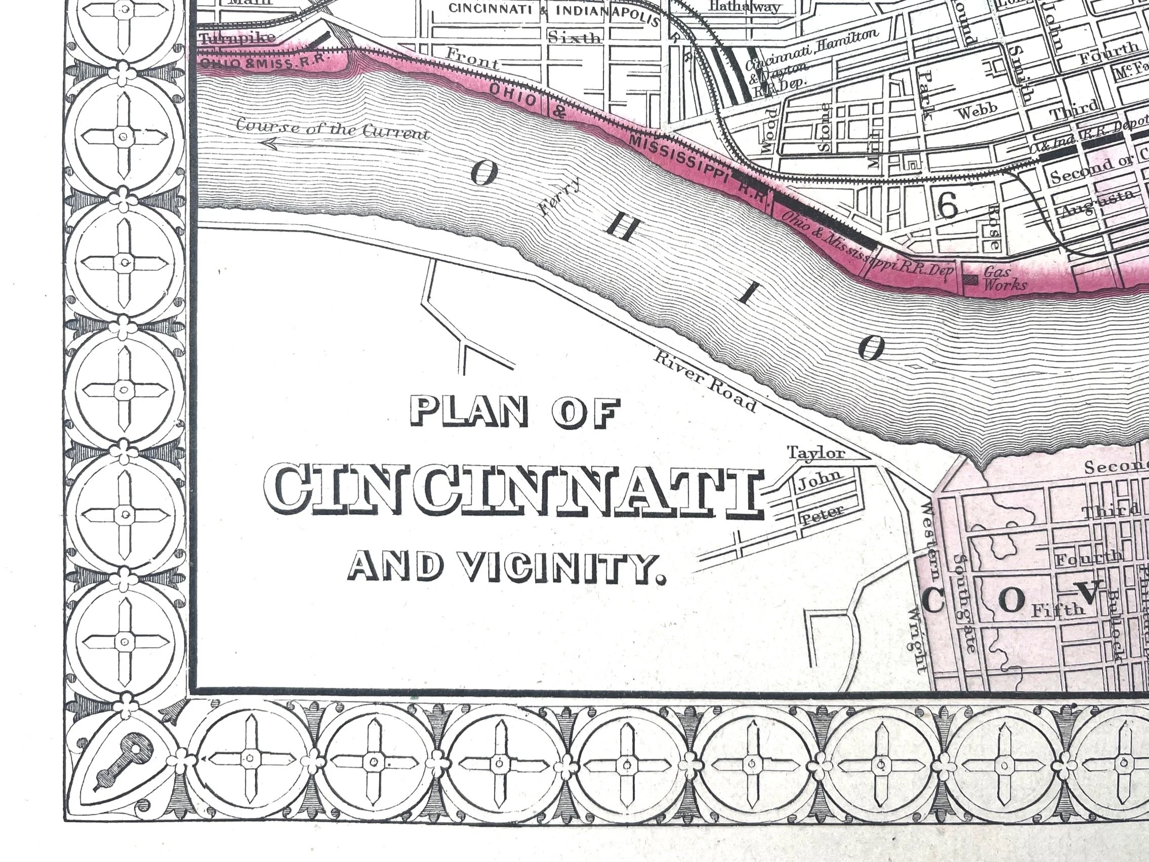
1865 Plan of Cincinnati and Vicinity
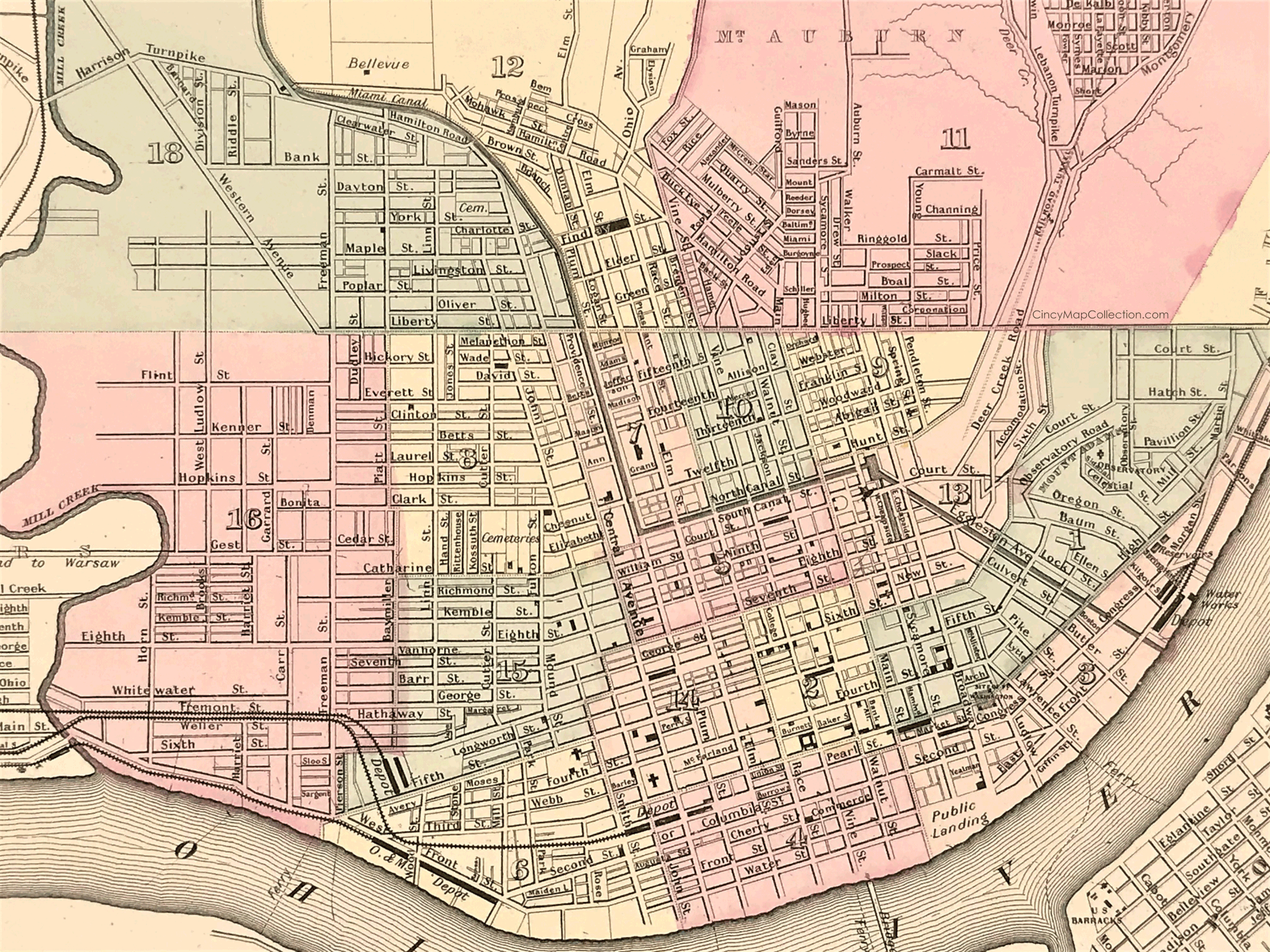
10
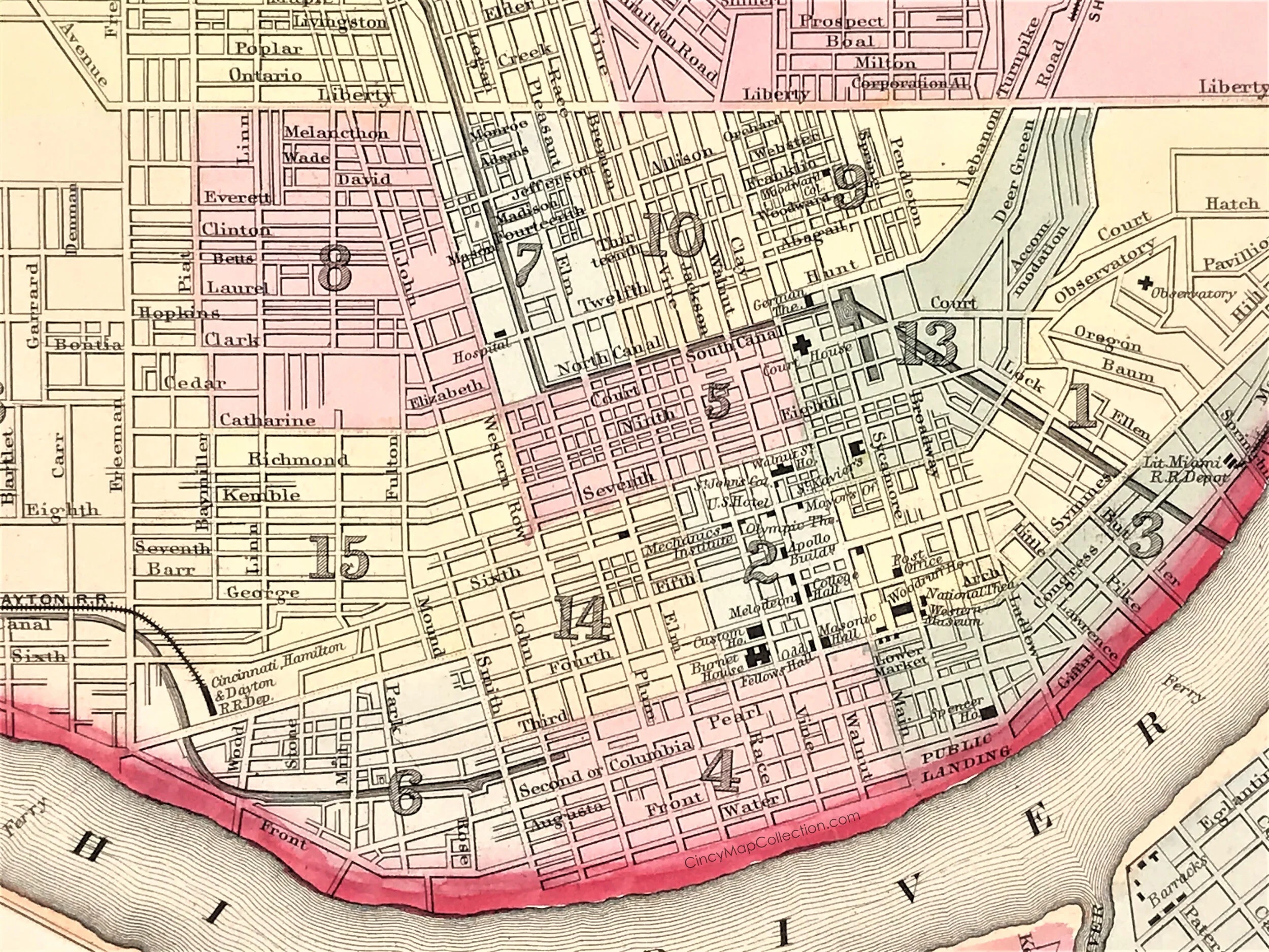
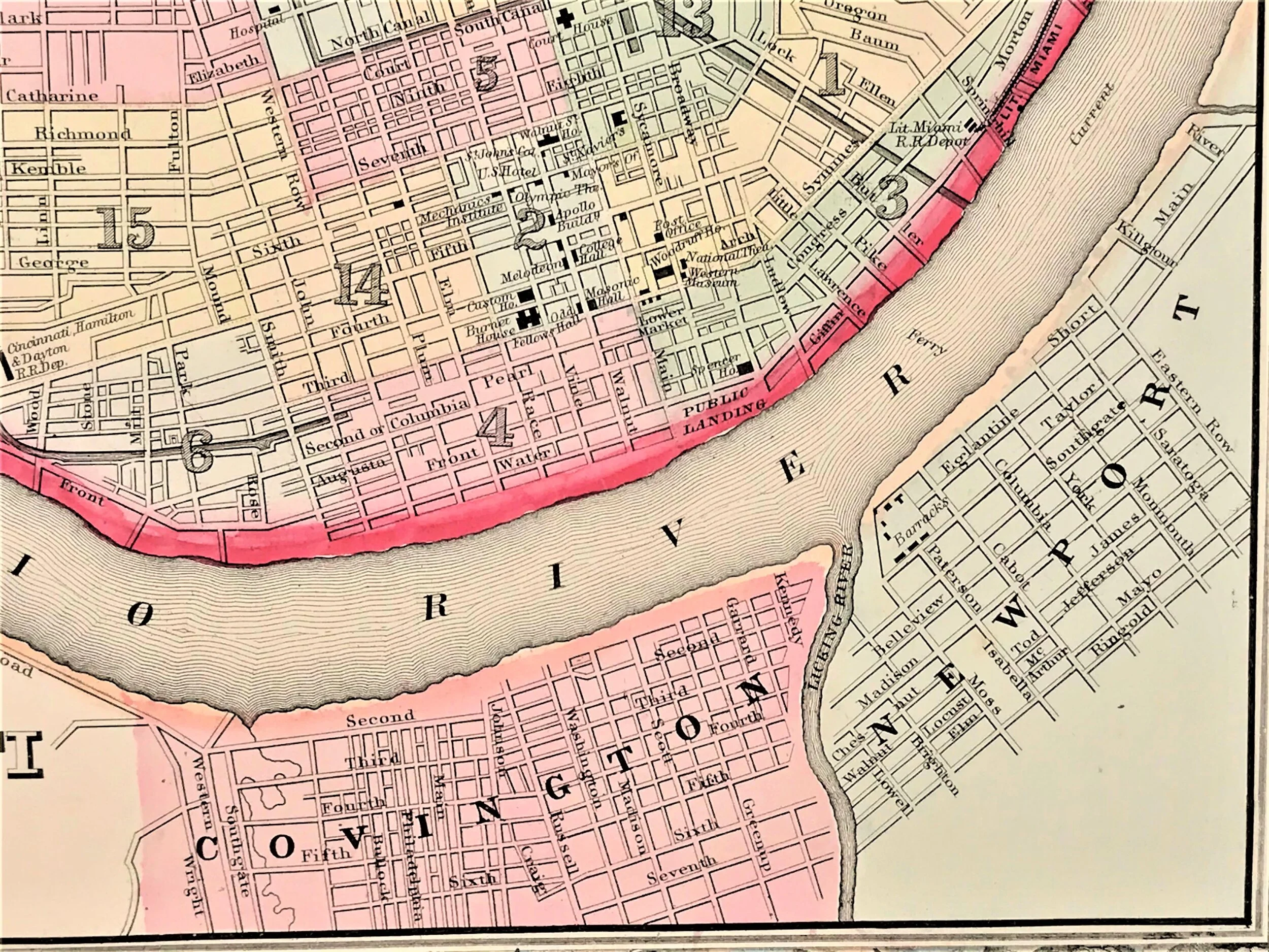
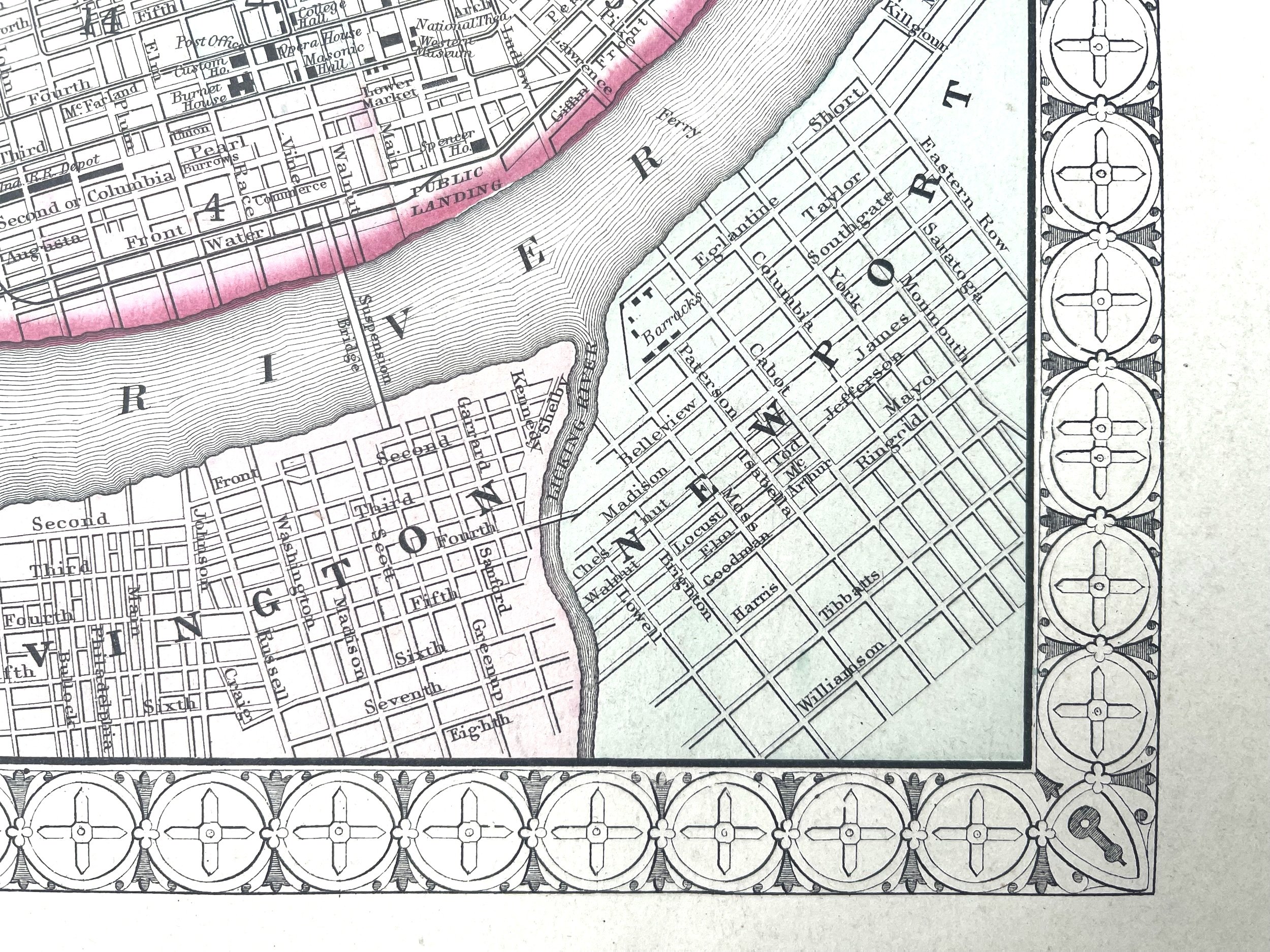
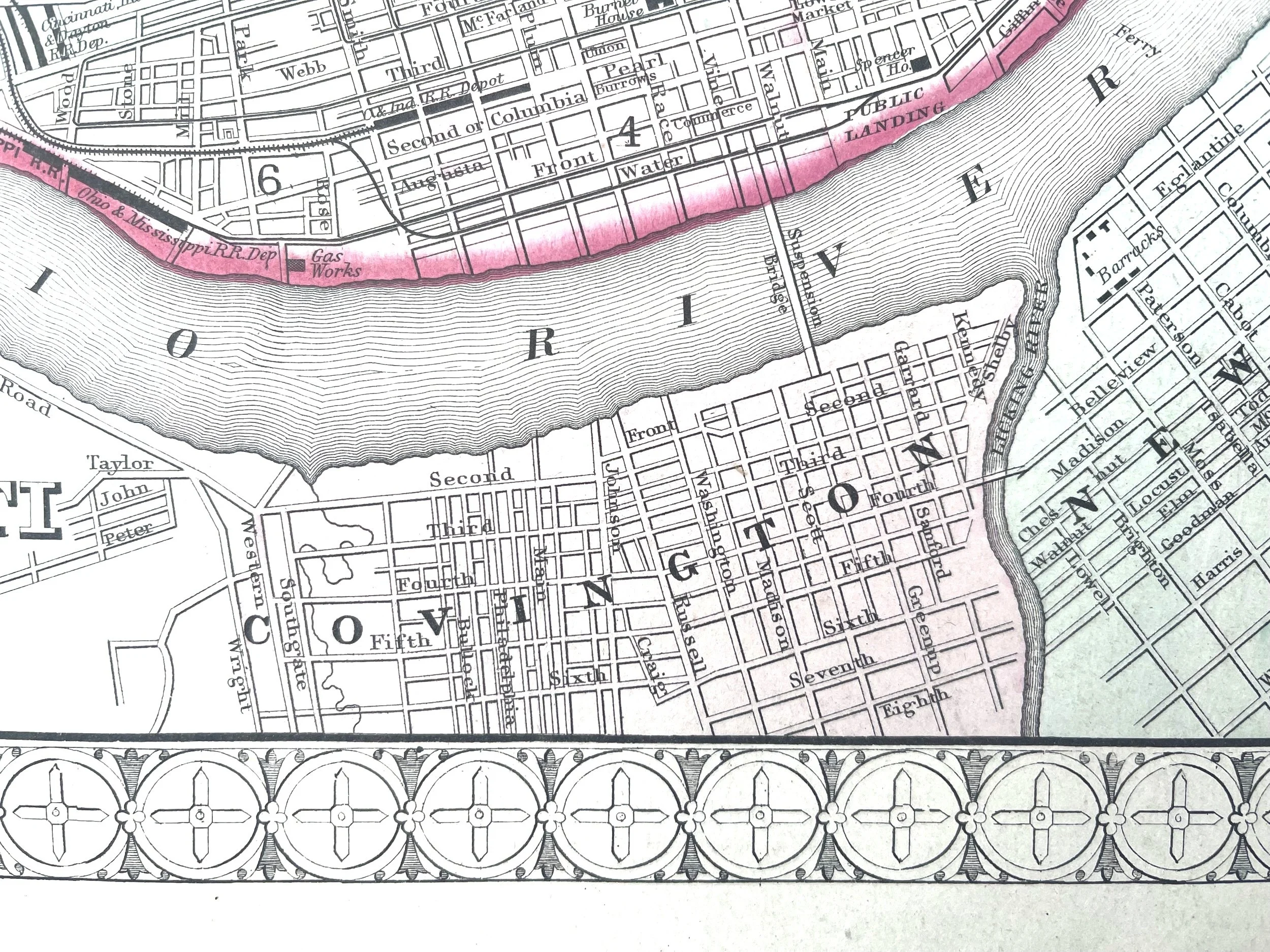
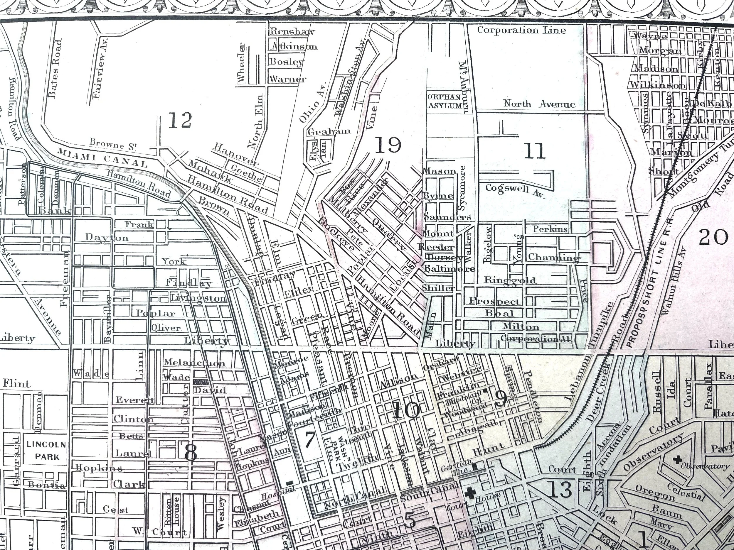
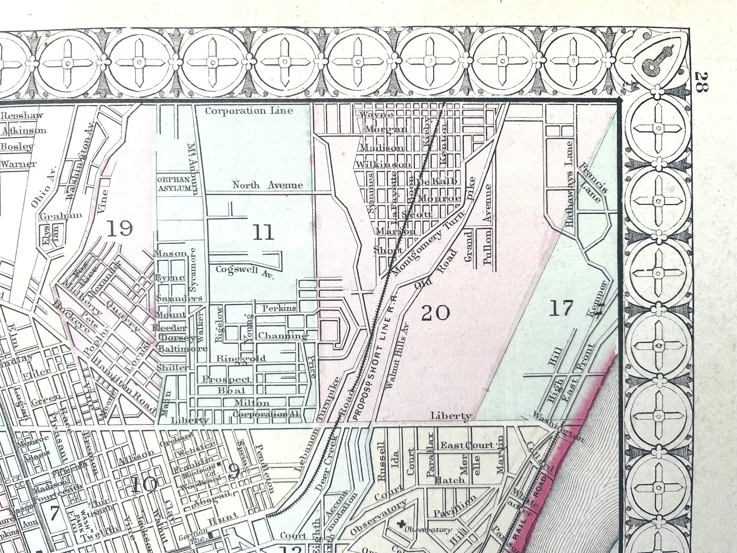
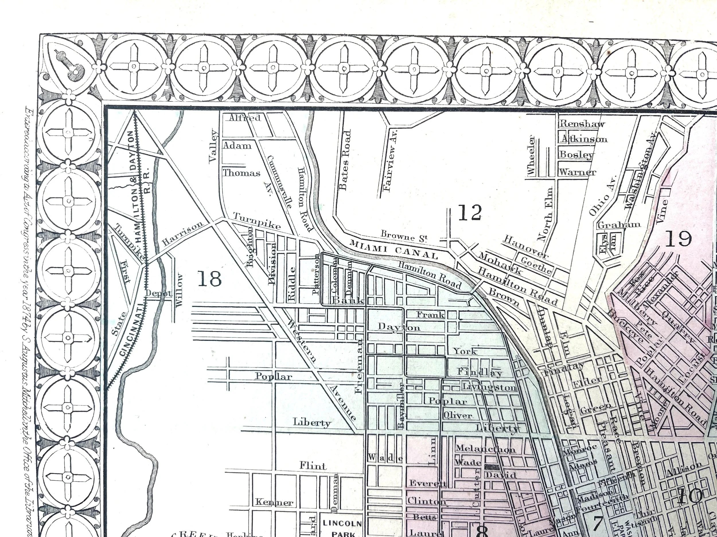
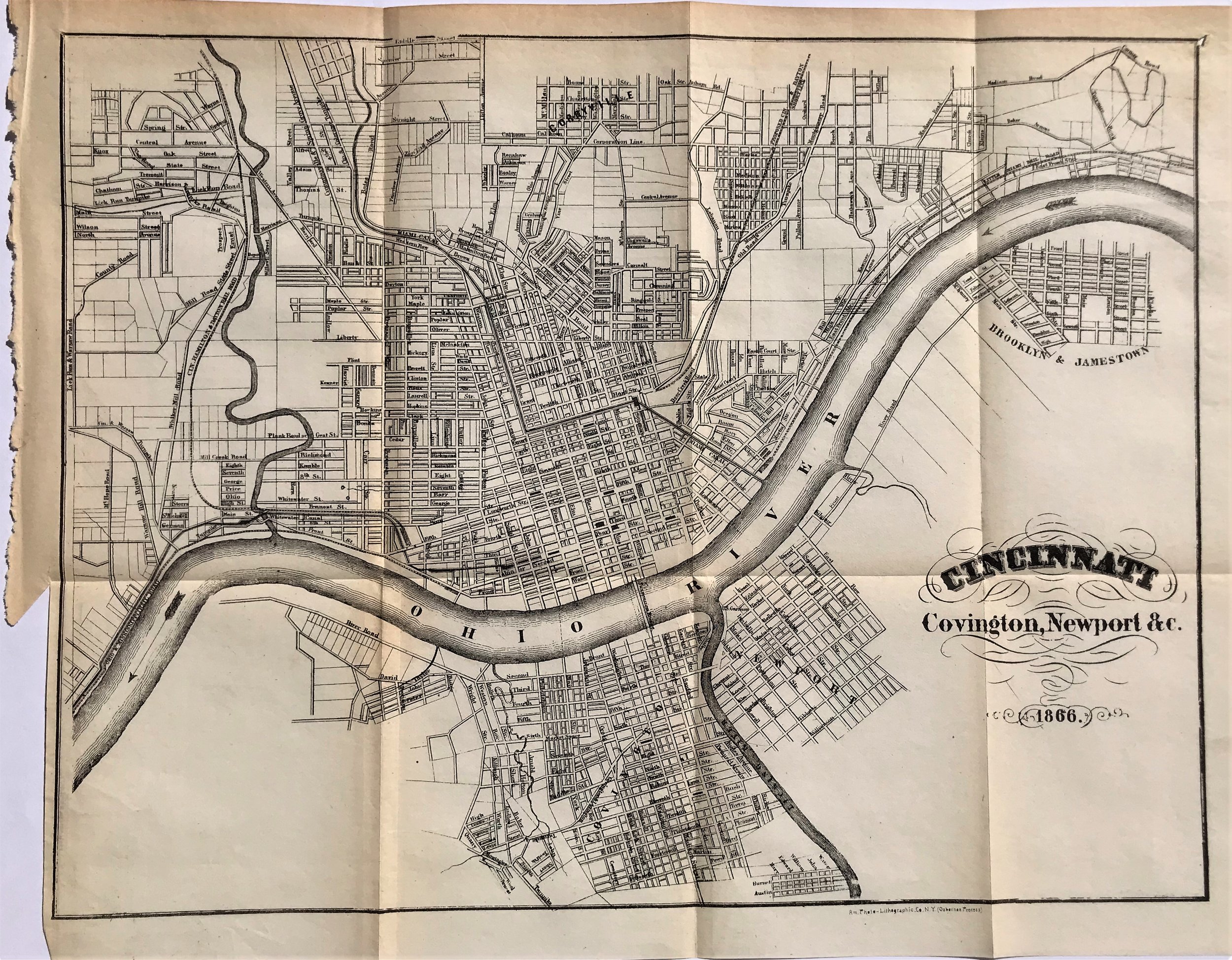
1866 Map of Cincinnati, Covington, Newport & C.
7
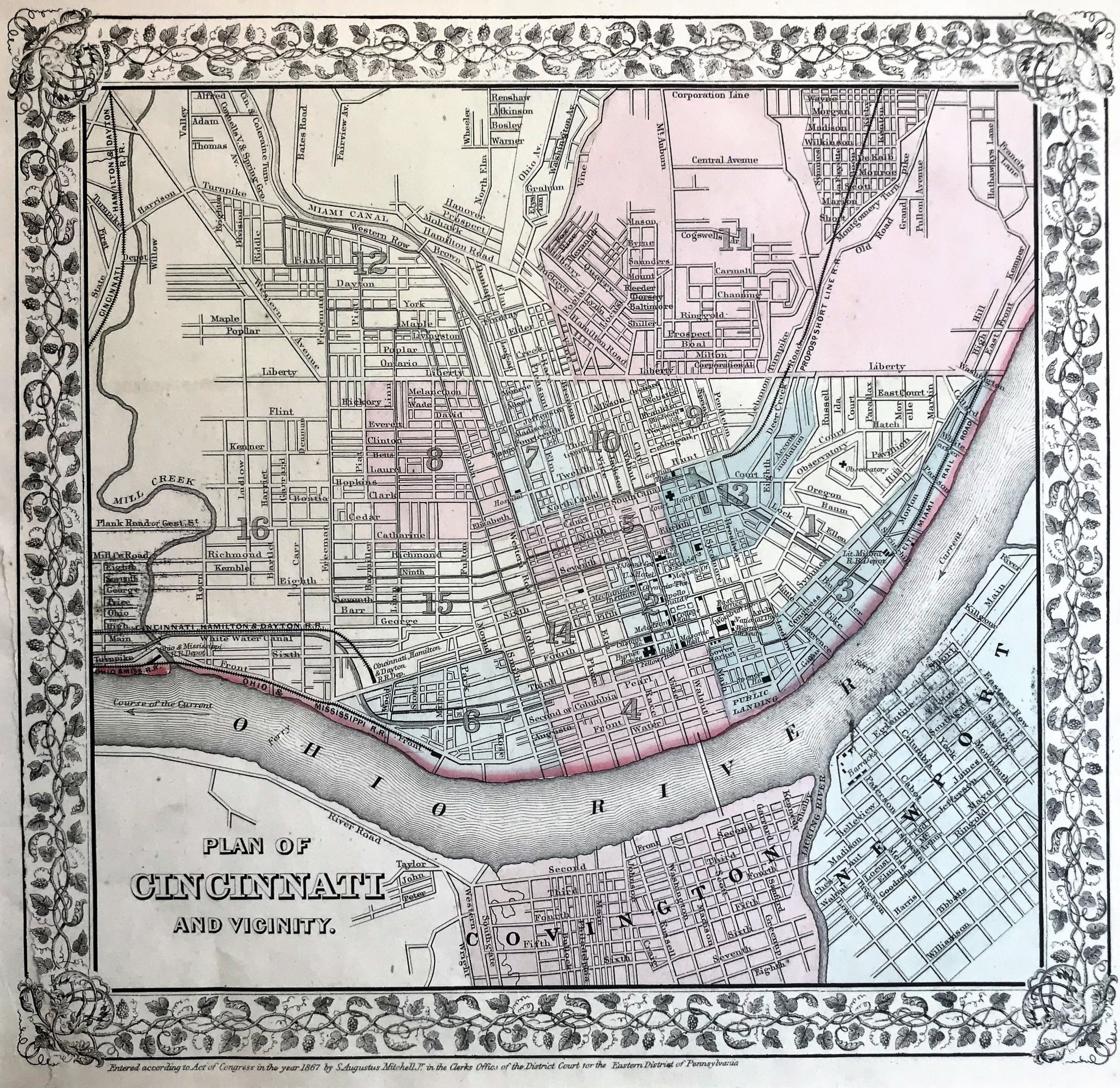
1867 Plan of Cincinnati and Vicinity
5
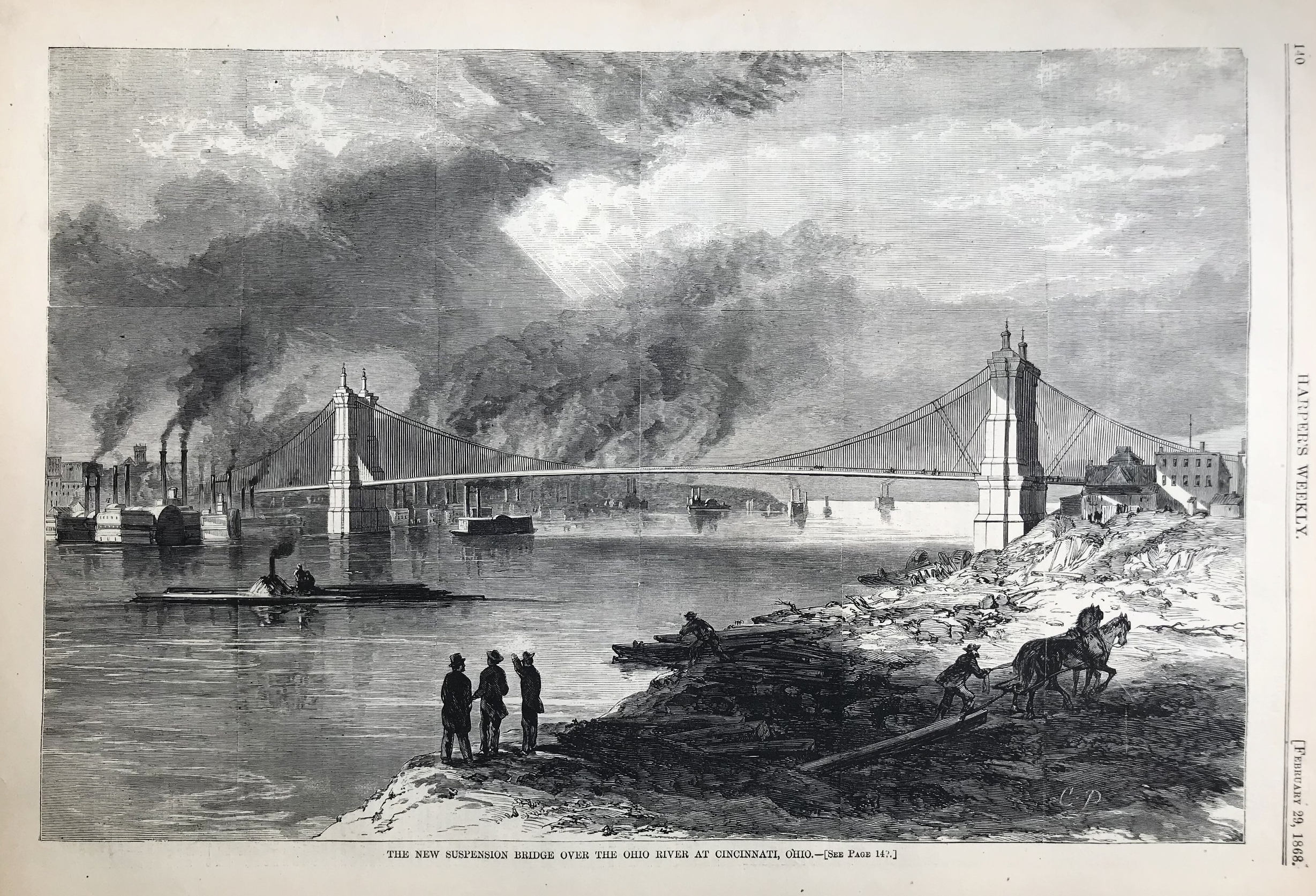
1868 Print: New Suspension Bridge over the Ohio River
5
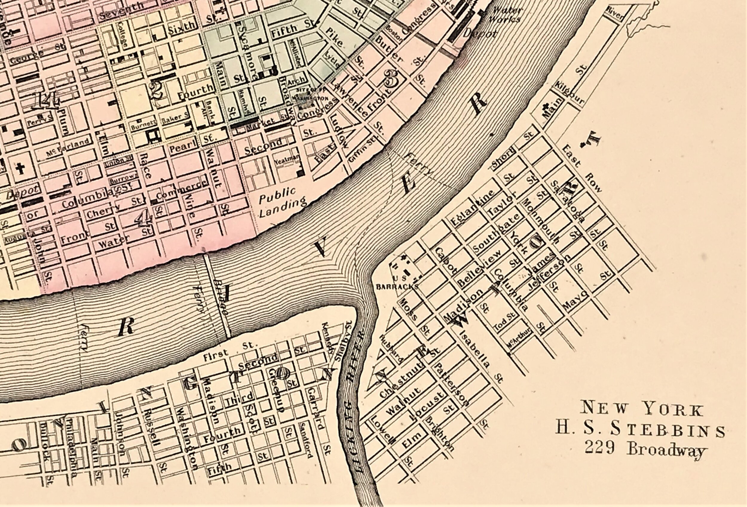
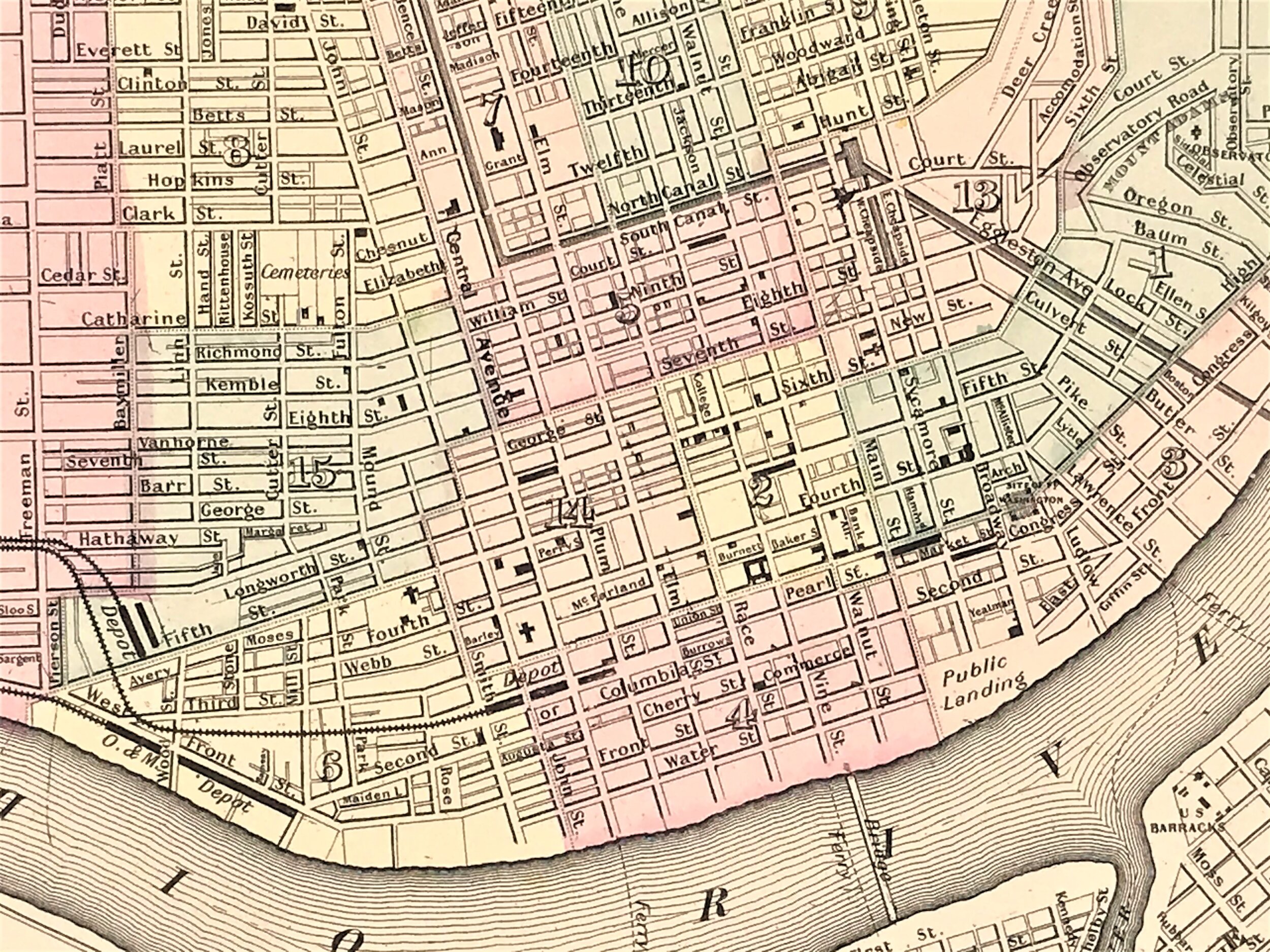
1868 Map of Cincinnati, H.S. Stebbins
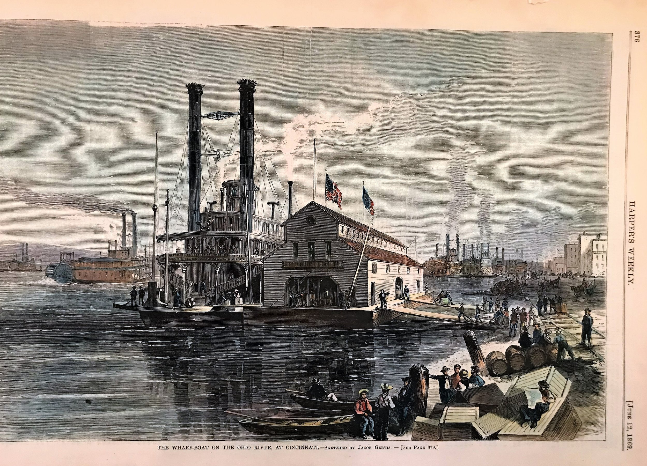
4
1869 Print: The Wharf-Boat on the Ohio River at Cincinnati
8
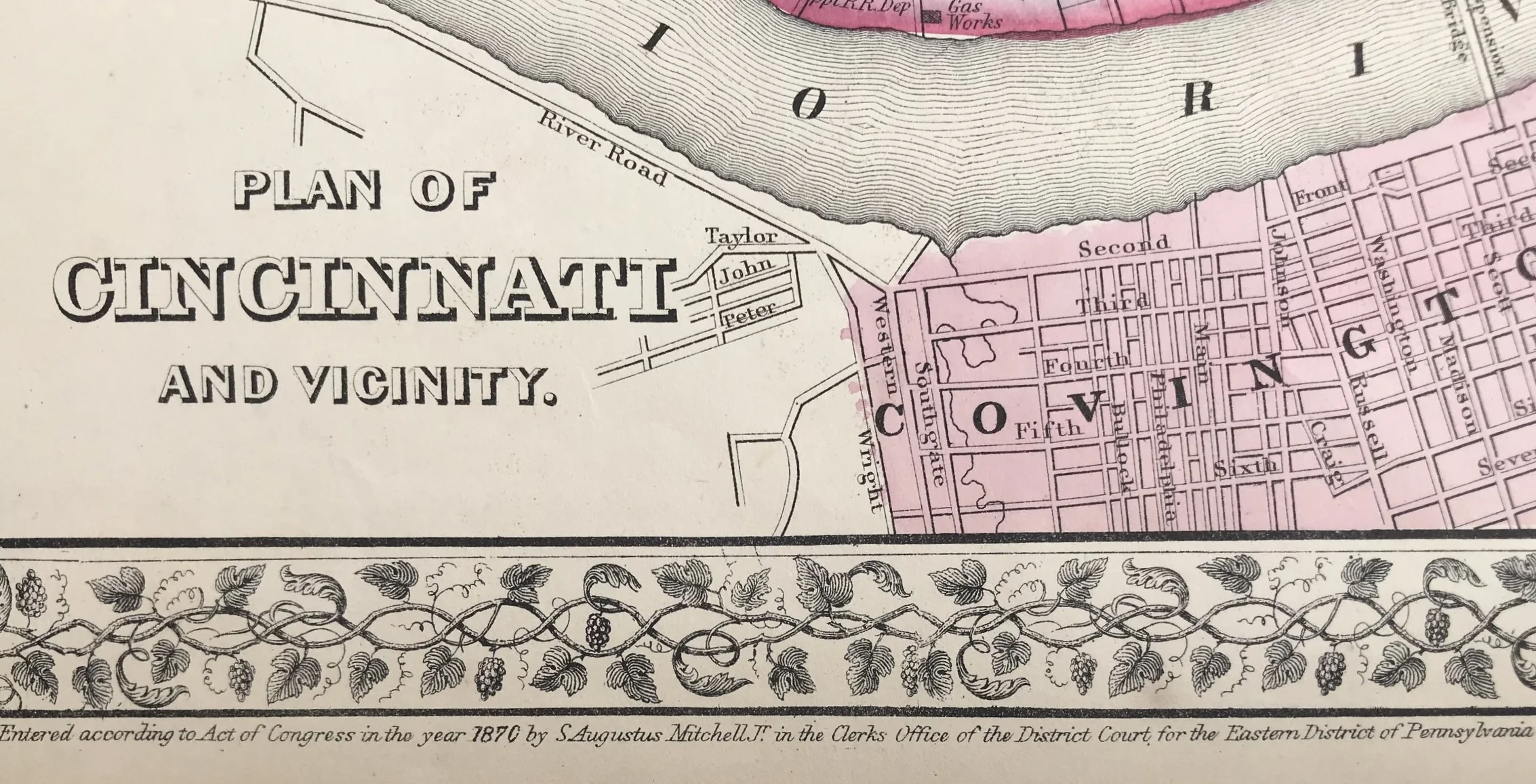
1870 Map of Cincinnati and Vicinity
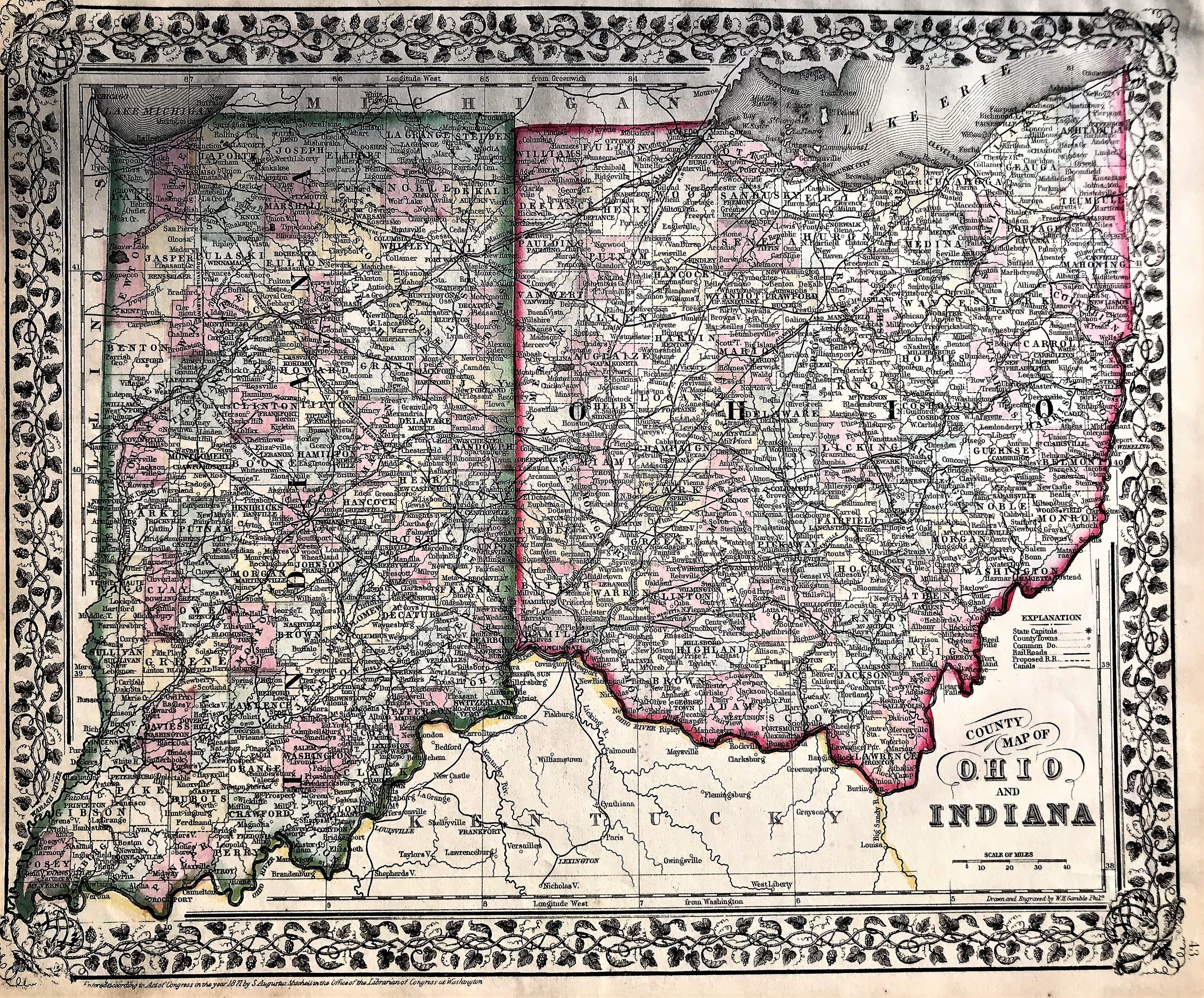
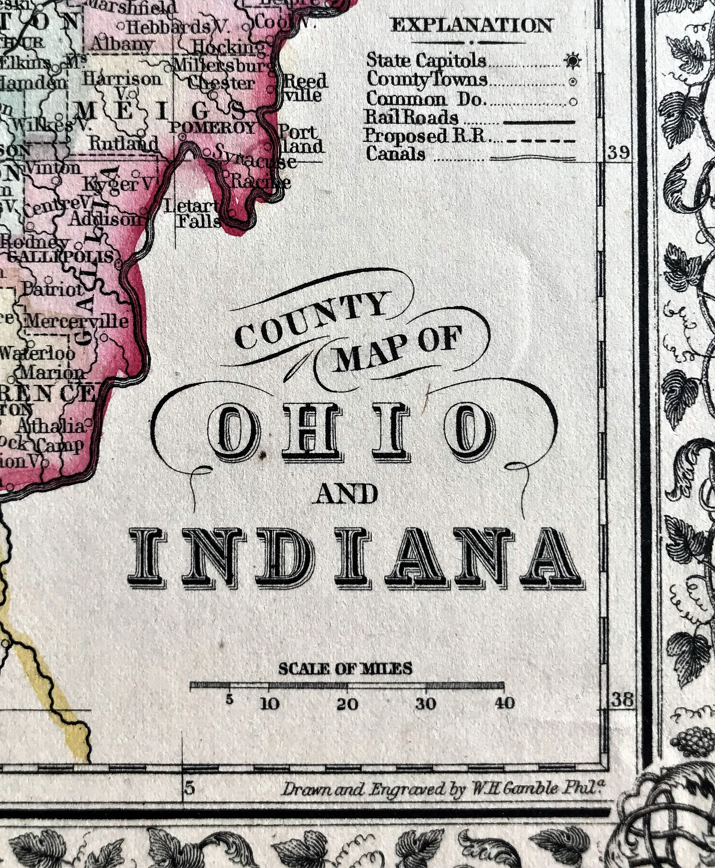
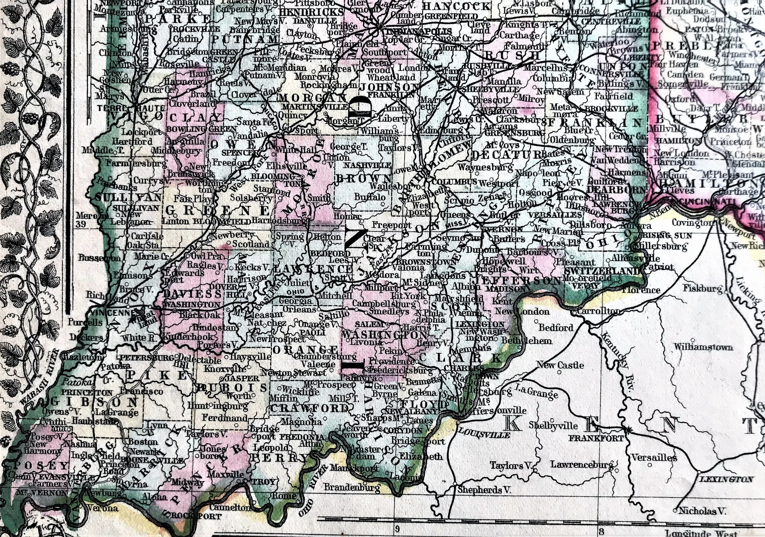
8
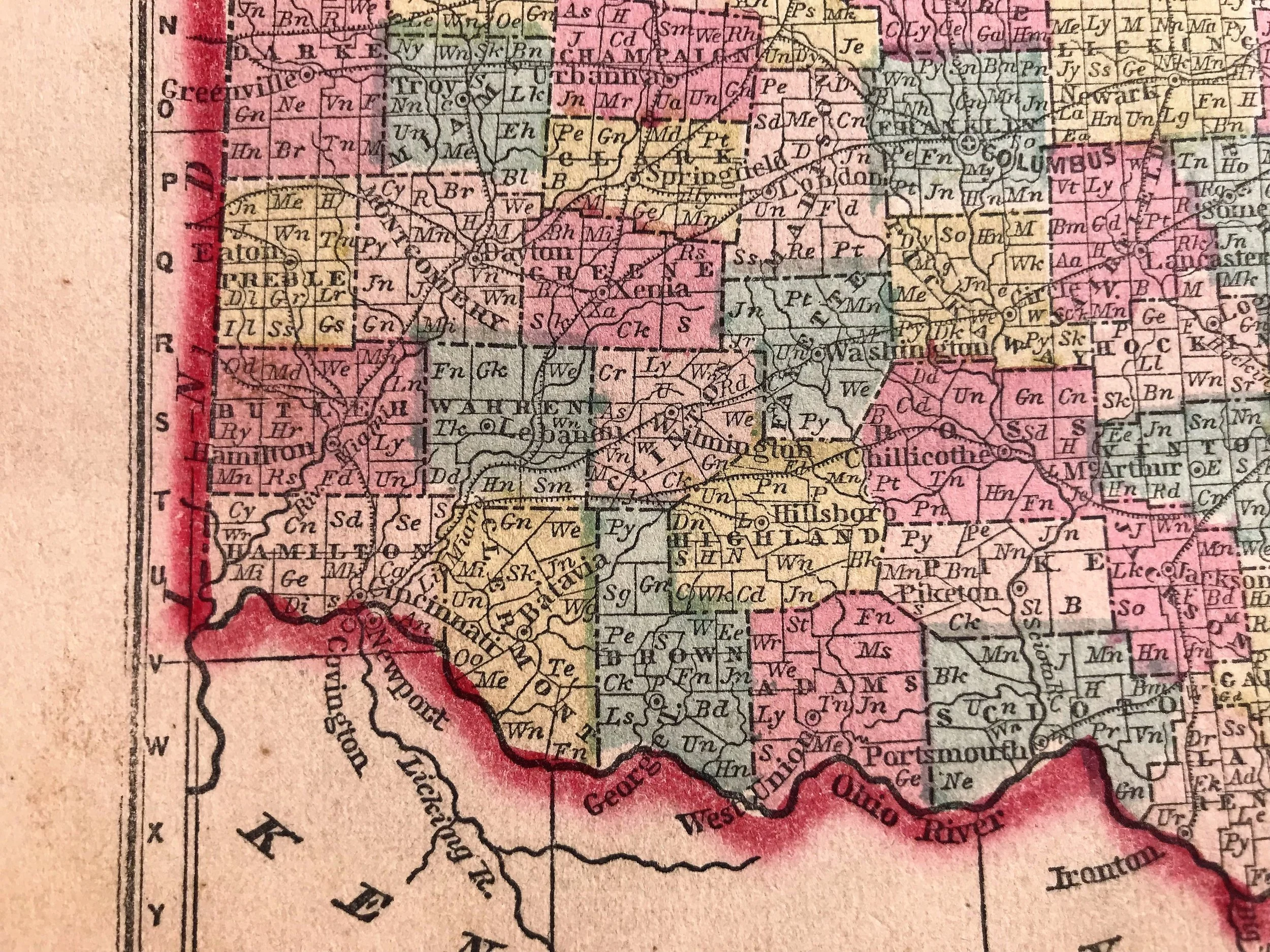
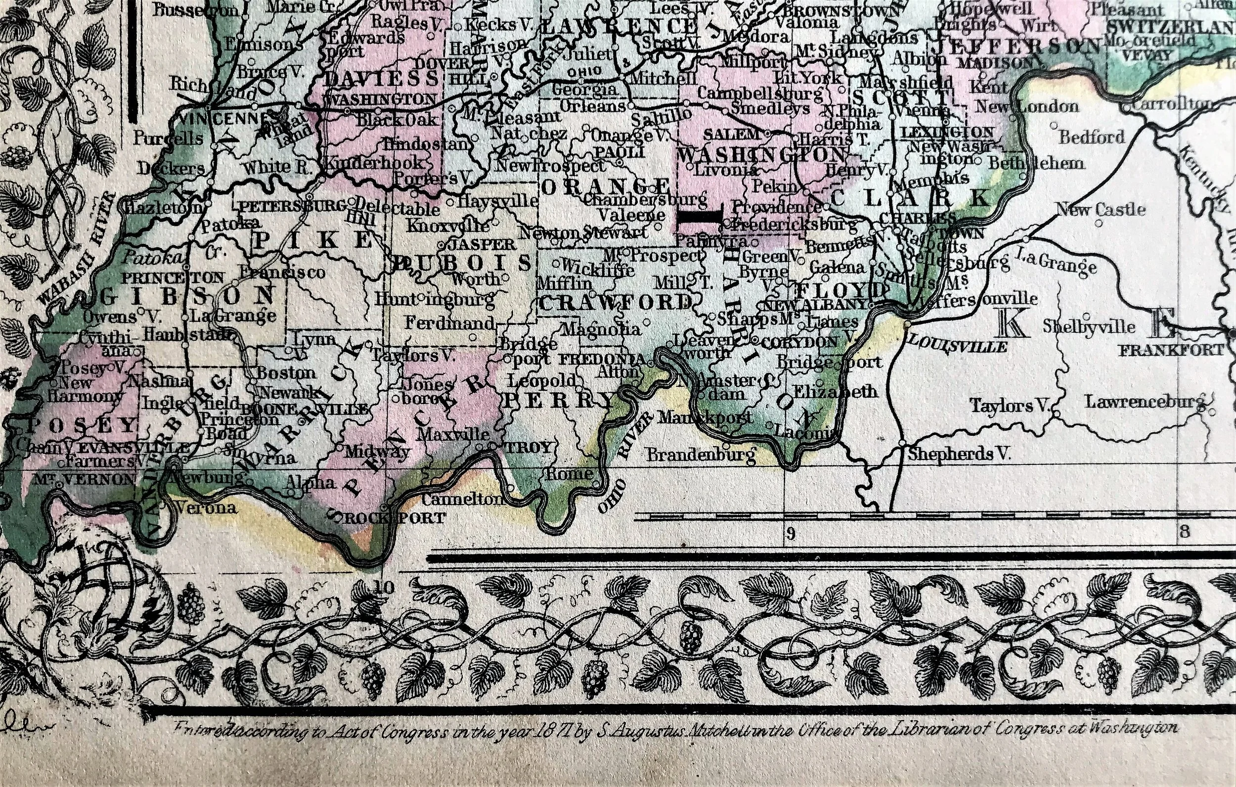
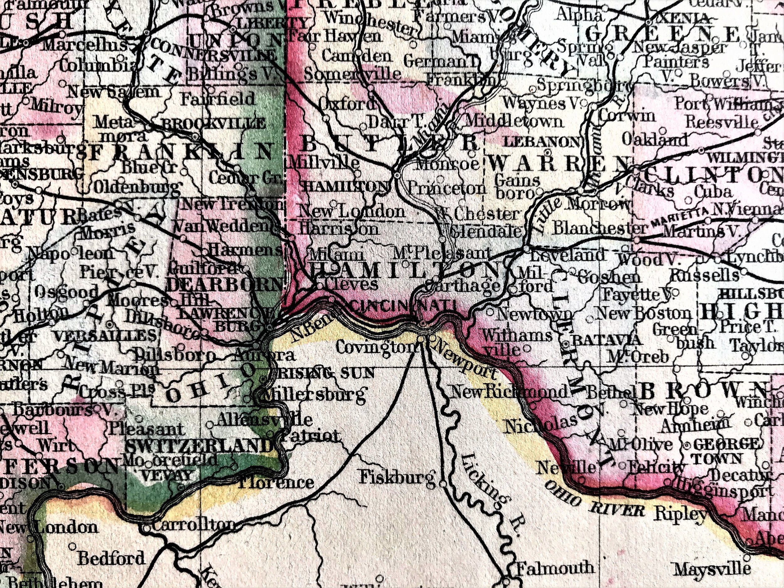
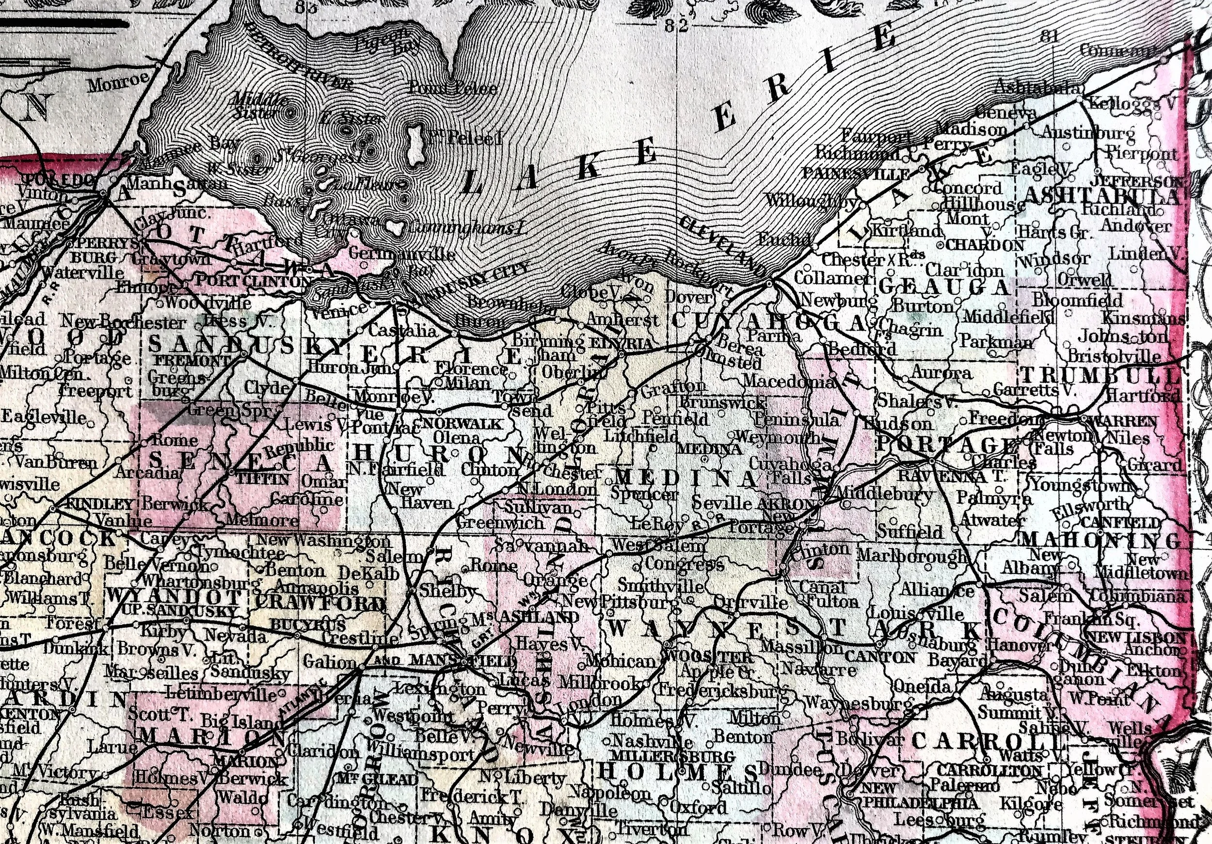
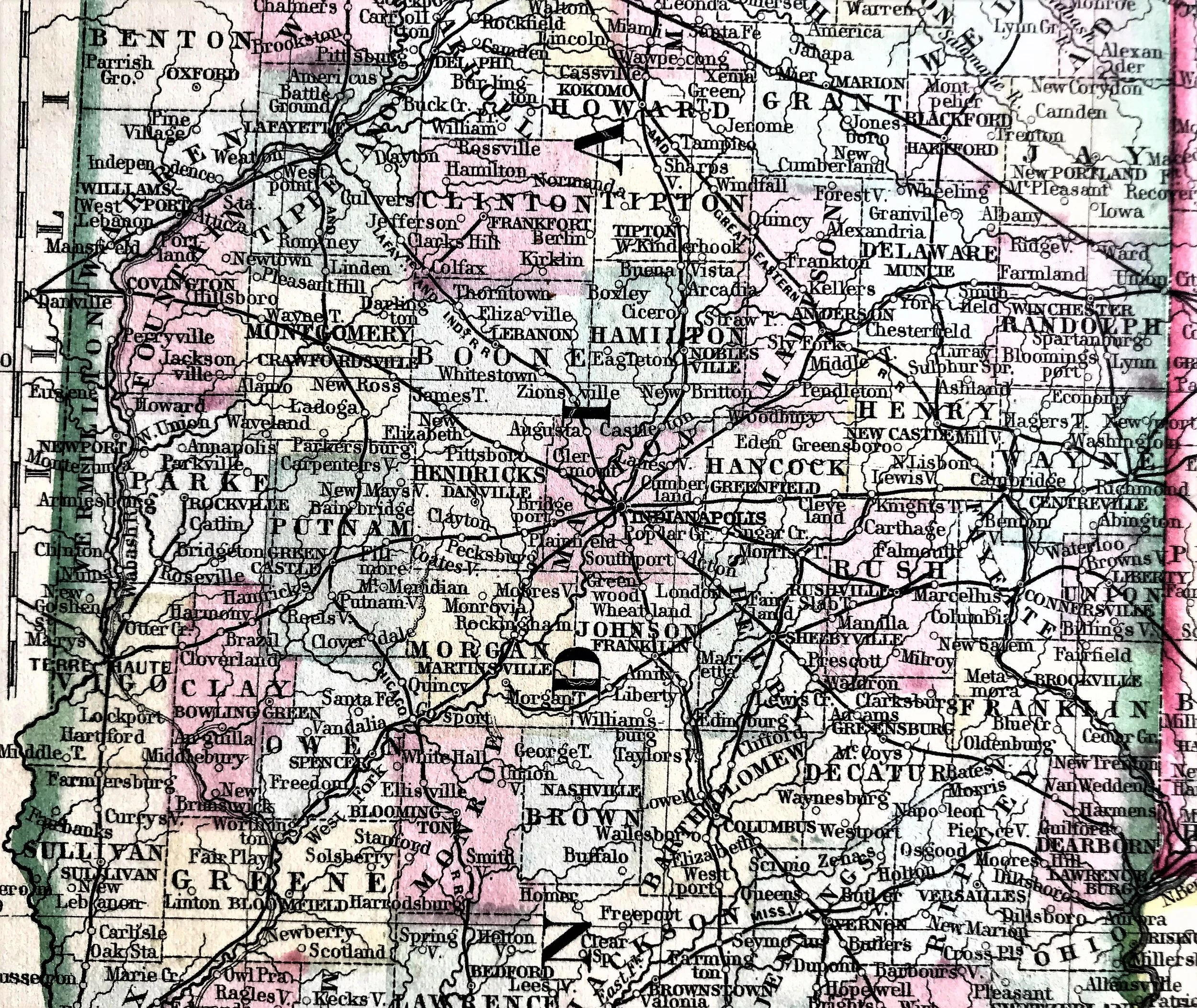
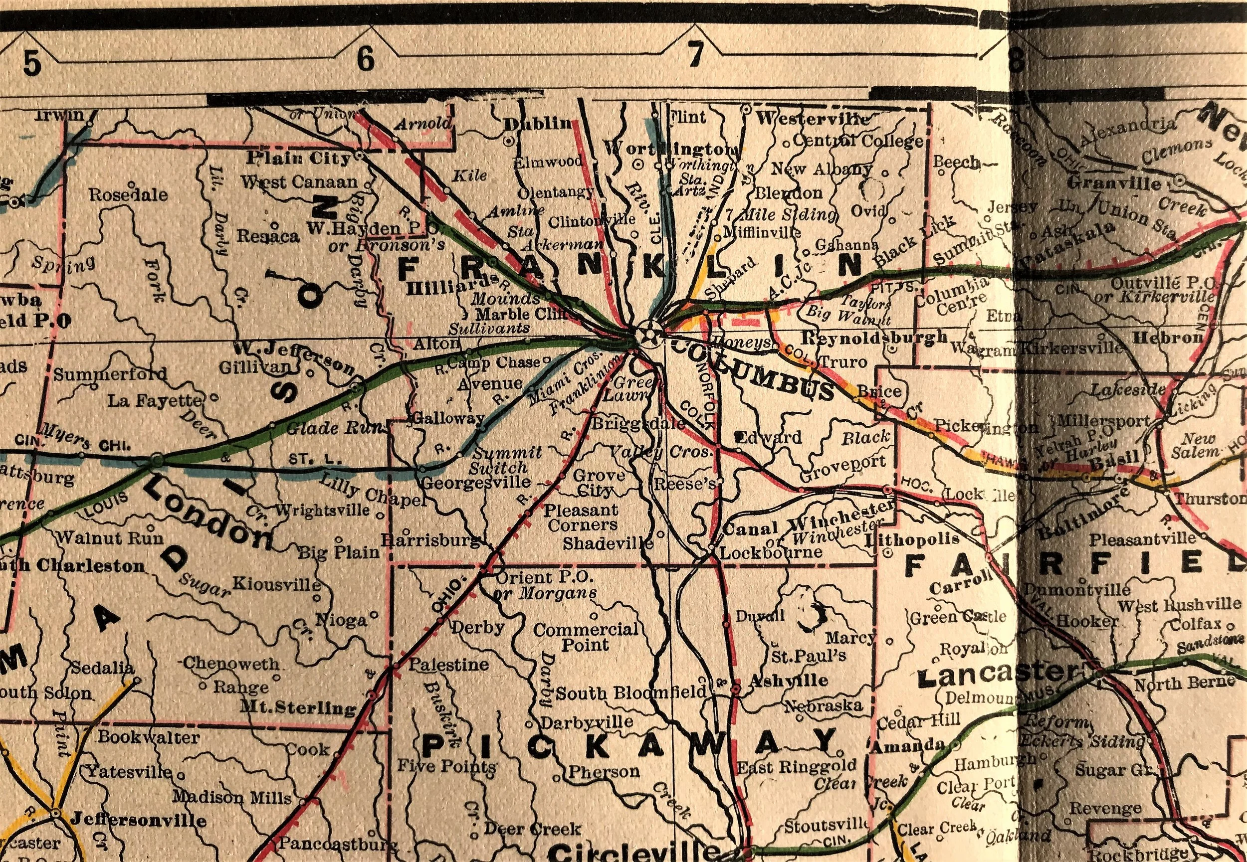
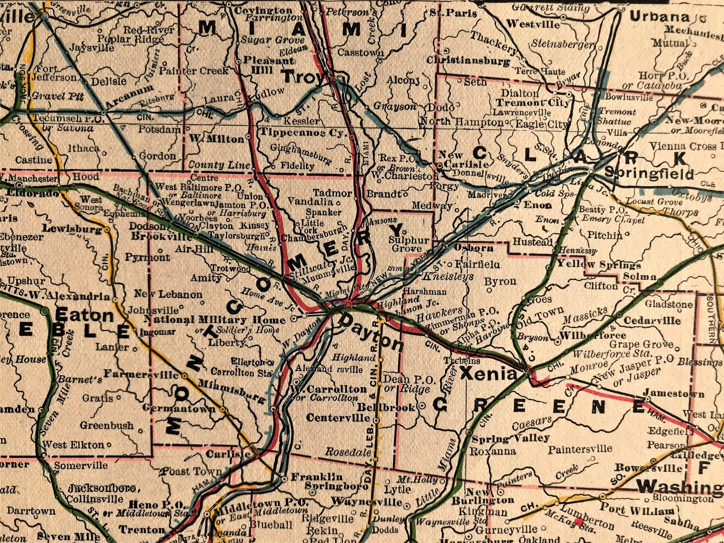
1871 County Map of Ohio & Indiana
8
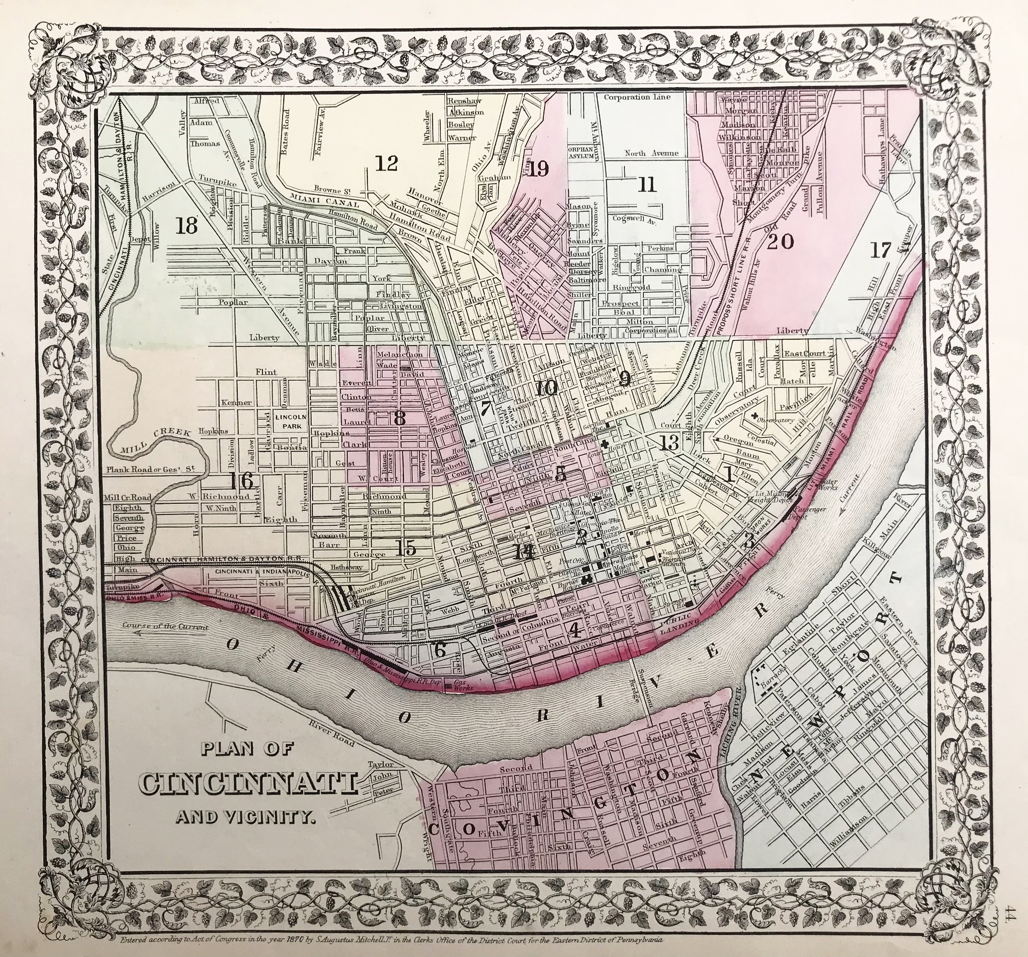
1871 Map of Cincinnati
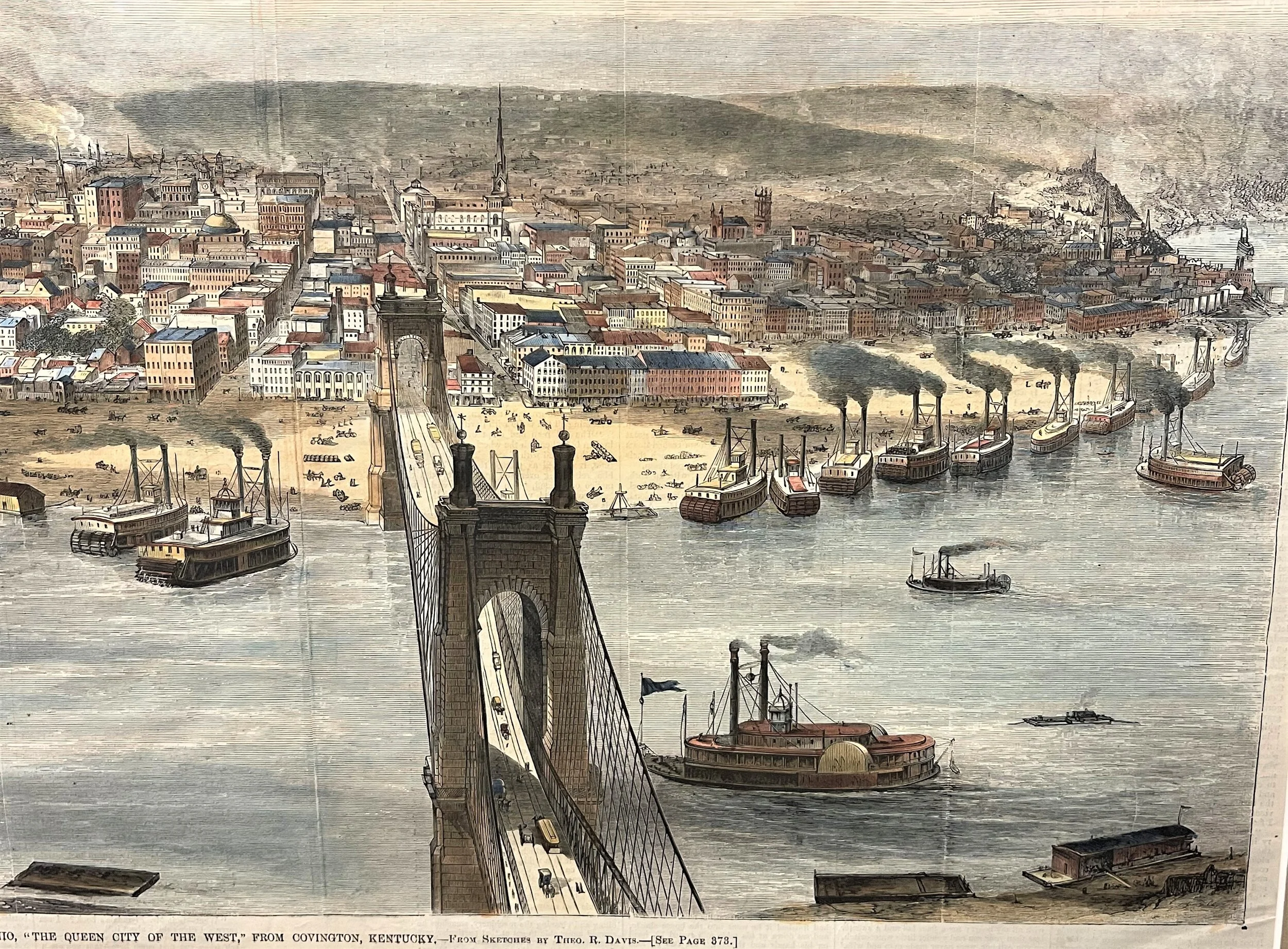
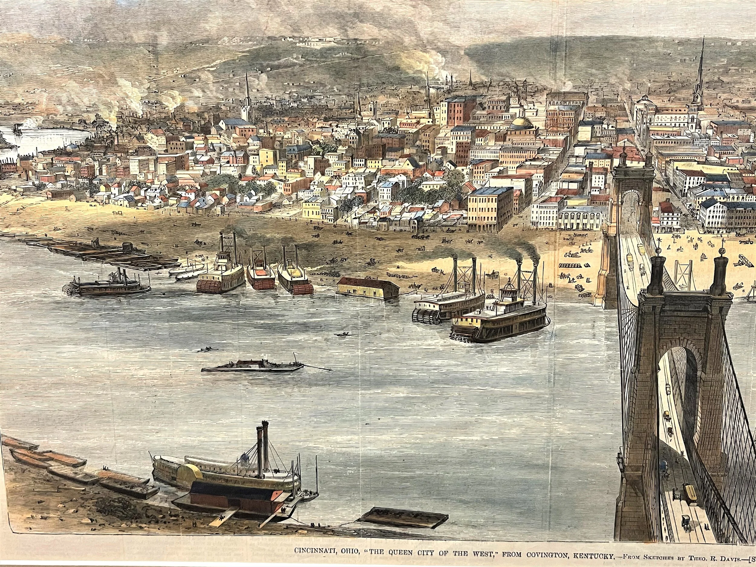
4
1872 Cincinnati, Ohio "Queen City of the West"
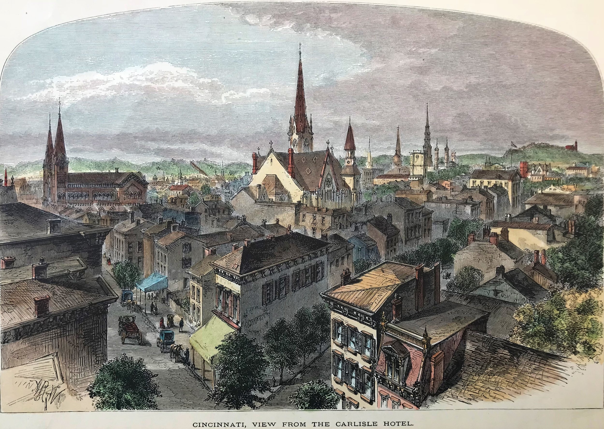
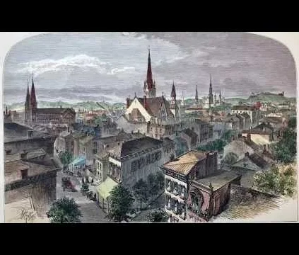
6
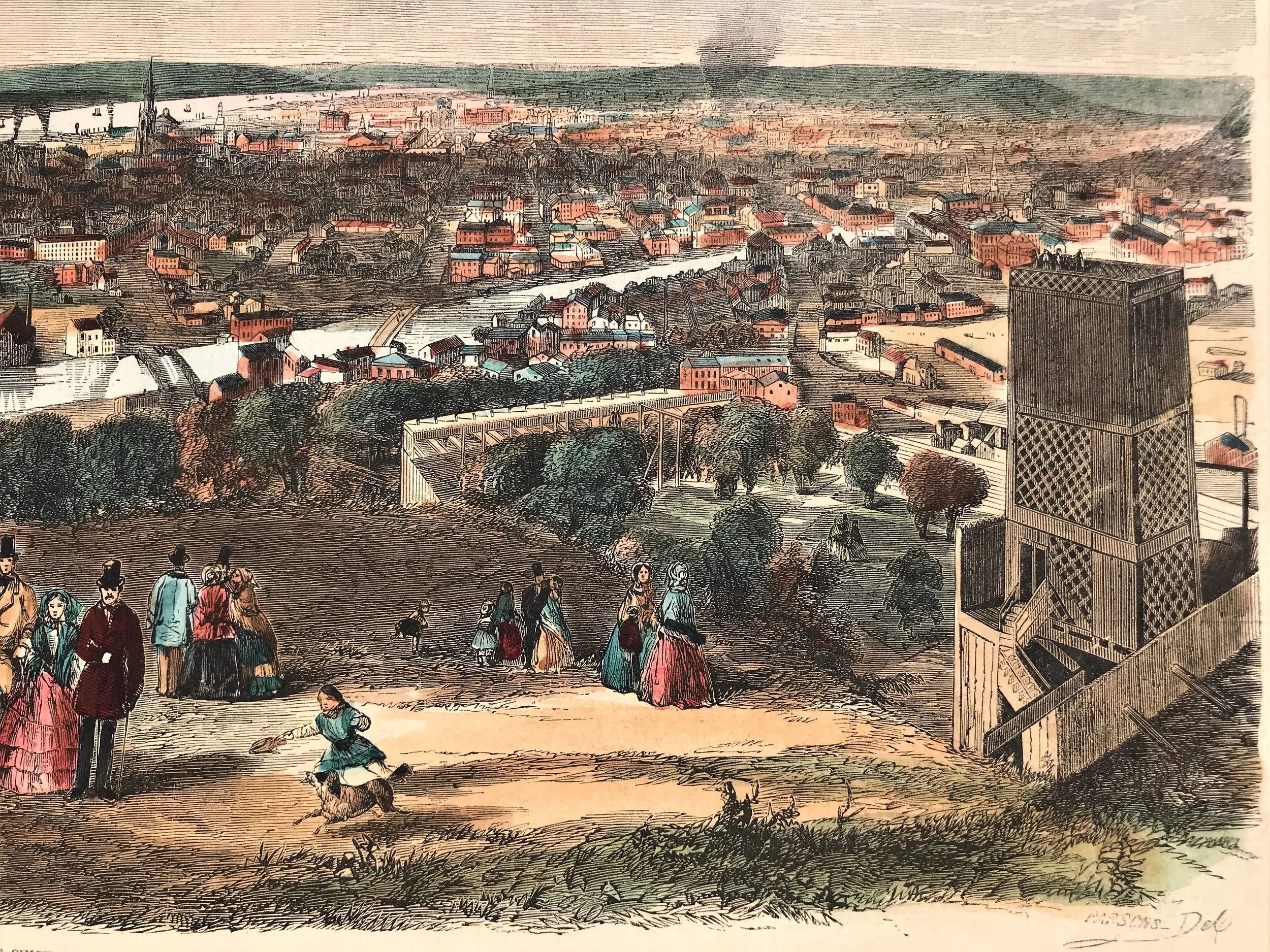
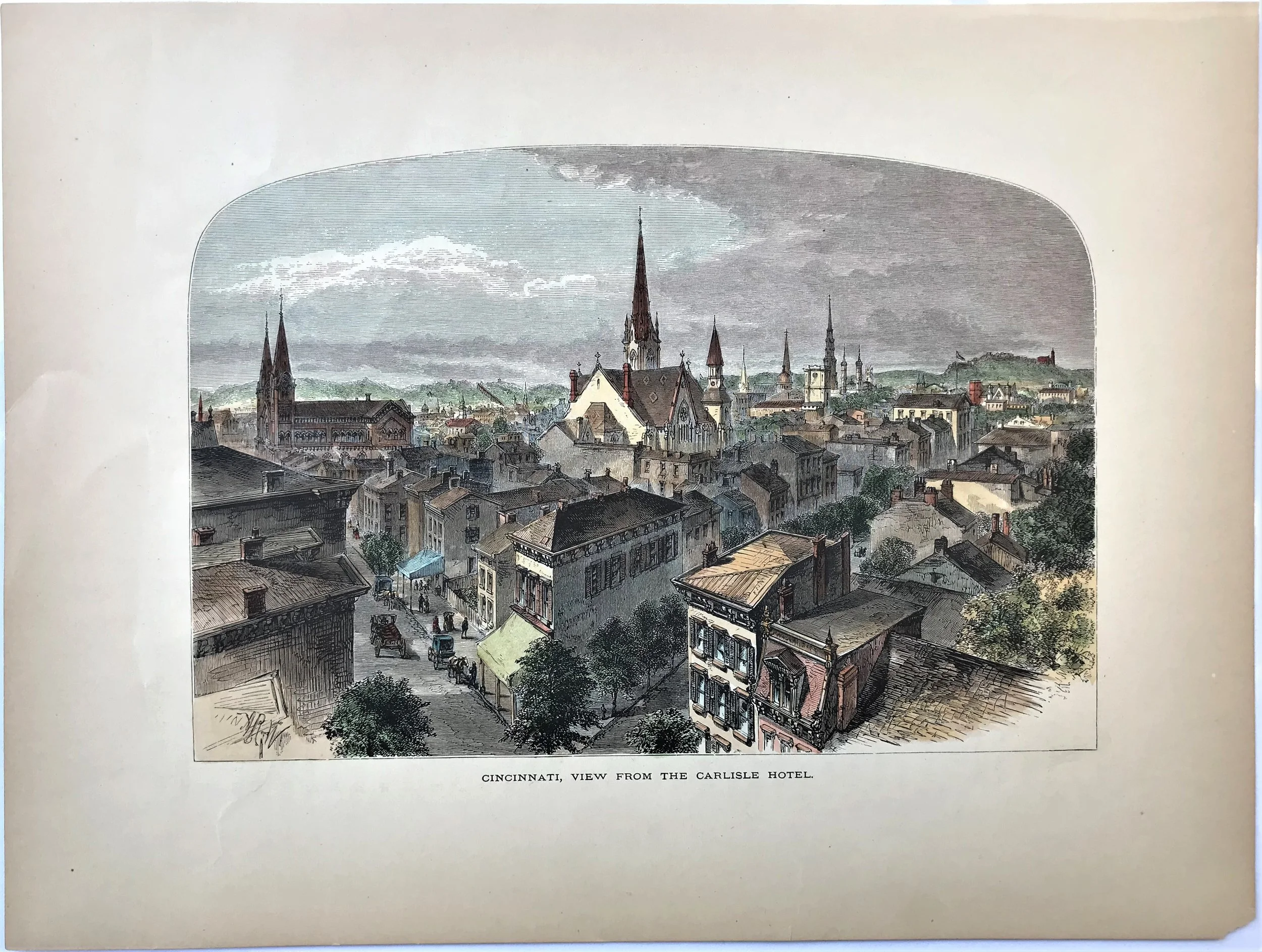
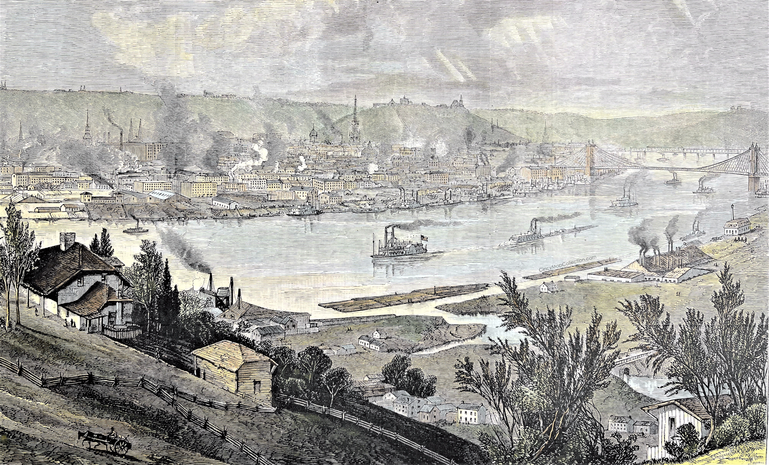
1873 Print: View from the Carlisle Hotel
8
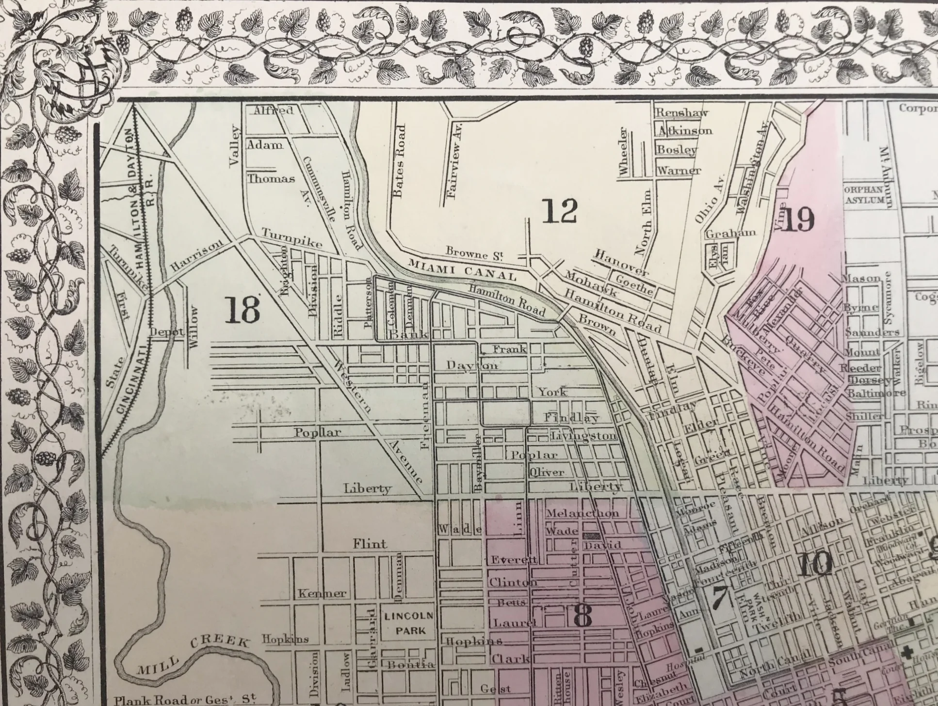
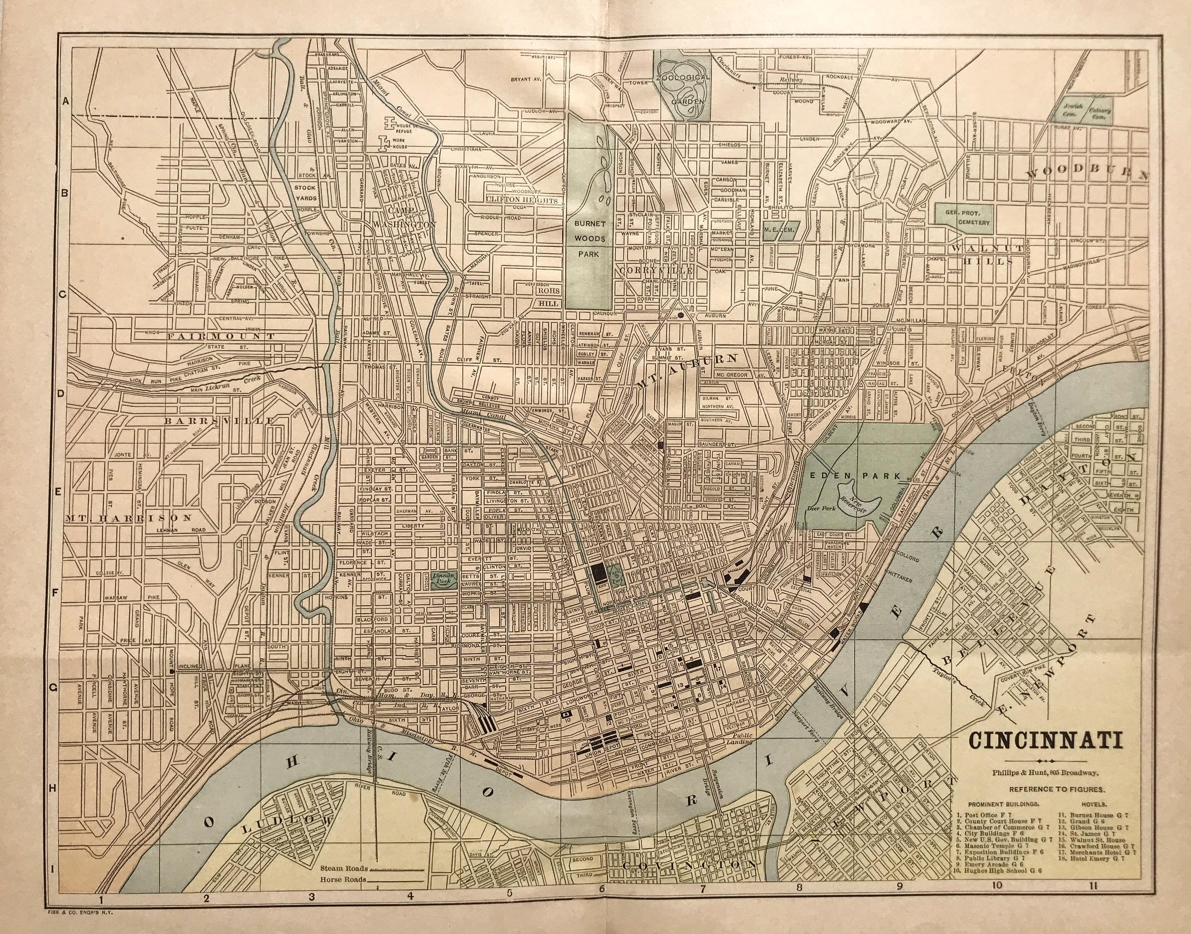
1874 Plan of Cincinnati and Vicinity
5
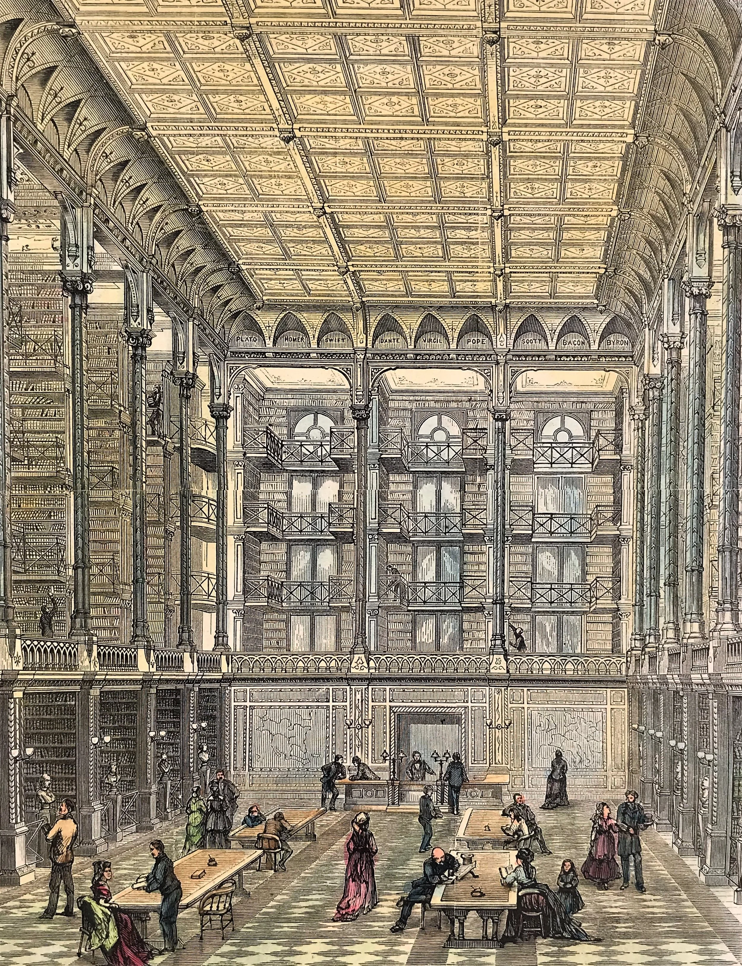
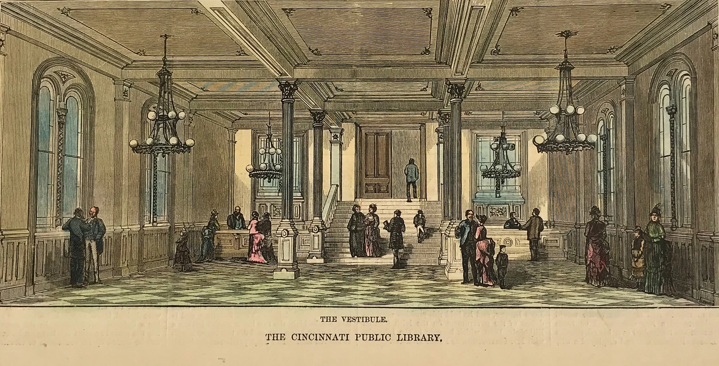
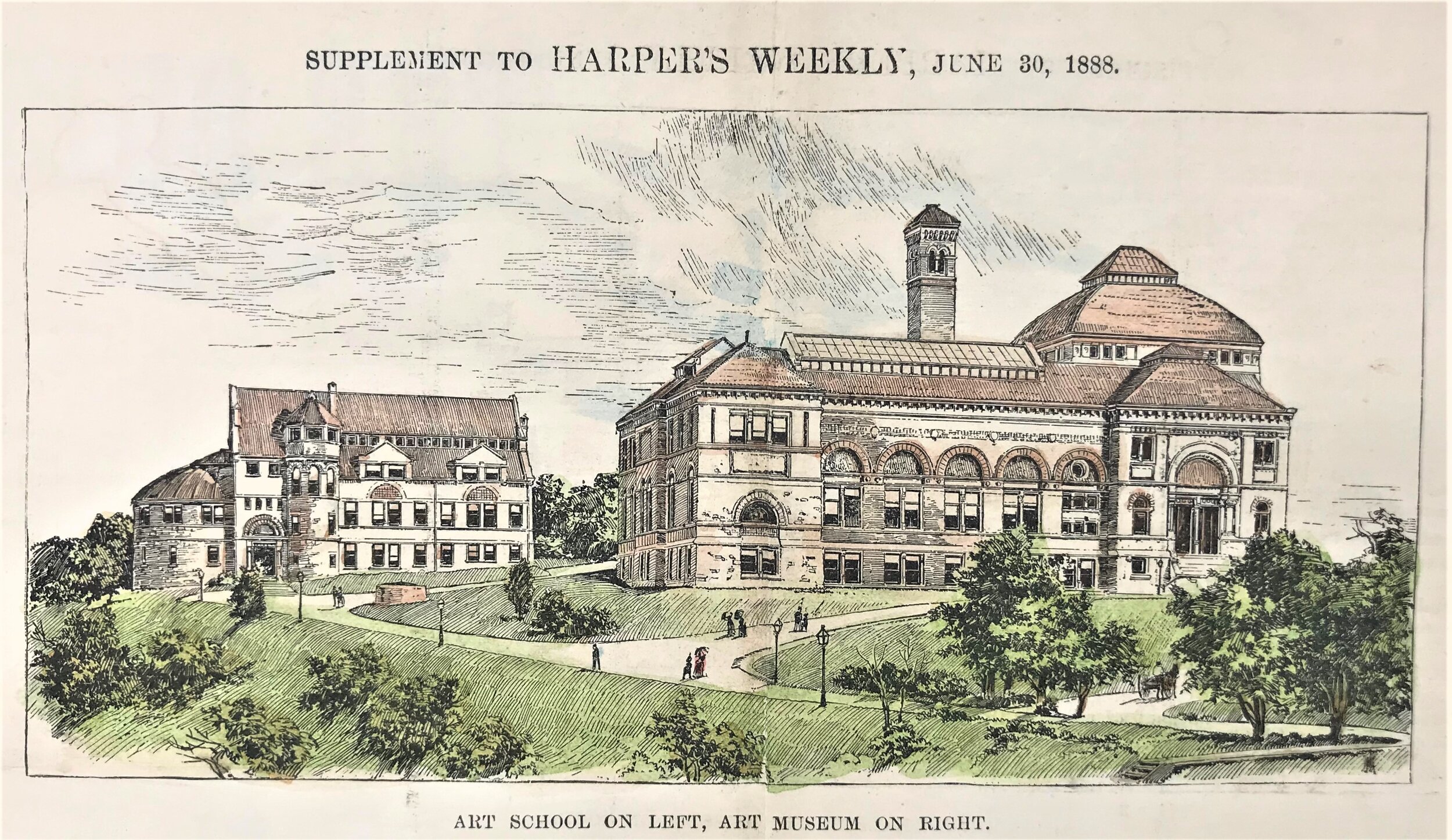
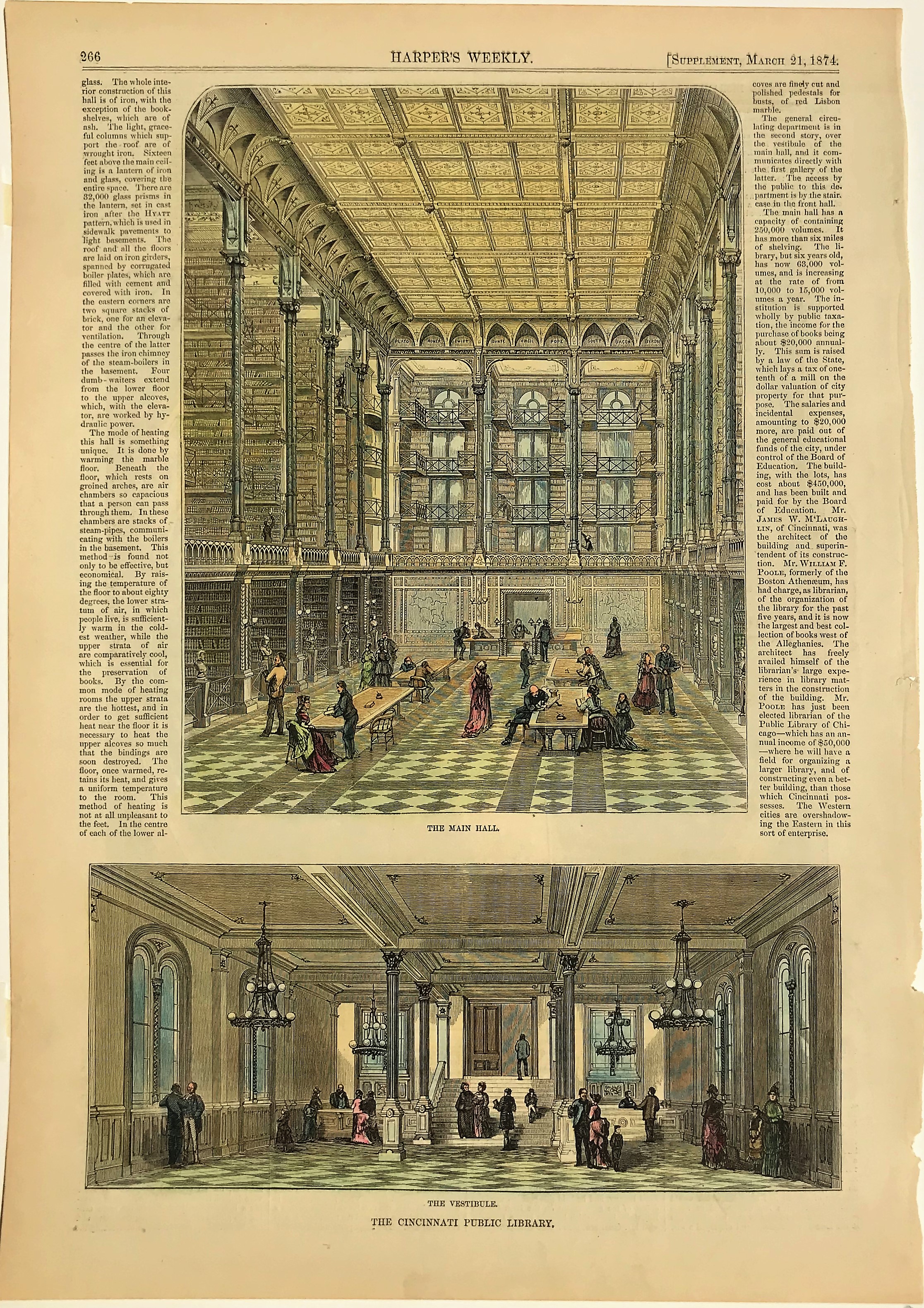
1874 Print: The Cincinnati Public Library
8
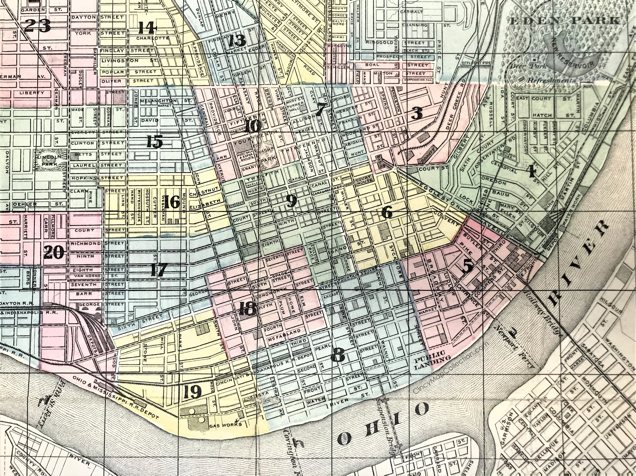
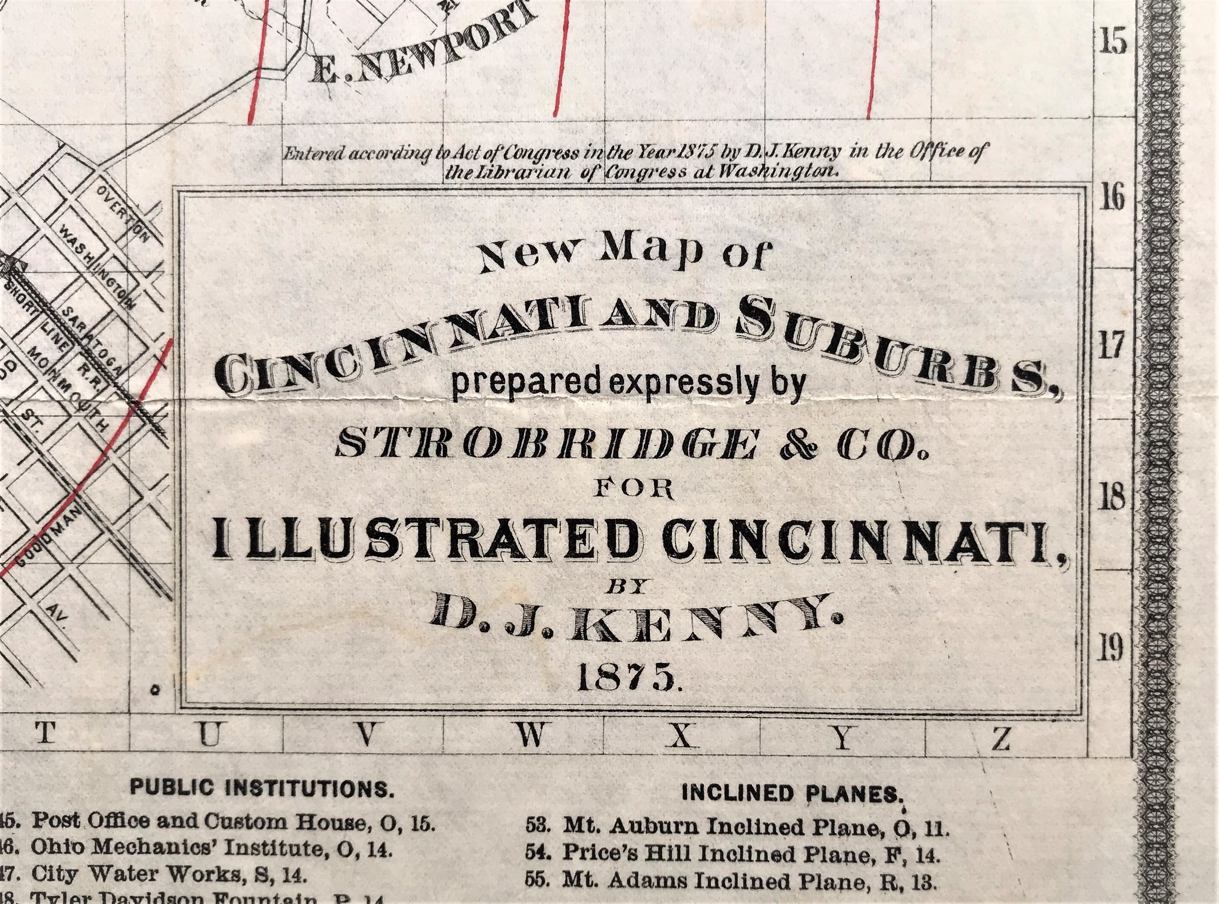
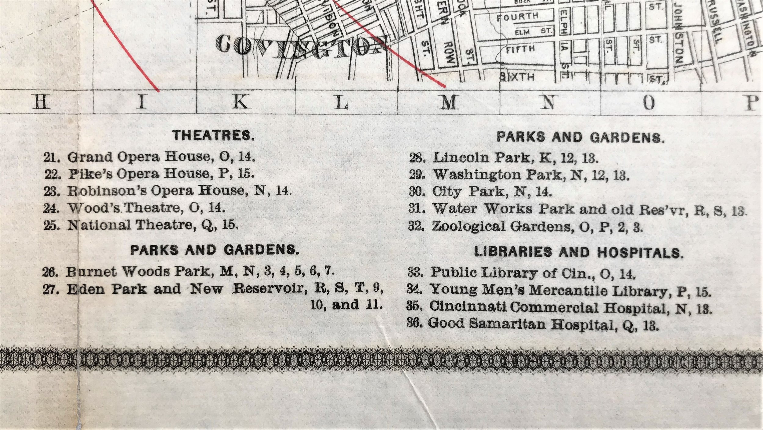
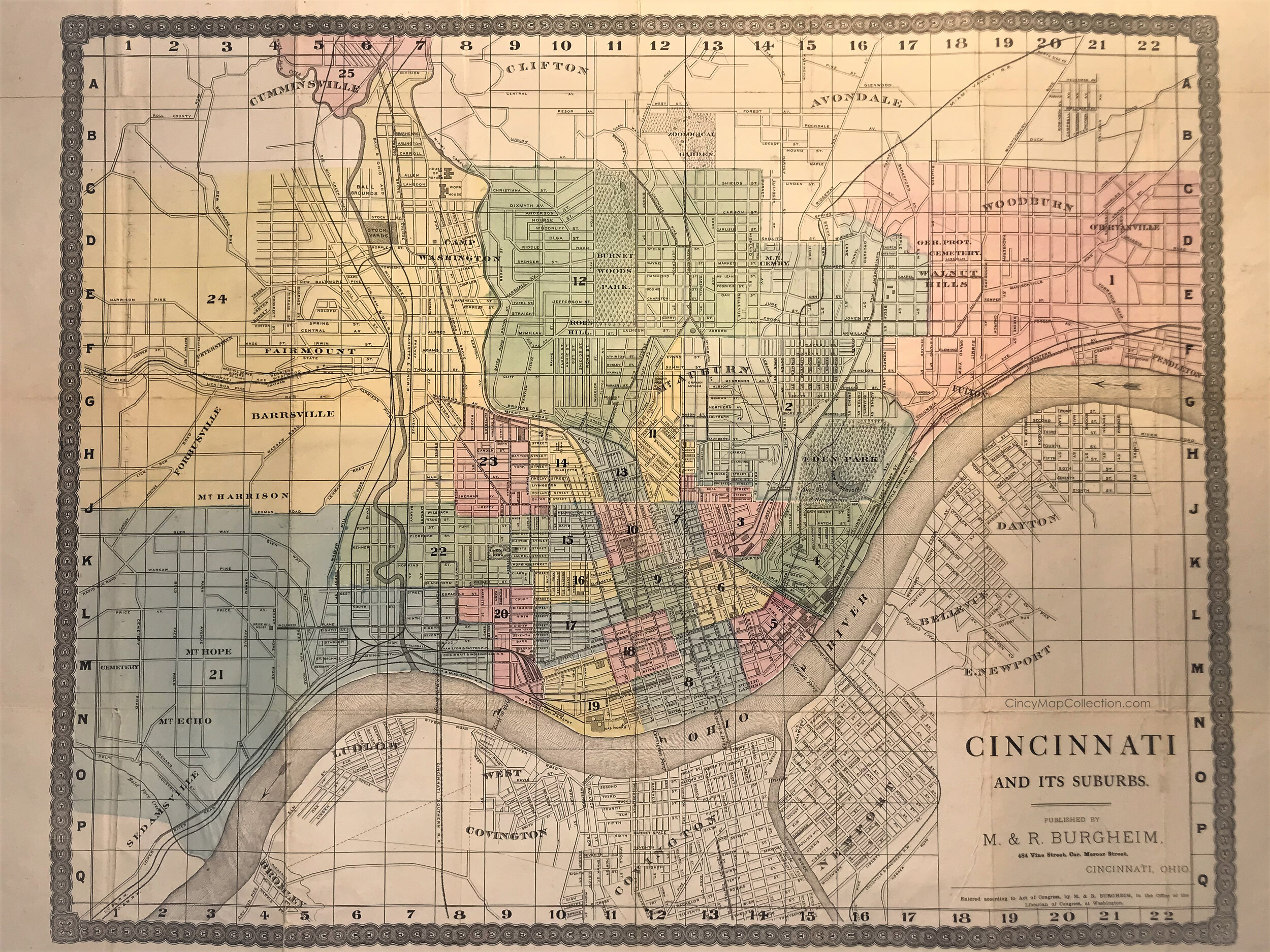
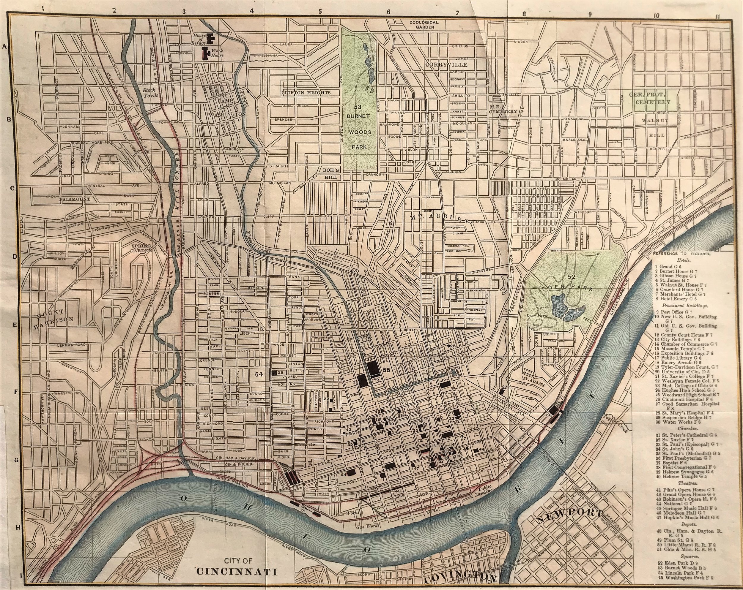
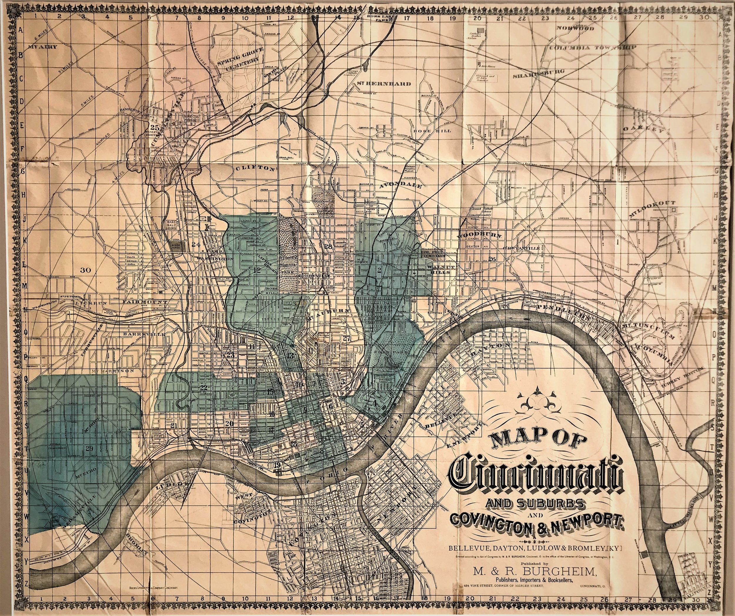
1875 Cincinnati and Its Suburbs
14
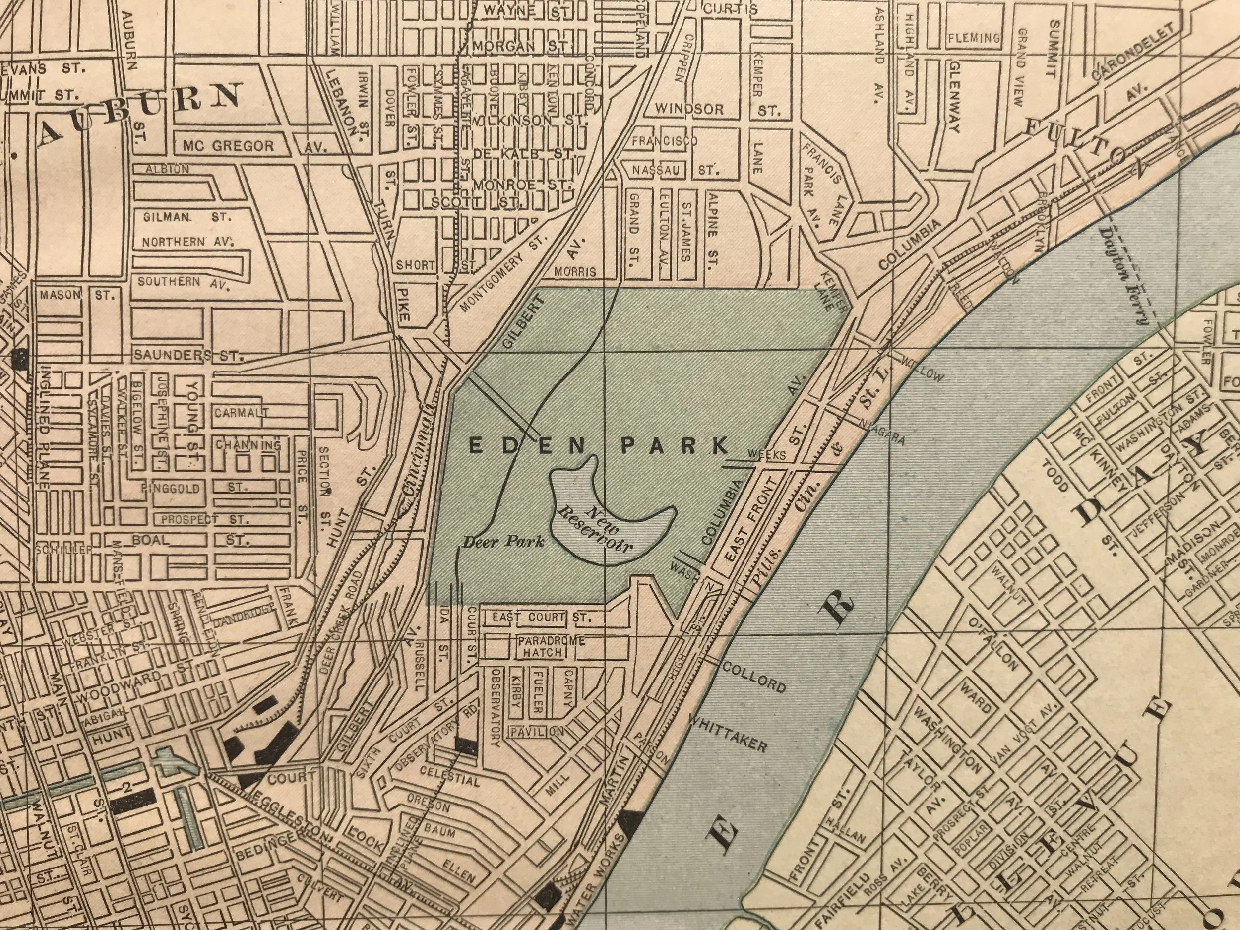
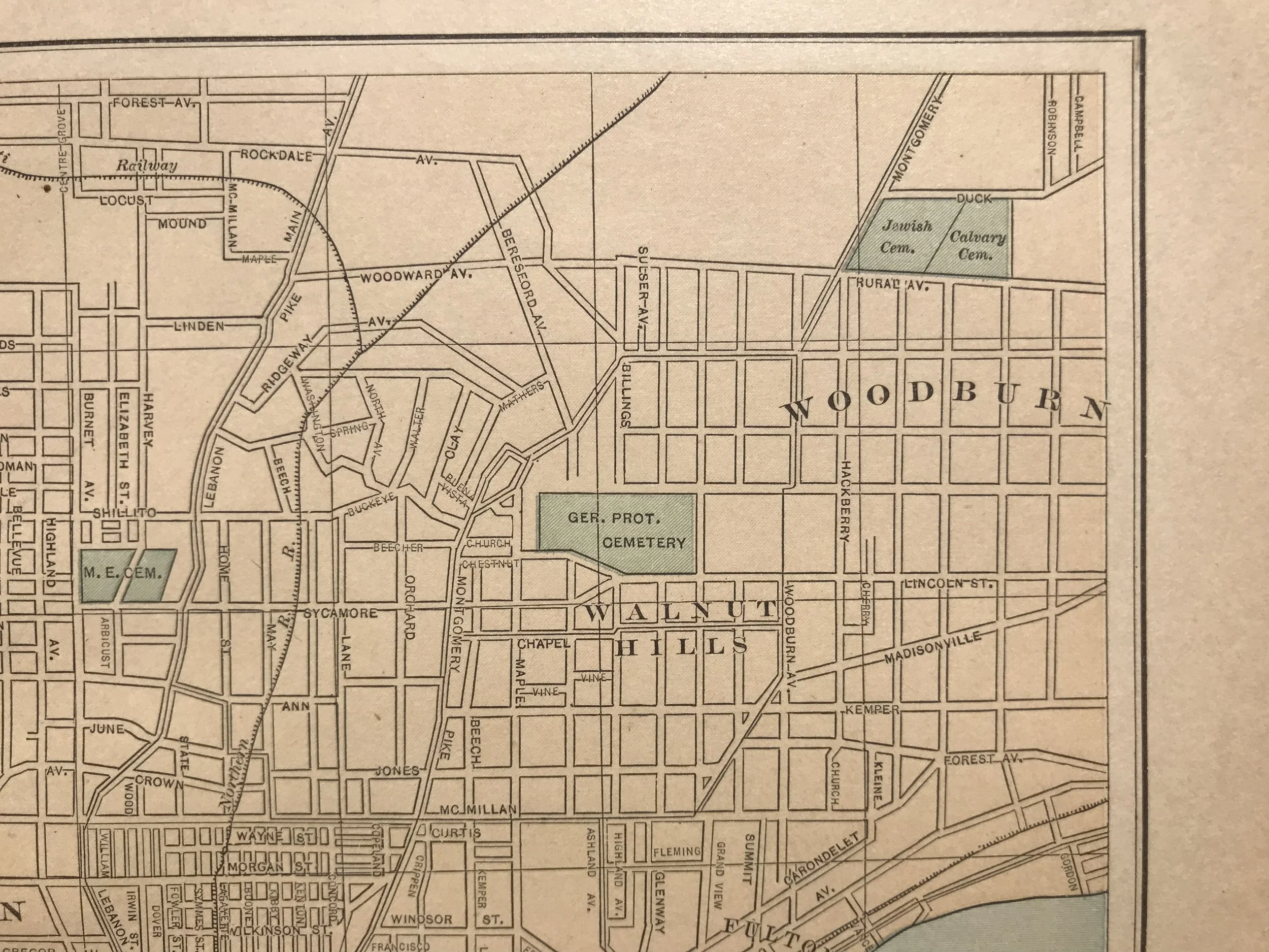
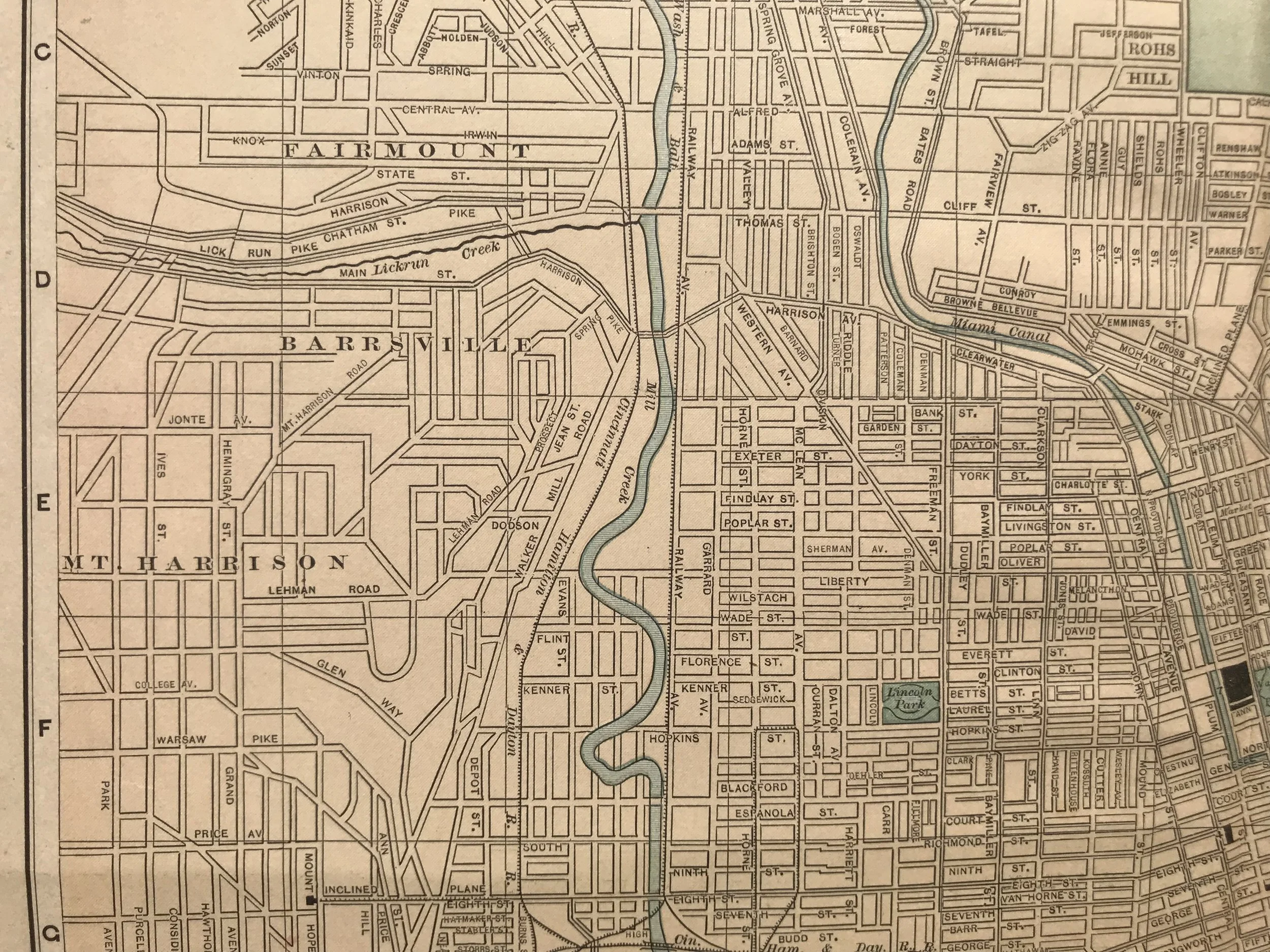
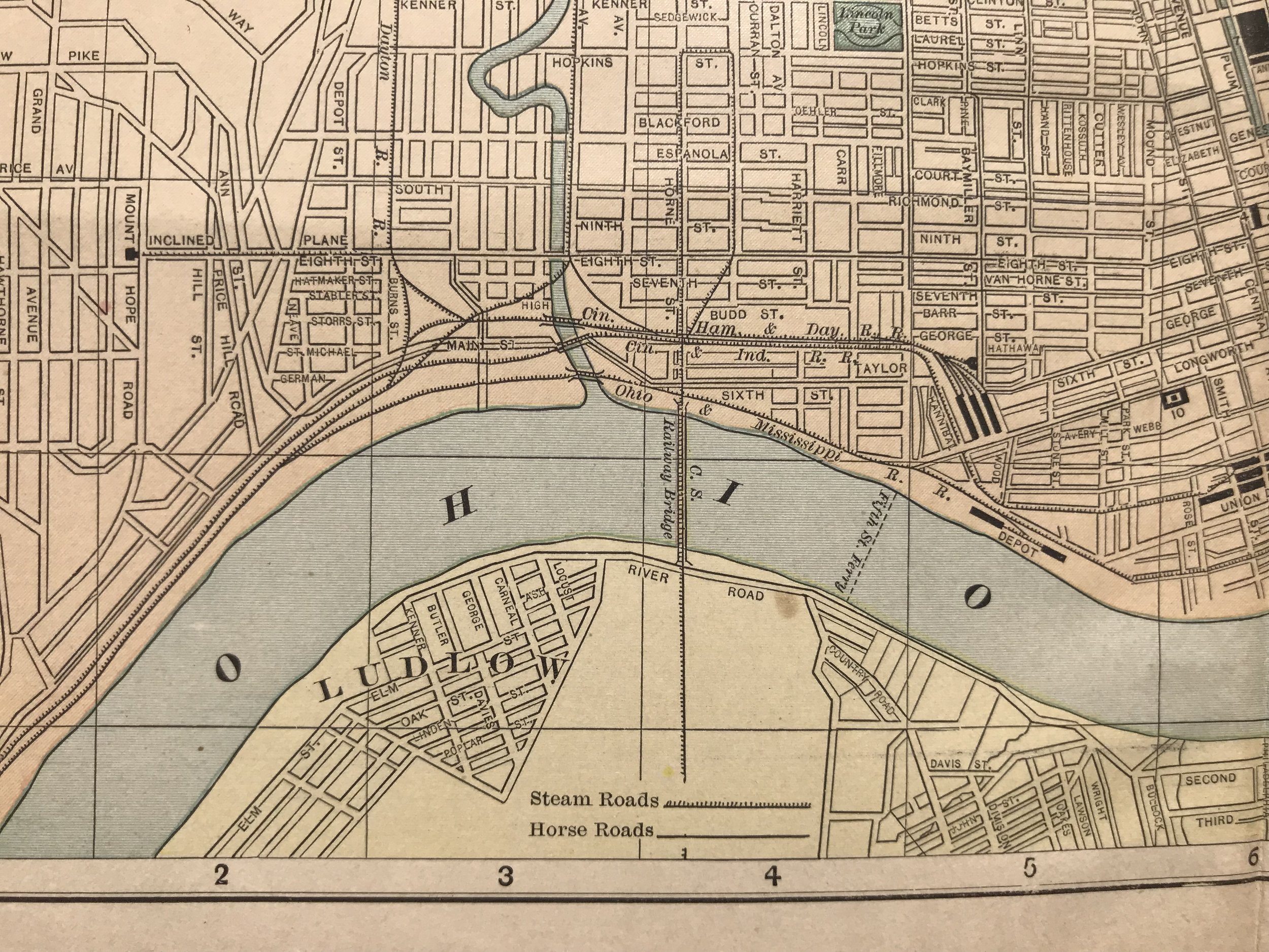
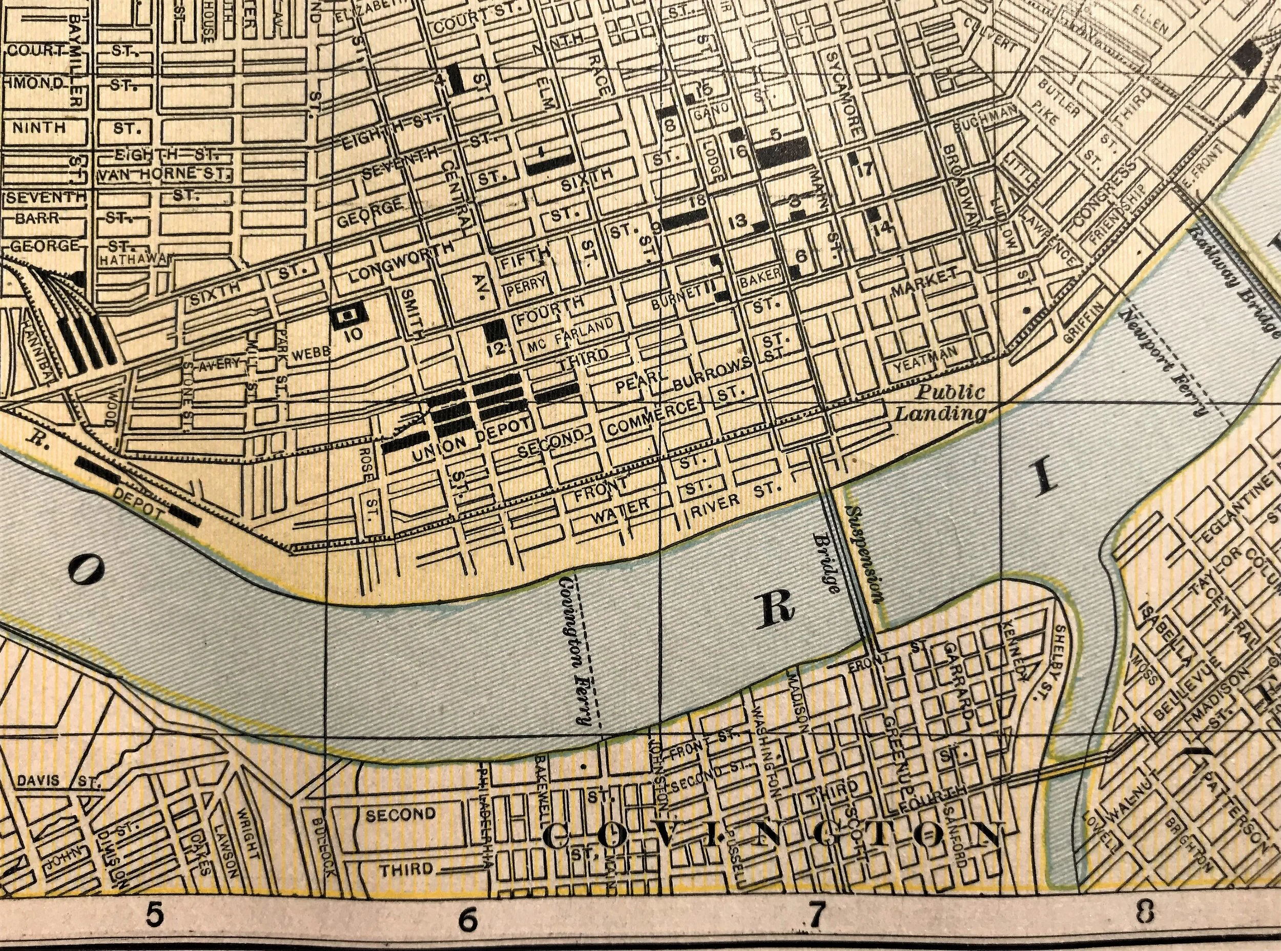
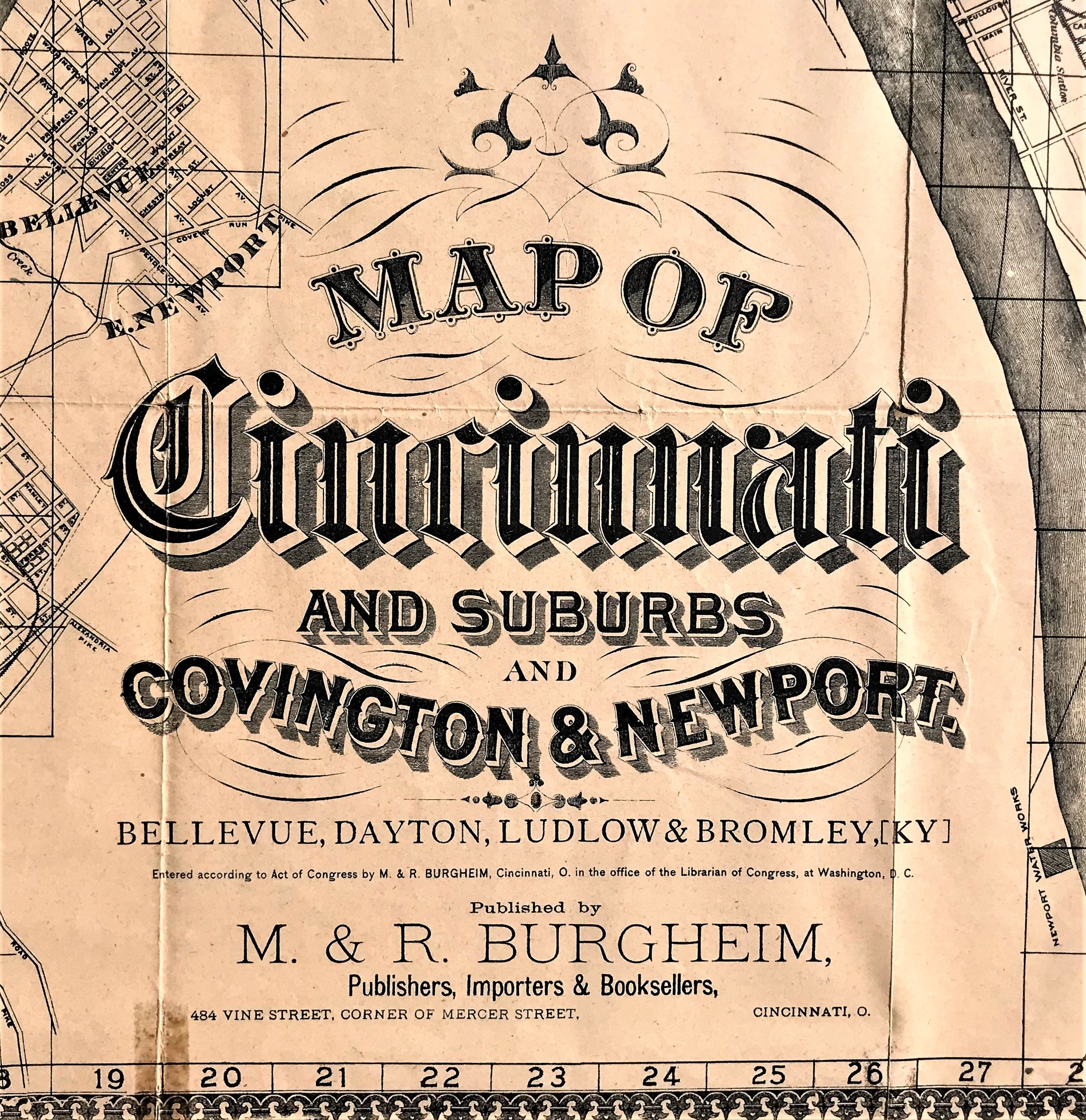
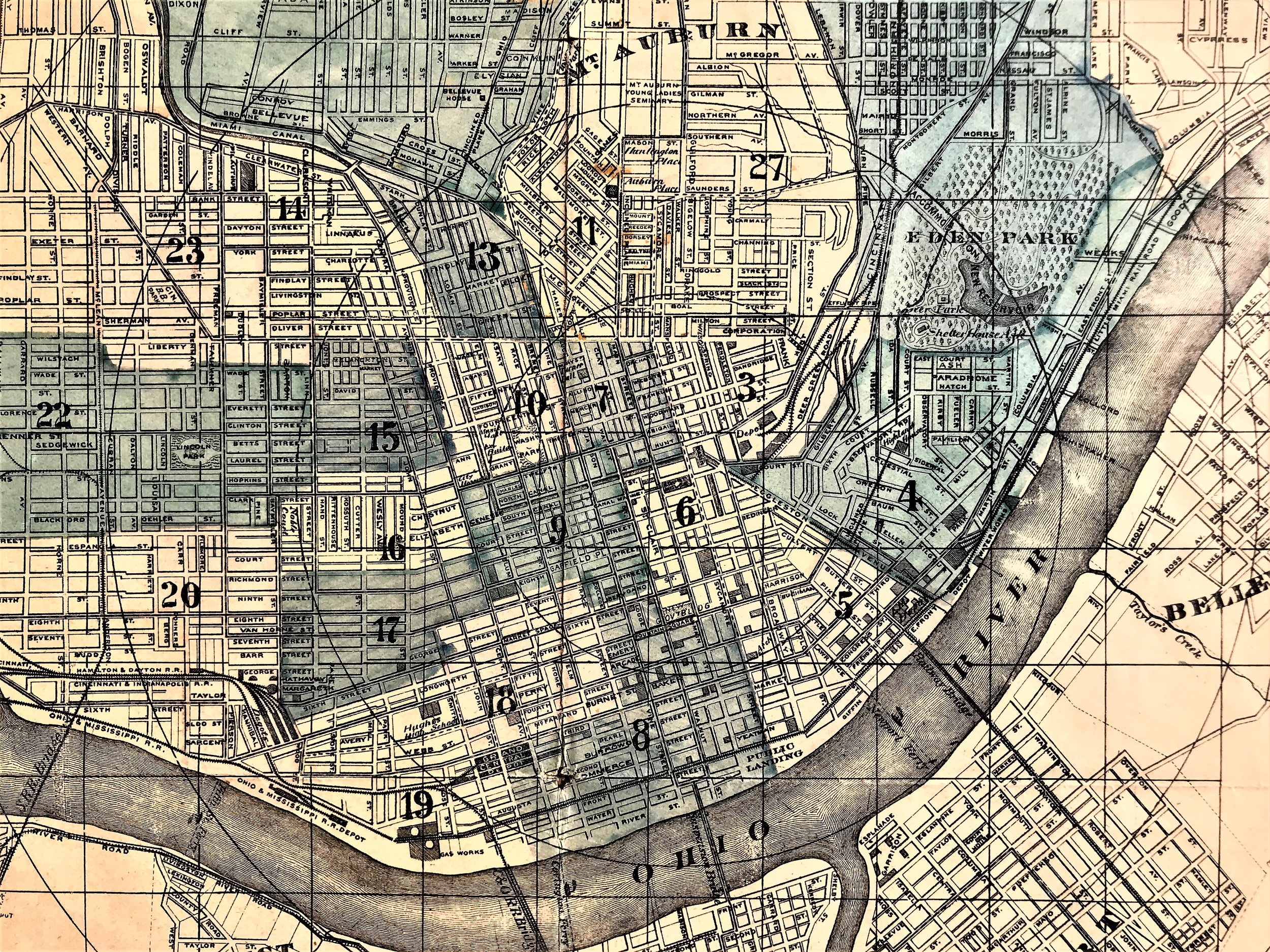
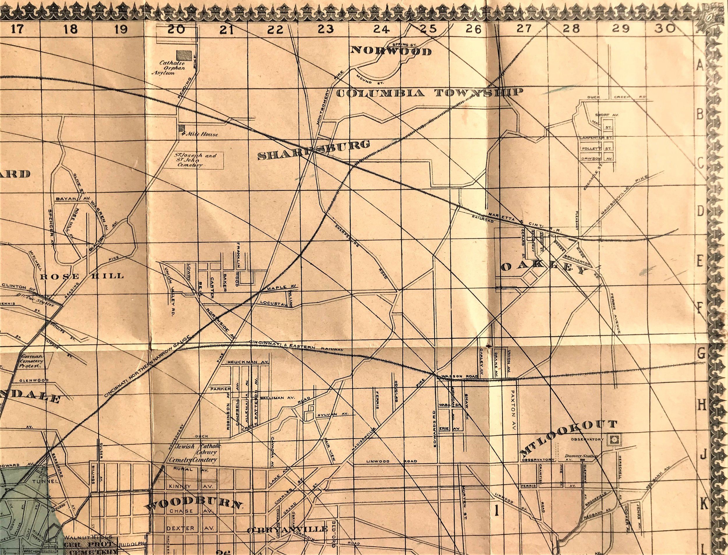
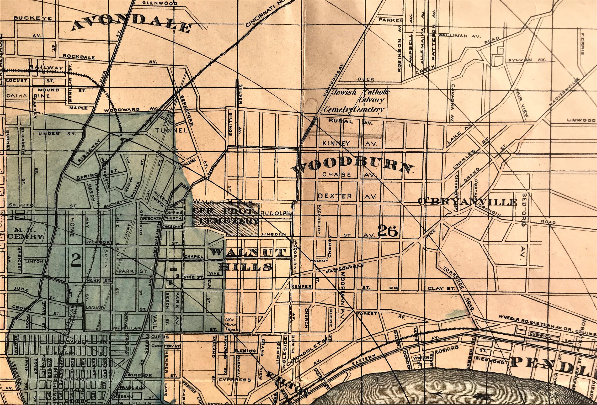
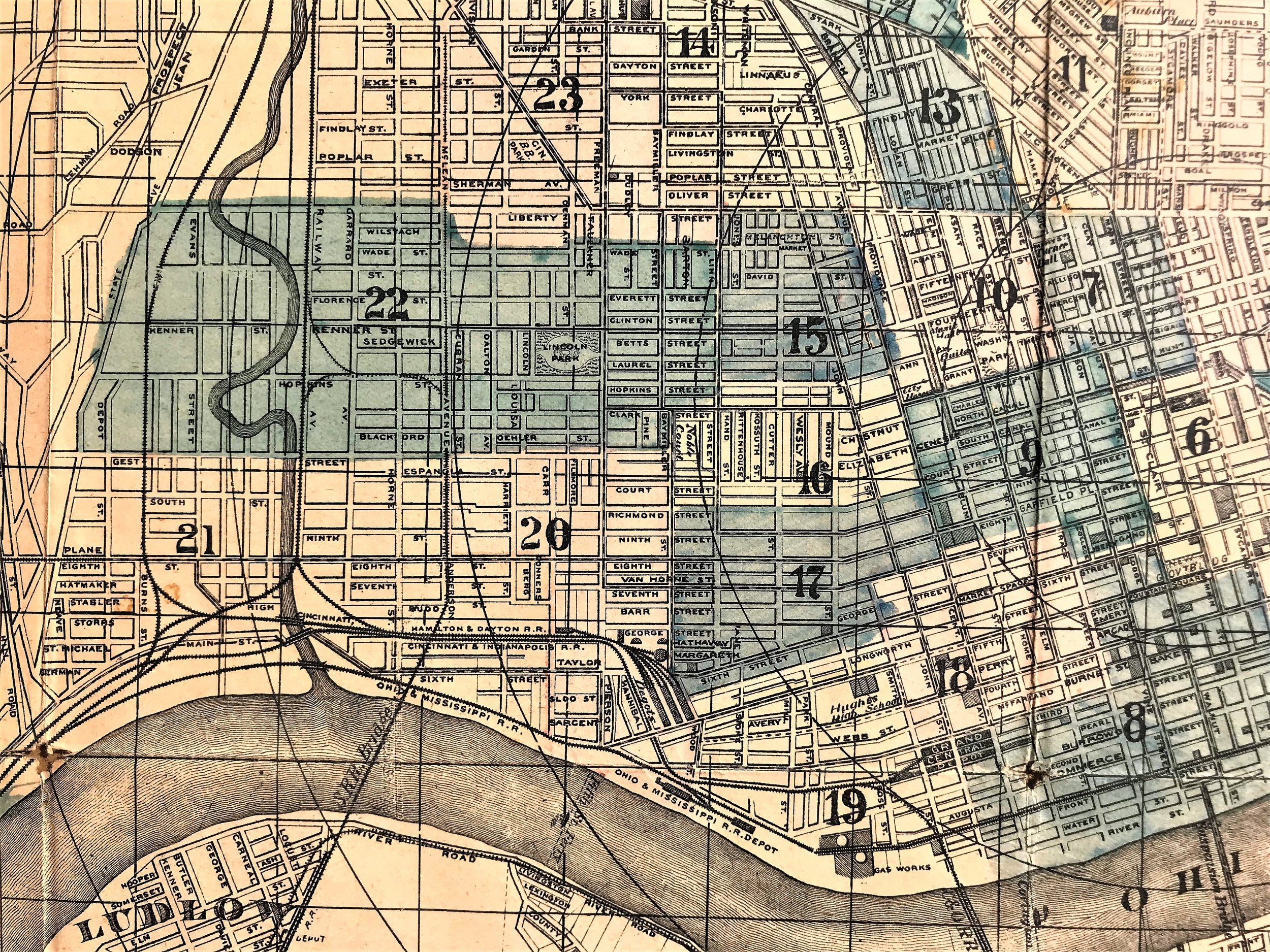
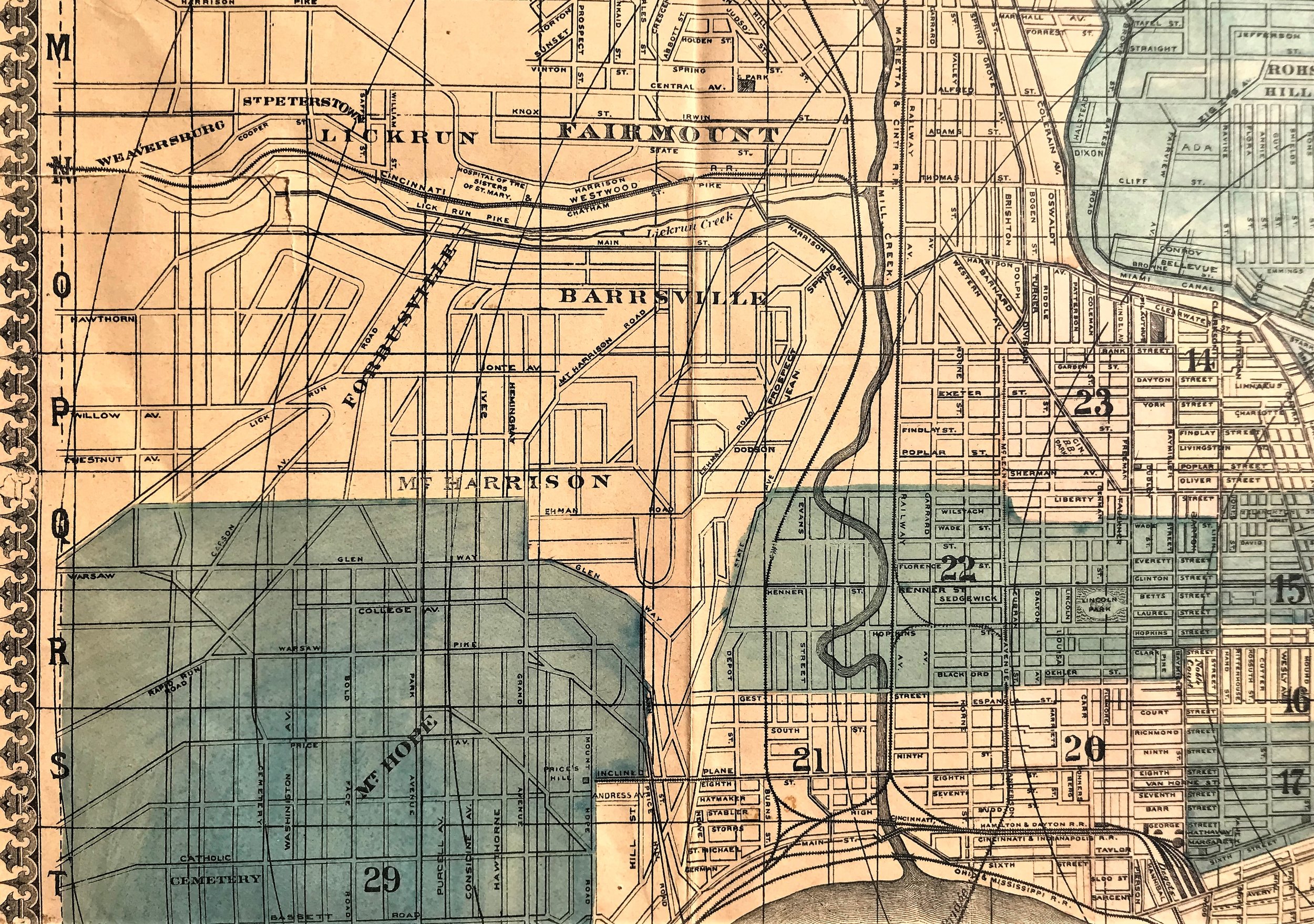
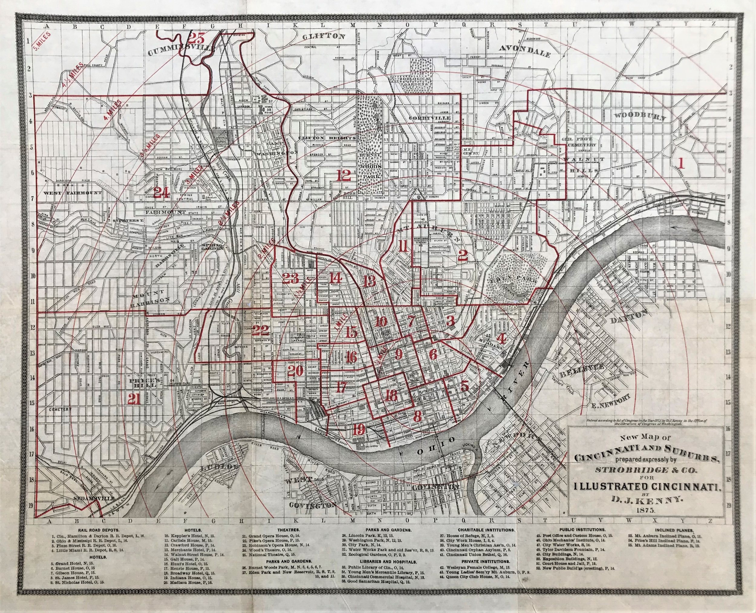
1875 New Map of Cincinnati & Suburbs
4
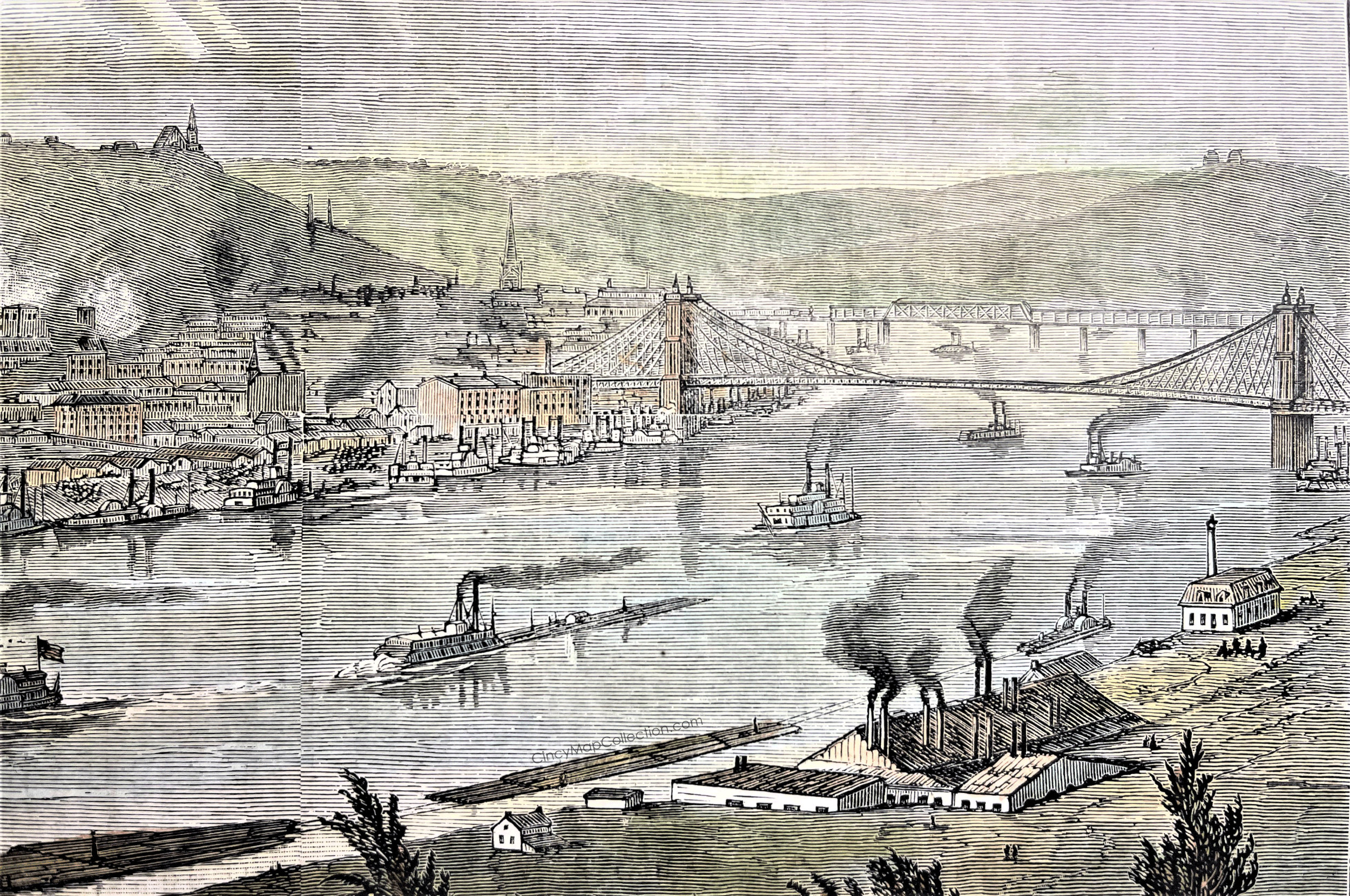
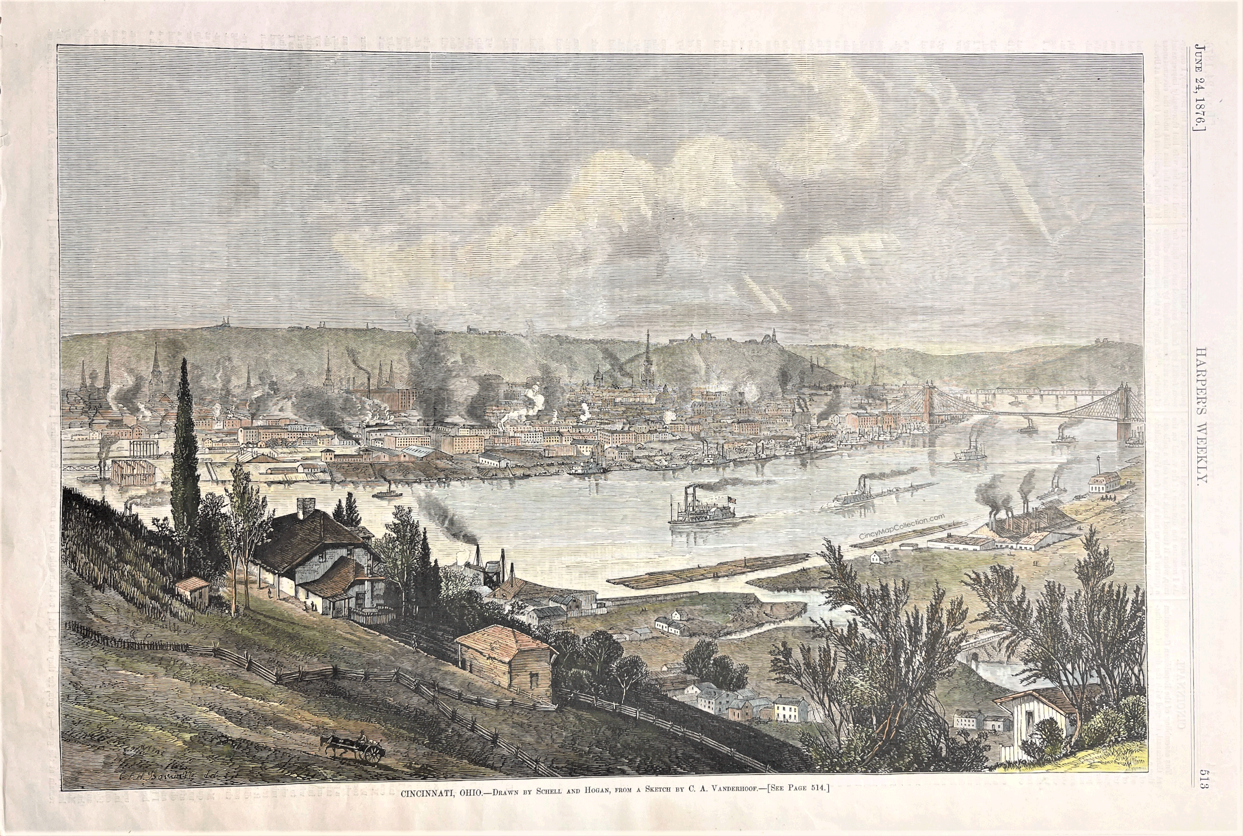
1876 Print: Cincinnati, Ohio
14
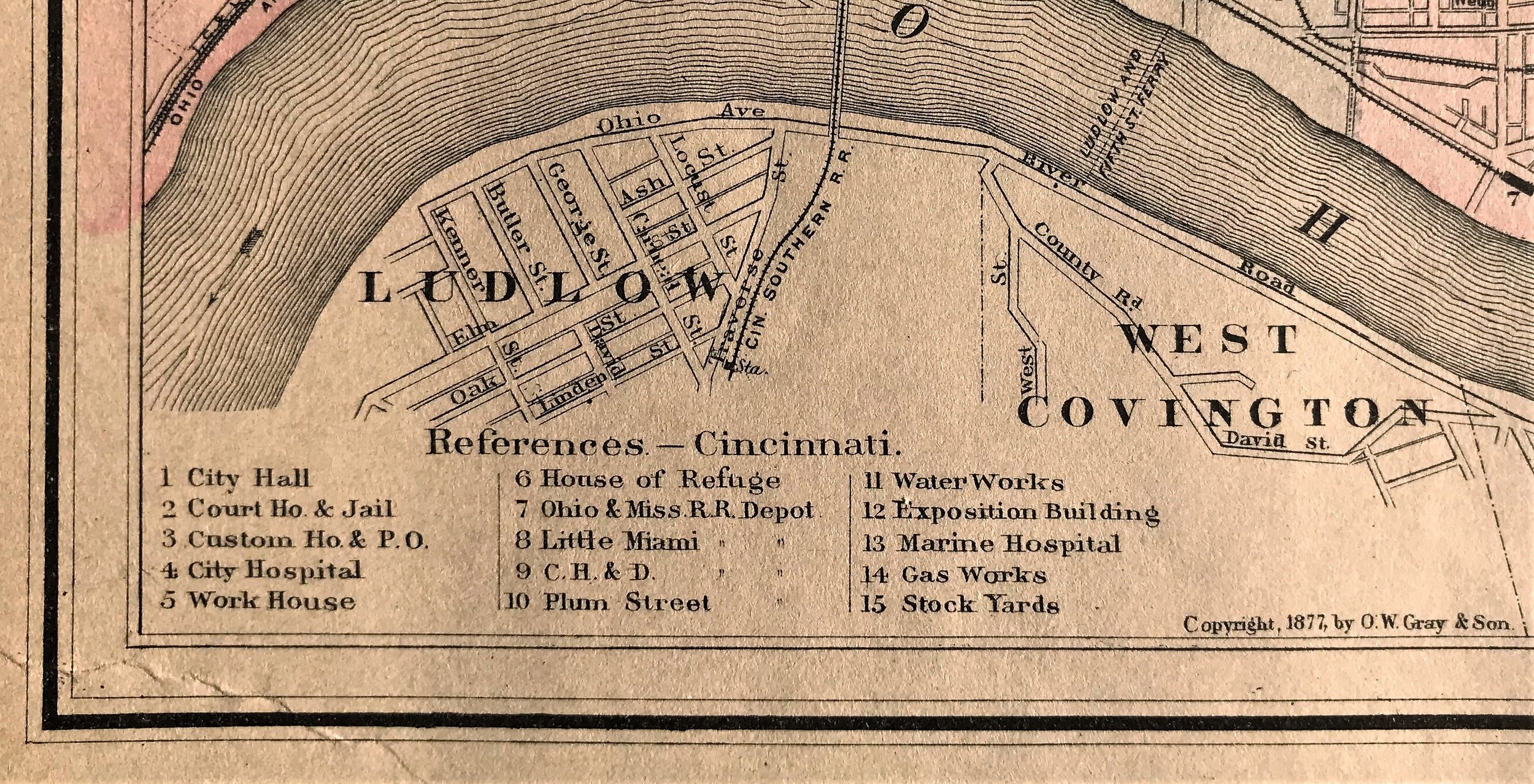
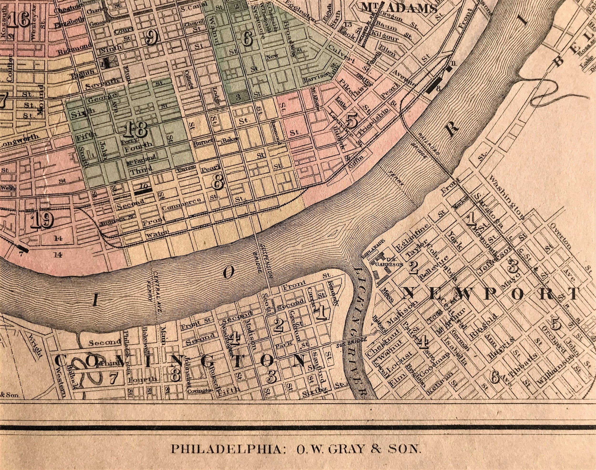
1877 Map of Cincinnati
4
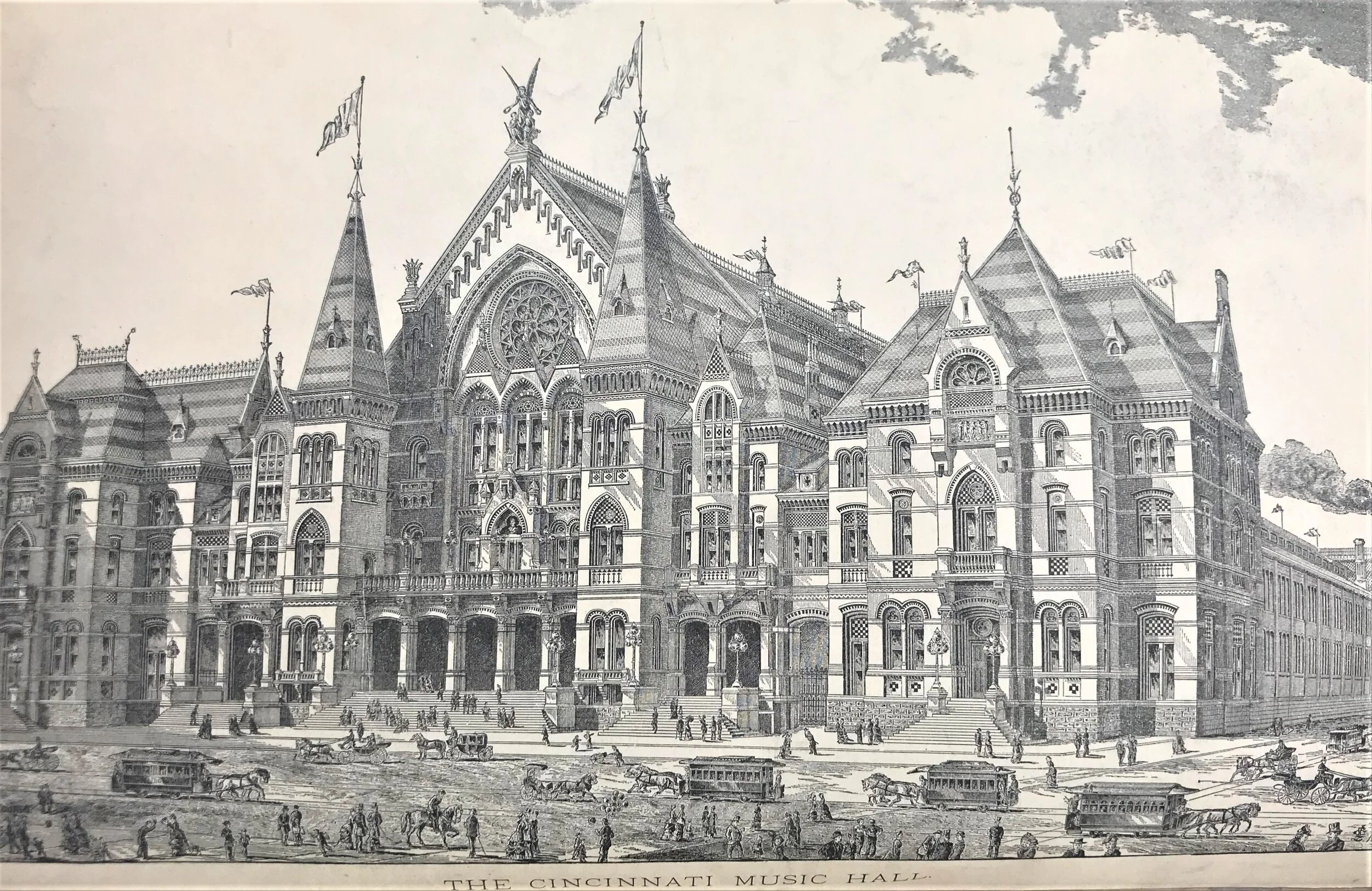
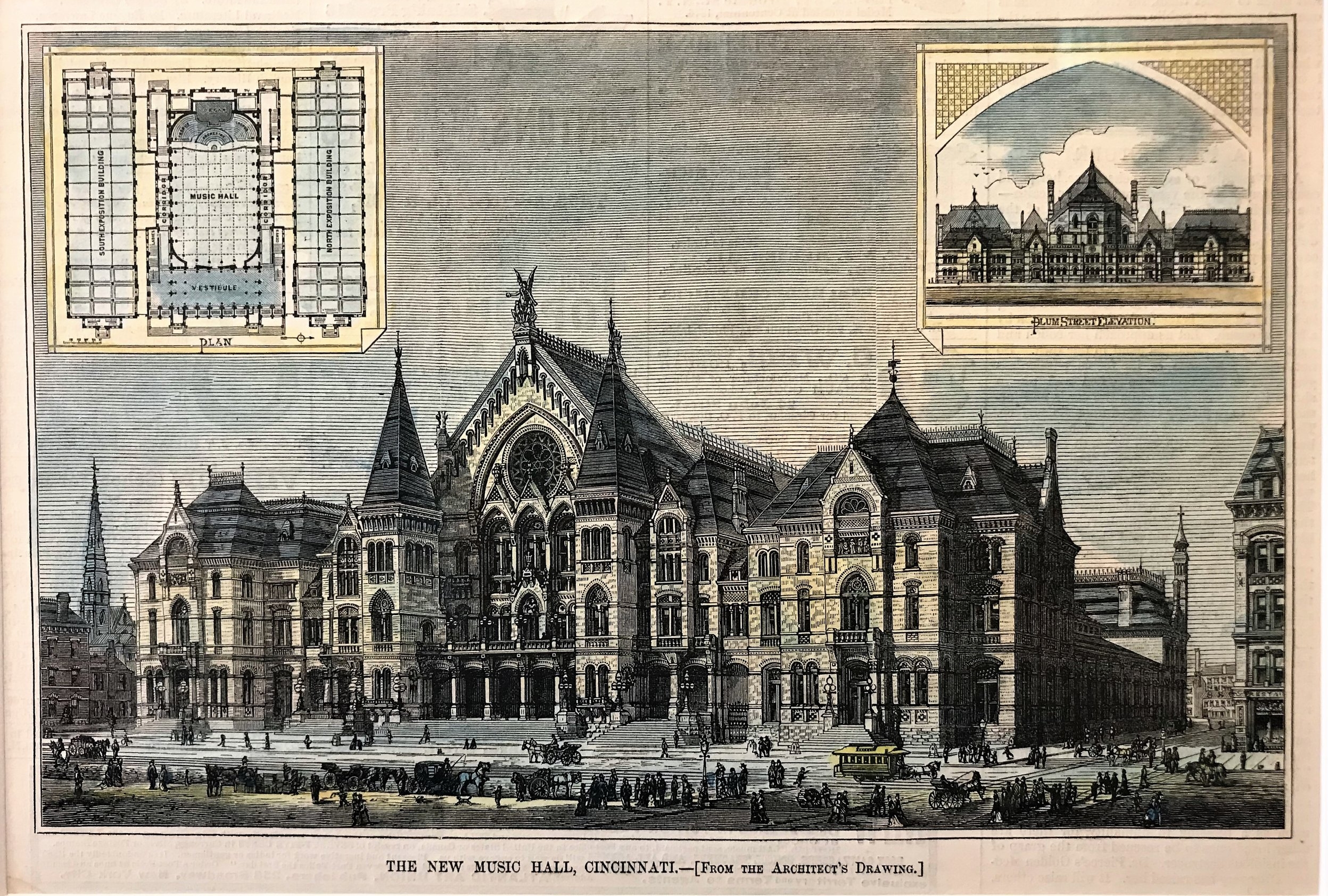
1878 Print: The New Music Hall, Cincinnati
7
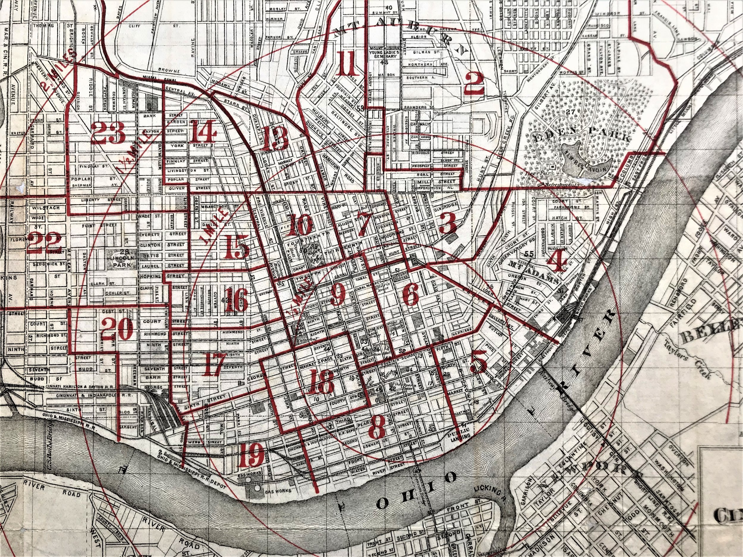
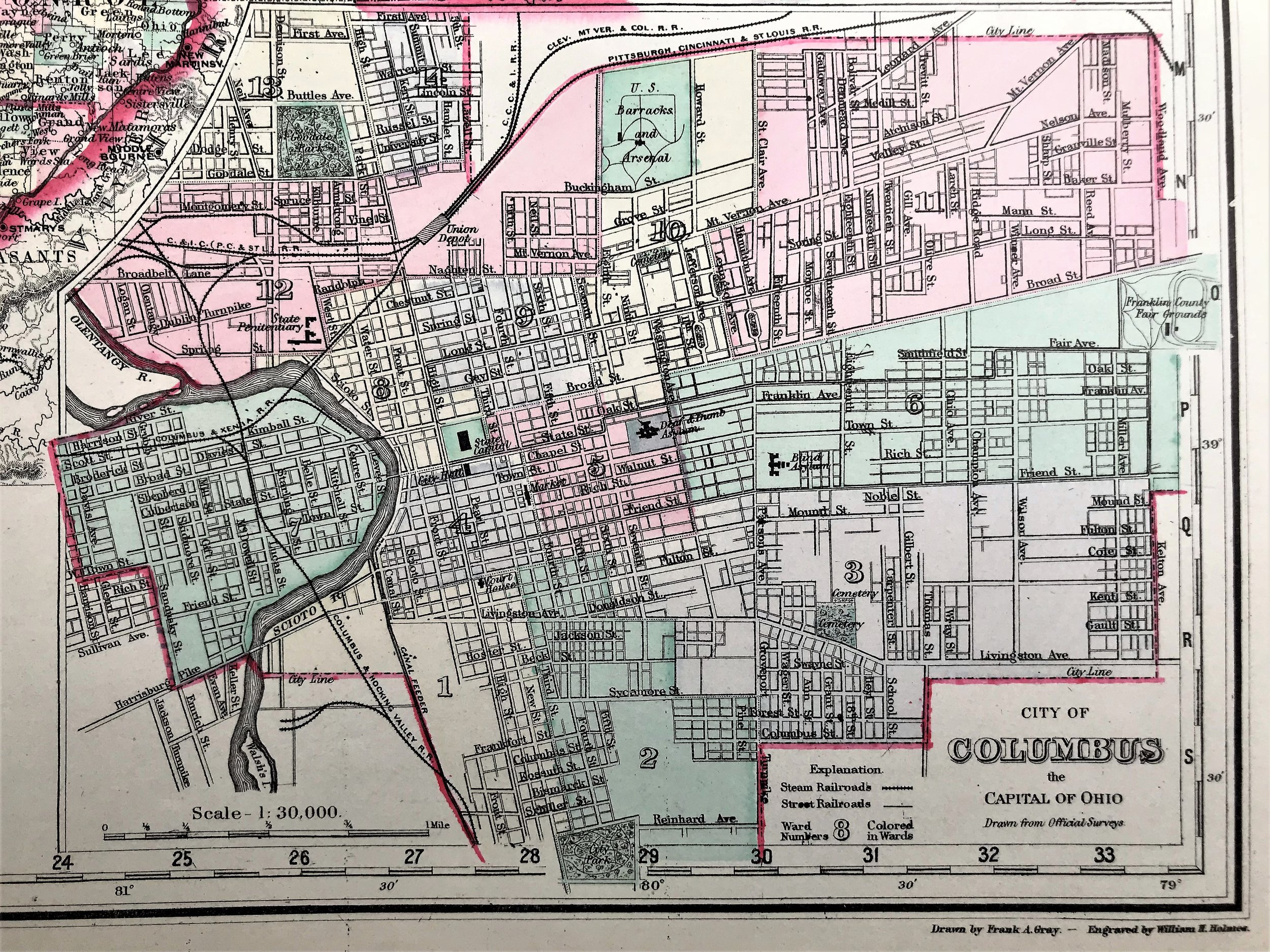
1879 City of Cincinnati
3
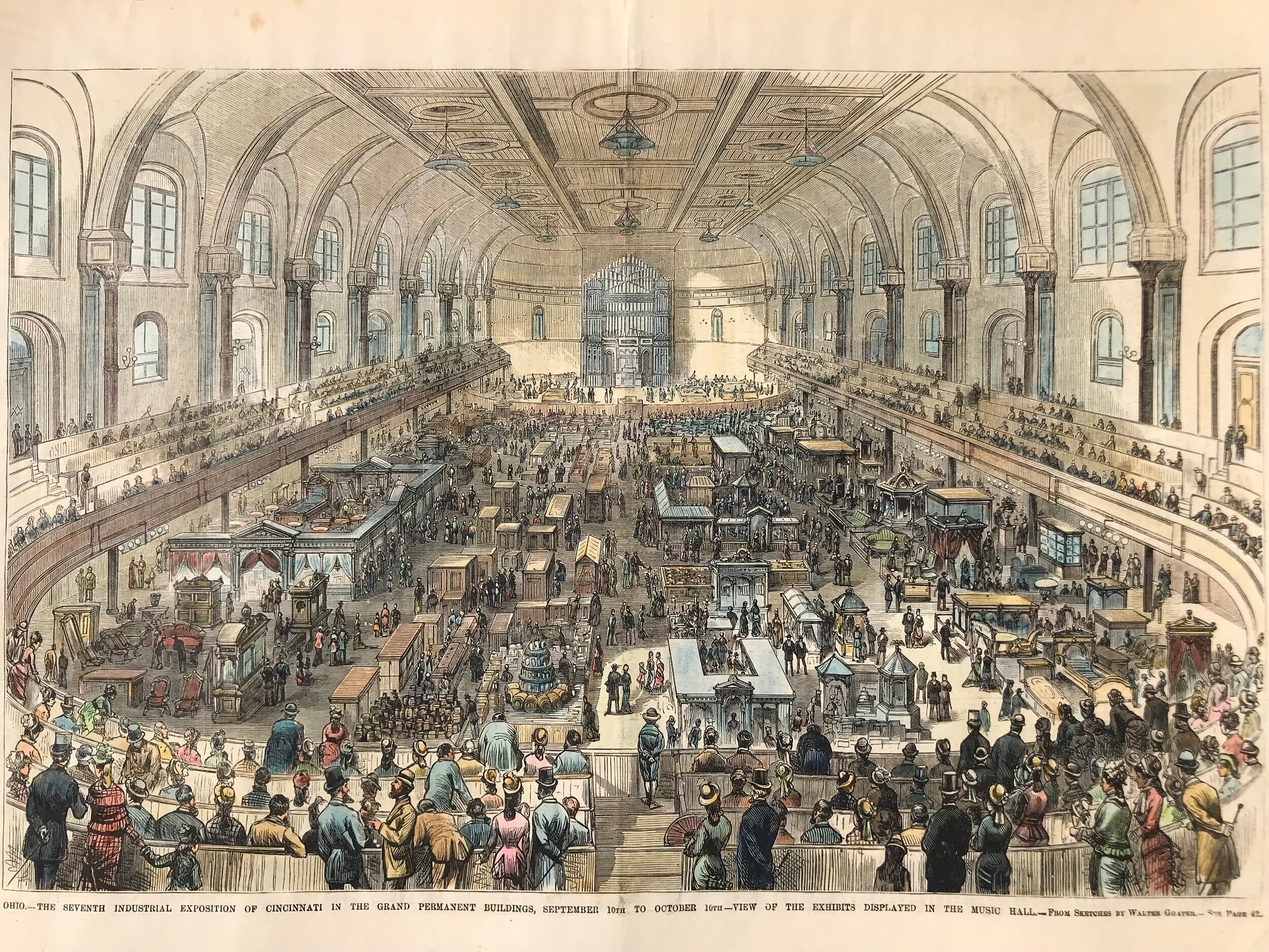
1879 View of Industrial Exposition in Music Hall
10
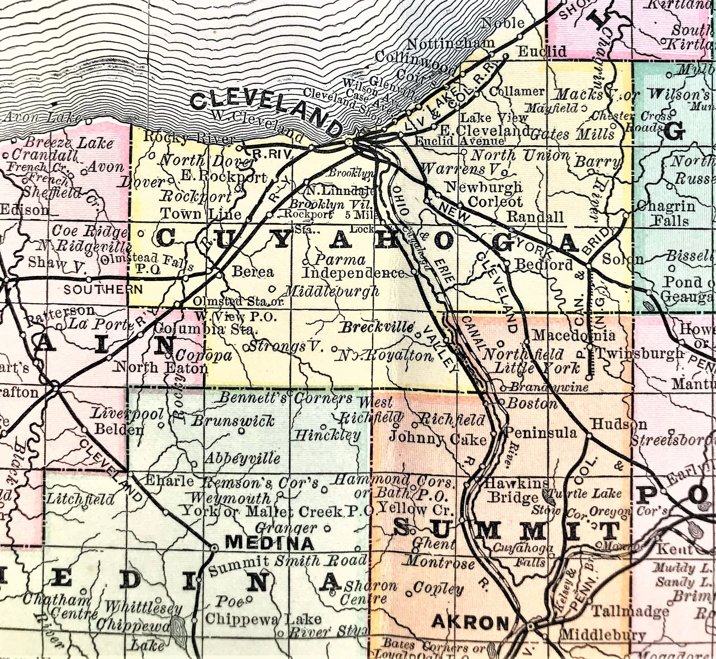
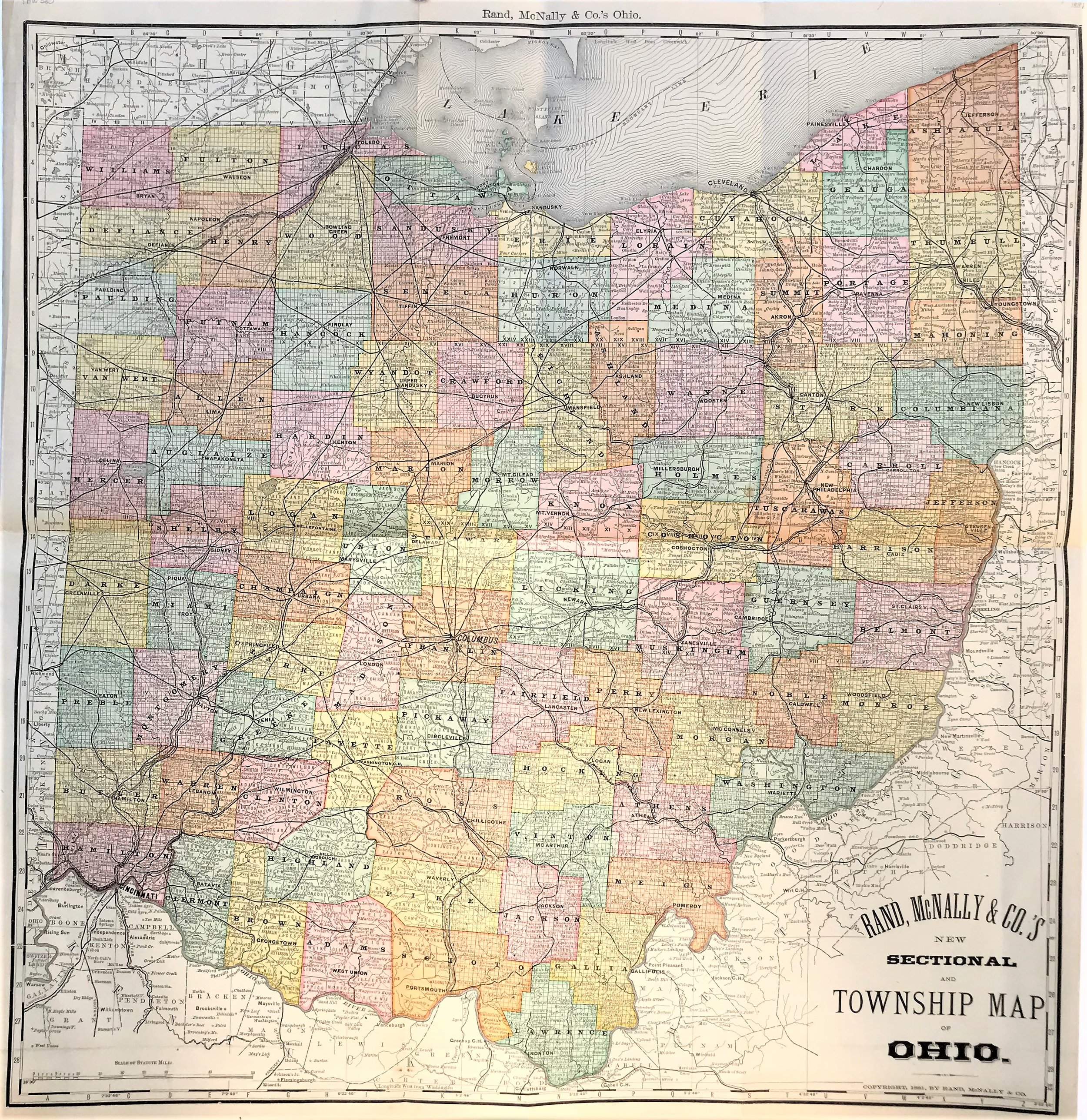
1881 Township Map of Ohio
5
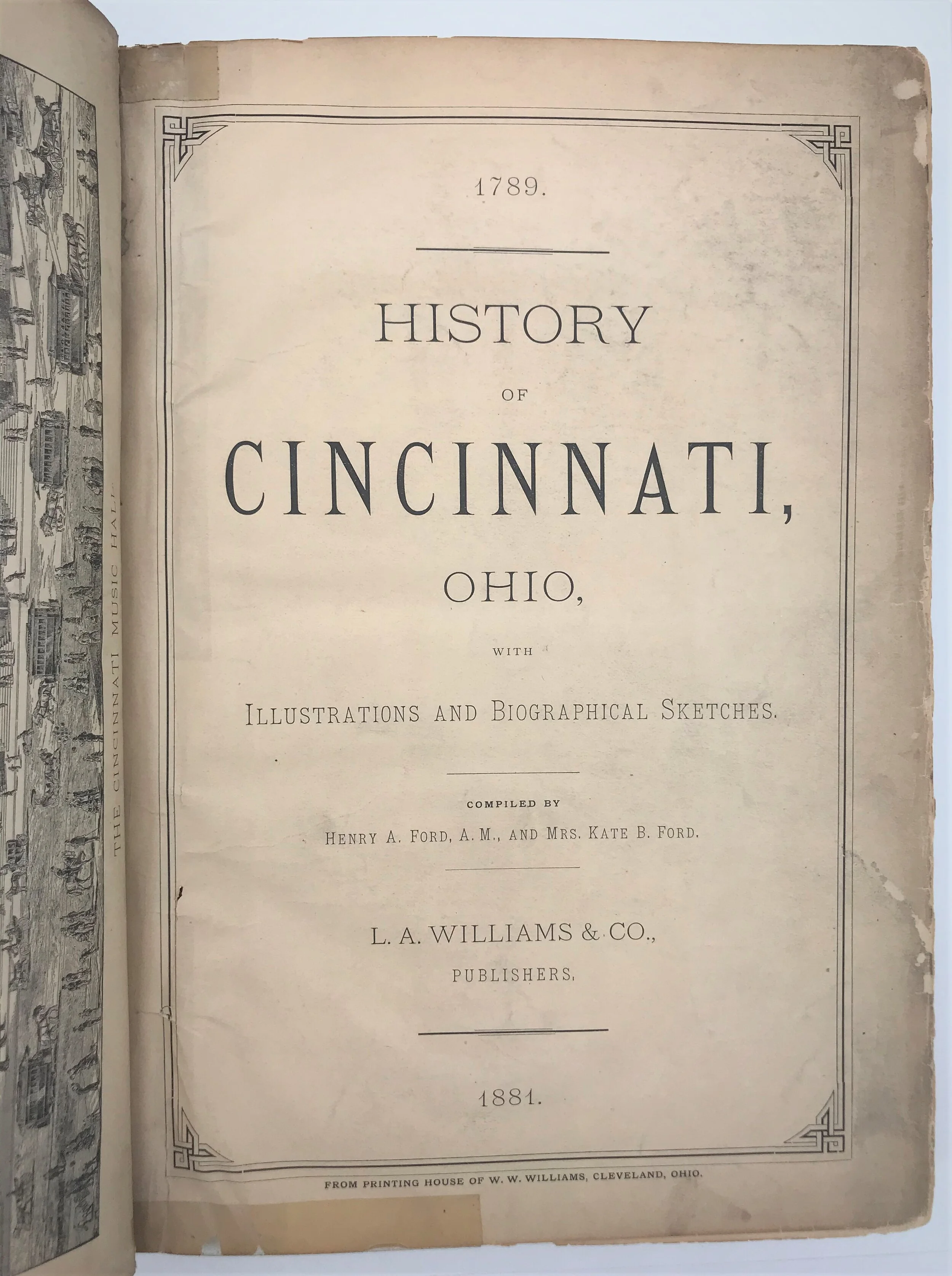
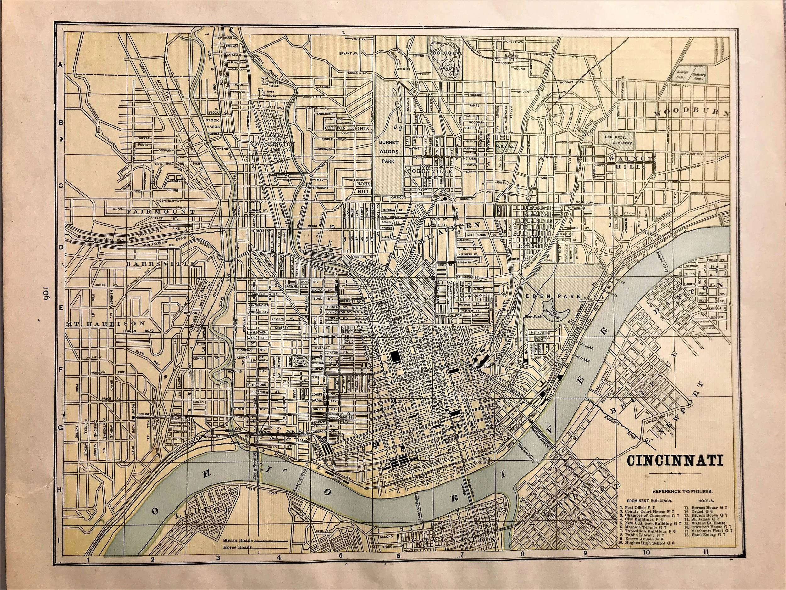
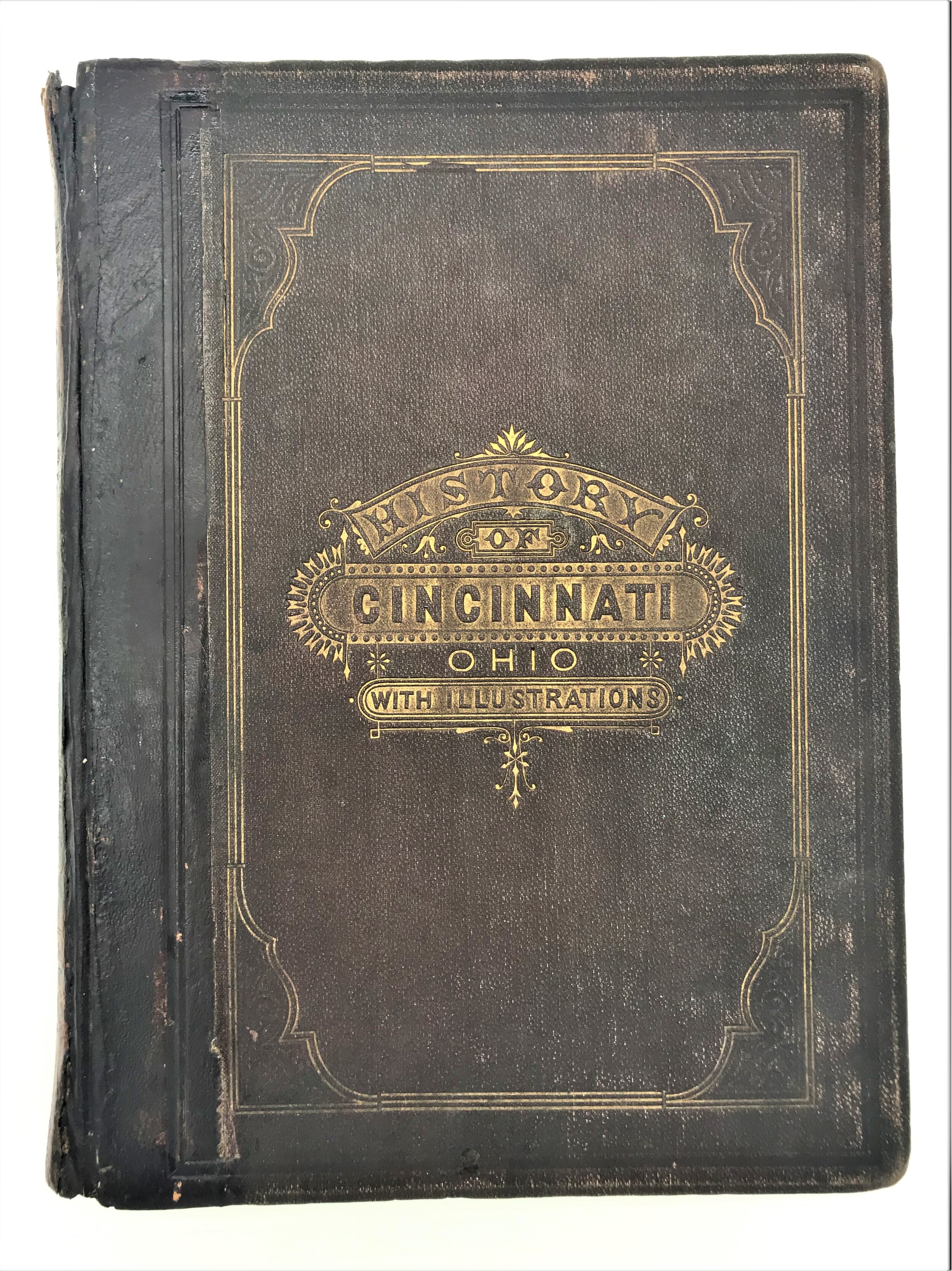
1881 Book: History of Cincinnati
14
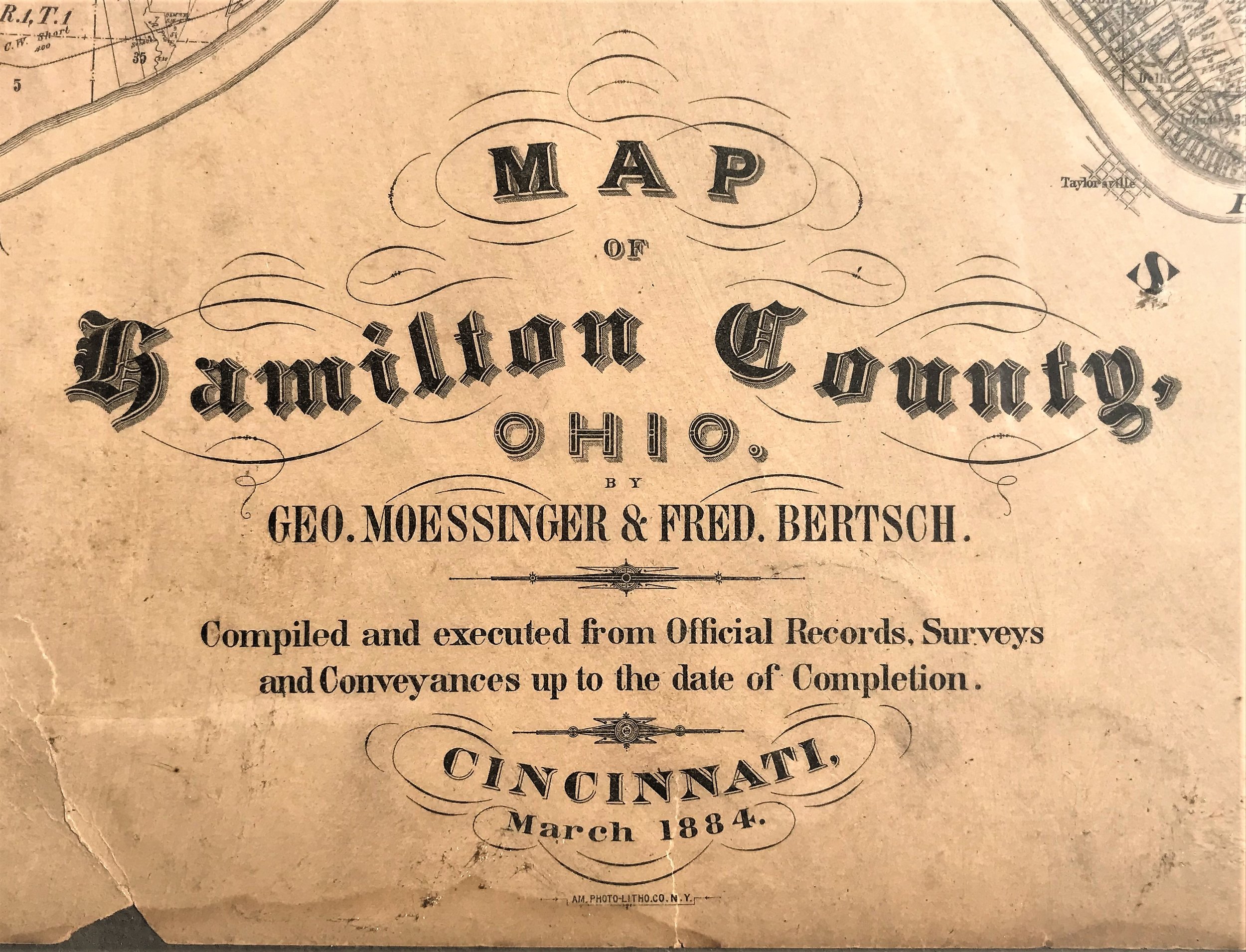
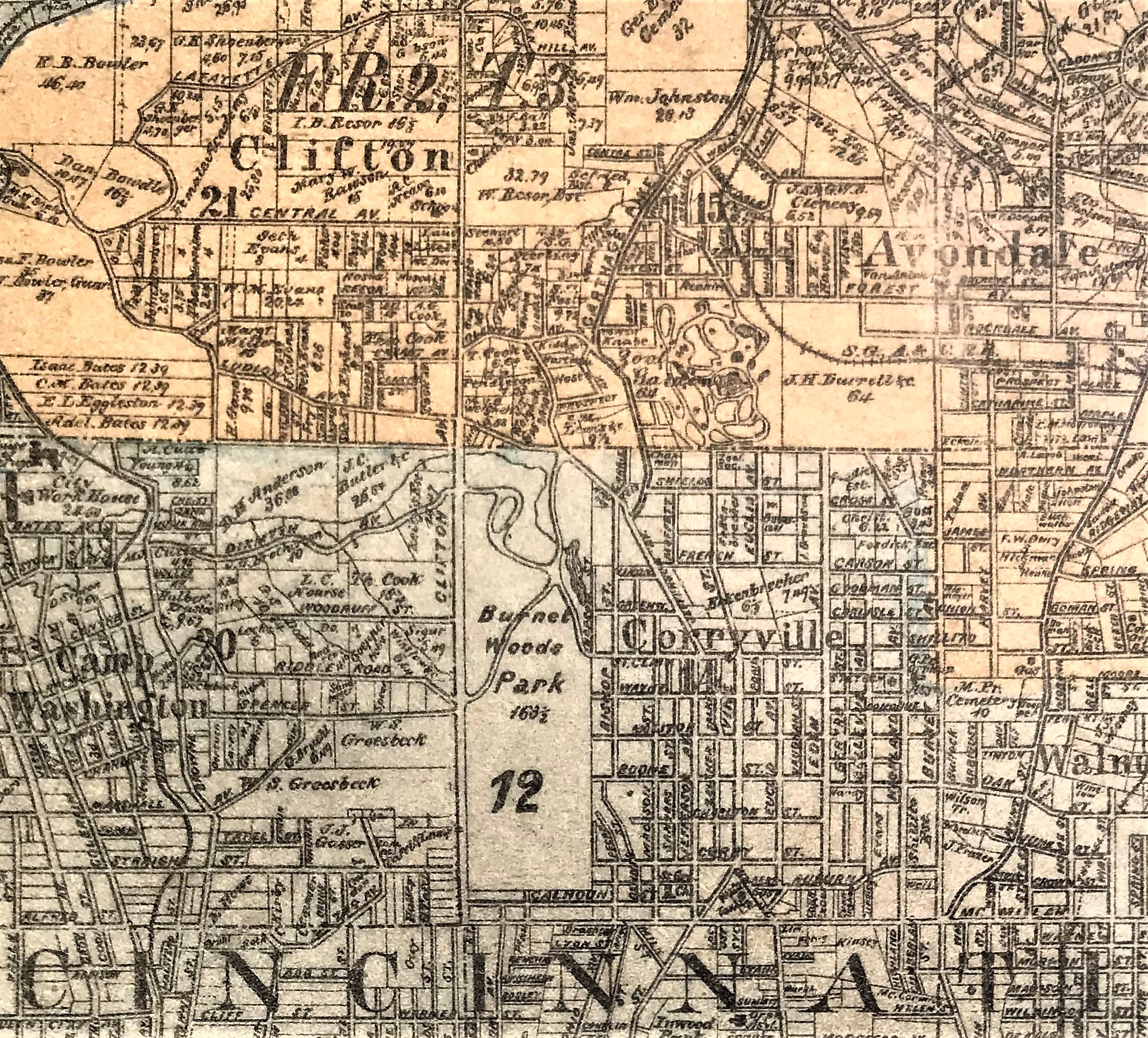
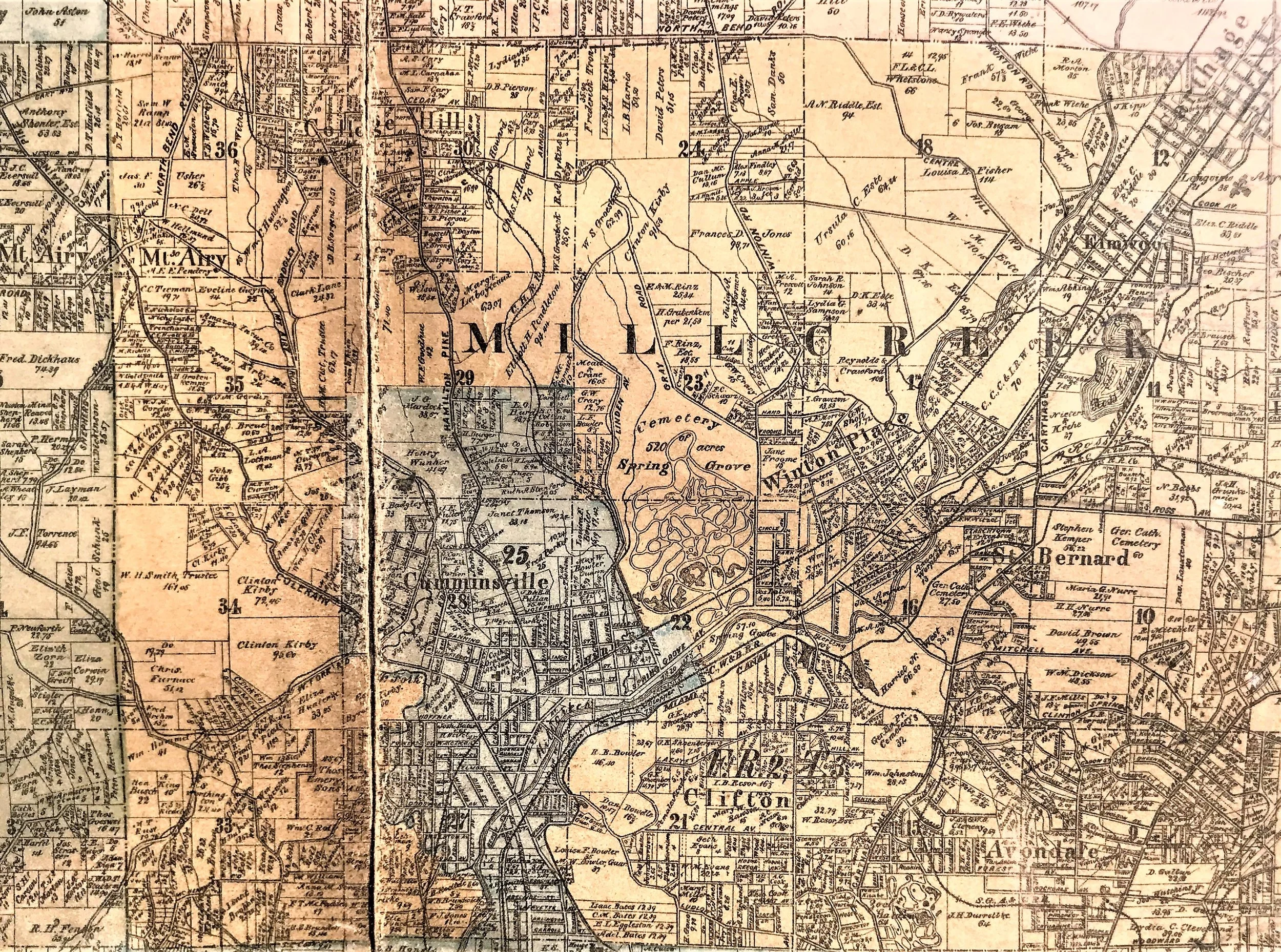
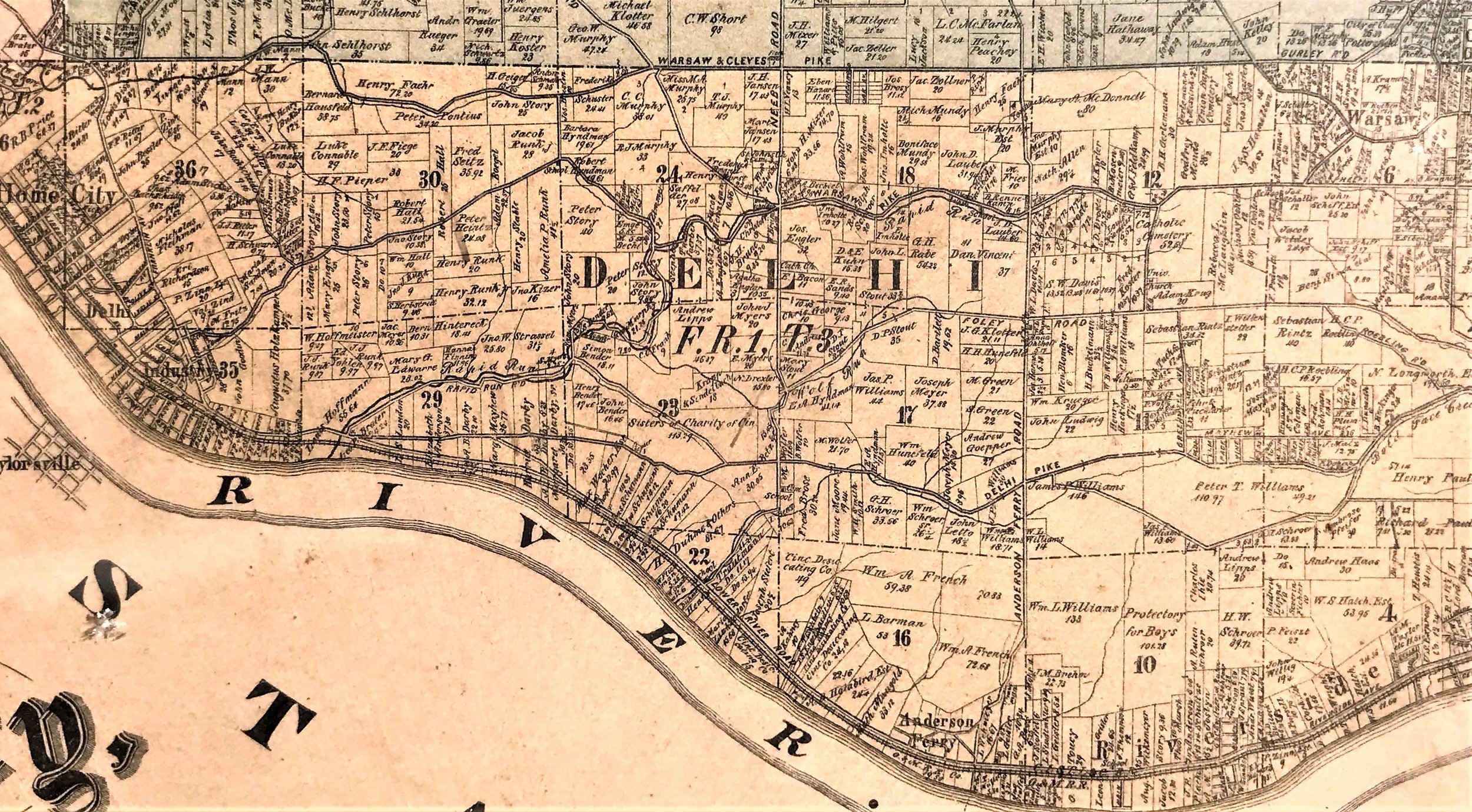
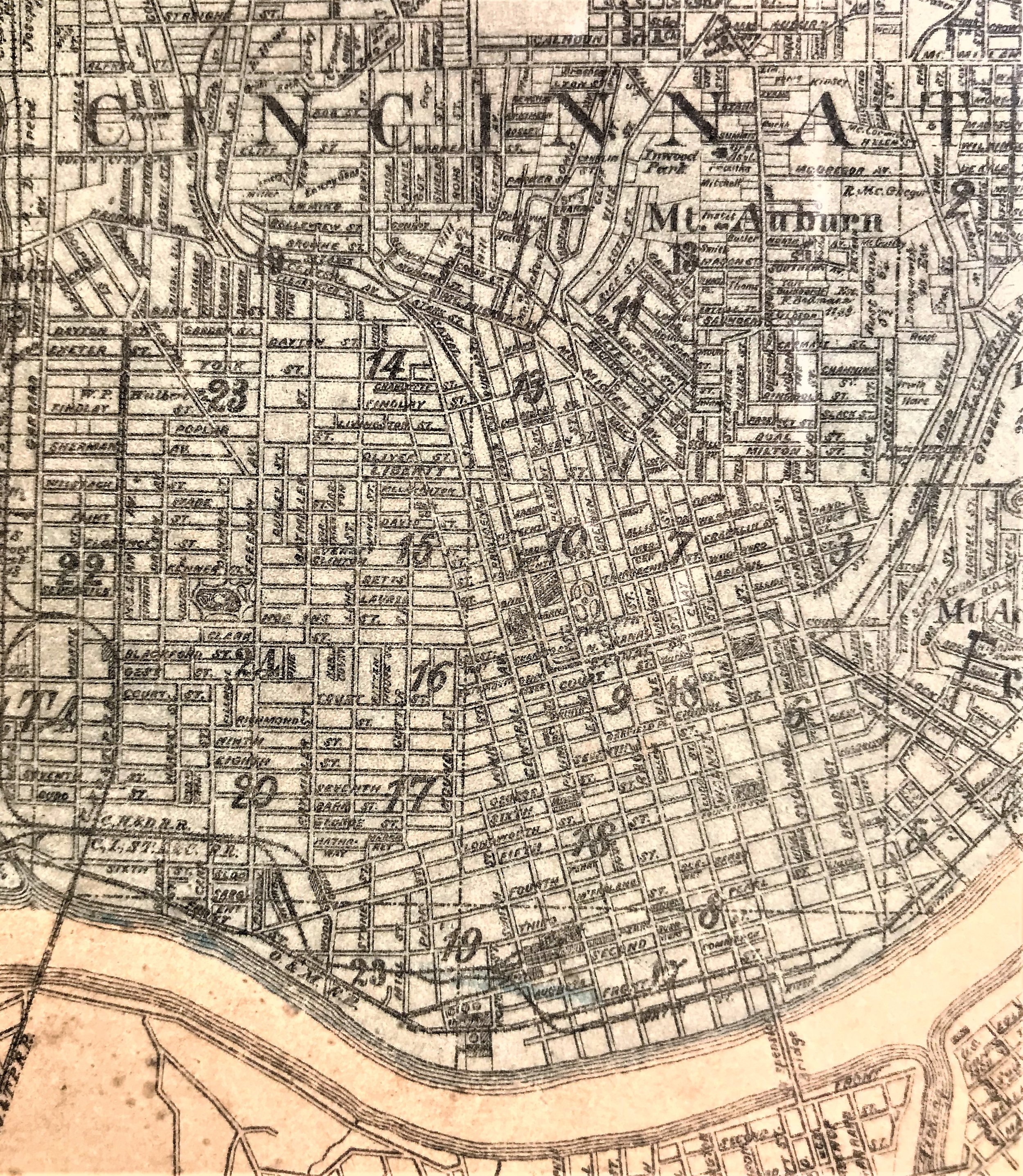
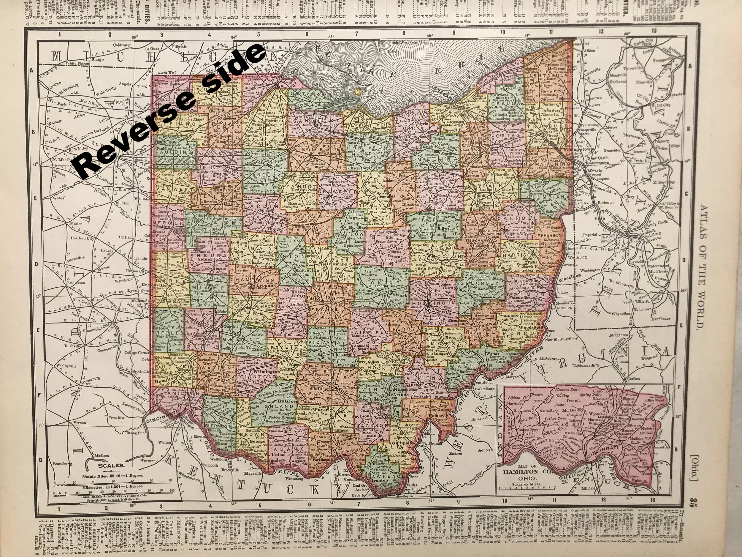
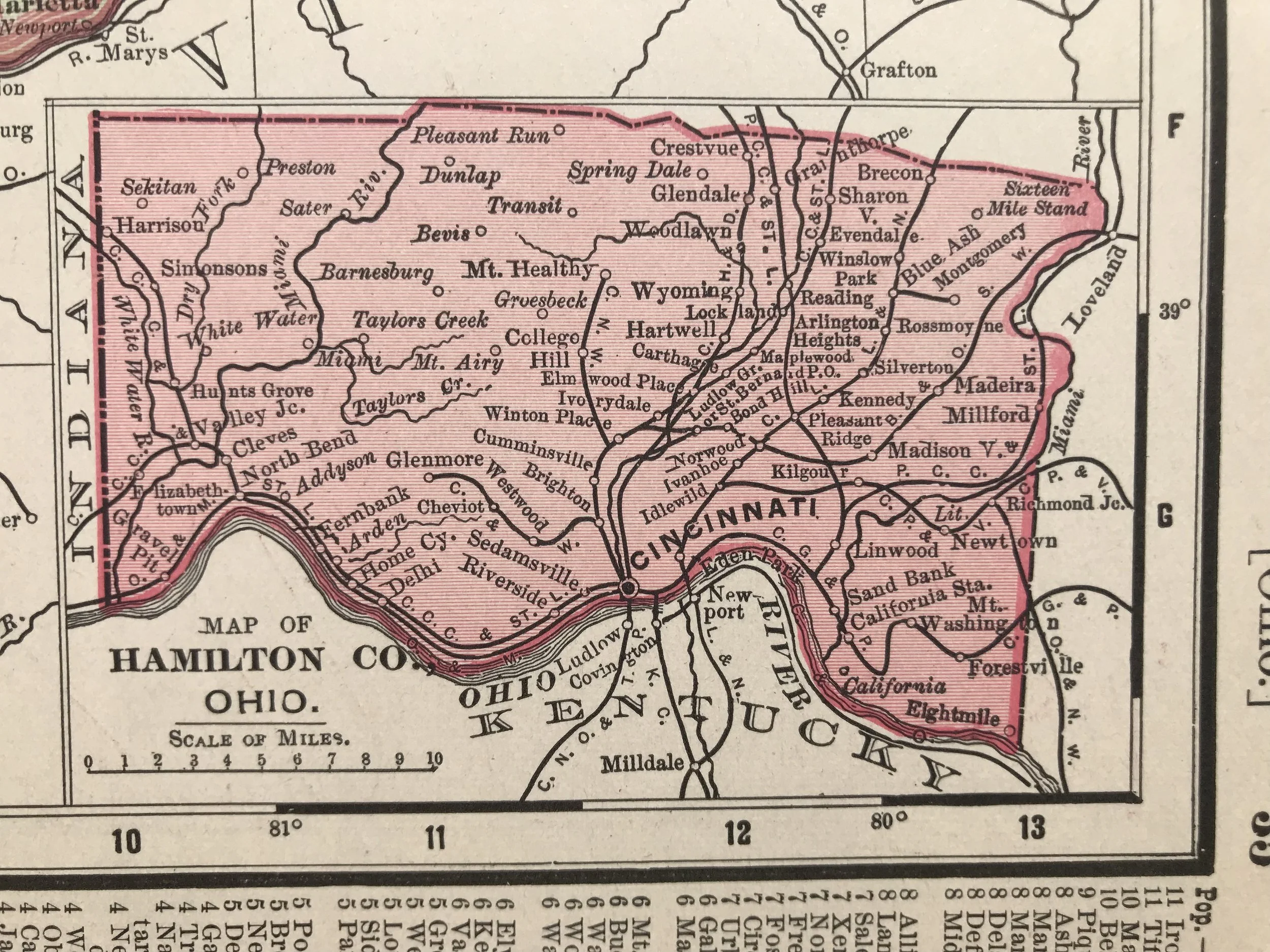
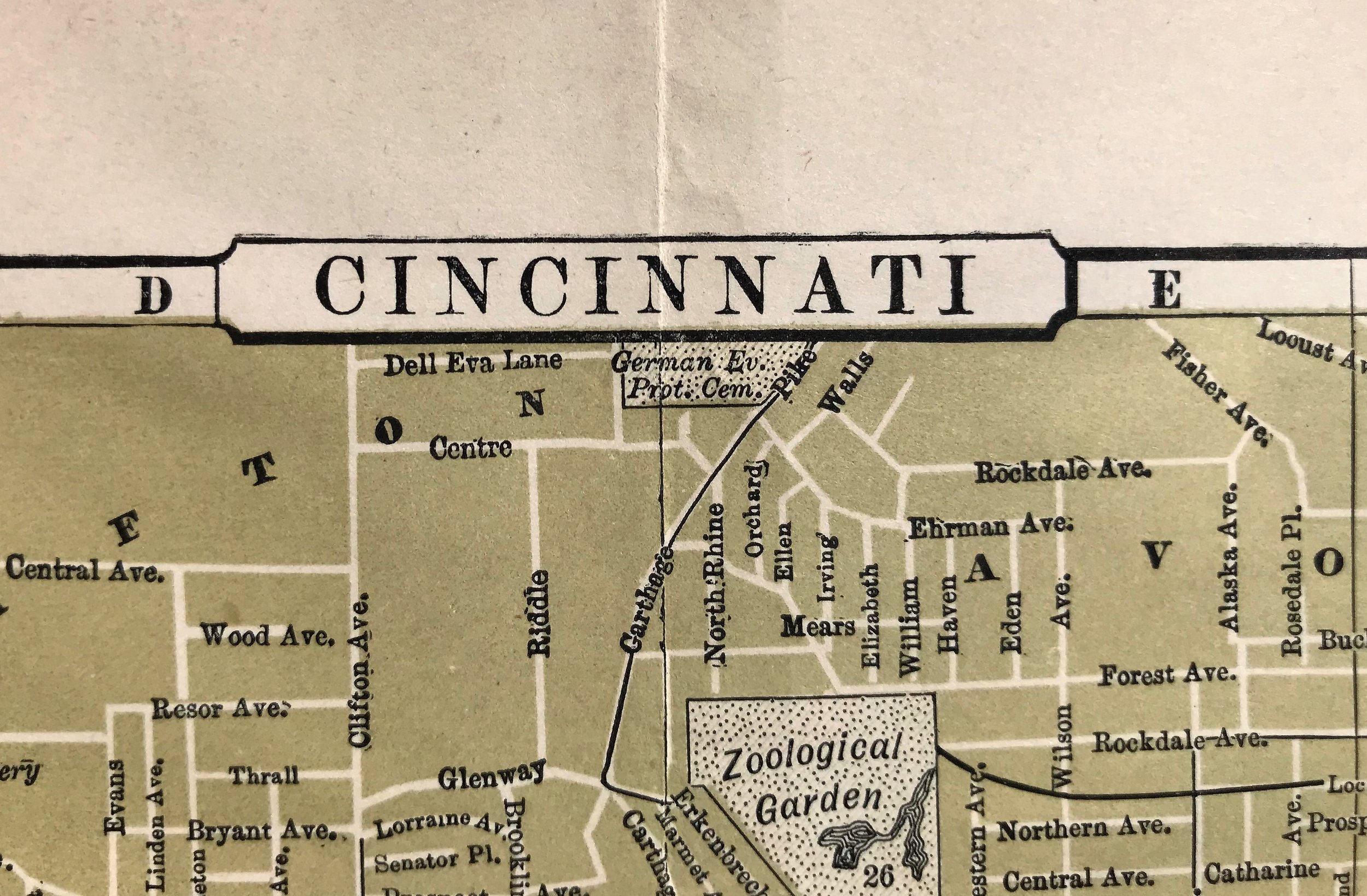
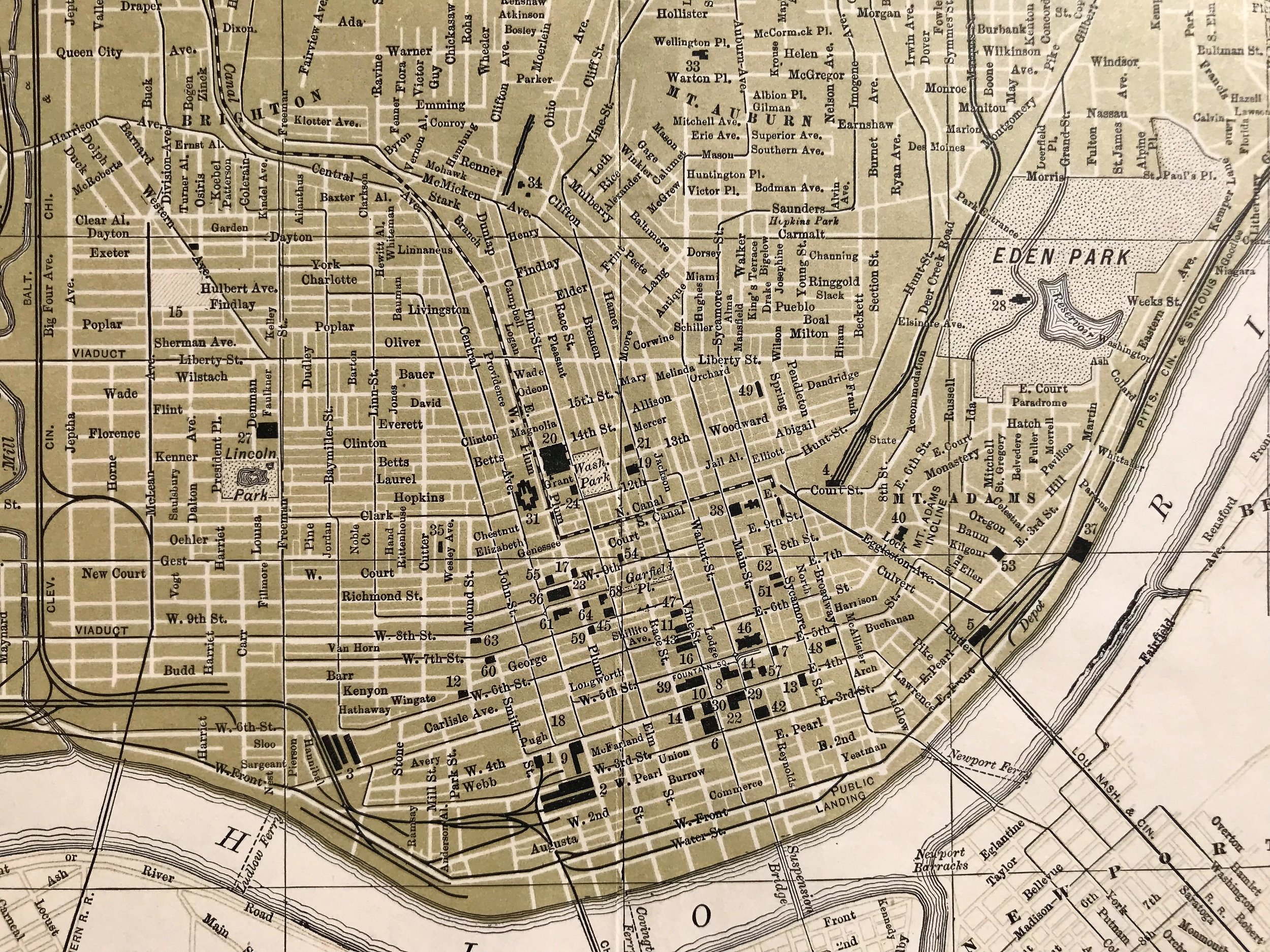
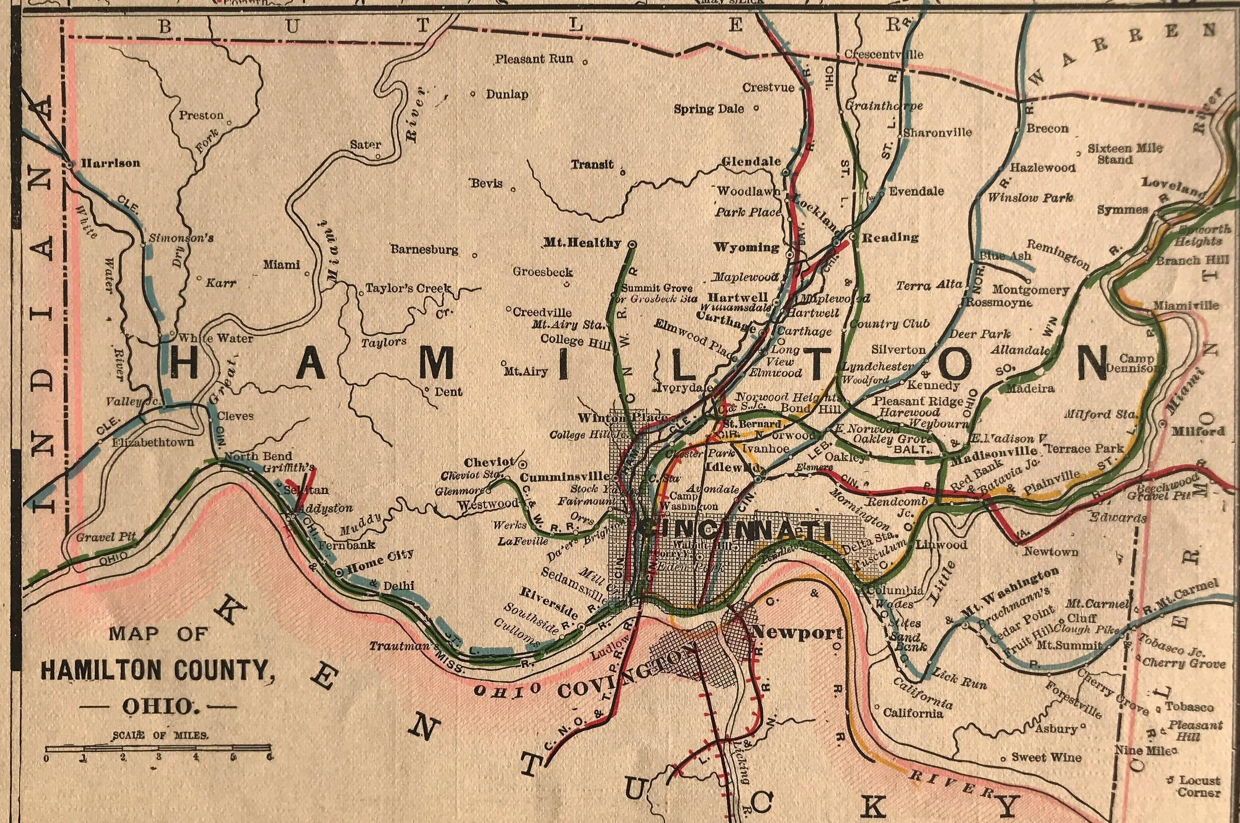
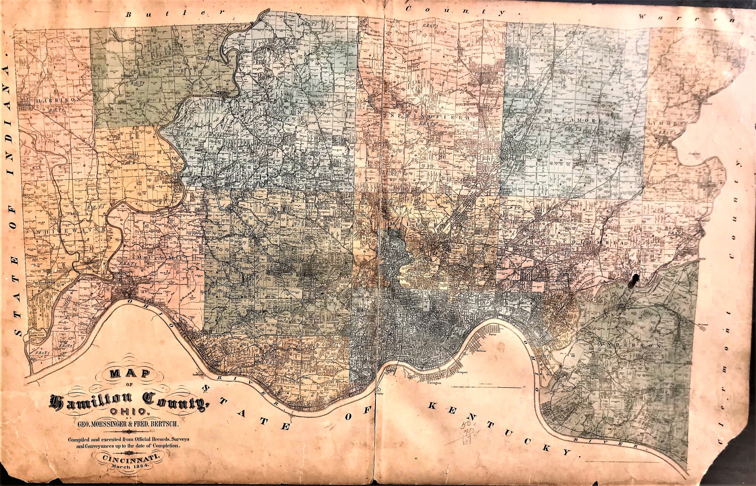
1884 Map of Hamilton County Ohio
3
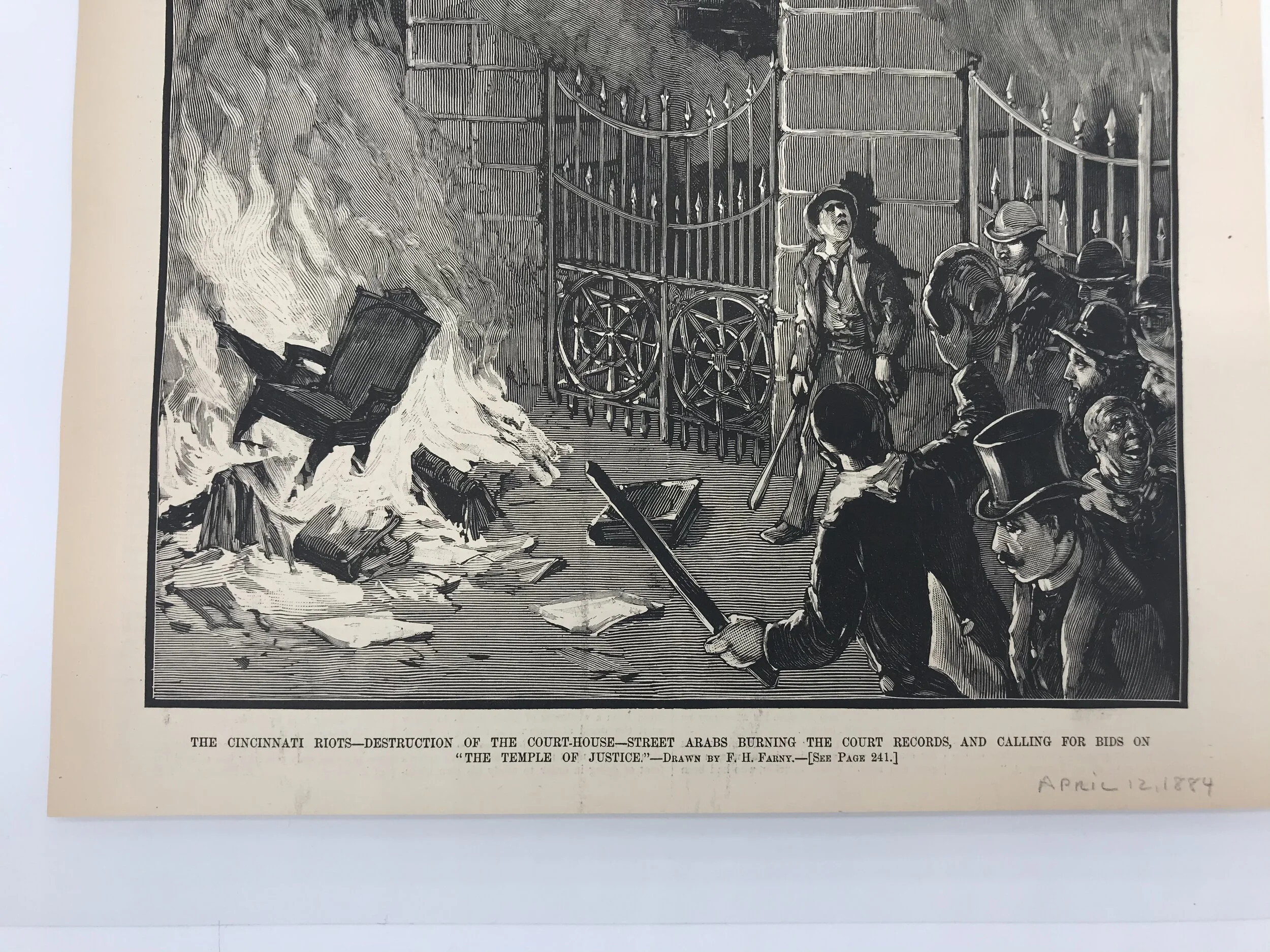
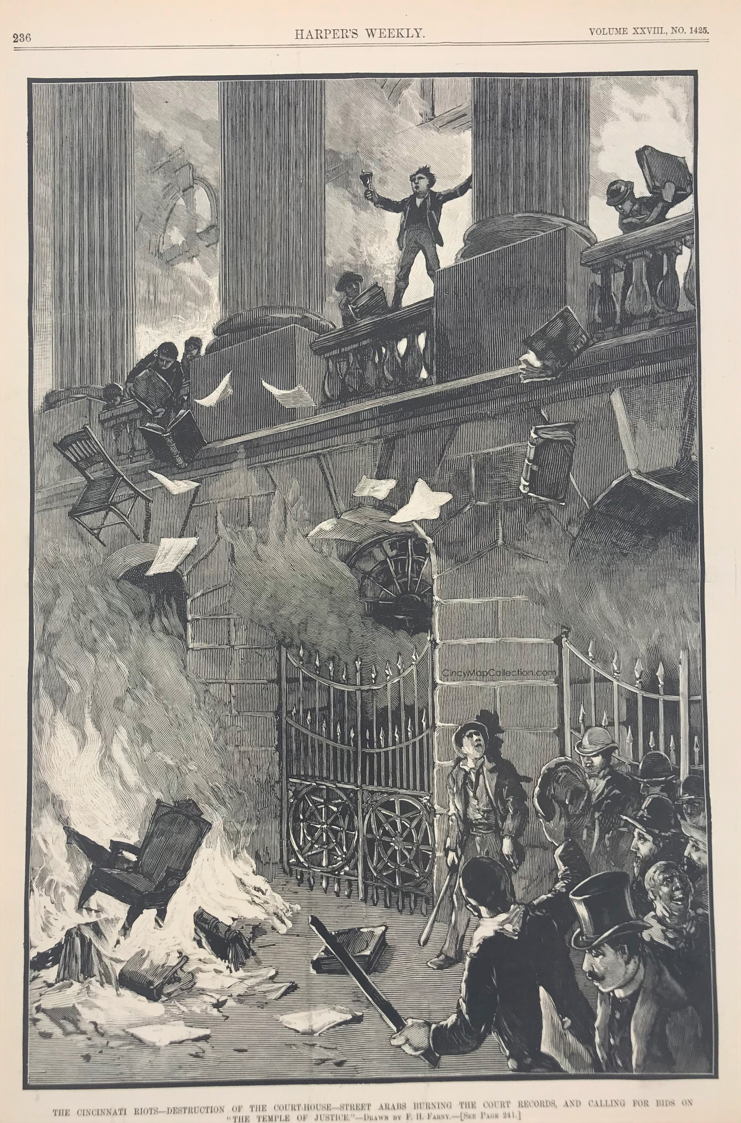
1884 The Cincinnati Riots
3
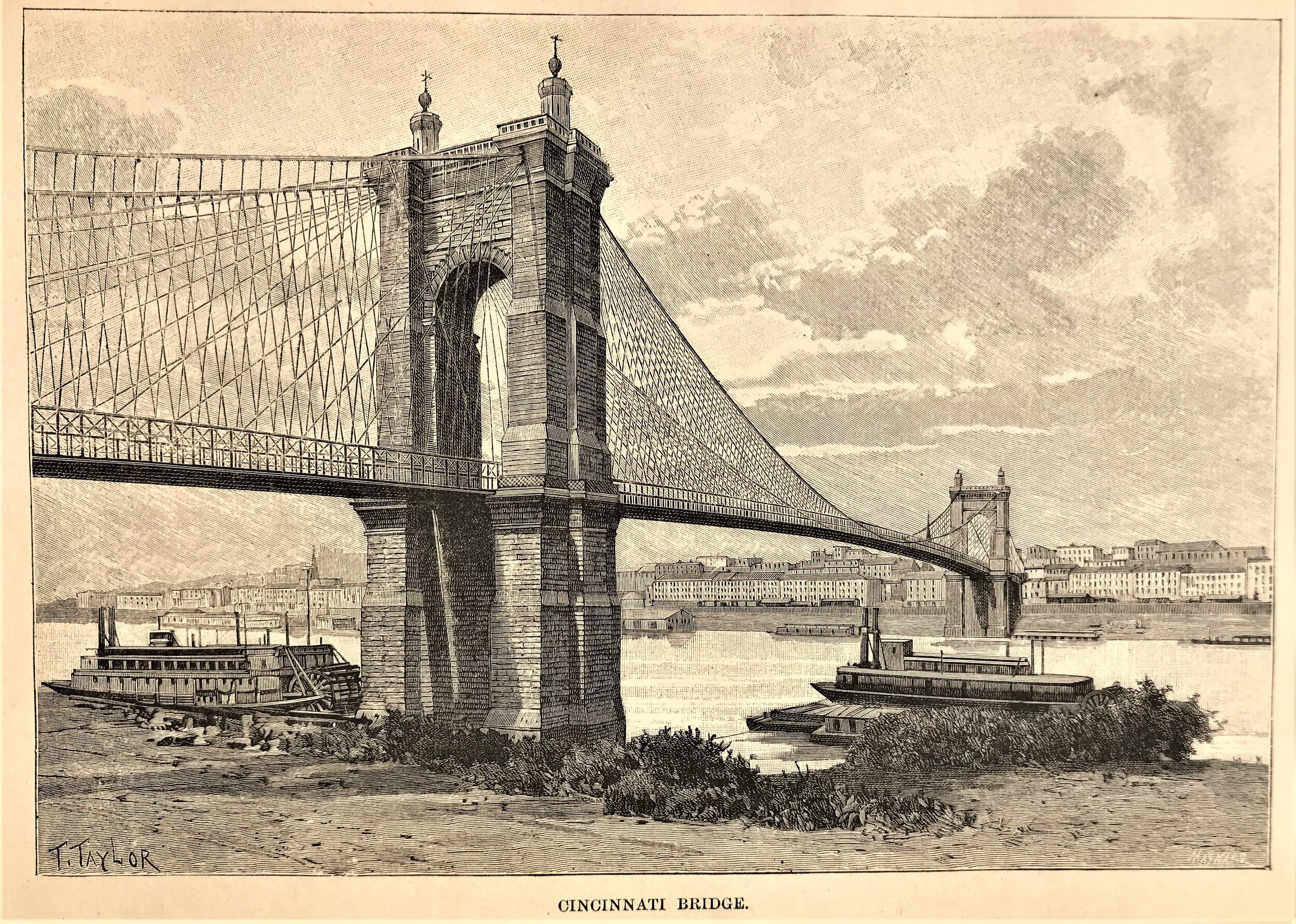
1885 Cincinnati Bridge
4
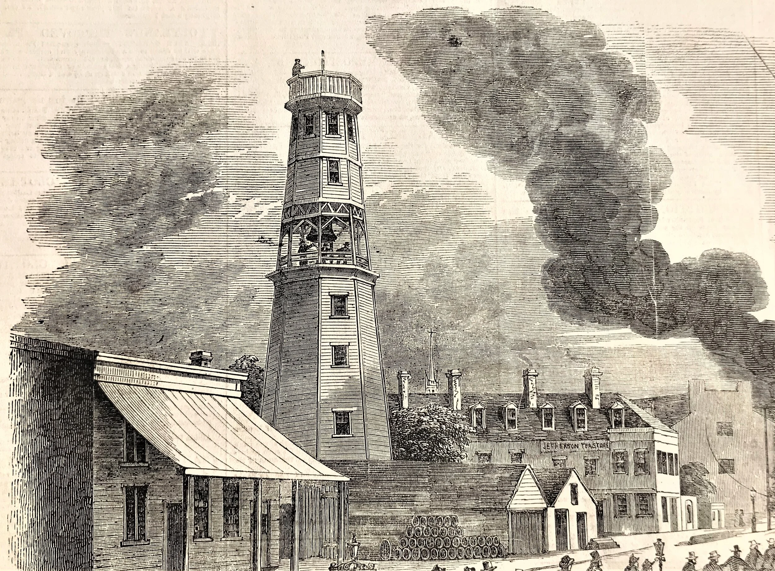
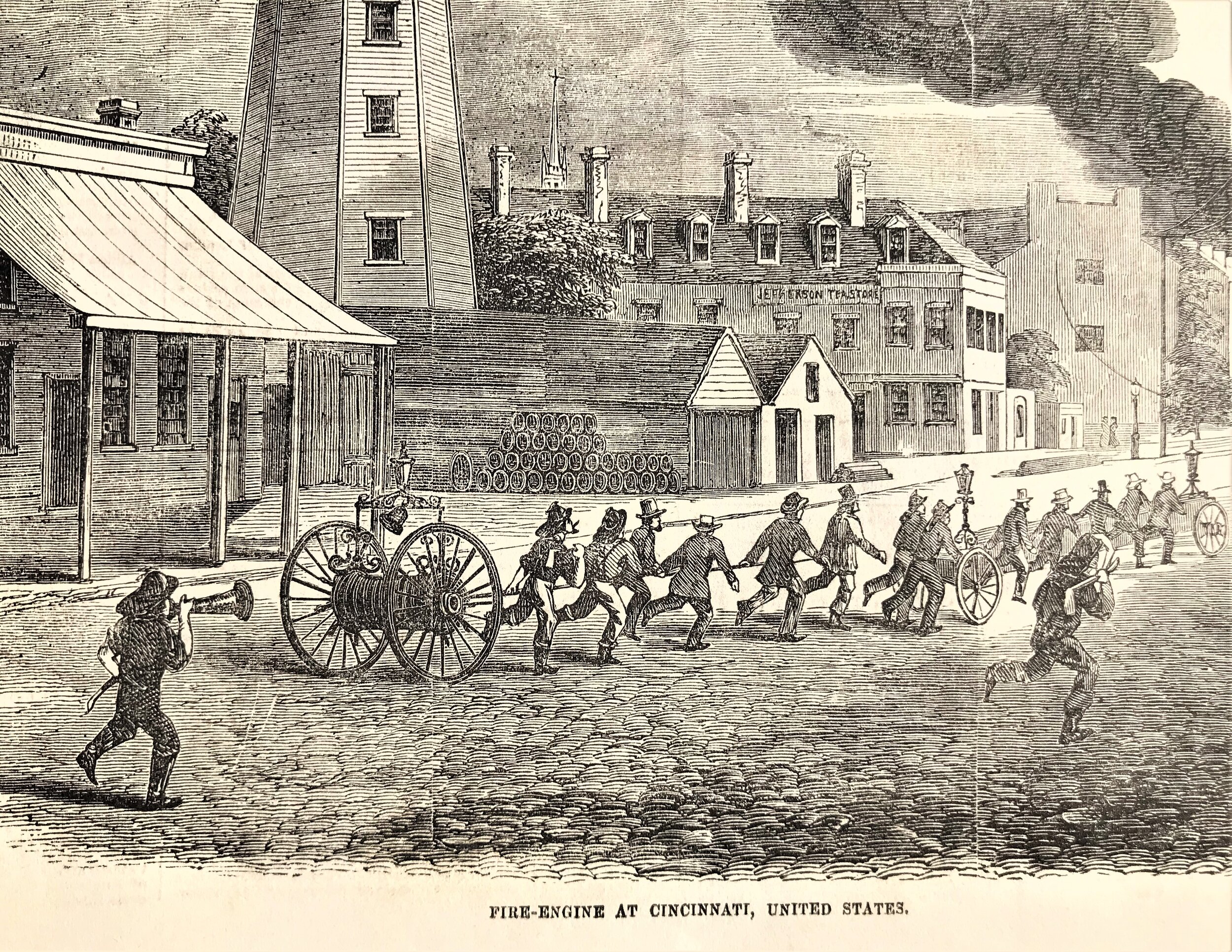
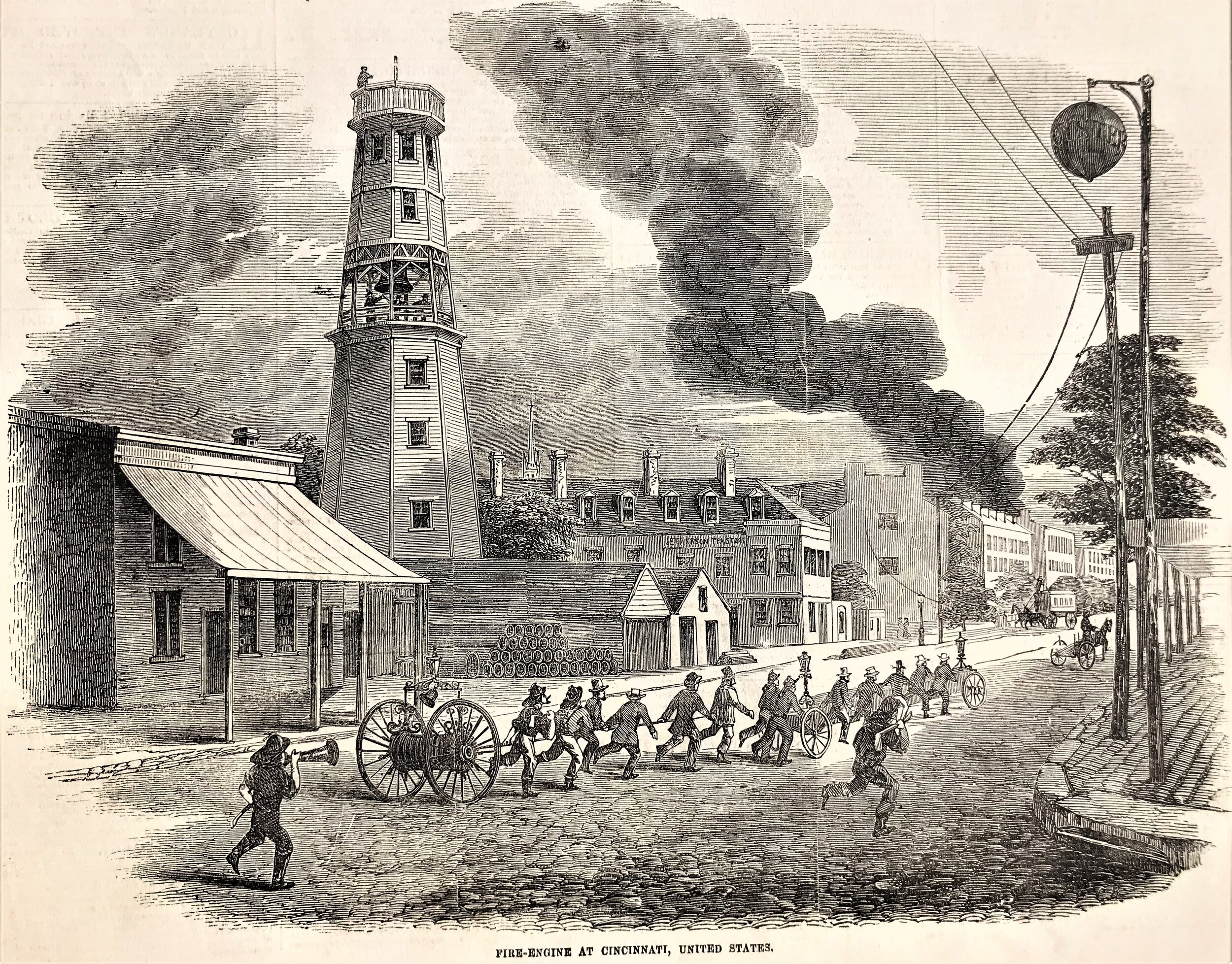
1885 Fire-Engine at Cincinnati
1
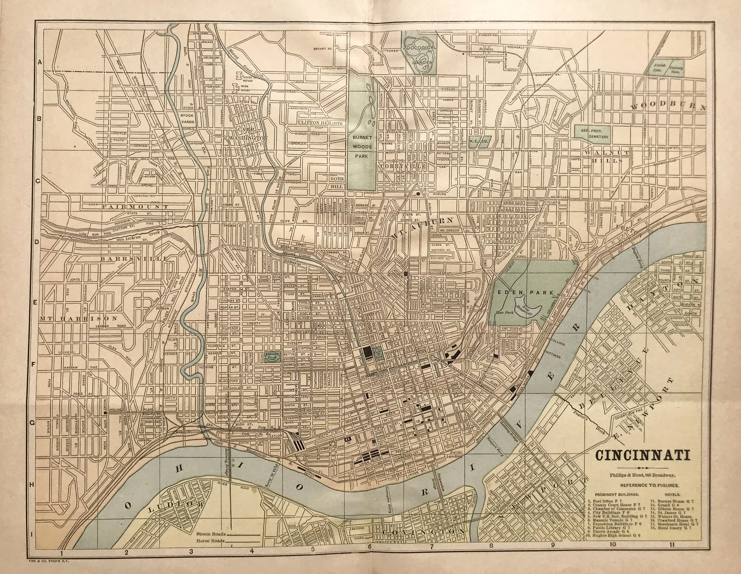
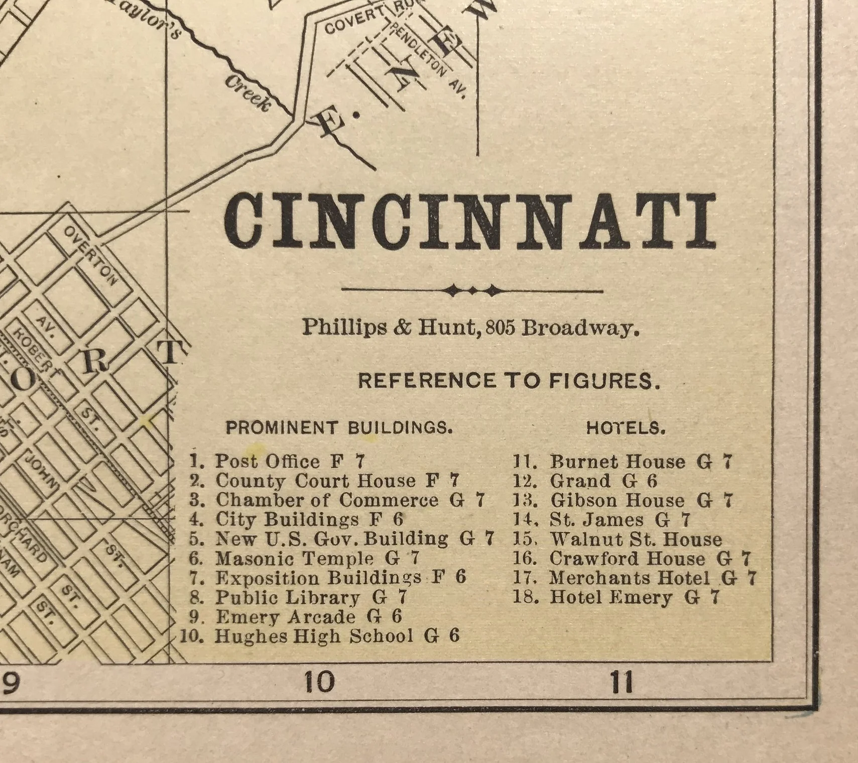
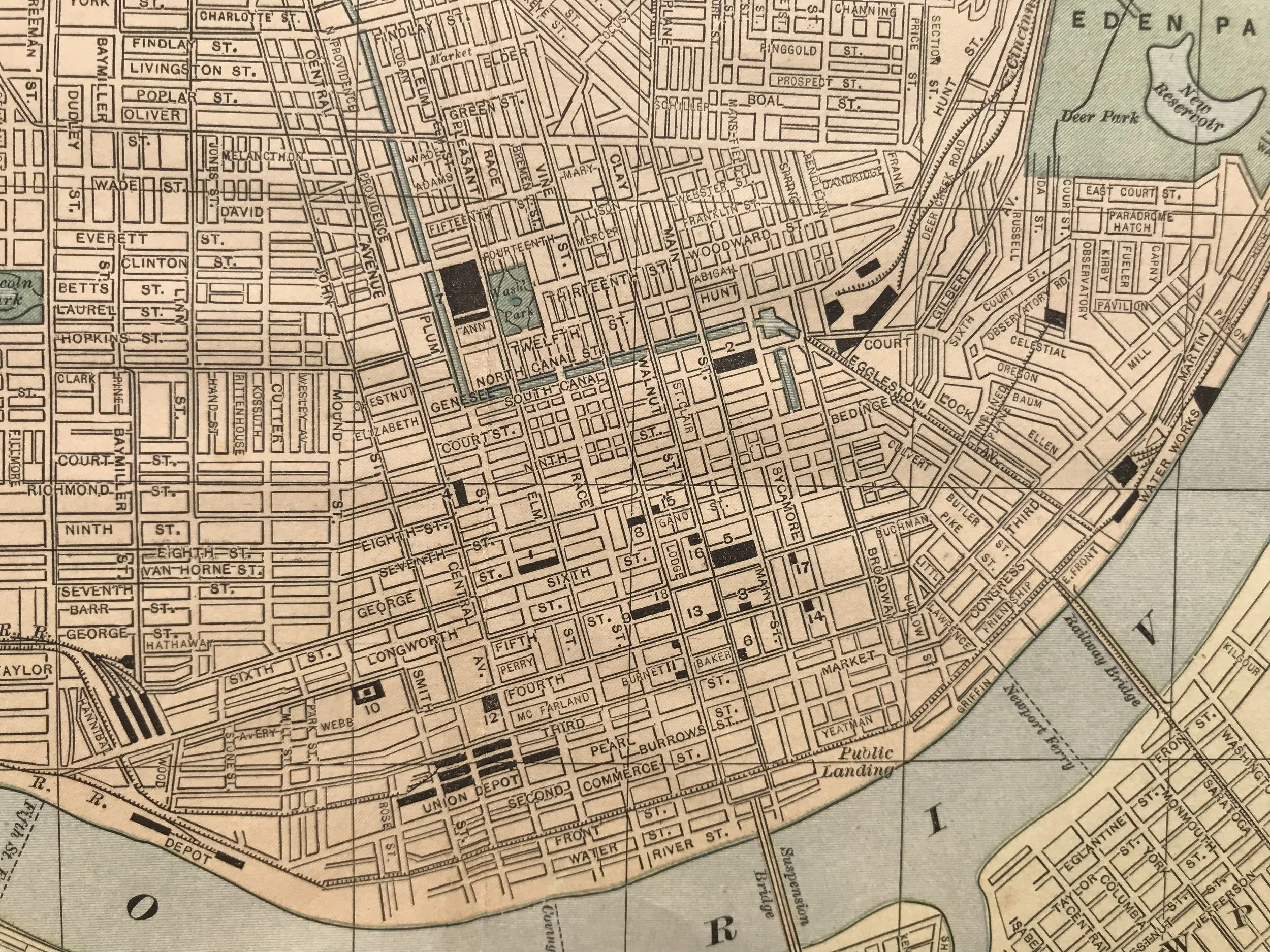
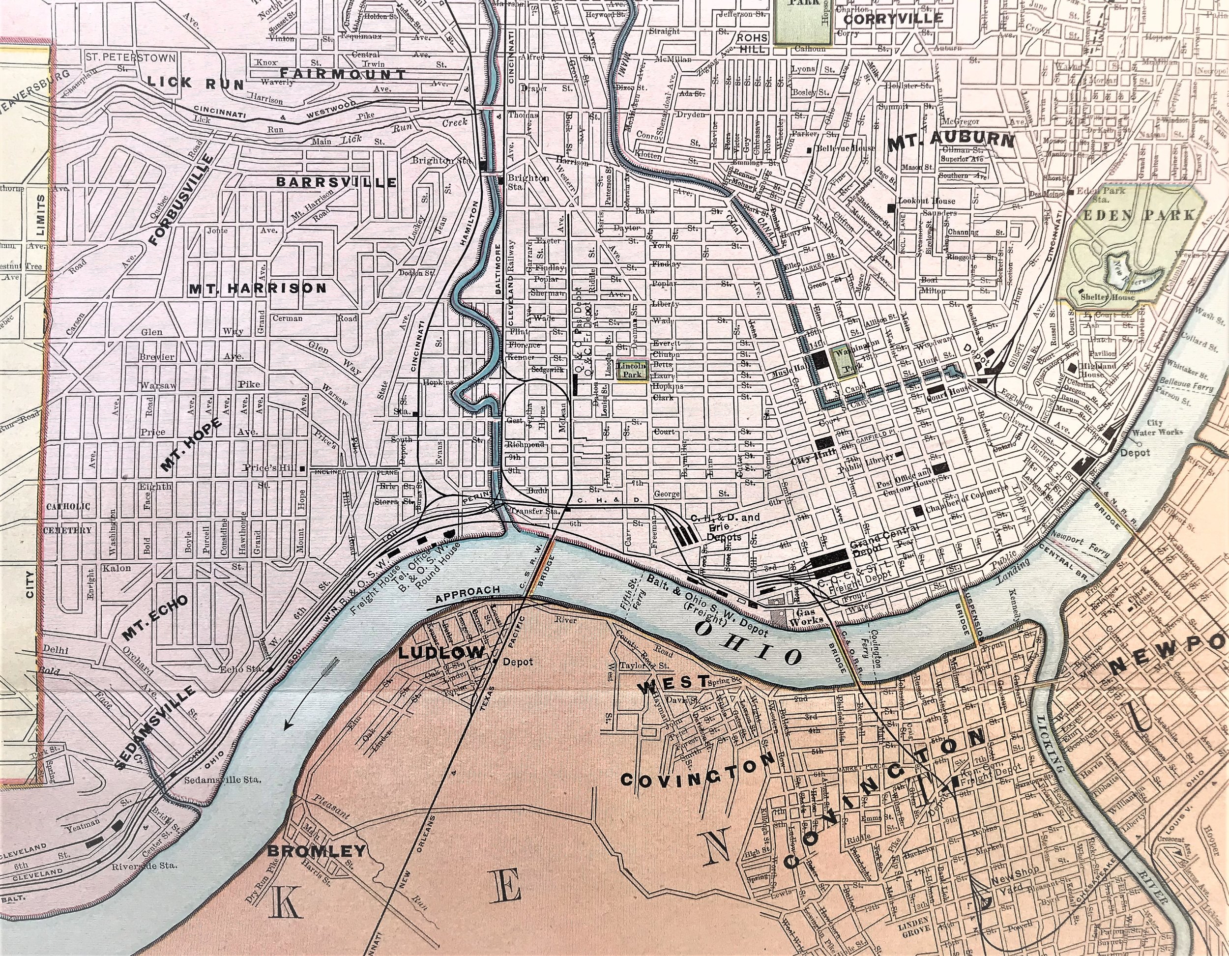
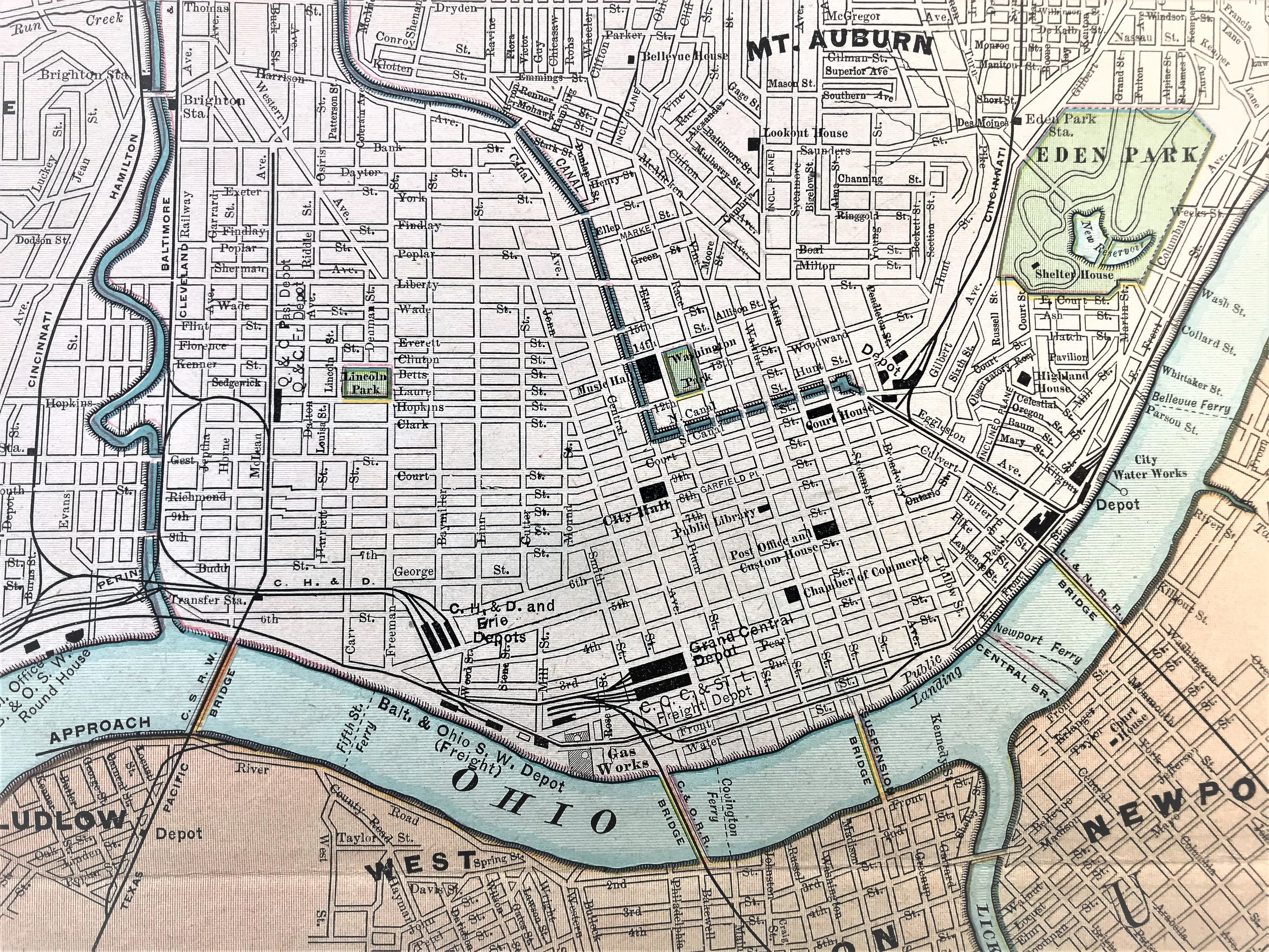
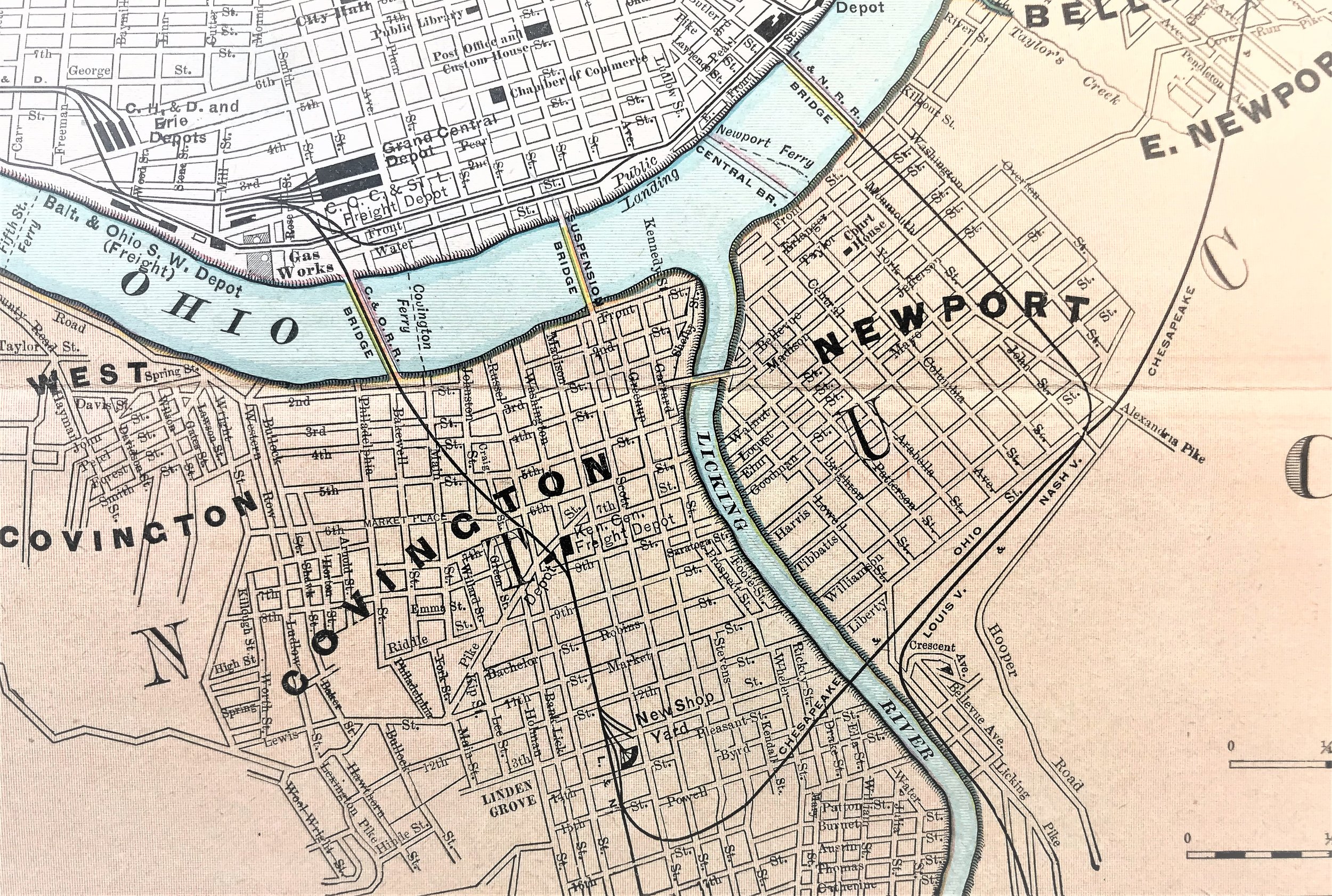
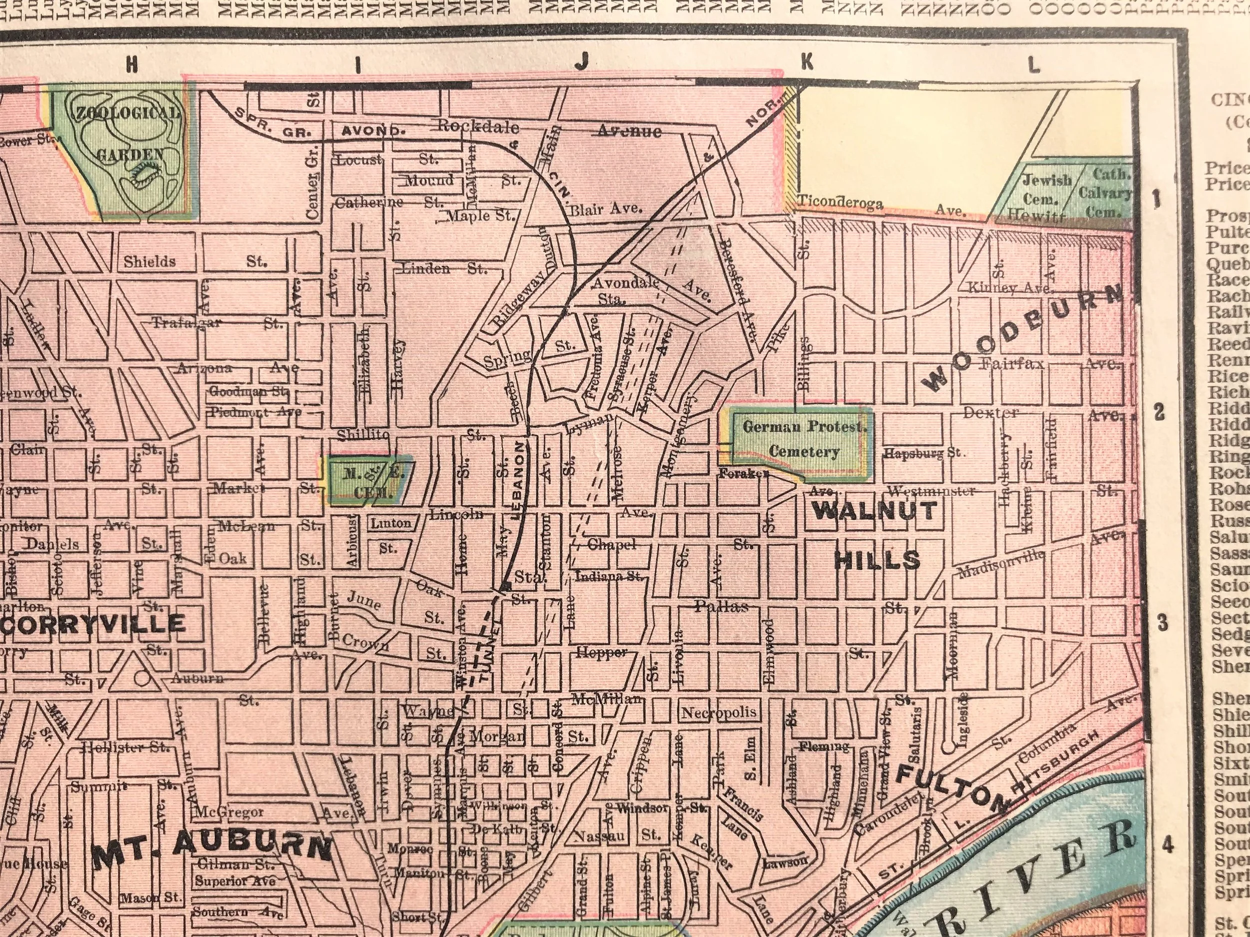
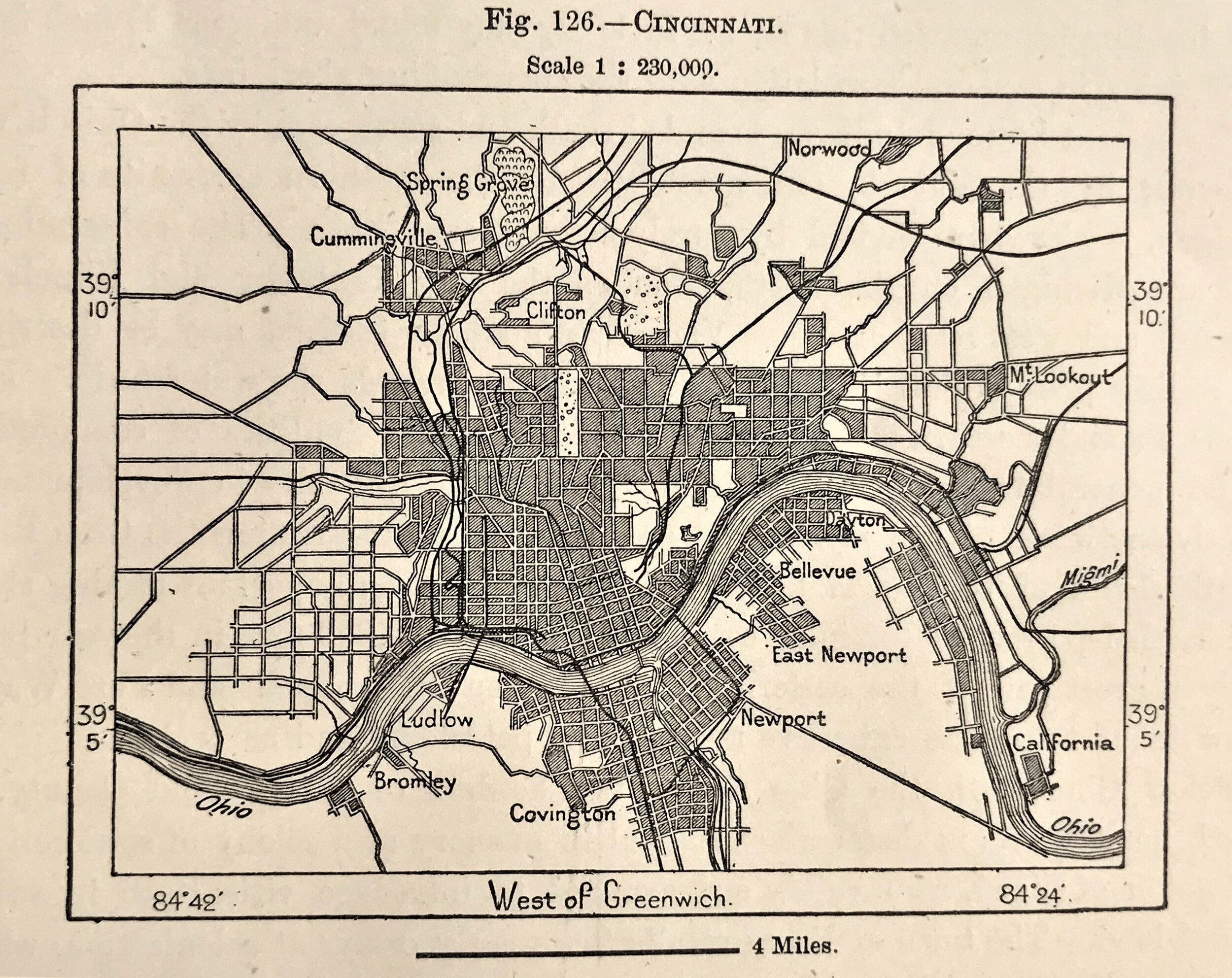
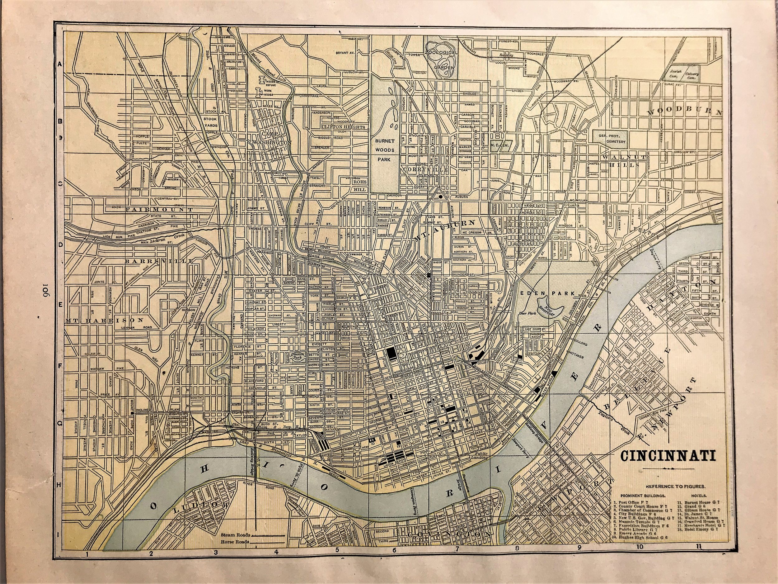
1885 Map of Cincinnati
9
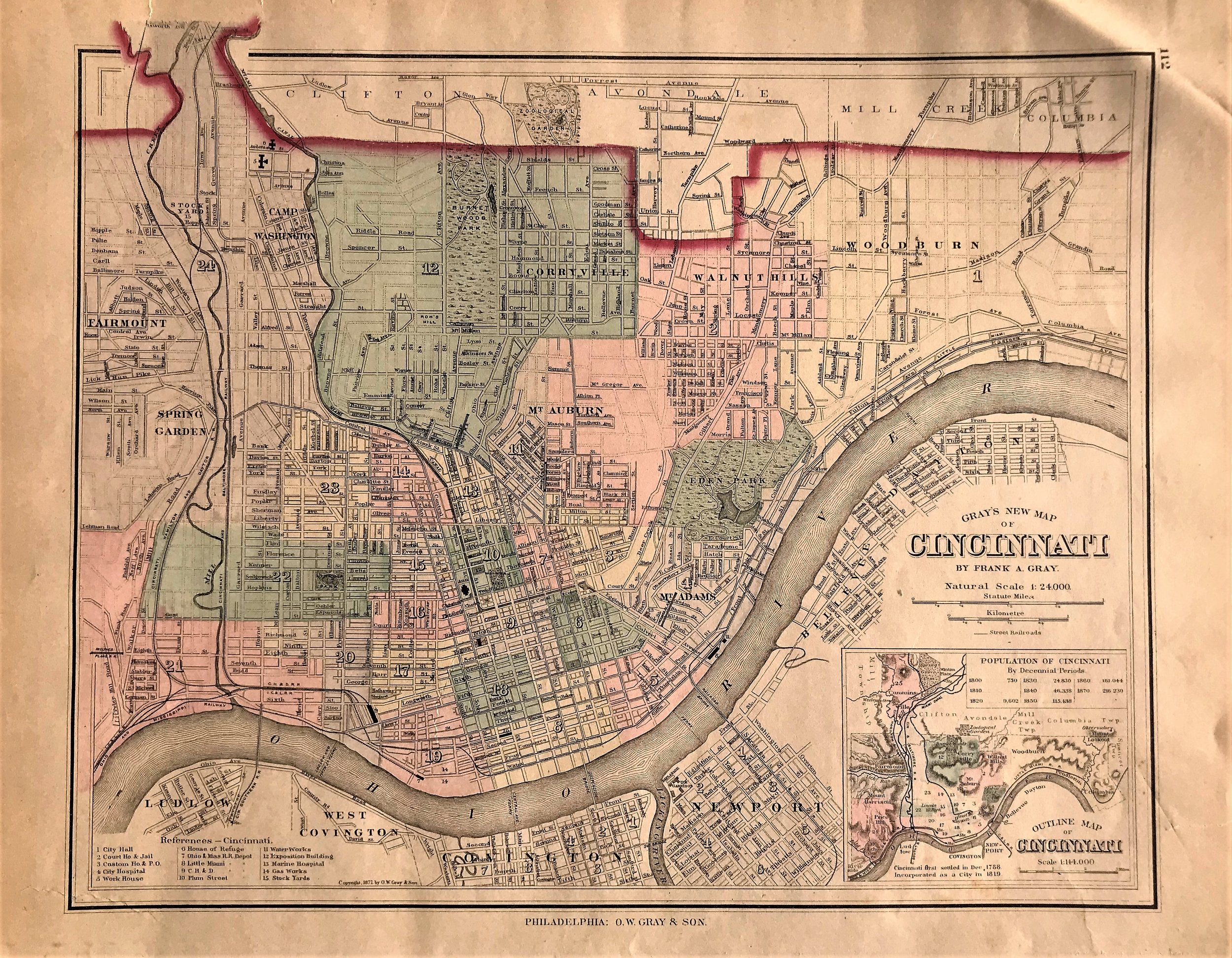
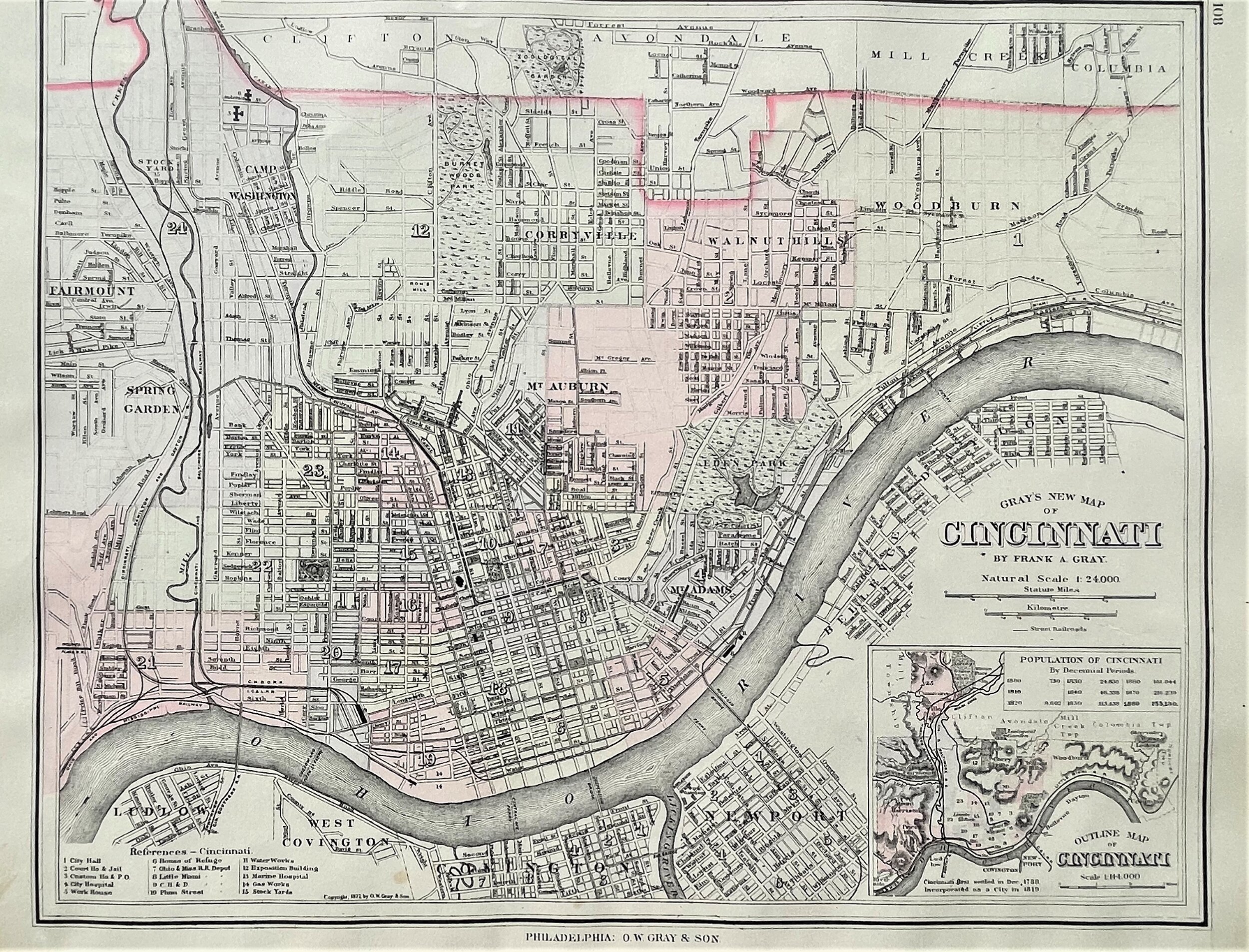
1886 Gray's New Map of Cincinnati
9
1887 Map of Cincinnati
8
1887 Plan of Cincinnati
7
1888 Map of Cincinnati
11
1888 Map of Cincinnati
12
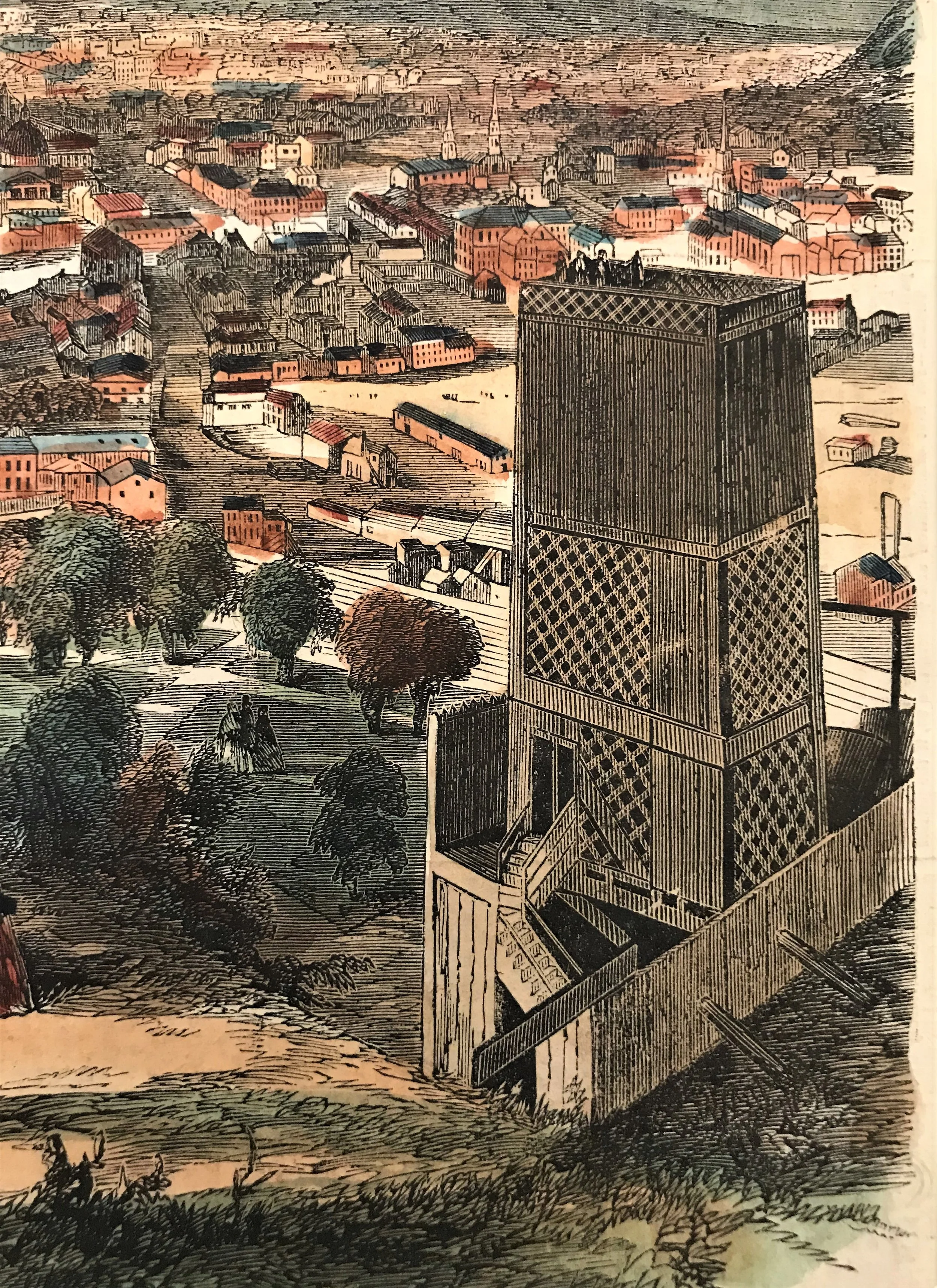
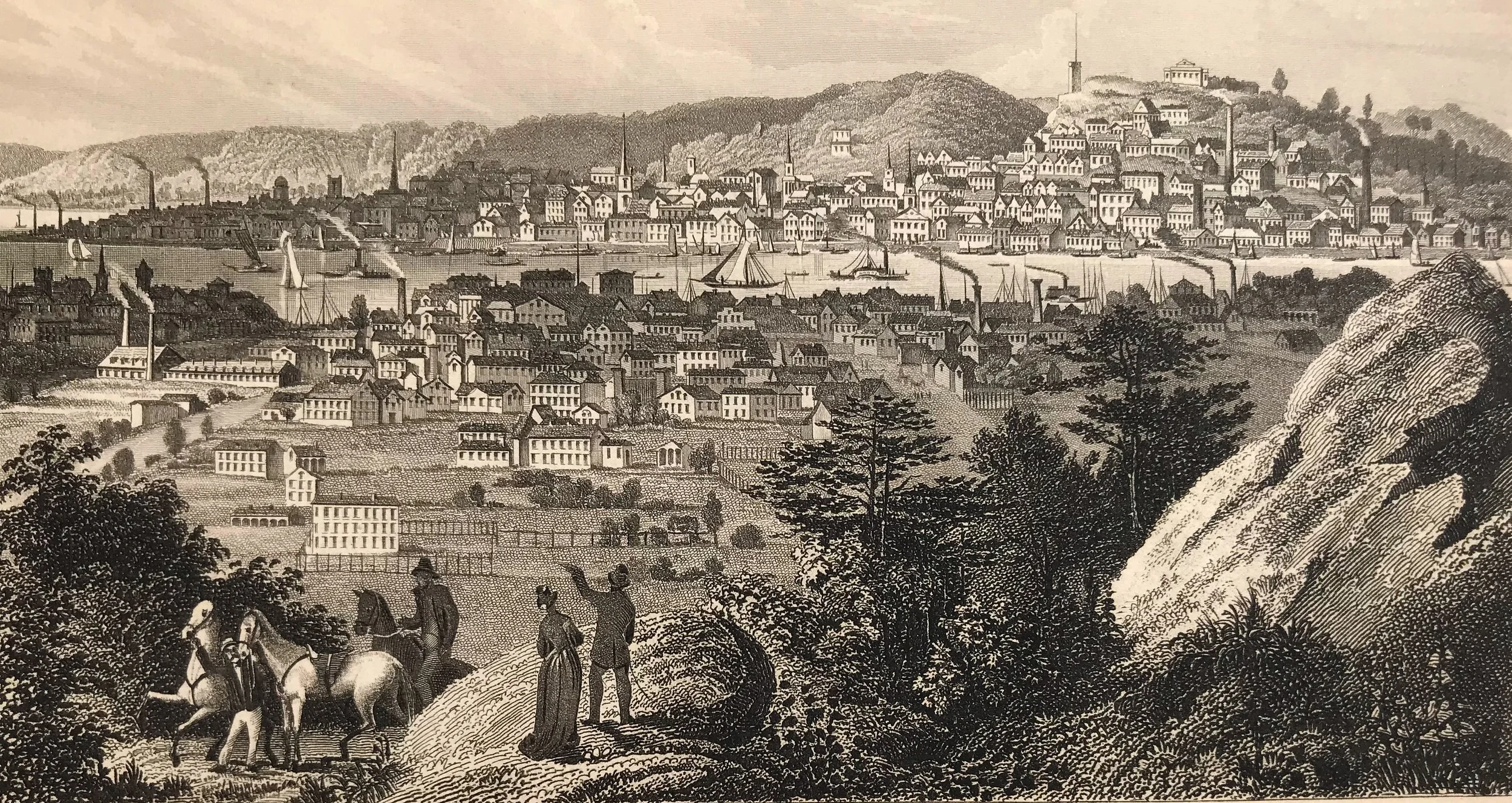
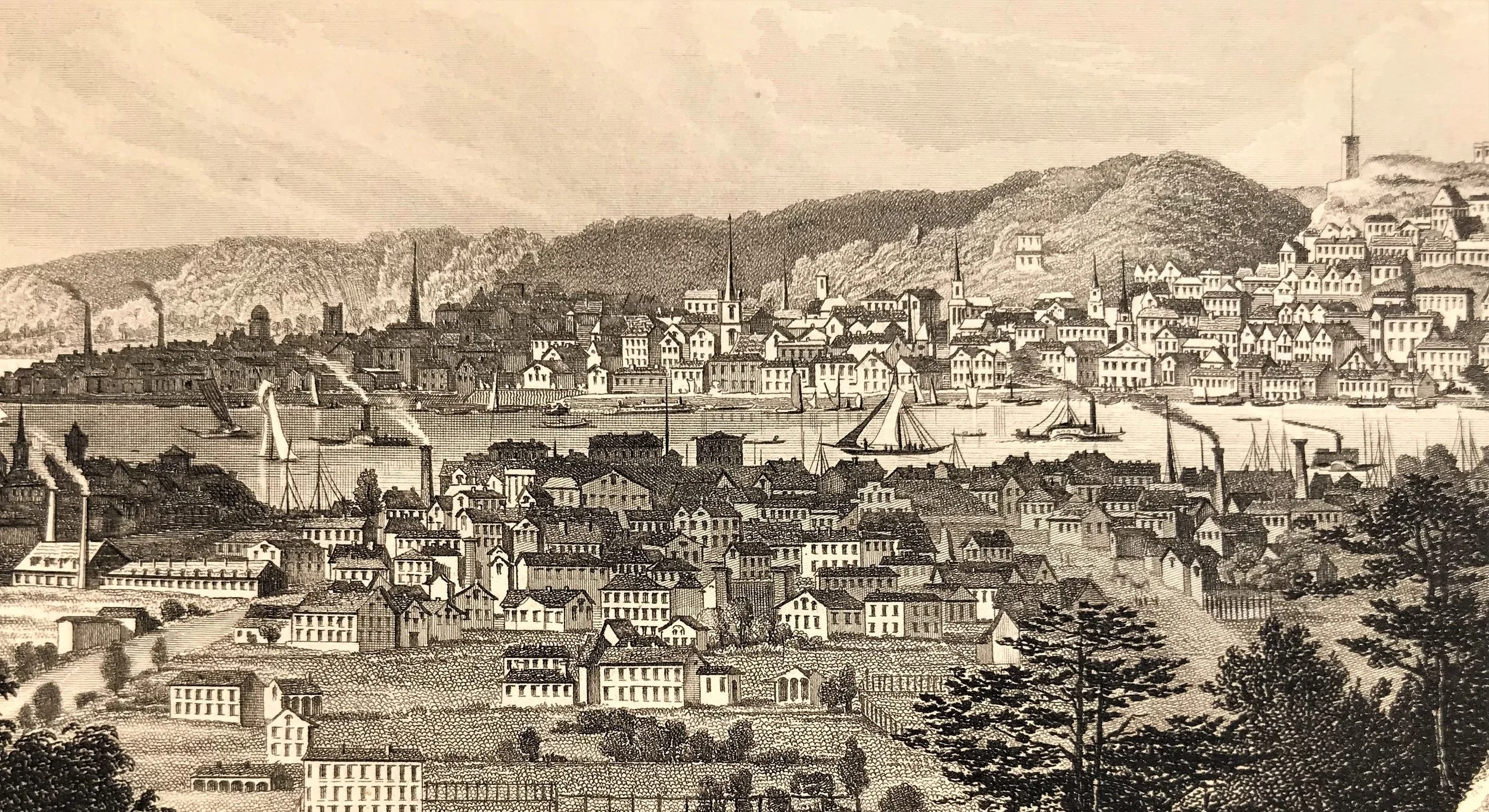
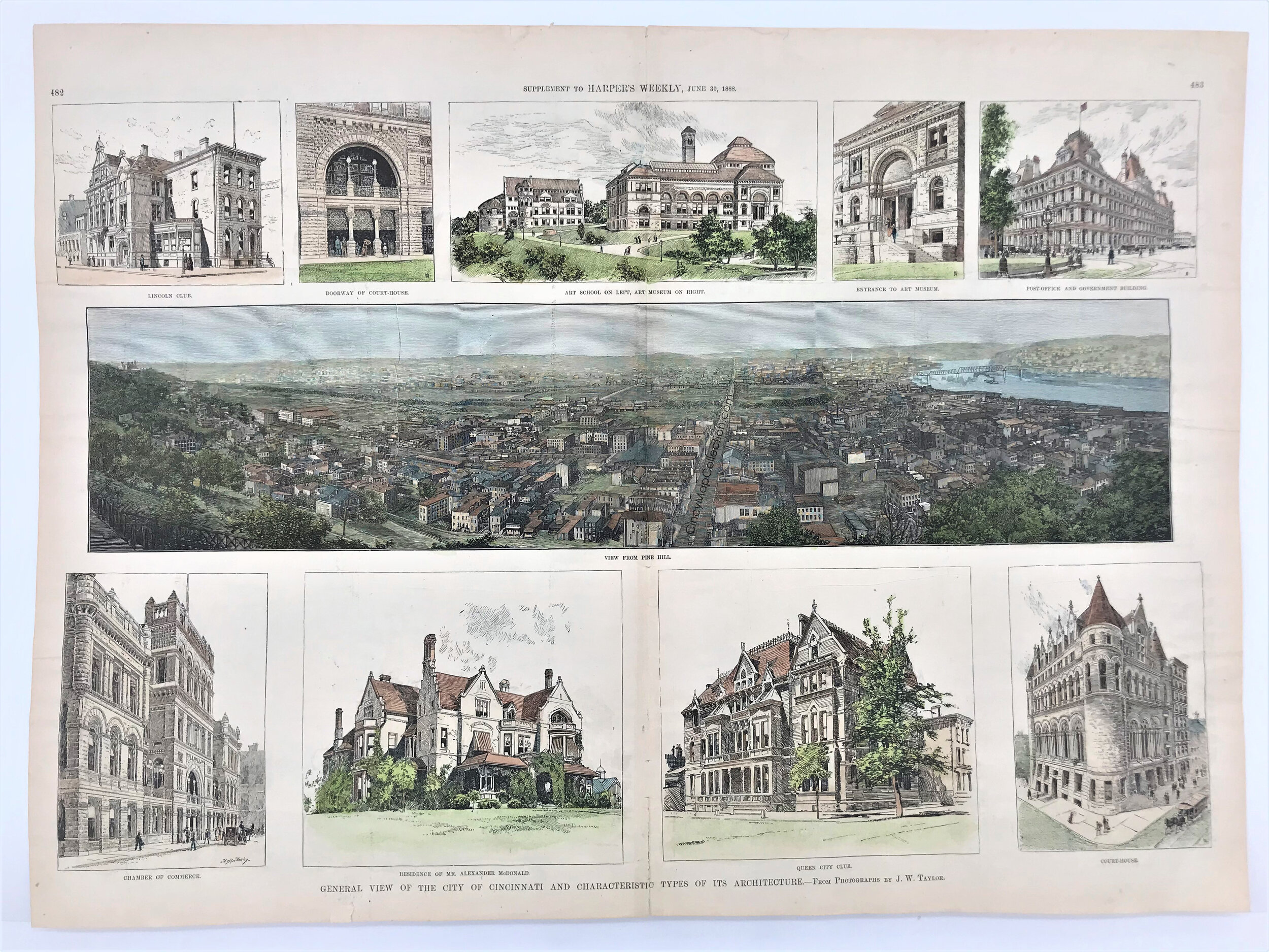
1888 General View of Cincinnati
5
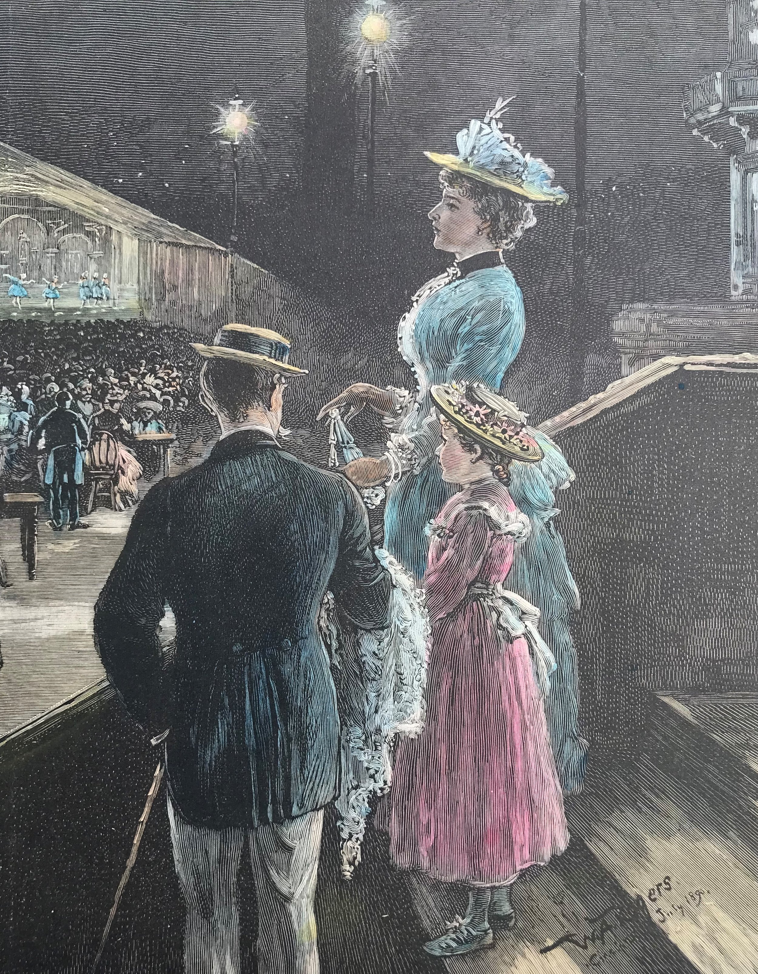
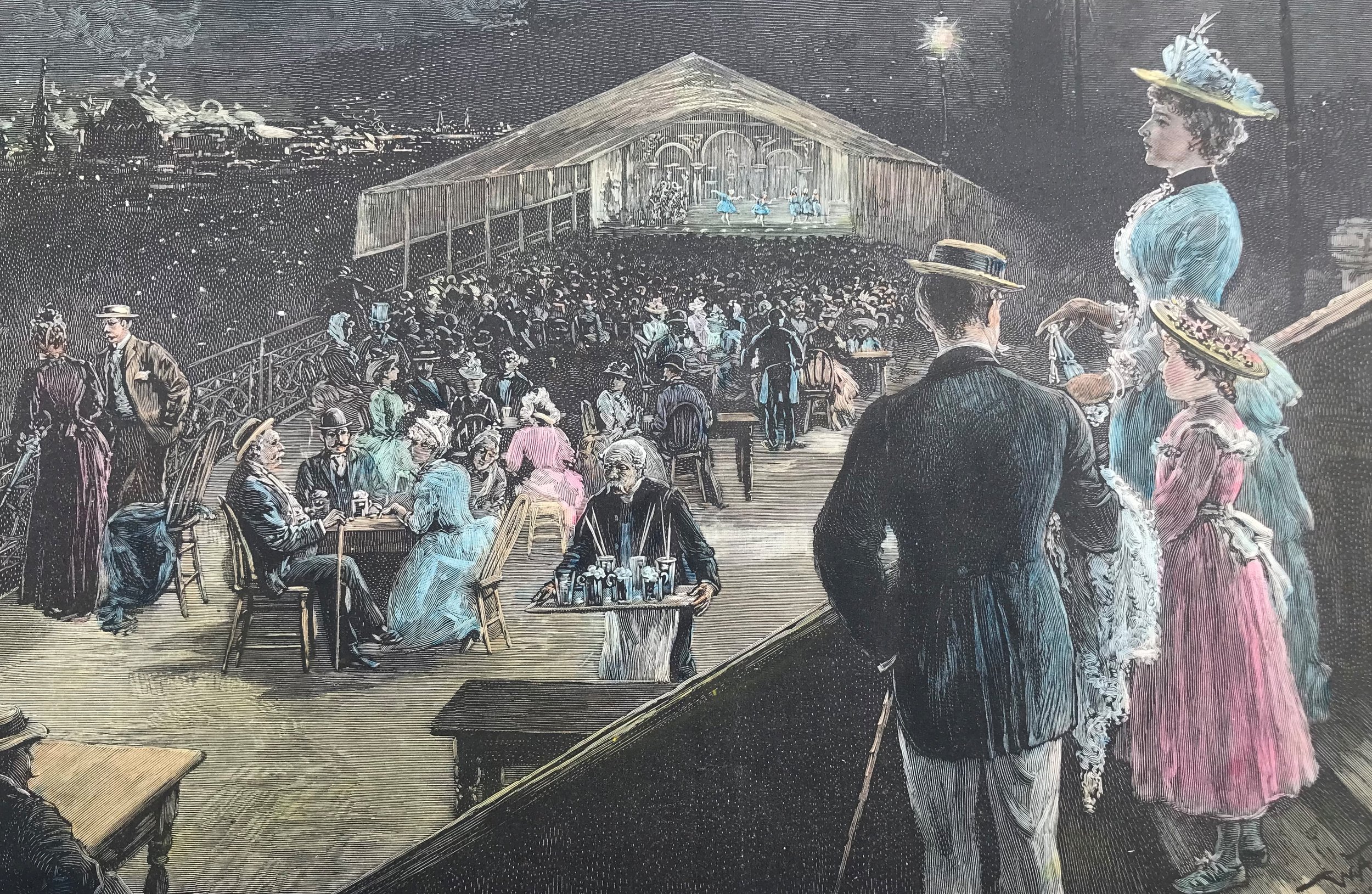
1890 Summer Night Amusement on The Bluff at Cincinnati
12
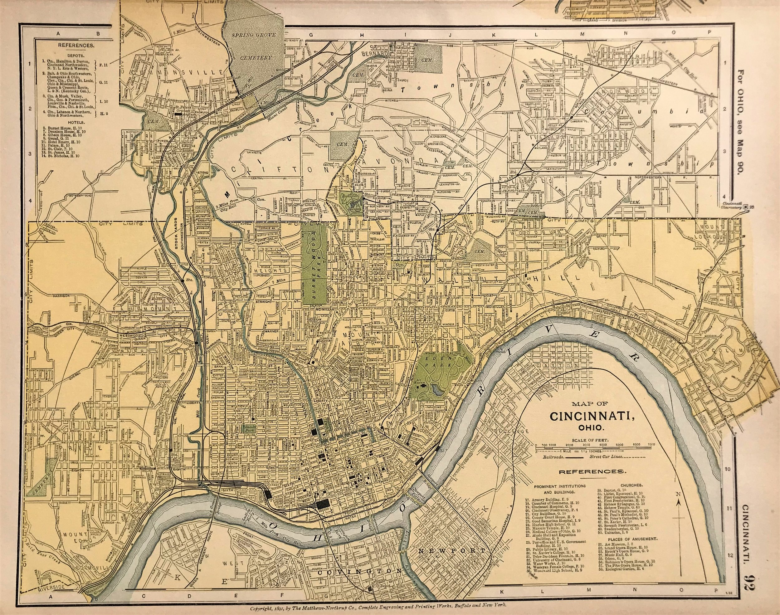
1891 Map of Cincinnati, Ohio
6
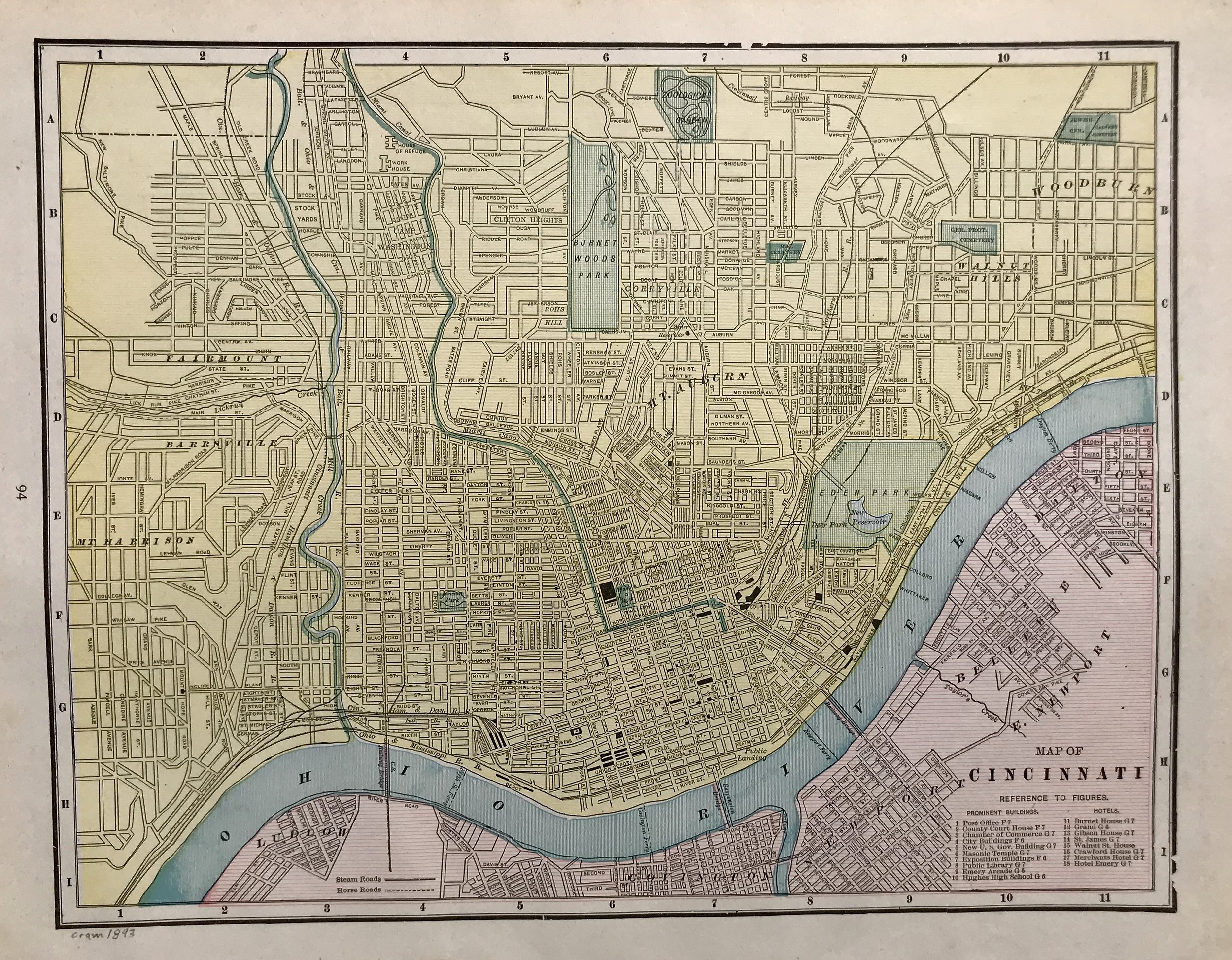
1893 Map of Cincinnati
9
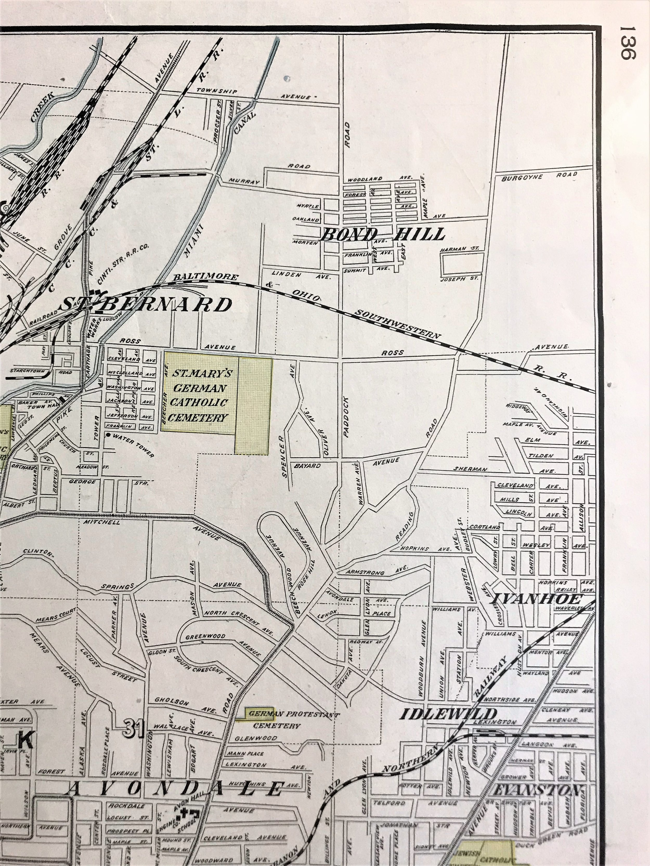
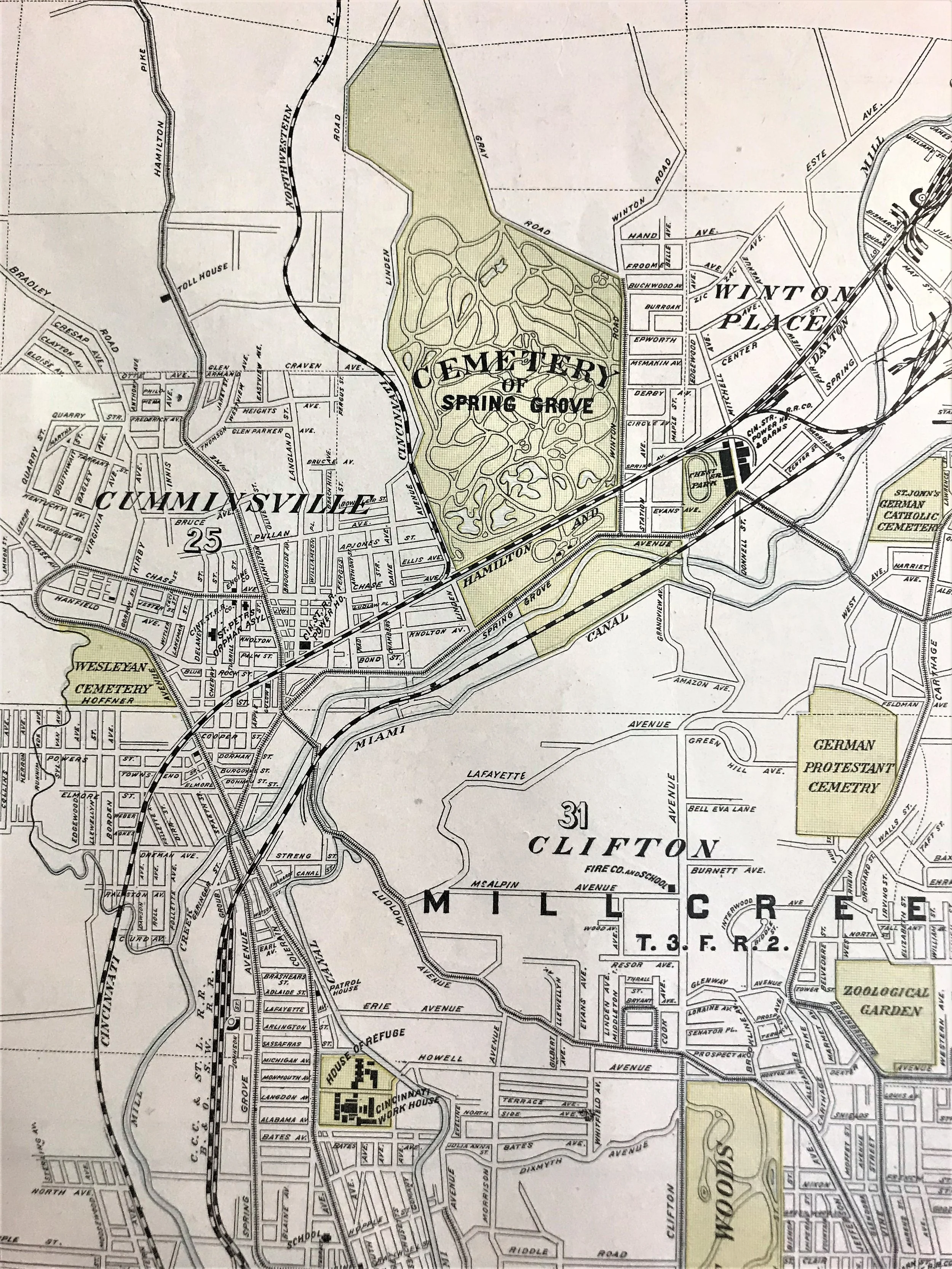
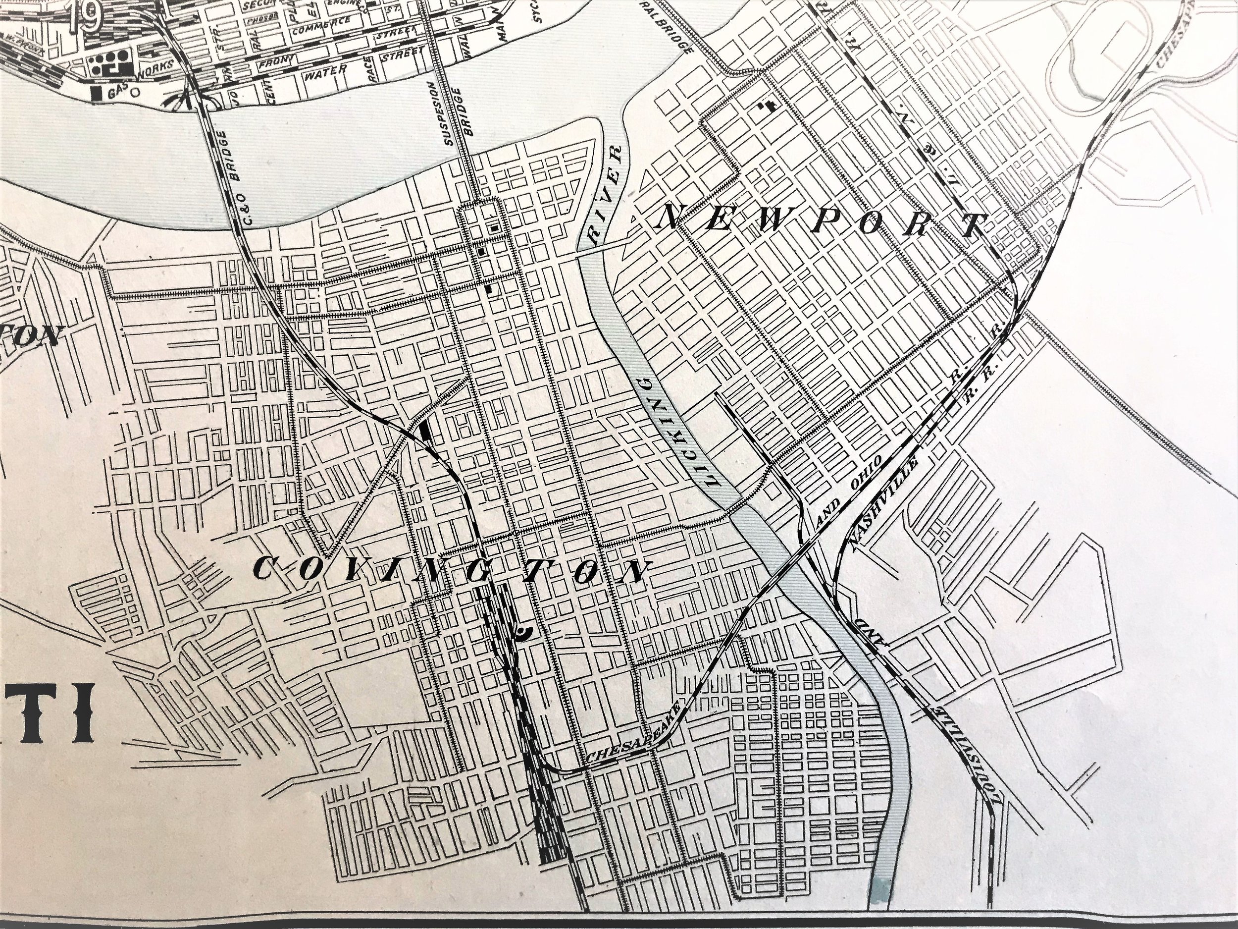
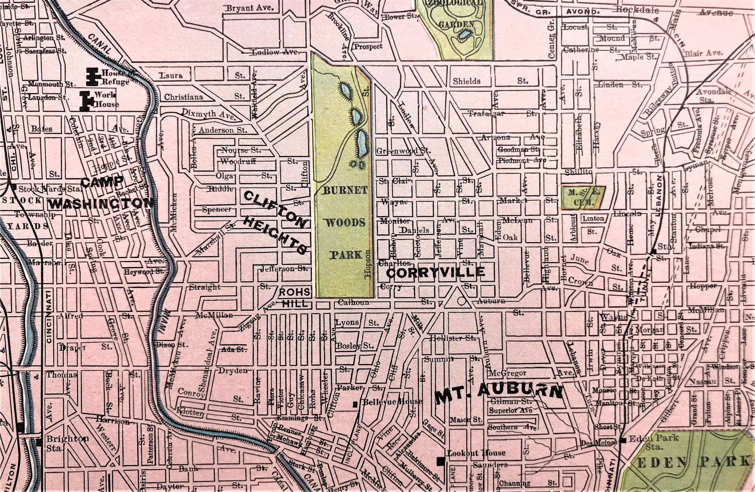
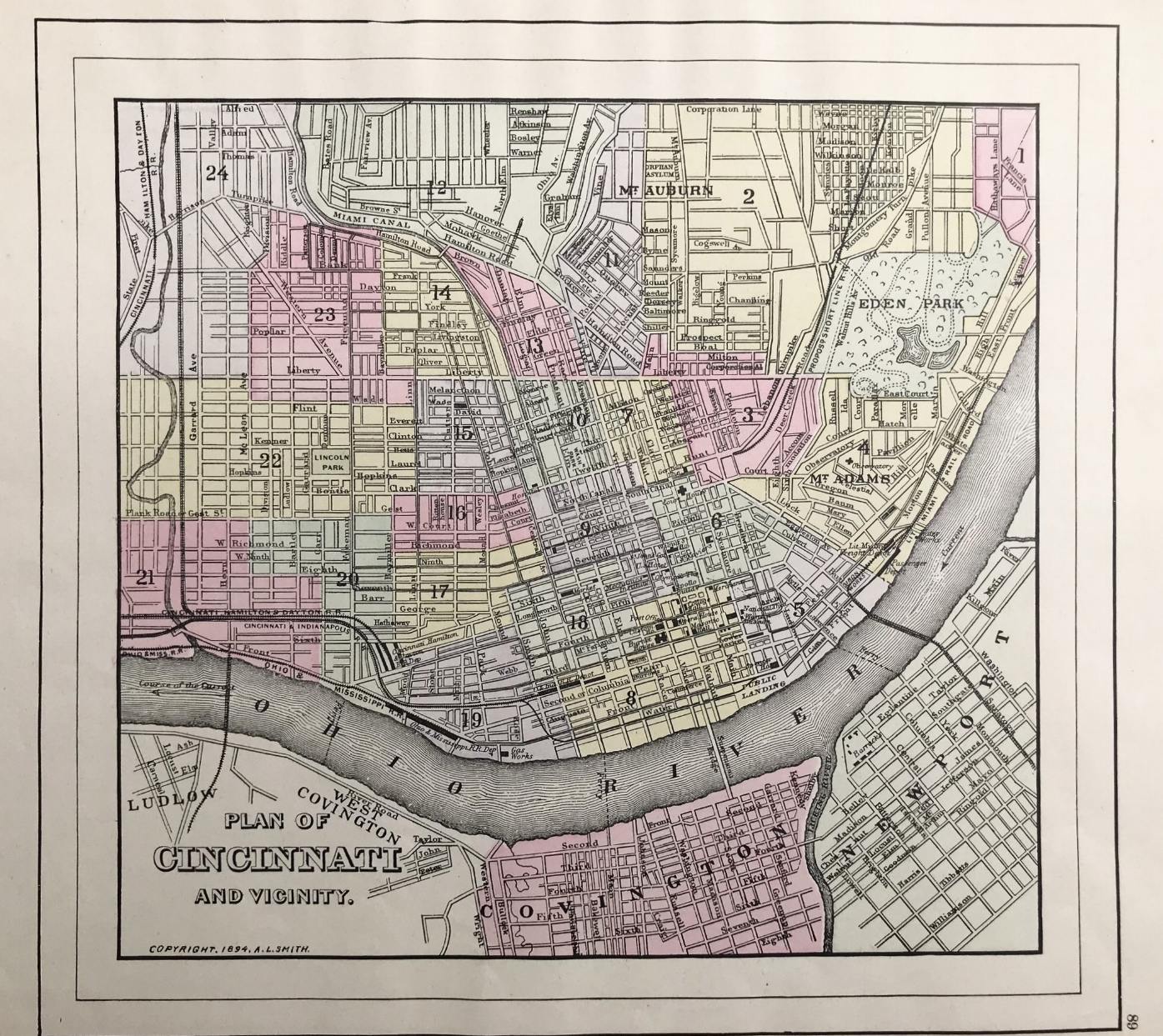
1894 Plan of Cincinnati and Vicinity
9
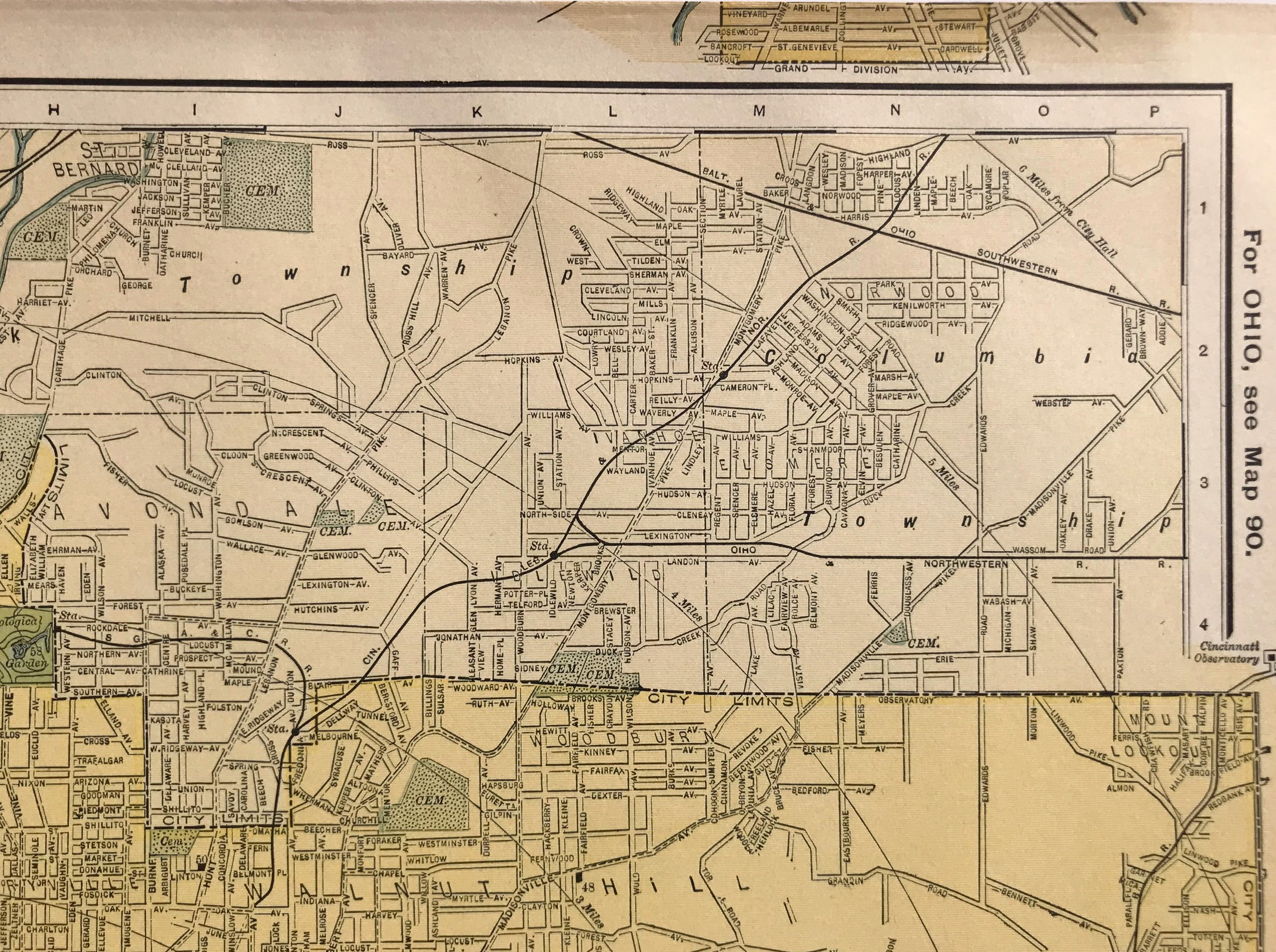
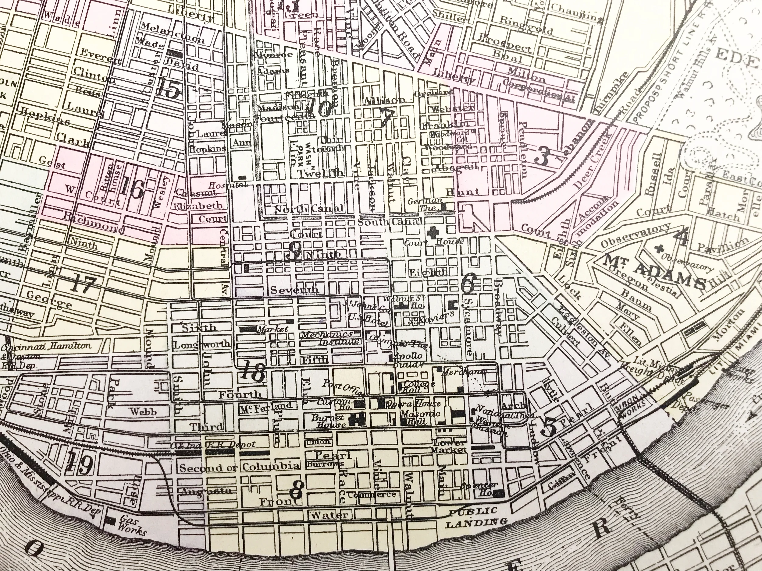
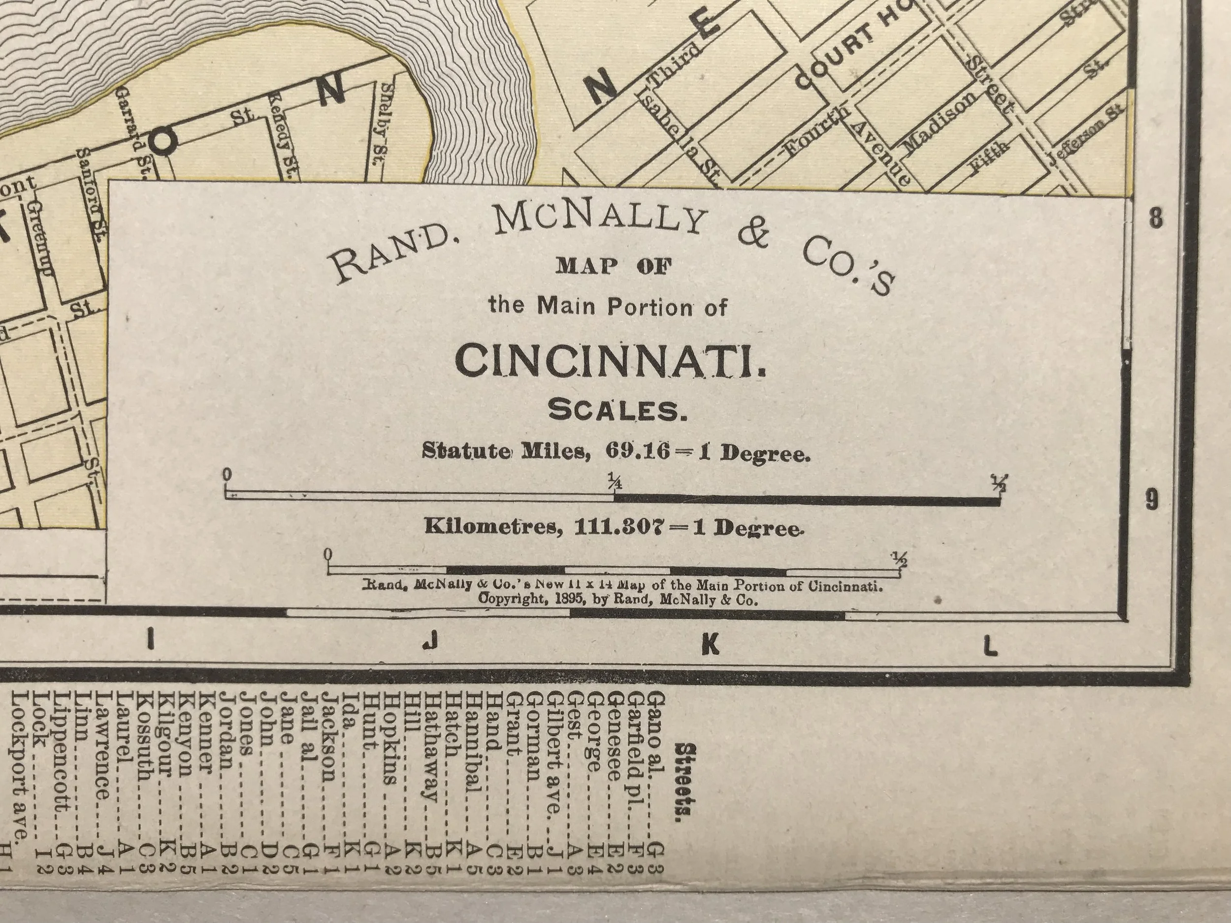
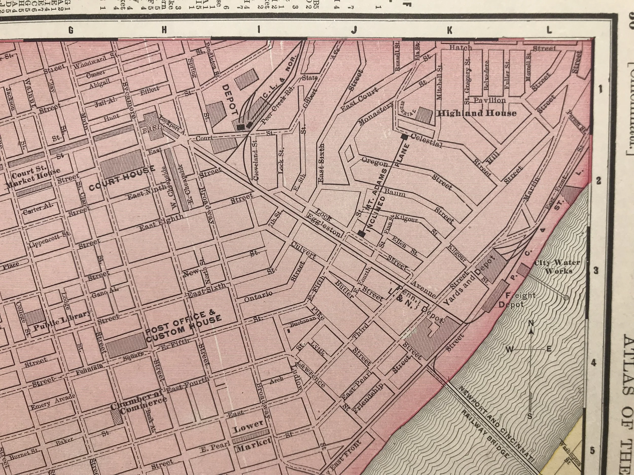
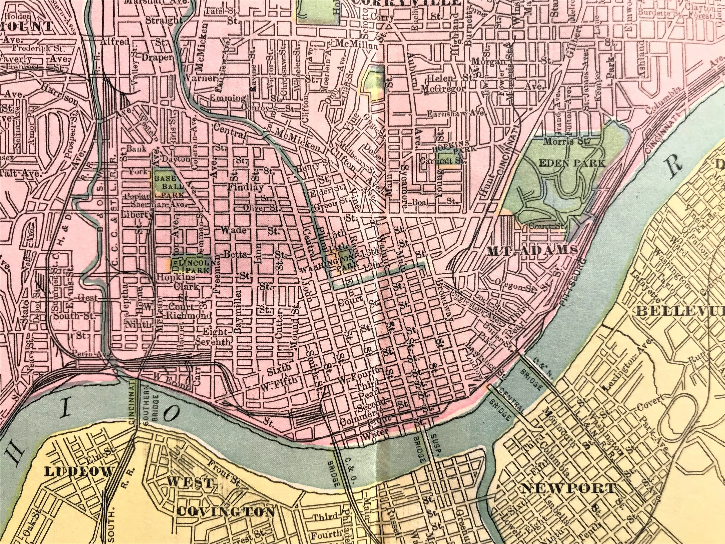
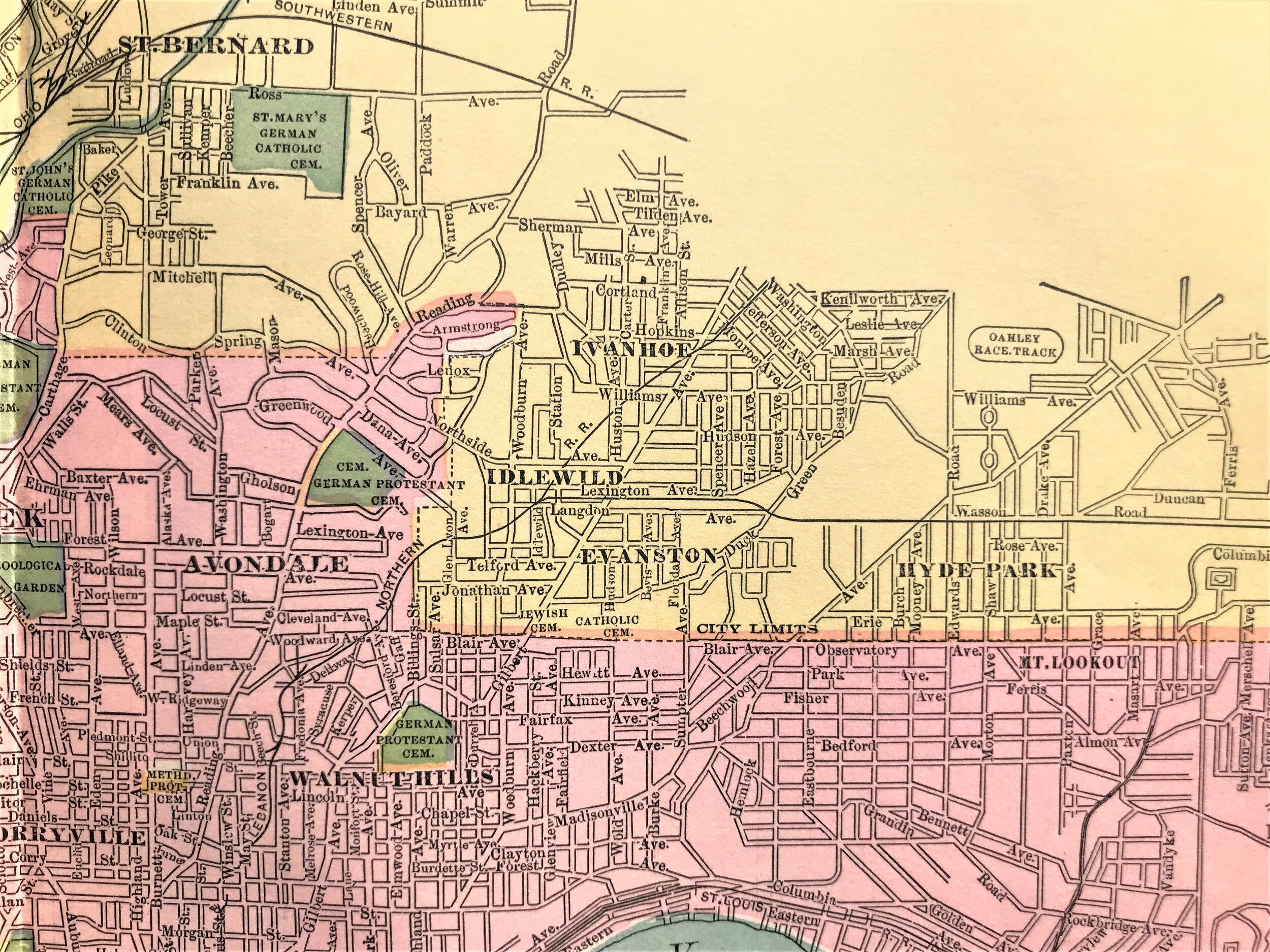
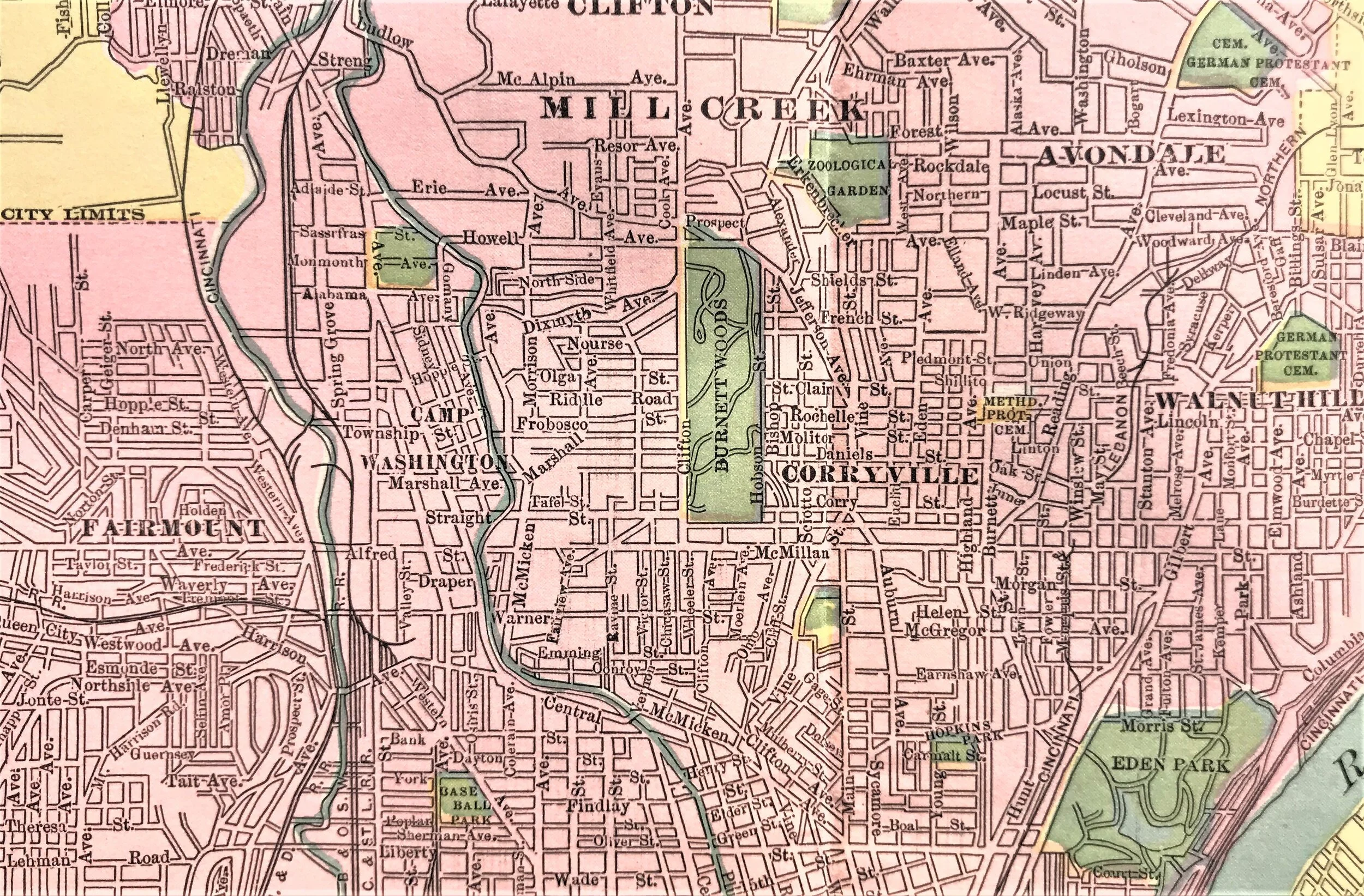
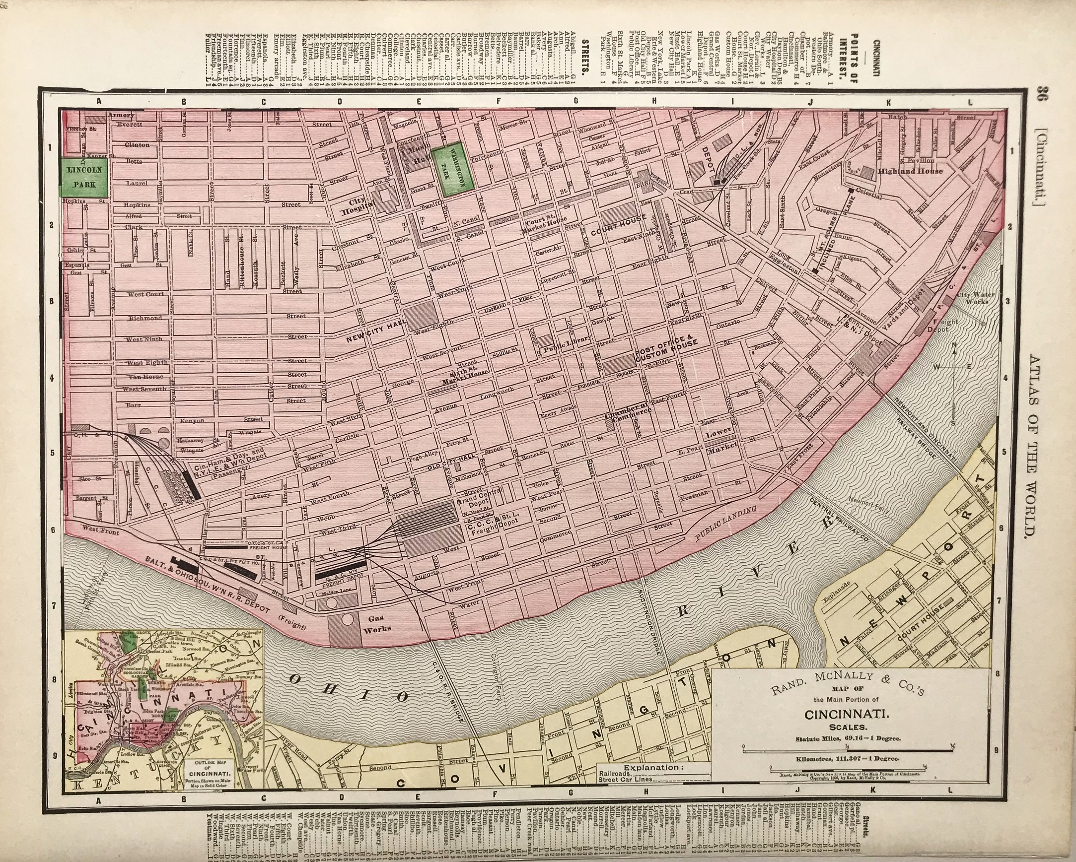
1895 Map of Main Portion of Cincinnati
10
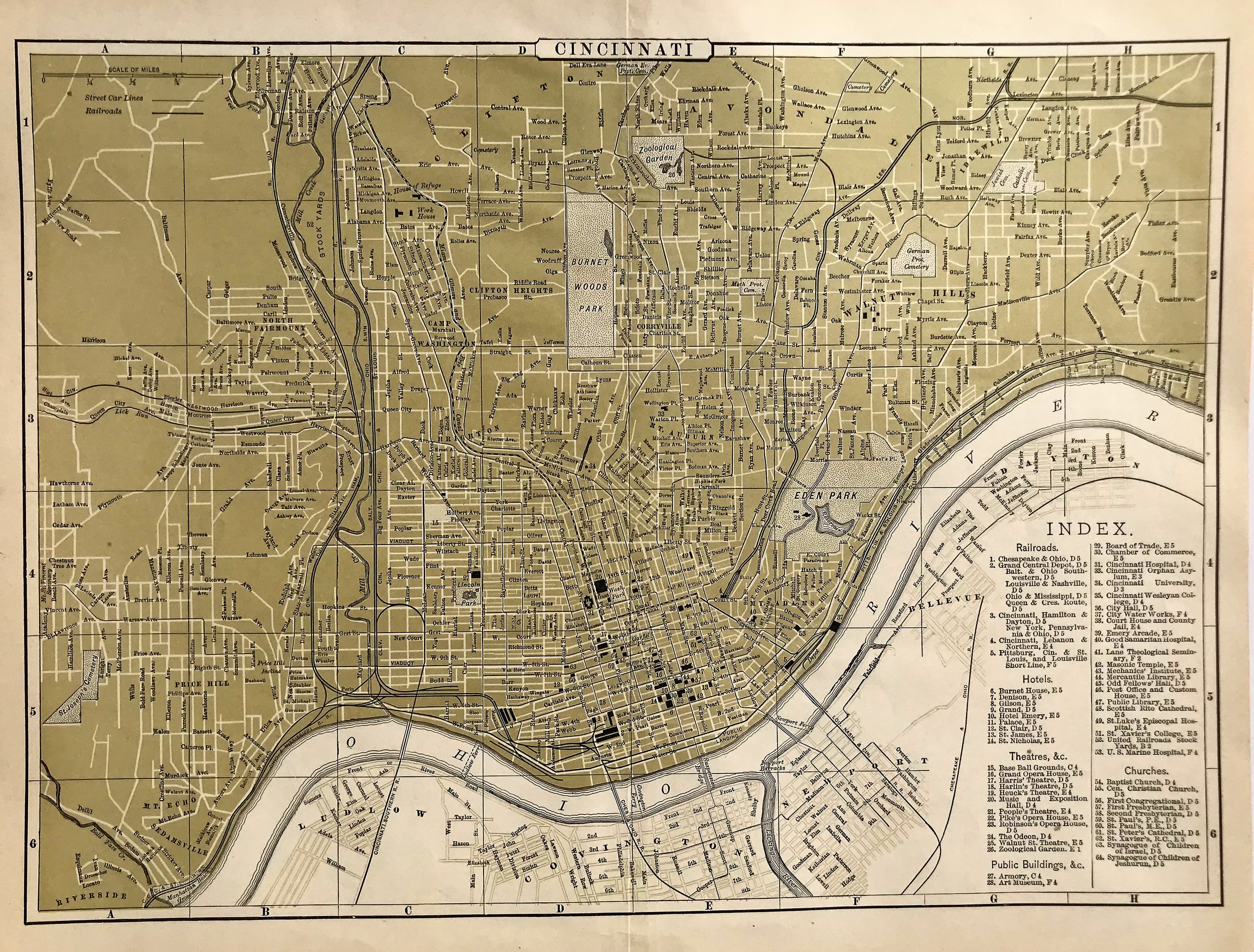
1896 Map of Cincinnati
7
1897 Map of Southern Ohio
8
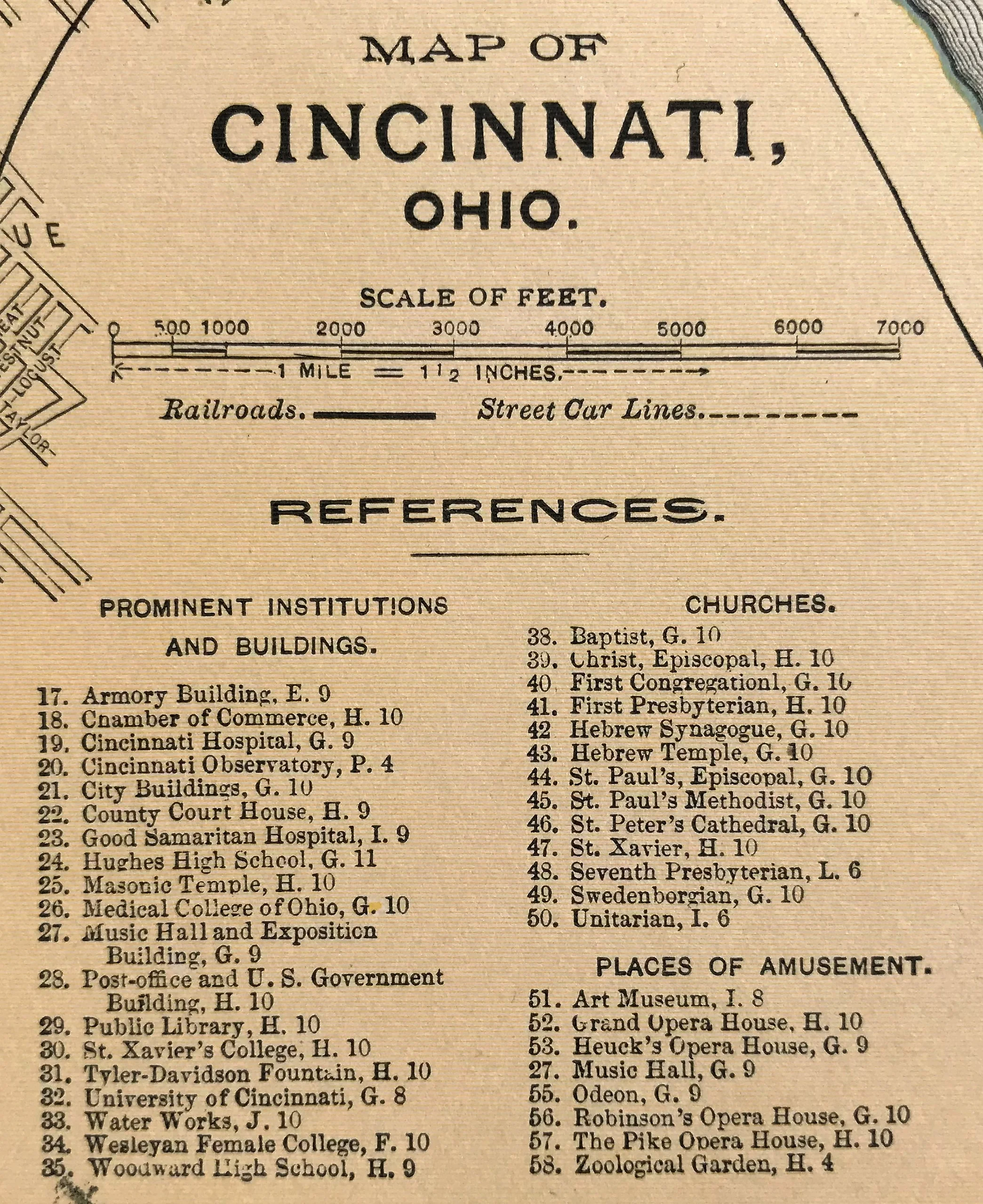
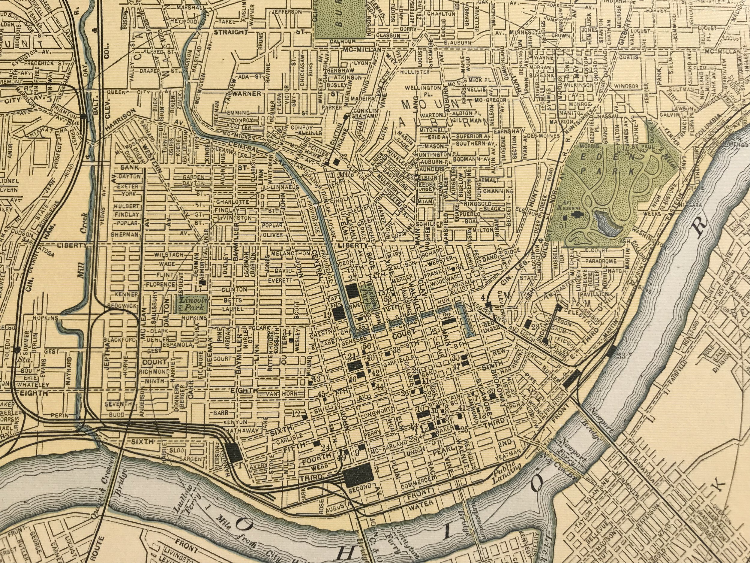
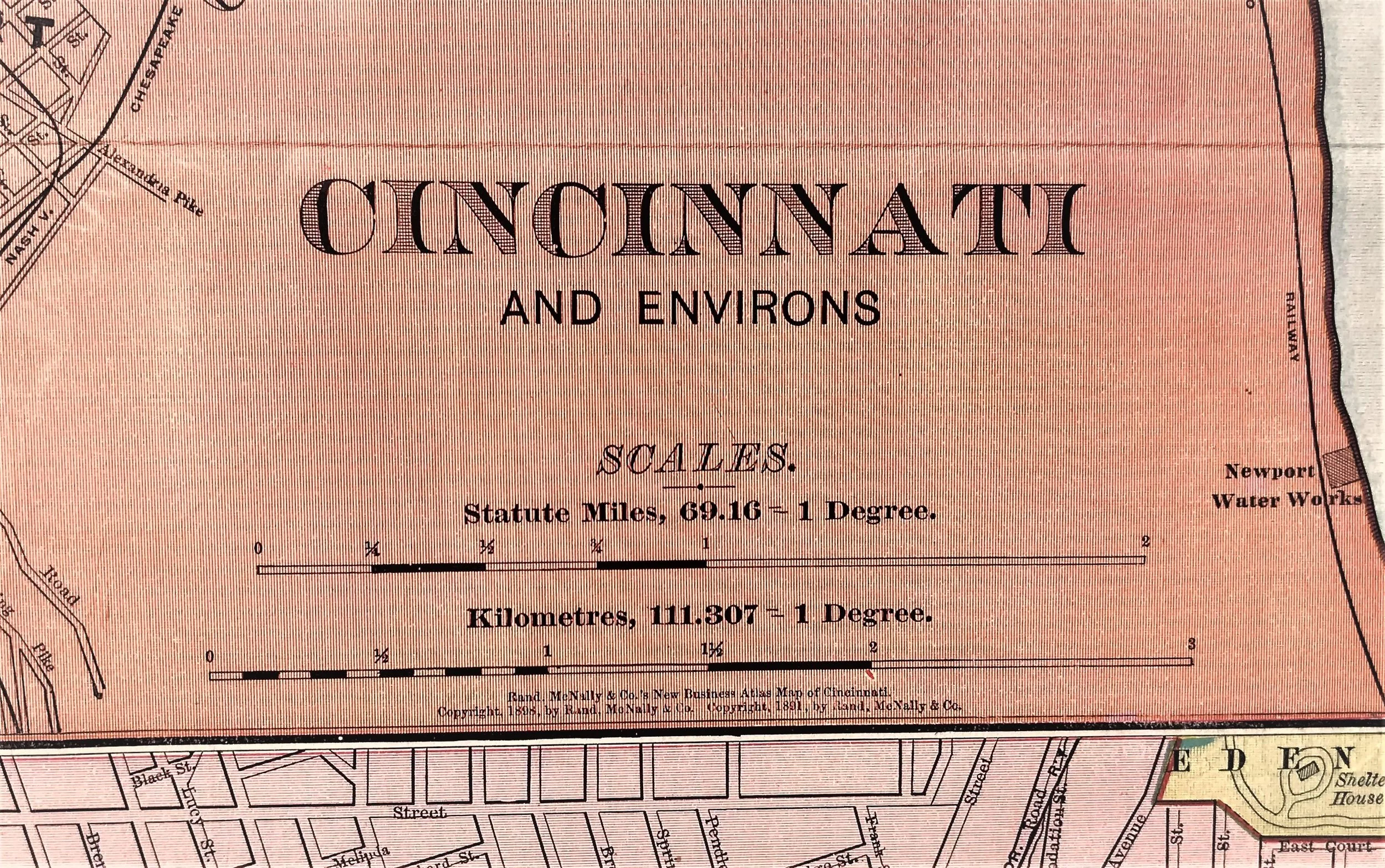
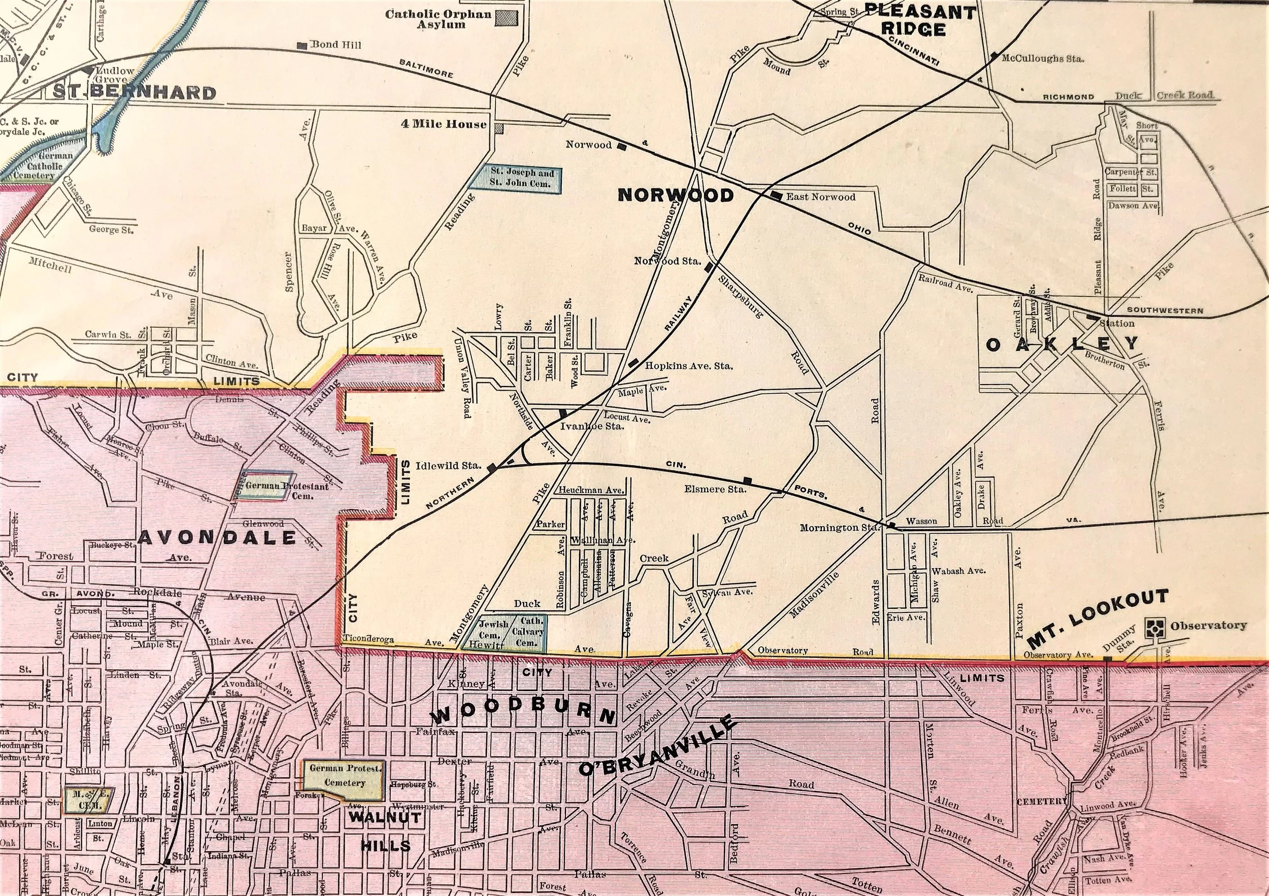
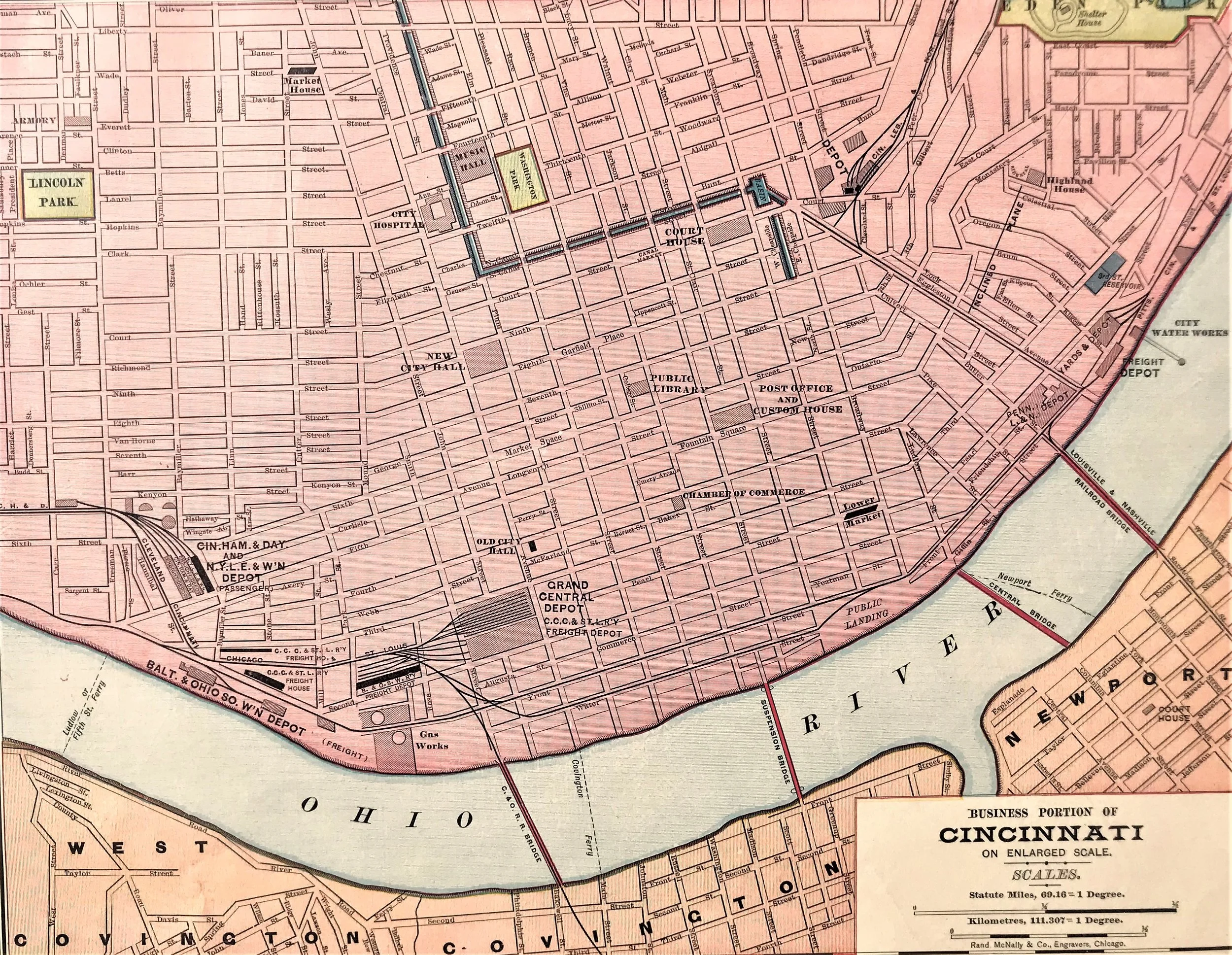
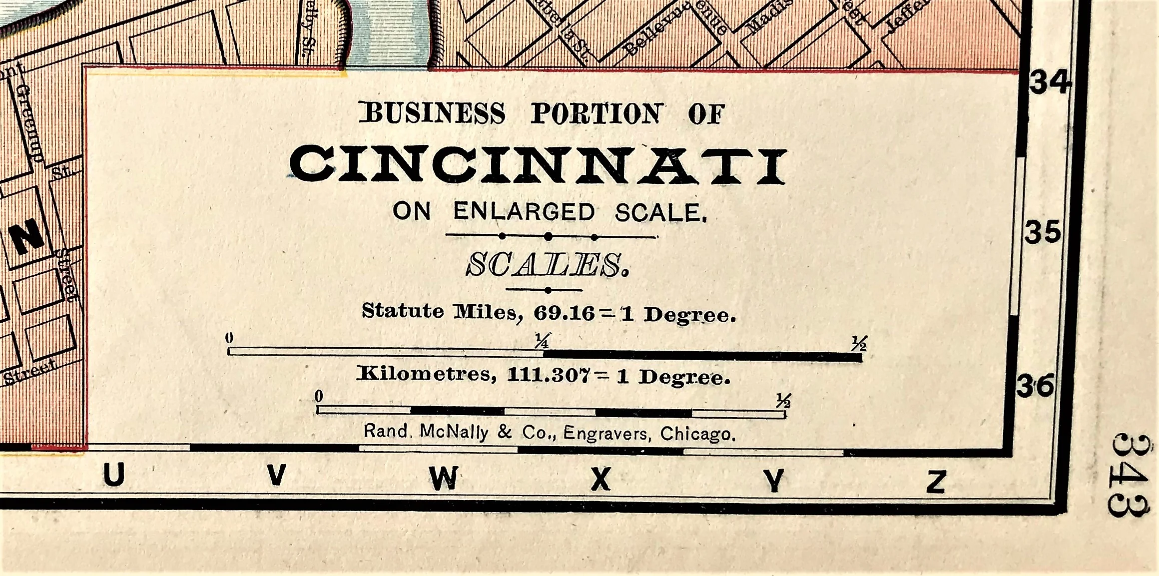
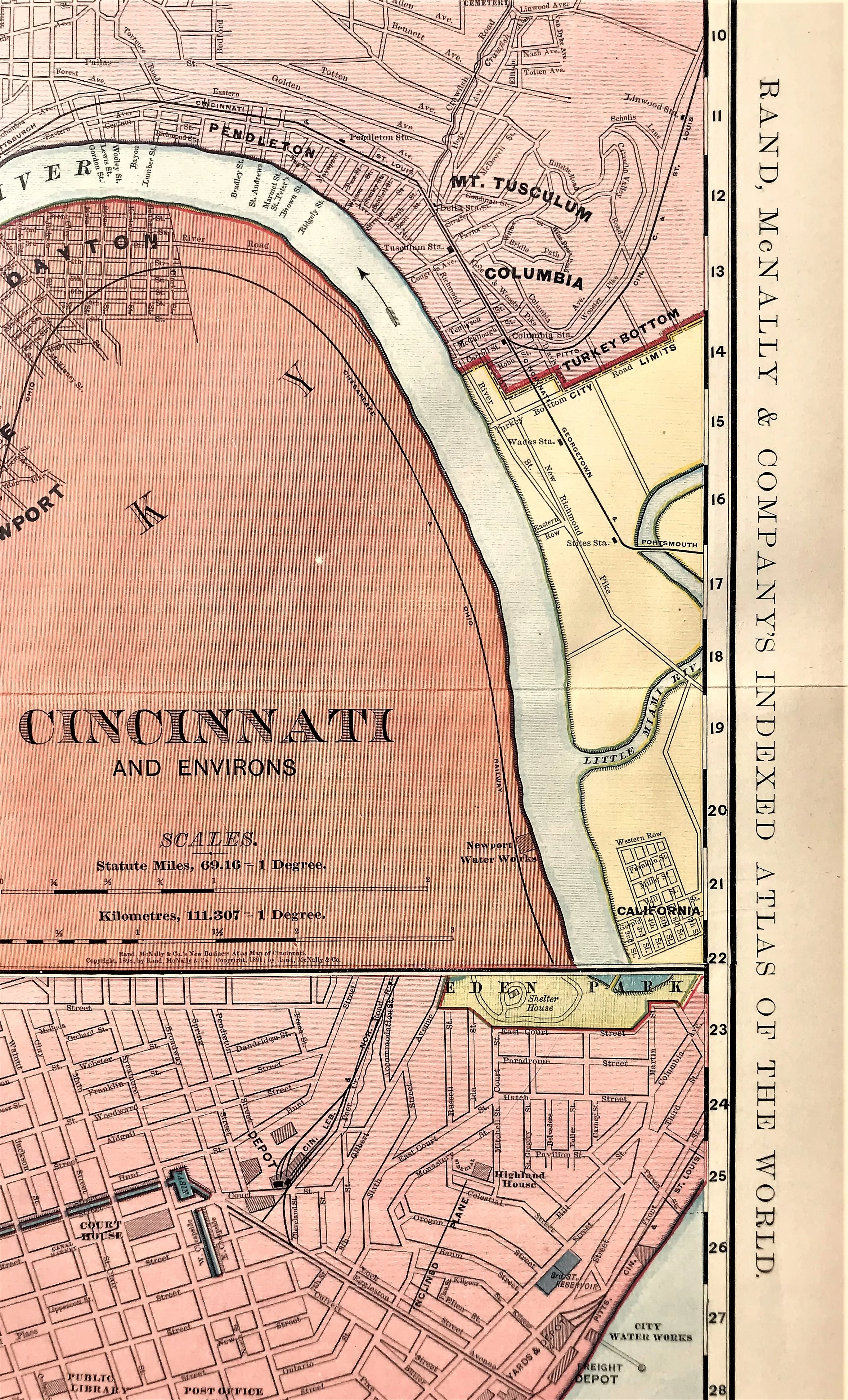
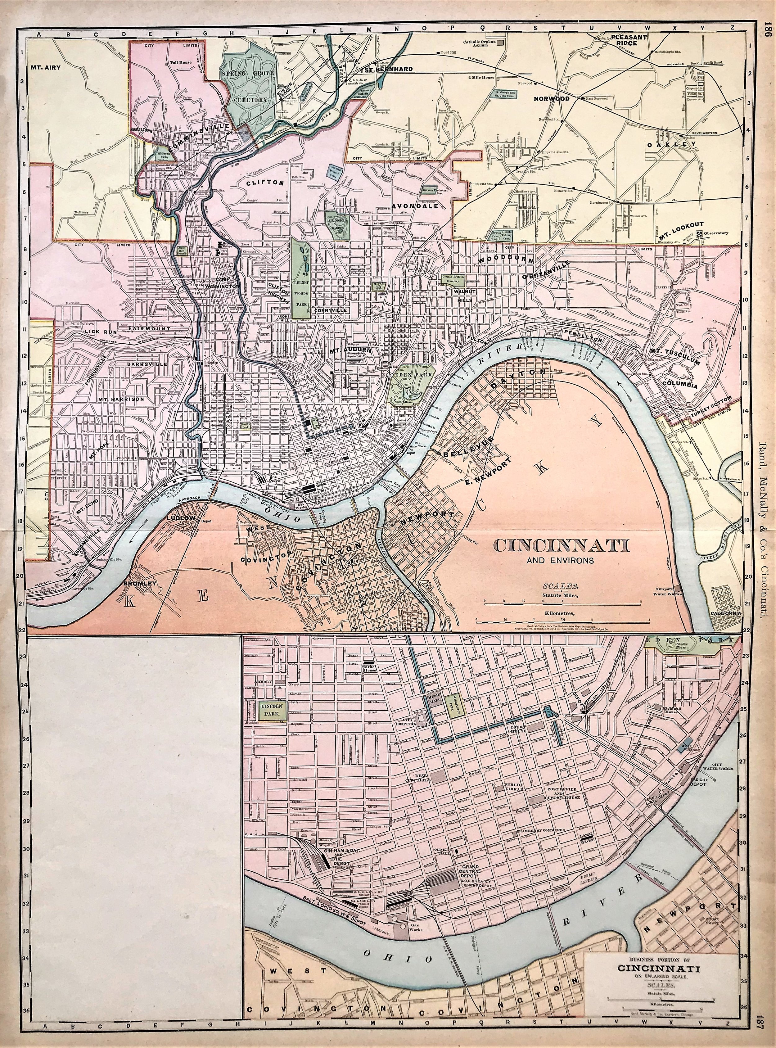
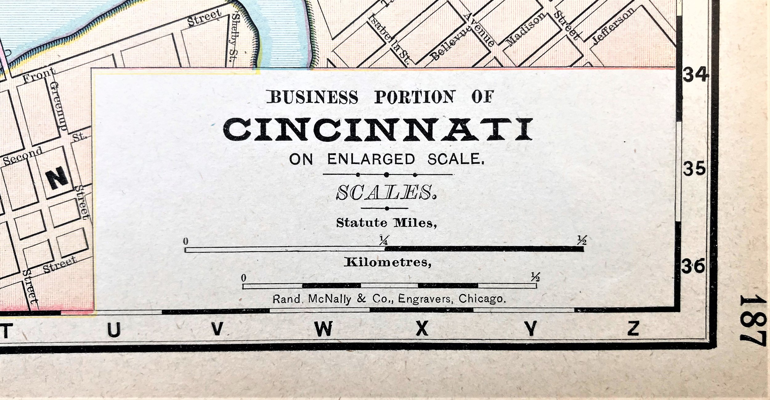
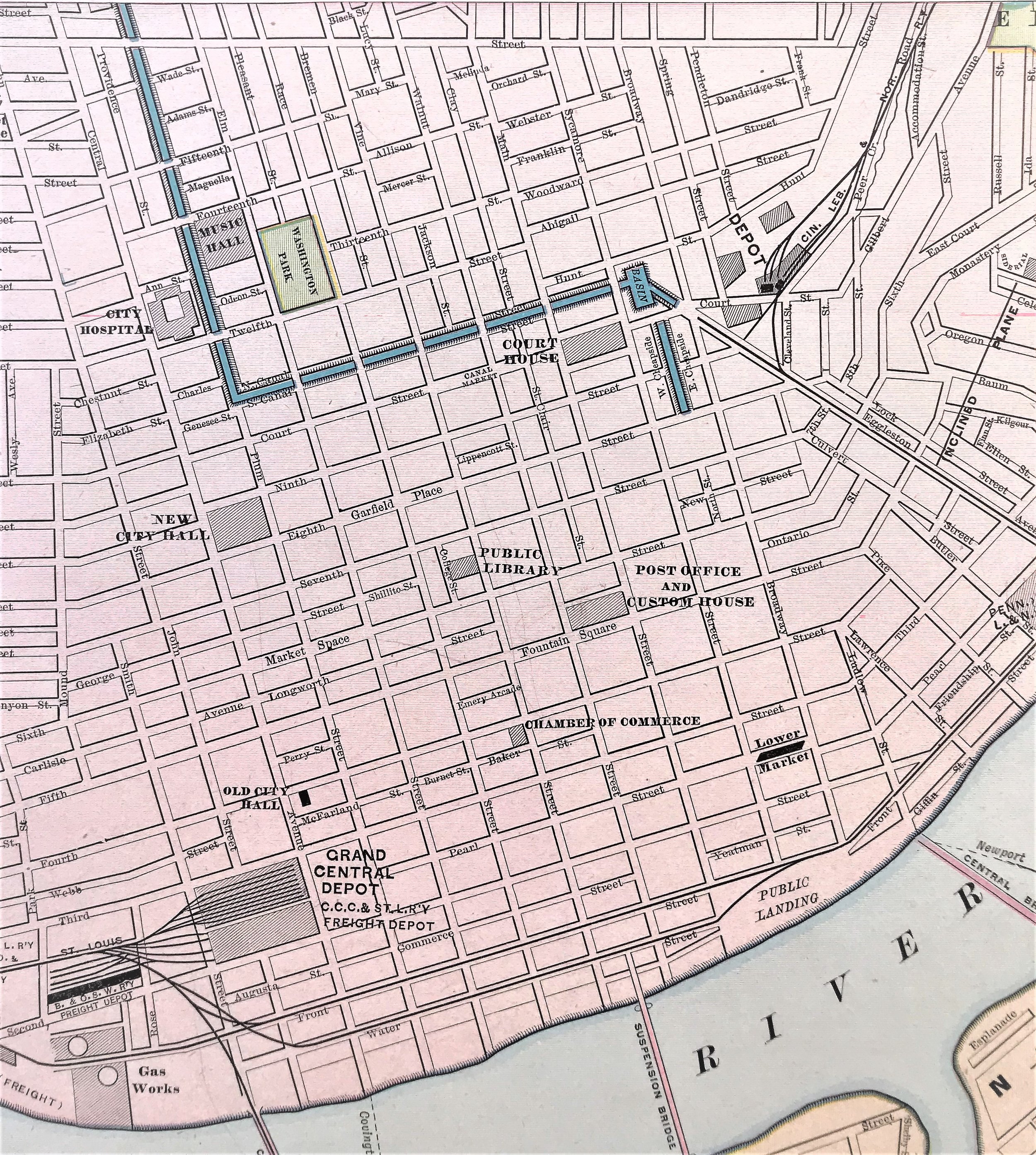
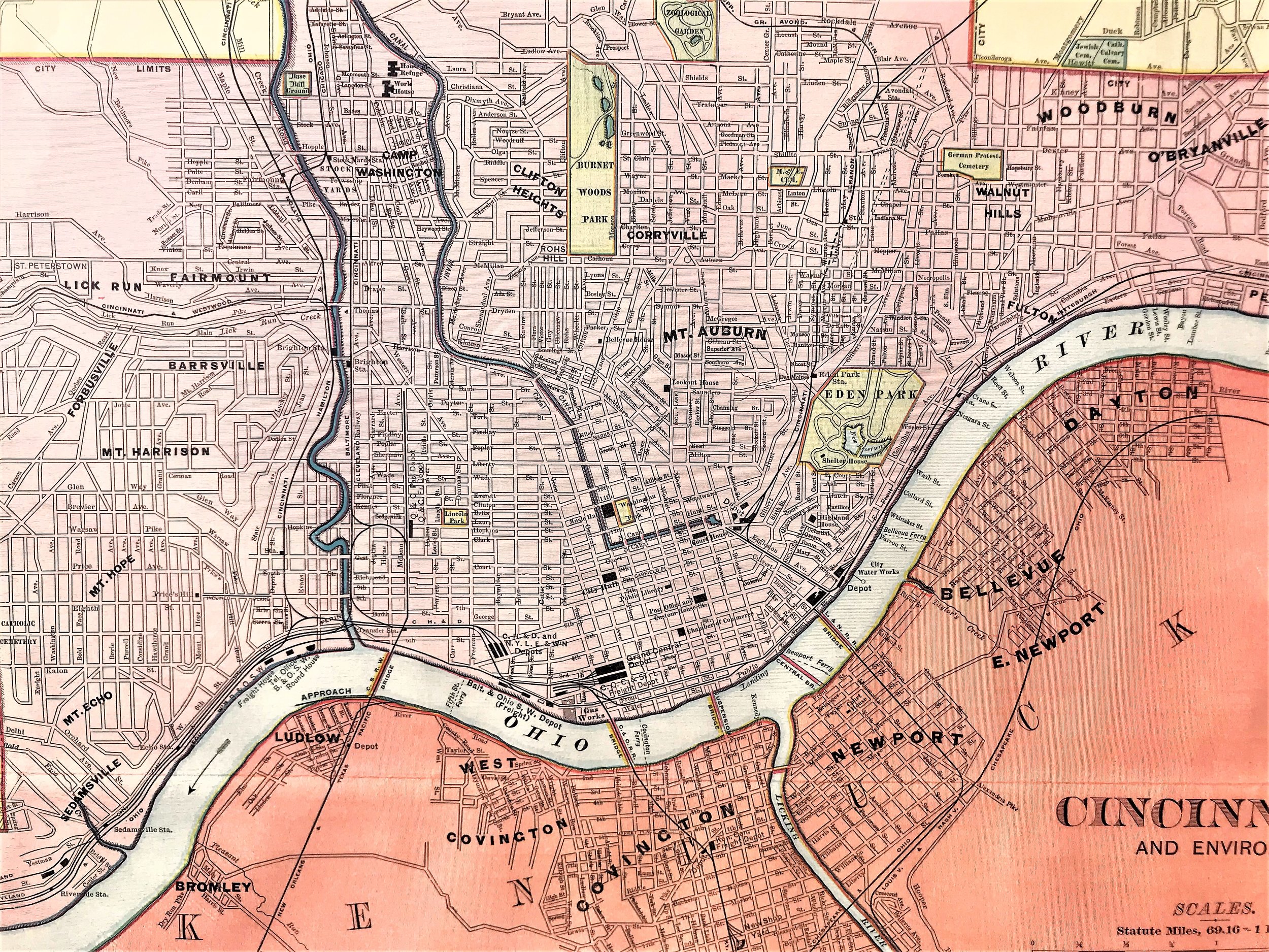
1898 Cincinnati and Environs
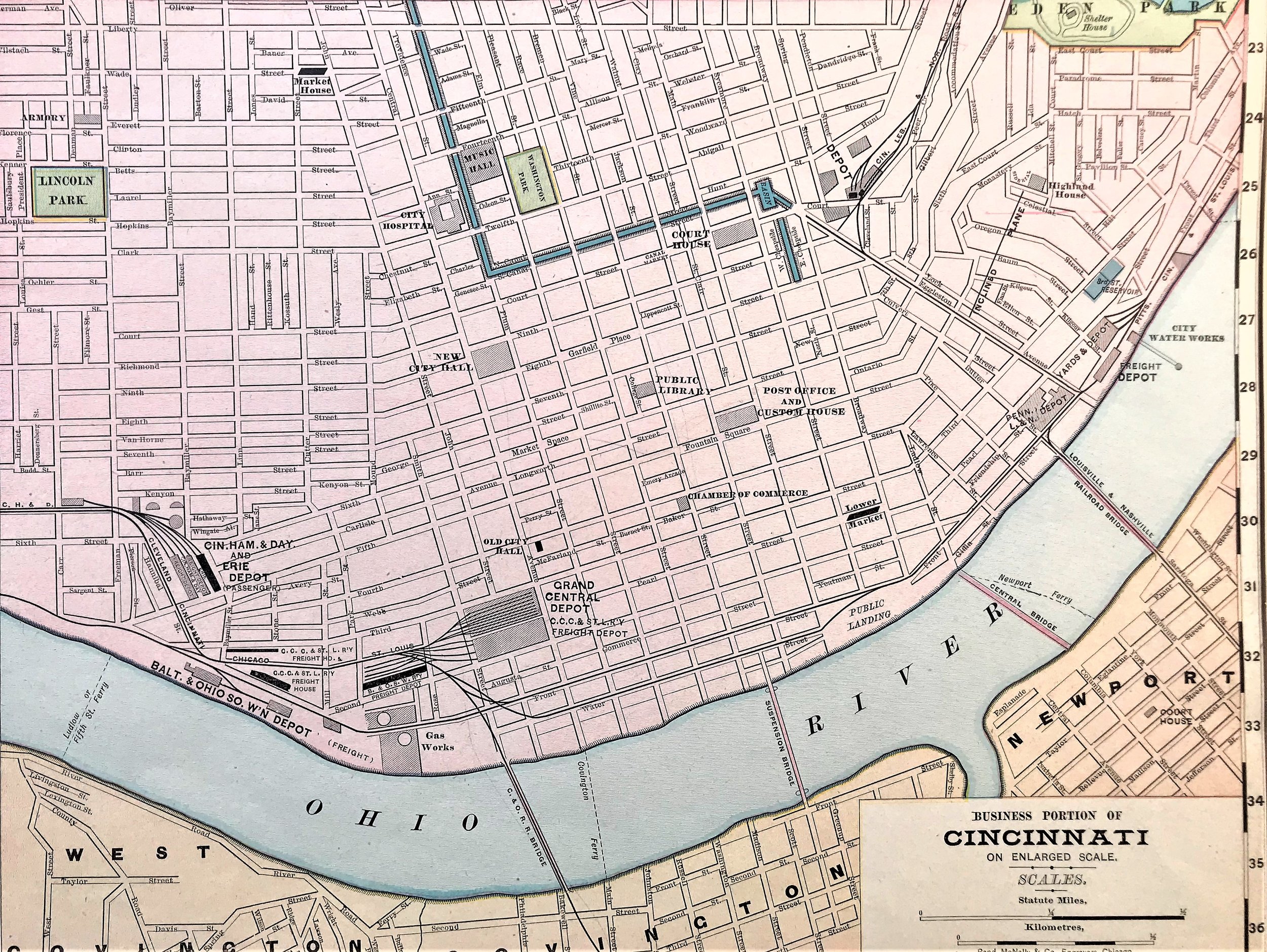
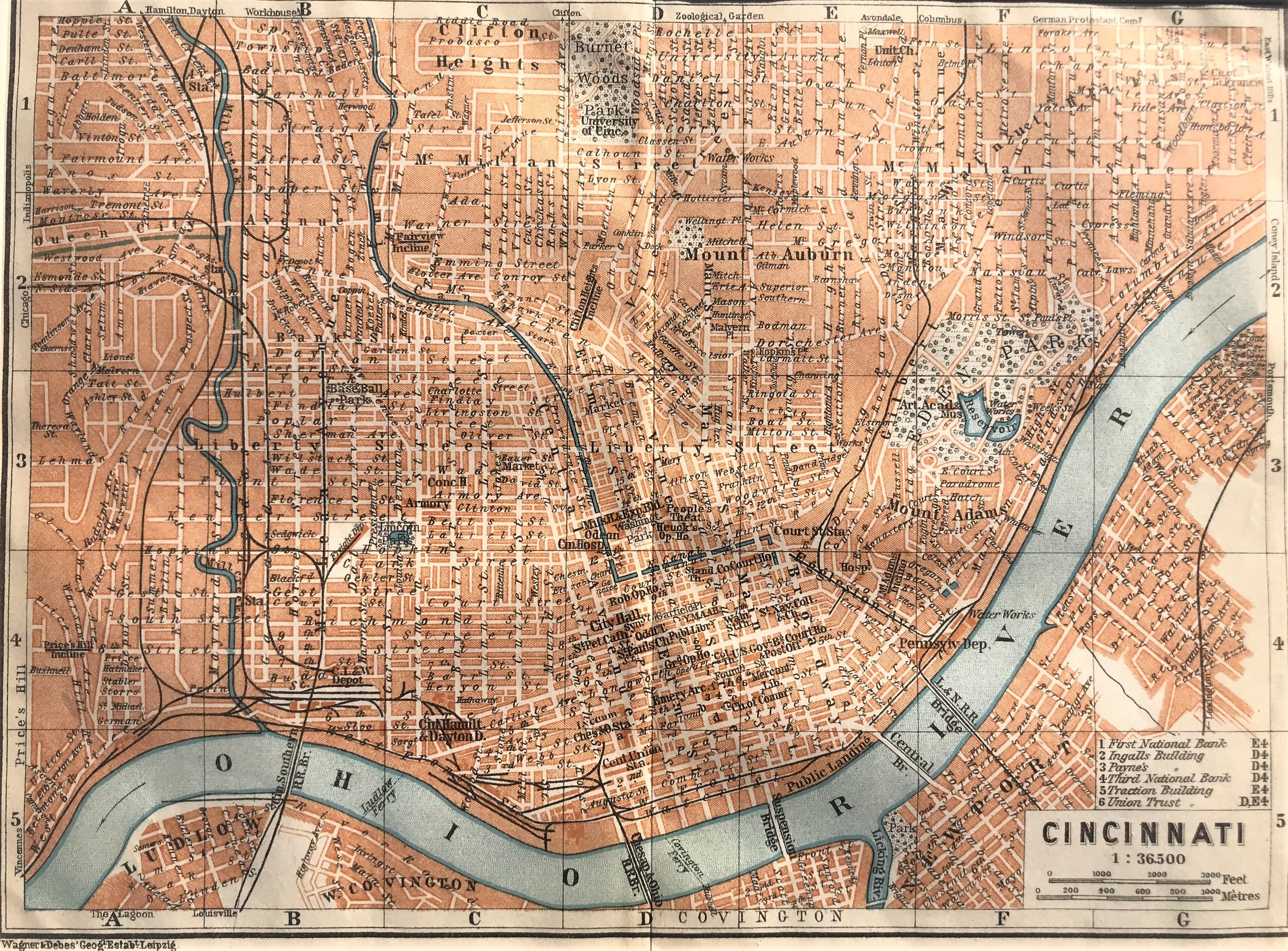
15
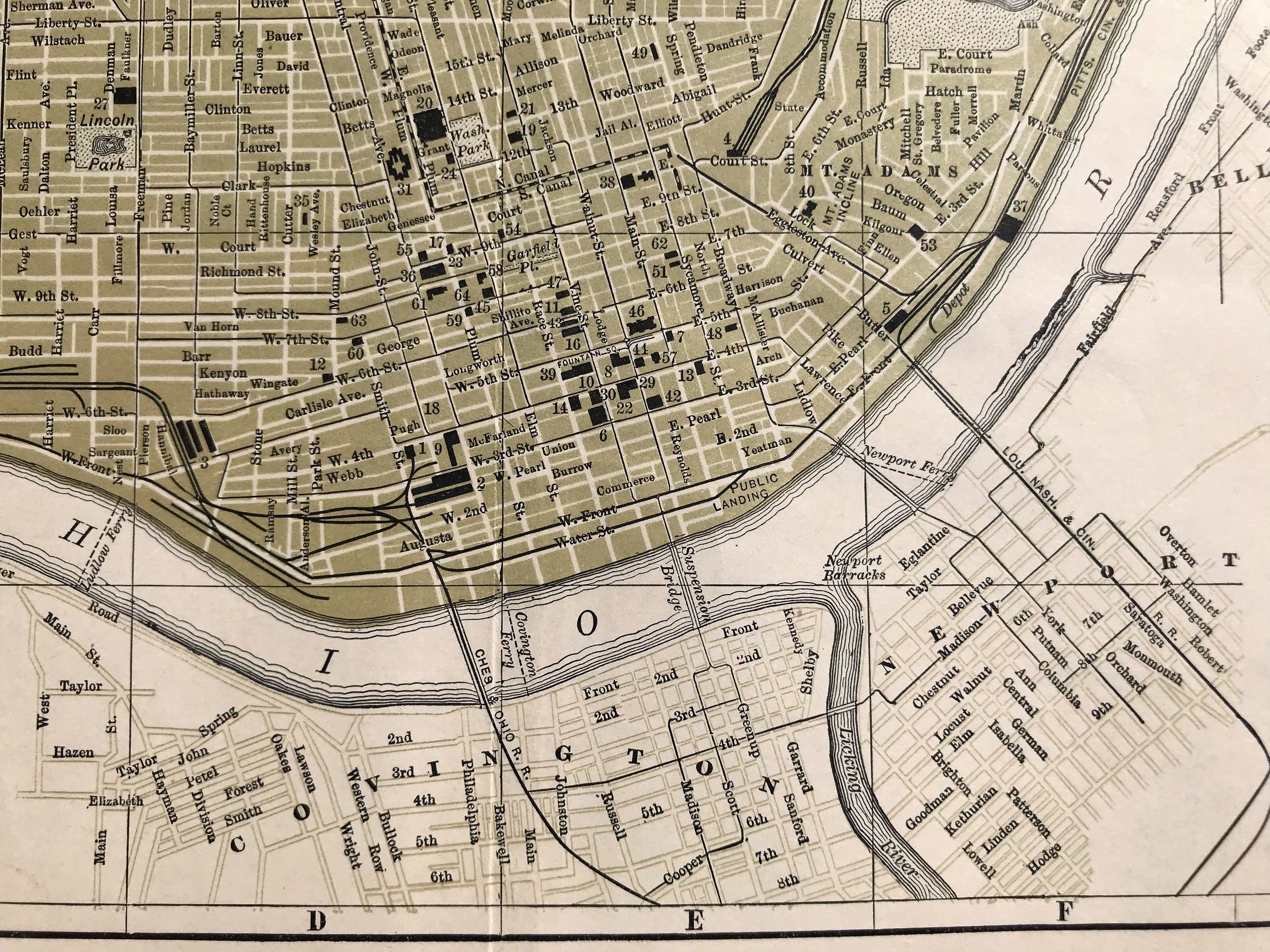
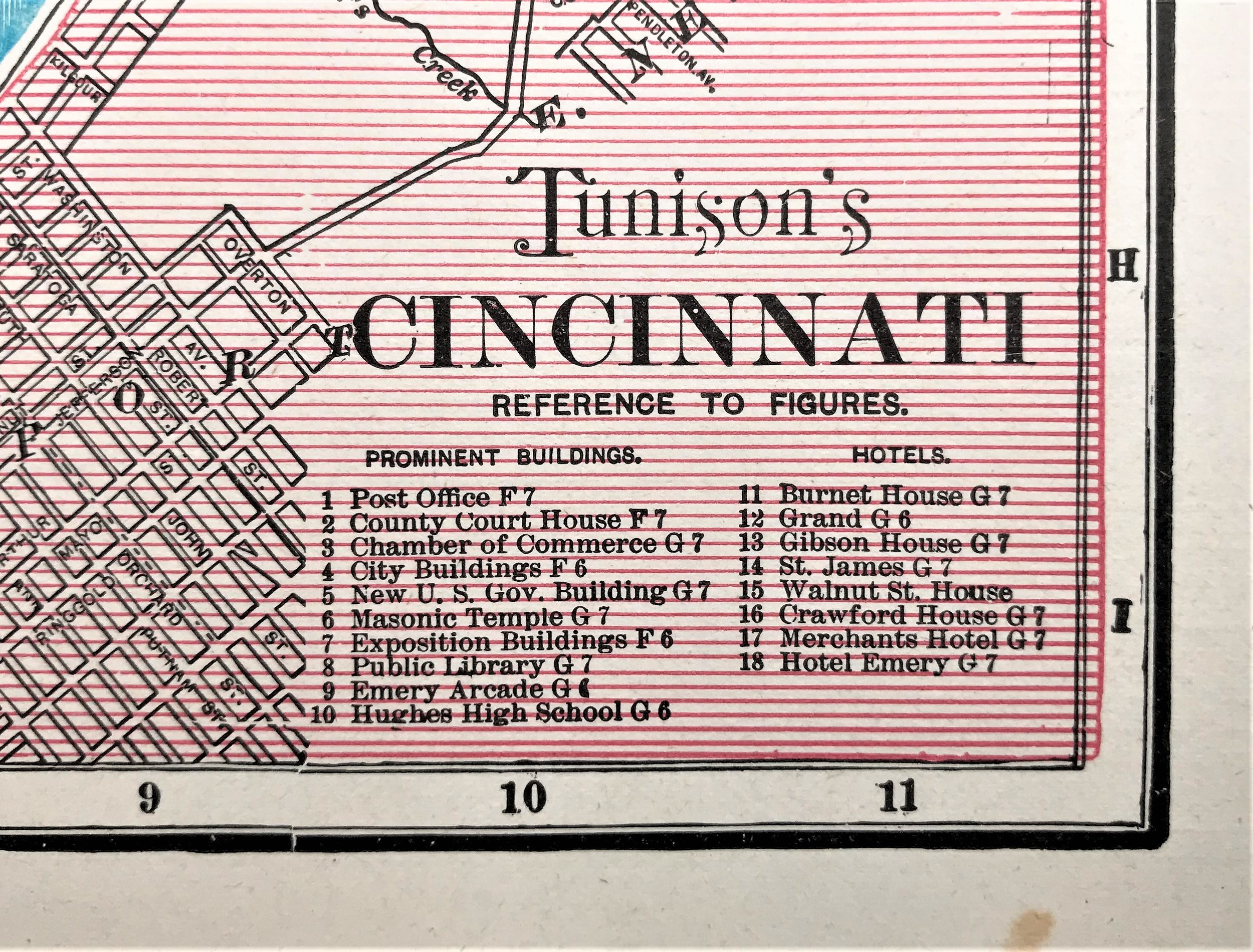
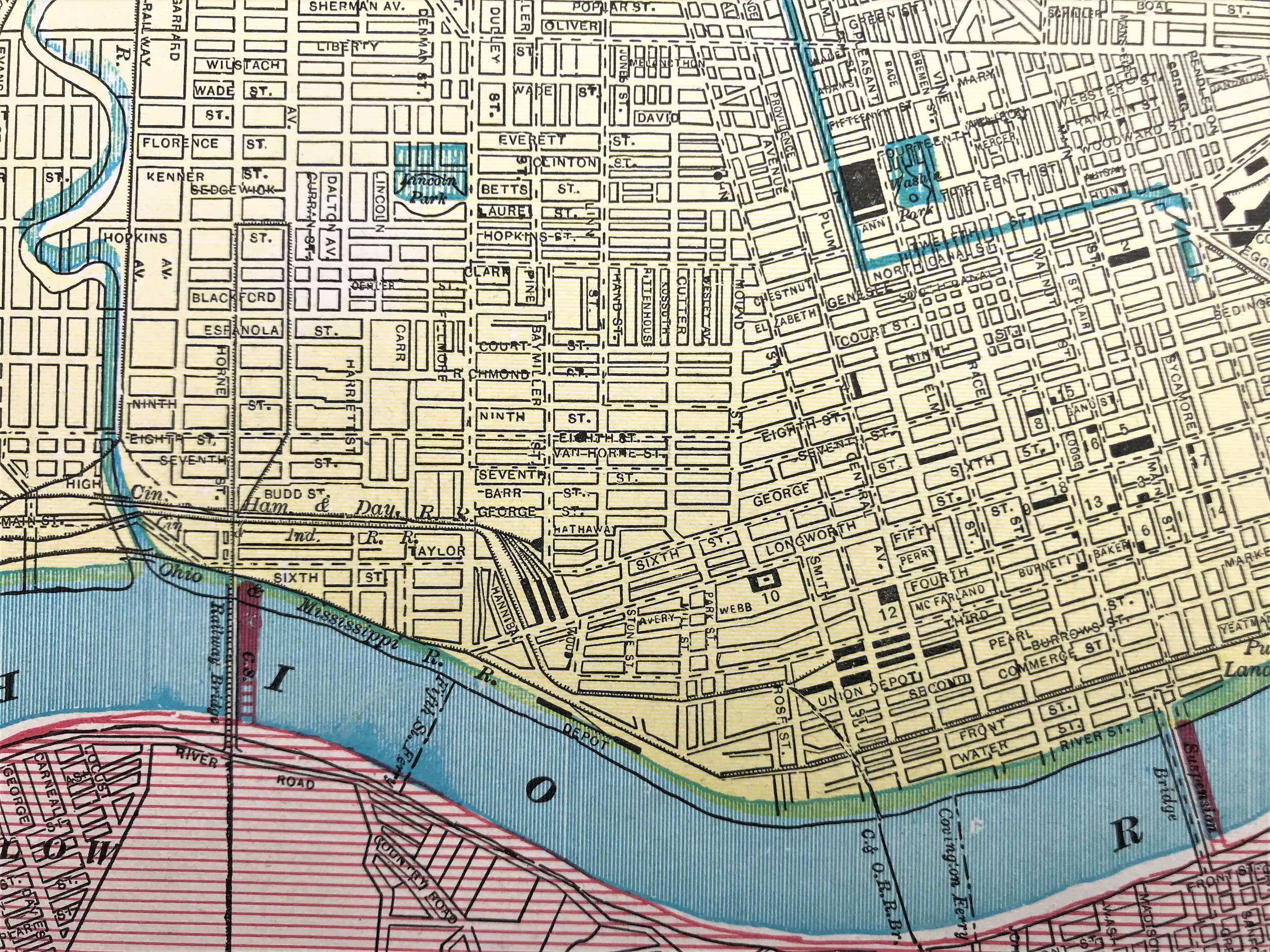
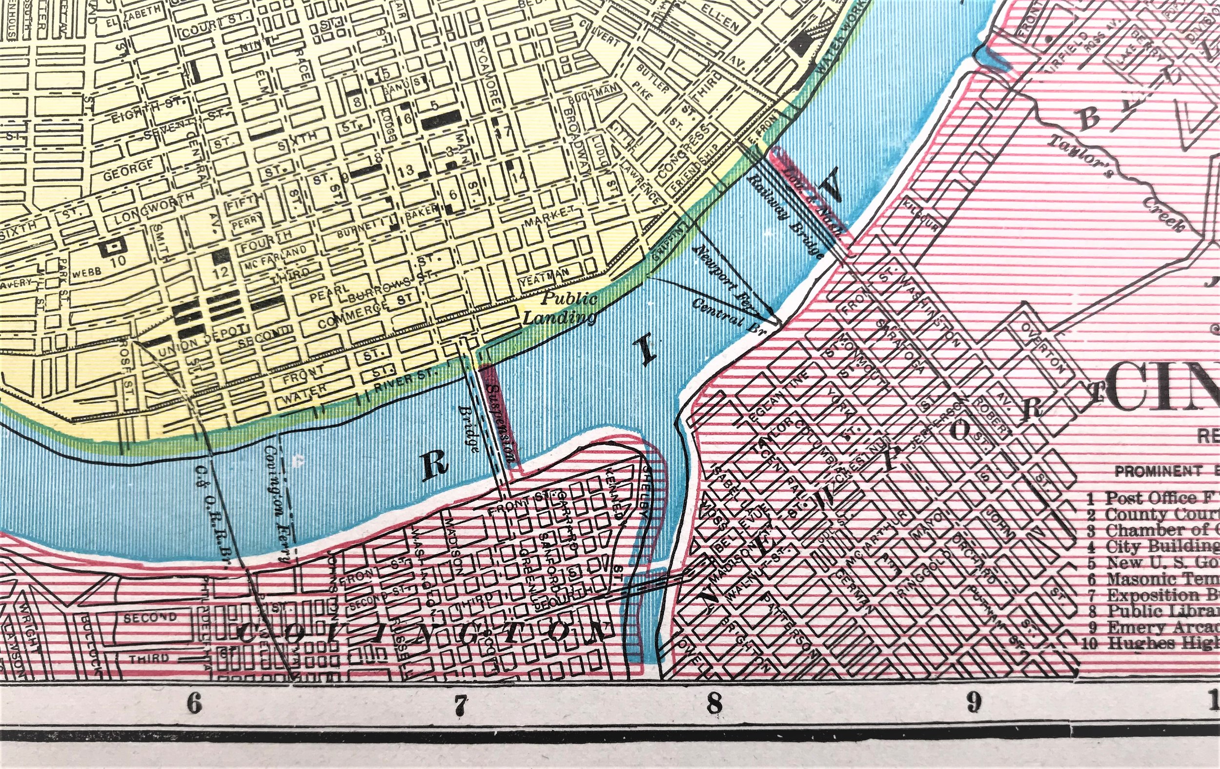
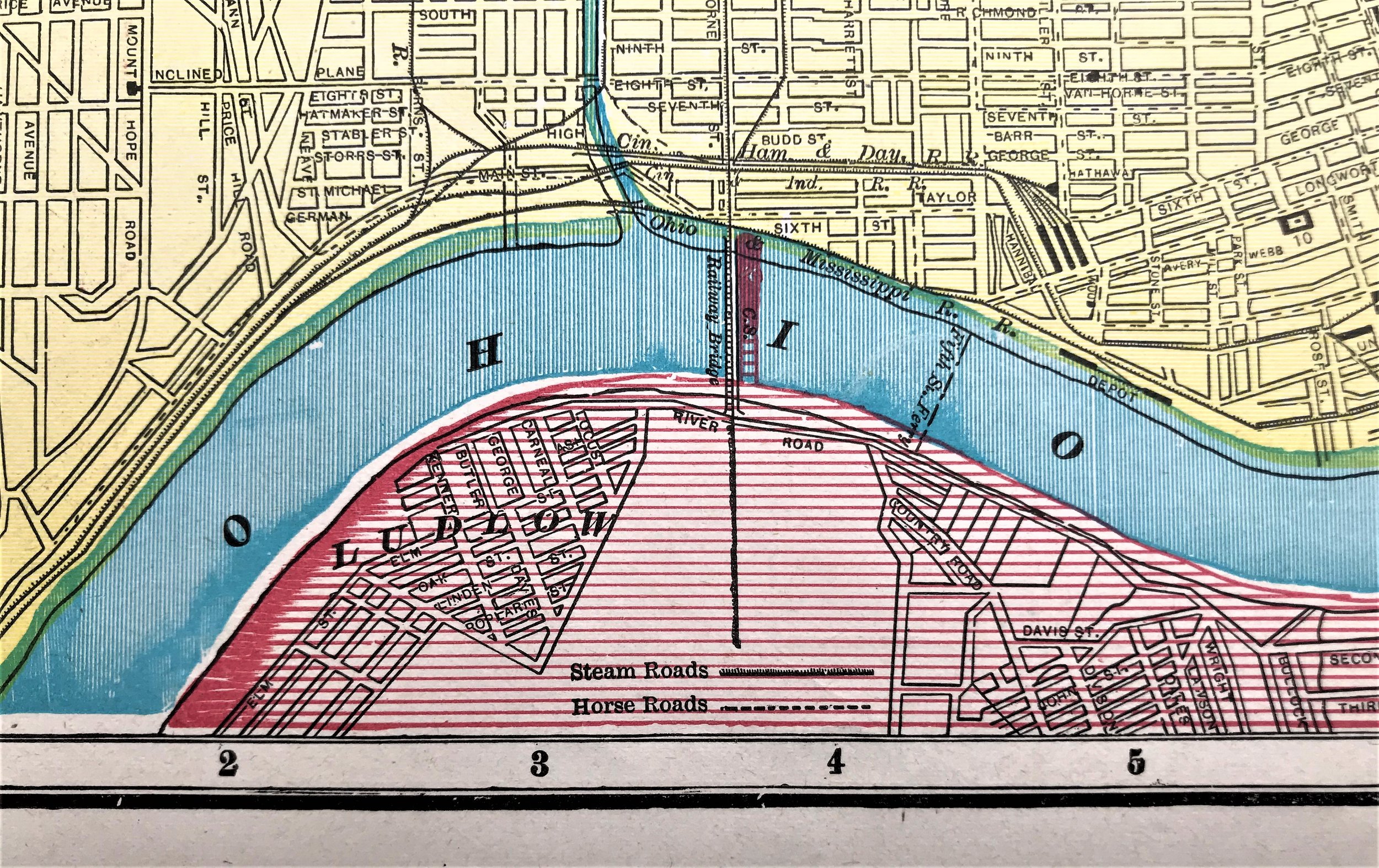
1898 New Business Atlas of Cincinnati
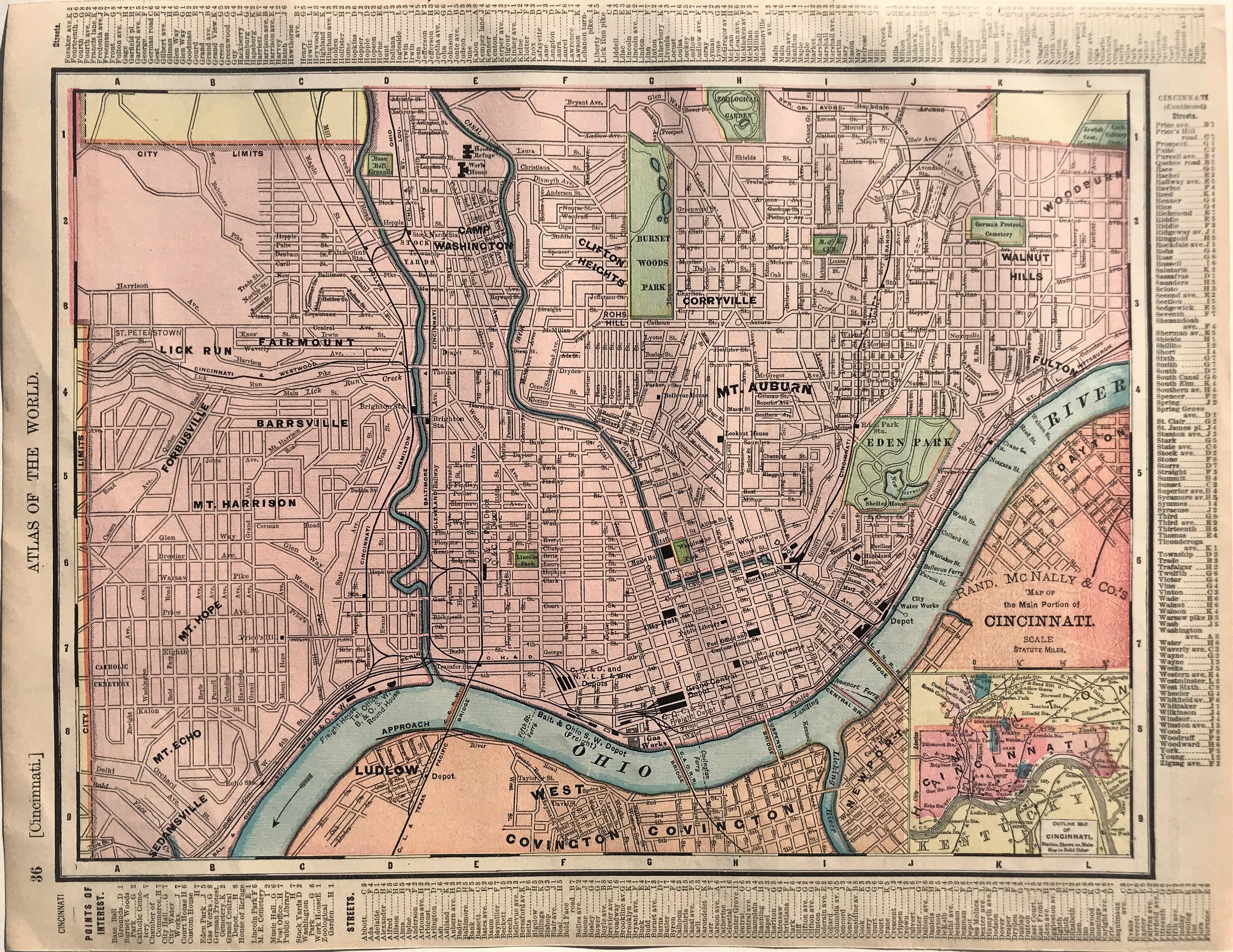
7
1898 Map of the Main Portion of Cincinnati
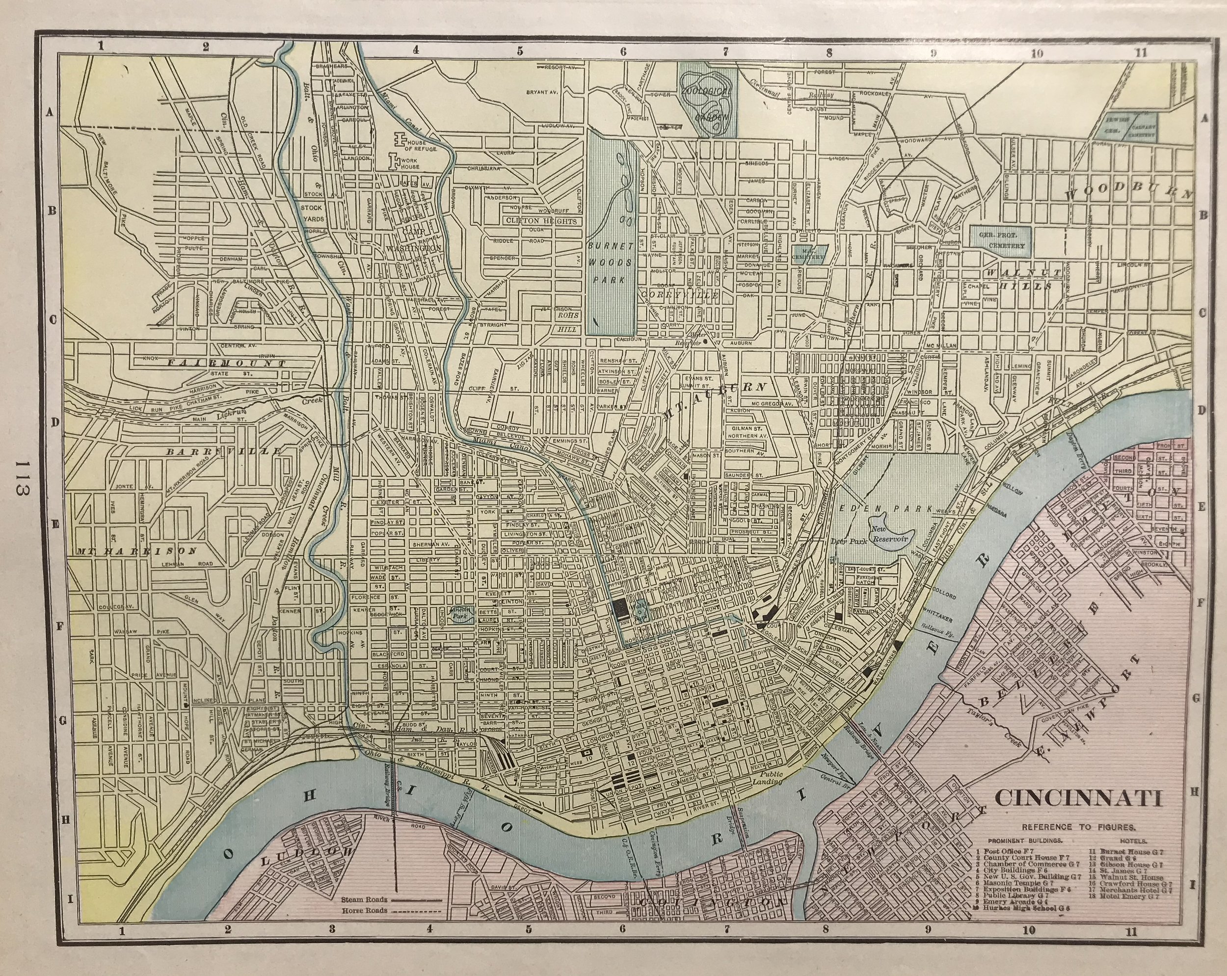
8
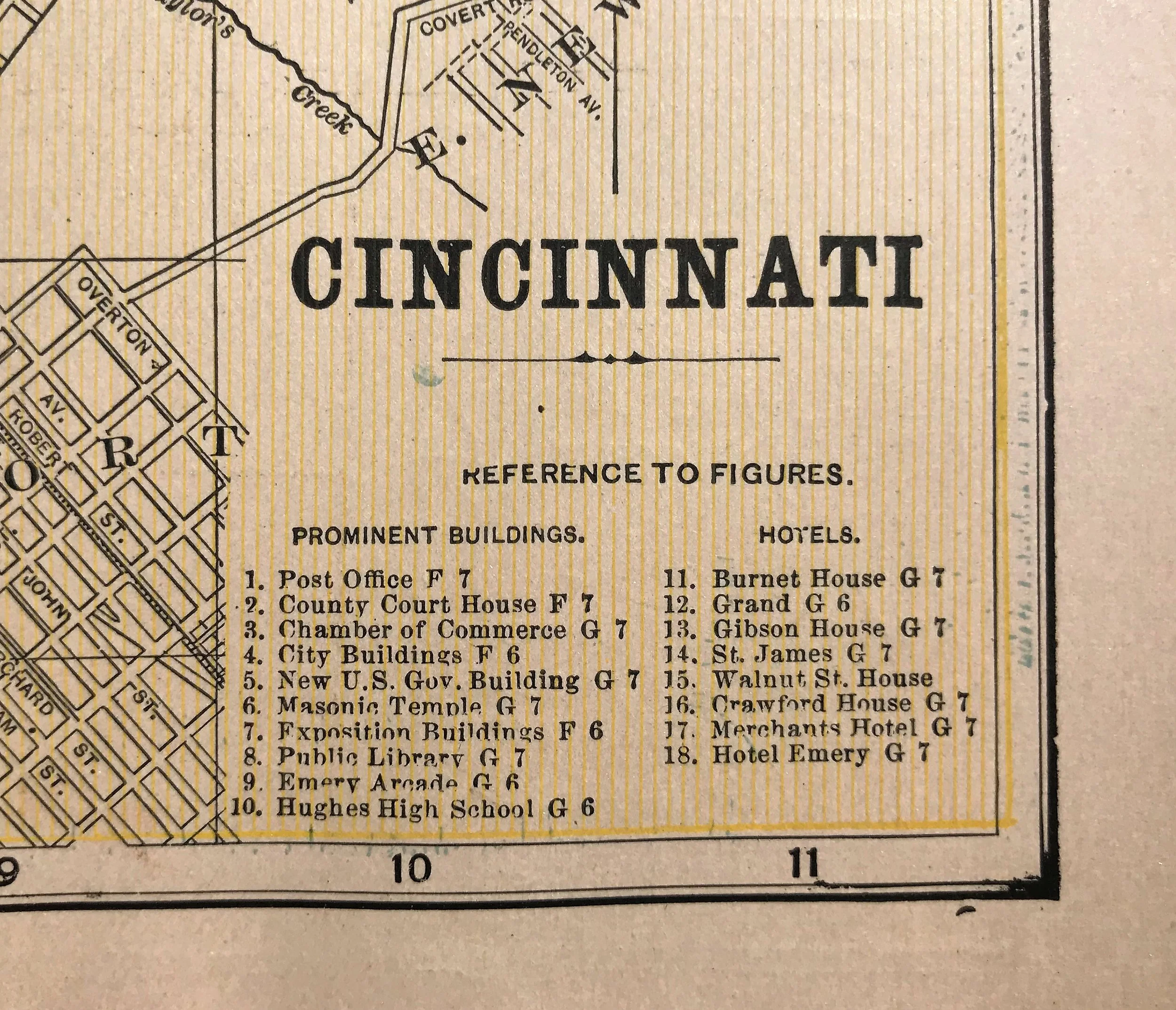
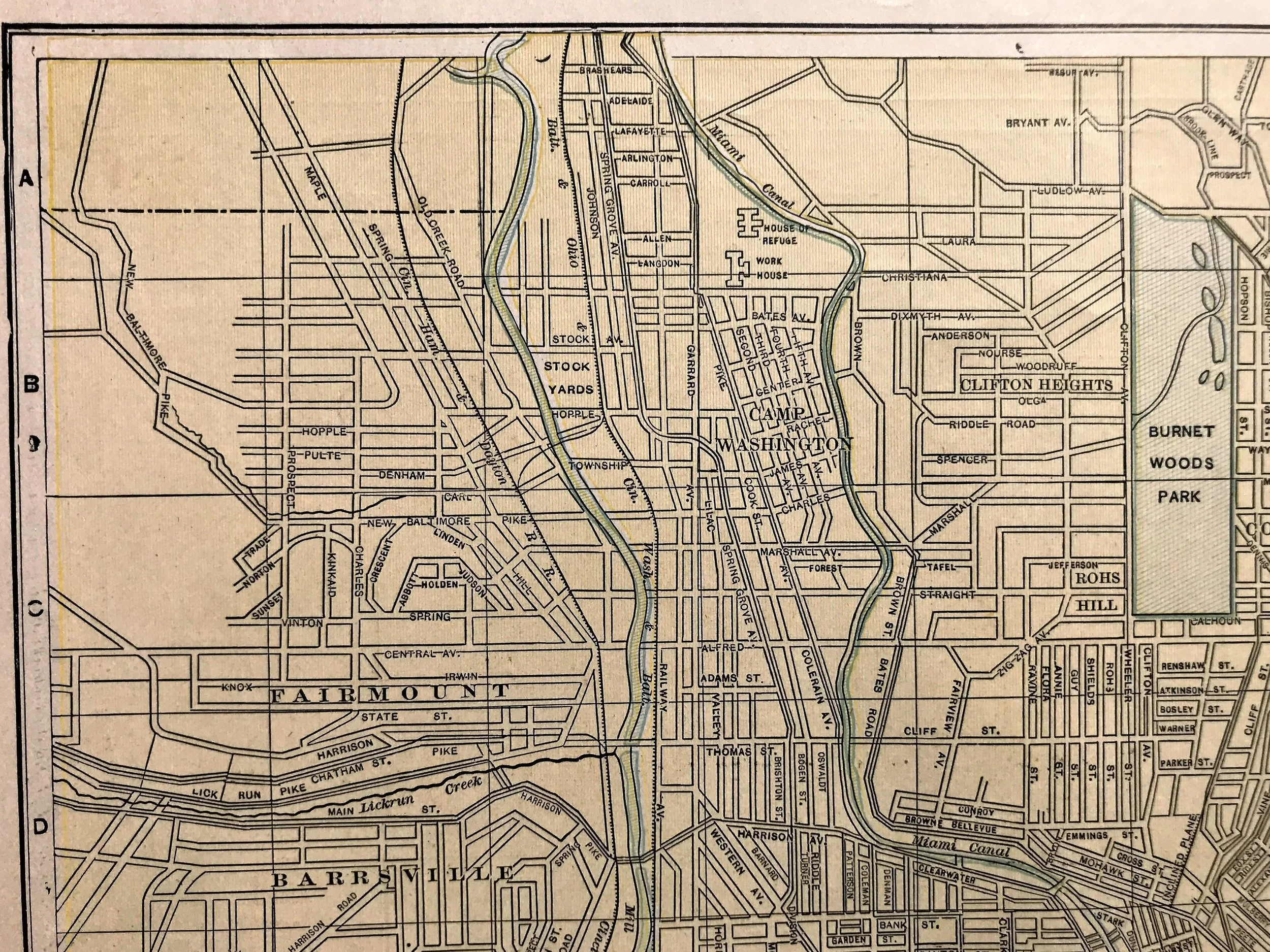
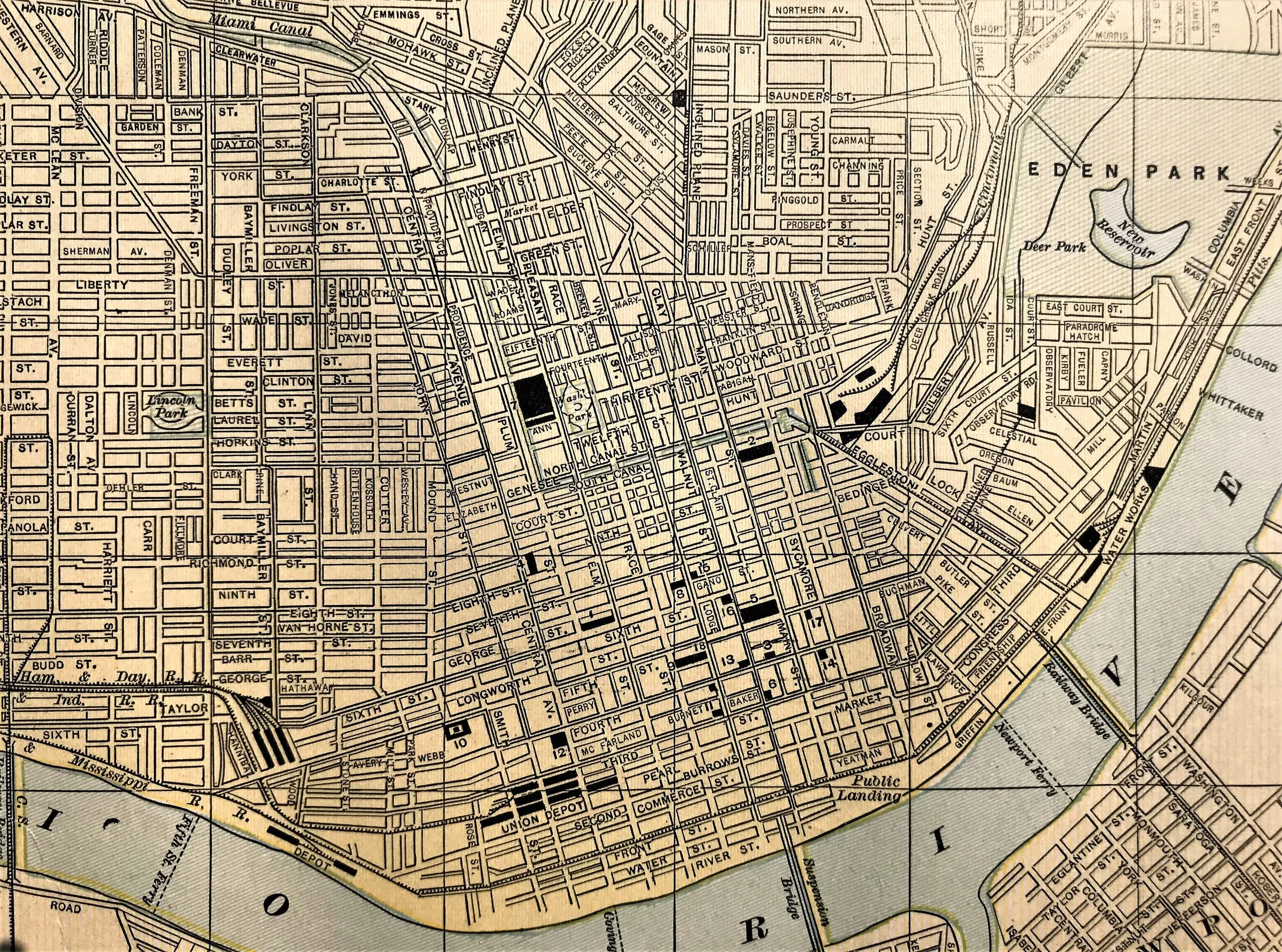
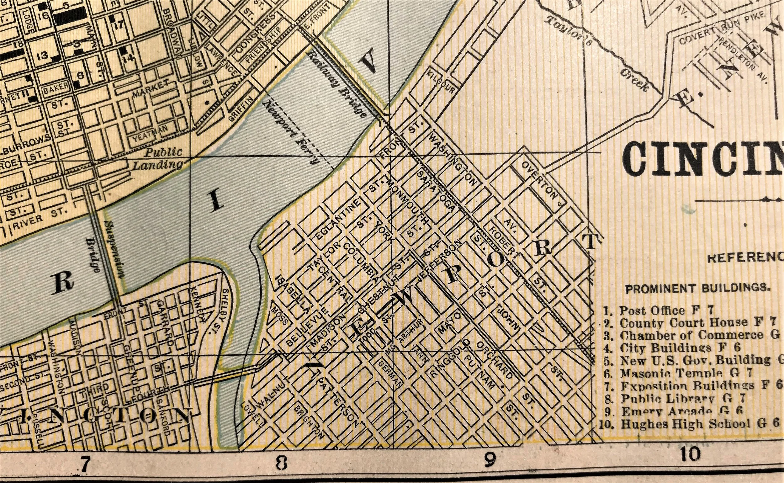
1901 Map of Cincinnati
11
1903 Map of Cincinnati
8
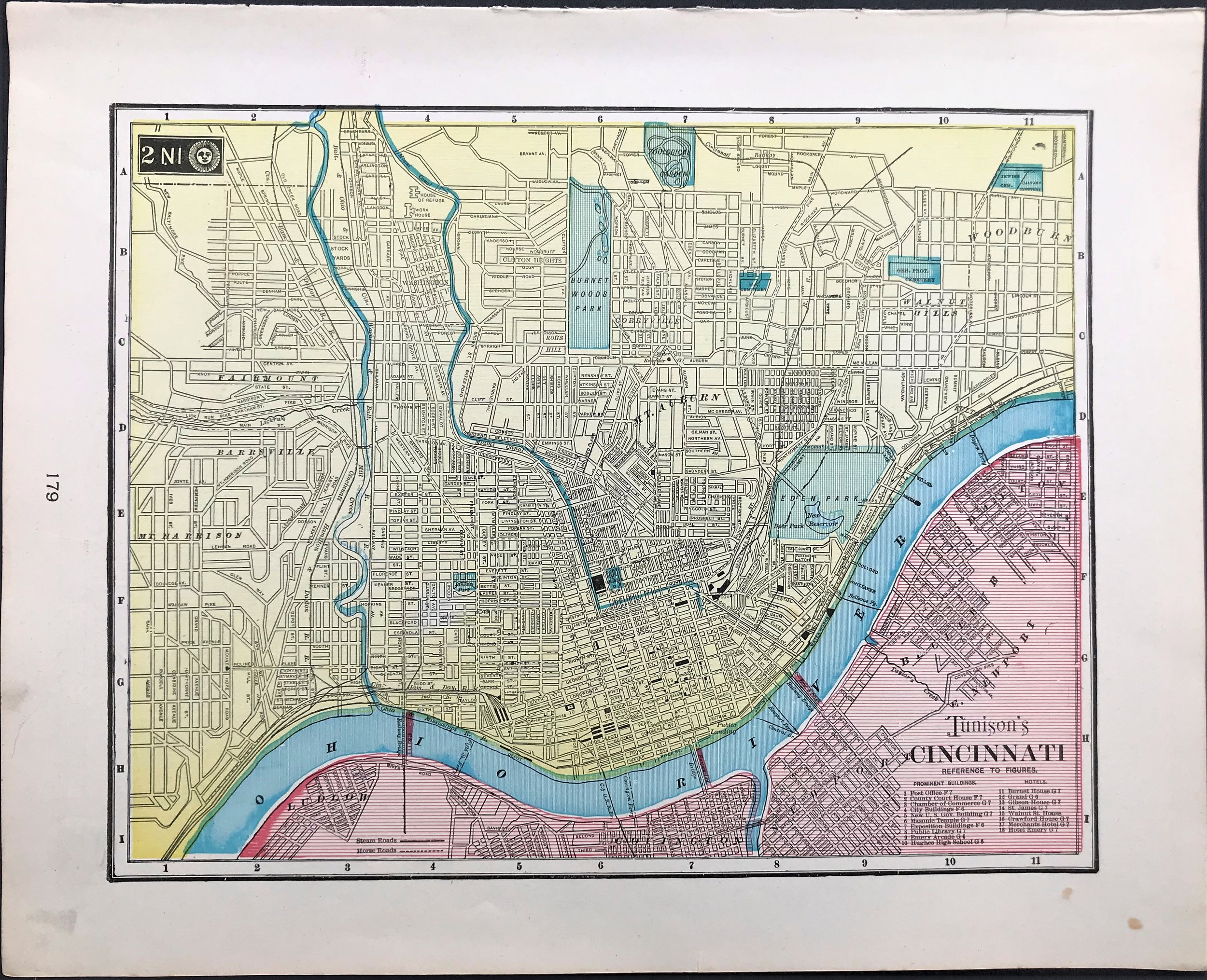
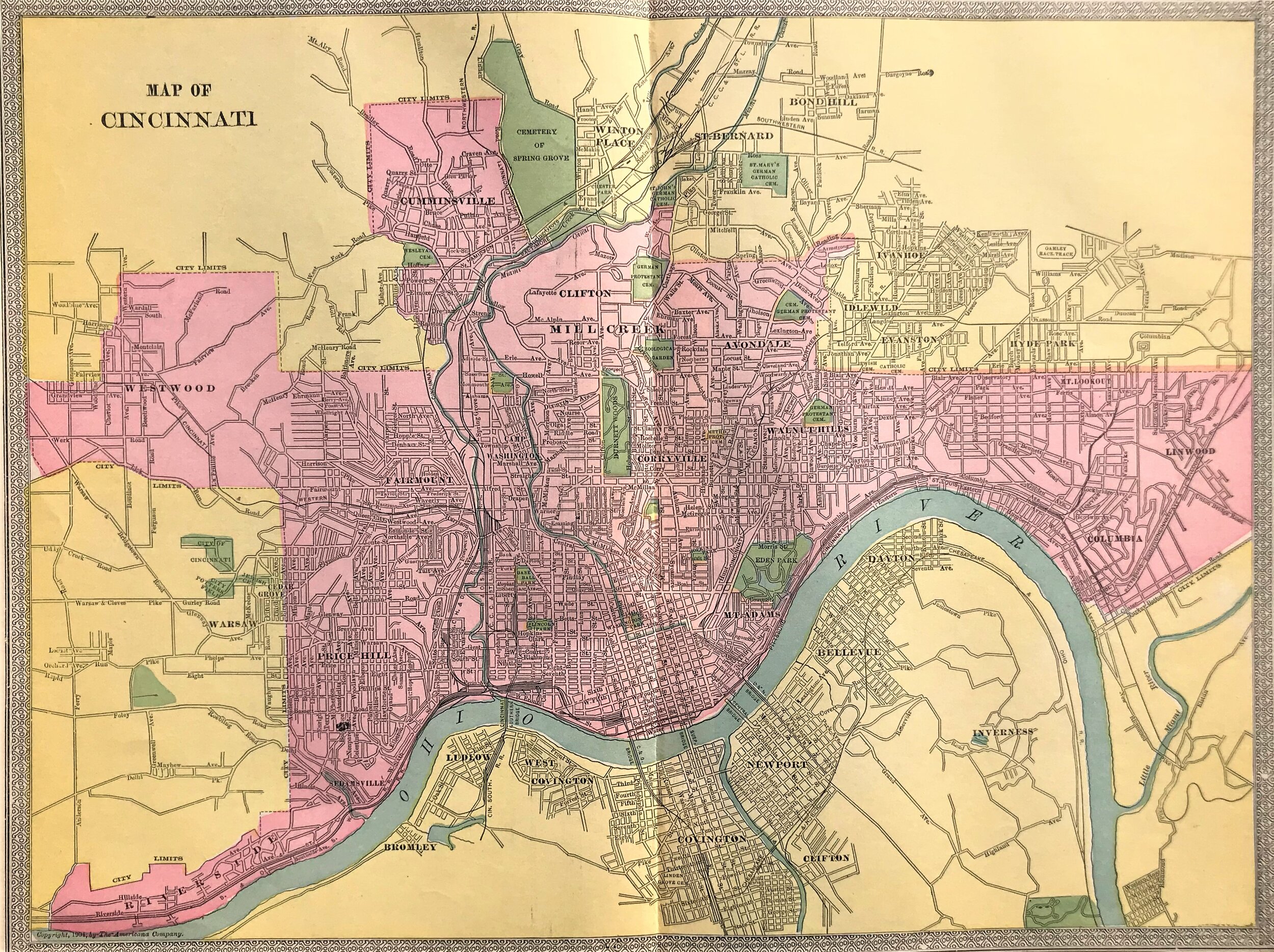
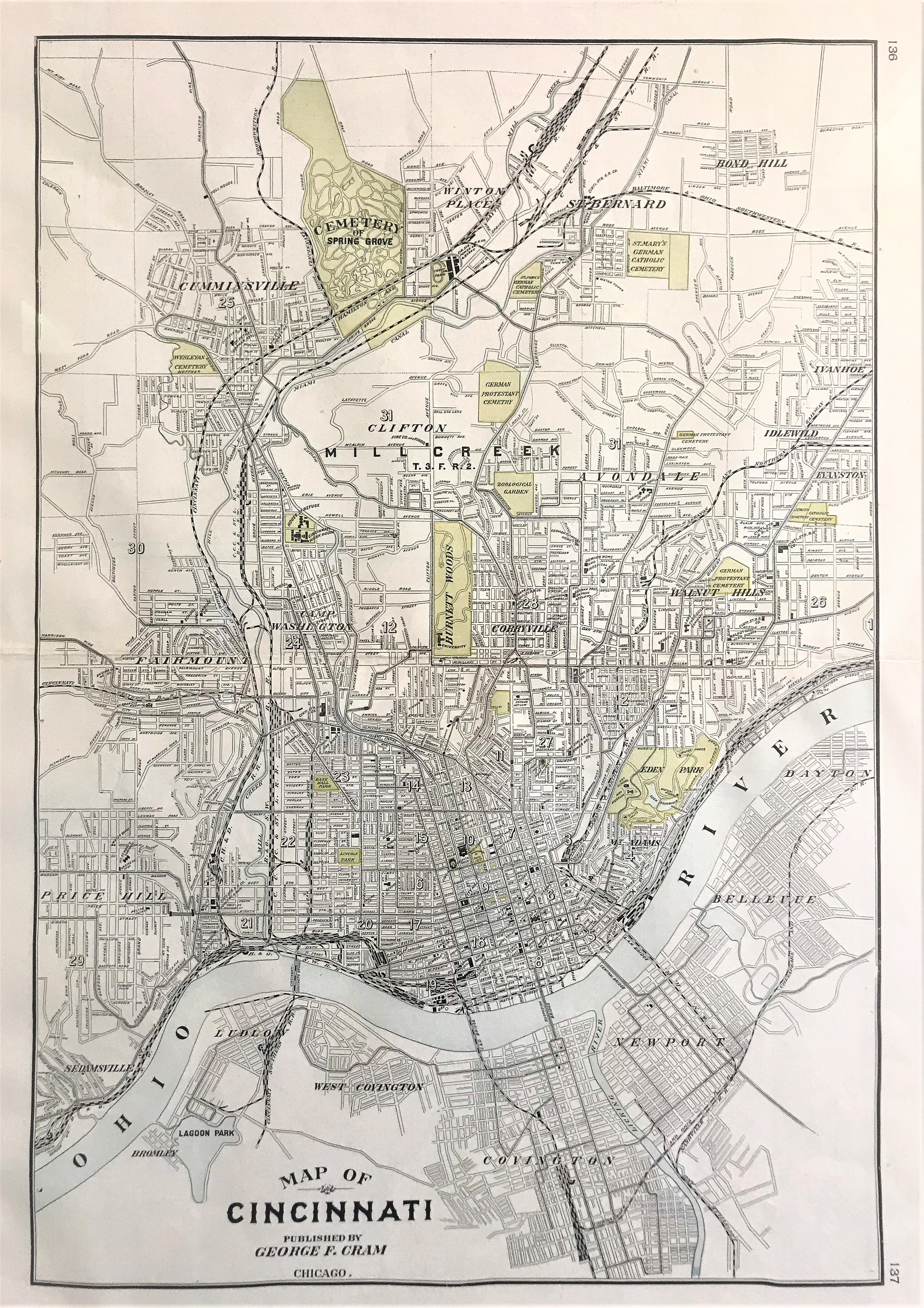
1904 Map of Cincinnati. Americana Co.
6
1904 Map of Cincinnati
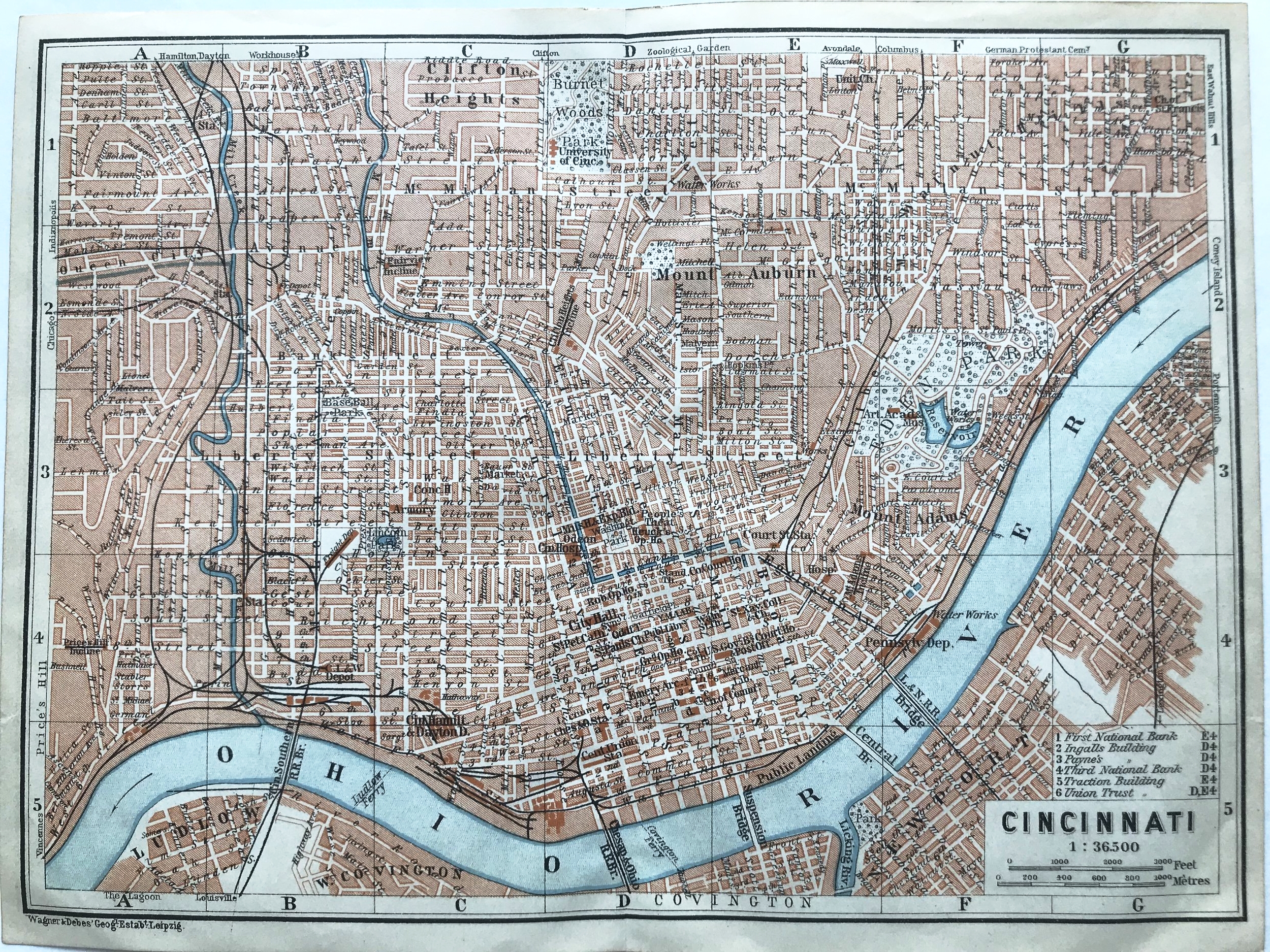
10
1906 Map of Cincinnati
1
1909 Map of Cincinnati
10
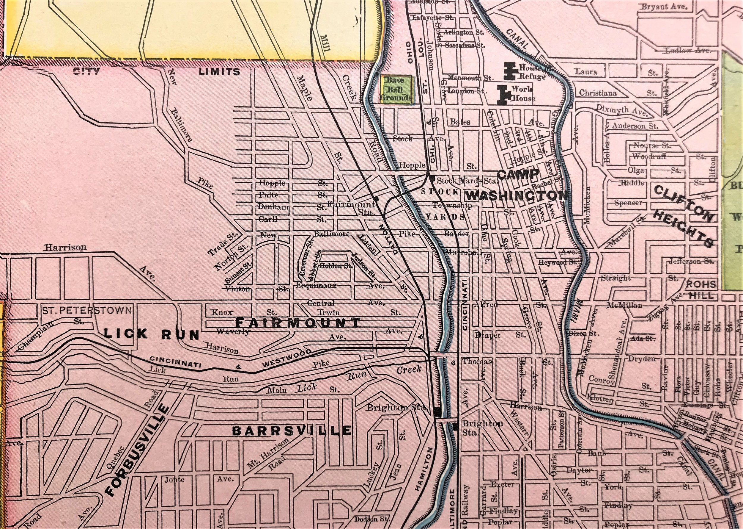
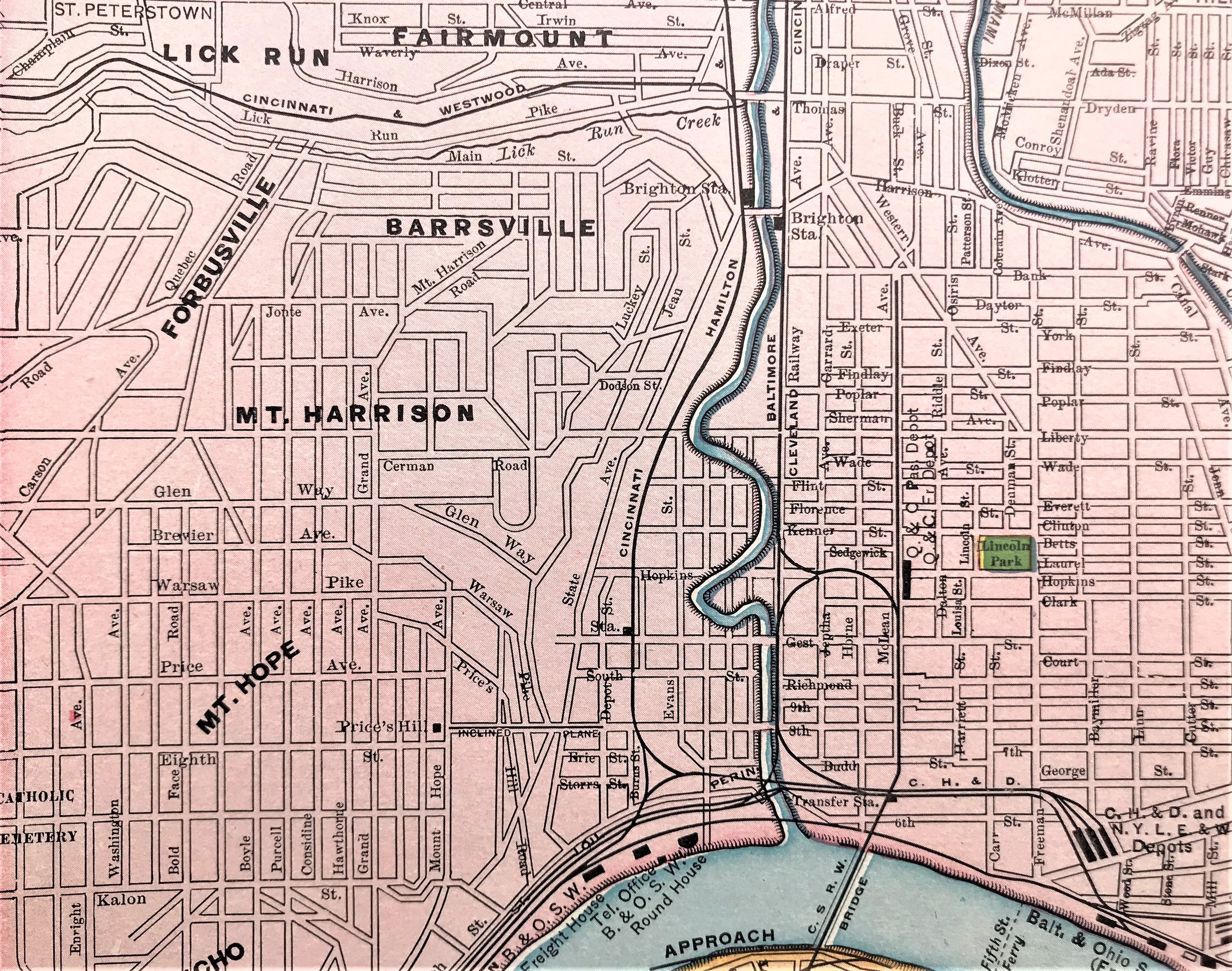
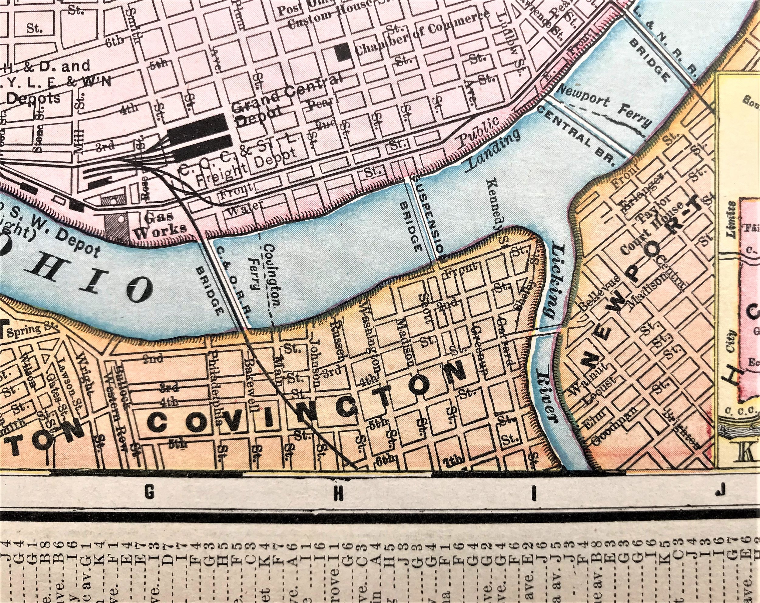
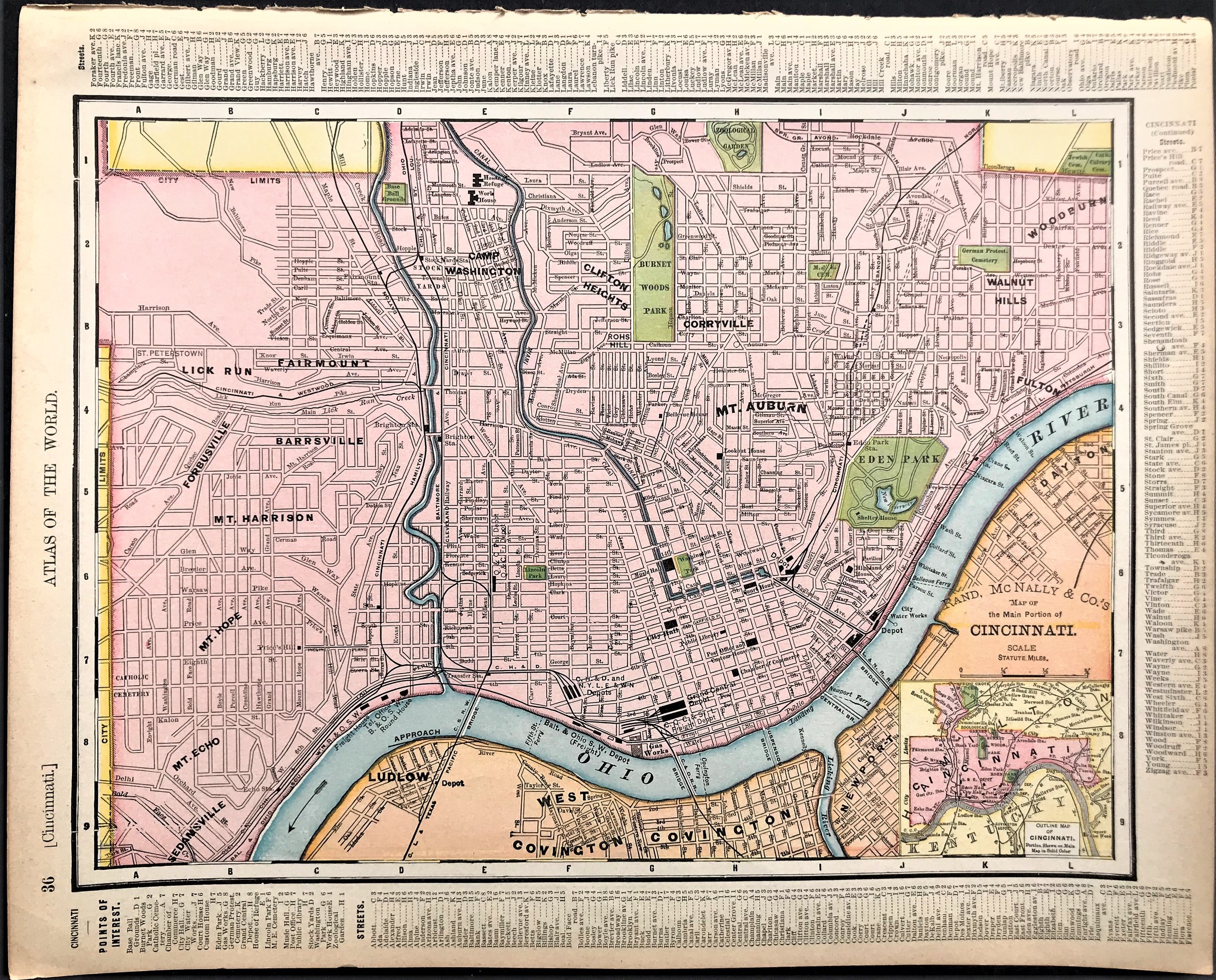
1909 Map of the Main Portion of Cincinnati
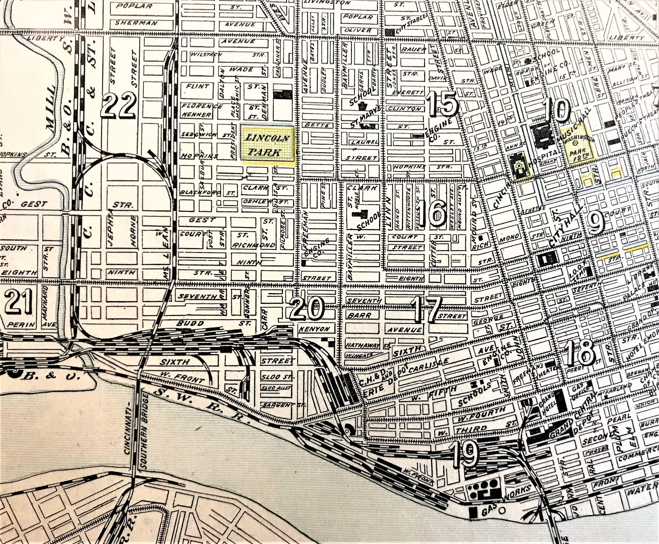
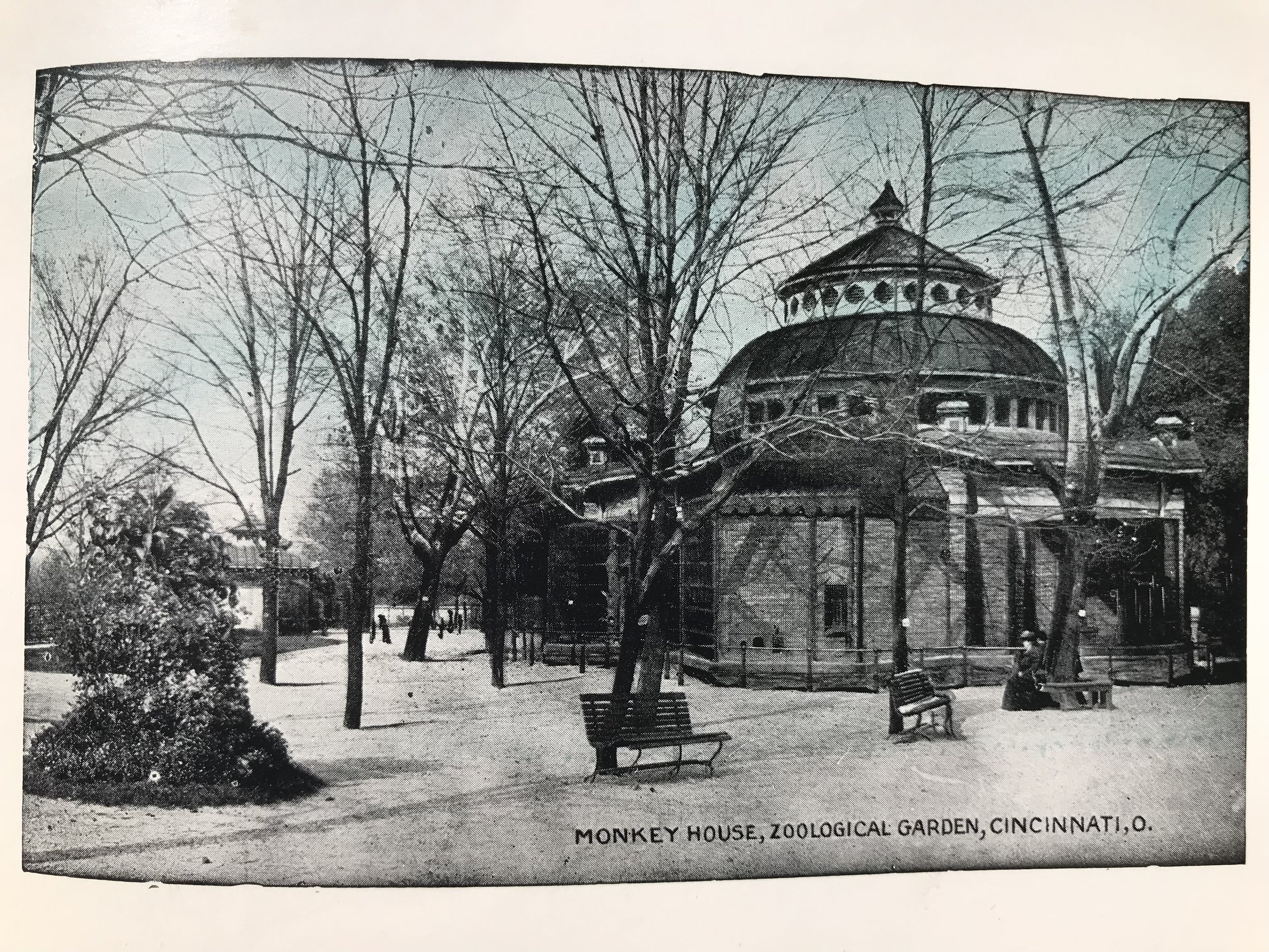
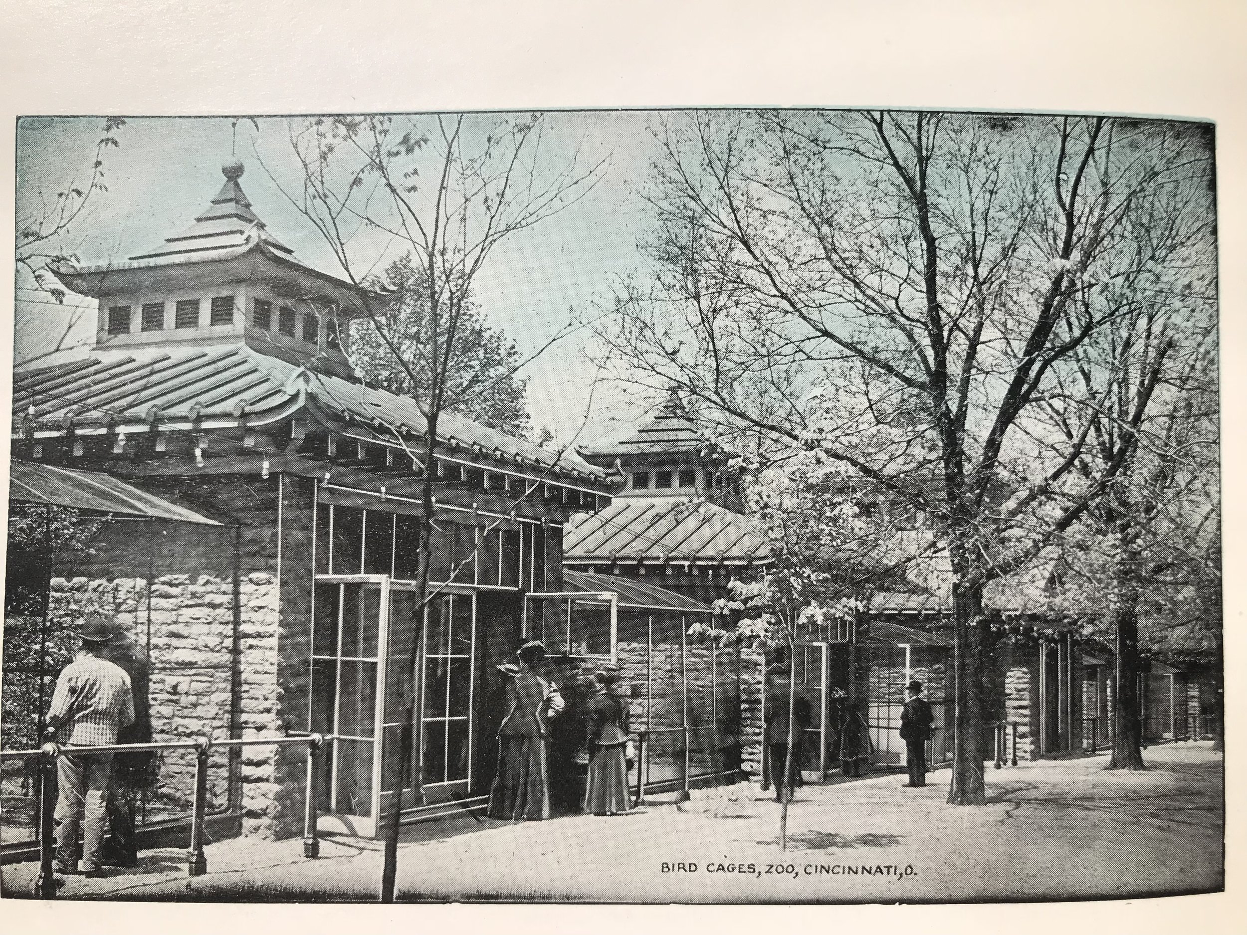
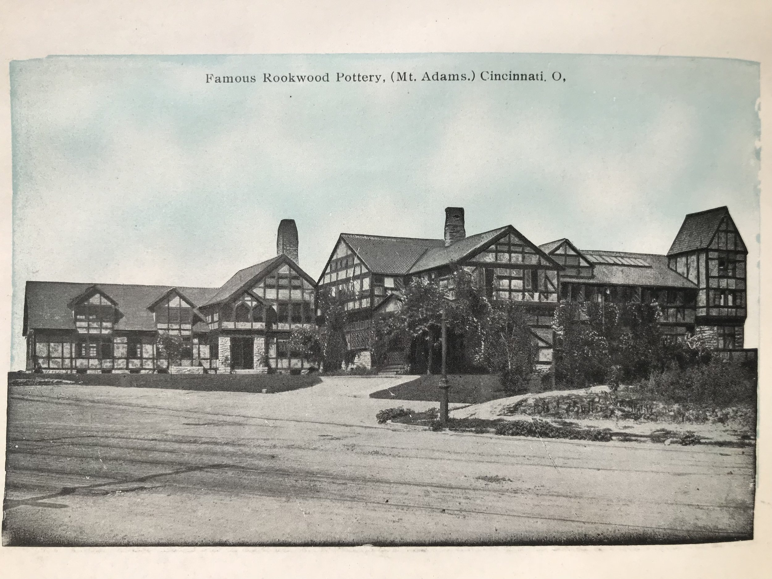
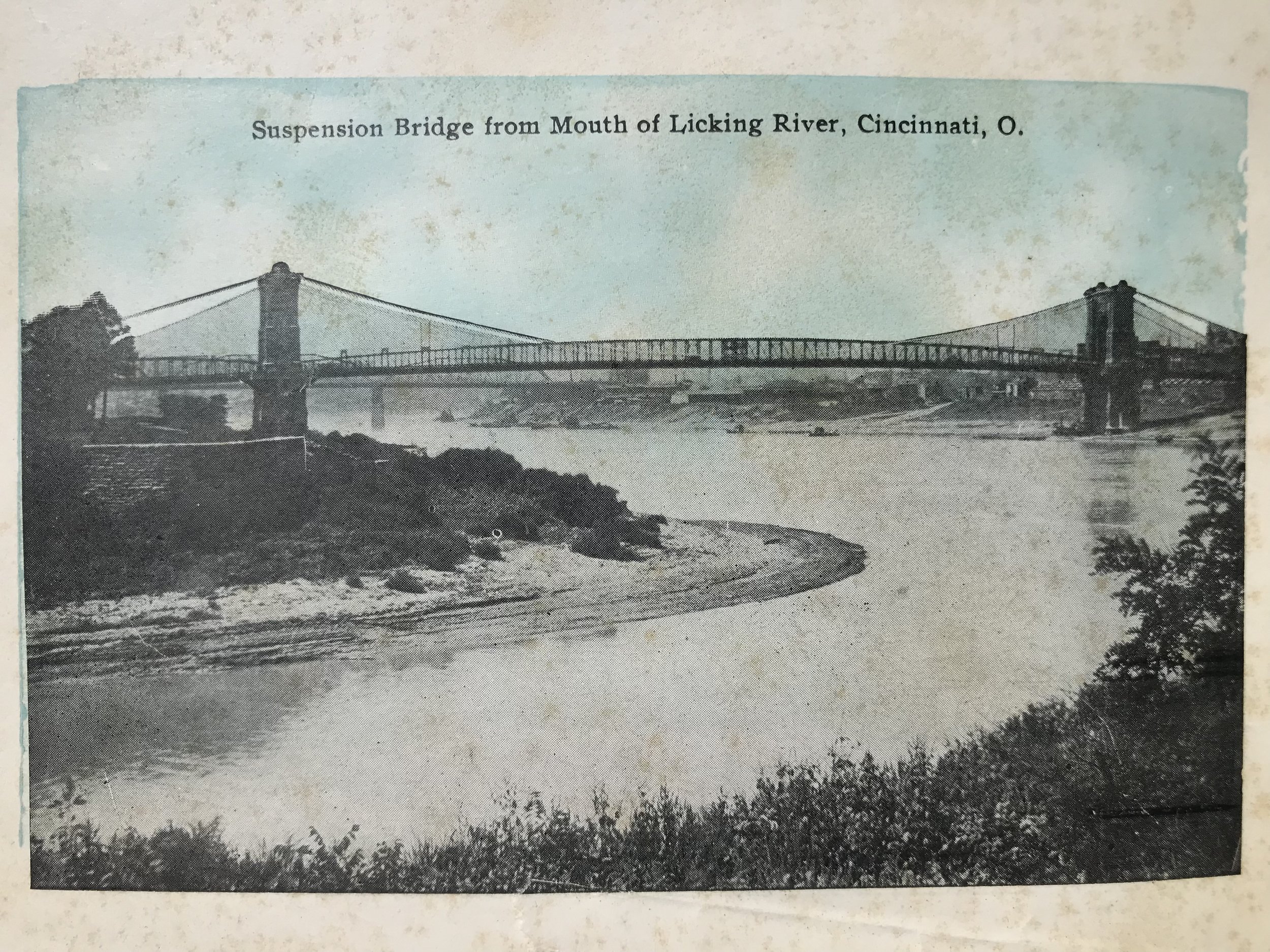
37
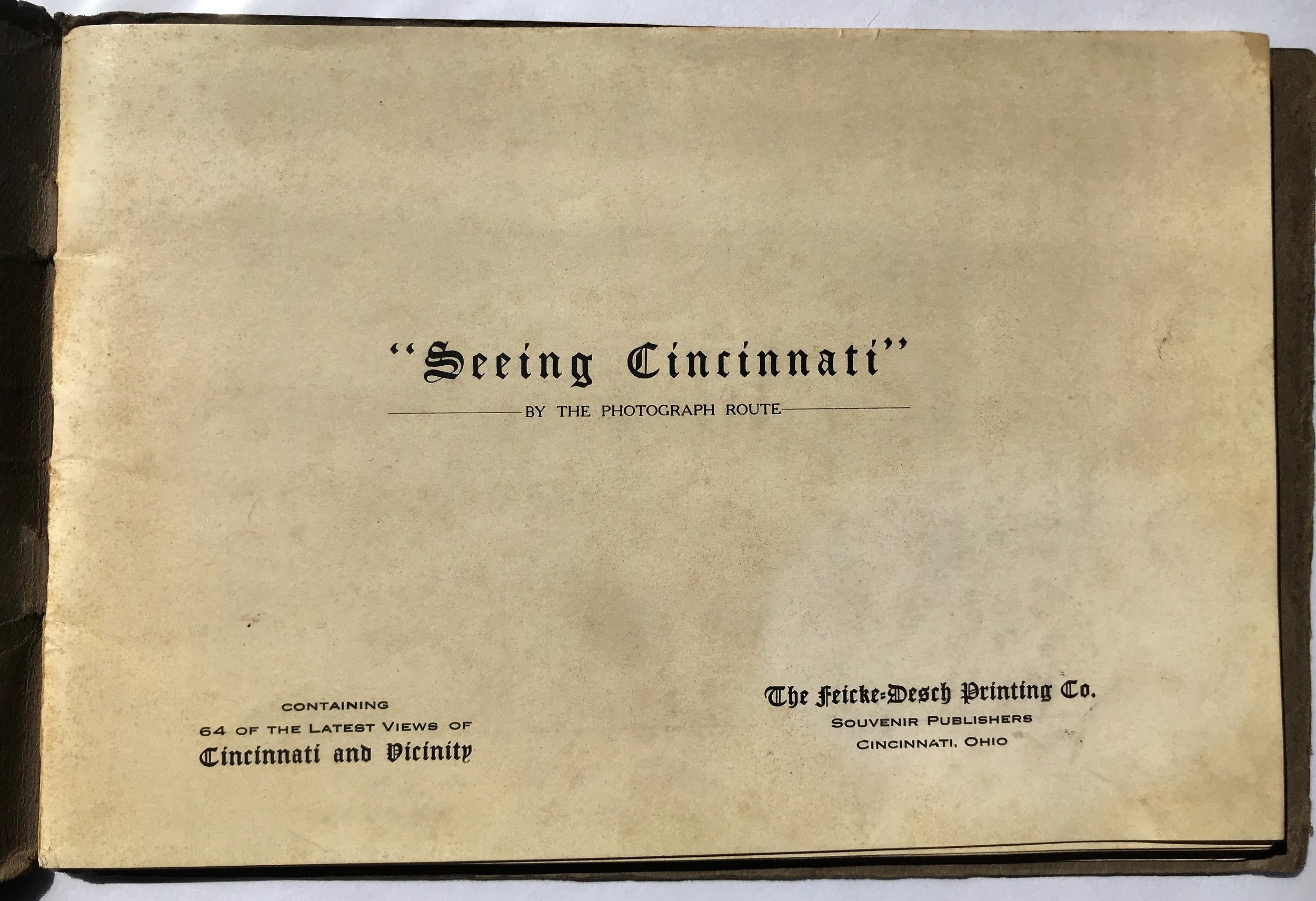
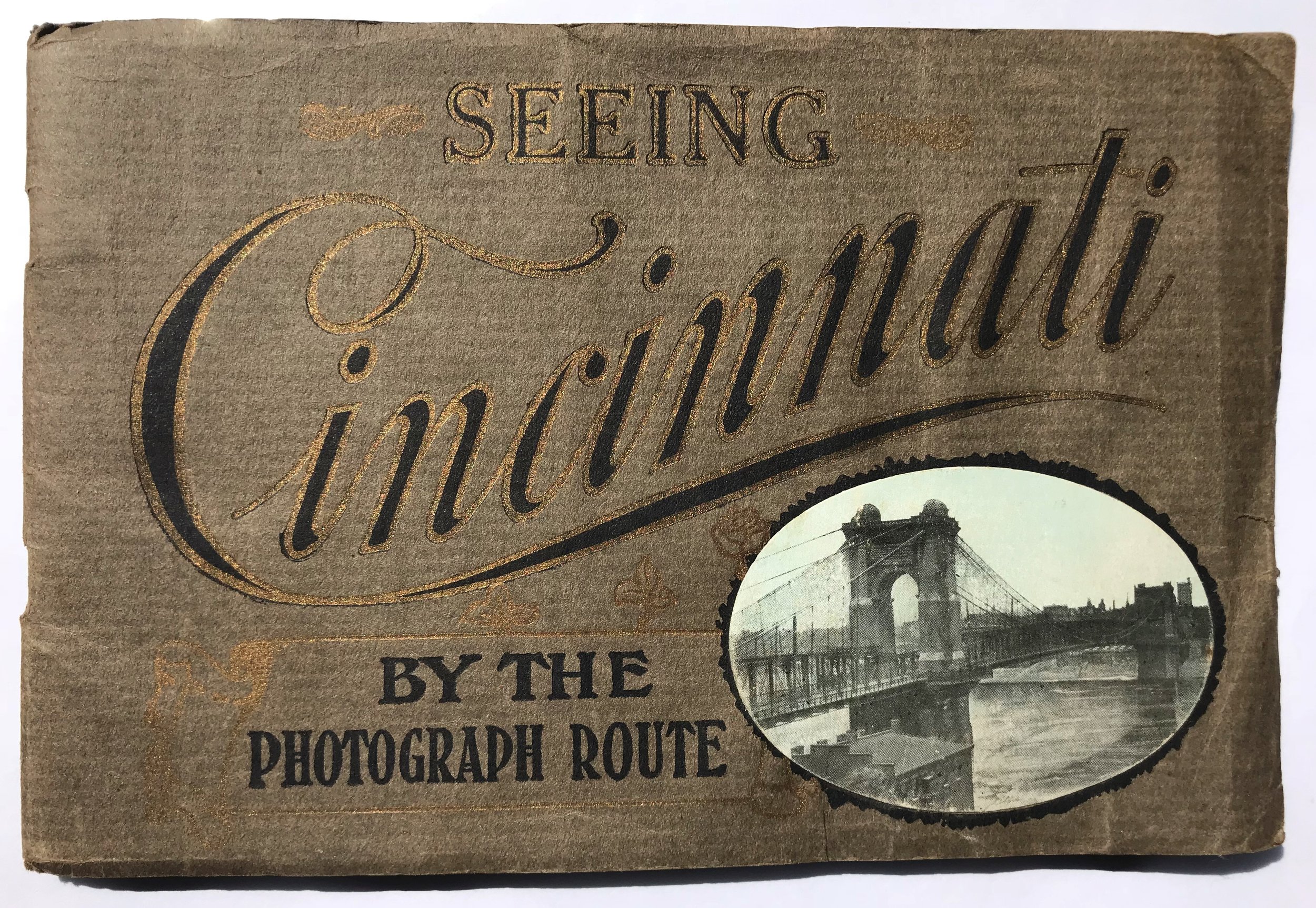
1910 "Seeing Cincinnati" by the Photograph Route
7
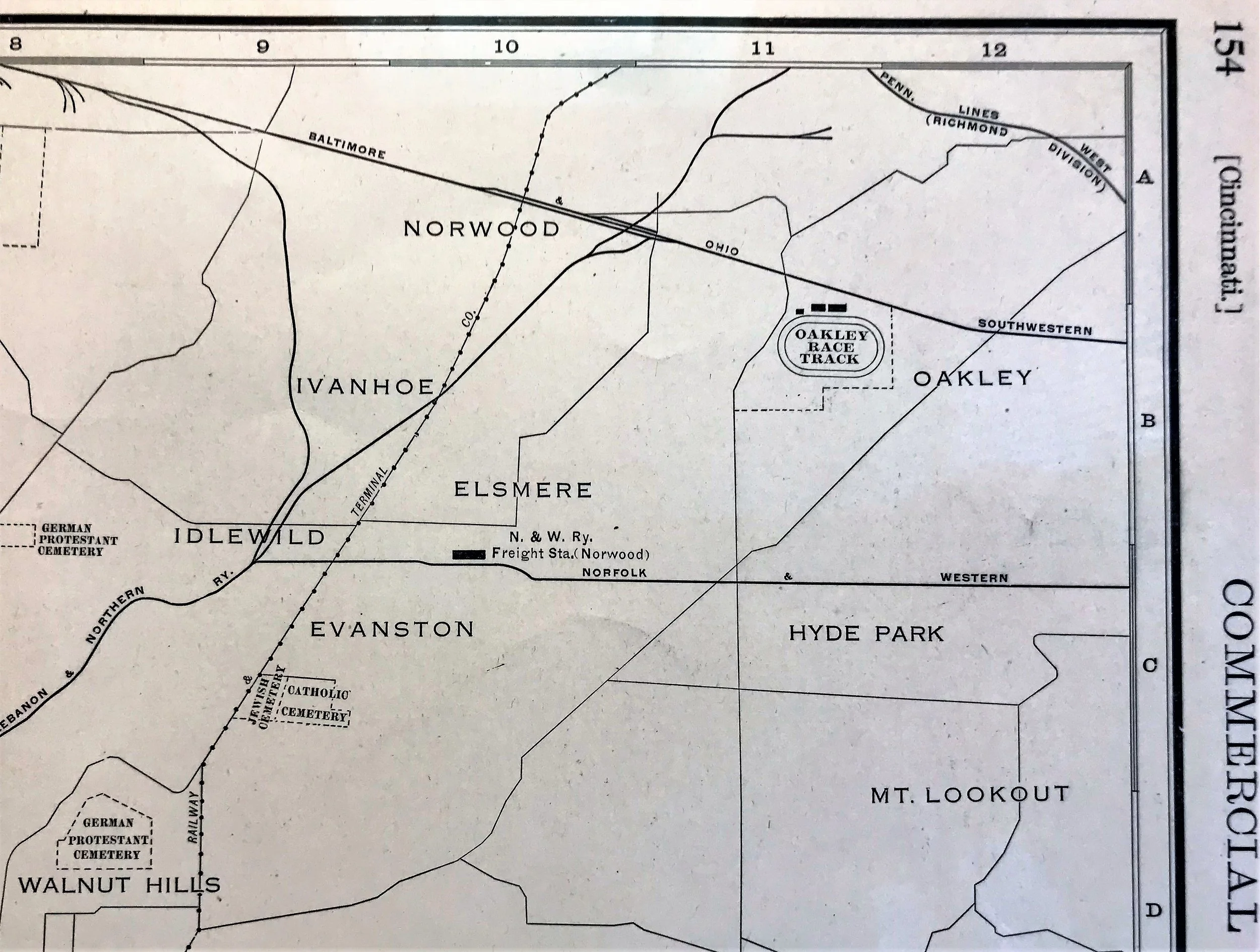
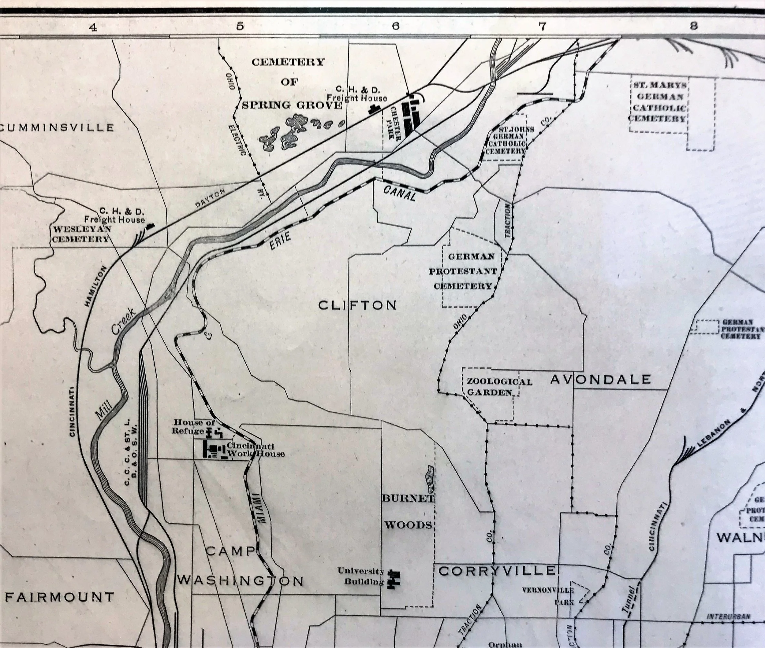
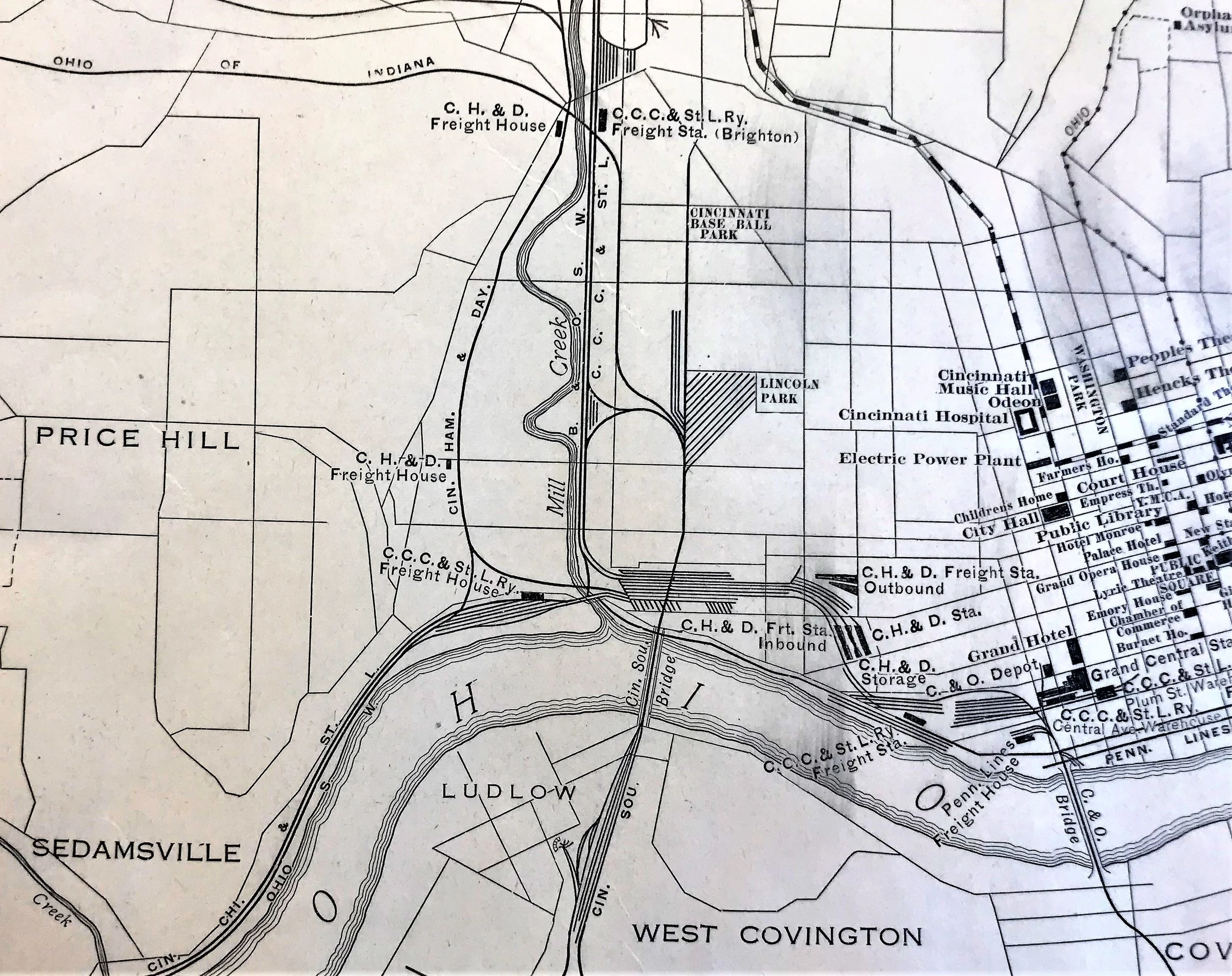
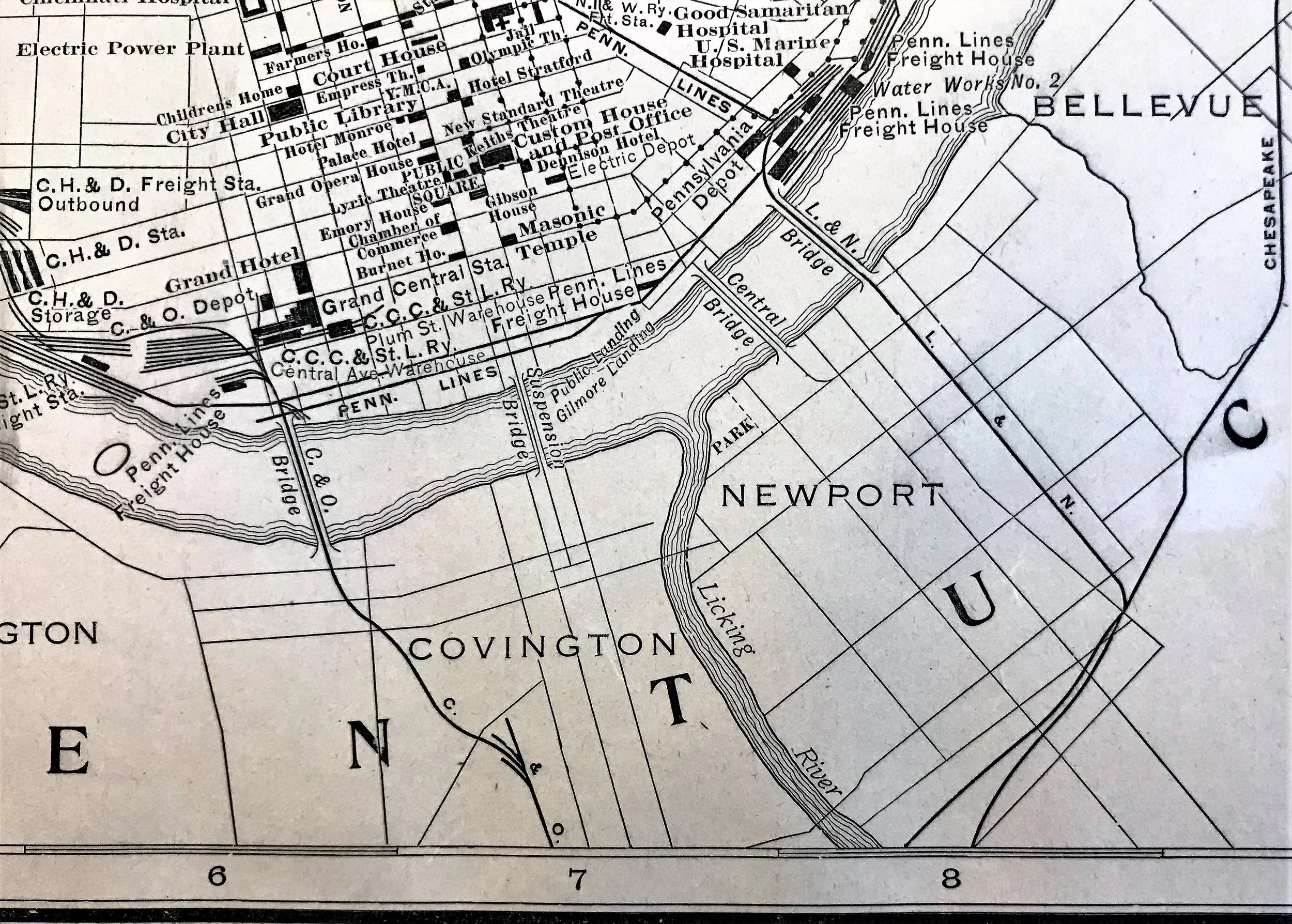
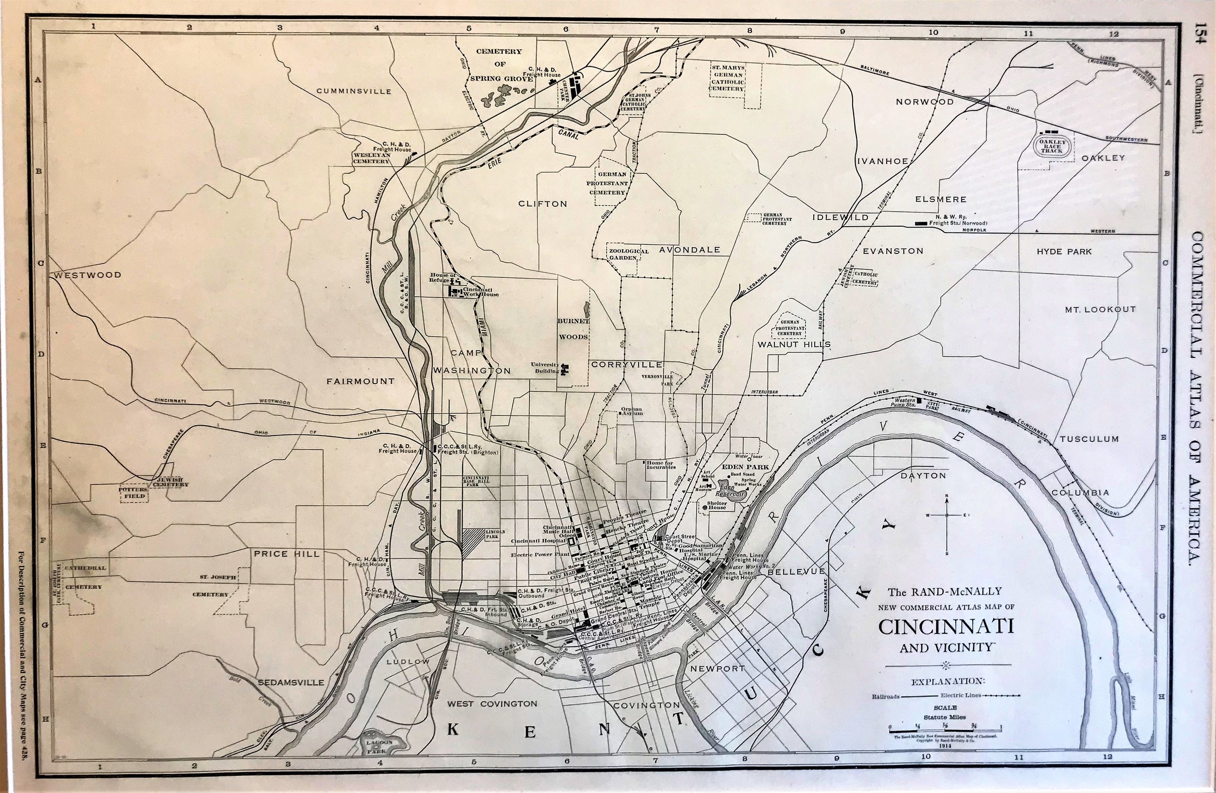
1914 Map of Cincinnati and Vicinity
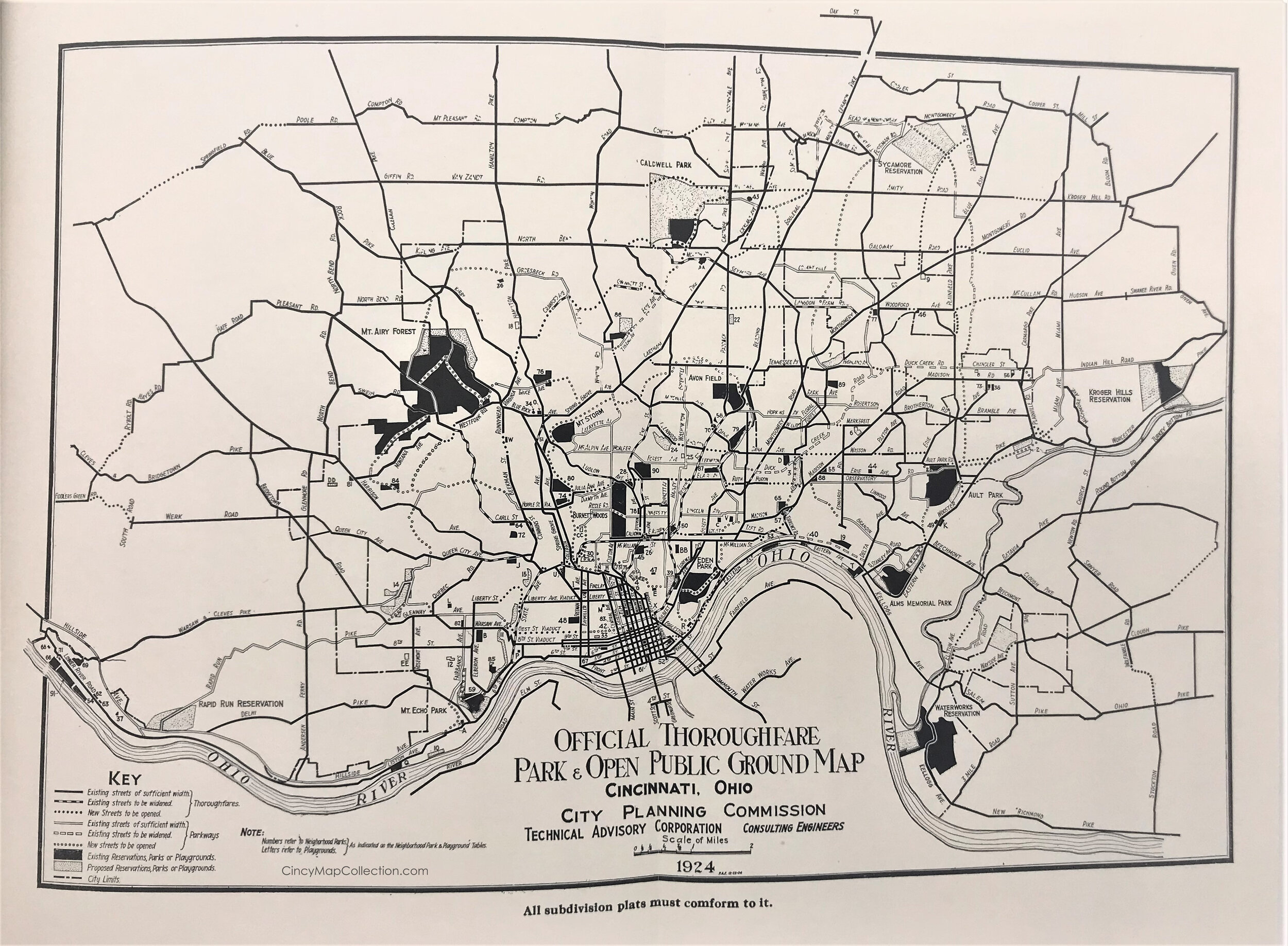
7
1924 Park & Public Ground Map, Cincinnati, OH
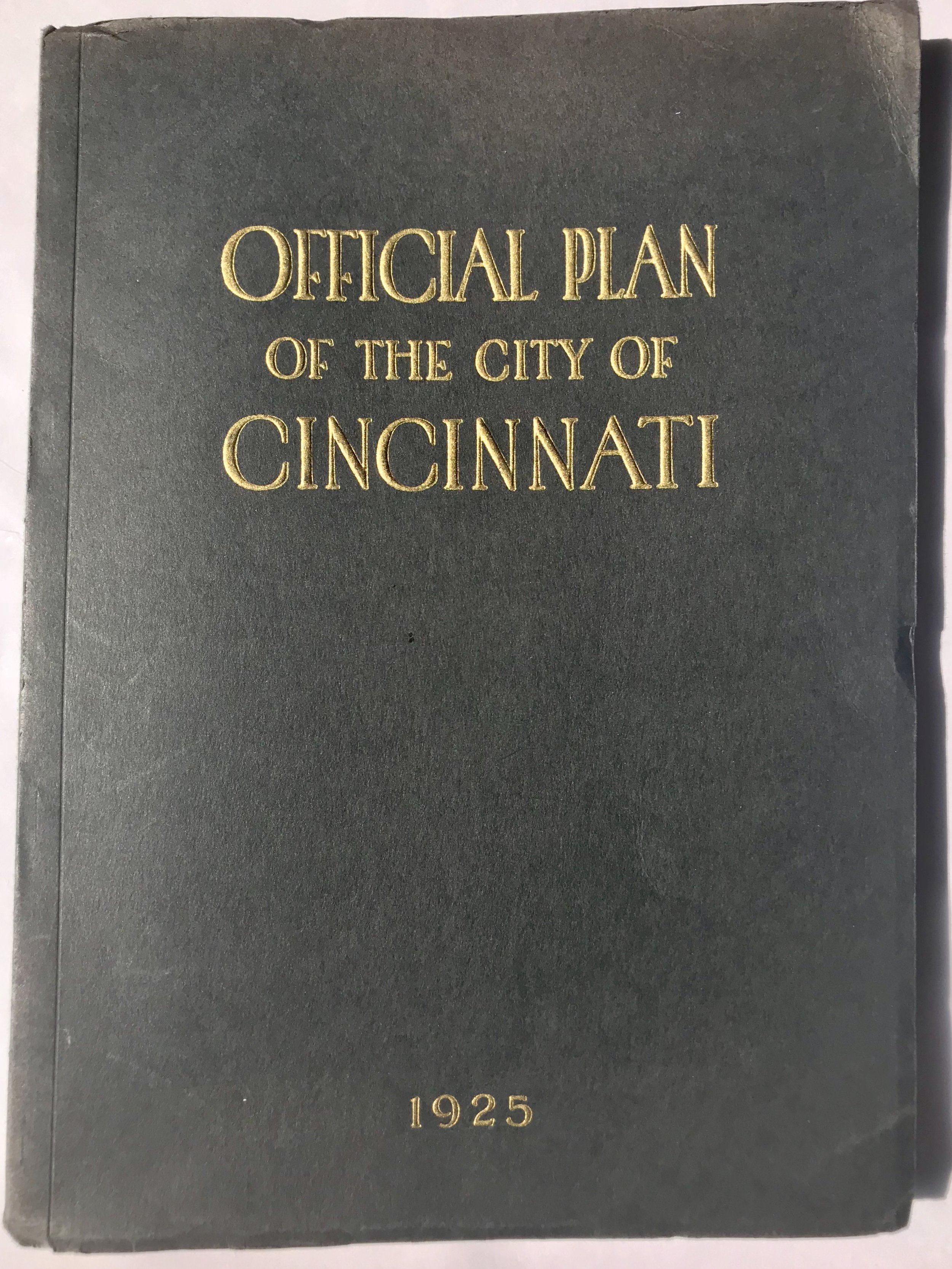
16
1925 Book: Official Plan of The City of Cincinnati
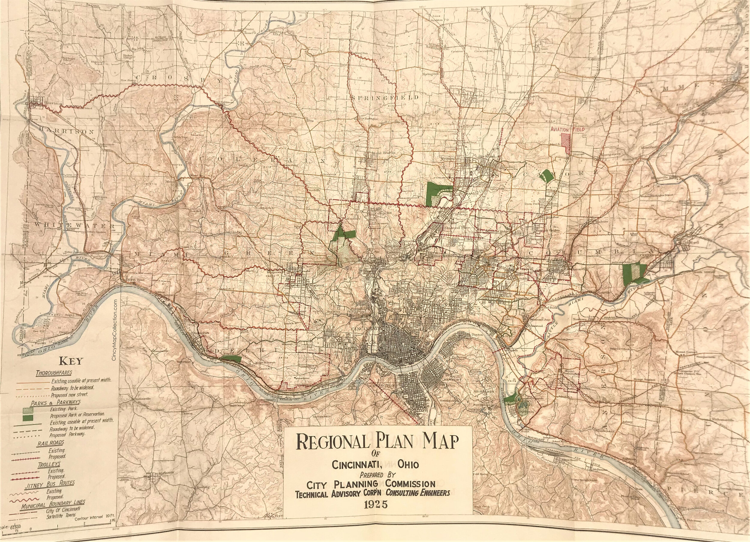
10
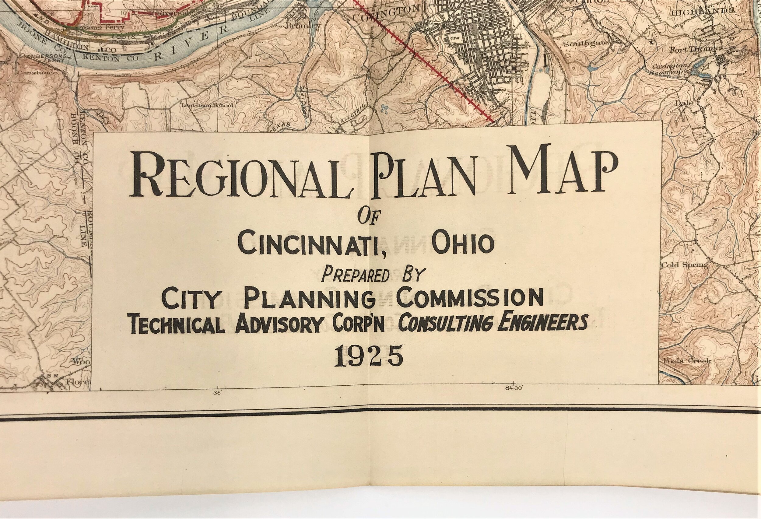
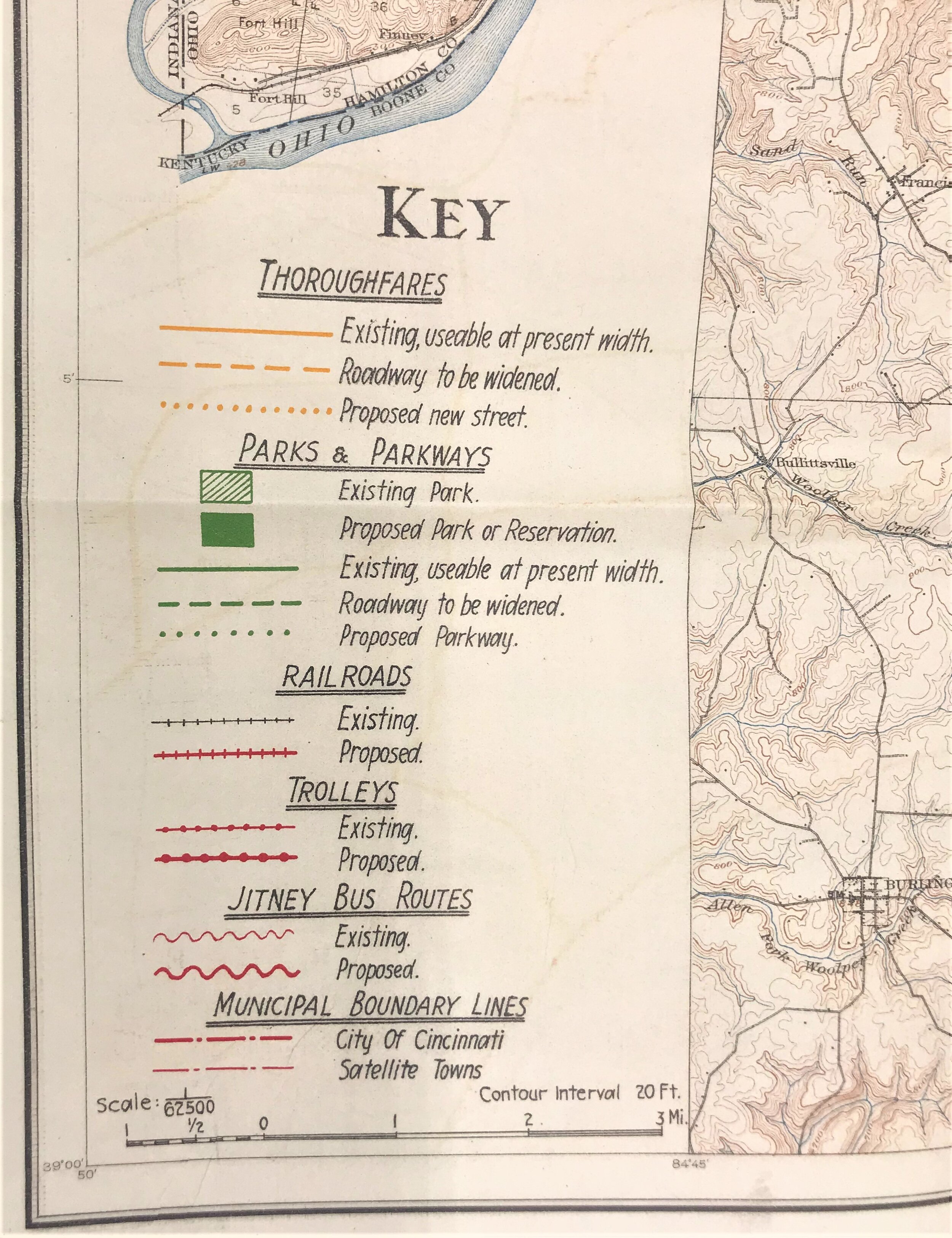
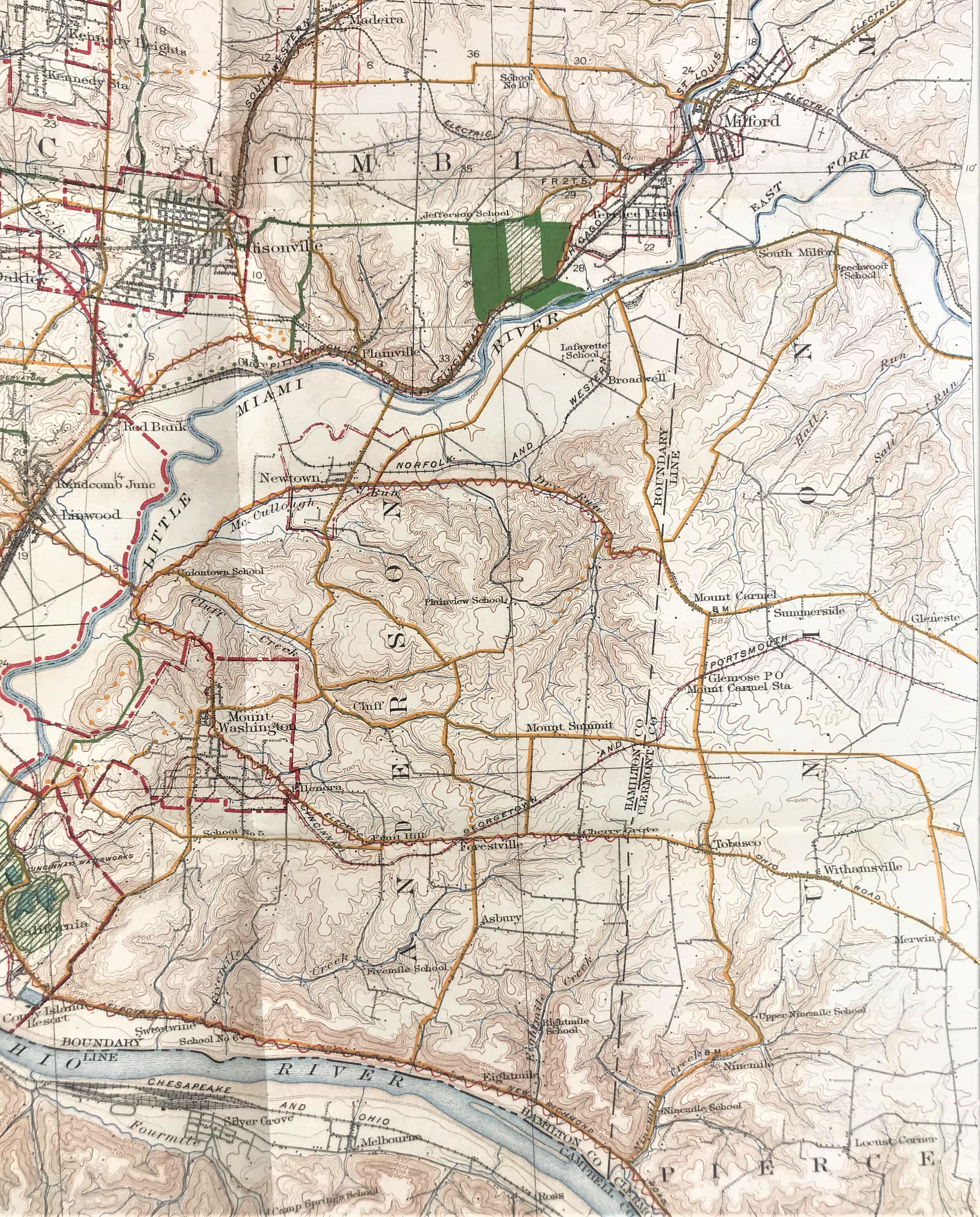
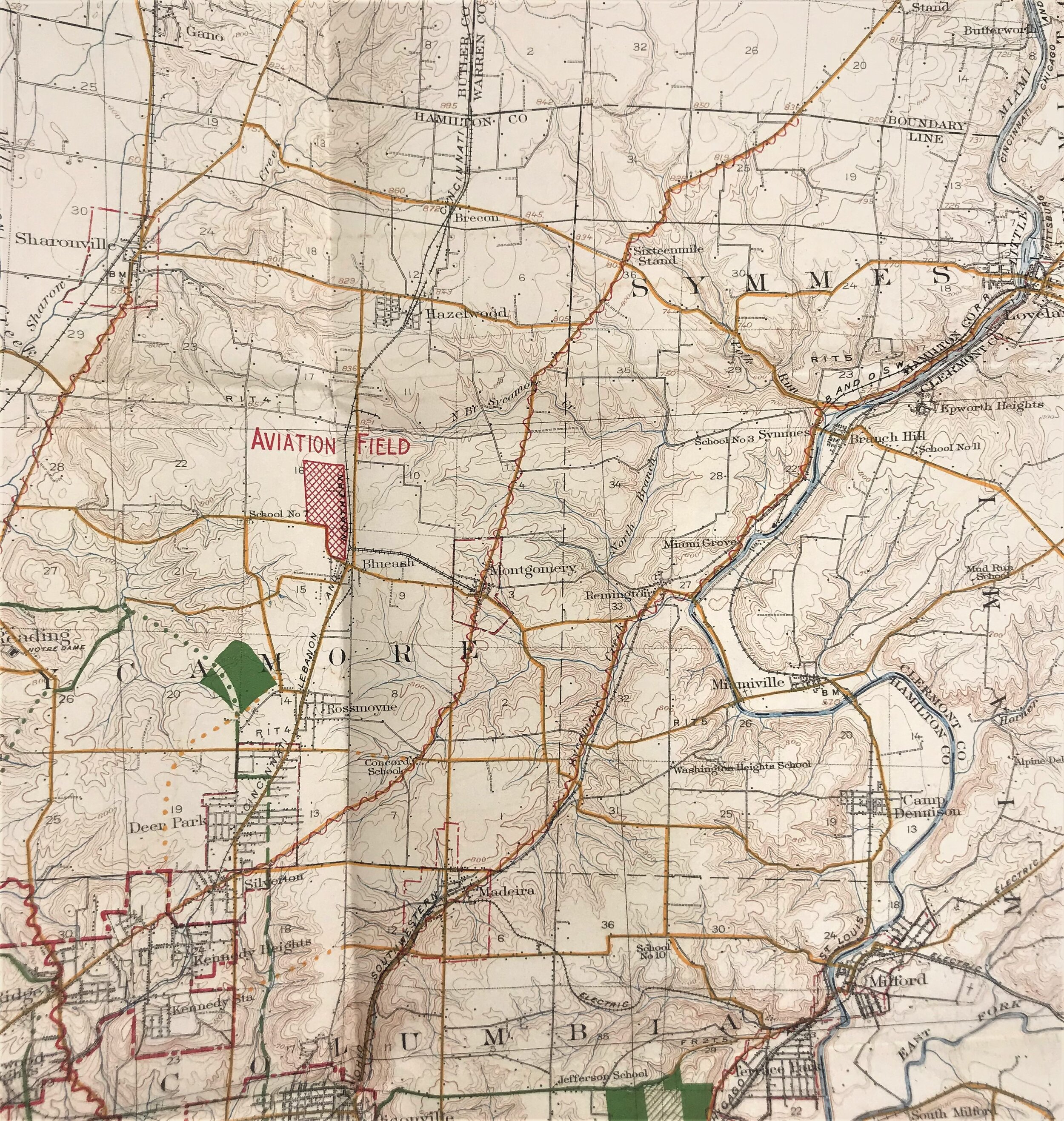
1925 Regional Plan of Cincinnati
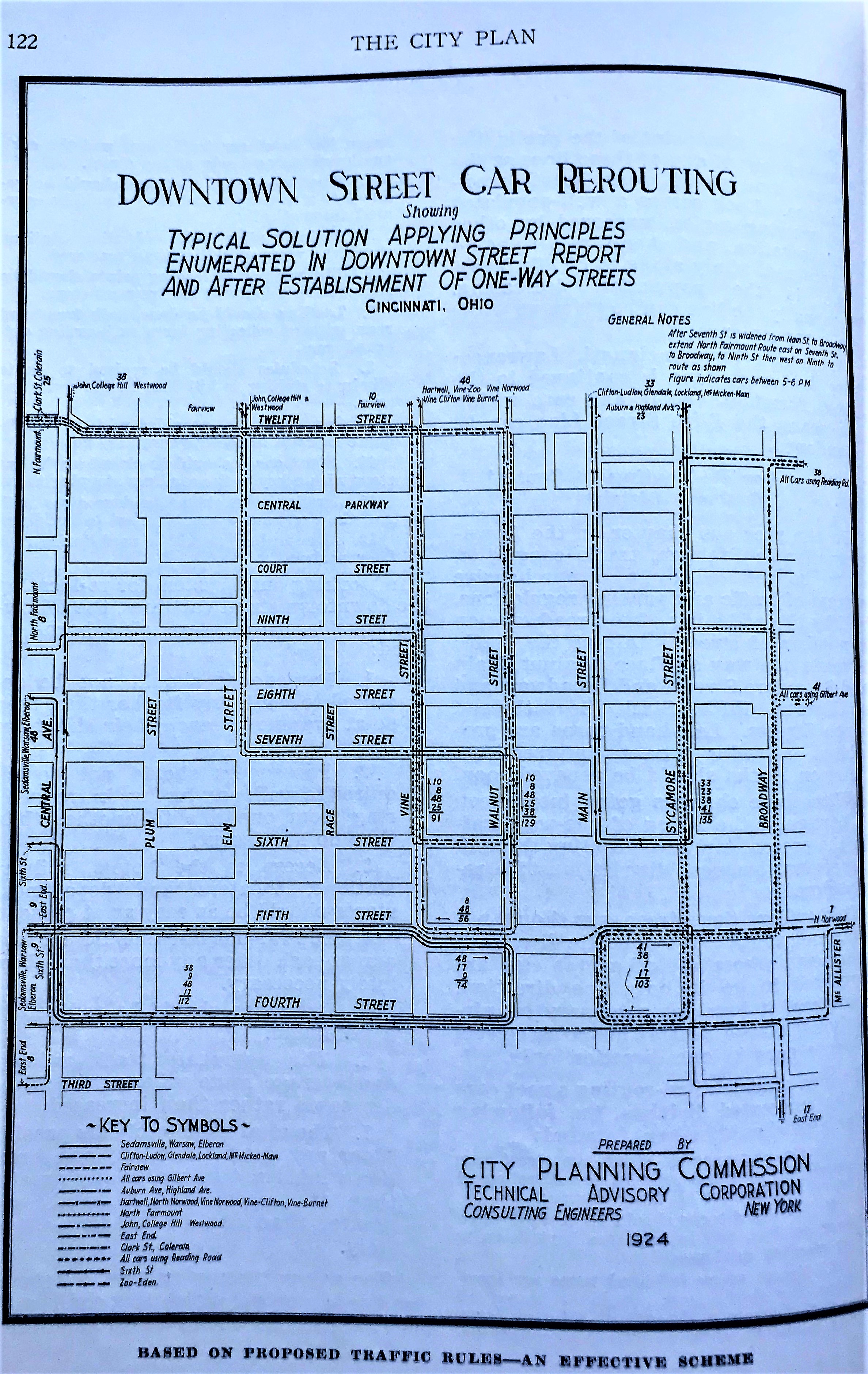
5
1925 Downtown Cincinnati Street Car Rerouting
9
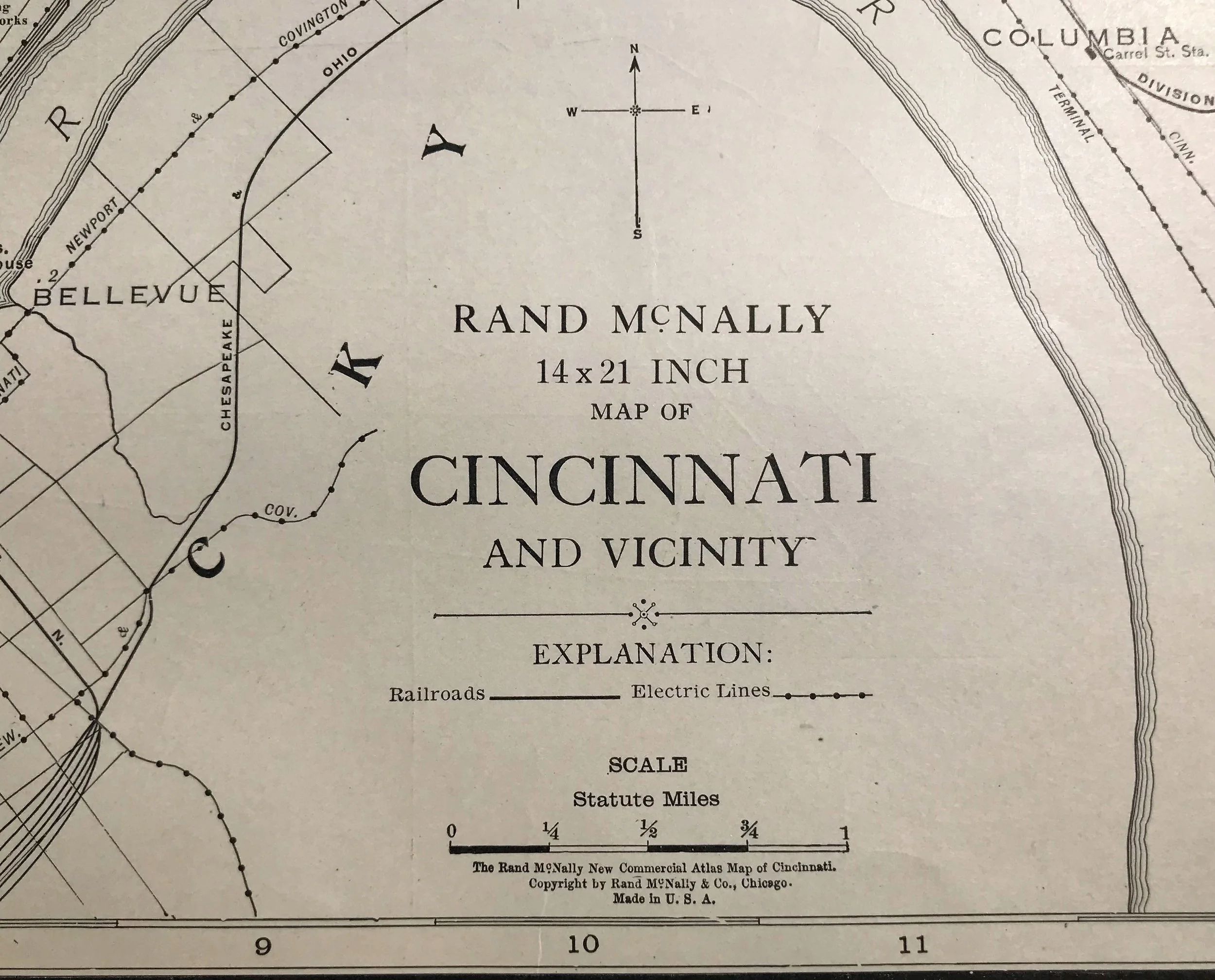
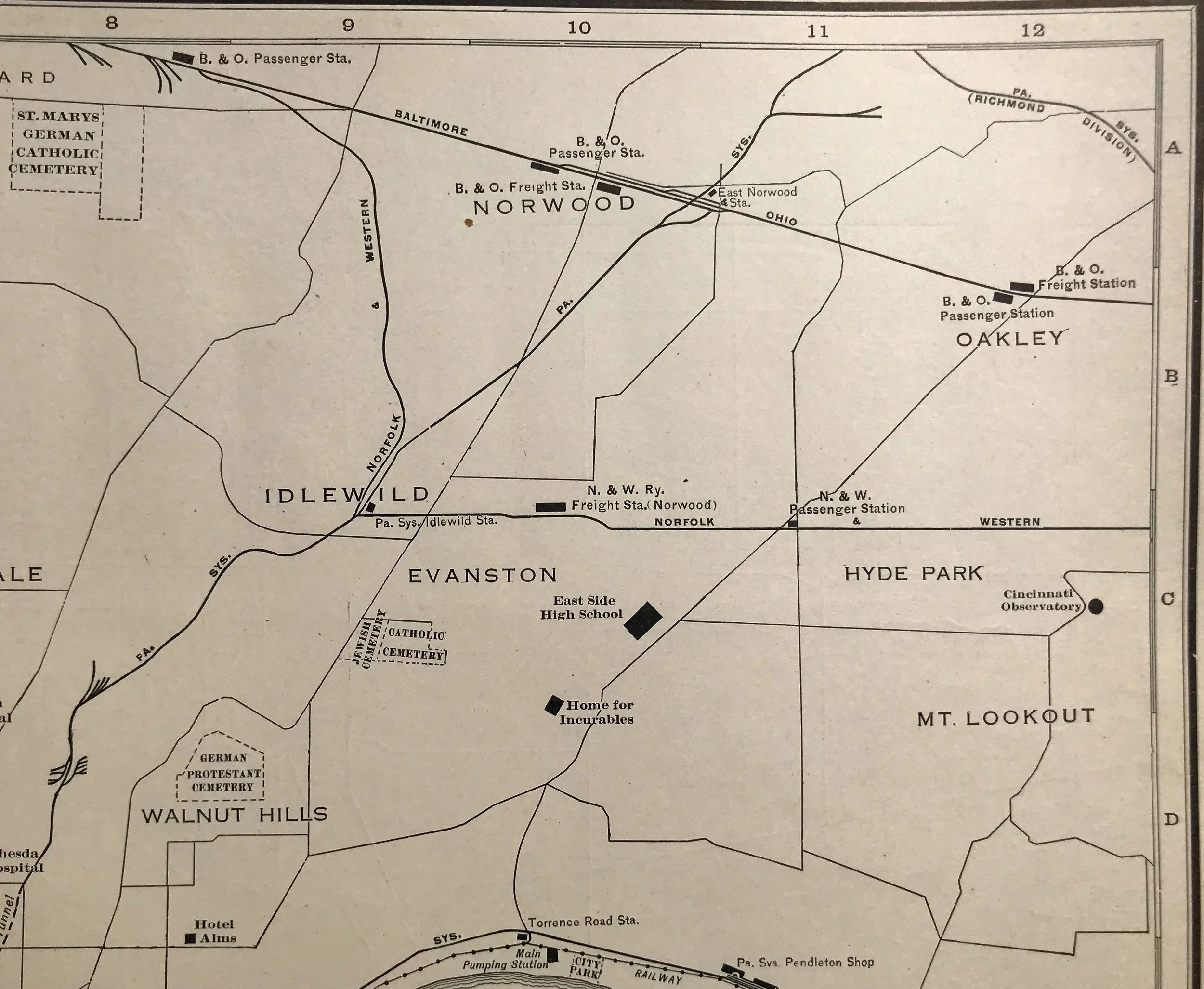
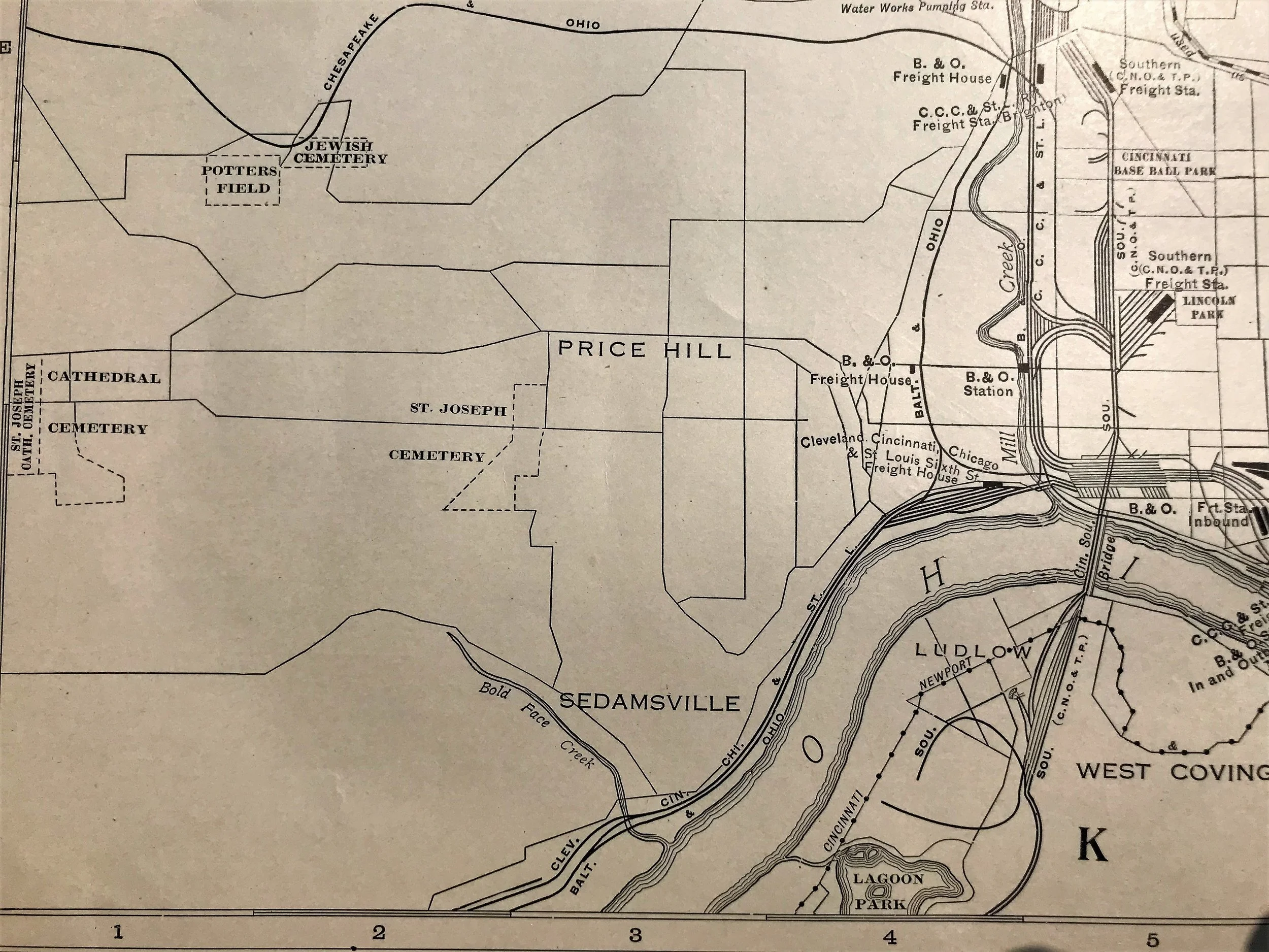
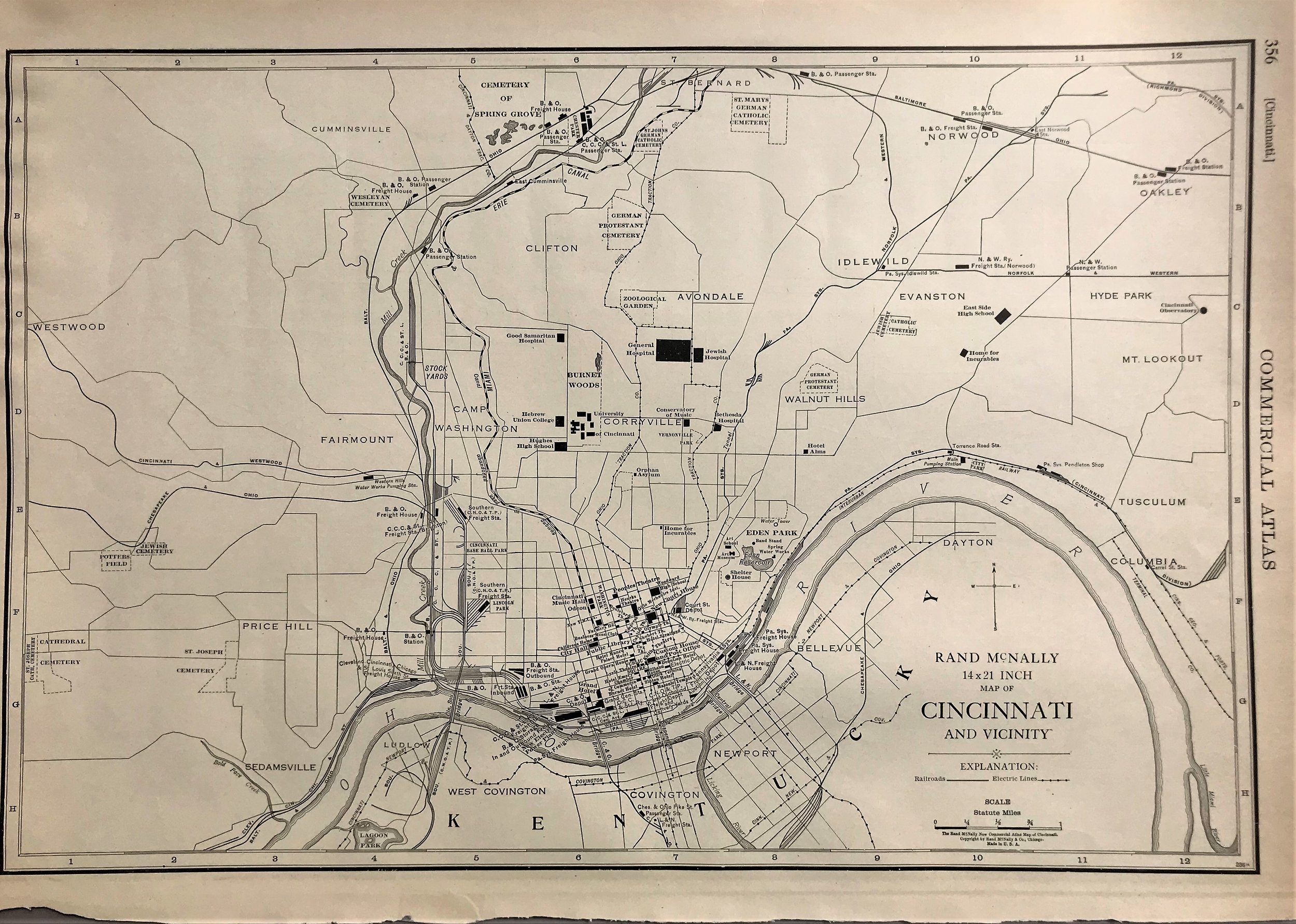
1927 Map of Cincinnati and Vicinity
8
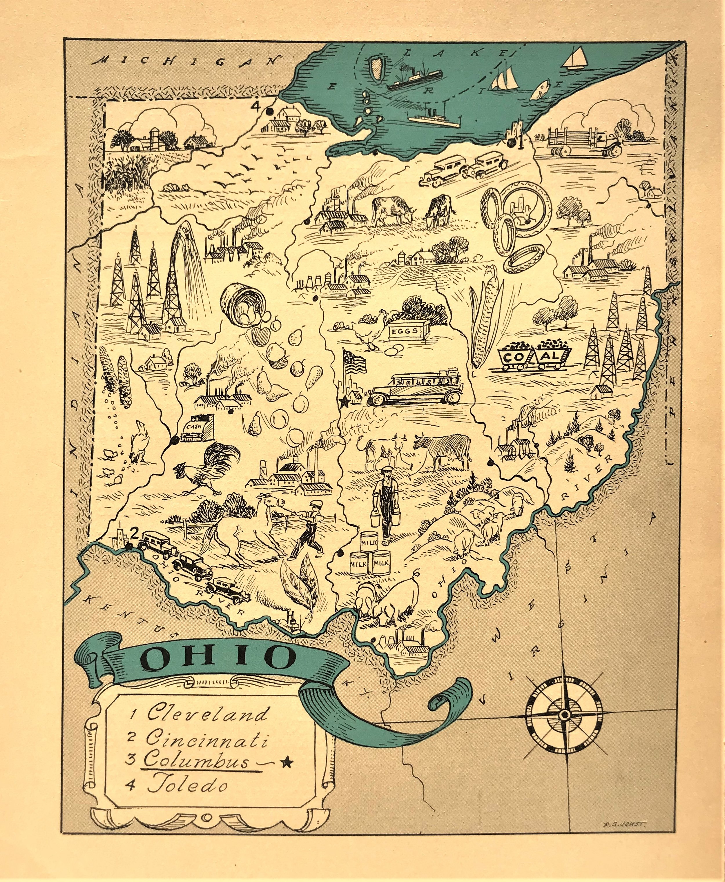
1931 Pictorial Map of Ohio
16
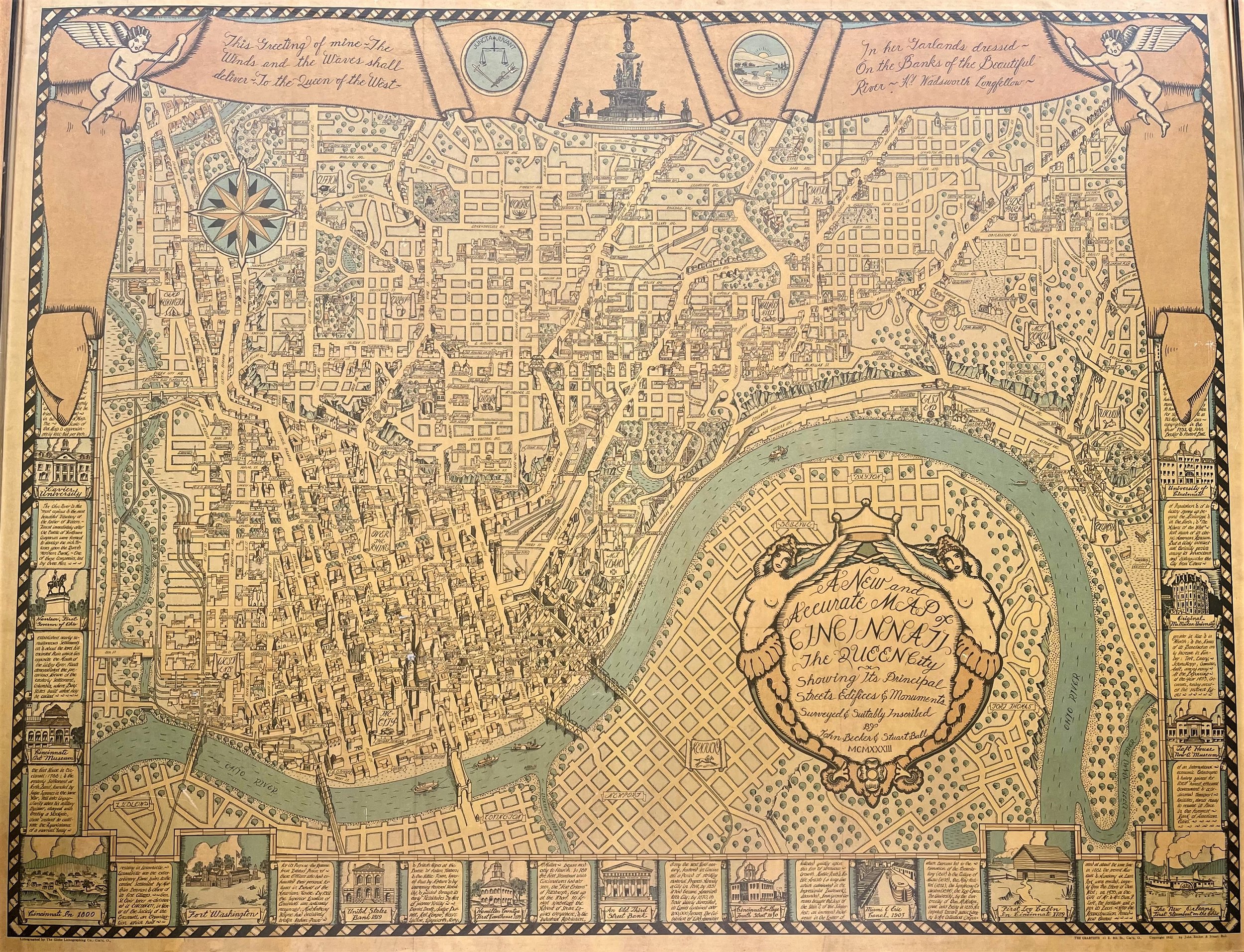
1933 A New and Accurate Map of Cincinnati: The Queen City
7
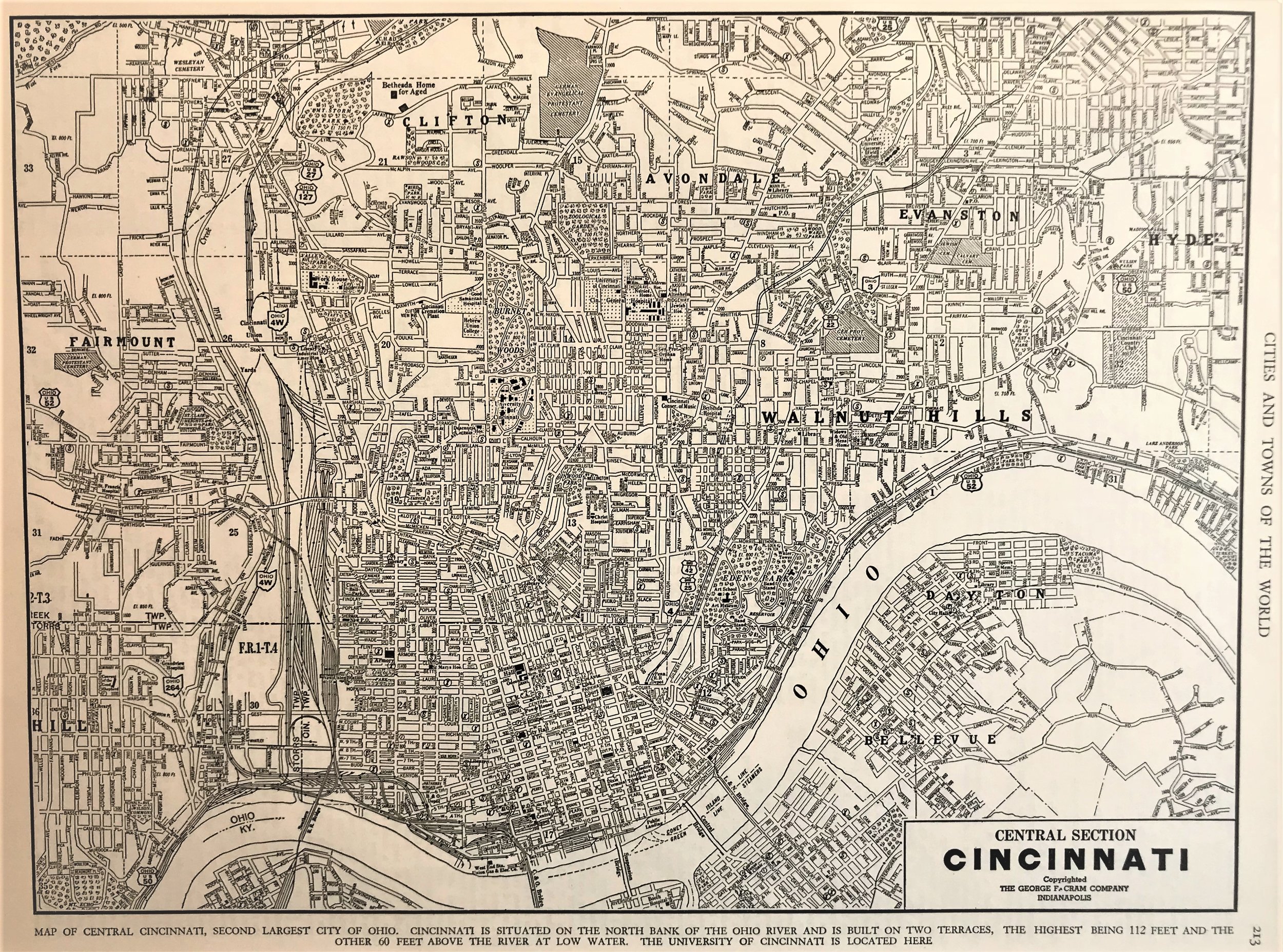
1938 Central Section, Cincinnati
9
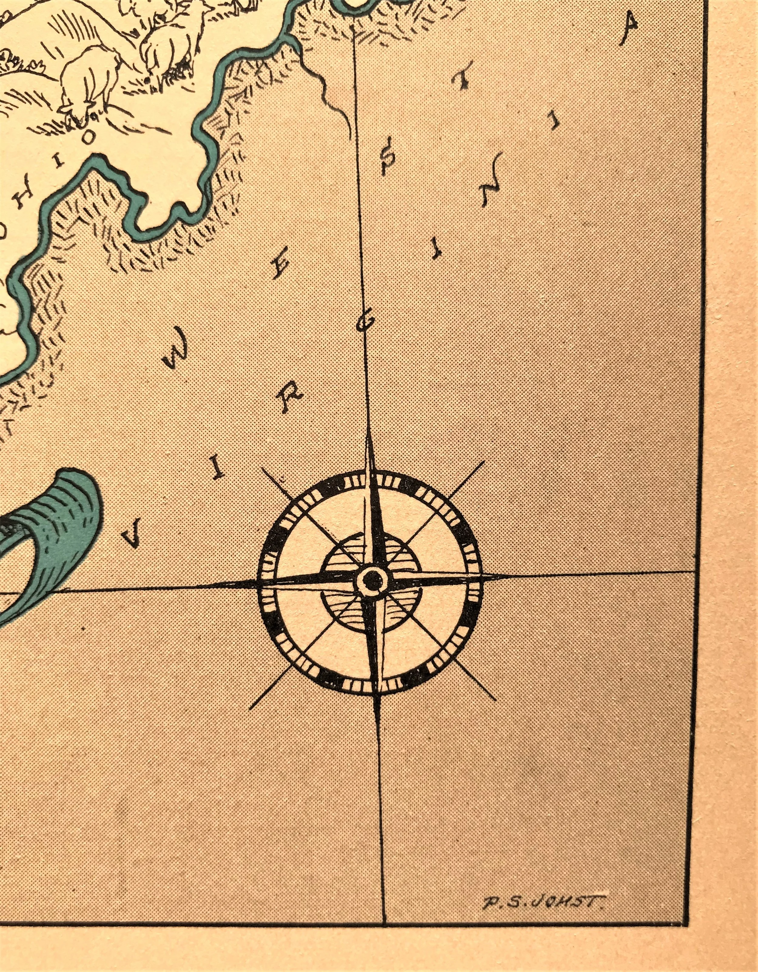
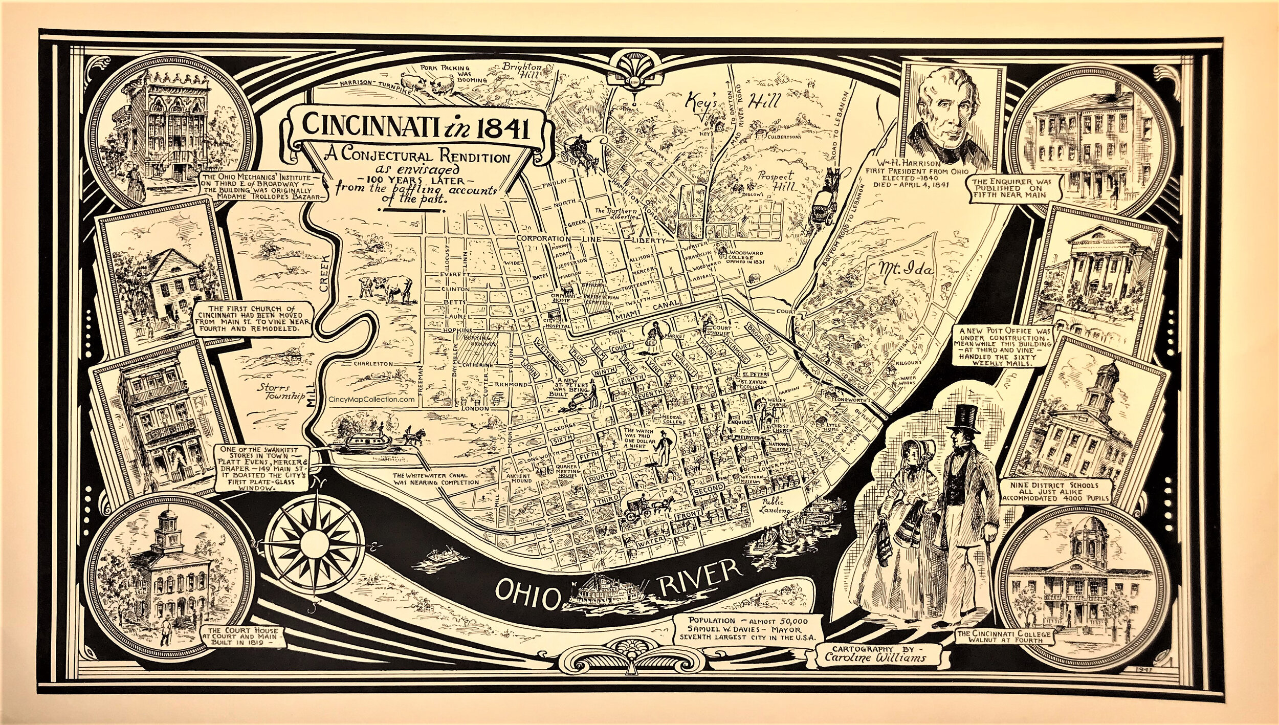
1941 Pictorial Map of Cincinnati as envisage 100 years ago
1
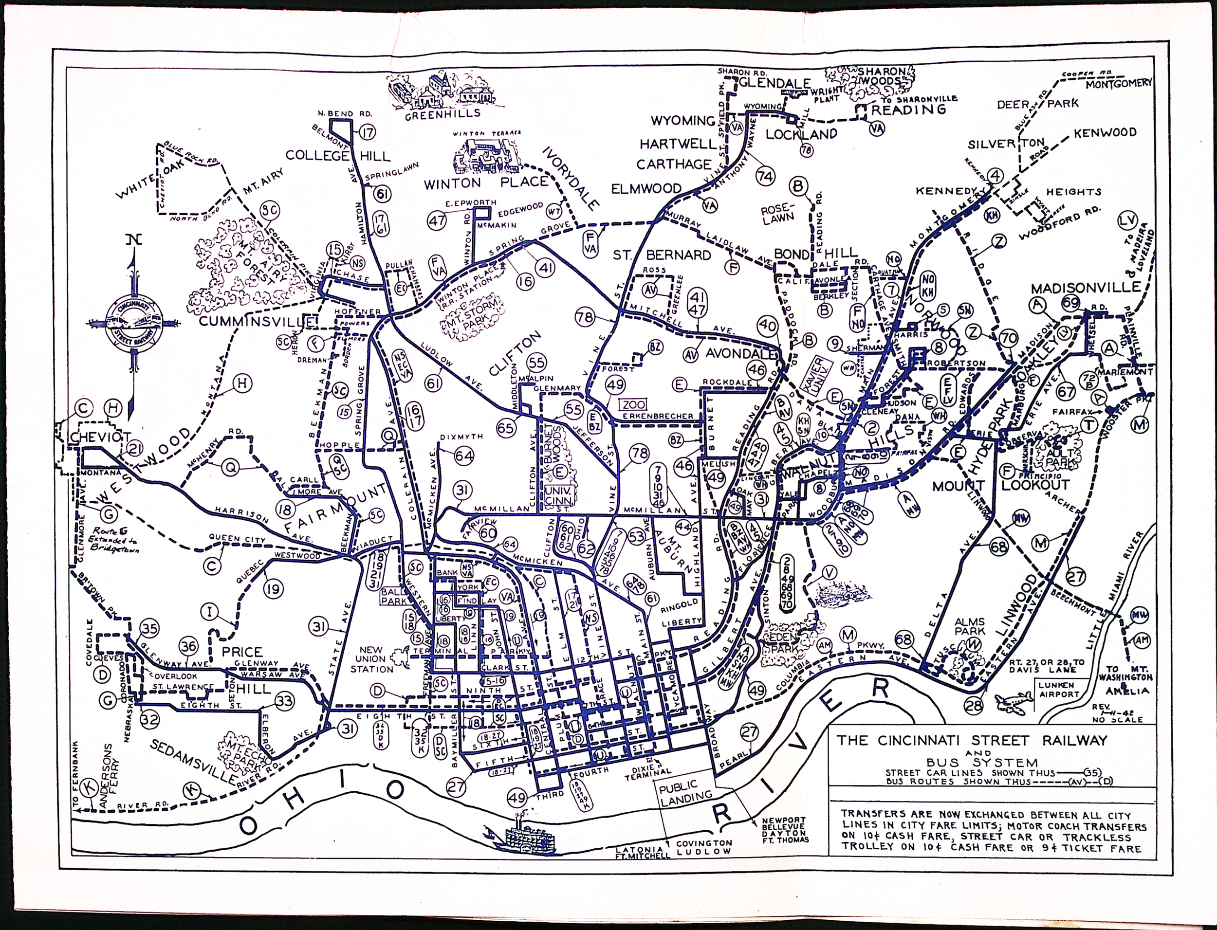
1942 The Cincinnati Street Railway & Bus System
1
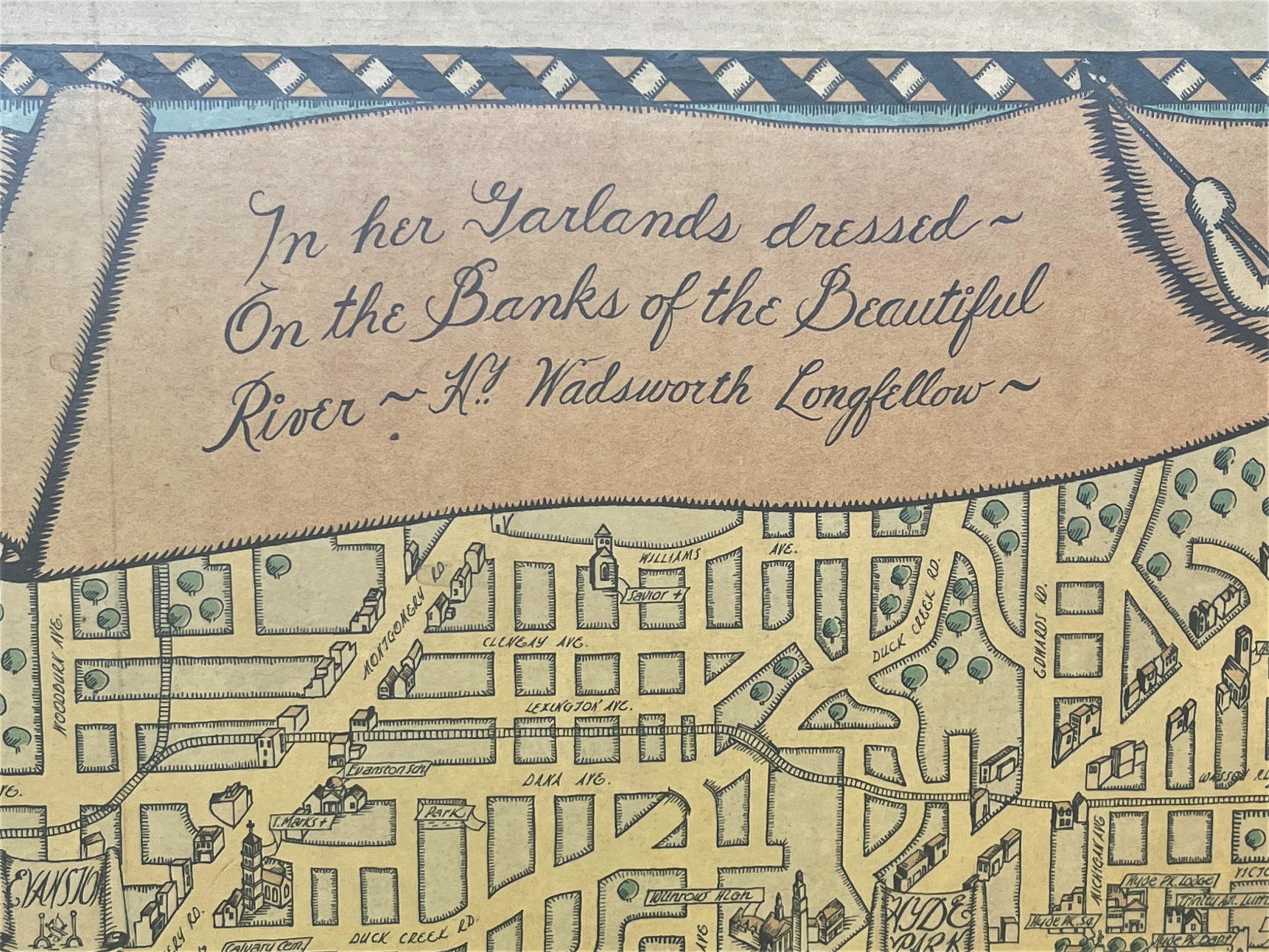
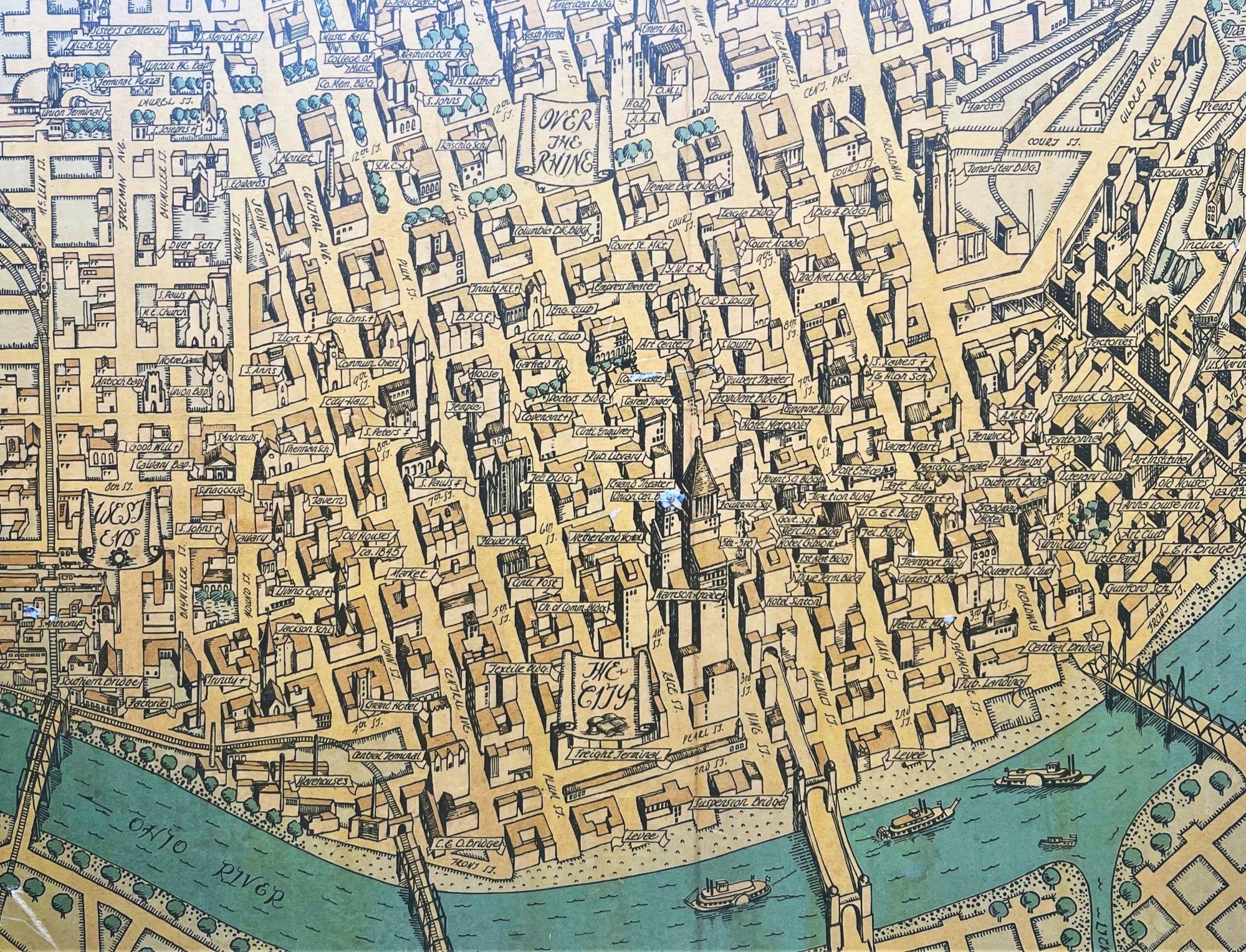
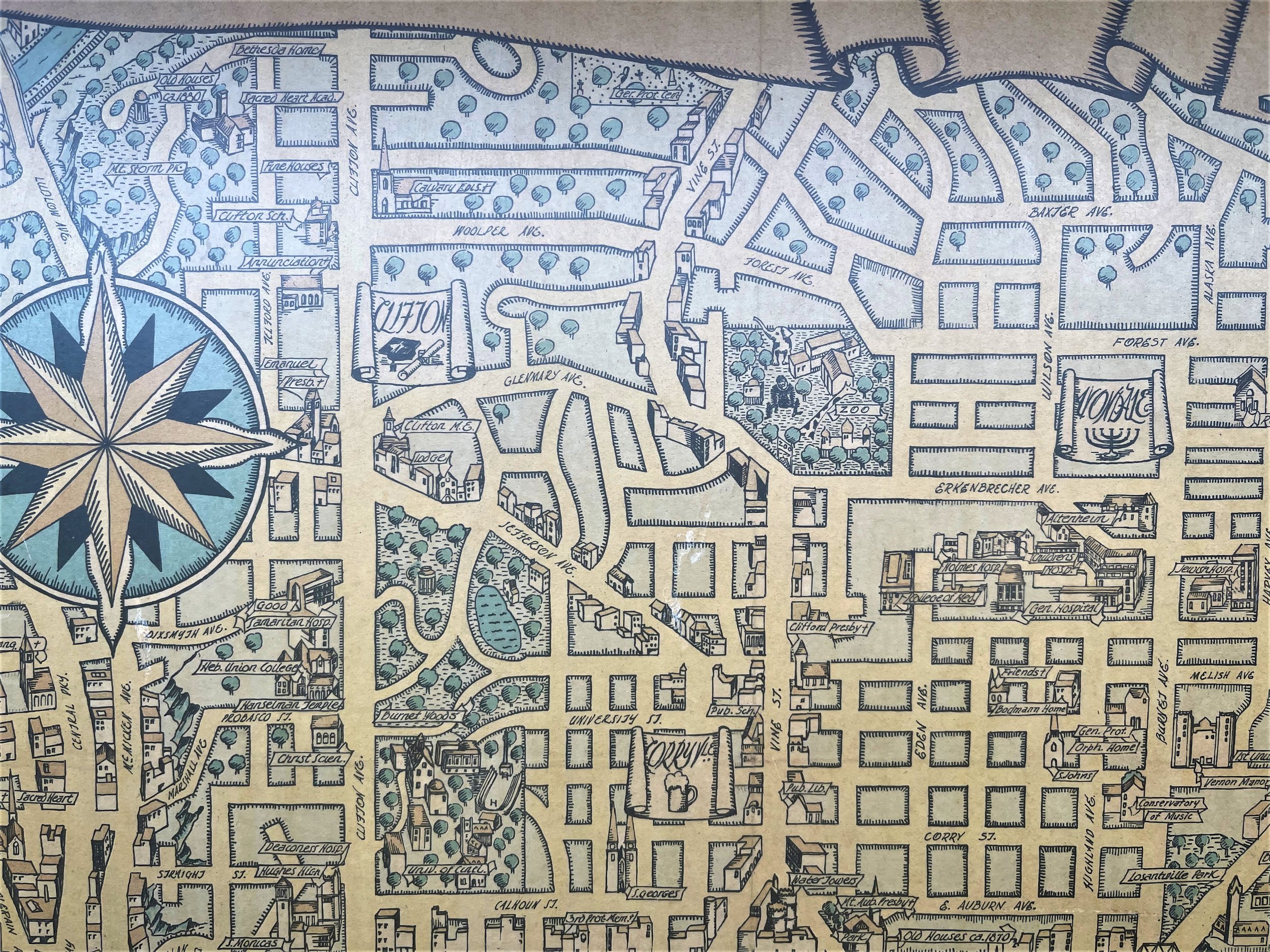
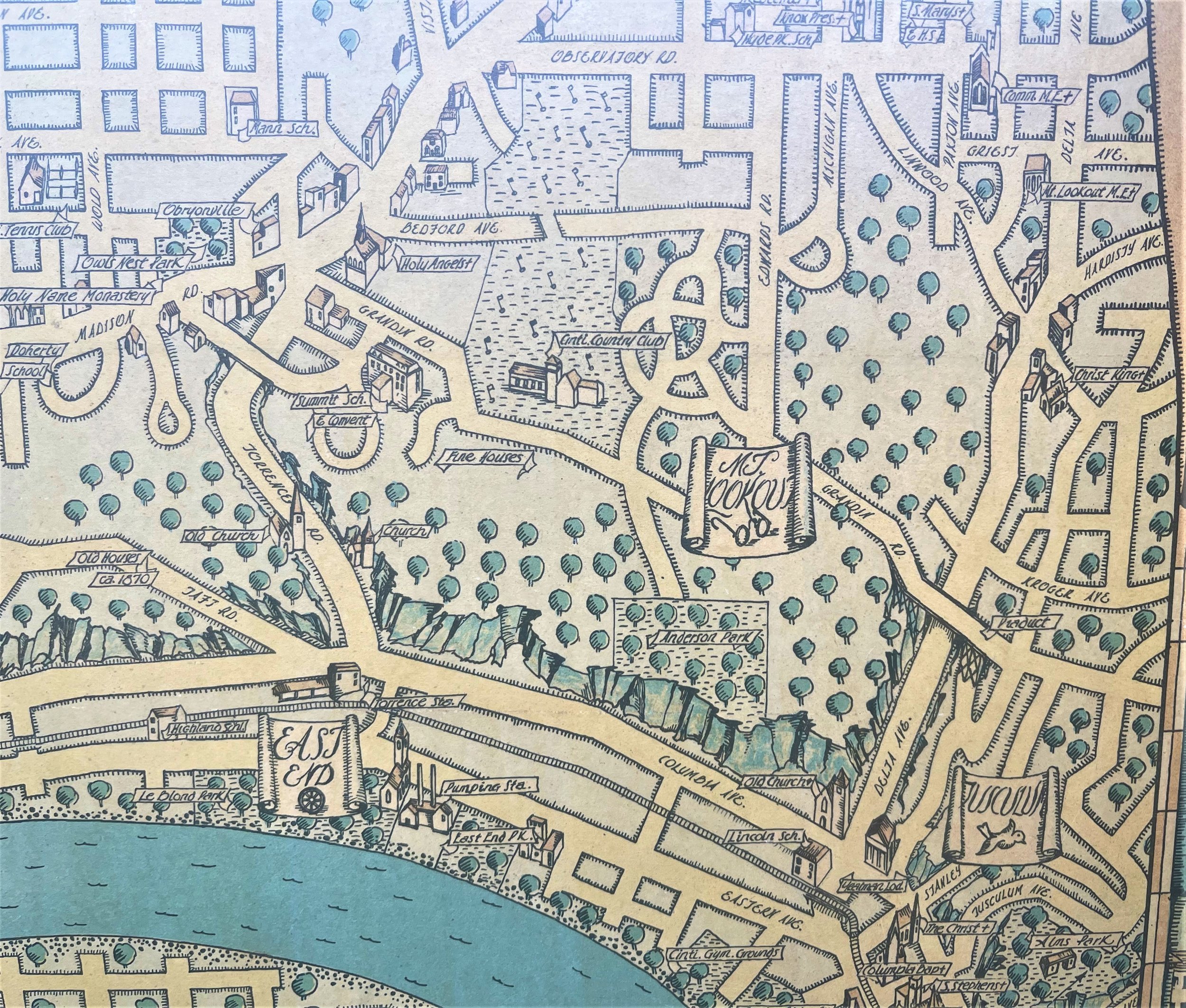
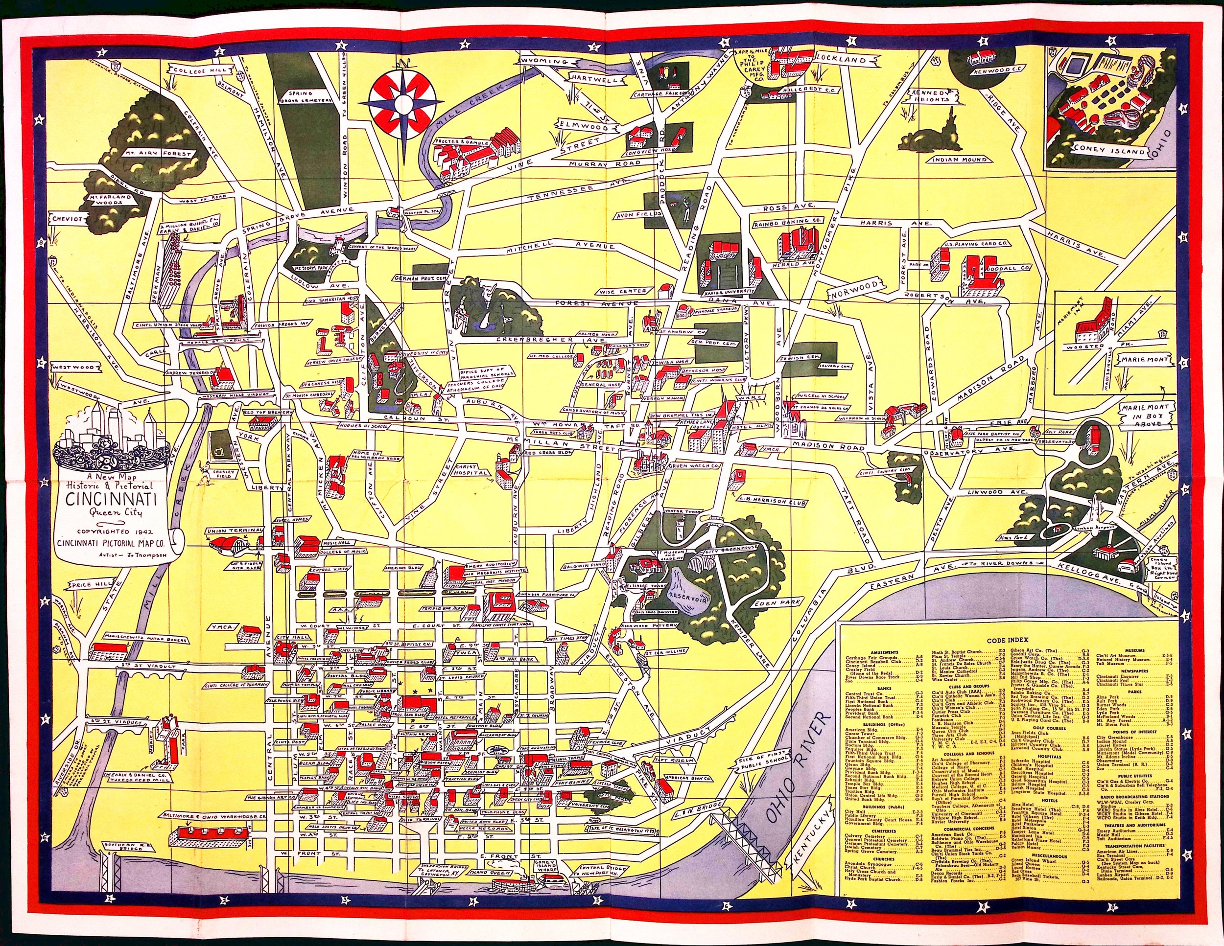
1942 Pictorial Map of Cincinnati
8
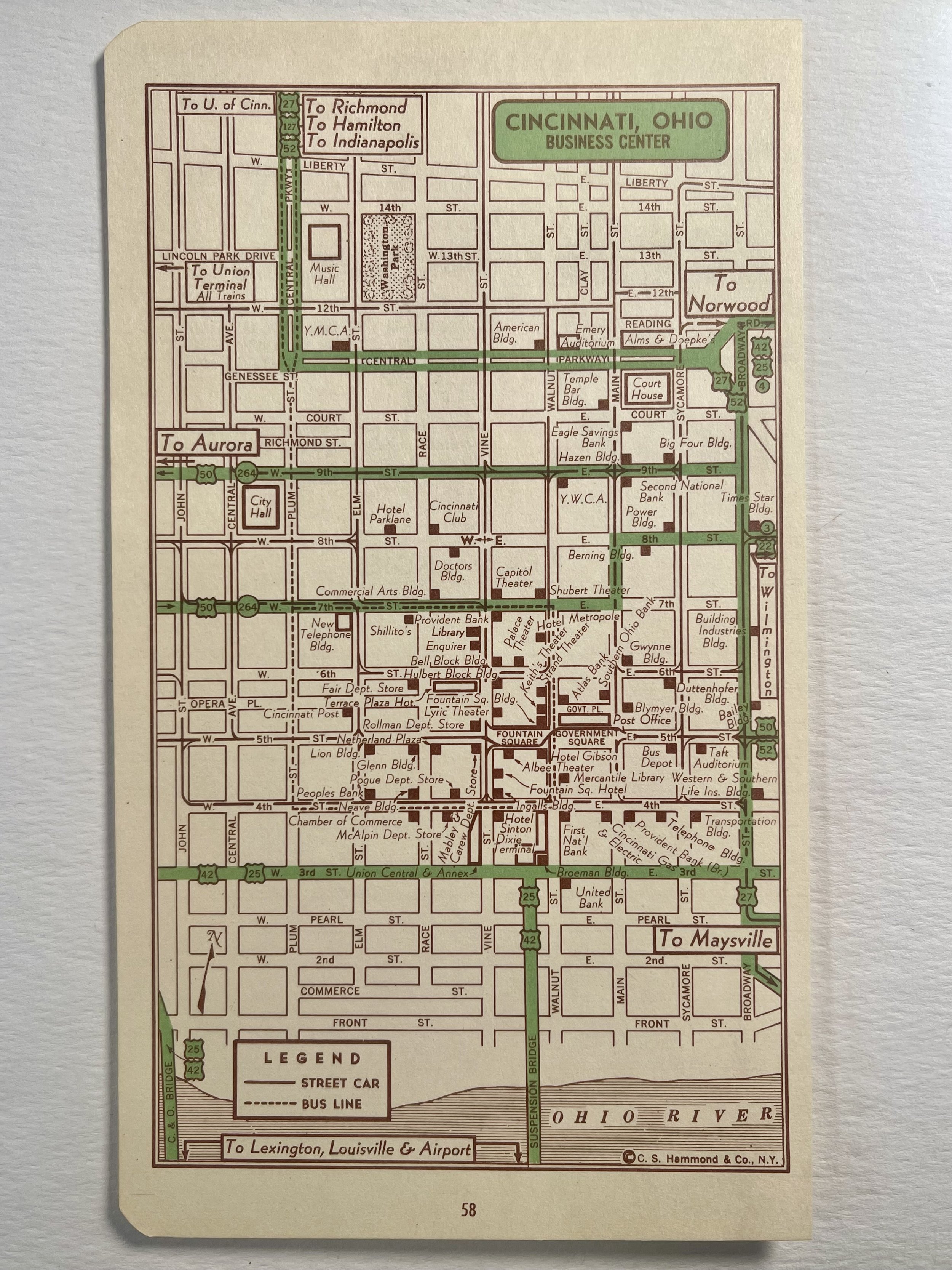
1951 Cincinnati Business Center
21
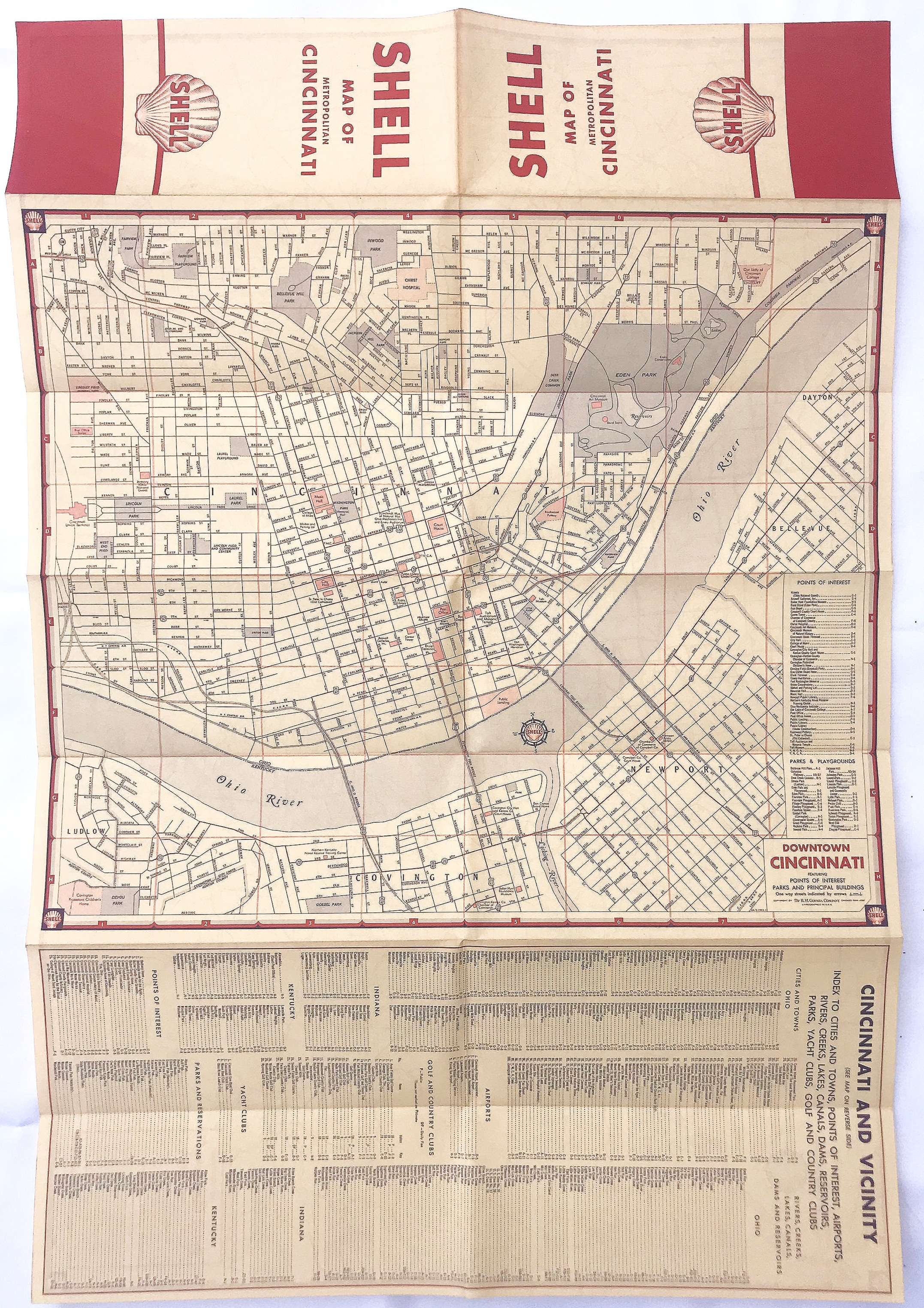
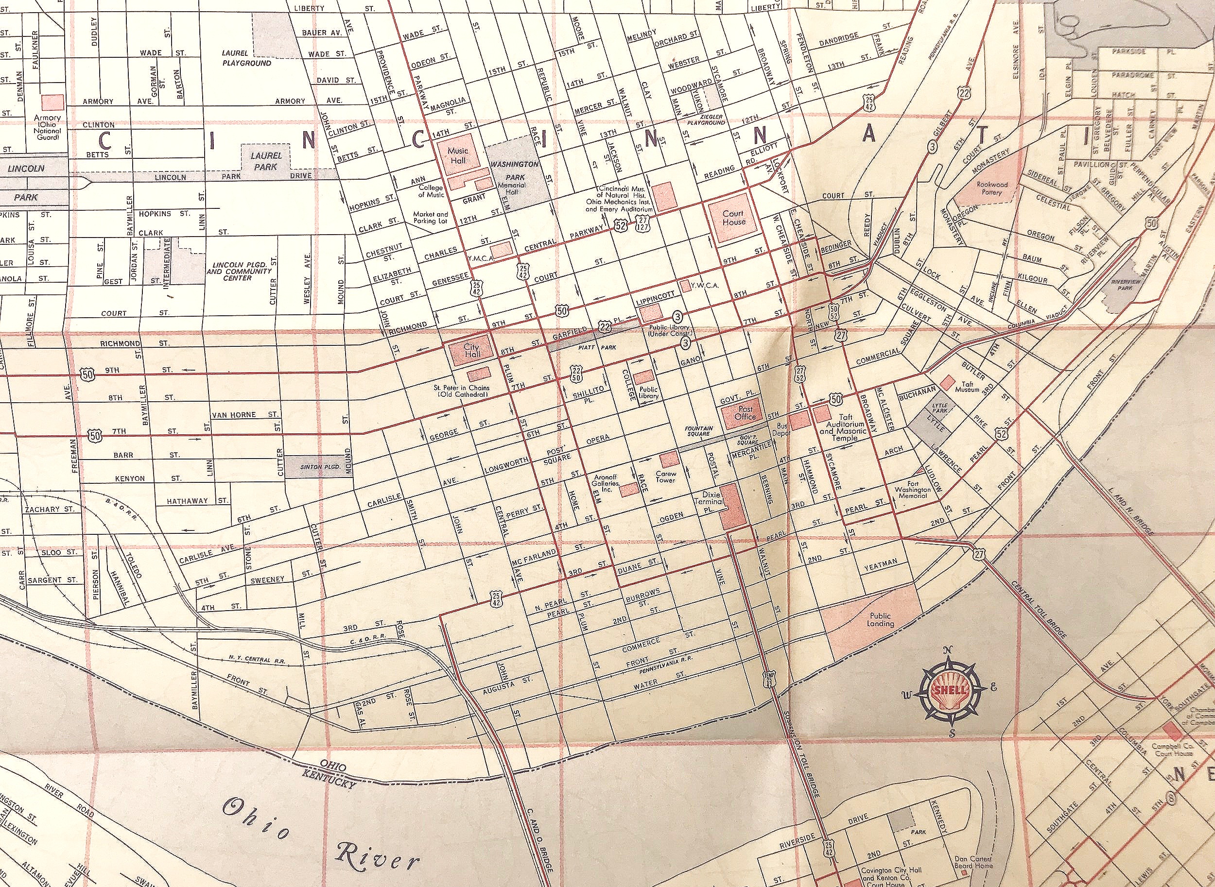
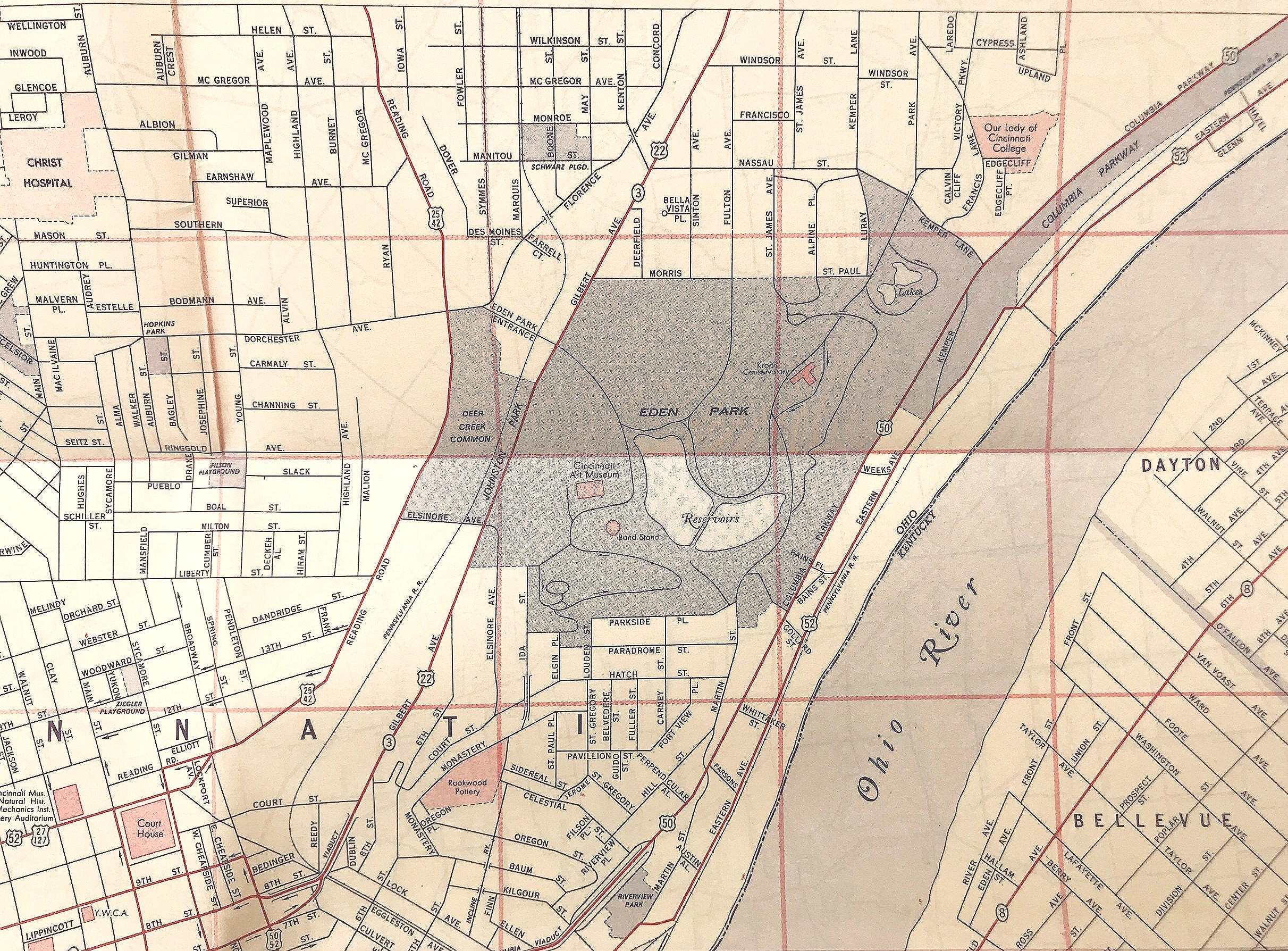
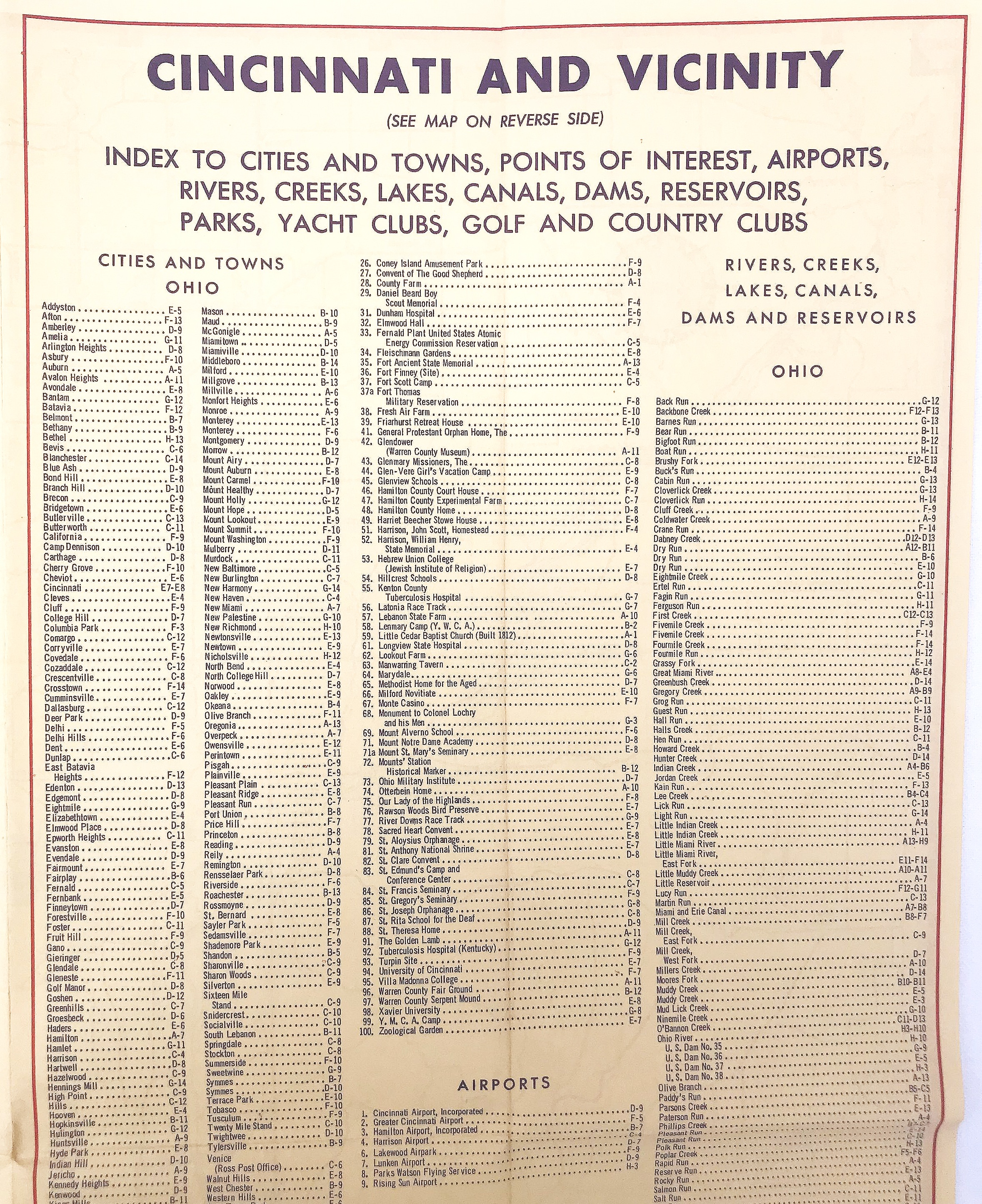
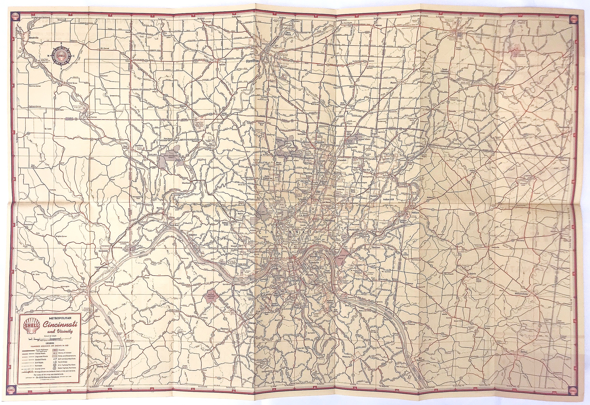
1953 Folding Map of Cincinnati
12
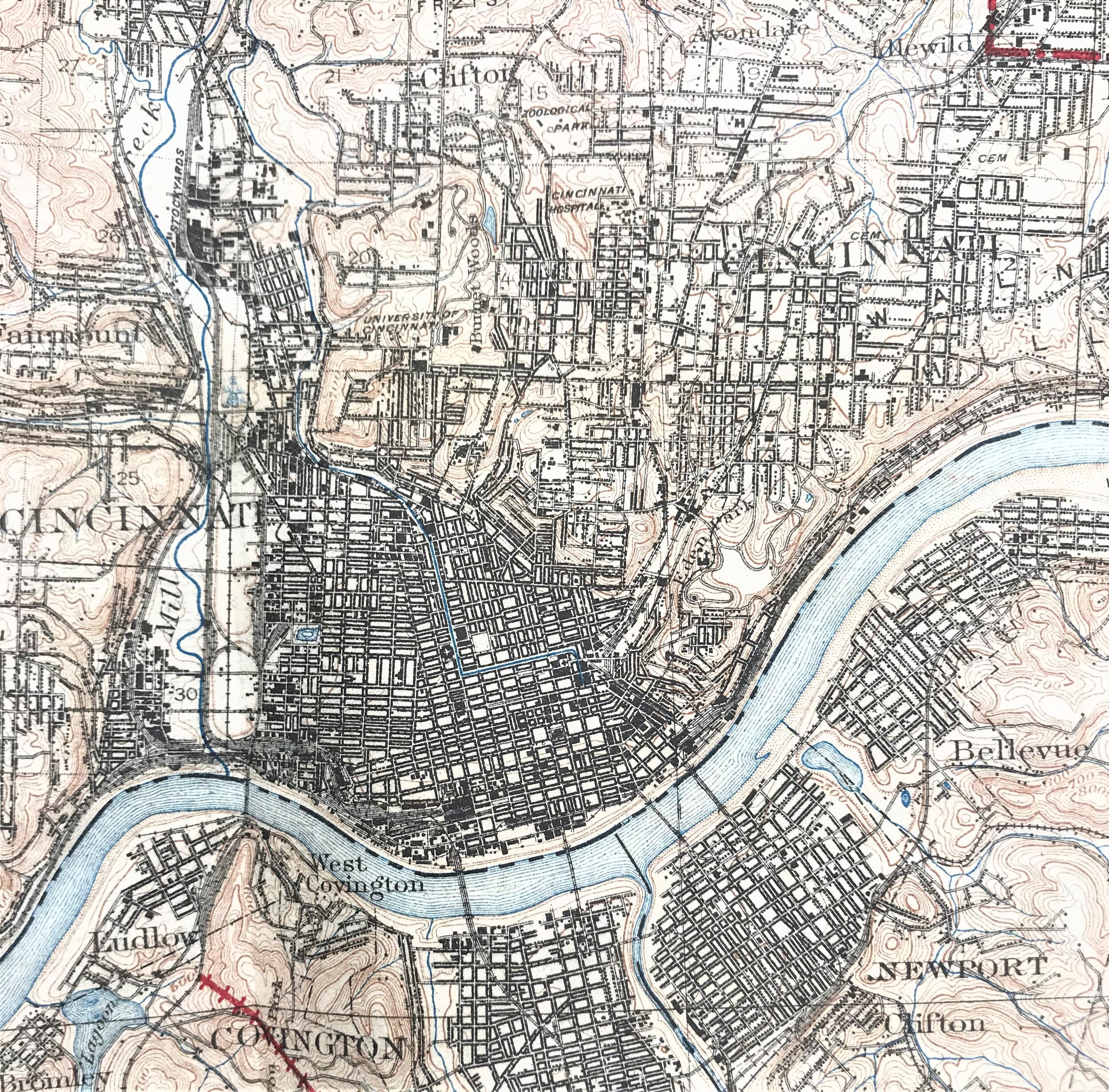
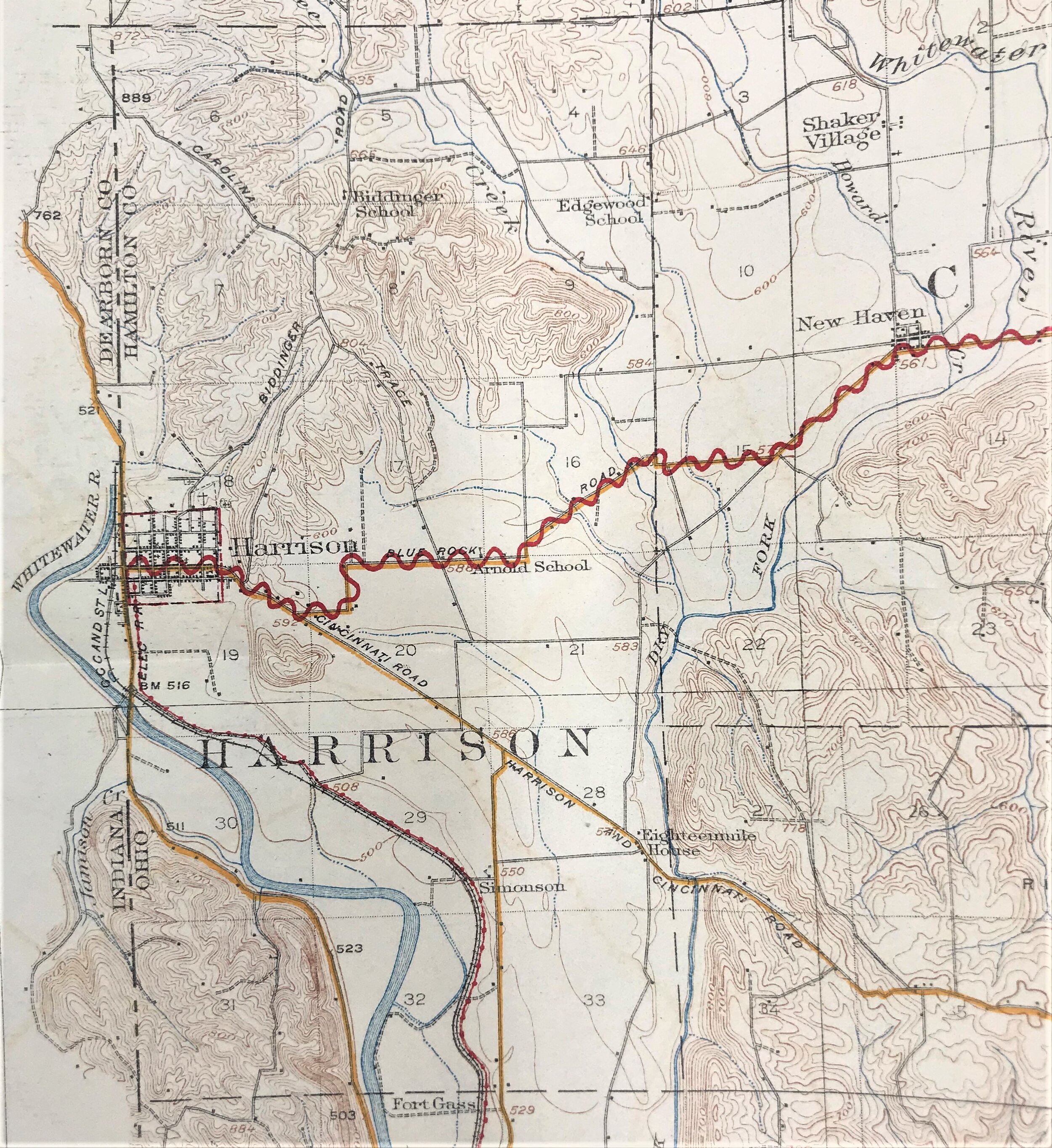
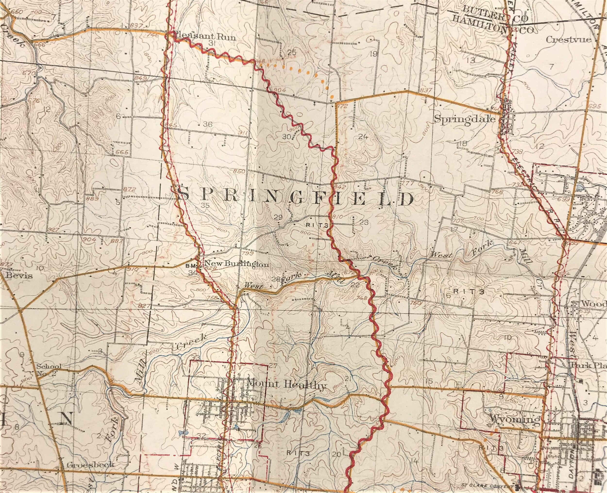
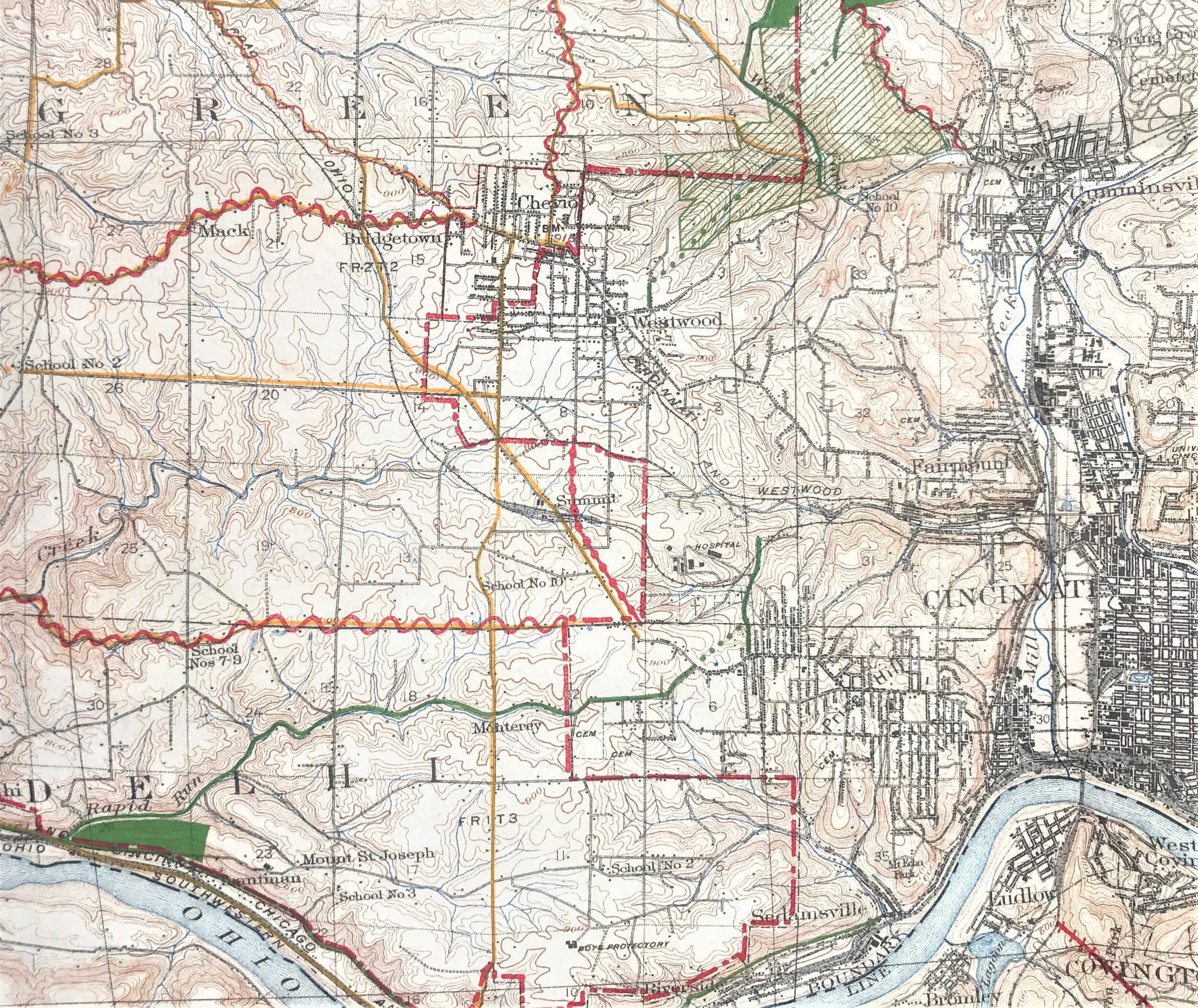
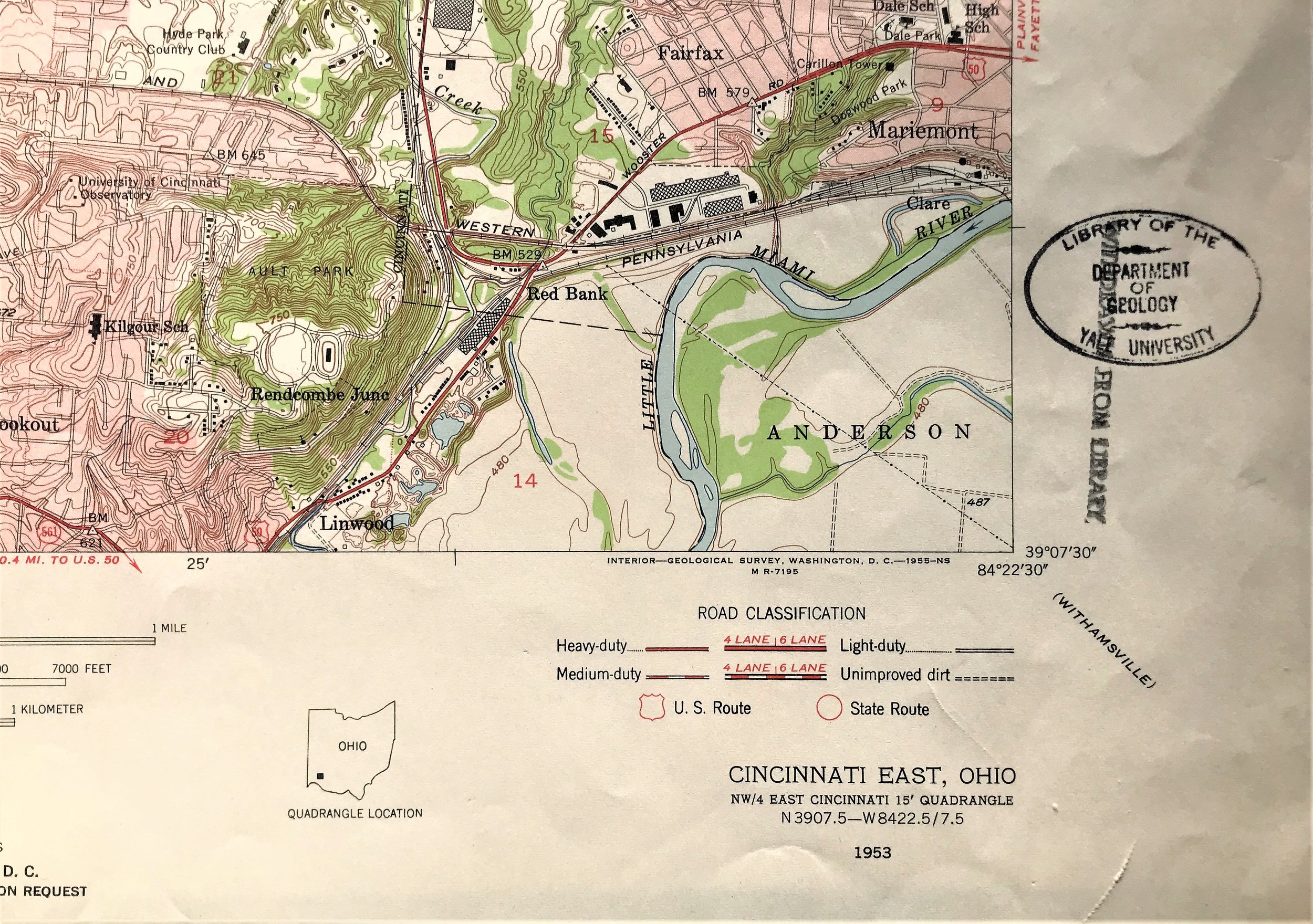
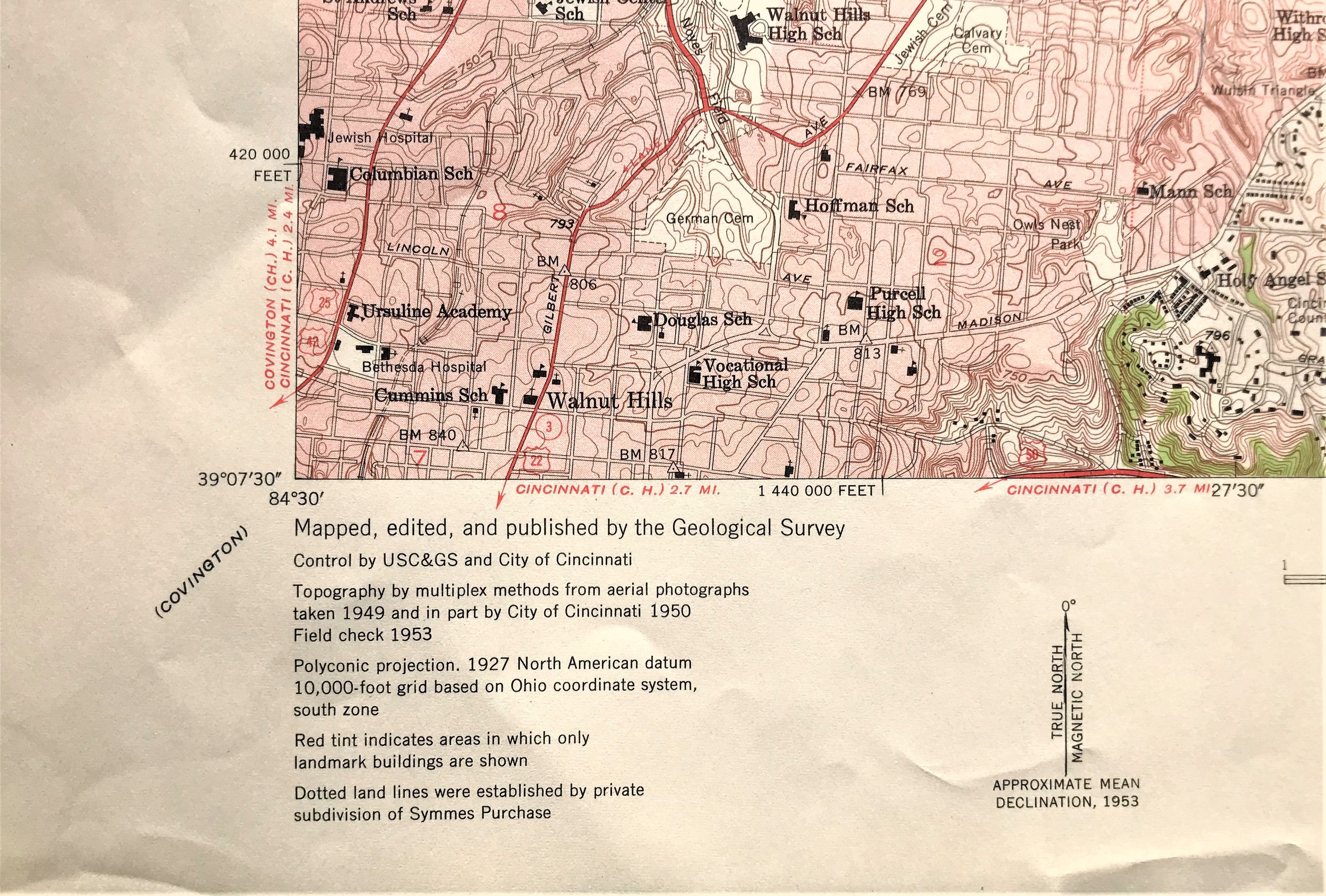
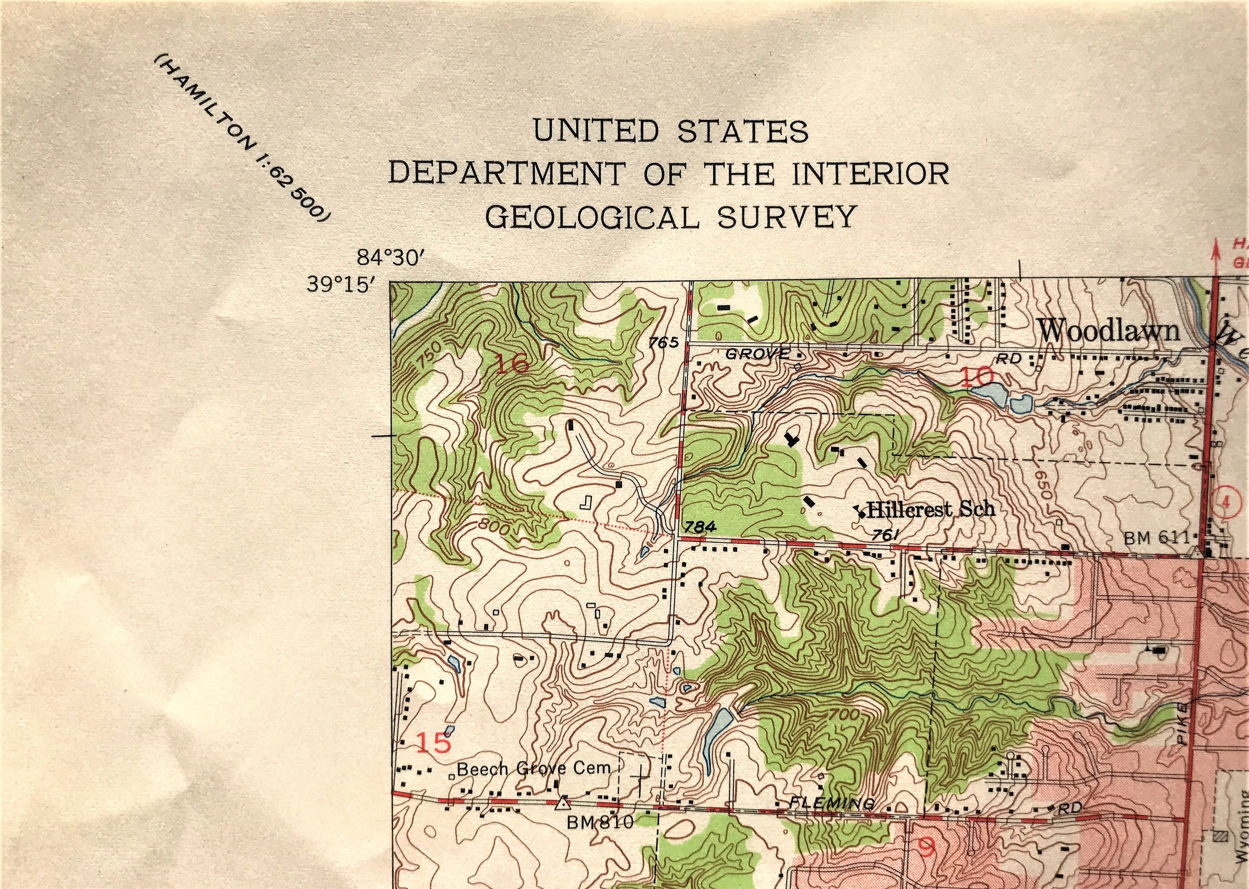
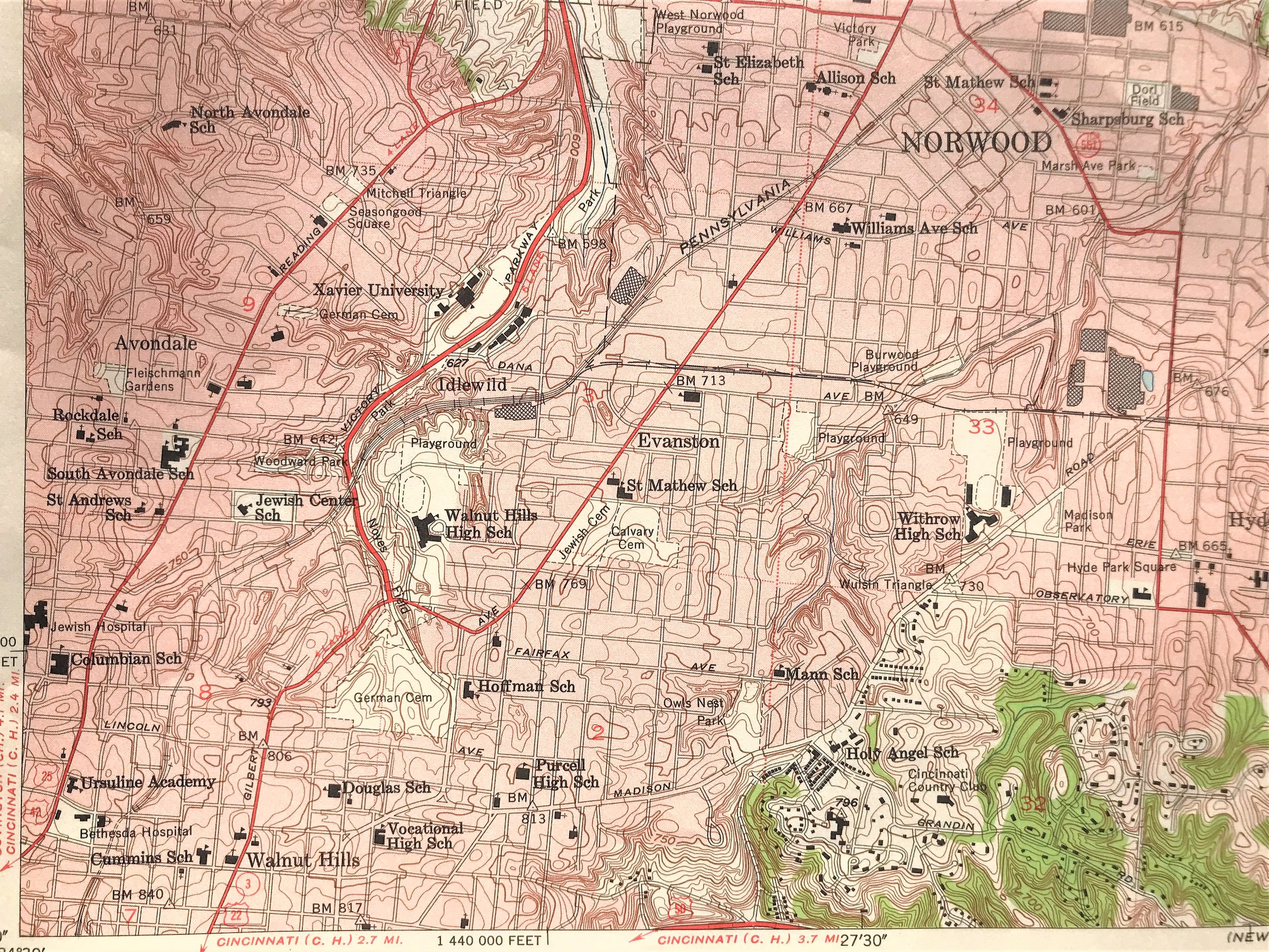
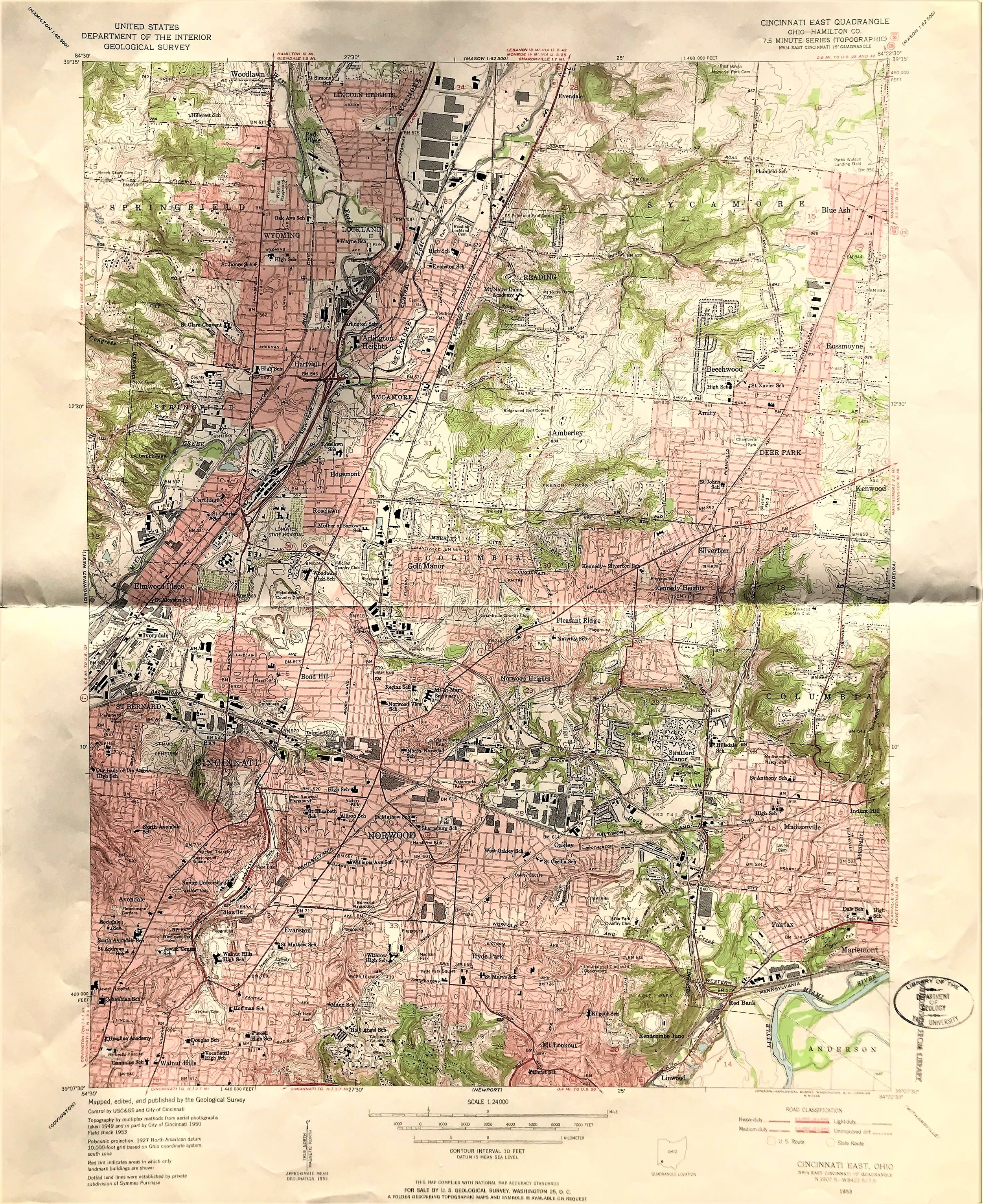
1953 Geological Survey of Cincinnati, NEQ

16
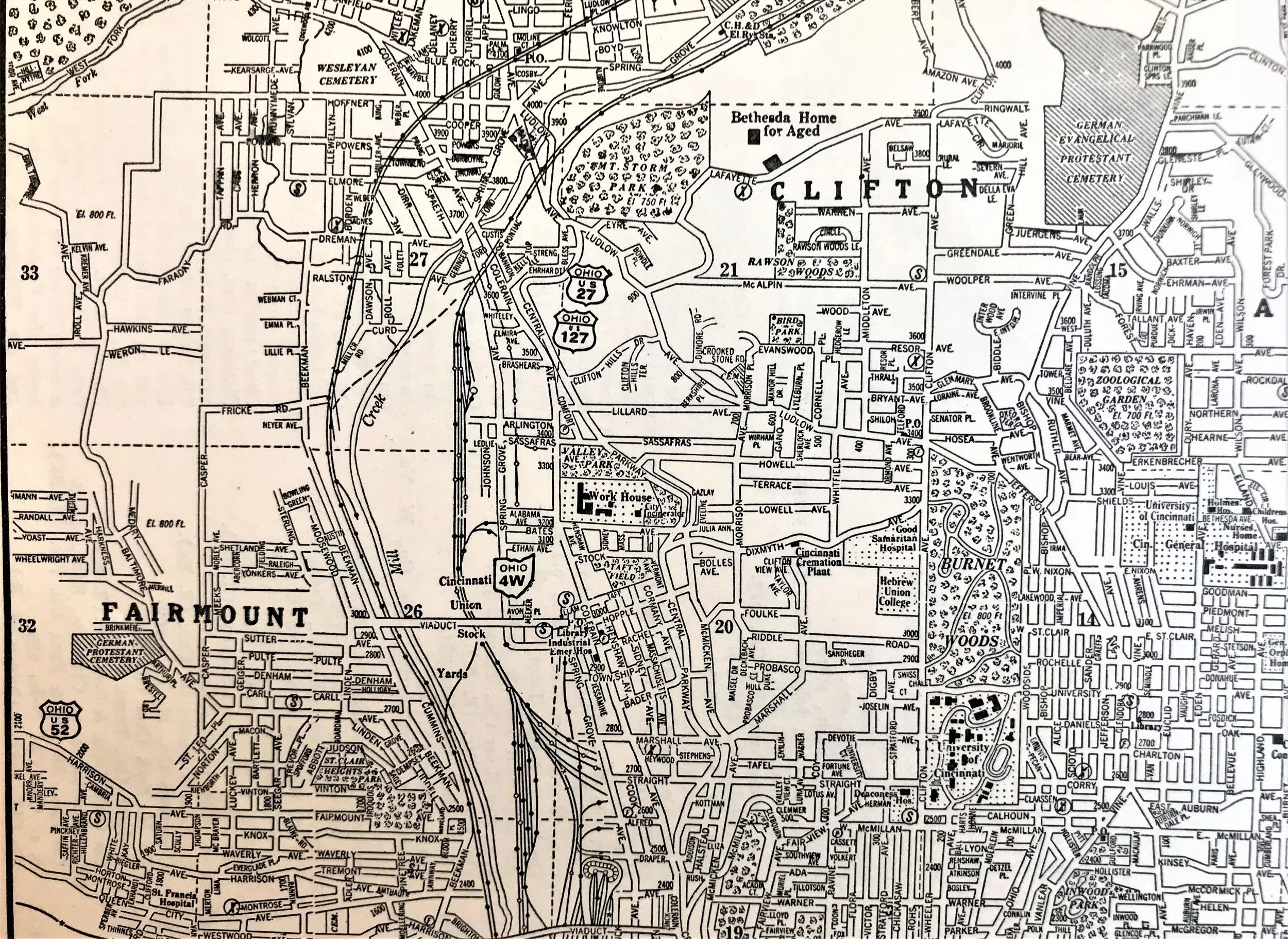
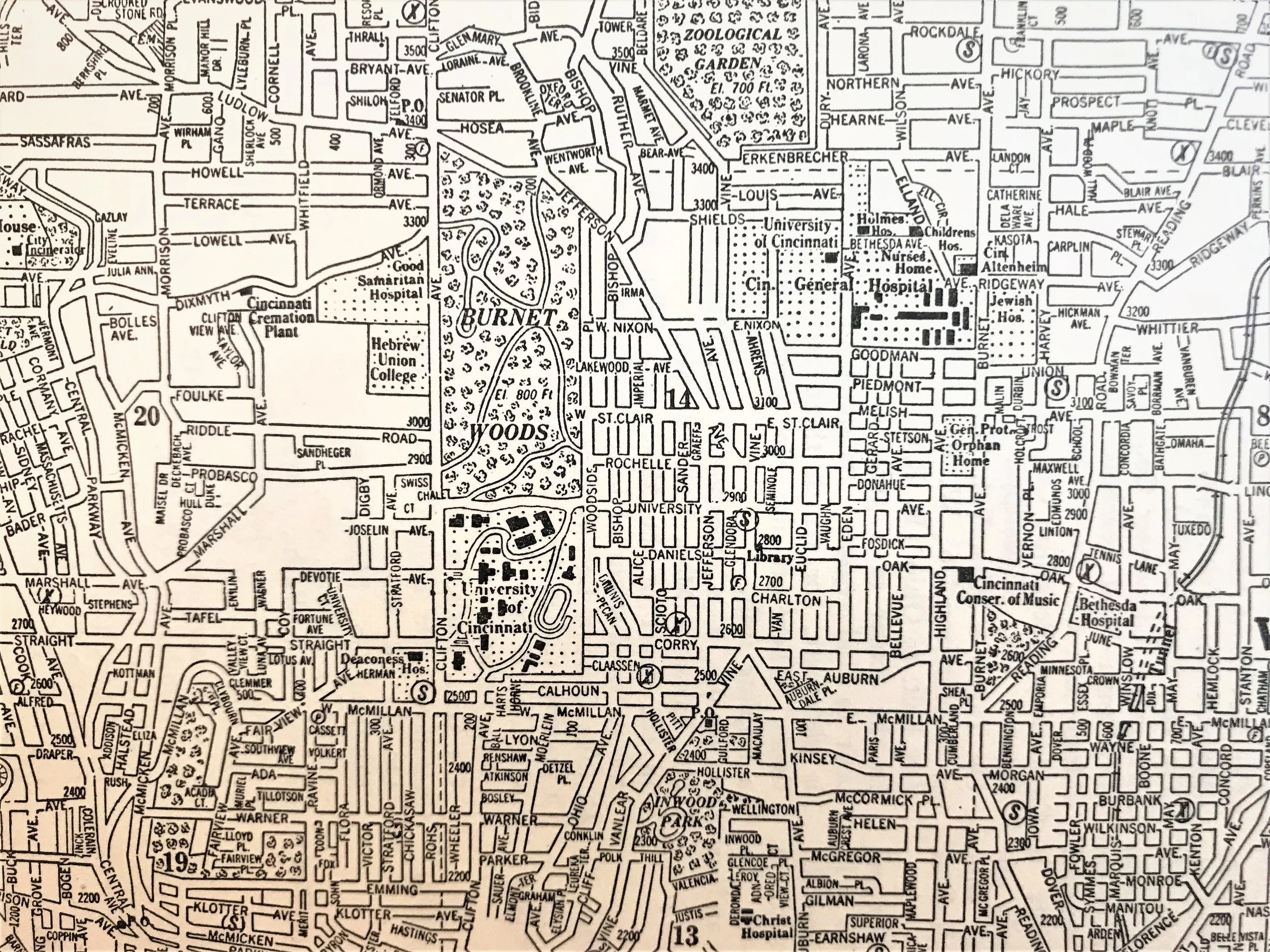
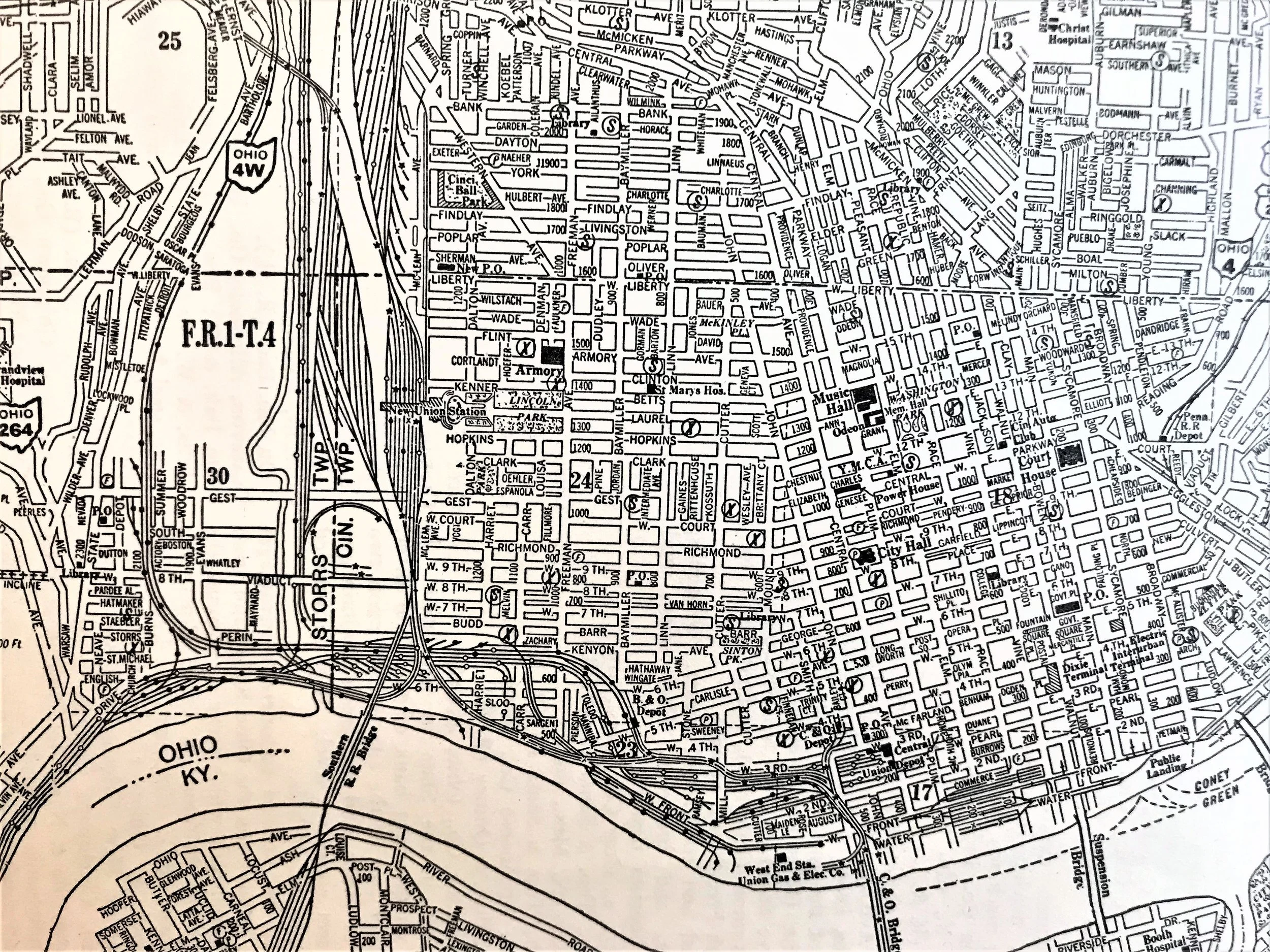
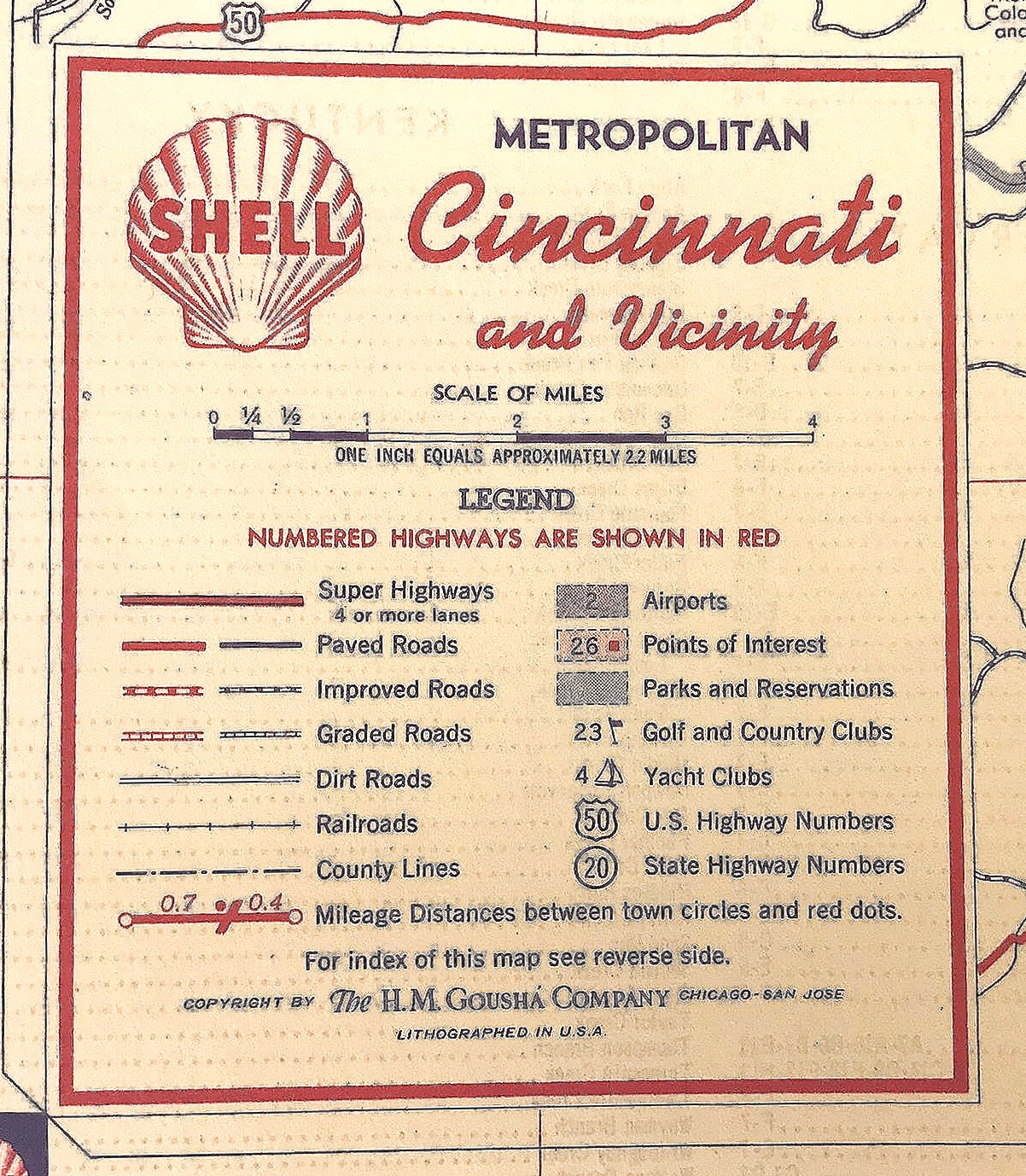
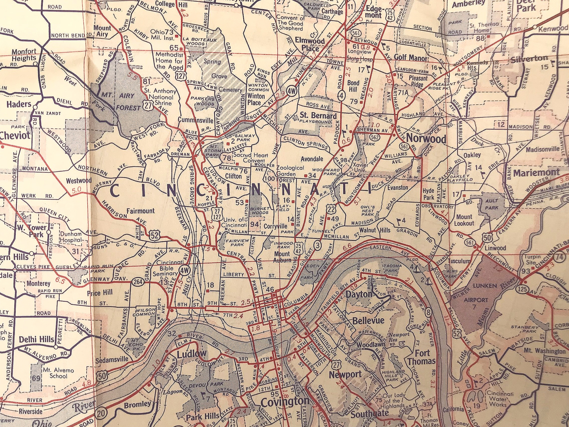
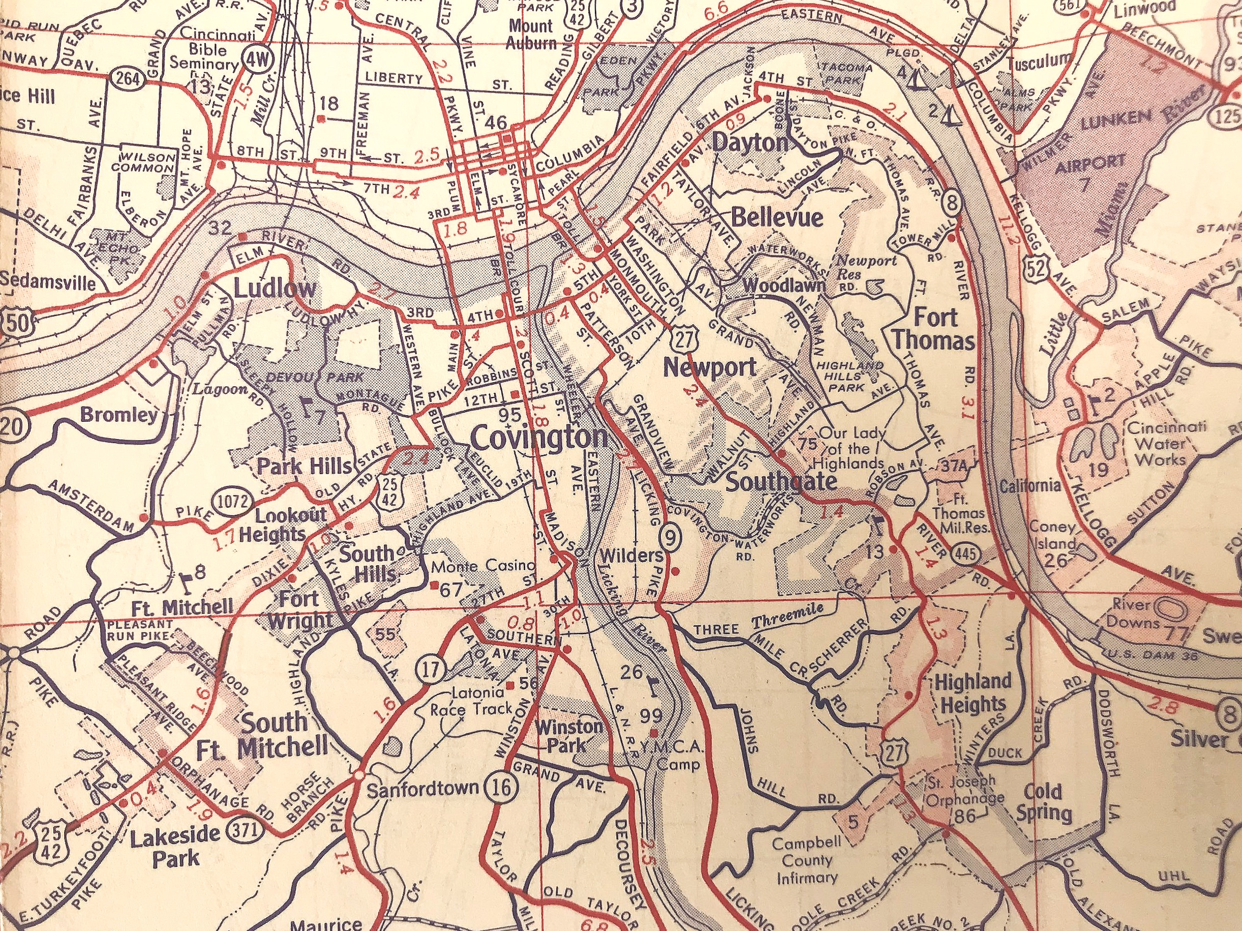
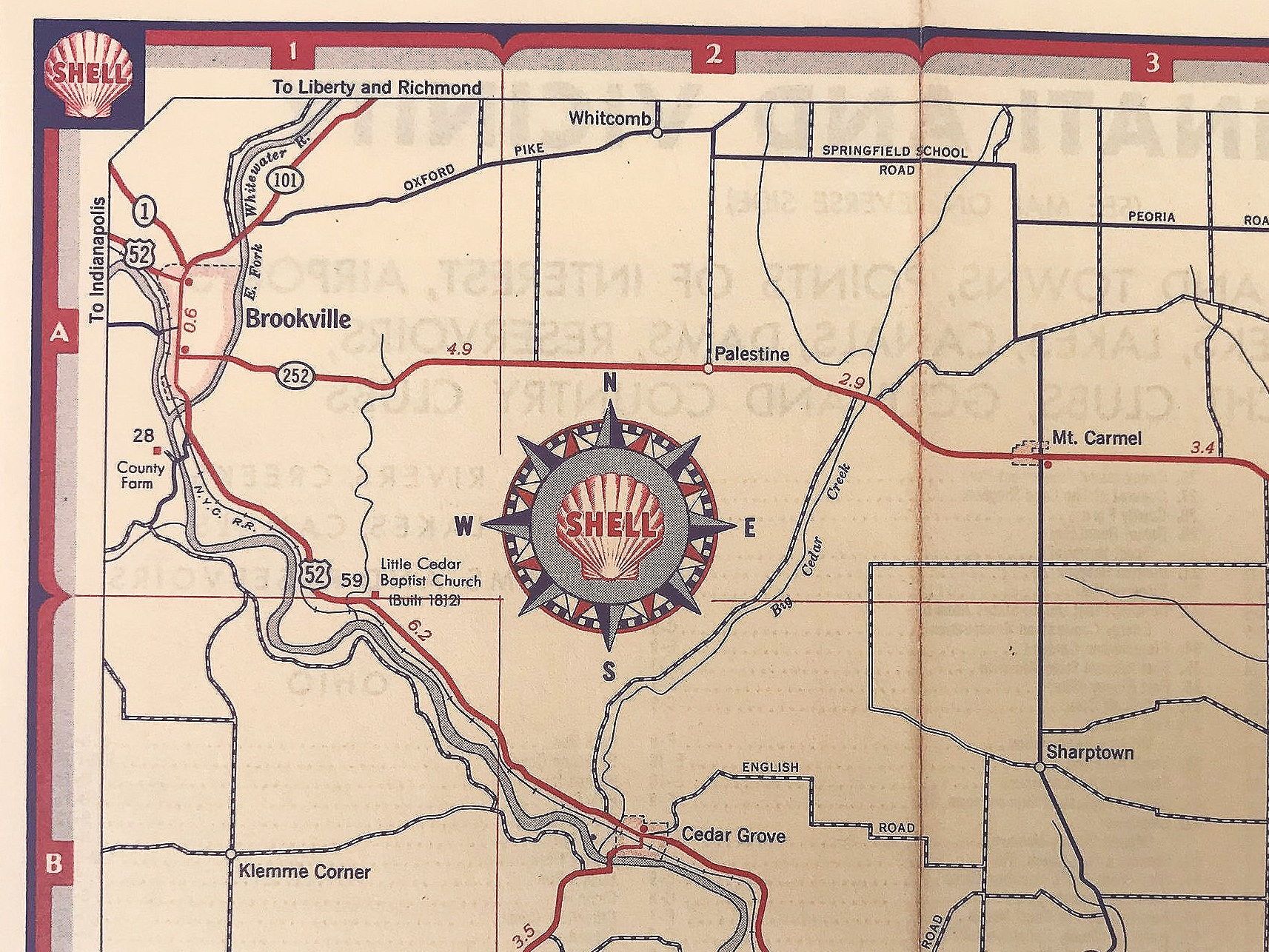
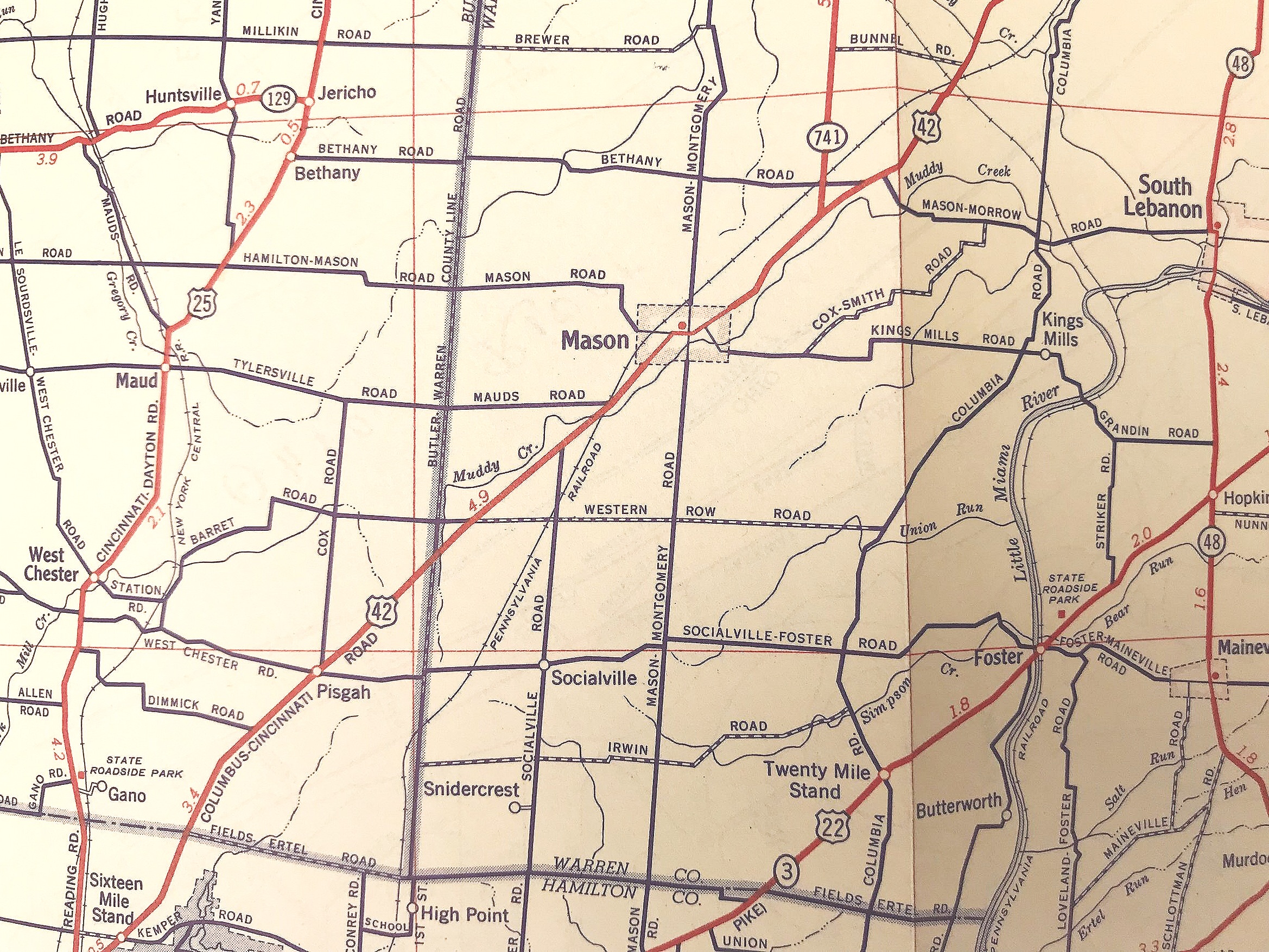
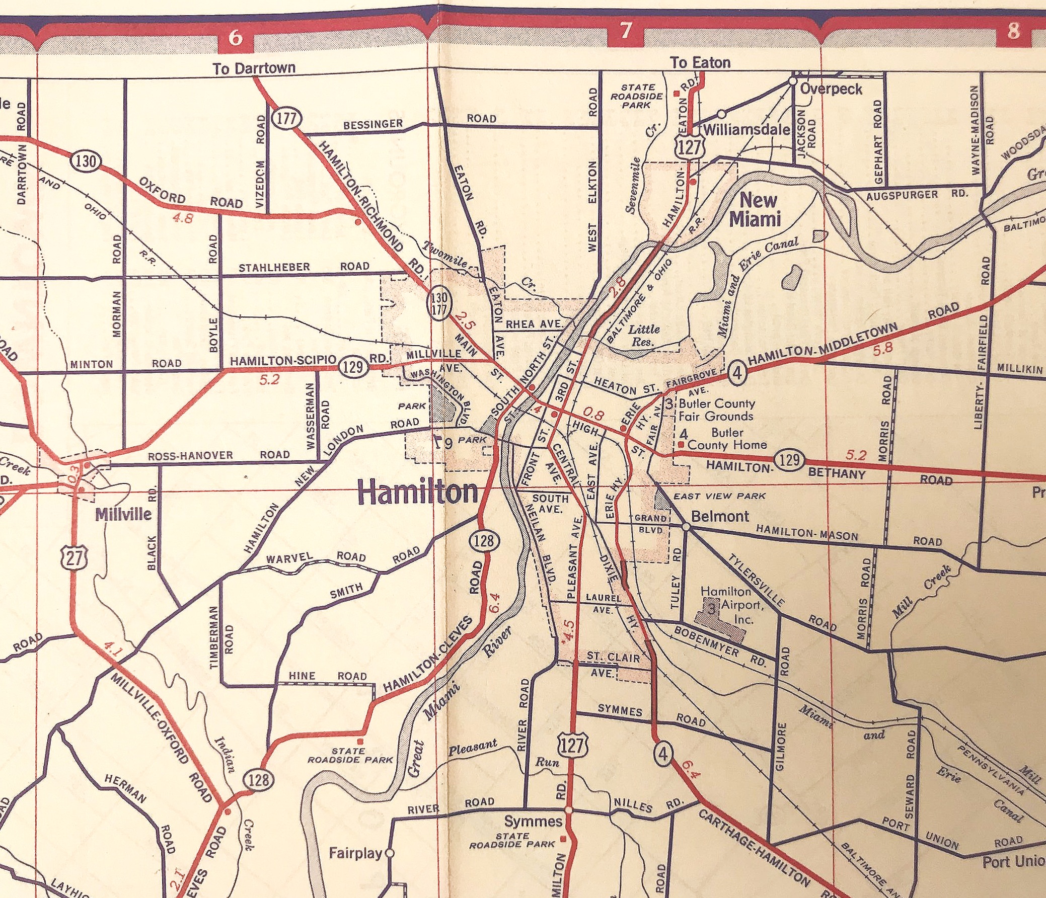
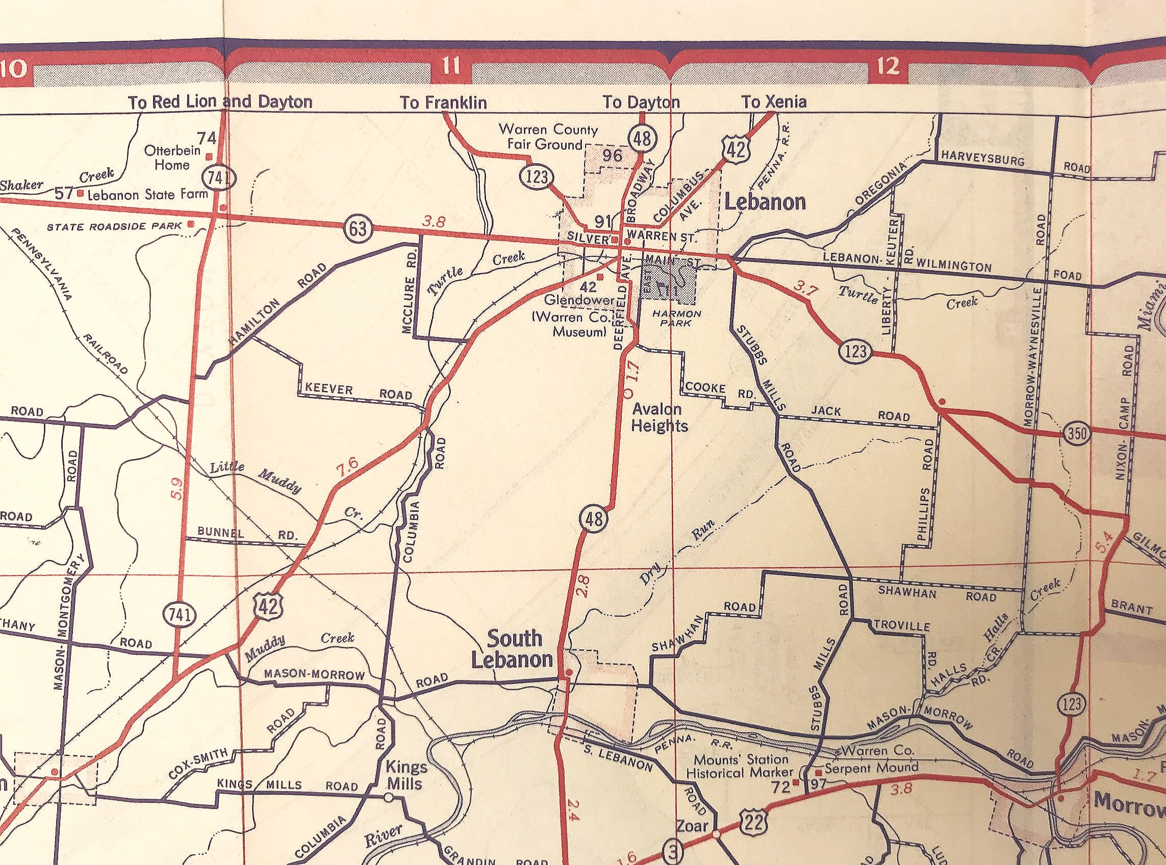
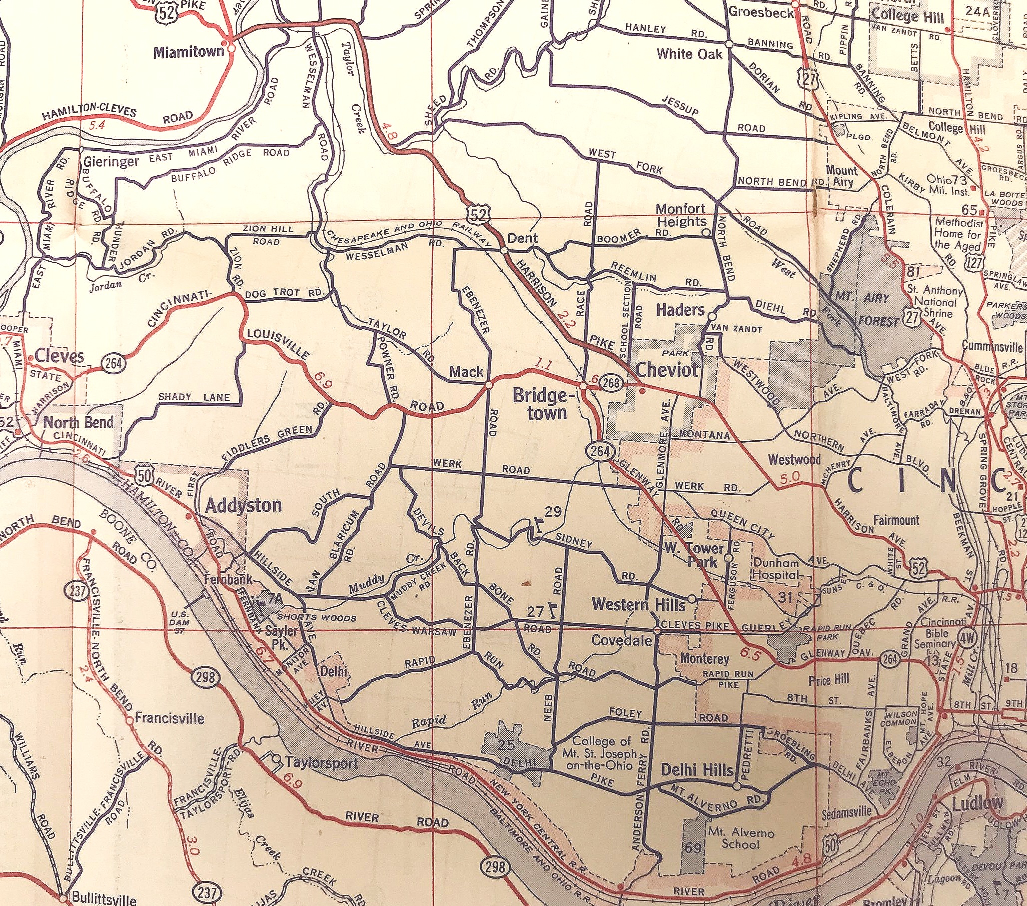
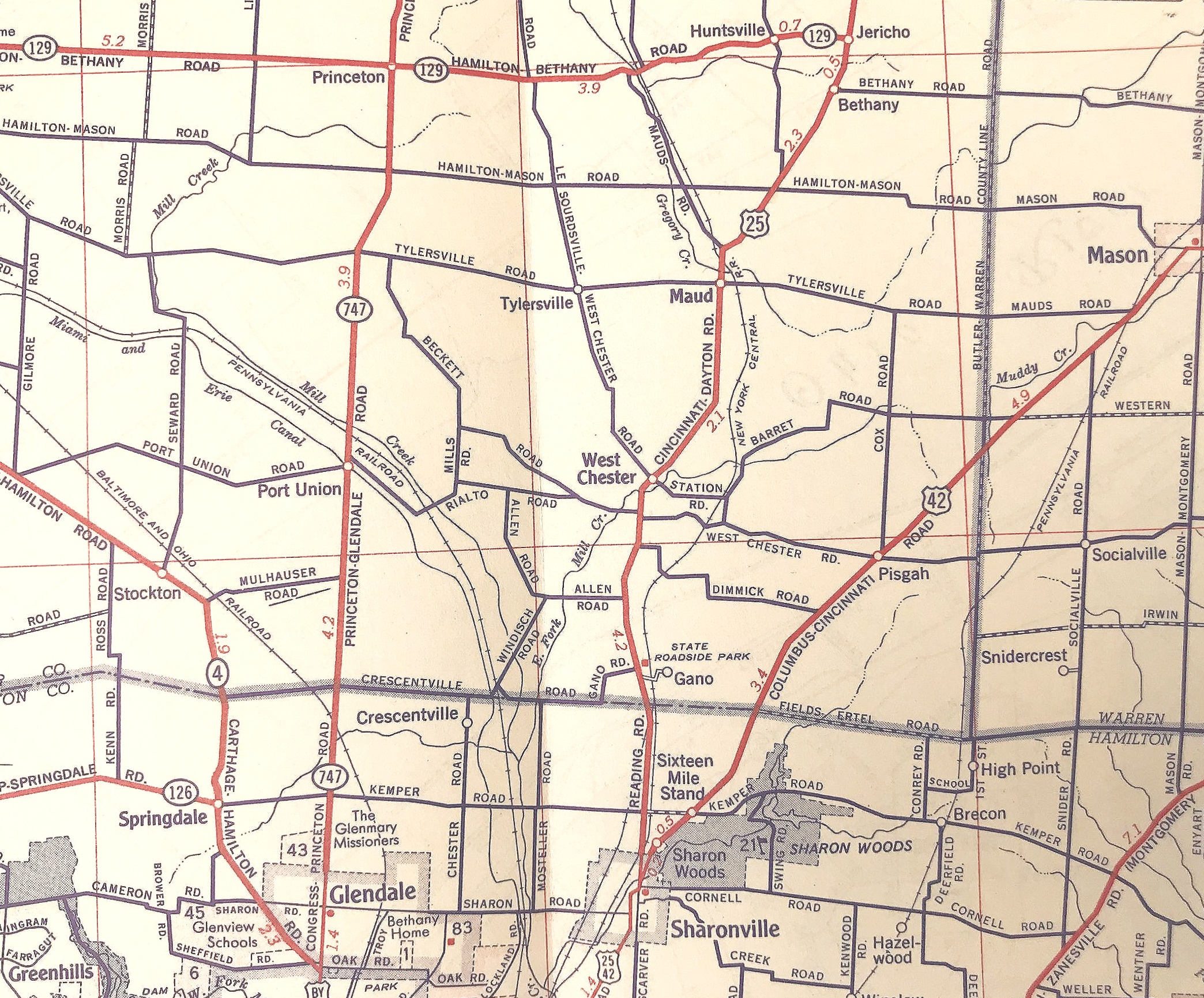
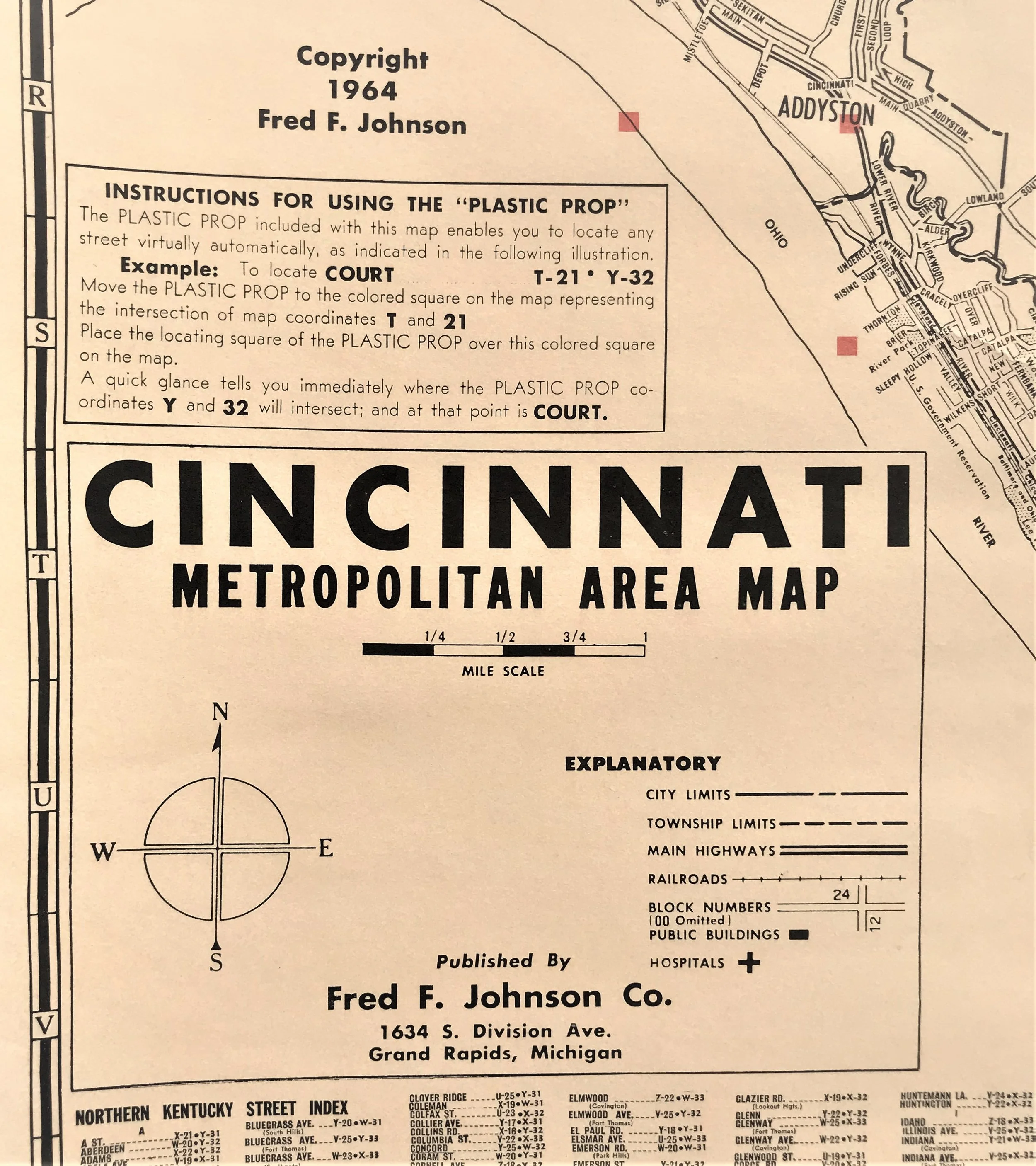
1964 Cincinnati Metro Area Map
11
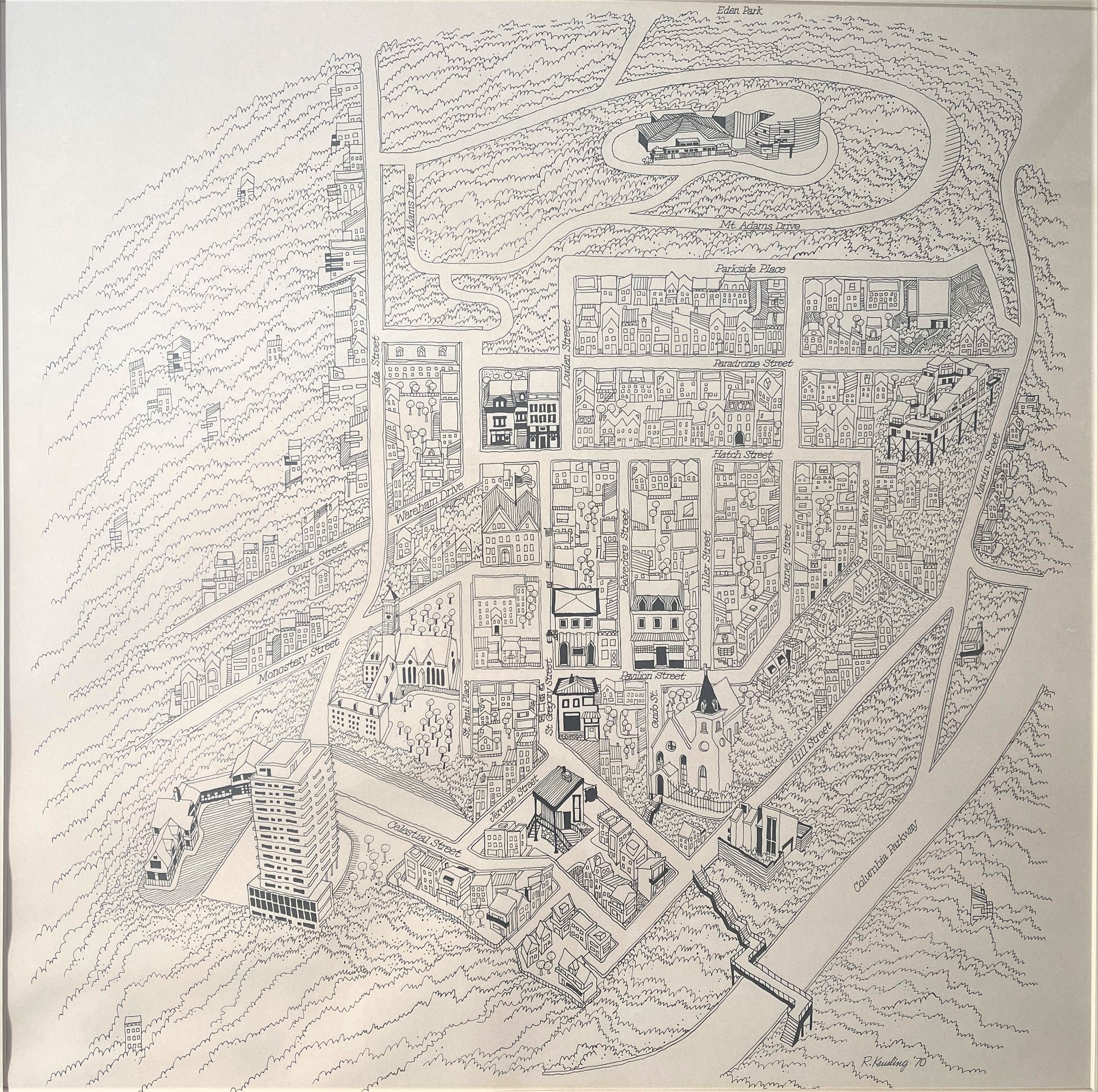
1970 Map of Mt. Adams