


8
1794 Map of The United States

1
1812 Map of Ohio

5
1820 Plan of Ancient Fortification, Warren County, OH

4
1827 Print: Survey of Big Blue River (Indiana)
11
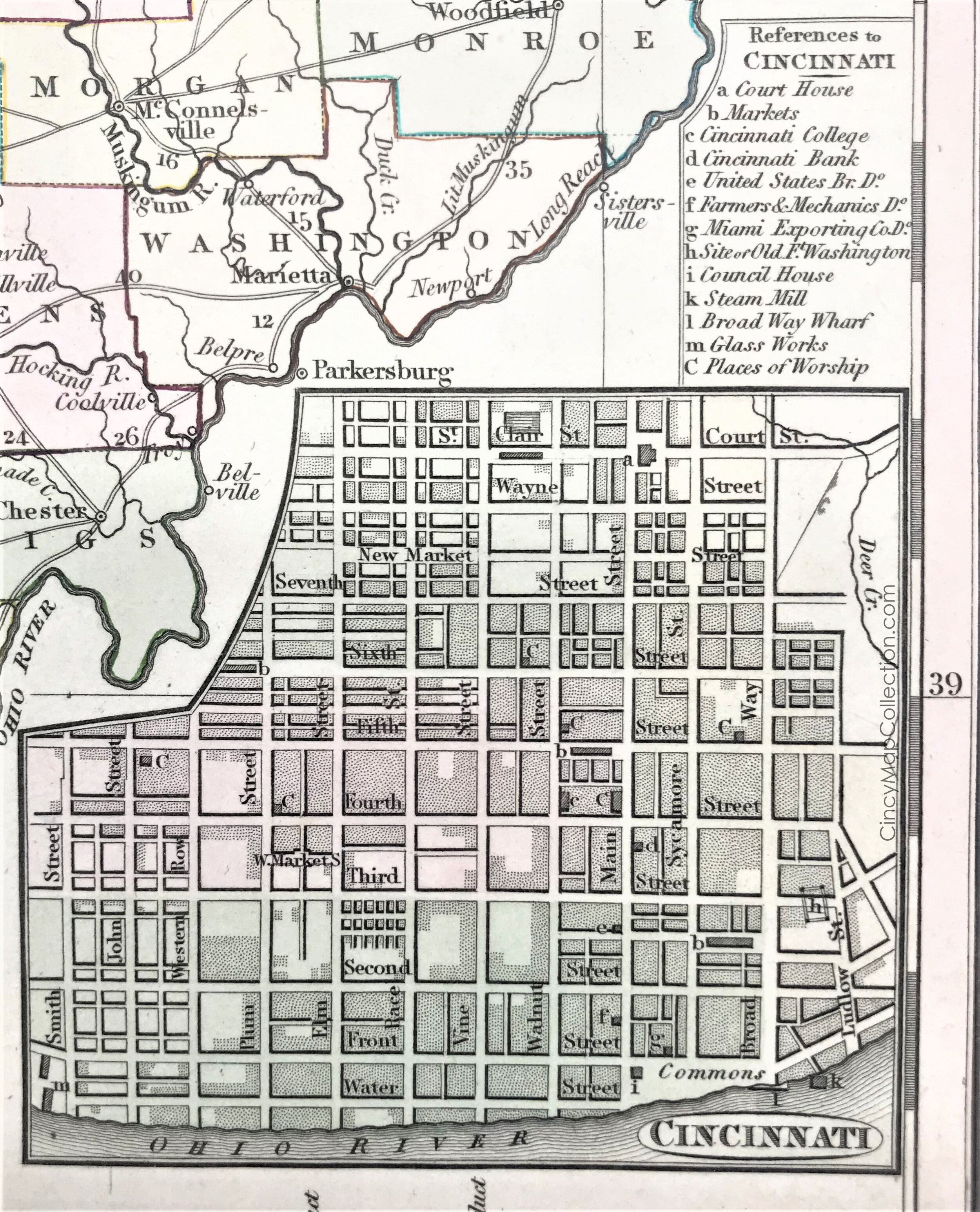
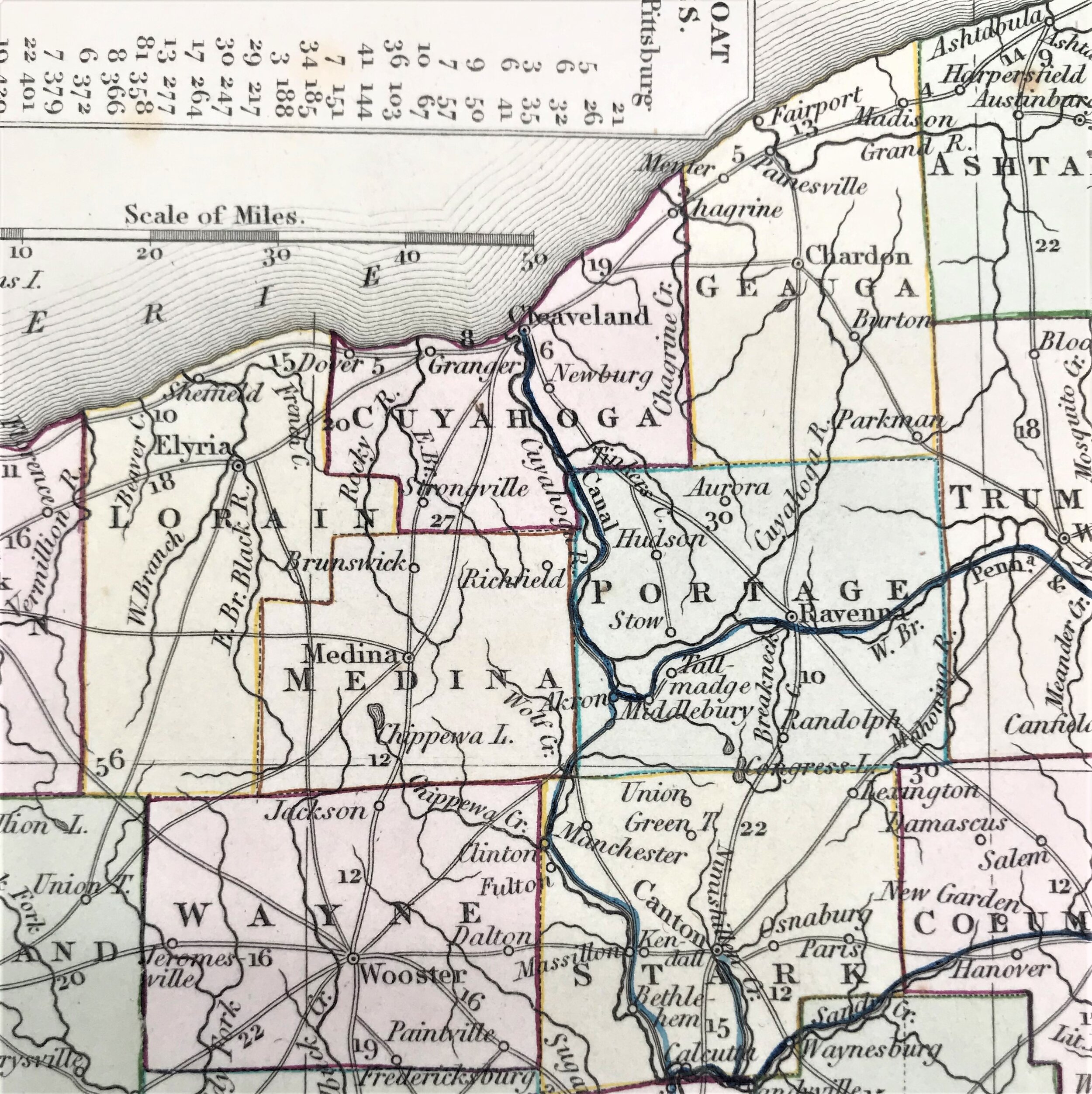
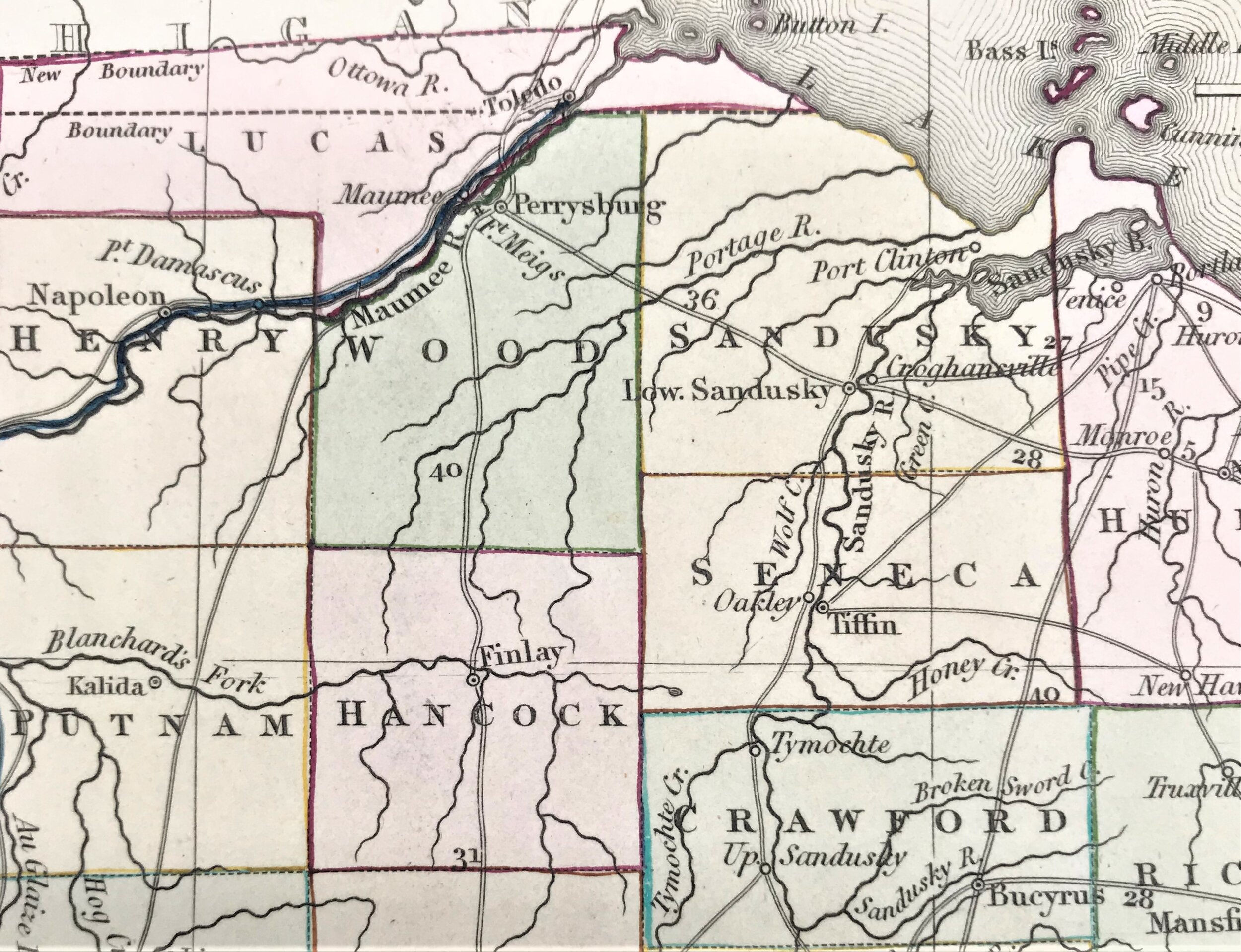
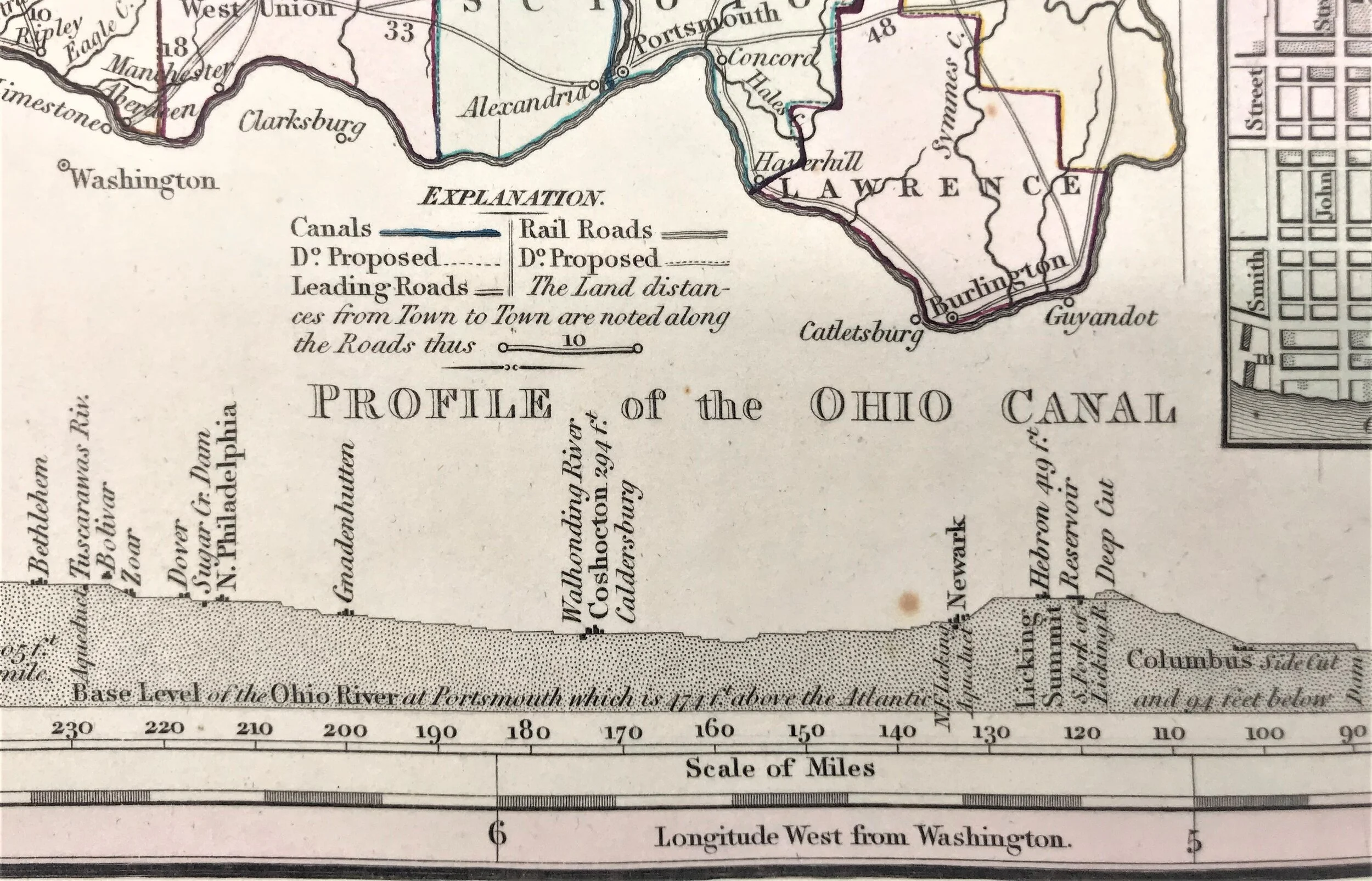
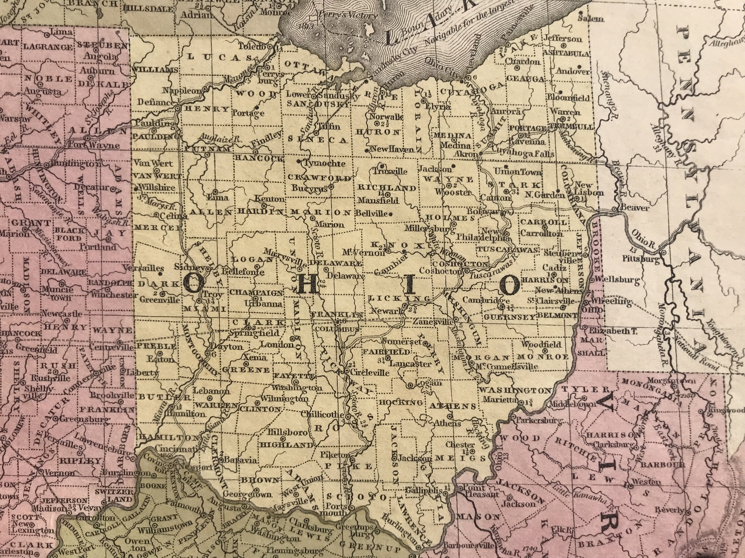
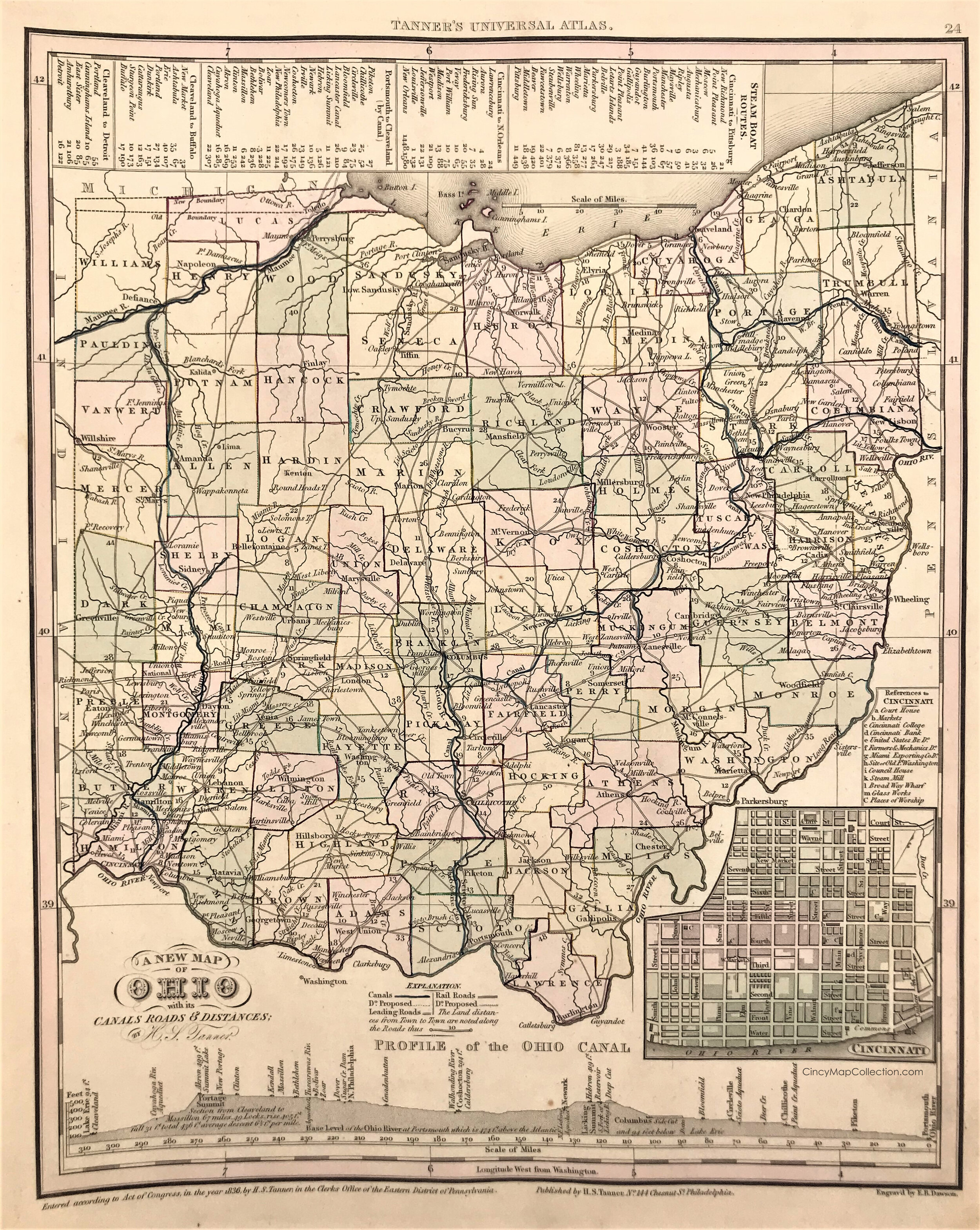
1836 Map of Ohio

9
1839 Map of the Chief Part of the Western States and part of Virginia

7
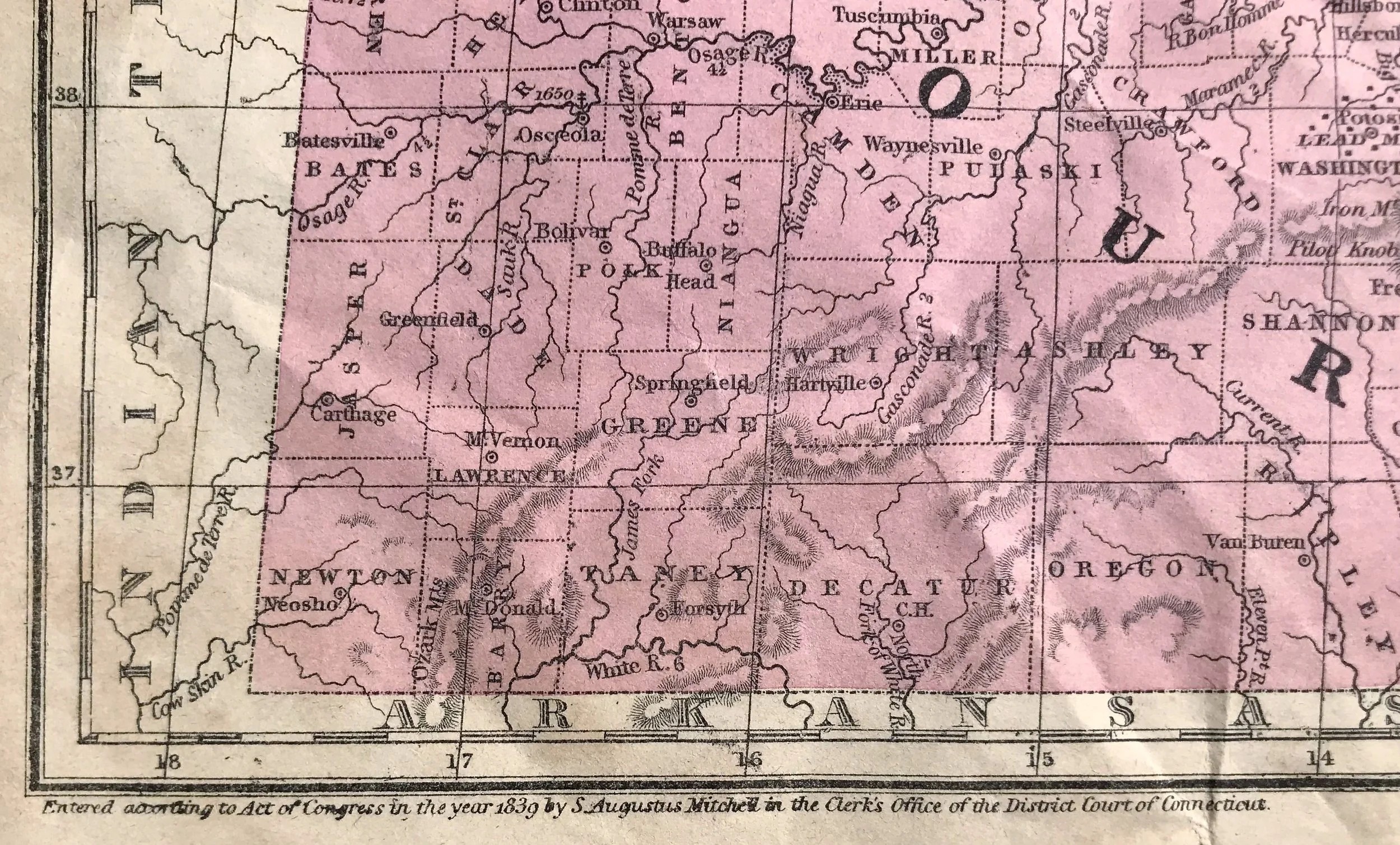
1850 Map of MO, IL, IN, OH, KY & TN
1
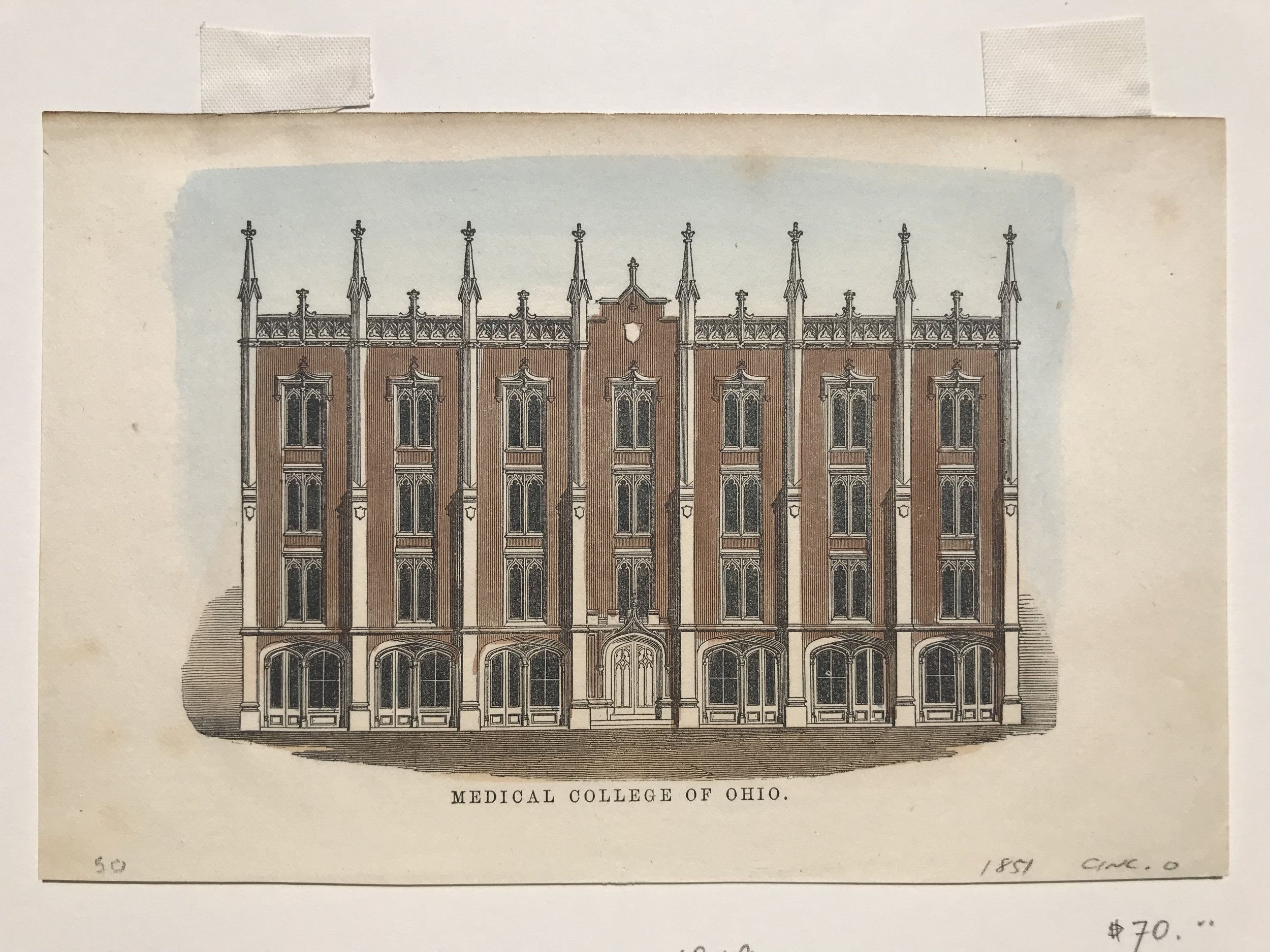
1851 Print: Medical College of Ohio (Cincinnati, O)
4
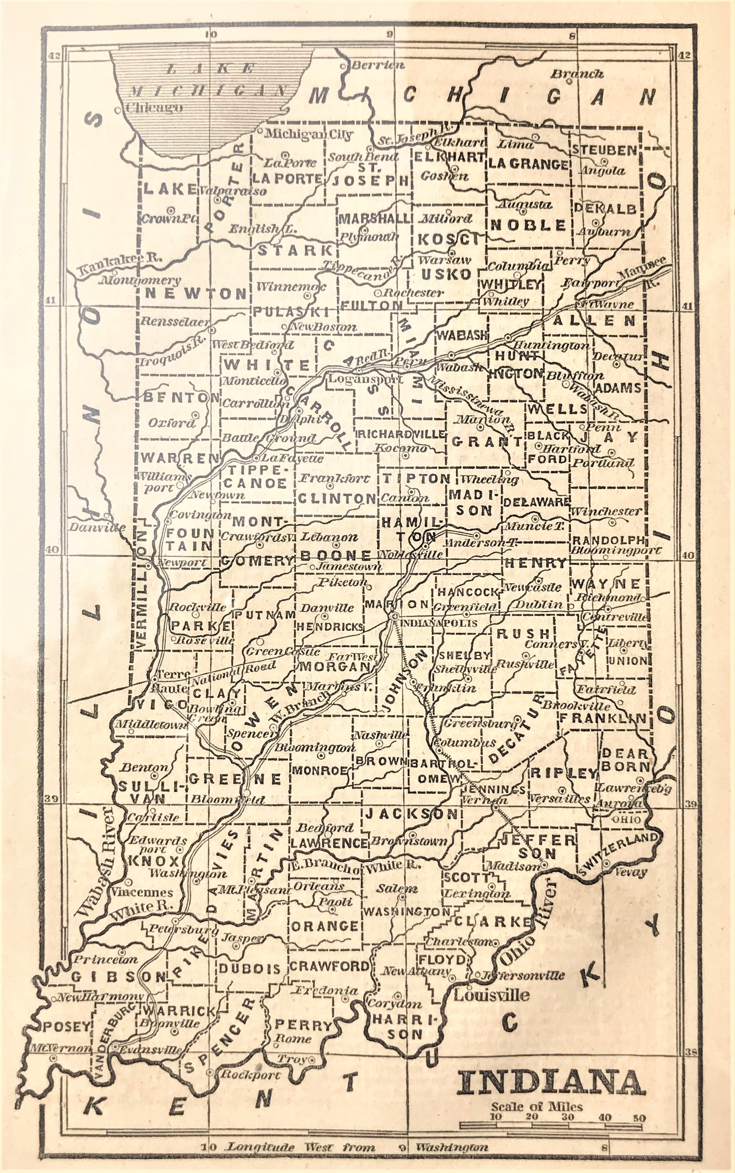
1854 Map of Indiana
3
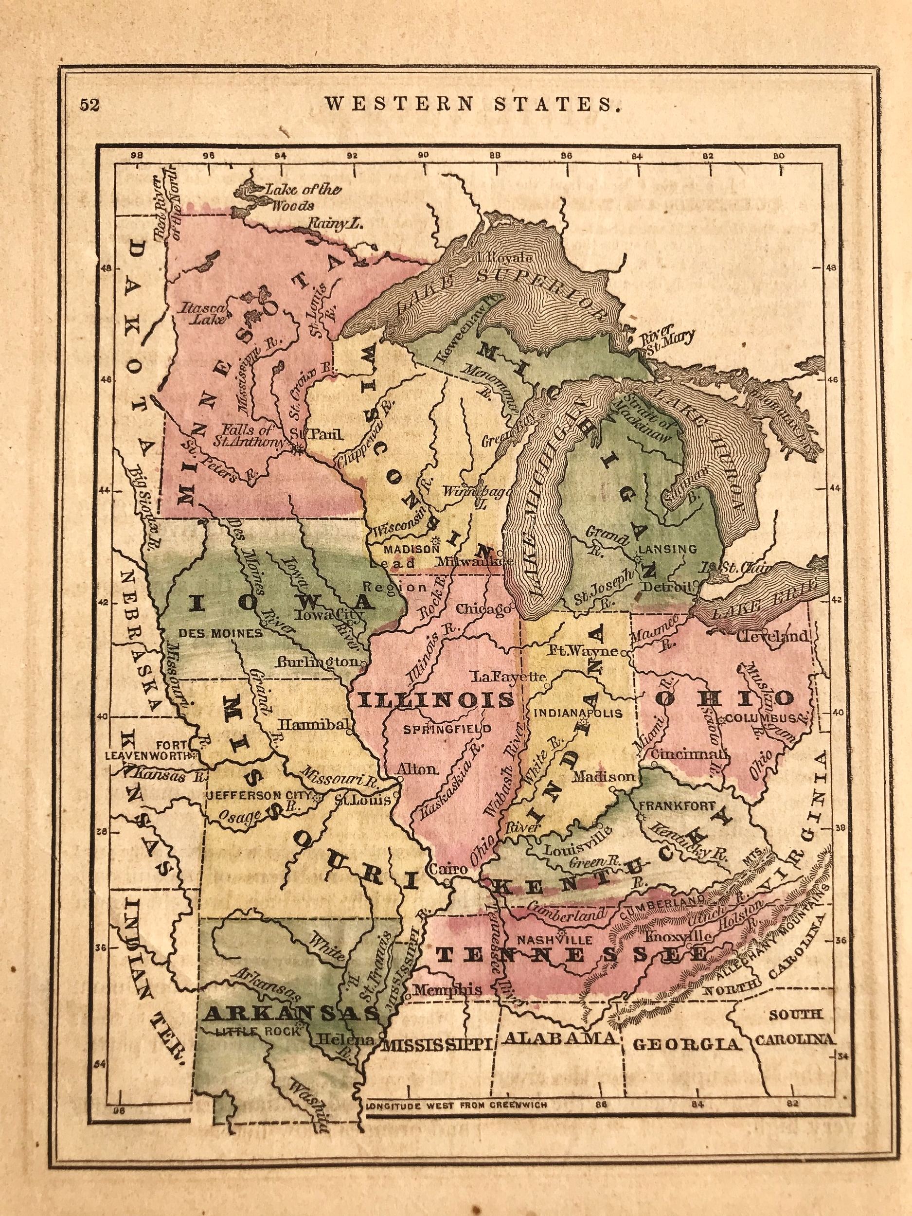
1862 Map of Western States

7
1866 State of Ohio
2
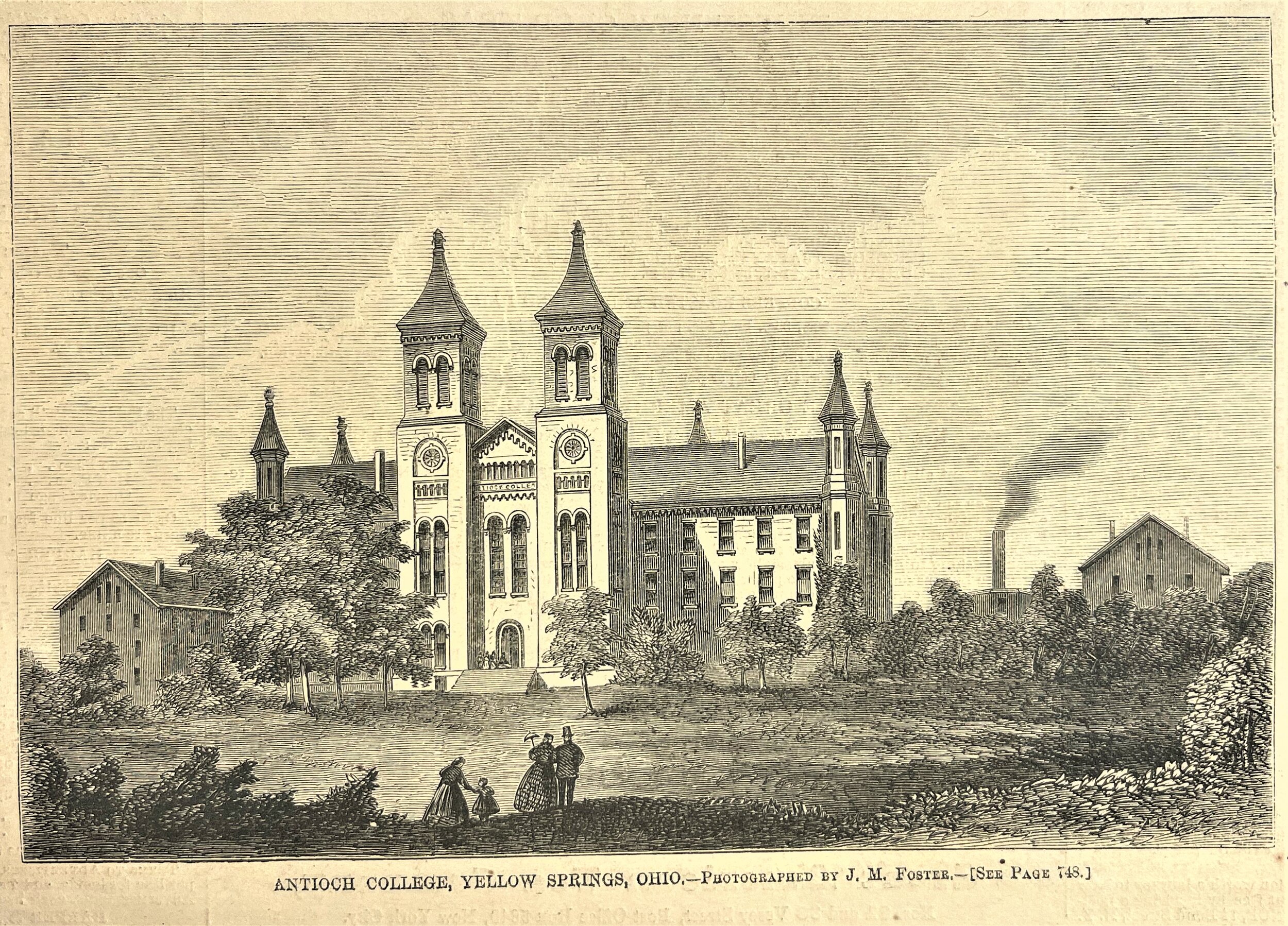
1867 Print: Antioch College, Yellow Springs, Ohio
7
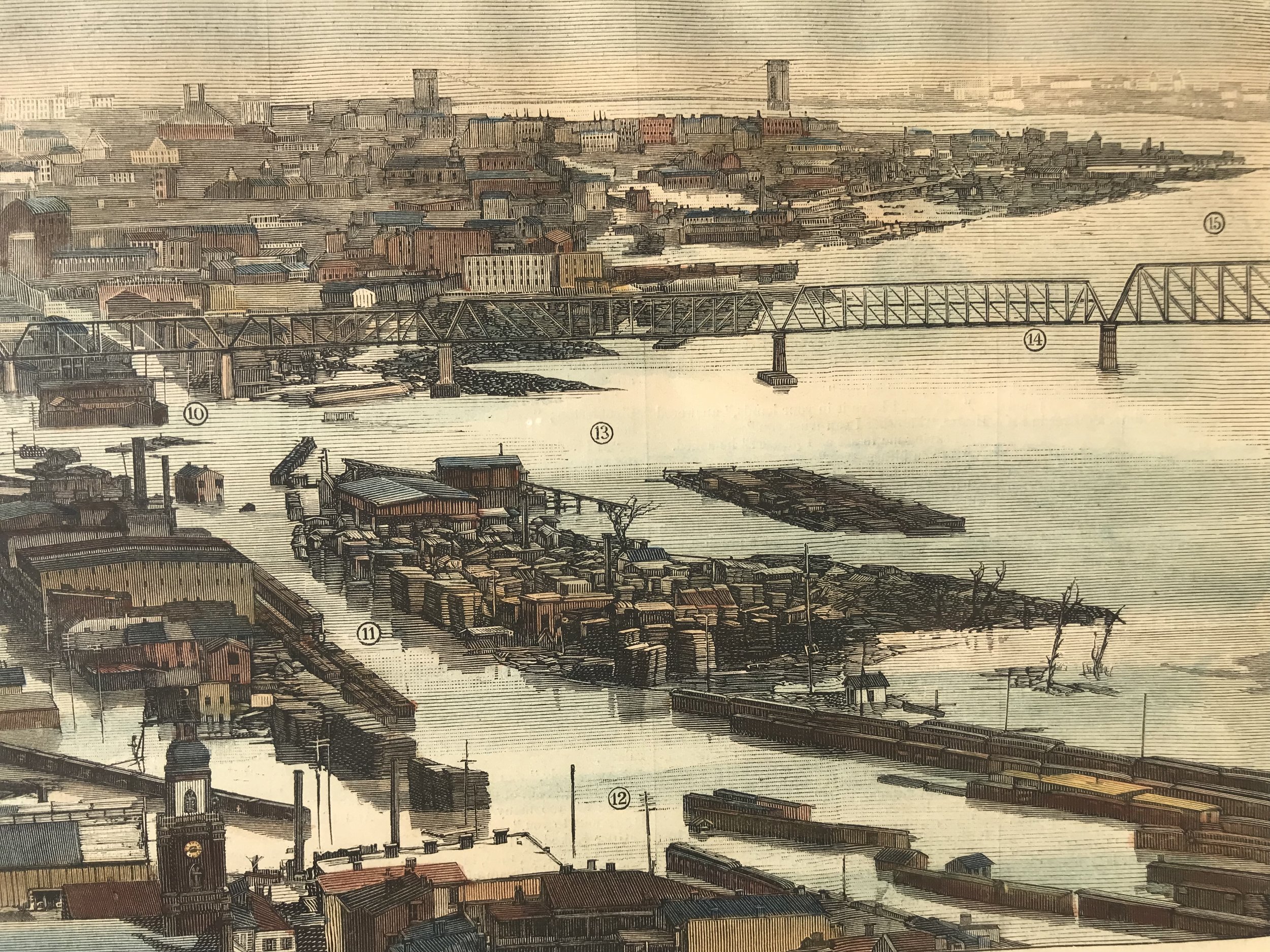
1872 Print: Flood in Cincinnati
9
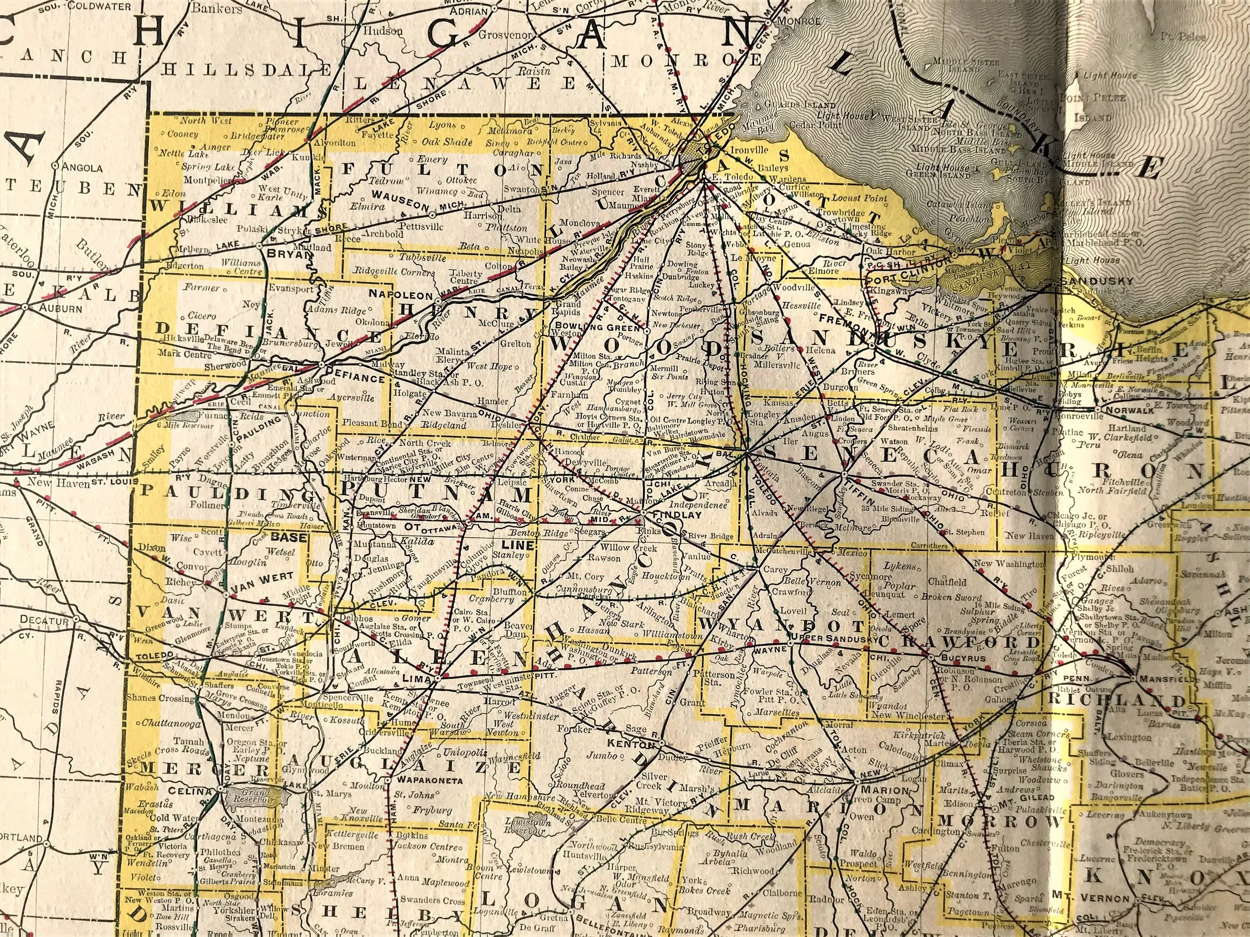
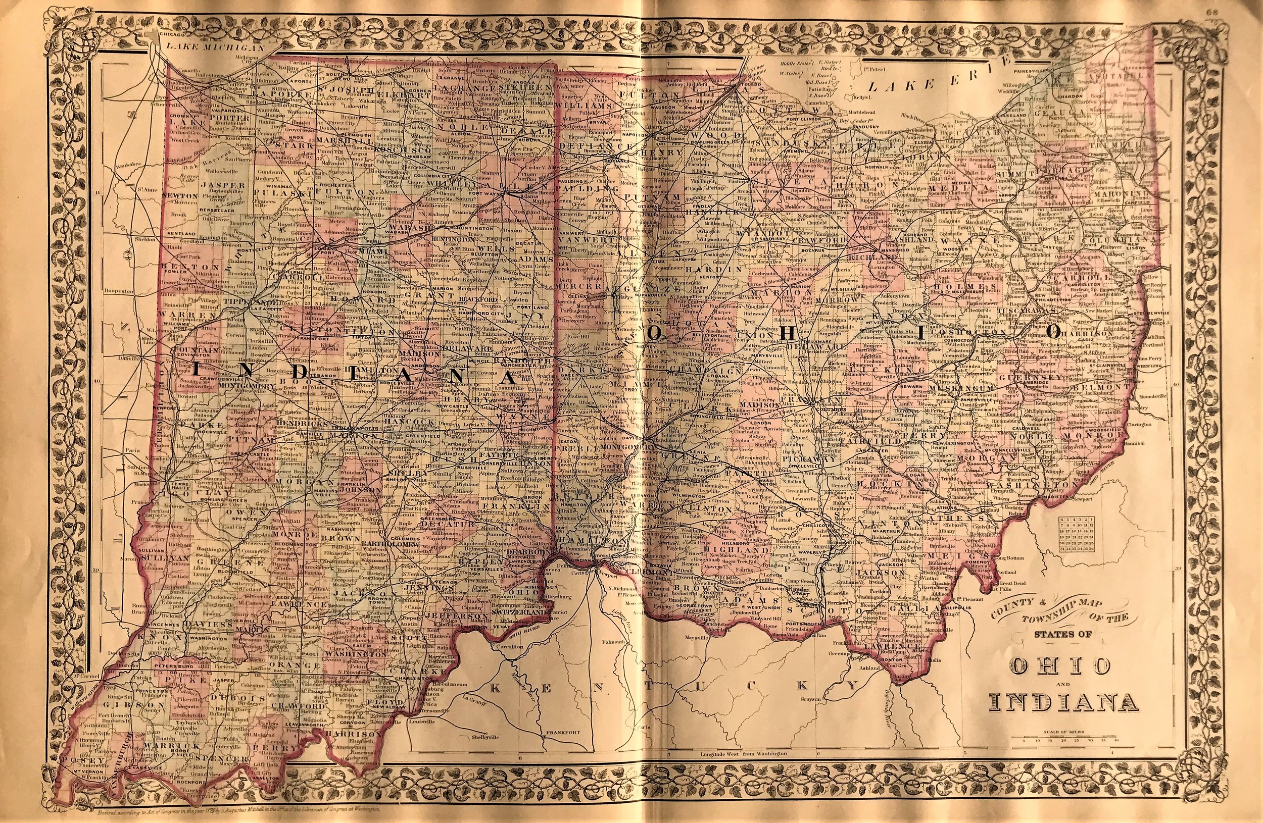
1879 County & Township Map of Ohio & Indiana
4
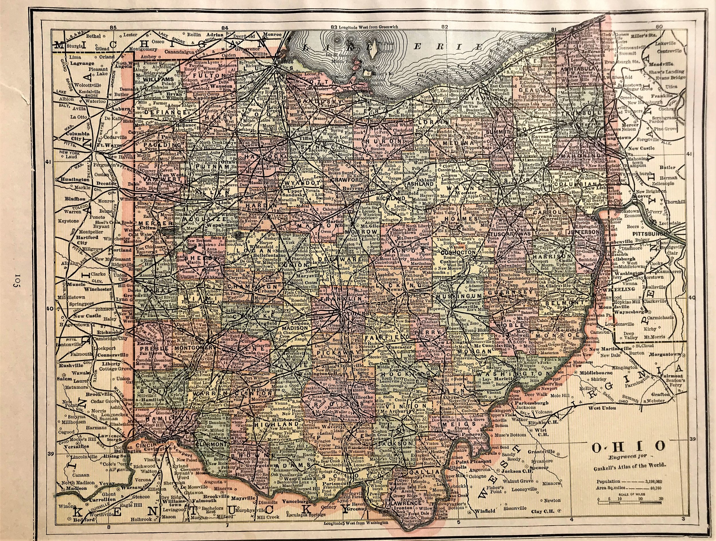
1888 Map of Ohio

10
1889 Map of Ohio
8
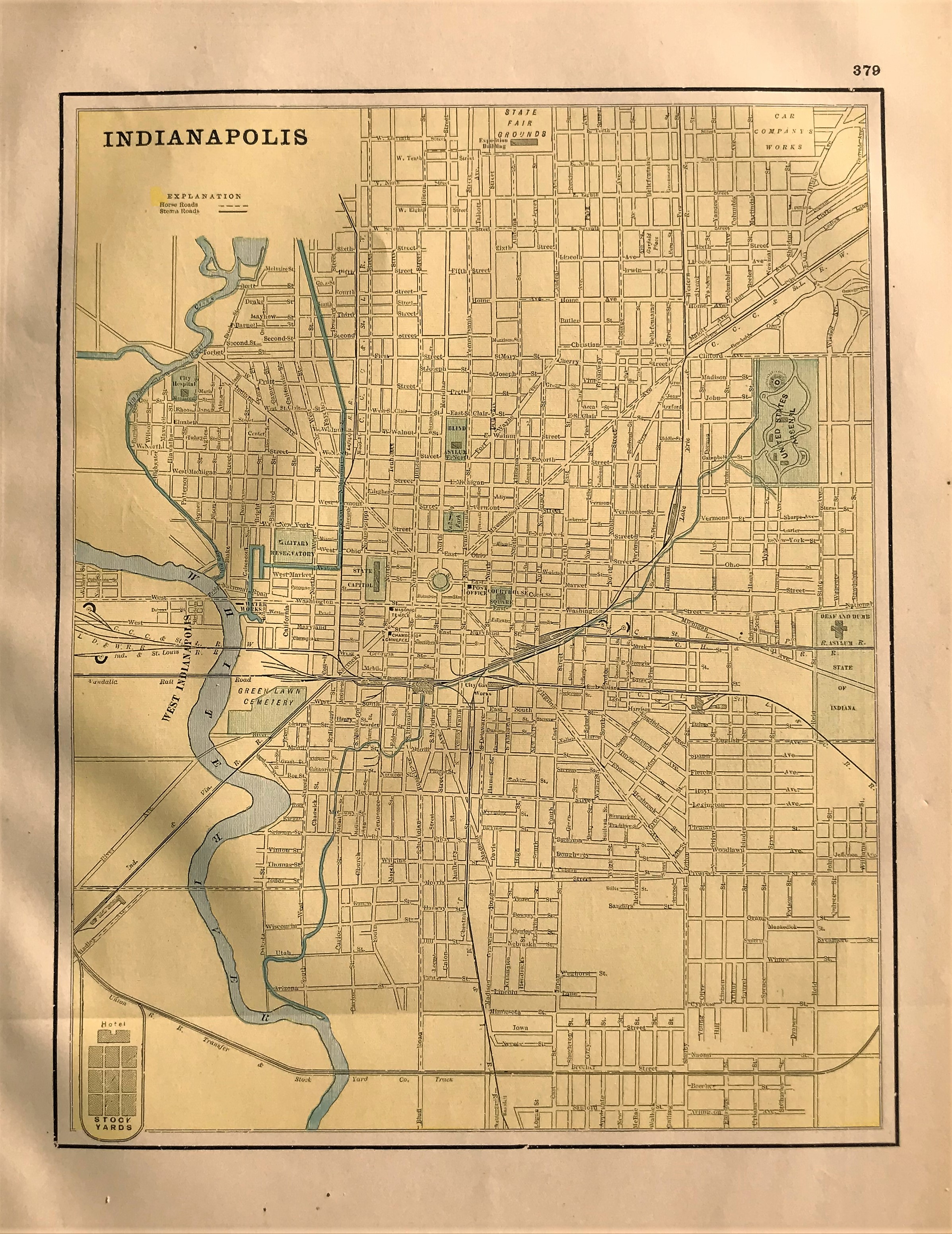
1892 Map of Indianapolis
2
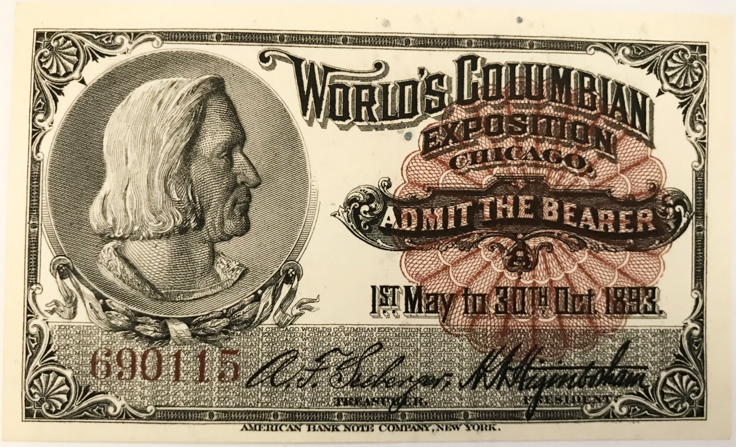
1893 General Admission Ticket to the World's Columbian Exposition, Chicago
4
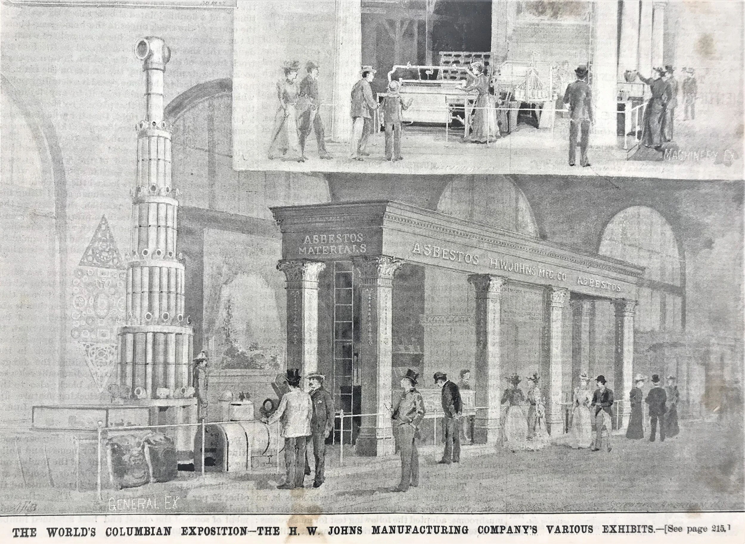
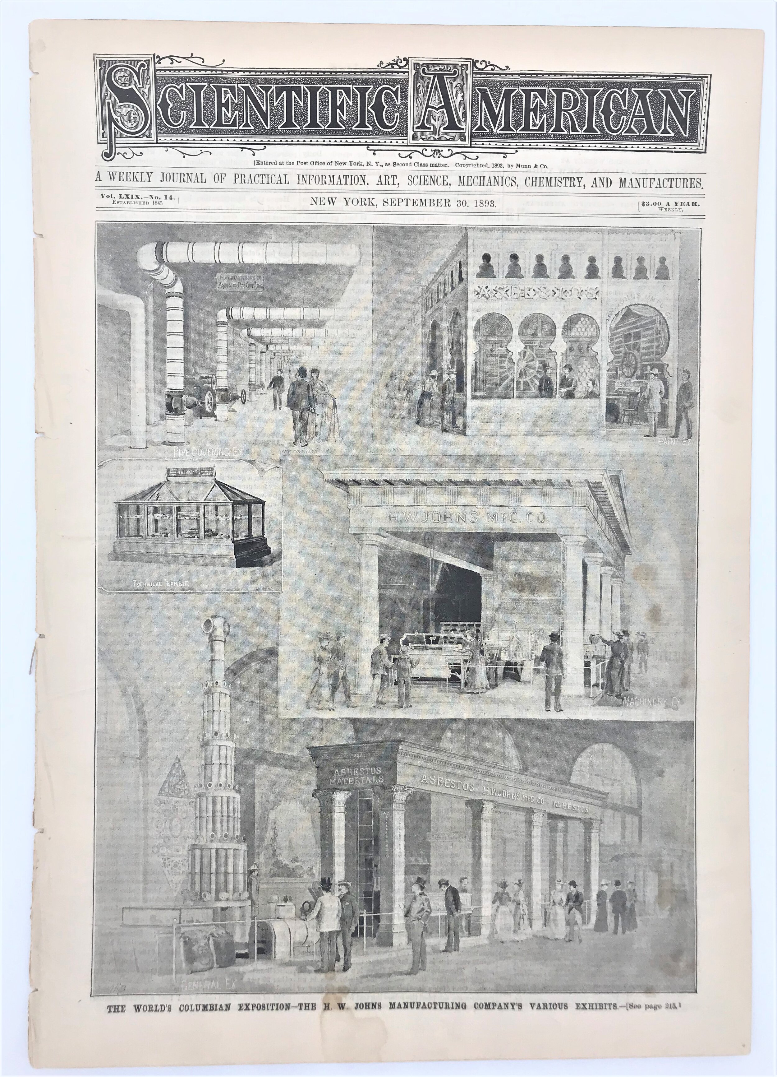
1893 Scientific American

4
1895 Map of Delaware, Maryland, Virginia and West Virginia
4
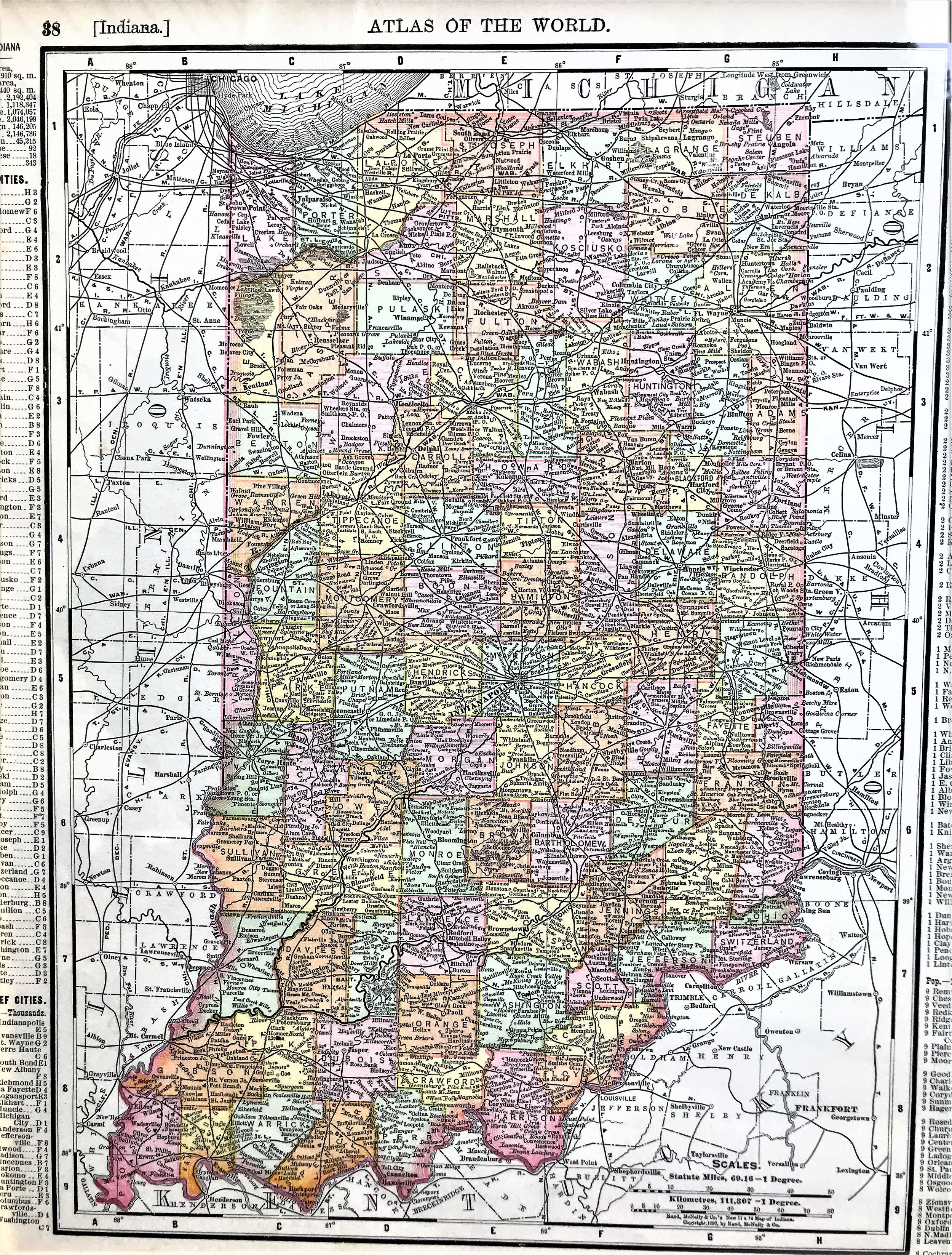
1898 Map of Indiana
3
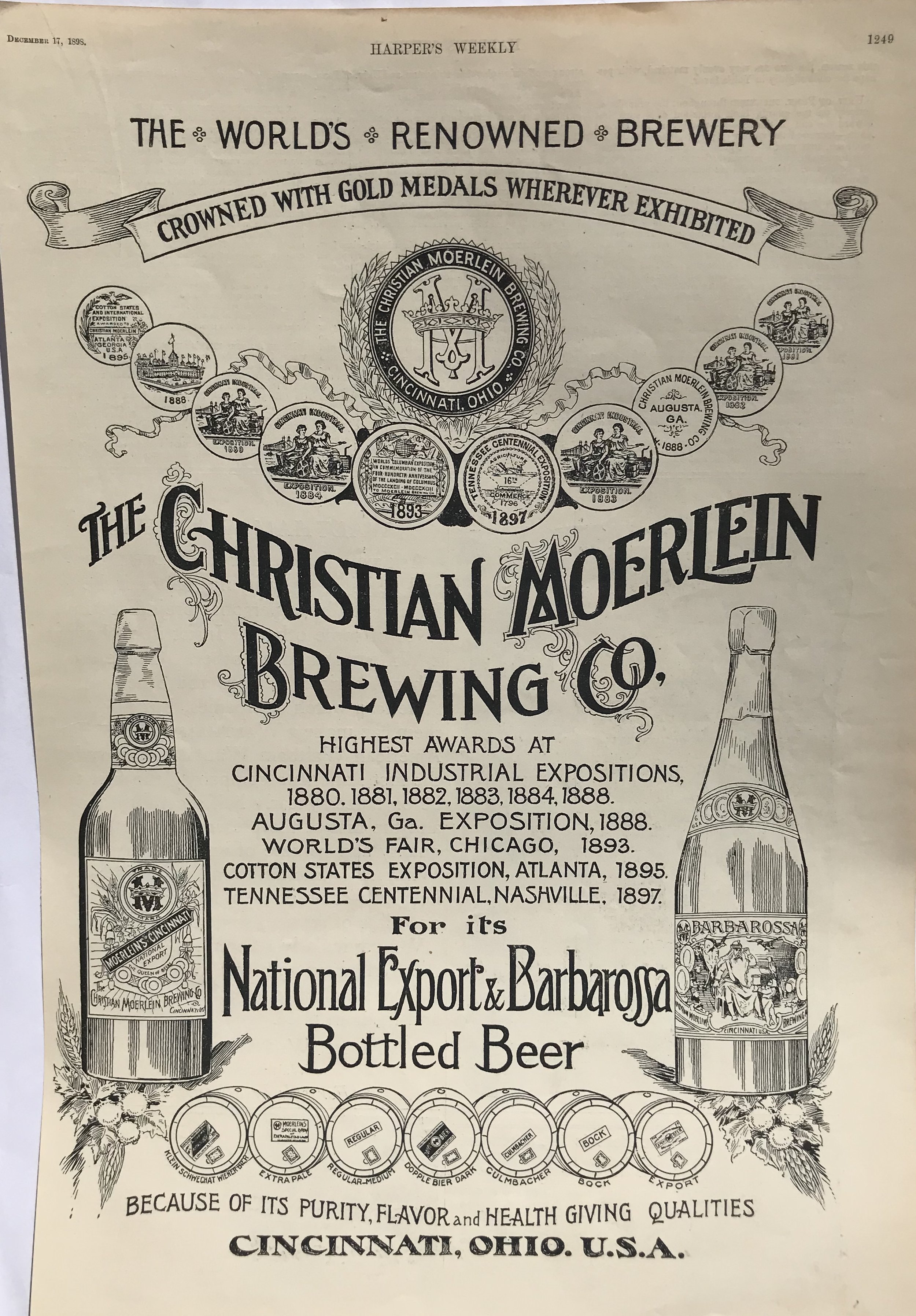
1898 Print: The Christian Moerlein Brewing Co. Advertisement

2
1889 Map of Ohio, Arbuckle trading card

8
1899 Map of Ohio, Southern Part

5
1900 Map of Ohio
5
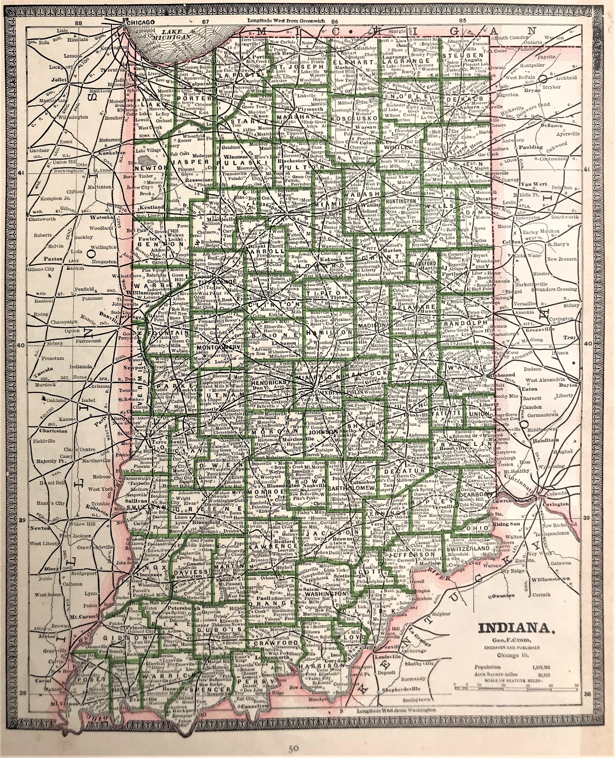
1900 Map of Indiana
9
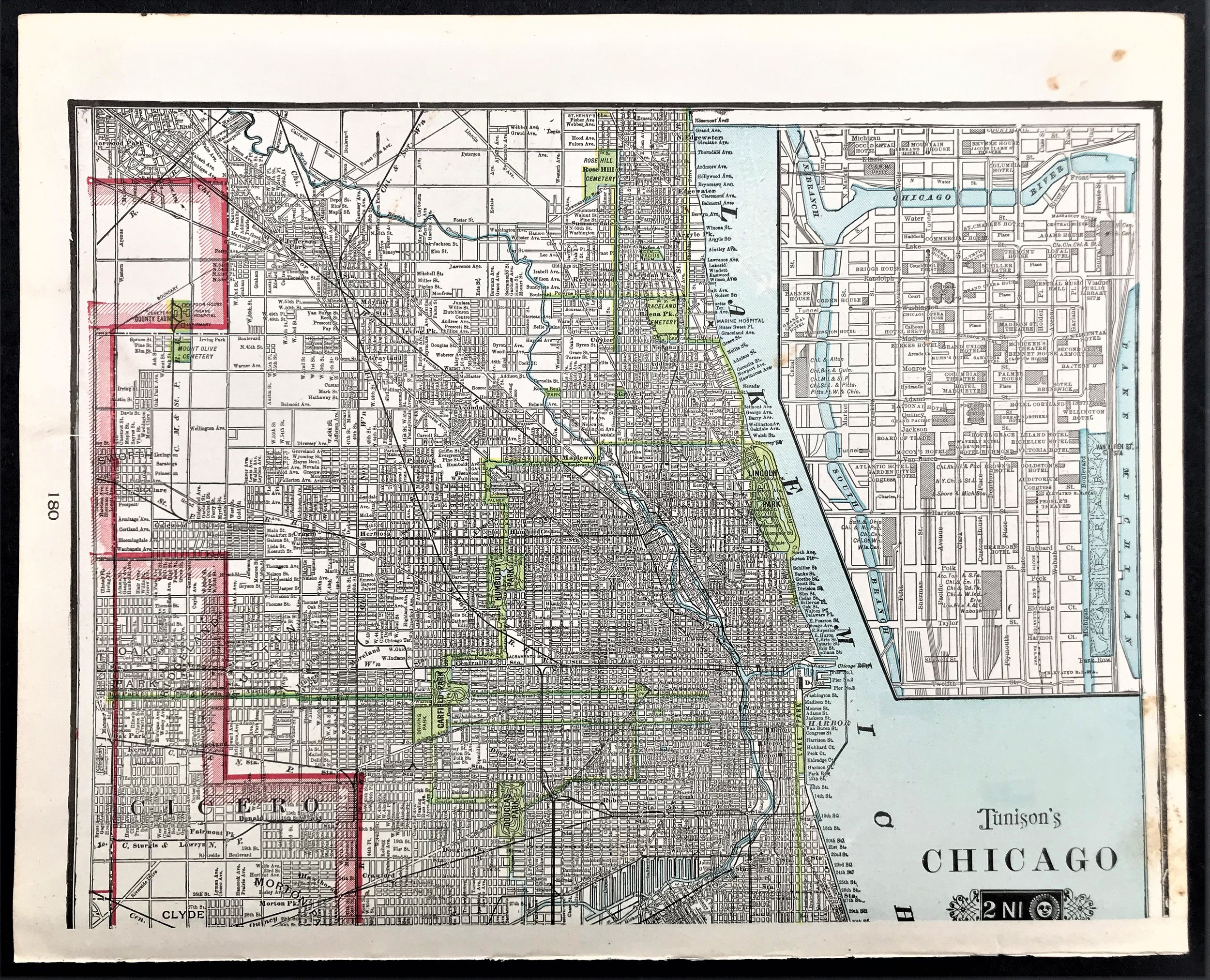
1903 Map of Chicago

3
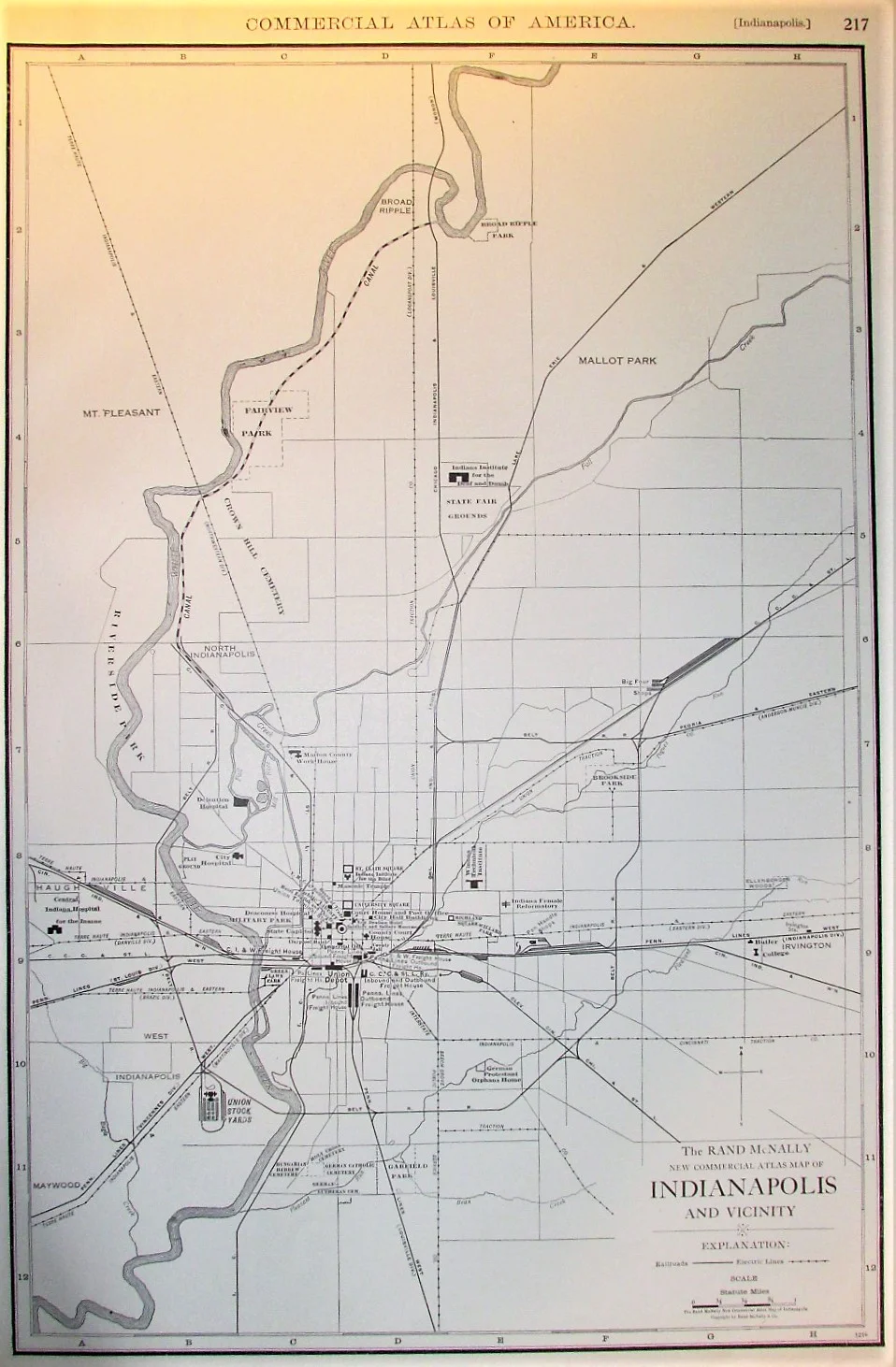
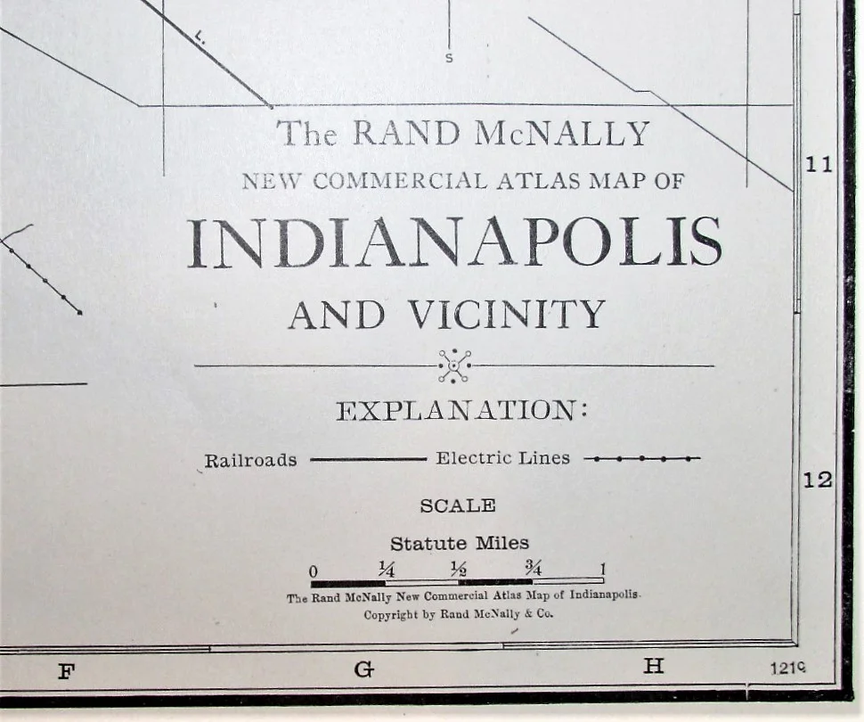
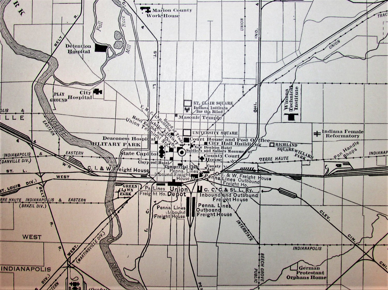
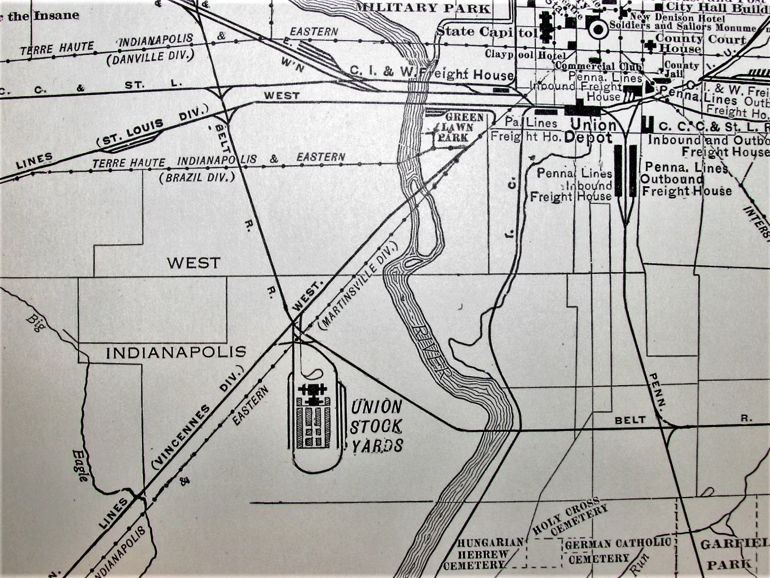
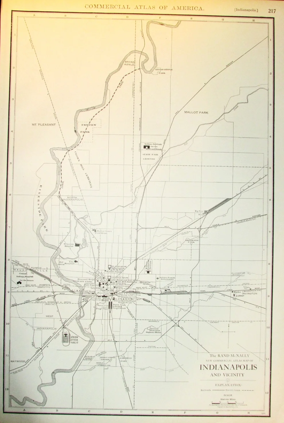
1909 Map of Indianapolis

10
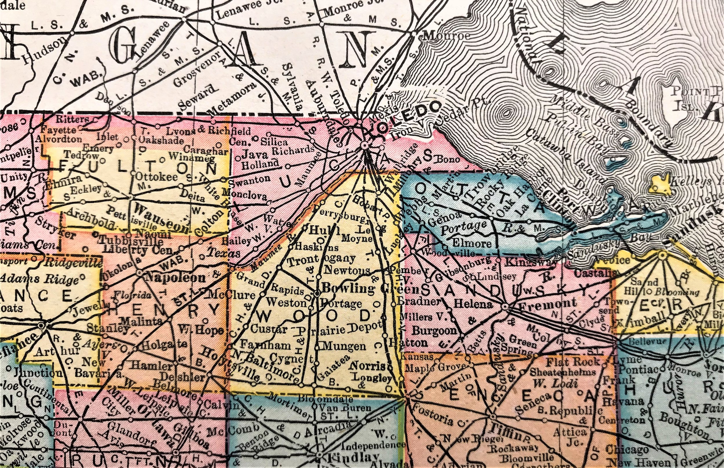
1909 Map of Ohio
4
1920 Map of Indianapolis

2
1927 Map of Ohio

3
1927 Map of Cleveland and Vicinity

10
1934 Pictorial Map of Ohio
9
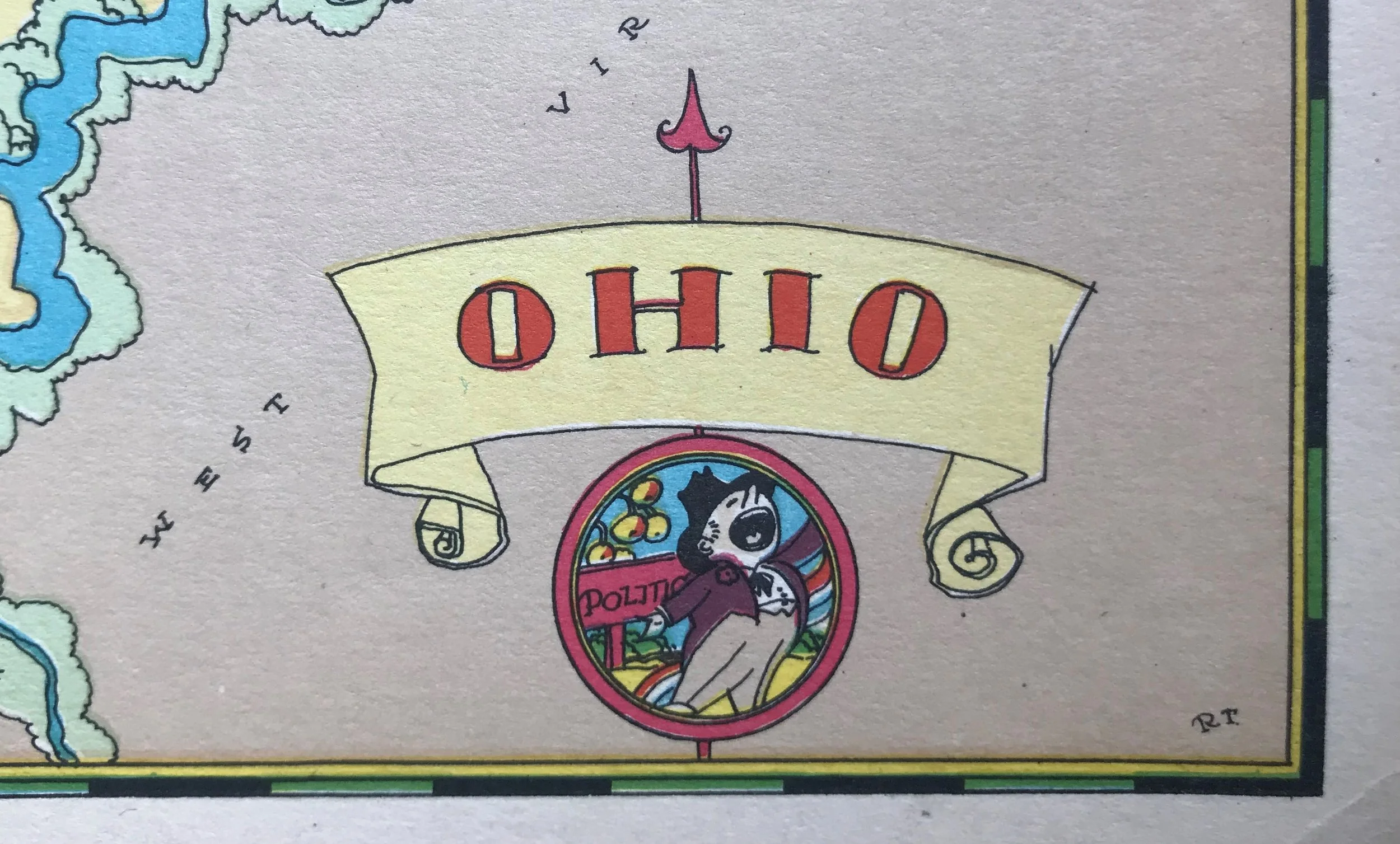
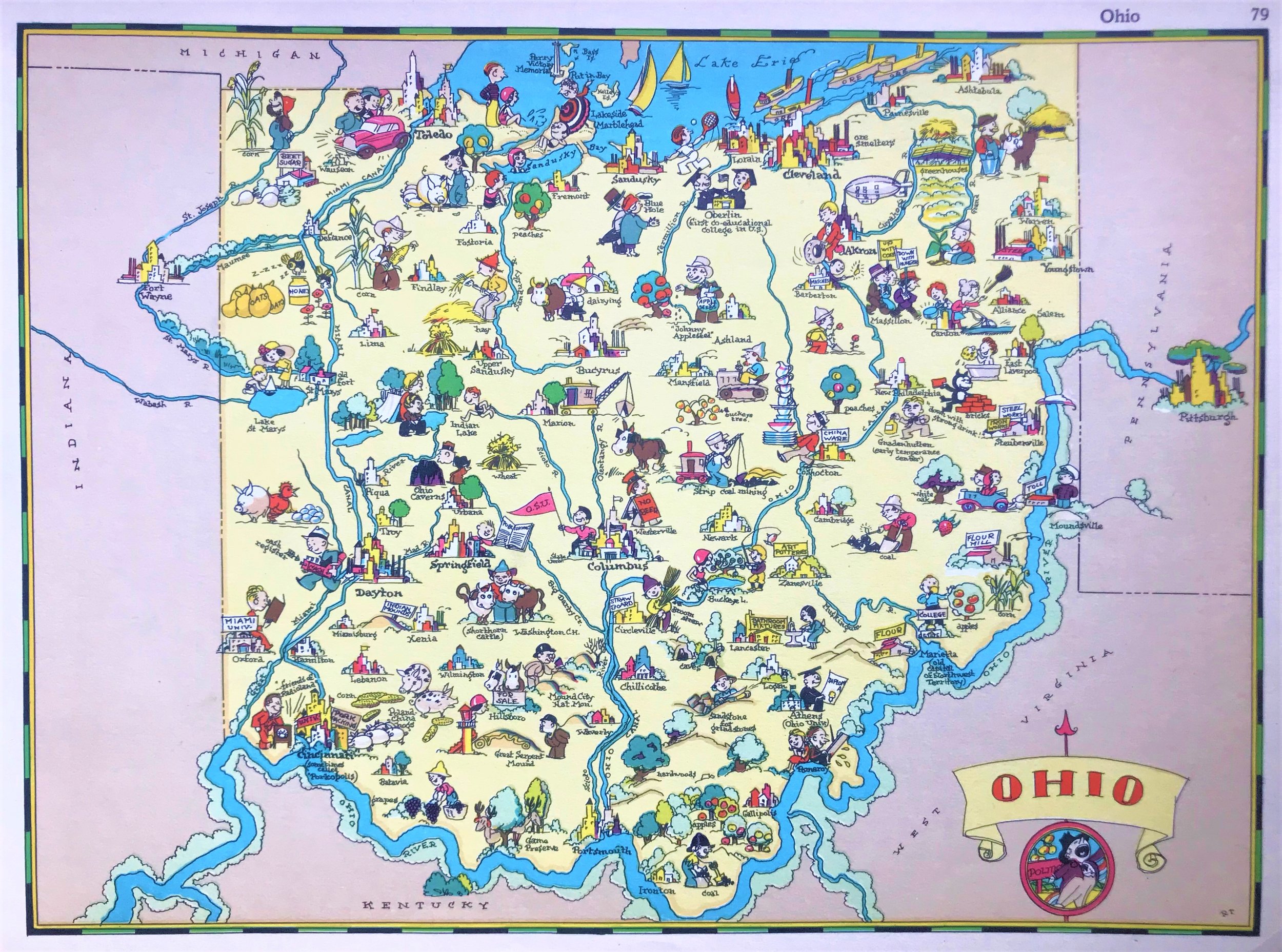
1935 Pictorial Map of Ohio
15
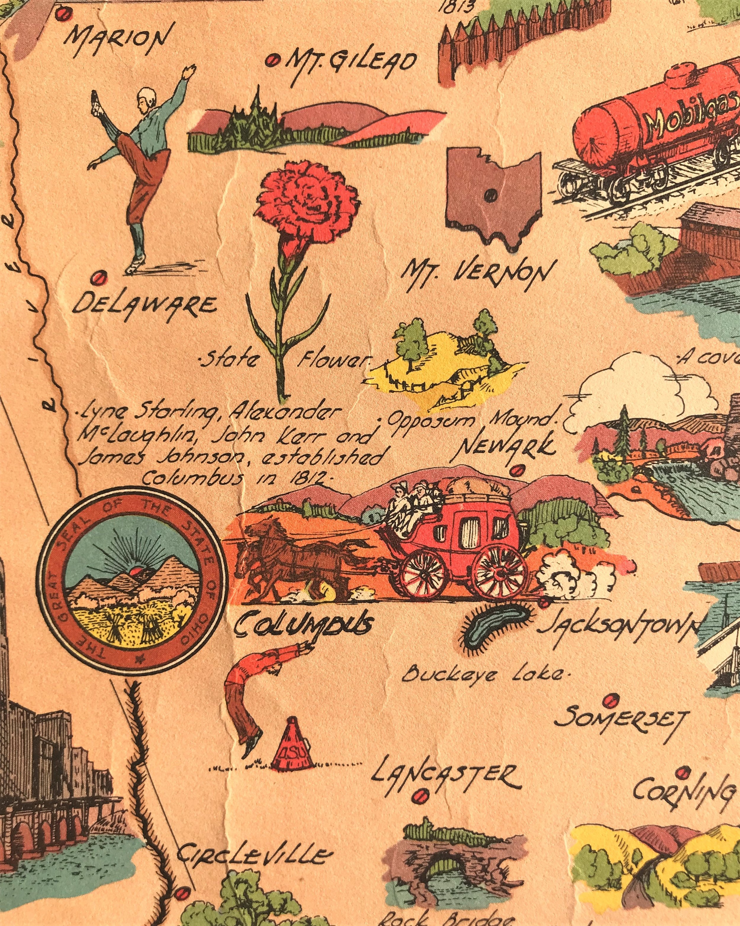
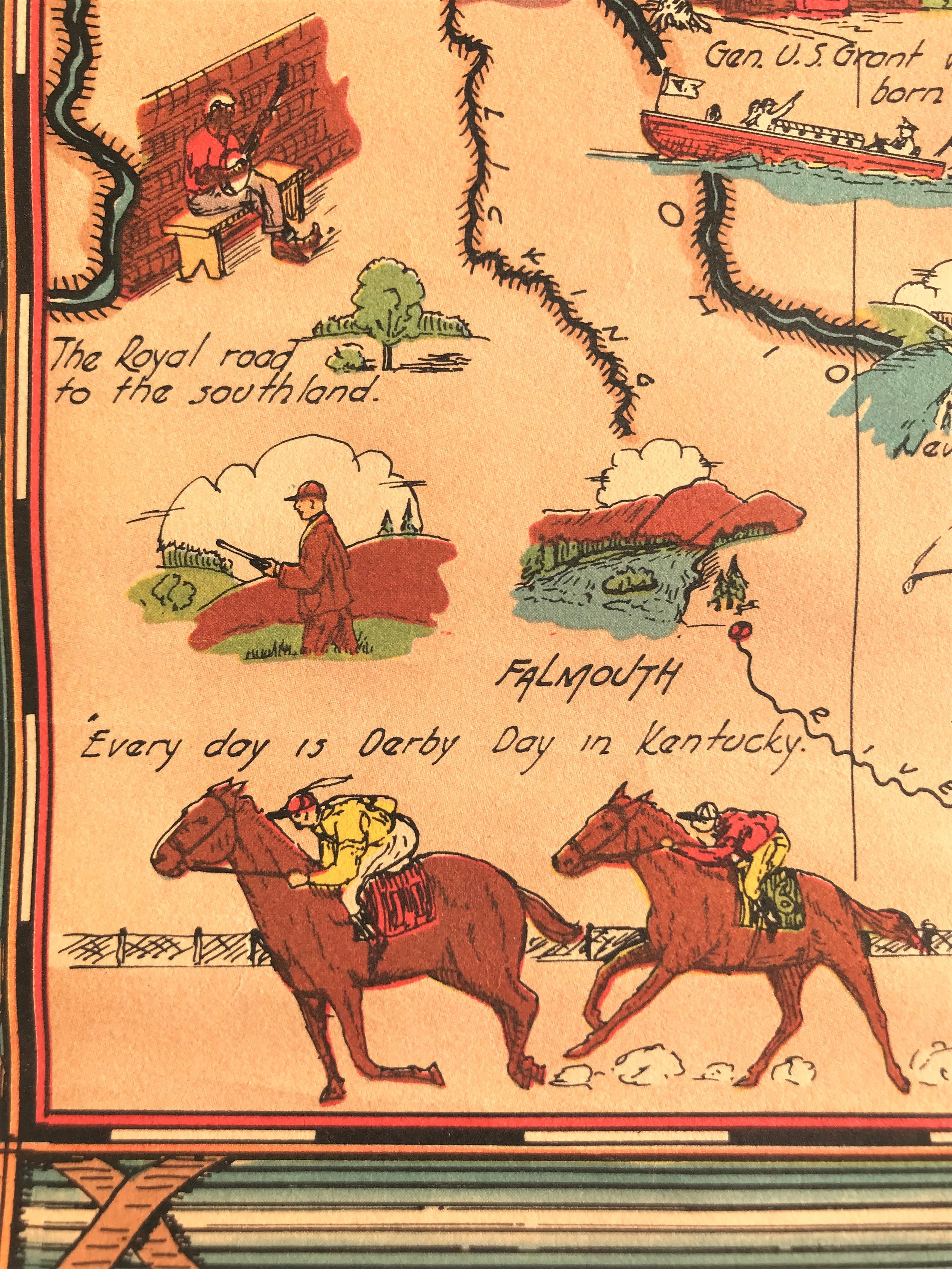
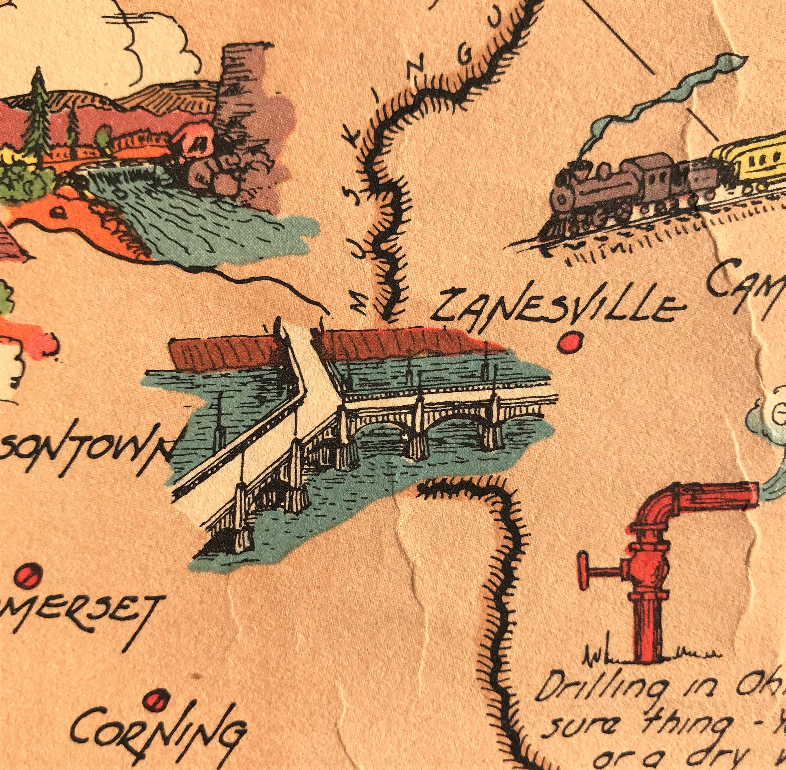
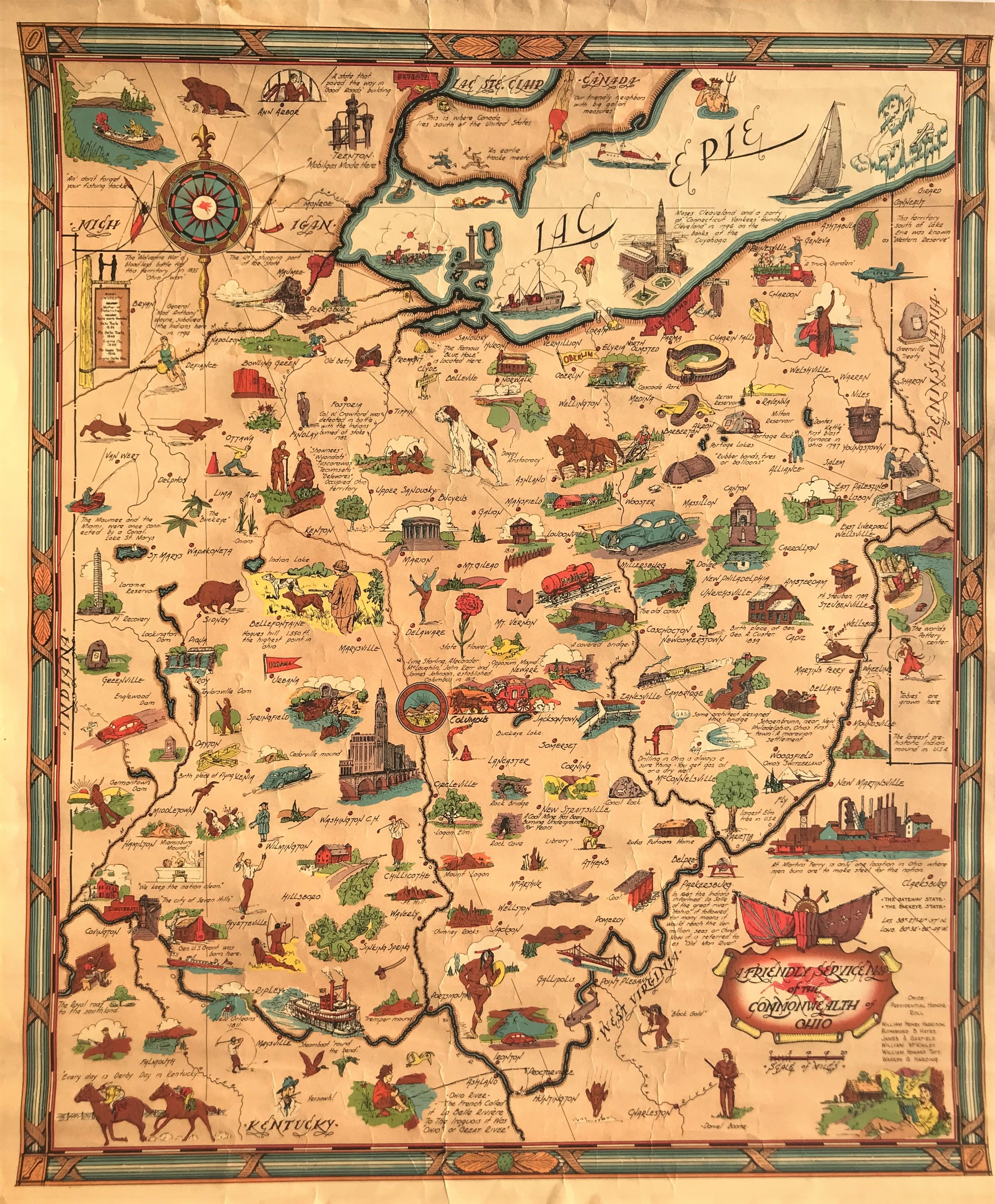
1940 Pictorial Map of Ohio
11
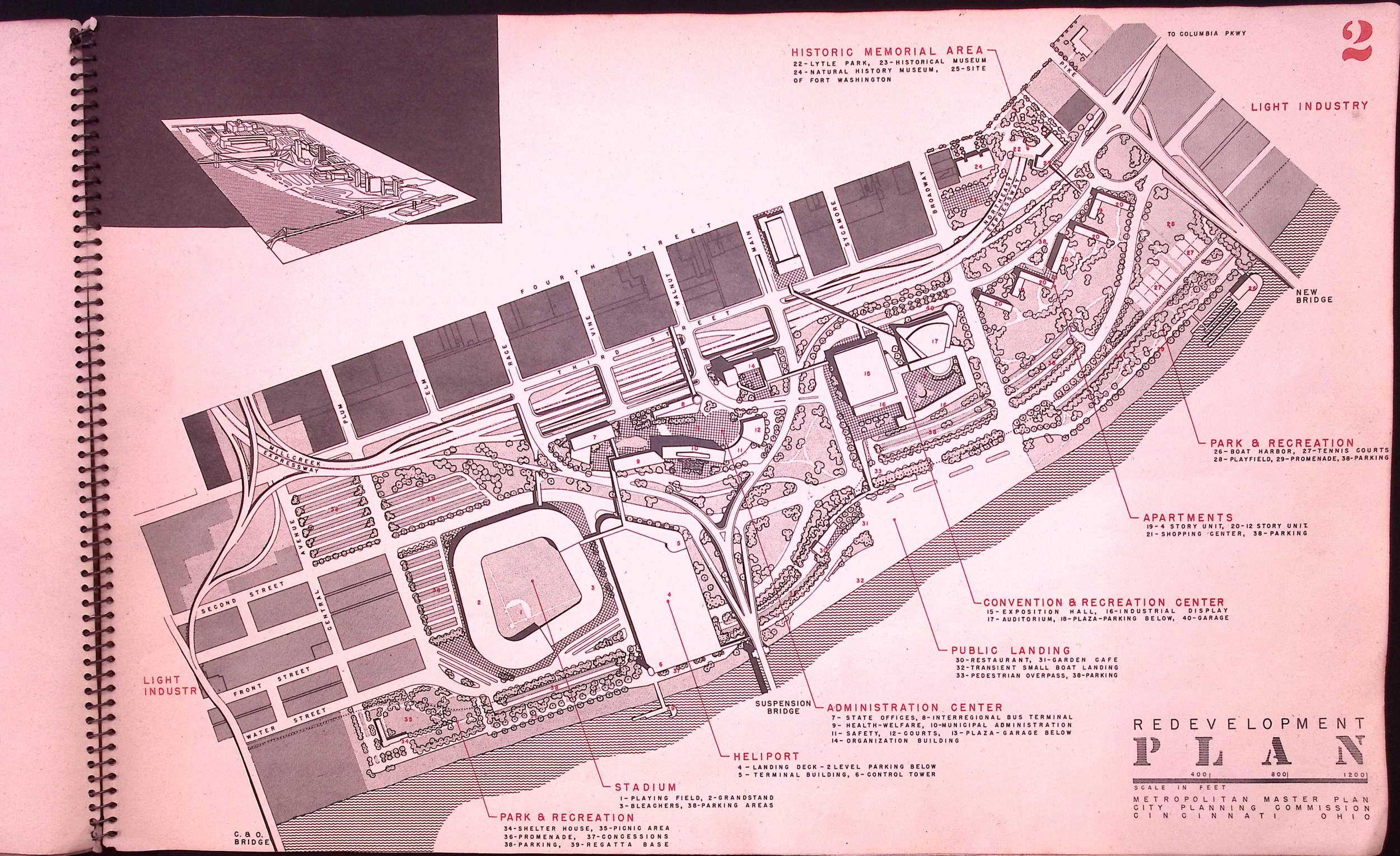
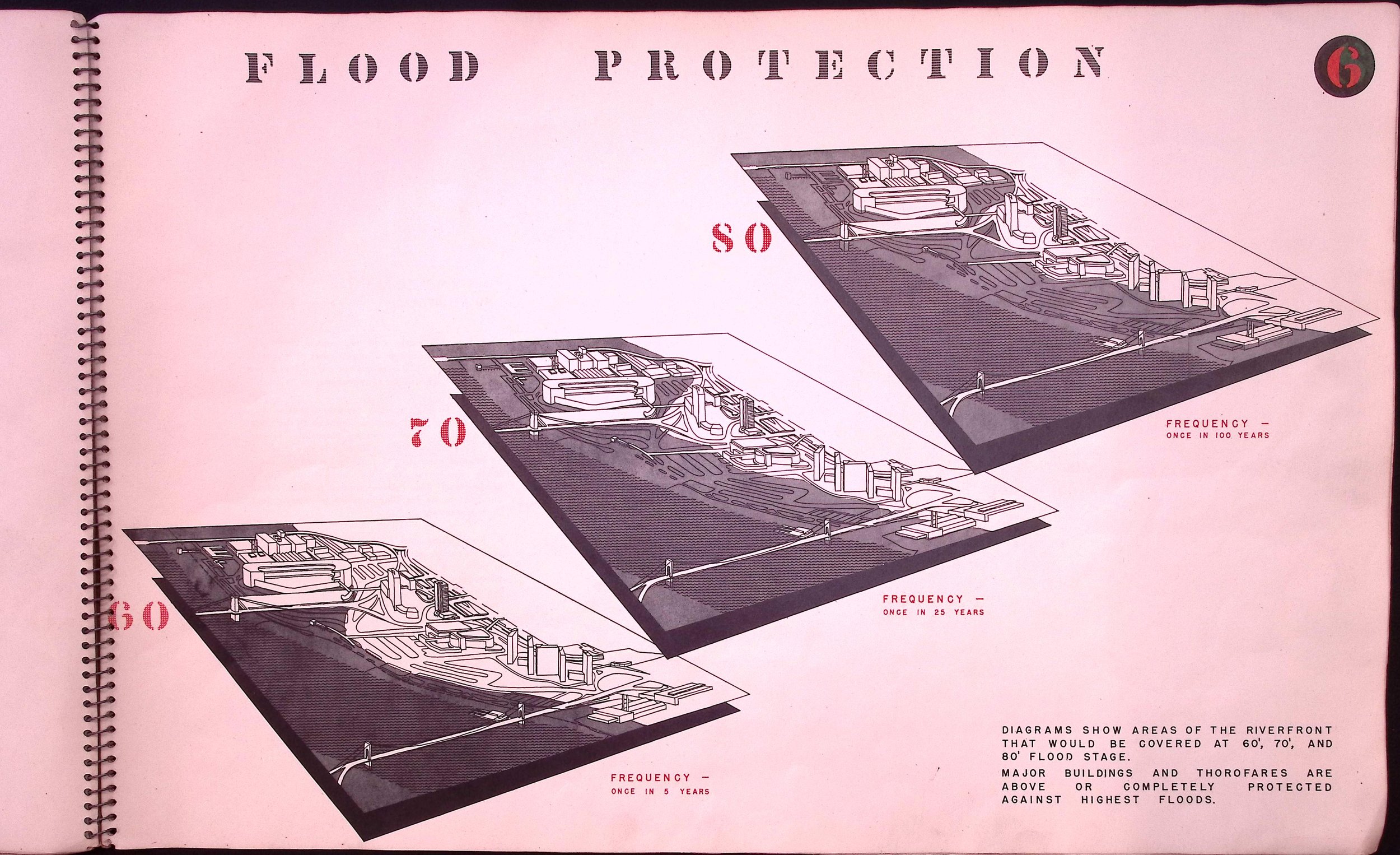
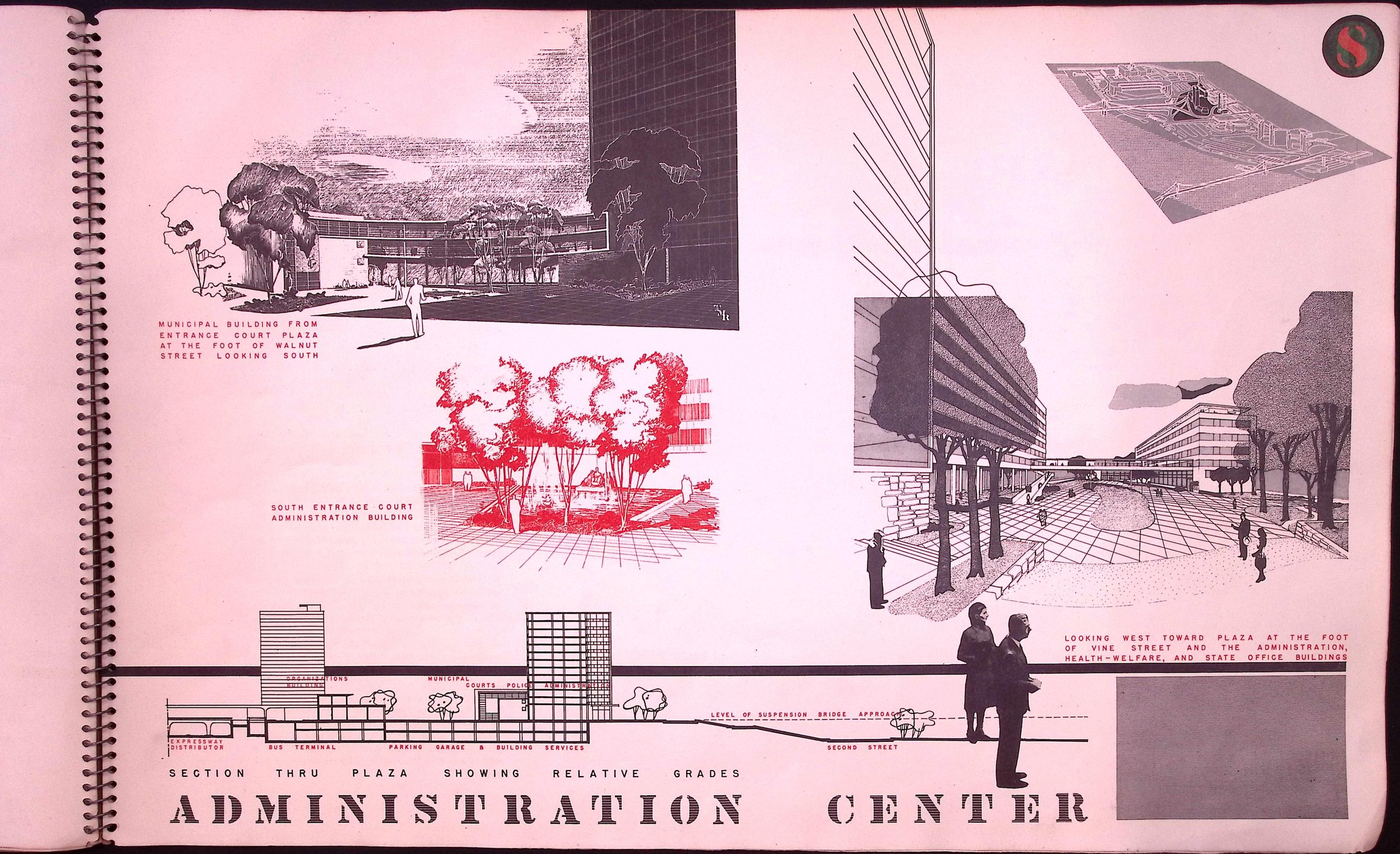
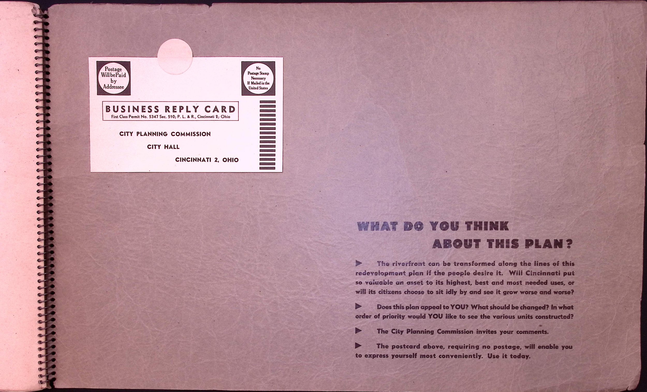
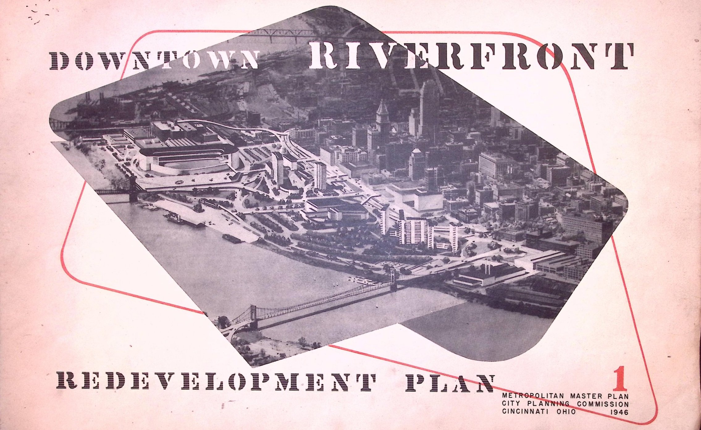
1946 Cincinnati Riverfront redevelopment